sps

Day 38: Big Bend National Park, TX + Dallas, TX by Wookie Kim

At 6 a.m. this morning in Big Bend, I had to make a choice: (1) reach the Rio Grande in Big Bend but have a ridiculously long drive to Dallas afterwards and (2) head straight for Dallas and still having a long driving day. I chose the first option and couldn't be happier with that choice.

I had plans to stay with Bradshaw H., a high-school classmate, in Dallas this evening. No matter what I did, I'd be in for a long drive. From the park's exit, Dallas was about 550 miles away. But I was already over 30 miles inside the park. And I wanted to drive another 30 miles in the opposite direction on the Ross Maxwell Scenic Drive to the Rio Grande. Specifically, I'd heard that Santa Elena Canyon was a must-see, so I decided to go there.

I broke camp quickly, and hit the road by 6:20 a.m. All was dark, and I felt at peace, just as I had on my pre-dawn cruise through West Texas the day before. The miles I slowly clocked on Ross Maxwell Scenic Drive felt weird; I was driving in the most amazing part of the park, but I couldn't see any of it yet. I knew I'd be retracing my route on the way out, but still.

All the light I had to guide me was on the front of my car. That small source of light was enough to show me the type of wildlife activity that goes on while we humans sleep. Every couple minutes while cruising at 45 miles per hour, I would see another animal. First, I saw a dozen or so rabbits. Here and there, I'd see roadrunners scampering across the road. I saw a white-tailed (?) fox using the human highway as his own highway (even though I rolled close to him, he continued trotting along the edge of the road as I passed him. And, magically, for the first time all trip, I saw, and almost collided with, a lumbering black bear (one of an estimated 50 black bears living in the park).

By 7:30 a.m., the sky was beginning to wake up. I could tell rain was on the agenda today, because the clouds looked dark and ominous. But that made for a more moody and grand landscape. I snapped some photos along the way.

By 8 a.m., I'd arrived at the trailhead to Santa Elena Canyon, which is in an incredibly remote part of an incredibly remote park. The canyon itself was carved out by the Rio Grande, the river that serves as the US-Mexico border in this part of the country. I was on the US side. But if I wanted to (and signs made clear that I shouldn't do this), I could simply hop into the river, swim the 25 yards across, and be on Mexican soil.

(Santa Elena Canyon might as well have been named Rabbit's Canyon because the desert cottontails were running wild here. Every 50 yards or so, I would see a new bunny, sometimes scurrying off the road into the grass, and sometimes just sitting still in the middle of the road as I rolled quietly by. I saw close to a hundred rabbits on my drive. There were lots of roadrunners, too.) 

Without any knowledge of the political history, I recognized that the landscape served as a perfect border between nations. The canyon was massive, and the high walls rose over a thousand vertical feet and extended for miles in both directions. It felt oddly reminiscent of the Great Wall in Game of Thrones. No border patrols would be needed here.

The hike to the vista in the canyon was supposed to be short, under 2 miles roundtrip. But it required crossing the Terlingua Creek, which is a tributary into the Rio Grande, and I couldn't find a place to cross the creek (without getting wet, that is). I ended up having to hike parallel to it. While standing on the creek's bank looking for a crossing point, I noticed a group of about six warthog-like animals. I'd never seen these creatures before, and didn't know their behavioral tendencies, so I shouted at them and stamped my feet. That apparently scared the crap out of them, because they scattered immediately. I got out my telephoto lens, but by the time I'd put it on, they'd already created a big gap. I later learned that these creatures were harmless javelinas.

I eventually found a drier part of the creek and crossed over towards the canyon. I hiked along the US side into the canyon. The sights were nothing short of breathtaking. This felt like the Zion Narrows on steroids. The water was a full river--a "Grand" river--and the canyon walls shot straight up into the sky.

Looking up, I could tell that the rain was going to pour at any minute. I was in awe looking at the contrast between the wisps of clouds that floated in the gap provided by the narrow canyon walls and the dark canyon walls themselves.

I'd never been to Mexico, and this was literally as close as I could get without being there (in another region of this gigantic park, there is a ferry that takes you into the Mexican town of Boquillas--passport required, if you want to return, that is).

It was also awesome to see the rest of Big Bend looking out from inside the canyon. I could even see some of the javelinas from afar.

Right as I got off the trail, the skies opened up. I was thankful that I was back in my car and on the road again, this time headed for Dallas. On the way out, I saw the landscape that I'd missed on the drive in. I saw the famous "Mule Ears", and more of the traditional Big Bend landscape.

And then I was off for Dallas. I had roughly 600 miles to go from this point. On open highway, this might take under 10 hours. But the first 60-70 miles would be inside the park, on 45 mph roads, and there would be other smaller highways I'd be jumping on and off of. I had a long day ahead of me in the driver's seat.

I-40 is not the most scenic of interstates. But, as I leapfrogged from one oil town to the next, the relentless rain clouds created an eerie and mesmerizing landscape in which to drive.

I didn't drive nonstop to Dallas. In Midland, I linked up with my friend, Lowell R., who'd had to bail yesterday on our plan to meet in Big Bend. We ate delicious Mexican food and posed by a photo of President Bush.

The rest of the day was utterly boring. The Central Texas landscape is uninspiring. Just about the only thing I saw besides the flat, barren land were oil rigs and machinery. This was obviously oil country.

I arrived in Dallas after 8 p.m. I was staying with my high school classmate, Bradshaw H., and his family.

I felt a little bit like an awkward intruder because Bradshaw's wife, Charity, was due to give birth in 36 hours (as of this writing, the family now includes a fourth kid, Blythe--congrats!). But they welcomed me anyways. While Charity put the kids to bed, Bradshaw and I caught up over TexMex.

I'd been up since before 6 a.m., and had driven 12 hours, so was utterly exhausted by the time we got home. But I knew that, the moment I'd left Big Bend, I'd ended the most epic segment of my trip. From here on out, I had exactly a week to go, and only two national parks left. My pace would slow down. I reflected on the the segment I'd just finished (which had included my Rim-to-Rim run of the Grand Canyon) and thought how much I'd done in so little time. I felt proud of the logistical feats I'd pulled off during that time to make everything happen--and without hitches!

Before I knew it, I was very sleepy. I hadn't showered or slept in a bed since four days earlier in Arizona. I'd gotten used to that state of affairs, but taking a shower and sleeping in a bed (Bradshaw and Charity were kind enough to let me sleep in their eldest daughter's bed that night) made me realize that I'd missed out on some of the better luxuries of modern life. That night, I fell asleep instantly.

Day 26: Channel Islands National Park, CA by Wookie Kim

We were pulling away from the mainland. It was a strange feeling. When I think of "national parks" I don't think of islands. But I was en route to Channel Islands National Park, one of our island-based parks.

The Channel Islands are a set of eight islands off the coast of southern California, of which five constitute Channel Islands National Park. The only way to get to the park is by ferries that leave from the coastal cities of Oxnard or Ventura, or plane. I'd decided to take the ferry to Santa Cruz, the largest island. As we were leaving the pier, we came across a buoy and saw several resting seals (sea lions?).

The sky was overcast, so I was a little wary of my day out on the island. But as we progressed away from the mainland, the sky cleared up, and the water turned bluer. It was turning out to be a nice day, albeit a hot one.

Finally, after just over an hour, we arrived at Scorpion Beach on Santa Cruz. The water was crystal clear. (I would later find out that it was crystal clean, too.)

I began in the visitor center, and looked at the scale model of the island. My plan was to ascend out of the beach and descend back over the other side of the ridge into Smugglers Cove. I heard the beach there was beautiful--a perfect place to touch the Pacific Ocean for the first time on this trip. The route was supposed to be 7 miles out and back. Given that it was 11 a.m., and the boat back to the mainland departed at 4 p.m., every day-tripper on my boat decided to go on a shorter hike, on the other side of the beach. Alone, I began heading up the dirt road towards Smugglers Cove.

Within 15 minutes, I was up on top of the small ridge. I could see the ocean, as well as Anacapa Island, also a part of the park.

From there, I turned inland, following a dirt road. I was a bit surprised; I'd not expected the island to look this barren.

Eventually, I made it over the ridge and found myself looking into Smugglers Canyon. I'd now descend to Smugglers Cove, which was at the bottom of the v-shaped notch on the right edge below.

I love fast descents. This one was fast. The decline was relatively modest, but still steep enough to fly. The trail was mostly dirt, with very few obstacles. I cruised down into the cove. A few seniors from the University of Santa Barbara were there, playing in the surf. I'd seen the Pacific almost a week ago, but hadn't yet touched the ocean, so I decided it would be a great opportunity to swim (and cool off--it had been an incredibly hot traverse). I was a bit worried about swimming in the ocean, because the salt and sand greatly increases the risk of chafing. Ironically, that aspect of the dip turned out to be fine. Stupidly, in hopping on some of the sharp rocks, I split open the skin on the bottom of my foot on one rock. Thankfully, it was pretty shallow. I cleaned the sand out from under my skin, and hoped that nothing worse would come of that misstep. The water was refreshing.

It was now past noon. After snacking on some food I'd brought (Channel Islands is unique in that you have to bring everything you'll need--aside from a couple pit toilets and a water spigot, there are no facilities on the island), I decided I was going to try and reach Montanon Ridge, one of the high points of the island, and the perfect place to see 360-degree views. It was a hot, sunny day, so I decided I'd run the rest of the day without my shirt. Shirtless, I began the ascent out of Smugglers Cove and continued up the ridge. The ascent was not insanely steep, but it got more taxing the closer I got to the ridgeline. 

I finally reached the ridge. On the other side of the ridge was fog and clouds. I loved being high up and seeing the mist flow over the top of the mountain and dissipate on my side of the island. I looked back to where I'd come from.

It was now getting really hot, and I was also out of water. So I decided I'd head back towards the beach, rehydrate, and also spend the hour before the ferry left cooling off at Scorpion Beach. On the way back, I saw a couple island foxes foraging for food. They were super cute, and didn't really mind my presence.

I made it back to the beach and found that most everyone was gathered there. People were chilling on the shore, splashing around in the water, snorkeling, kayaking, or stand-up paddleboarding. My core body temperature had risen--I could really feel the blood pulsing through my veins--and I used this time as an opportunity for a cool bath in the ocean. It was the perfect end to a great day on the island.

We loaded up and left promptly at 4 p.m. The return voyage included a special surprise. The captain had mentioned he had seen a pod of dolphins on the way over here. We would try and catch them on the way back to the mainland.

Not 10 minutes into our trip, we spotted our first dolphins. I scrambled to catch a glimpse, thinking that it would be hard to see them. I slightly regretted not bringing any other lens but my 24mm prime lens, which is meant for landscapes and has no zoom. 

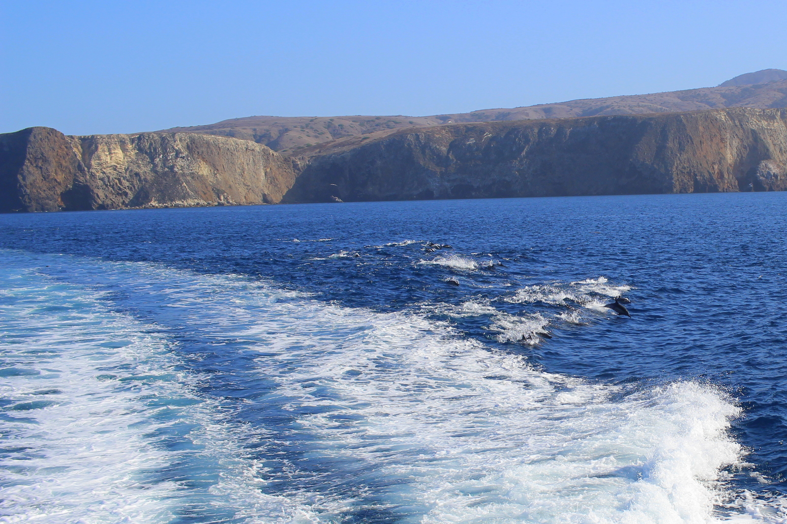
What I didn't realize was that we eventually swam right over the pod--and that the pod included roughly 1,000 dolphins! They were like a swarm around our boat. Seeing all these dolphins frolicking in the ocean around us really brought a smile to my face.

Things only got better. The captain said he would create a wake, and that the dolphins would surf in that wake. Sure enough, as the captain sped up, we could see the more athletic dolphins surfing the wake created by the ferry. They jumped in and out, in and out. Again, I was smiling.

2015-09-22 17.17.00.jpg

I love moments like these. The ones that are so memorable but were completely spontaneous and unplanned. I'd had absolutely no expectations that I'd see any marine animals on the boat ride. And I'd gone whale watching and whatnot before. But seeing the thousand-strong pod was one of the coolest things I'd seen while on a boat.

We eventually docked in Ventura just past 5 p.m. I got into my car and booked it into Los Angeles. I was heading in to the city to stay with my friend, Molly Mitchell (of @meandmyboifriend fame). The traffic was wretched. I realized that L.A. was not the city for me. It was so spread out, and so car-filled, that I felt lost the entire time I was driving into the city. I was thankful for Google Maps.

After showering at Molly's (and realizing that running shirtless was a bad idea!), we headed out on Sunset Boulevard for burgers and, most importantly, churro ice cream sandwiches from Churro Borough. They were incredible.

It was another fulfilling day, this time in L.A. (rhyme intended!).

Day 19: Mount St. Helens National Volcanic Monument, WA + Portland, OR by Wookie Kim

I think Washington State doesn't like me much. Yesterday's weather was absolutely miserable, and I'd spent 5+ hours on the Wonderland Trail wondering where Mount Rainier was. This morning, I broke camp early and made my way out of the park, only to turn a bend and see this.

I imagined what yesterday would've been like had snow and fog been replaced by light clouds and sun. I turned a few more bends, and saw another picturesque view of the mountain. It was at this point that I also grew jealous of my friends who'd either climbed (Julie D.!) or were planning to climb (Victoria B.!) Mount Rainier. I was determined to get out of the state.

But not without seeing Mount St. Helens. After all, I was in the area, and it was on the way to Portland, my next destination. I was barely over 100 miles away from that famous volcanic mountain, but I knew that many of those miles were on windy, mountain roads. It took almost 3 hours to go that distance. After popping out of the forest and getting my first view of the valley, my heart sunk. This was what I saw.

I'd already spent 2 hours driving deep into the forest, so I decided to continue to the end of the scenic road, which was another 10 miles up the valley. I secretly hoped that I'd drive high enough so that I'd be above the fog and clouds. I reached Windy Ridge and saw this.

I was done. Done with trying to see mountains. And, more importantly, done with the state of Washington. I was now Portland bound! I retraced my route, and continued along the windy forest road to the main highway. The drive was so long and there were so many windy turns that my wrists started getting sore from all the pushing and pulling of the steering wheel. 

Just 50 miles outside of Portland, Washington state redeemed itself. I passed through what I later learned was an unincorporated town called Yale. I stopped by Yale Park, marveled at Yale Reservoir, and even took a look at Yale School. (Can you guess where I went to school?)

Finally on good terms with Washington, I crossed over into Oregon state and into Portland. My friend, David Y., had already made arrangements for my arrival. The first thing I did was laundry. It's been almost 3 weeks and I've had zero opportunities to wash my clothes. I then washed my cookware, most of which was starting to get grimy. After showering, I decided to roam the streets a bit before David got back from work. I did the stereotypical Portland tourist things; I visited the Ace Hotel, took down an espresso from Stumptown Coffee Roasters, and stopped by Powell's. (I'd been to all these places before, but why not go again?)

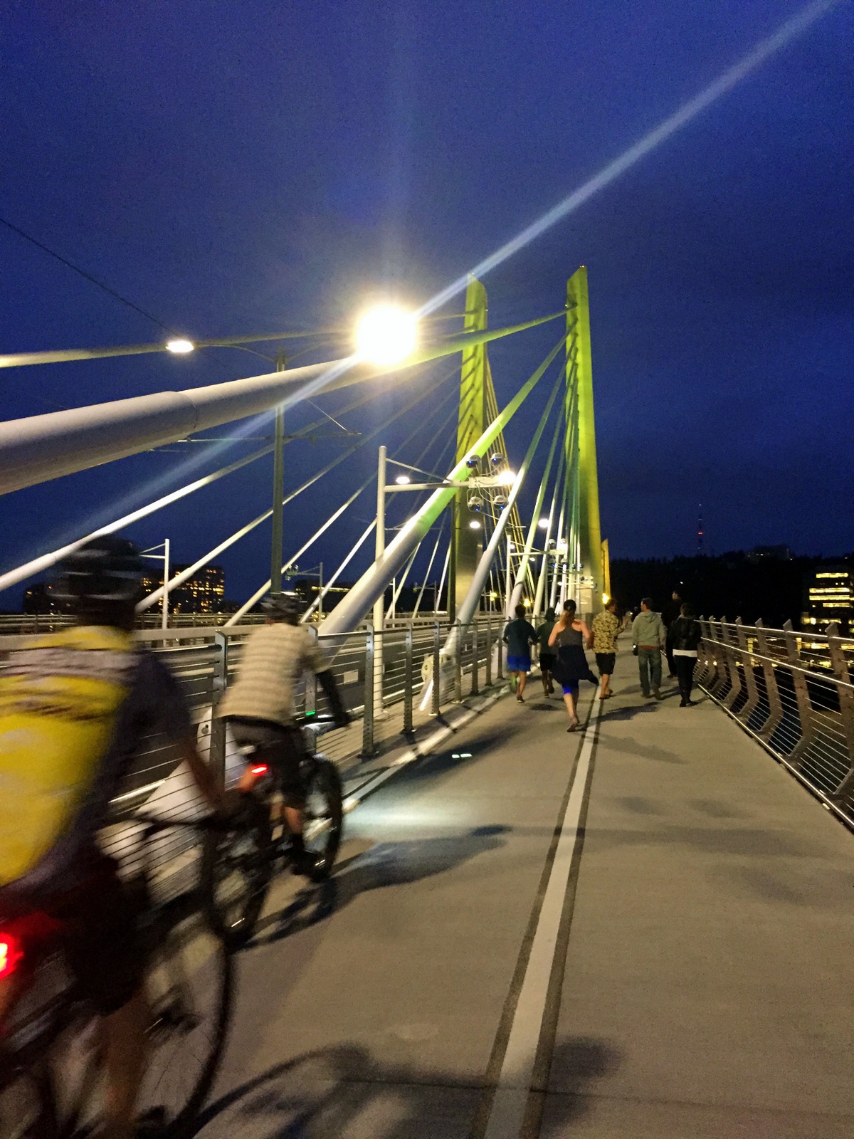
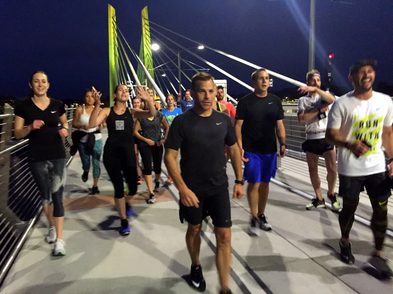
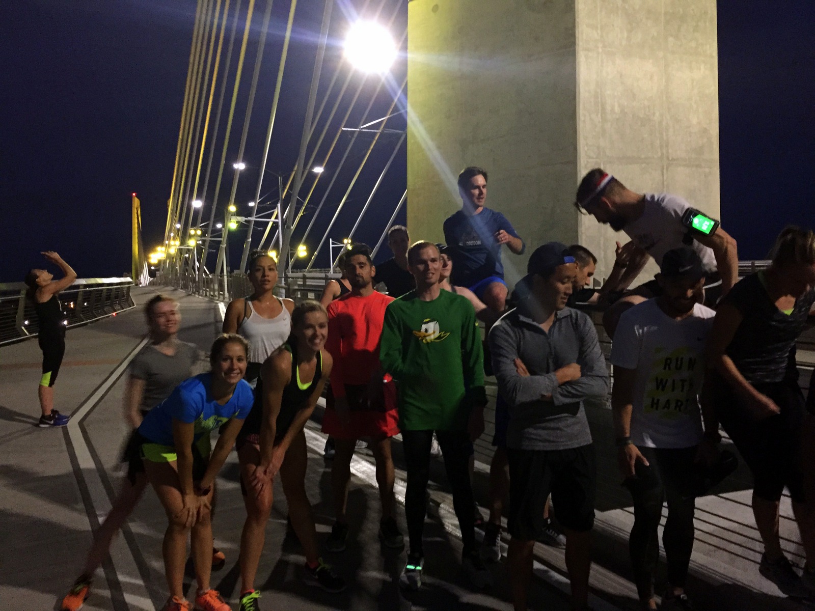
David arrived in the late afternoon. We caught up, got on a conference call regarding our high school, and then prepared for the run for the day: the Portland Stumprunners group run. The Stumprunners are the closest thing Portland has to November Project (query: why hasn't November Project established itself in this city?). A group of about 15 passionate, outdoorsy, runner types showed up at 7 p.m. outside the Peculiarium. Tonight's run destination was particularly cool; we ran to and across Tilikum Crossing, the new bridge across the Willamette River that allows everyone but drivers.

I had a blast. I think this was so for a number of reasons. First, I was running with a group again. I'd spent the last 2.5 weeks running alone. It was refreshing to run in a pack, and to chat with other like-minded runners. Second, I was running on flat road. My pace over the past few weeks has been incredibly slow. As just one example, I ran yesterday's 15 miles on the Wonderland at 19-minute pace. I couldn't even remember the last time I ran anything under 7:30 pace. It was nice to run unencumbered by dirt, rocks, and vertical. Third, as I've explained before, running is the best way to explore a new city. This was a workout, but it was a running tour, too. I got to see Portland in a new light (well, without light--it was after sunset).

We started at a relatively brisk pace, but casual enough so that we could chat. I hung with David and chatted with some of the runners. When we reached Tilikum Crossing, we stopped midway to take some group photos. From there, it was 4 miles back to the start. I decided I'd give my legs a spin, to rev the engine a little bit. The three of us in the front accelerated into a smooth but persistent pace. It was somewhat chilly, but I was now beginning to sweat. But it felt great. My legs were turning over quickly, and I could feel my stride lengthening as we picked up the pace. I was particularly surprised by our pace. We were cruising between 6:15 and 6:45 and I didn't even notice it. We'd done the last 3.5 miles at 6:35 pace--and it felt easy.

This little tempo piece at the end was reassuring. I'd spent part of the last few days wondering if all of this super-slow, super-long running would affect my ability to run fast. Lately, I'm lucky if I spend a couple miles under 9-minute pace. I know the rough terrain and the significantly higher time-on-feet account for some of that. But still. I wasn't sure I could run fast anymore. Tonight, I proved myself wrong. In fact, I think I'm getting into the best running shape I've been in for quite some time. I now plan to add a fall marathon to the calendar just to see what I can do on the road (on top of the Patapsco Valley 50K, which, seeing as it is "home turf", I want to crush).

After the run, a few of us met at Samurai Blue, a sushi joint on Mississippi Avenue. We nommed on sushi and beer, and chatted about Nike (practically everyone in Stumprunners appears to work at Nike). And after eating sushi, we ate ice cream, and continued chatting about Nike.

Then it was time to head home. I was staying at David's sweet new pad. I finished folding laundry, and we chatted about all of the things.

One of the other benefits of the group run was that I now know where I'll be running tomorrow. I'll begin by following David to the Nike campus for a quick tour. Then, I'll drive to Silver Falls State Park to do the Trail of Ten Falls. I'll make my way to Eugene to see the legendary Hayward Field (and maybe run a lap or two on it, if the cross country team will let me). And I'll end by setting up camp in either the Willamette or Deschutes National Forests.