southwest

Day 38: Big Bend National Park, TX + Dallas, TX by Wookie Kim

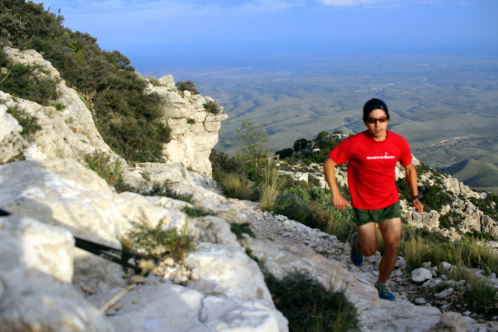
At 6 a.m. this morning in Big Bend, I had to make a choice: (1) reach the Rio Grande in Big Bend but have a ridiculously long drive to Dallas afterwards and (2) head straight for Dallas and still having a long driving day. I chose the first option and couldn't be happier with that choice.

I had plans to stay with Bradshaw H., a high-school classmate, in Dallas this evening. No matter what I did, I'd be in for a long drive. From the park's exit, Dallas was about 550 miles away. But I was already over 30 miles inside the park. And I wanted to drive another 30 miles in the opposite direction on the Ross Maxwell Scenic Drive to the Rio Grande. Specifically, I'd heard that Santa Elena Canyon was a must-see, so I decided to go there.

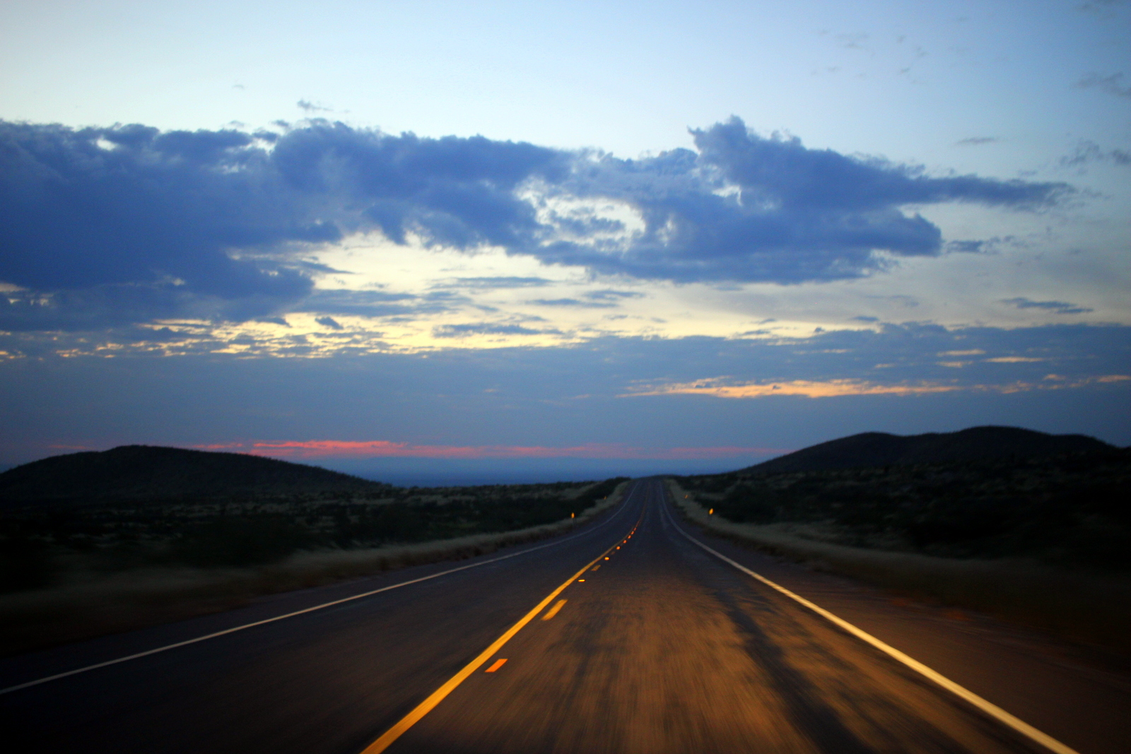
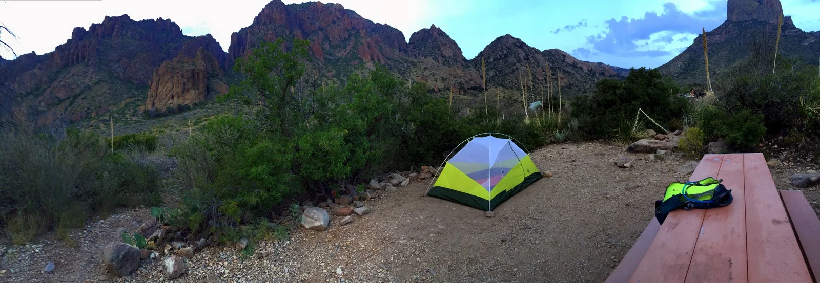
I broke camp quickly, and hit the road by 6:20 a.m. All was dark, and I felt at peace, just as I had on my pre-dawn cruise through West Texas the day before. The miles I slowly clocked on Ross Maxwell Scenic Drive felt weird; I was driving in the most amazing part of the park, but I couldn't see any of it yet. I knew I'd be retracing my route on the way out, but still.

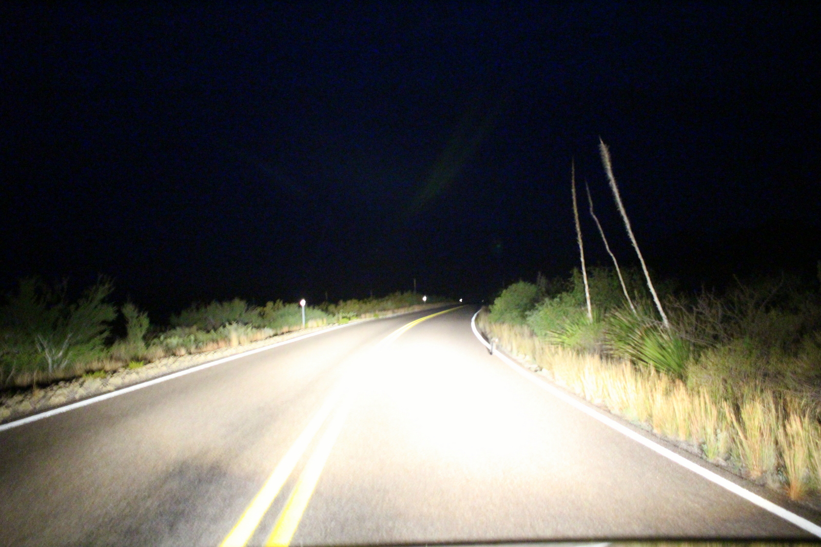
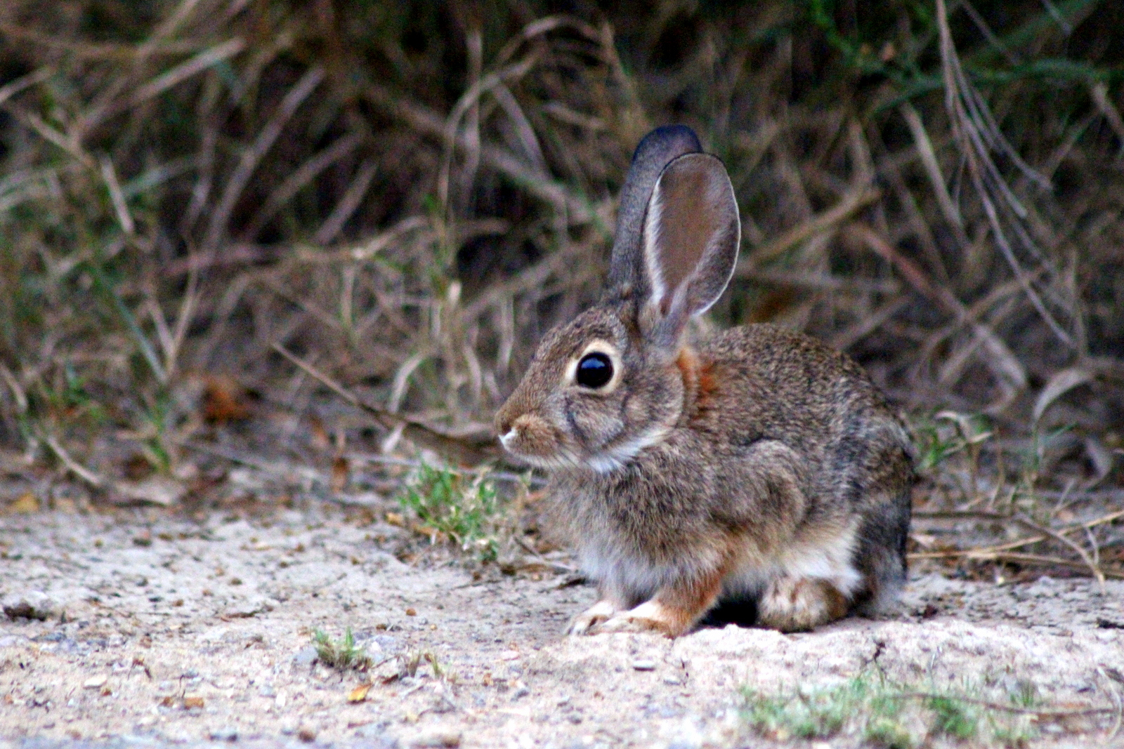
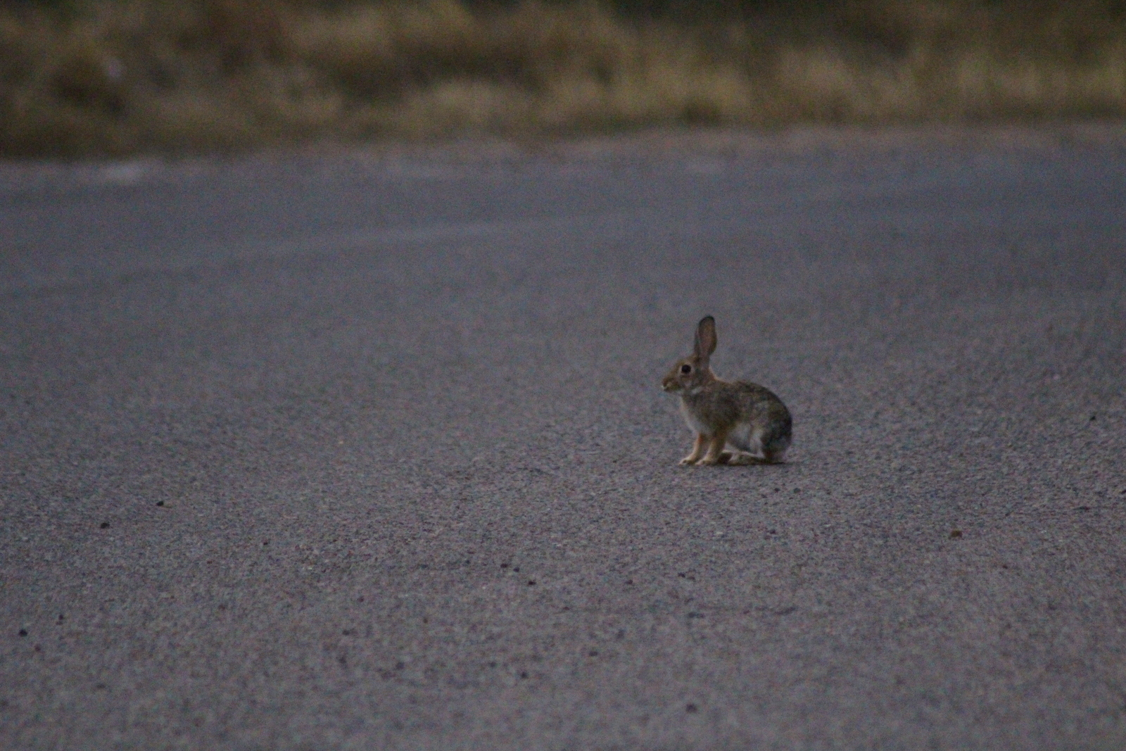
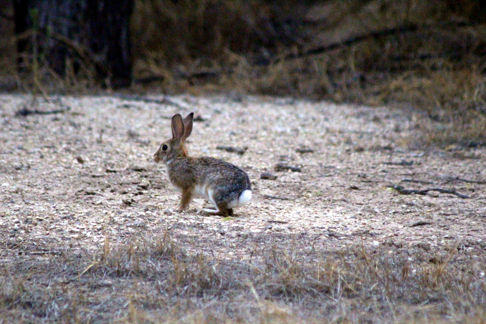
All the light I had to guide me was on the front of my car. That small source of light was enough to show me the type of wildlife activity that goes on while we humans sleep. Every couple minutes while cruising at 45 miles per hour, I would see another animal. First, I saw a dozen or so rabbits. Here and there, I'd see roadrunners scampering across the road. I saw a white-tailed (?) fox using the human highway as his own highway (even though I rolled close to him, he continued trotting along the edge of the road as I passed him. And, magically, for the first time all trip, I saw, and almost collided with, a lumbering black bear (one of an estimated 50 black bears living in the park).

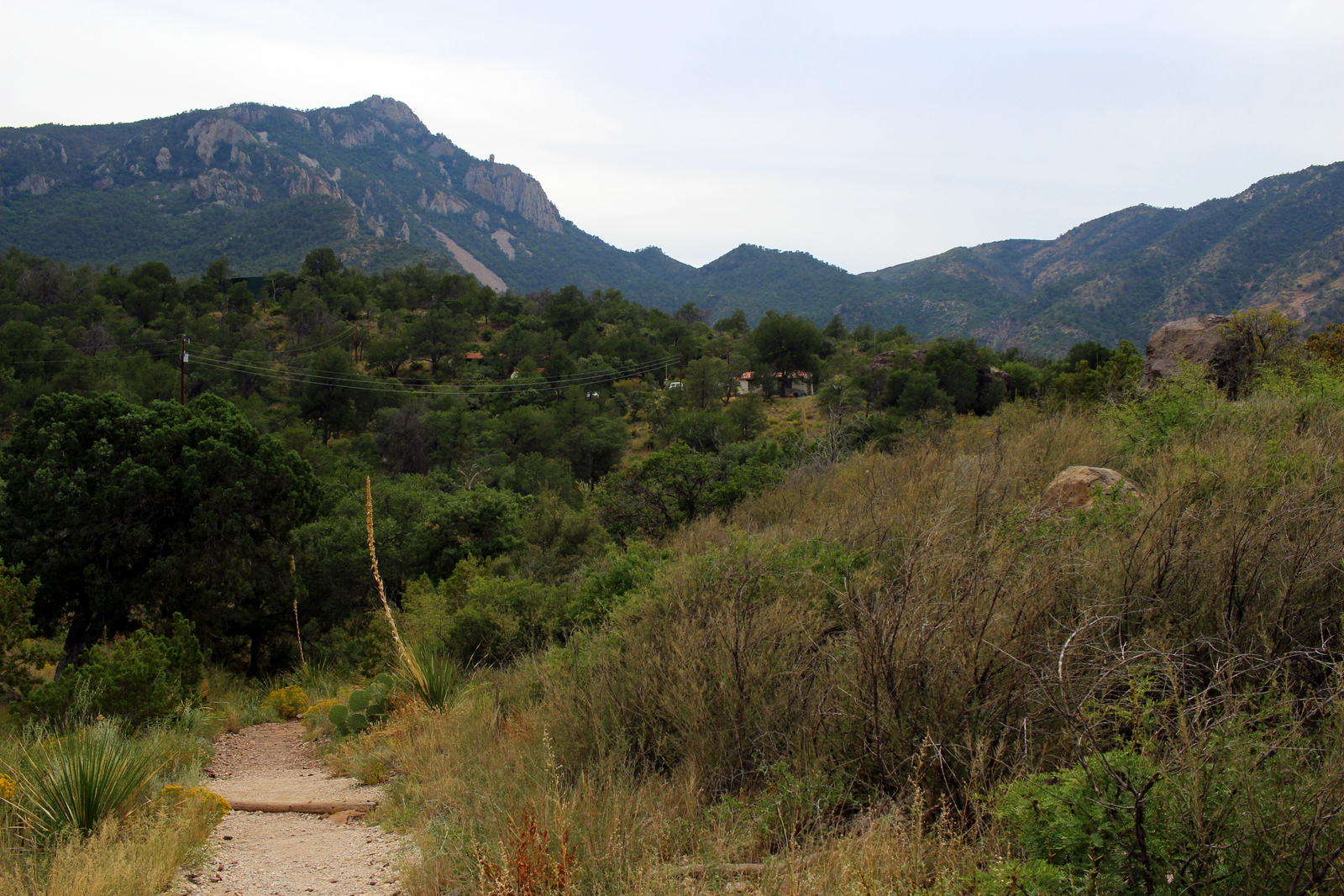
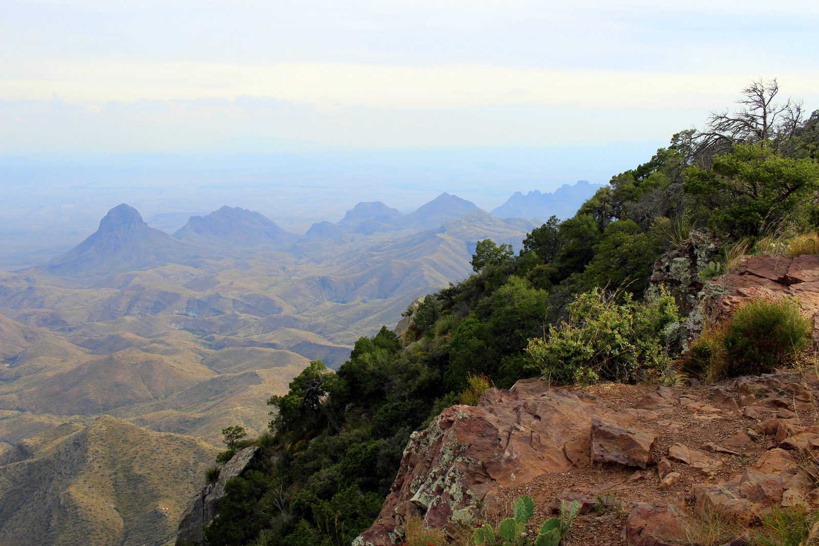
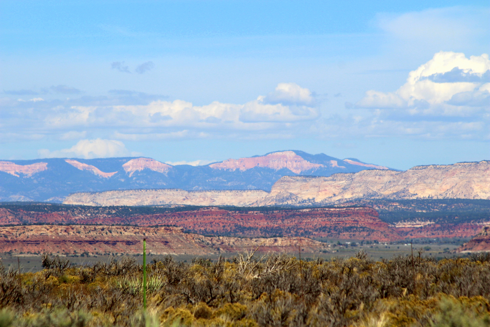
By 7:30 a.m., the sky was beginning to wake up. I could tell rain was on the agenda today, because the clouds looked dark and ominous. But that made for a more moody and grand landscape. I snapped some photos along the way.

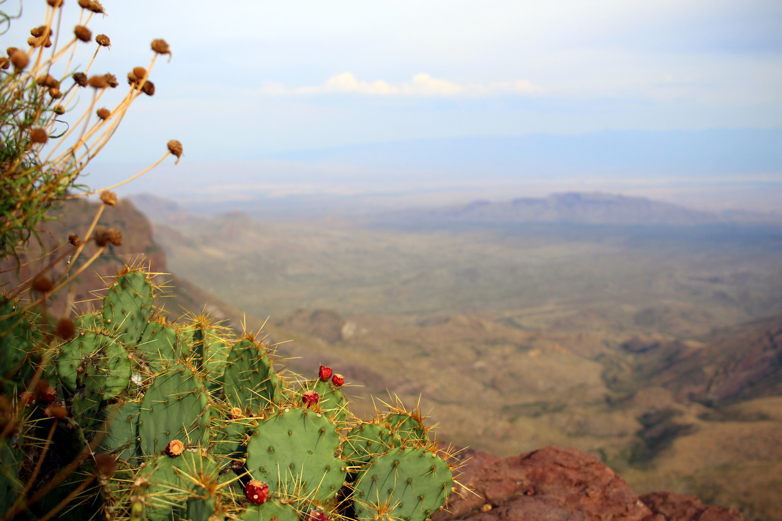
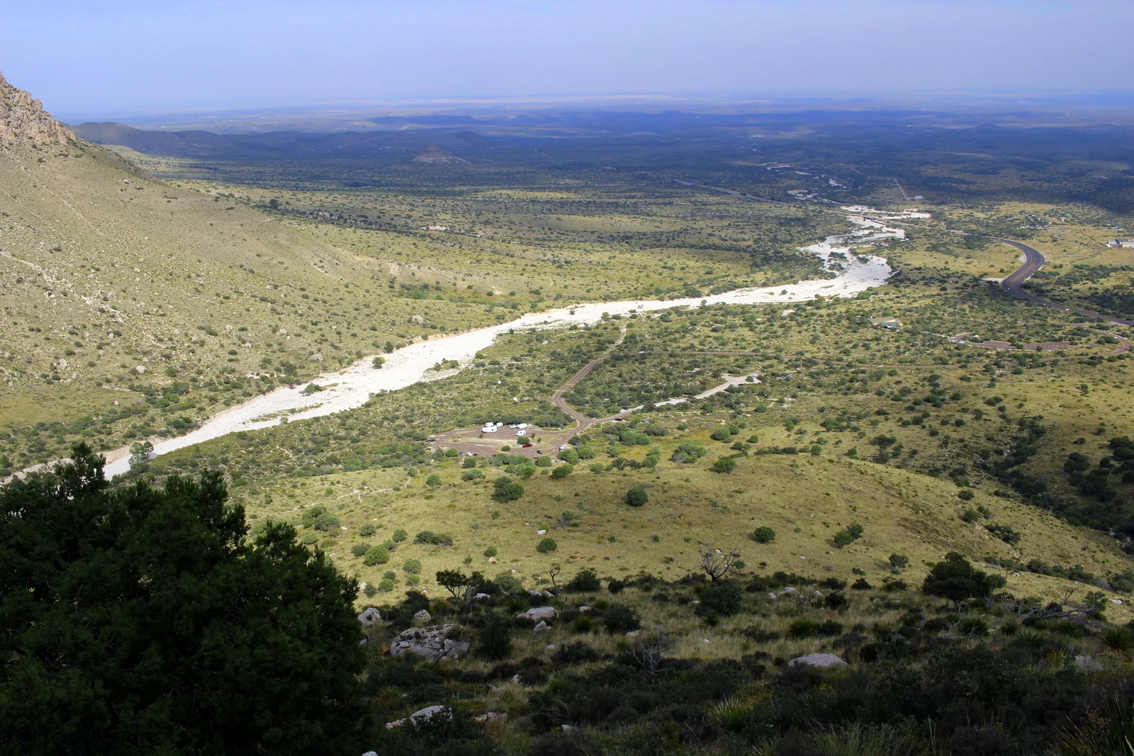
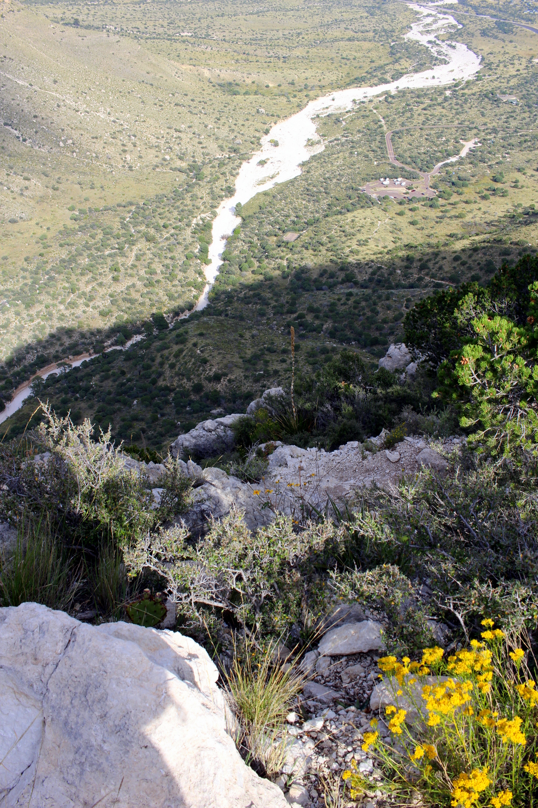
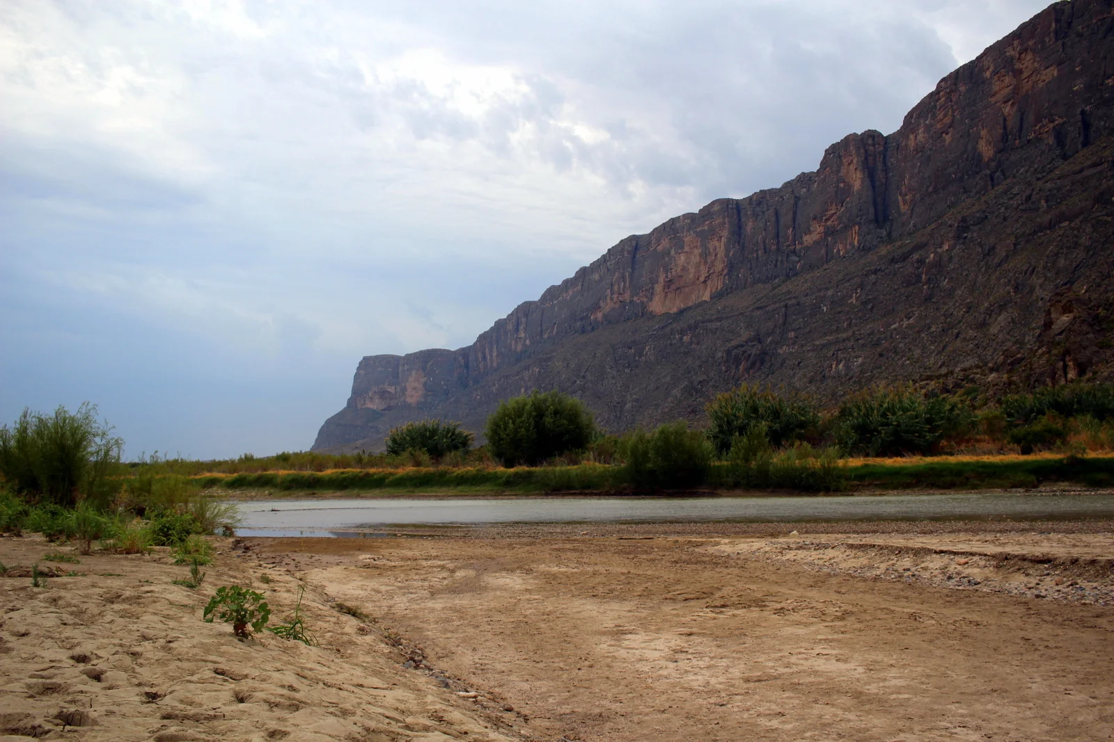
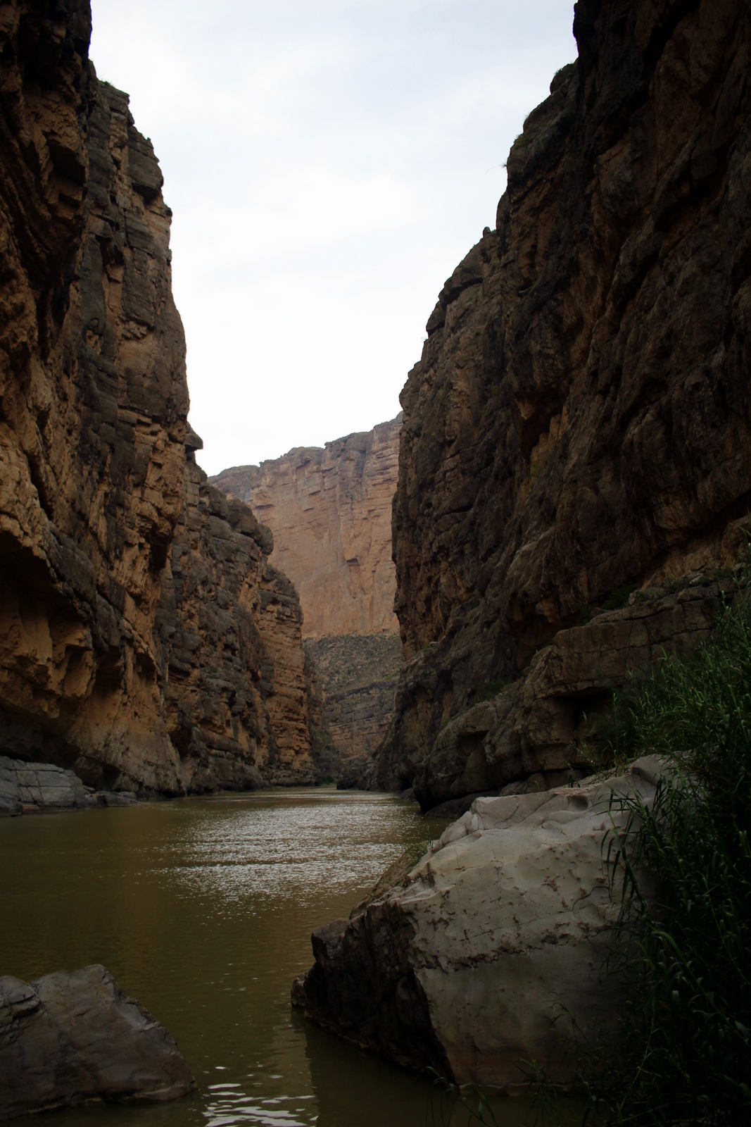
By 8 a.m., I'd arrived at the trailhead to Santa Elena Canyon, which is in an incredibly remote part of an incredibly remote park. The canyon itself was carved out by the Rio Grande, the river that serves as the US-Mexico border in this part of the country. I was on the US side. But if I wanted to (and signs made clear that I shouldn't do this), I could simply hop into the river, swim the 25 yards across, and be on Mexican soil.

(Santa Elena Canyon might as well have been named Rabbit's Canyon because the desert cottontails were running wild here. Every 50 yards or so, I would see a new bunny, sometimes scurrying off the road into the grass, and sometimes just sitting still in the middle of the road as I rolled quietly by. I saw close to a hundred rabbits on my drive. There were lots of roadrunners, too.) 

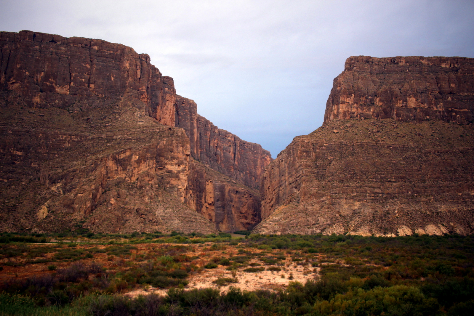
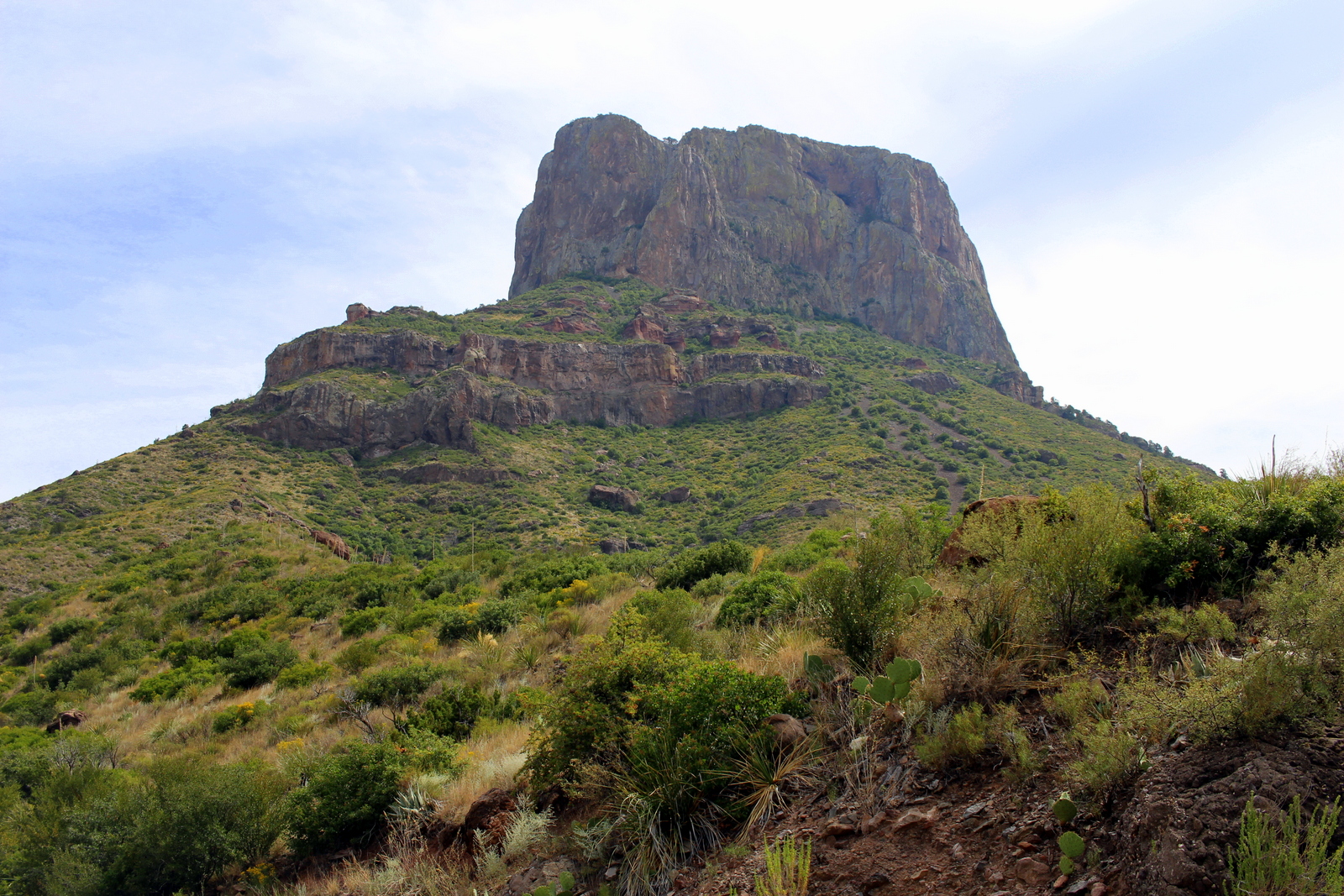
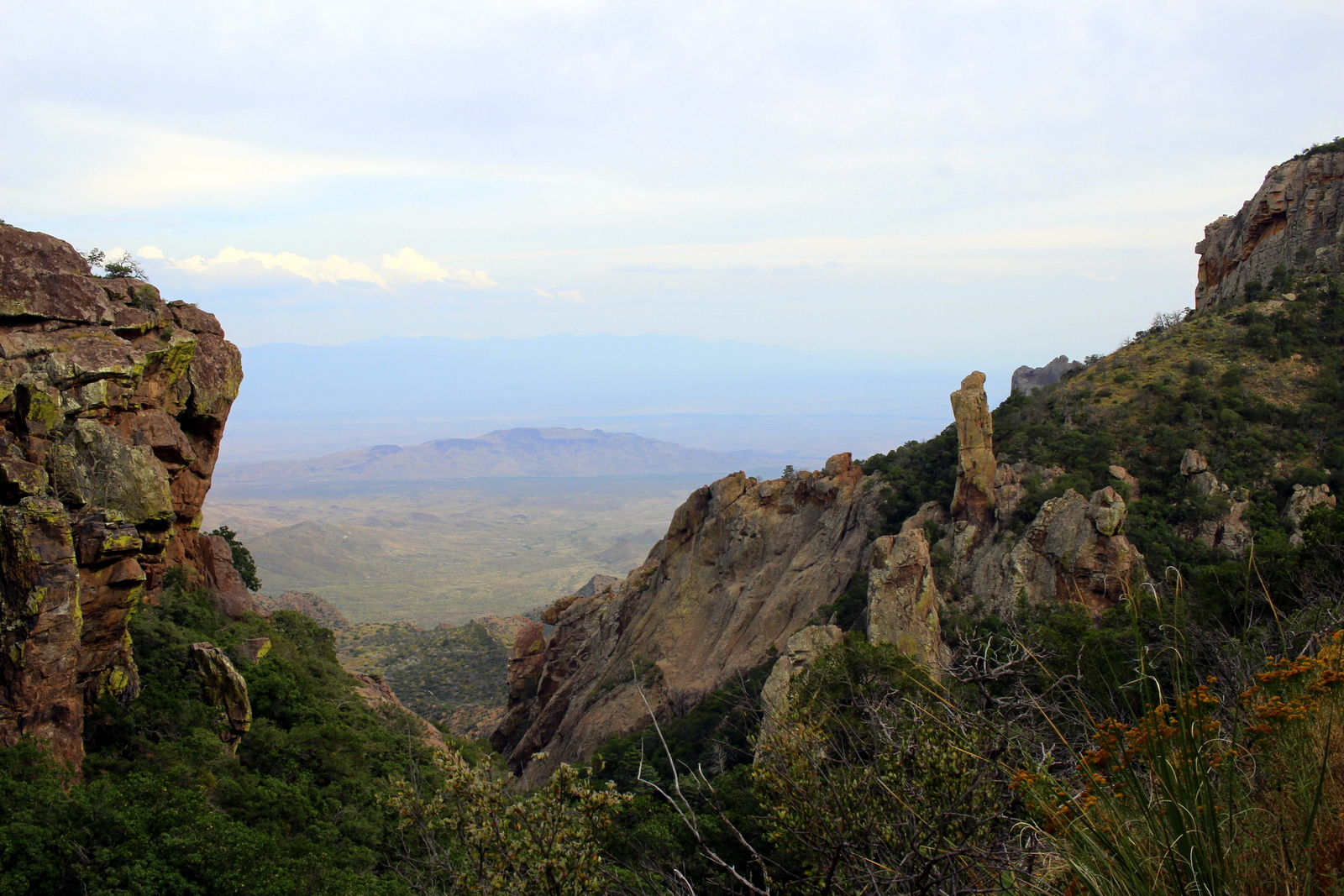
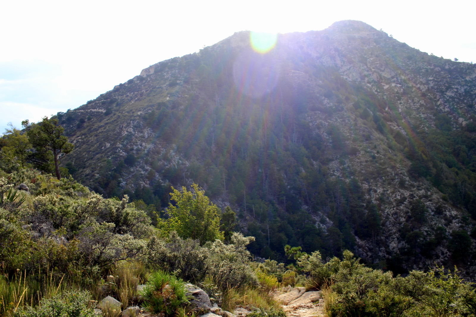
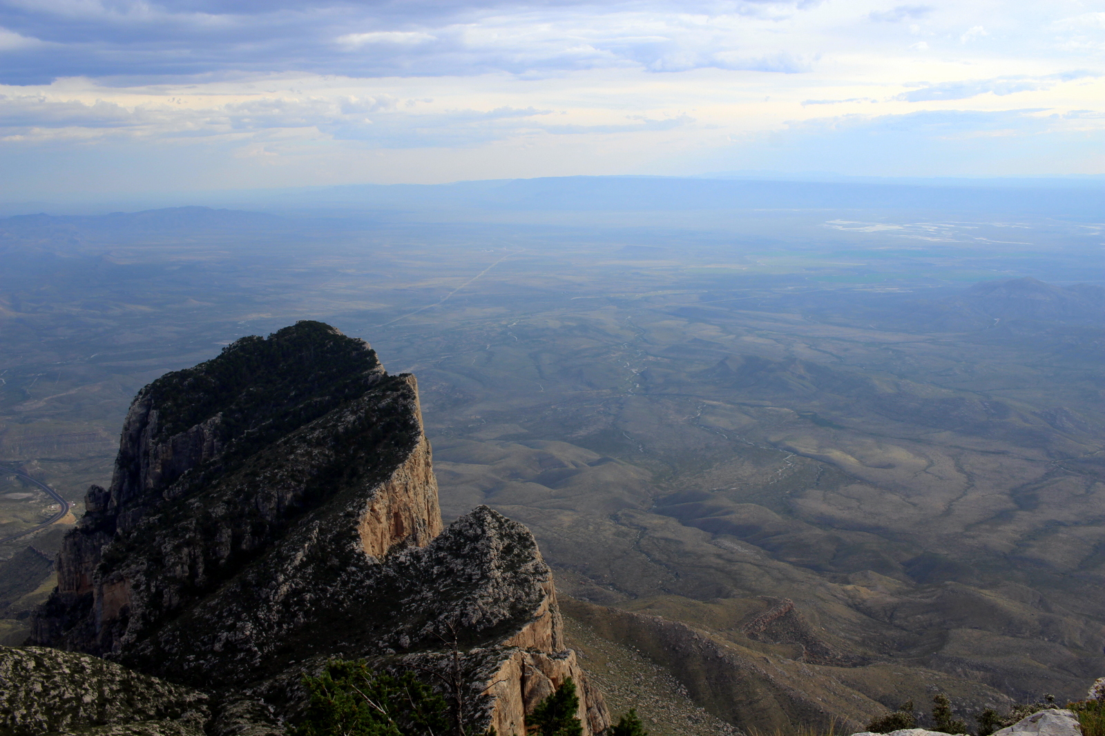
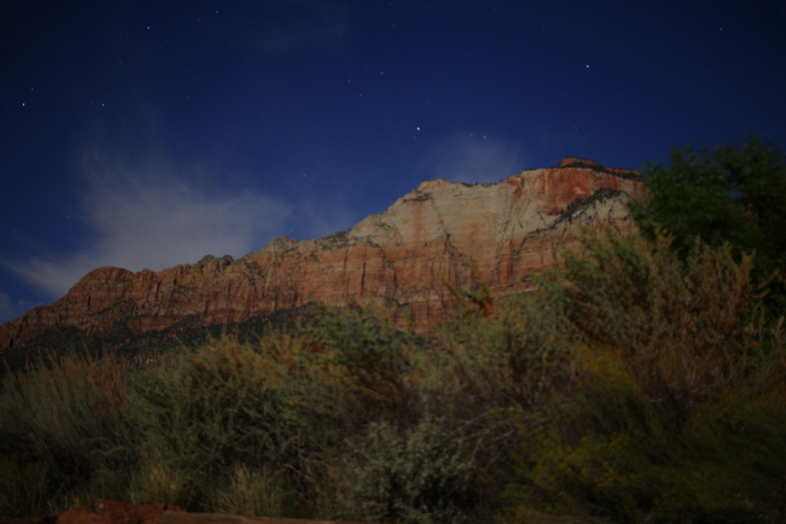
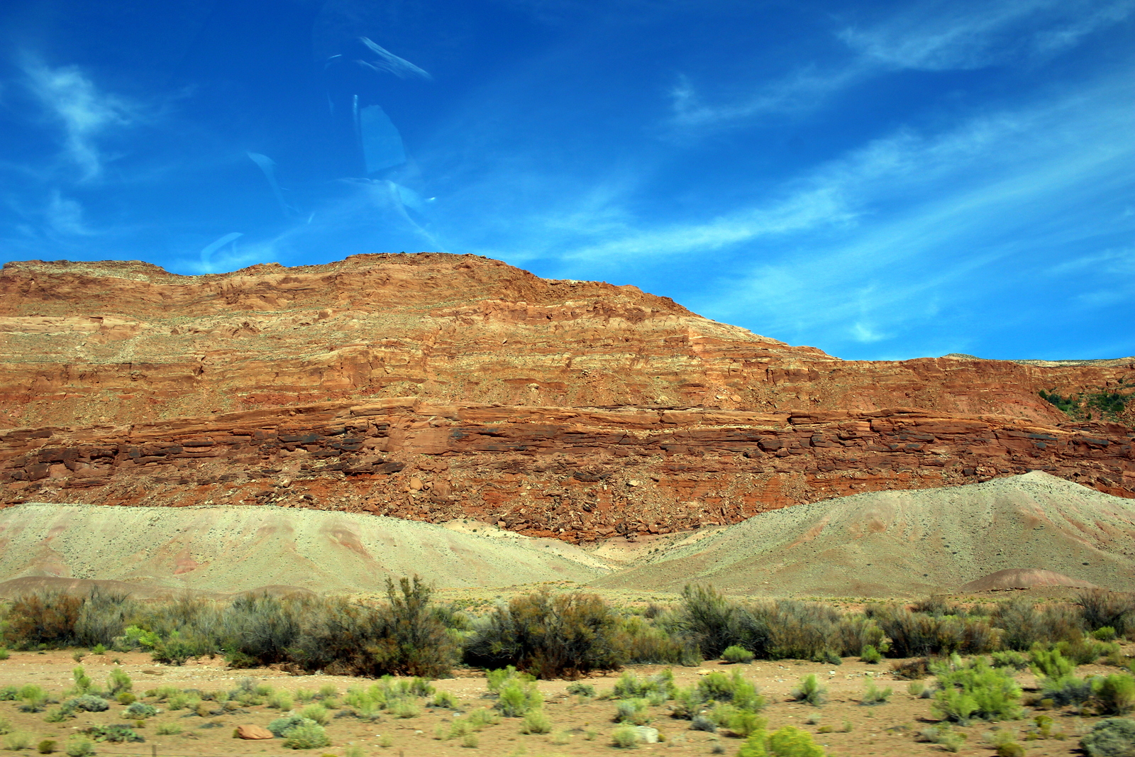
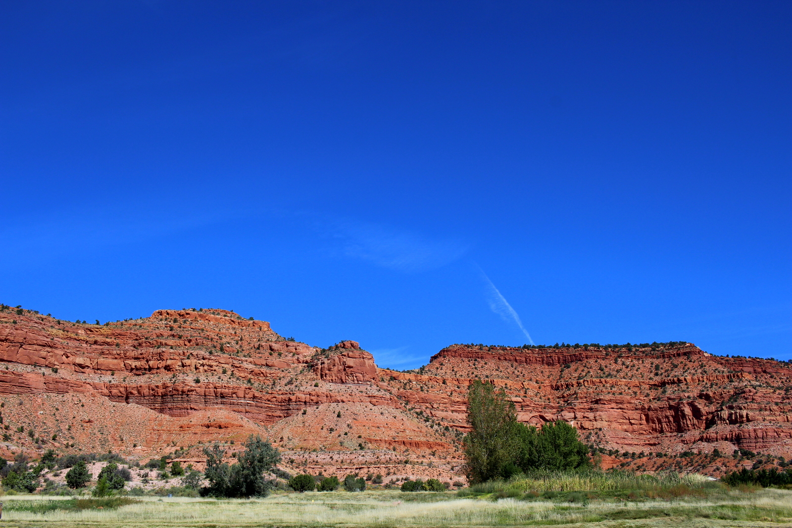
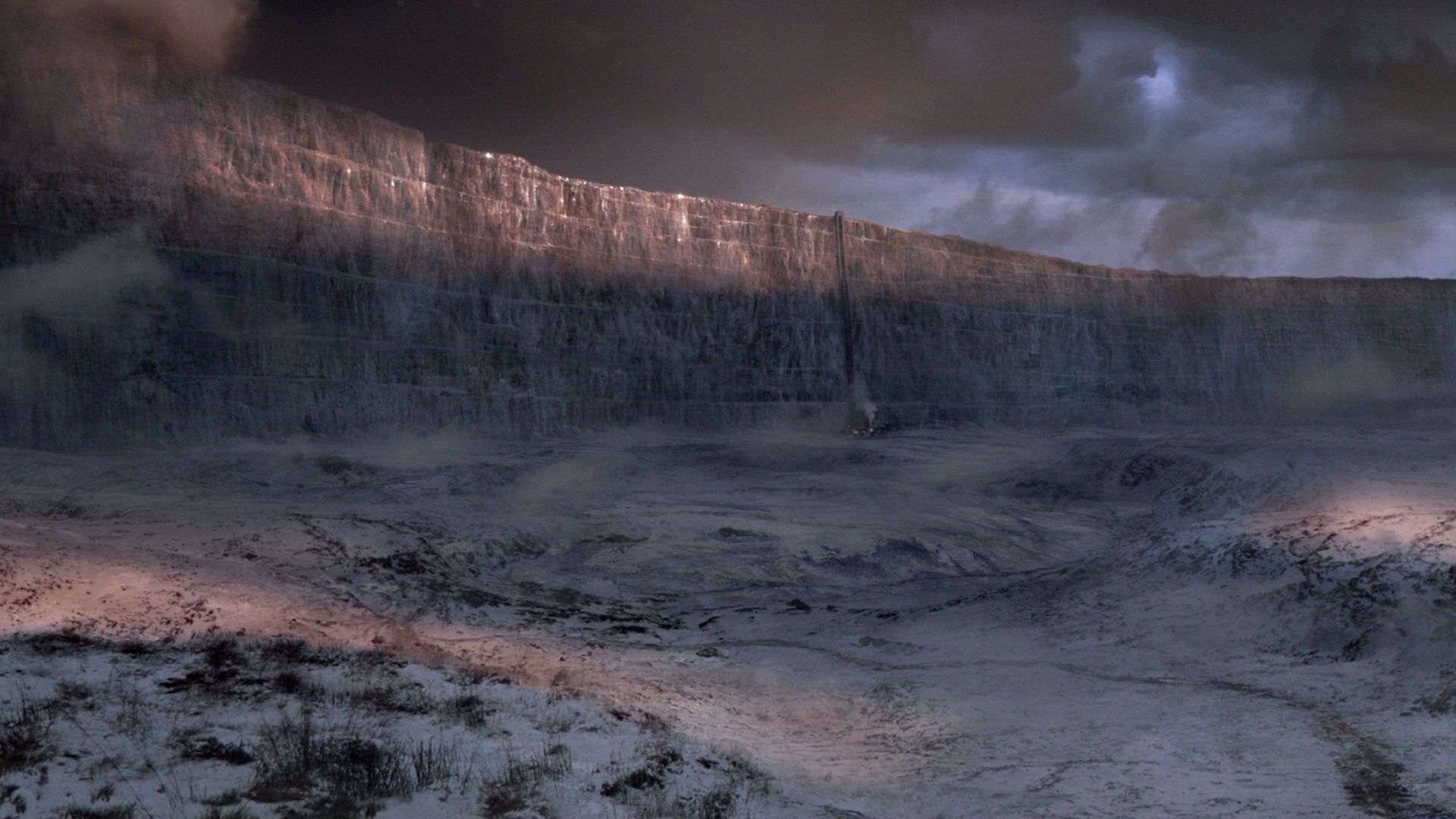
Without any knowledge of the political history, I recognized that the landscape served as a perfect border between nations. The canyon was massive, and the high walls rose over a thousand vertical feet and extended for miles in both directions. It felt oddly reminiscent of the Great Wall in Game of Thrones. No border patrols would be needed here.

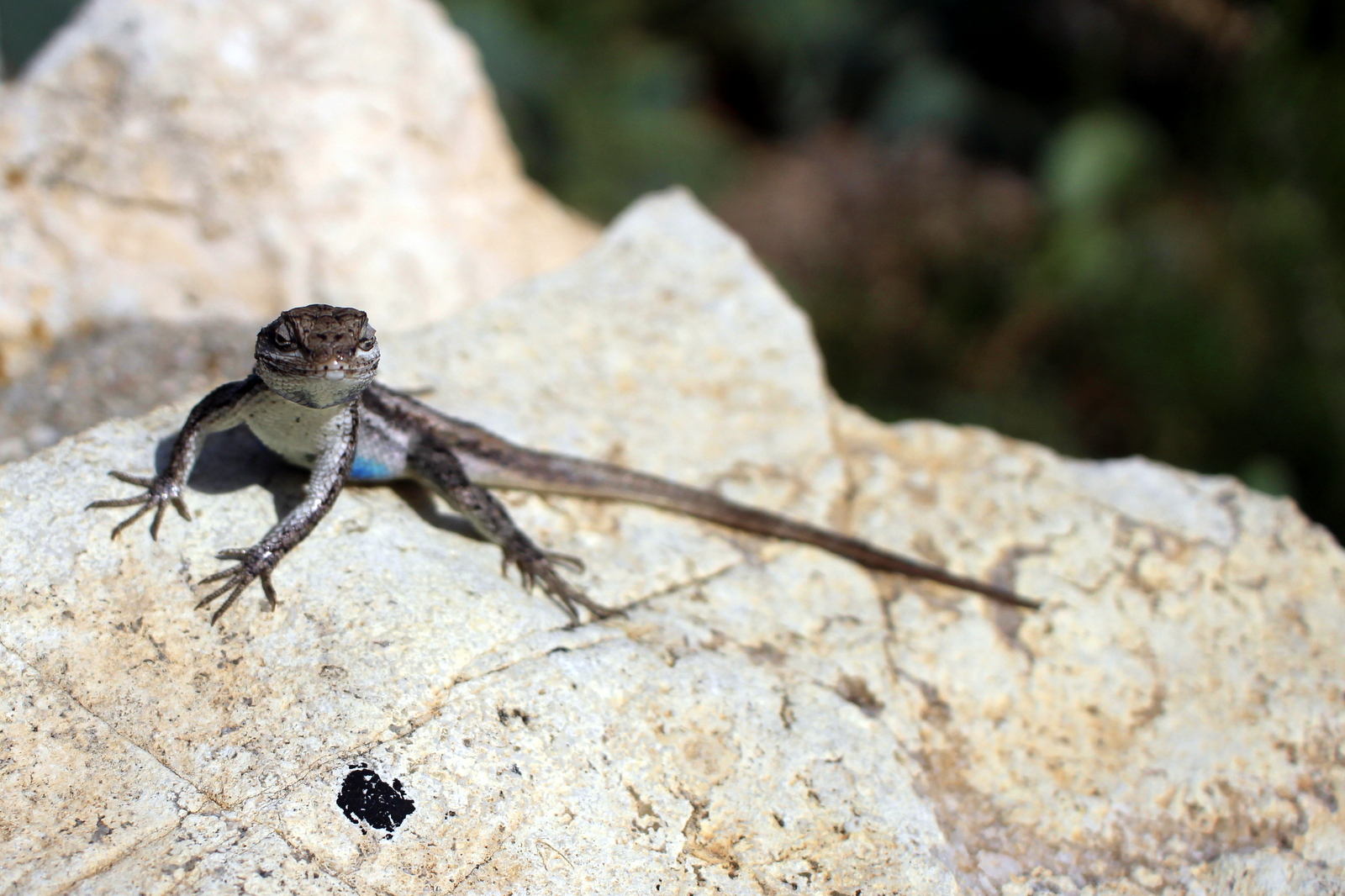
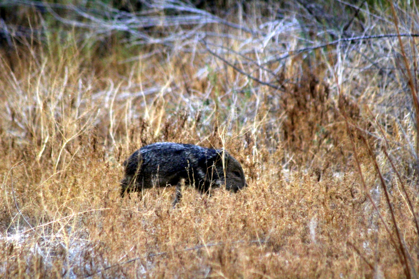
The hike to the vista in the canyon was supposed to be short, under 2 miles roundtrip. But it required crossing the Terlingua Creek, which is a tributary into the Rio Grande, and I couldn't find a place to cross the creek (without getting wet, that is). I ended up having to hike parallel to it. While standing on the creek's bank looking for a crossing point, I noticed a group of about six warthog-like animals. I'd never seen these creatures before, and didn't know their behavioral tendencies, so I shouted at them and stamped my feet. That apparently scared the crap out of them, because they scattered immediately. I got out my telephoto lens, but by the time I'd put it on, they'd already created a big gap. I later learned that these creatures were harmless javelinas.

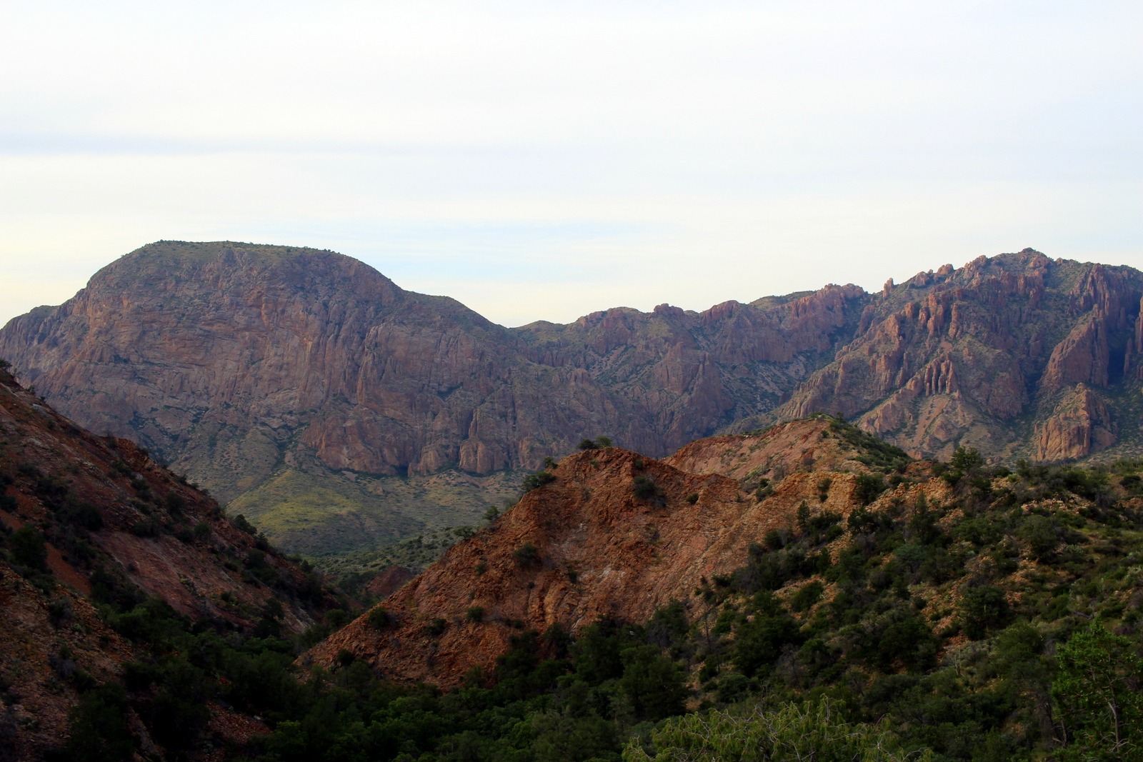
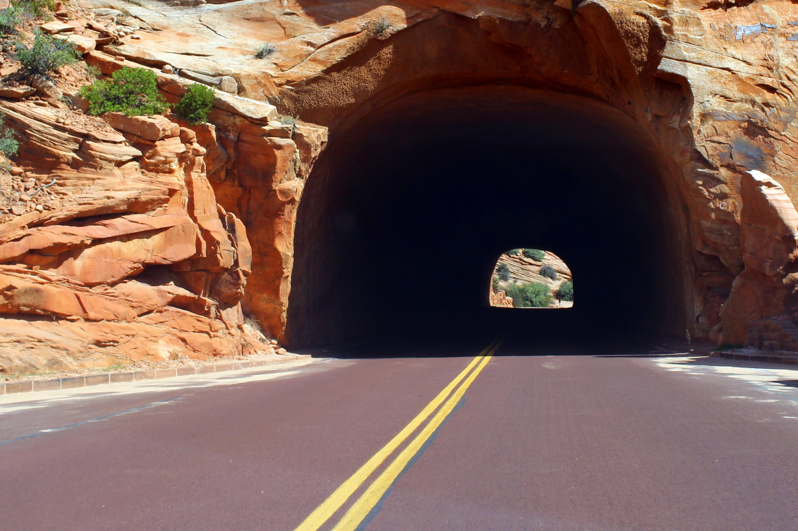
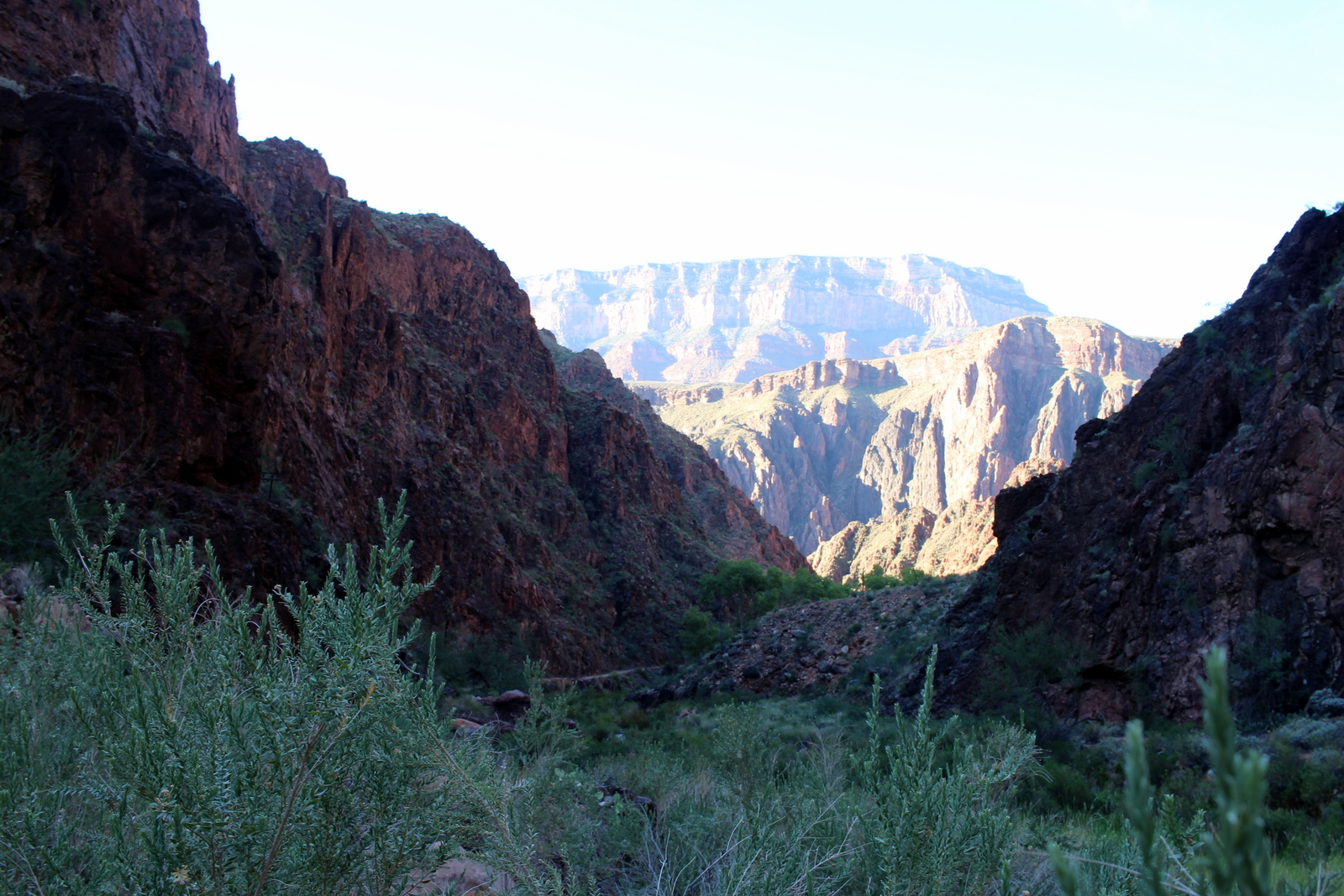
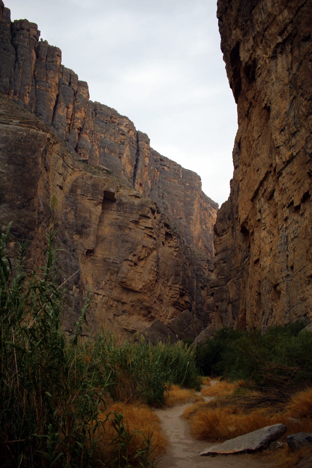
I eventually found a drier part of the creek and crossed over towards the canyon. I hiked along the US side into the canyon. The sights were nothing short of breathtaking. This felt like the Zion Narrows on steroids. The water was a full river--a "Grand" river--and the canyon walls shot straight up into the sky.

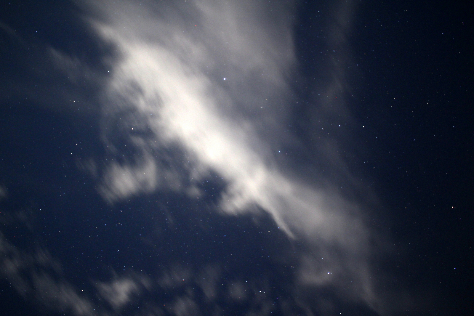
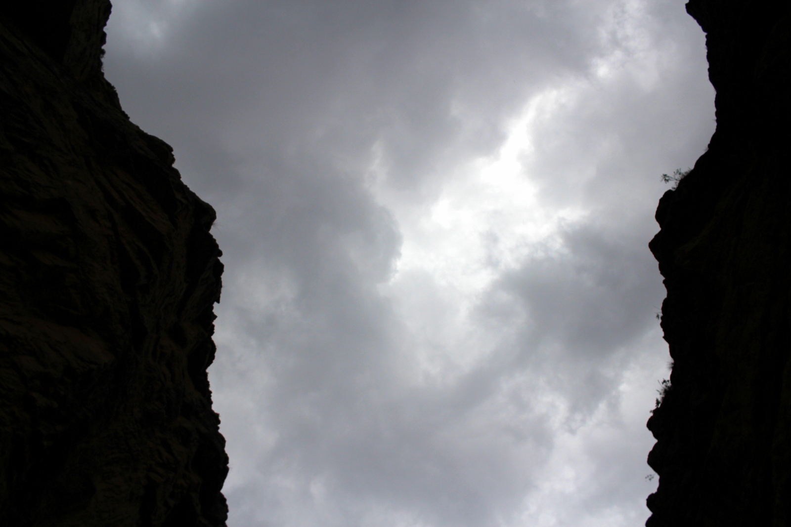
Looking up, I could tell that the rain was going to pour at any minute. I was in awe looking at the contrast between the wisps of clouds that floated in the gap provided by the narrow canyon walls and the dark canyon walls themselves.

I'd never been to Mexico, and this was literally as close as I could get without being there (in another region of this gigantic park, there is a ferry that takes you into the Mexican town of Boquillas--passport required, if you want to return, that is).

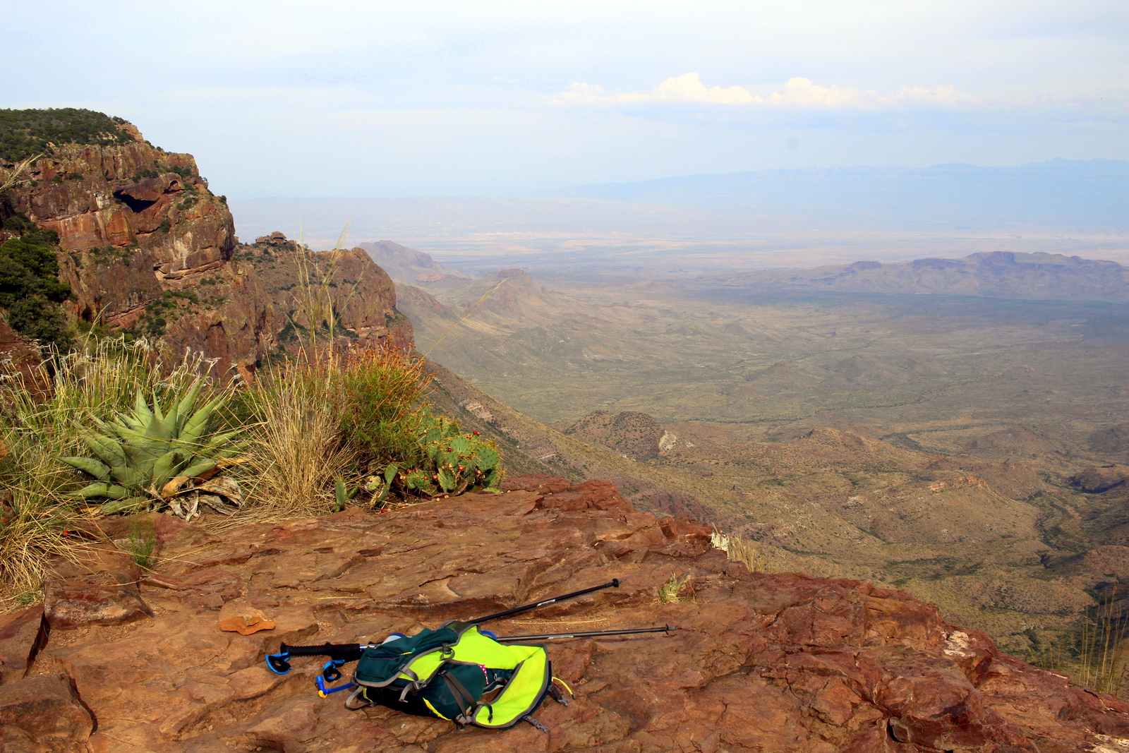
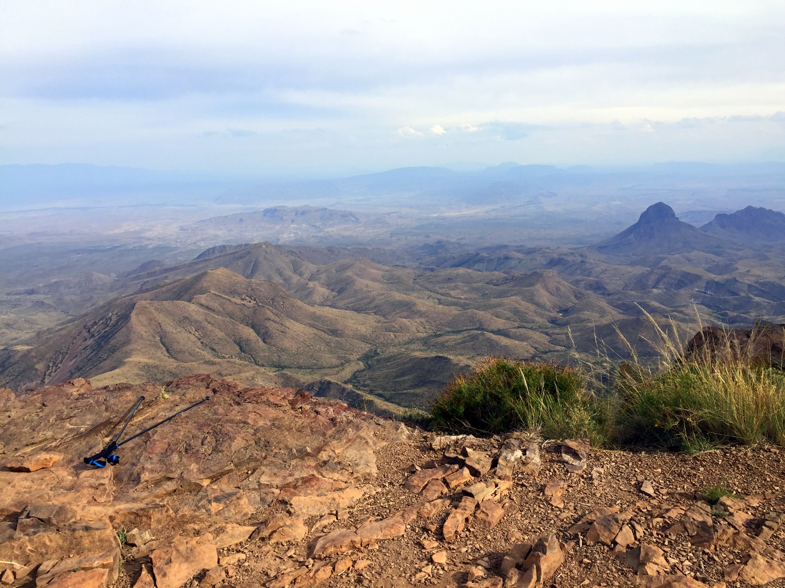
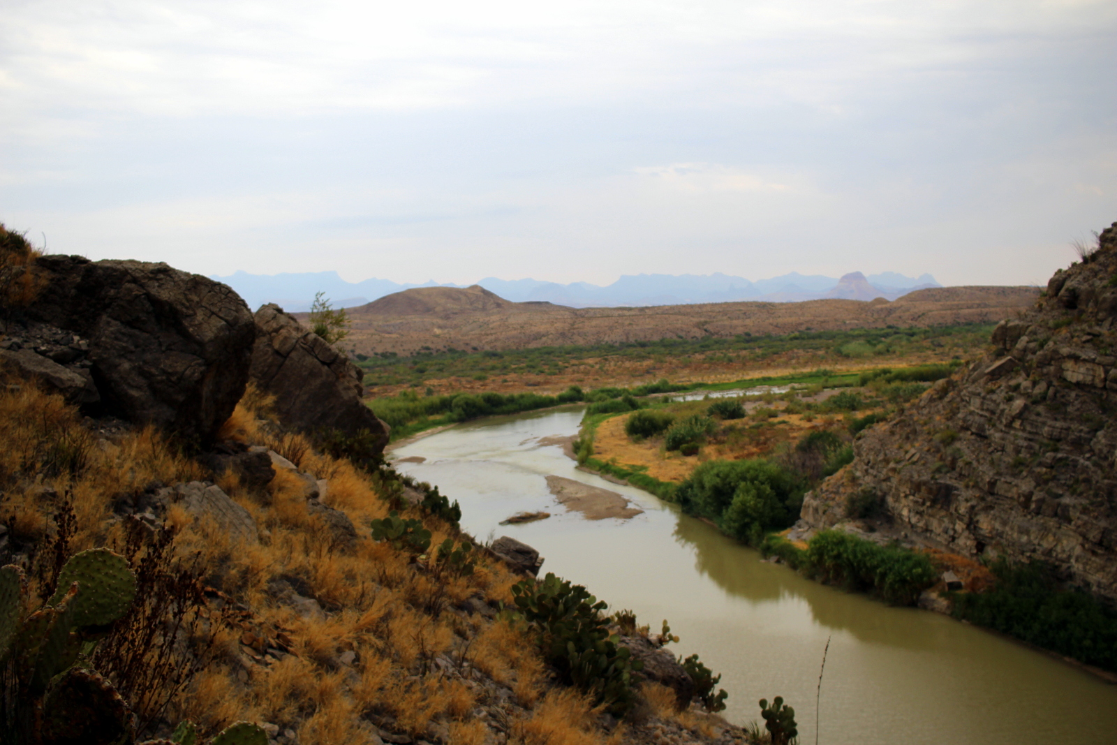
It was also awesome to see the rest of Big Bend looking out from inside the canyon. I could even see some of the javelinas from afar.

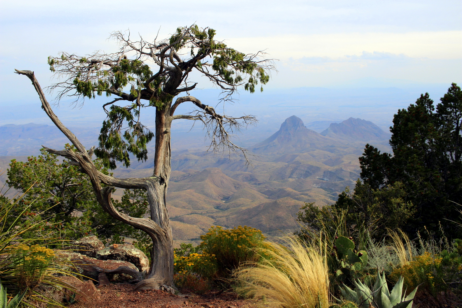
Right as I got off the trail, the skies opened up. I was thankful that I was back in my car and on the road again, this time headed for Dallas. On the way out, I saw the landscape that I'd missed on the drive in. I saw the famous "Mule Ears", and more of the traditional Big Bend landscape.

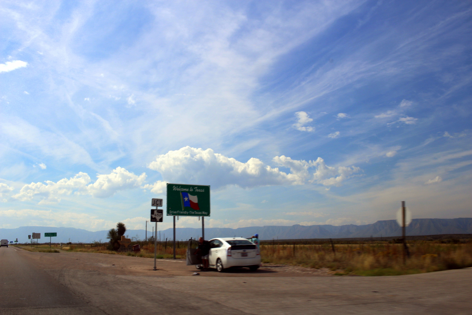
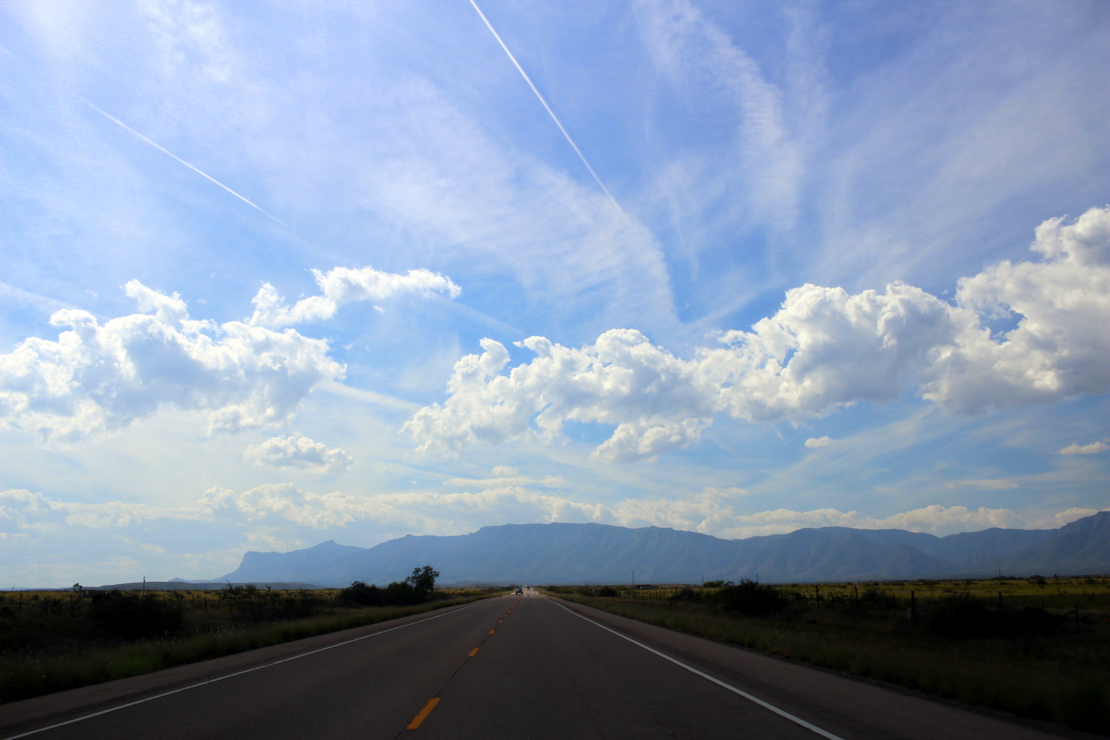
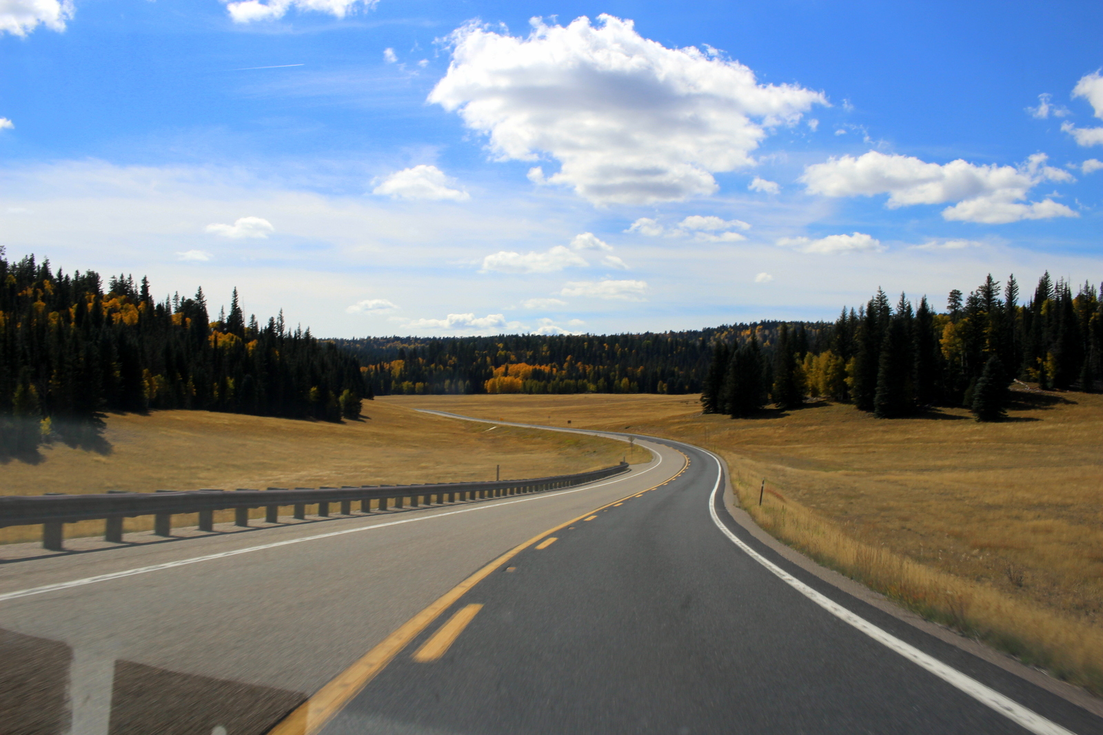
And then I was off for Dallas. I had roughly 600 miles to go from this point. On open highway, this might take under 10 hours. But the first 60-70 miles would be inside the park, on 45 mph roads, and there would be other smaller highways I'd be jumping on and off of. I had a long day ahead of me in the driver's seat.

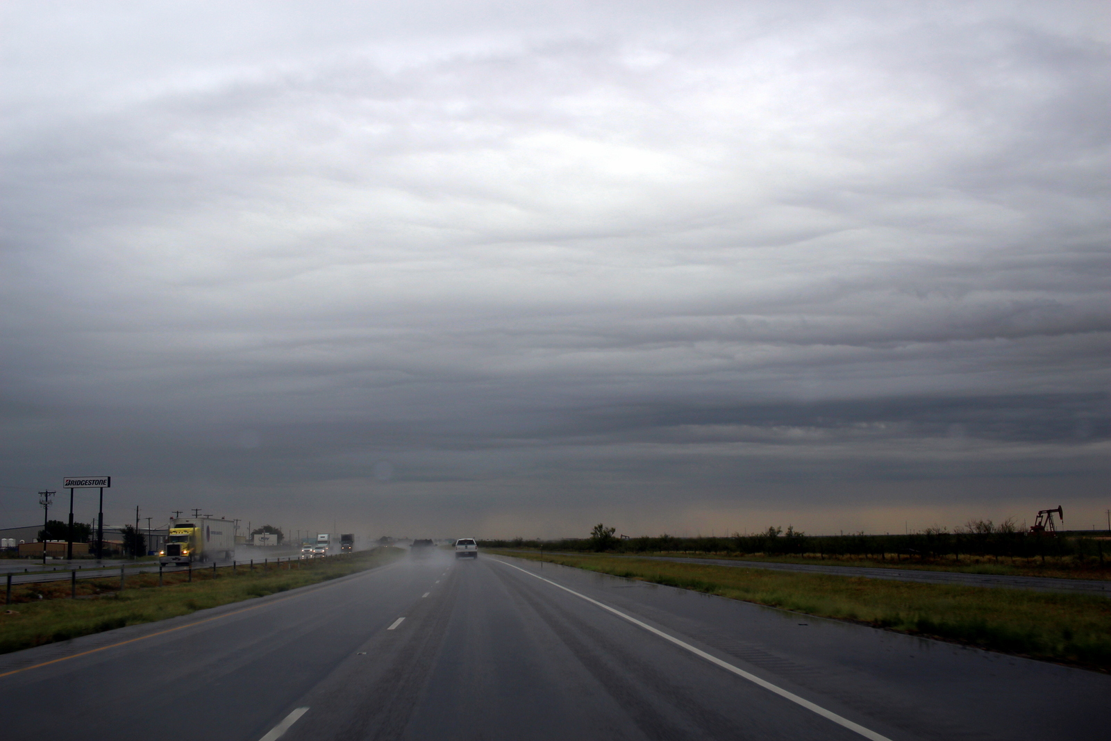
I-40 is not the most scenic of interstates. But, as I leapfrogged from one oil town to the next, the relentless rain clouds created an eerie and mesmerizing landscape in which to drive.

I didn't drive nonstop to Dallas. In Midland, I linked up with my friend, Lowell R., who'd had to bail yesterday on our plan to meet in Big Bend. We ate delicious Mexican food and posed by a photo of President Bush.

The rest of the day was utterly boring. The Central Texas landscape is uninspiring. Just about the only thing I saw besides the flat, barren land were oil rigs and machinery. This was obviously oil country.

I arrived in Dallas after 8 p.m. I was staying with my high school classmate, Bradshaw H., and his family.

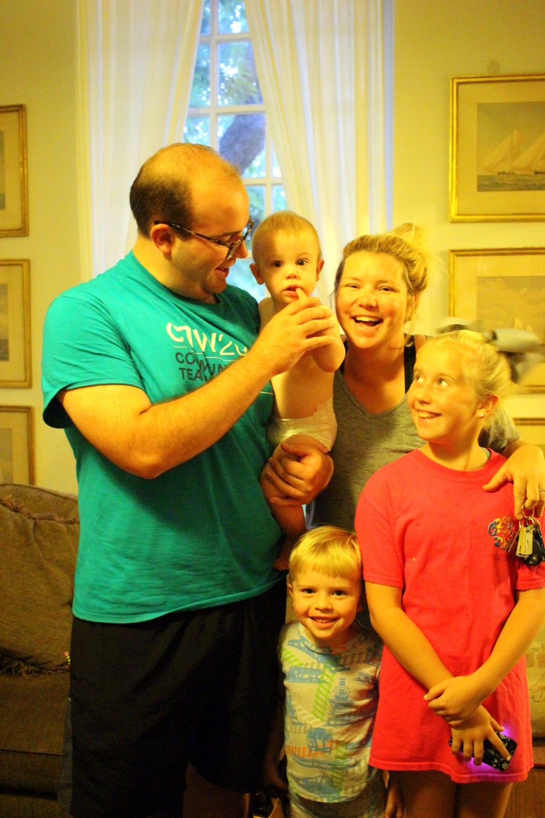
I felt a little bit like an awkward intruder because Bradshaw's wife, Charity, was due to give birth in 36 hours (as of this writing, the family now includes a fourth kid, Blythe--congrats!). But they welcomed me anyways. While Charity put the kids to bed, Bradshaw and I caught up over TexMex.

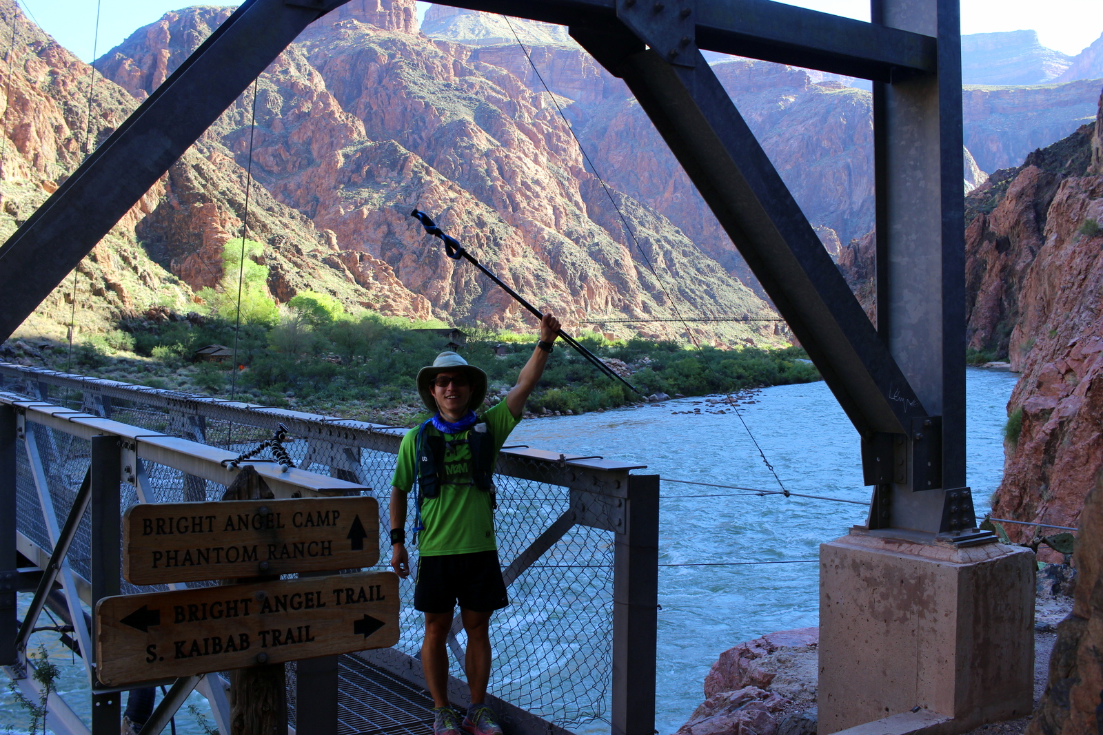
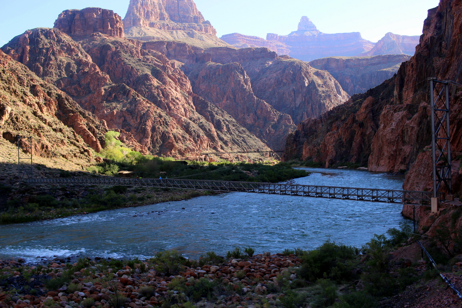
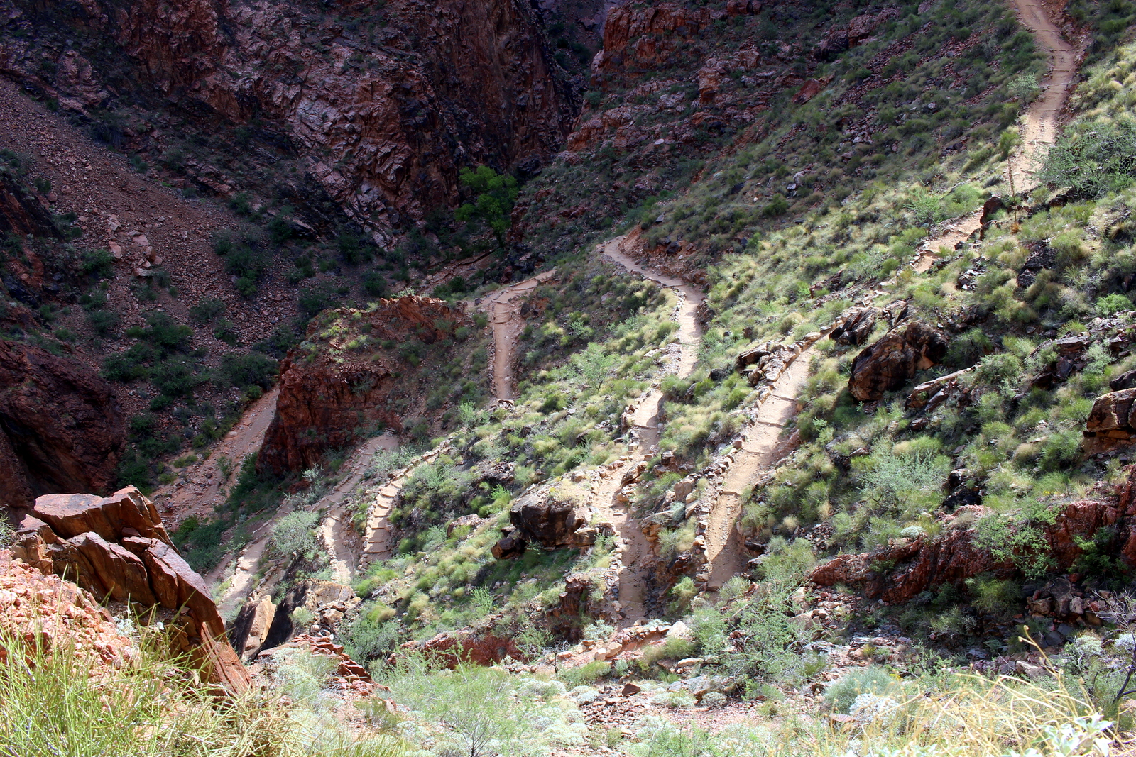
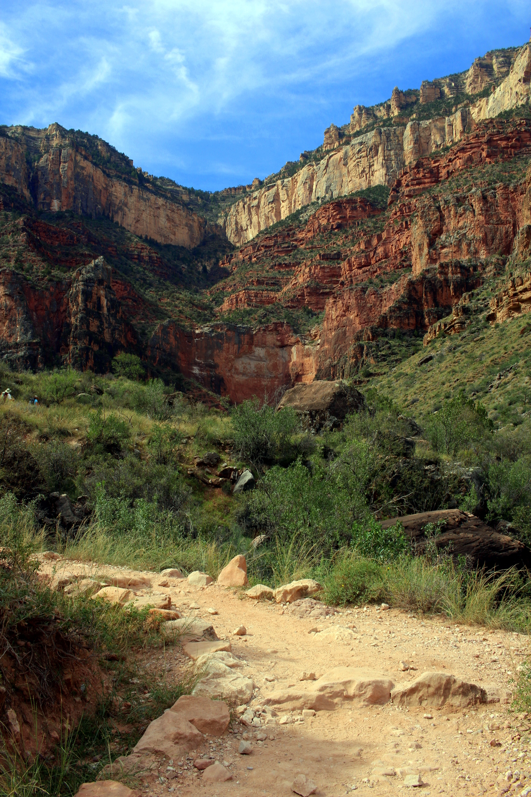
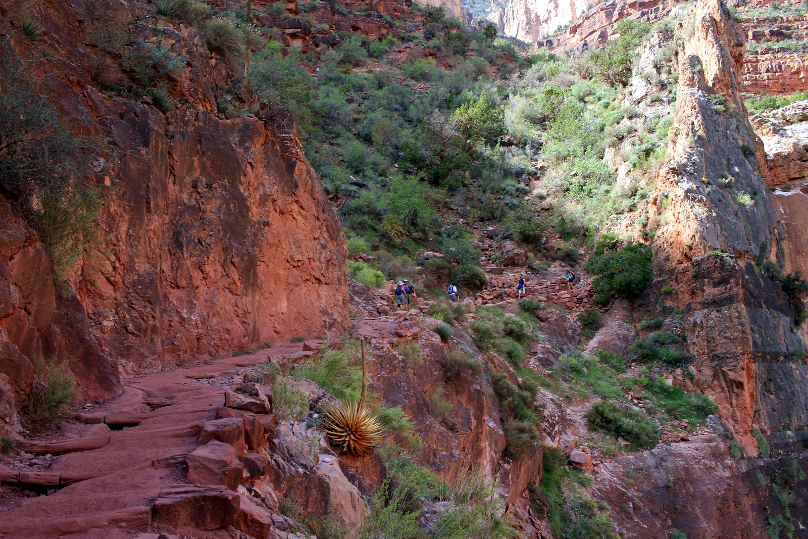
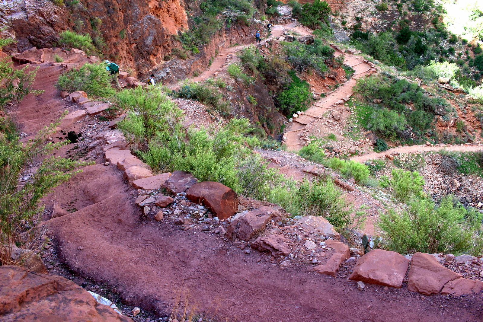
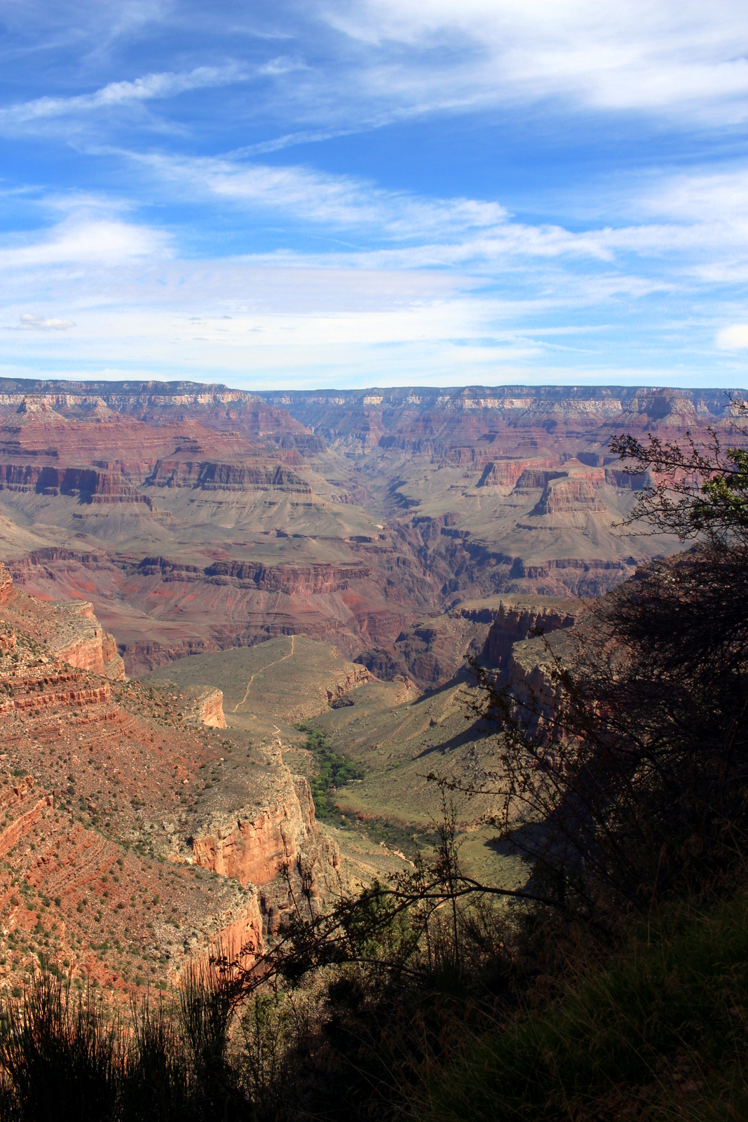
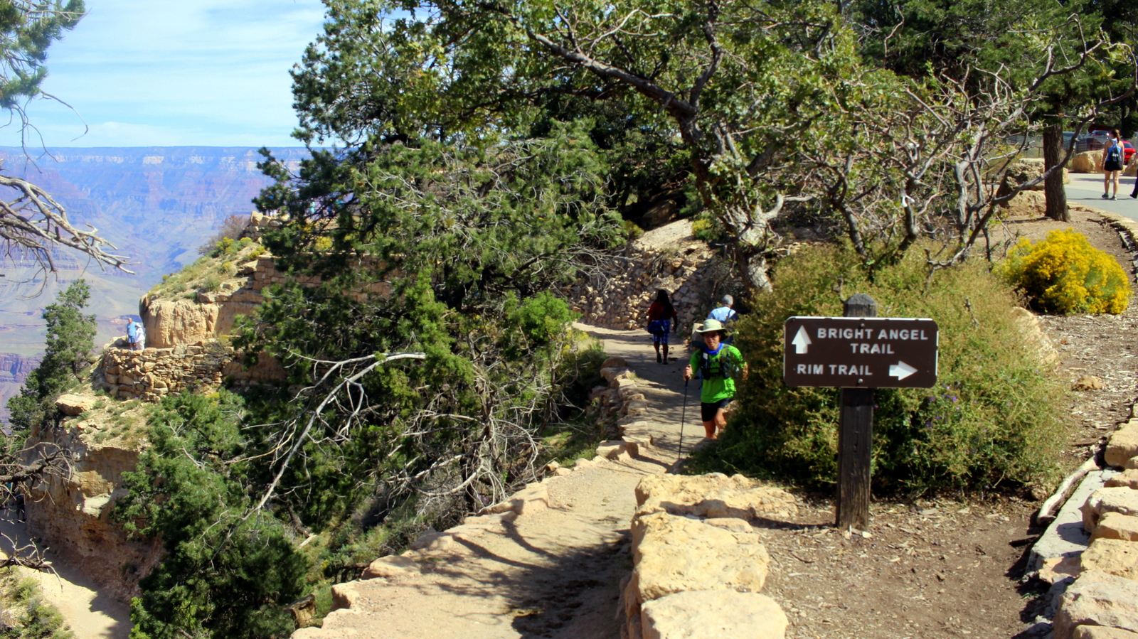
I'd been up since before 6 a.m., and had driven 12 hours, so was utterly exhausted by the time we got home. But I knew that, the moment I'd left Big Bend, I'd ended the most epic segment of my trip. From here on out, I had exactly a week to go, and only two national parks left. My pace would slow down. I reflected on the the segment I'd just finished (which had included my Rim-to-Rim run of the Grand Canyon) and thought how much I'd done in so little time. I felt proud of the logistical feats I'd pulled off during that time to make everything happen--and without hitches!

Before I knew it, I was very sleepy. I hadn't showered or slept in a bed since four days earlier in Arizona. I'd gotten used to that state of affairs, but taking a shower and sleeping in a bed (Bradshaw and Charity were kind enough to let me sleep in their eldest daughter's bed that night) made me realize that I'd missed out on some of the better luxuries of modern life. That night, I fell asleep instantly.

Day 37: Big Bend National Park, TX by Wookie Kim

Today's destination was Big Bend National Park, in an isolated part of West Texas on the border with Mexico. Along the way, I would stop by the artsy desert town of Marfa. Once inside Big Bend, I would make a beeline for the Chisos Basin, where I'd set up camp and then run up to the South Rim to catch views of the Chihuahuan Desert surrounding the mountains. And then I would fall asleep under the brilliant night sky.

It takes discipline to hit the road before the sun rises, but I've loved pre-dawn driving every time I've done it. It is just so peaceful. I had good reason today; my plan was to meet Lowell R., a high school friend who was coming from Midland, TX, at the Chisos Basin in Big Bend by 1 p.m. I left the campground at 5:40 a.m. and cruised in the dark on the open road.

At 6:40 a.m., the sun was beginning to rise. This is when the feeling of peace peaks. It felt so good to drive alone on the highway as the world around me started to wake up.

I had plans to stop in Marfa, TX, an odd town that has developed into a little bit of an artists' haven. I really only had one thing I wanted to see there: Prada Marfa. This is an art installation on the side of US 90 that resembles a Prada store--except that it's just a facade. The Prada company supported the project, and even donated real Prada goods to be put on display inside the store. But, since installing Prada Marfa in 2005, the artists have stuck to their plan of letting the store disintegrate over time into the desert. Totally weird, but totally worth seeing, especially because it was on the way to Big Bend.

Because cell service was spotty, and I didn't know where exactly the installation was located, my plan was to just drive into Marfa and ask a local. About 40 miles from Marfa, though, I saw a flash of white on my right side. I looked over my right shoulder and swore I saw a building that said Prada on it. How could this be? I was still a few miles from Valentine, and another 30 miles from Marfa. Was this a fake? It was just after 7 a.m., so almost no cars were on the road. I U-turned in the middle of the highway and drove back. Clearly, this was it.

I got out of my car and came in for a closer look. As I'd read, the store did have Prada goods inside.

I figured I needed a couple photos in front of the store. I took photos by placing my camera at several points on the shoulders of the highway, but I soon realized that the best vantage point was right in the middle of the highway, and I wanted to give that kind of shot a try. So, I looked down the highway in both directions for cars and, once I saw the coast was clear, set my camera down, hit the timer, and ran across the shot. Here are photos from different perspectives.

What a strange place. But Marfa got only stranger. By the time I'd actually arrived in town, I was ready for breakfast, and proceeded to Buns N' Roses. While finishing up my meal, I got a call from Lowell. He was en route, but had pulled over a couple times to throw up. Last weekend, he'd broken a rib in a dirt bike crash. His recently prescribed pain meds hadn't gone well with some alcohol he'd drank last night. He had to bail. 

I told him that he'd clearly made the right choice. It was still a bummer. Lowell had planned out a pretty awesome 24 hours for me. Also, I was going to ditch the running pack and simply go on an overnight backpacking trip with him. It would've been a nice change of pace, and an opportunity to camp under the night sky from atop the rim of the Chisos Mountains. But obviously Lowell was in no shape to continue driving, let alone put on a heavy pack and go on a strenuous hike into the mountains. As a compromise, I learned that I'd have to drive through Midland on the way to Dallas the following day. I'd try and stop by for lunch in Midland.

Because I now had more time, I decided I'd stop at one more place in Marfa: the Chinati Foundation. This is one of Marfa's primary art museums. Most of the works are viewable only on a guided tour, but since I didn't have the time to wait for the next one, I went on a self-guided tour of the concrete works in the field.

They were what you'd expect from modern art these days...

Basically, Donald Judd put together a series of concrete structures shaped in a variety of geometrical forms and patterns. 

There were signs telling visitors not to step on the works. But I guess those rules didn't apply to grasshoppers.

Having had my fill of Marfa art, I decided I'd head for Big Bend and hit the trails ASAP. As I was driving through town, though, I saw Marfa Book Co. down a side street. I'd heard about this place, and like any good bibliophile, decided I needed to stop. It was cool in there, but I already had a loaded car, so chose not to buy anything.

What an interesting town. I'm not sure I needed more than the 90 minutes I'd spent there, but at the same time I could understand the appeal for artists and other tourists. I passed Marfa's water tower and said goodbye.

At noon, I hit a milestone: 40,000 miles in my Prius. I got my driver's license in 2010, and have only driven this car my entire life. Looking at my trip odometer, I noticed that I'd also broken 8,000 miles. In other words, in less than 40 days, I'd basically driven the distance I'd typically drive in a year. Wow.

I made it to the entrance to Big Bend just before 2 p.m. I still had many miles to go inside, but it was good to finally see the NPS sign.

After driving for a while across the very flat desert terrain, I noticed mountains rising up out of the desert in the distance. I figured these were the Chisos Mountains. My plan was to drive right into the Chisos Basin, snag a campsite there, and then run the Pinnacles Trail up to the South Rim to catch the sunset.

I finally got to the Basin at 3:30 p.m. It was an incredible place. The Chisos Mountains are an example of what are called "sky islands"--isolated mountains surrounded by radically different lowland environments (here, the Chihuahuan Desert). As a result, they provide a bit of an oasis for a lot of wildlife and plant life. The Chisos also have steep and jagged rock faces. In the basin, you could see these faces in every direction.

I hit the trailhead just before 4 p.m. My route today was the Pinnacles Trail up to the South Rim and back. This would be at least 12 miles roundtrip, with almost 3,000 feet of elevation gain, so it wouldn't be an easy run (plus, I'd just run hard up to the top of Guadalupe Peak the day before), but I was determined to get up and down before the sun set at 7 p.m.

The trail ascended at a more gradual, but still steep, rate. I guess I'd been tackling some very steep trails recently, so a merely "steep" trail didn't feel too bad. I made good progress, proceeding up into the peaks of the Chisos.

About an hour in, I'd gotten far enough over the peaks, that I was looking through a gap into the Chihuahuan Desert that surrounded the Chisos. I believe this area is called the Window, which is named so for obvious reasons.

Interestingly, after passing the Window, the trail took me back in between the peaks, and into a moist woodland area. Here, the trees were lush, and I noticed I was following some kind of stream that flowed gently between the peaks. This was not what I'd imagined when I'd thought of the desert.

The weird landscape continued. This was some kind of river corridor--an oasis--right in the middle of the mountains in the middle of a desert. It was pretty incredible to think about.

At 5:30 p.m., I finally hit the South Rim. The view was breathtaking, not because of the aesthetics, but because the contrast was so stark--between the tall, rocky, powerful Chisos above, and the barren, bumpy desert below. It was breezy on the rim, so I put my pack down and let my sweat dry up.

Every direction provided a new set of contrasts. The haze limited how far I could see, but it also provided a contrast in sharpness between things far away from and things close to me. 

It was interesting, too, to see cactus--the plant that everyone associates with desert environments--up in high altitude.

And then there was this lone tree, sitting upright on the edge of the rim, with the best view in town.

I've loved seeing the extreme on this trip. It's the extremes on the spectrum that always have the most power to wow. Here, towards the southeast, the cliff face dropped off almost vertically. Am I not right that this looks very much like Pride Rock from the Lion King?

And then I was on my way back to the Basin. At the top, I'd learned that there was a different route down--the Laguna Meadows Trail--that would still take me to the same trailhead. I preferred to see new landscapes, so I headed that way around the Southeast Rim and down. Along the way, I saw some very colorful and pretty wildflowers.

As I got closer to the Basin, the foothills (?) that I'd been looking down on from the rim seemed more at eye level. I was crashing back down to earth.

Just before 6:30 p.m., I'd made it back to the Chisos Basin. I looked up to see what I'd conquered today. It had been a solid afternoon.

Of course, by now, with almost 40 days on the road, and dozens of hours running on tough, technical trails, my feet have taken a pretty hard beating. I haven't had anything serious--no injuries or pains--but I've been dealing with nuisances like blisters and calluses. One blister on the side of my left big toe was acting up today. (Please ignore my very clean and healthy toes...)

I made it back to the campground and cooked up a quick dinner. I planned to catch tonight's ranger talk on raptors. I liked my campsite for the evening--I was surrounded by the Chisos.

I learned a lot at the ranger talk. I now know what raptors are; they're carnivorous birds of prey that have "3 sharps": eyesight, beaks (used to tear apart food), and talons (used to kill prey). I also learned that Big Bend is the best place in the country to go birding. It has the most species of birds of any national park. Too bad I'm not so good at distinguishing birds.

I returned to my campsite in the dark. When I looked up, I noticed how bright the night sky was. Big Bend is as isolated as places get in the lower 48. It lies on the Mexican border, and the nearest big city airport is over 5 hours away. This makes for a truly wild--and dark--place. In fact, Big Bend is one of only fourteen gold-tier international dark sky parks in the world. Using my very basic camera, and nothing but a couple rocks to prop it up at an angle, I started to tinker with shots of the night sky. I ended up capturing a brilliant night sky, but it was mostly washed out (too high of an ISO setting, or maybe too long of an exposure?). I'd never done night sky photography, so I was really just playing around with settings and seeing what showed up on the screen.

Eventually, I realized that shooting the night sky exclusively was missing part of the beauty of the area. I needed some contrast, and the jagged peaks of the Chisos would provide it. So I took several more 30-second exposures, and managed to catch a couple shots like this. Incredible.

I ended up sleeping under the stars, without my rain fly. I kept my eyes open until the clouds rolled in and blocked my view of the universe. At around 3 a.m., the clouds opened up and rained on me in my exposed tent. I scrambled to put my rain fly on and then fell right back asleep. I was wet, and a bit cold, but I thought to myself how it was all worth it.

Day 36: Carlsbad Caverns National Park, NM + Guadalupe Mountains National Park, TX by Wookie Kim

I drove only 200 miles today, which meant I could do more exploring. That also allowed me to visit two national parks in two different states and still enjoy an evening camped out under the stars. This was my kind of day.

The best days are the ones that start with a good meal. Since arriving in the southwest, I've eaten almost exclusively Mexican food. Nutritionally, I just can't find a better package anywhere. Plus, finding small mom and pop places has meant that I can get a lot to eat for not very much money. On the way to Carlsbad Caverns National Park in New Mexico, I stopped in the town of Artesia to dine at La Herradura. It hit the spot.

One of the fun parts about driving in a Prius is that you get to see all the numbers while you drive. It seems like a small thing, but it probably changed lots of drivers' habits--for the better. By knowing how your car is working, in the moment, you're much more likely to drive in safer, and more economical way. The beauty about starting your day in the mountains is that you can drive over 50 miles at 96.3 miles per gallon.

I made it to Carlsbad Caverns National Park by 1 p.m. This trip's theme has been running, so this park didn't really fit (though there are a few above-ground trails). Still, I couldn't pass up a chance to stop by and see what this place was about. The above-ground drive into the park and to the visitor center was impressive. The blue skies with white, wispy clouds helped.

As with most of our parks, there was evidence of prior eras everywhere. Here was a set of Civilian Conservation Corps buildings. The CCC, which FDR created as part of the New Deal, did a lot in the early 20th century to beef up our nation's infrastructure.

I was determined to get in and out of the caves relatively quickly. After all, I still had another national park to visit the very same day, and I wanted to hit the highlight of that park (i.e., Guadalupe Peak, the highest point in Texas). I decided I'd do a self-guided tour into the Natural Entrance and down to the Big Room. At the bottom, I'd just take the elevator back up to the surface.

The Natural Entrance was large--far larger than any natural entrance I'd seen (I've visited two other cave systems on this trip). I could see why Carlsbad Caverns was so popular.

Before entering, I happened across a small lizard who'd just snagged a fly to eat. I was able to get pretty close to him. He didn't seem bothered by me.

And then I proceeded into the cave, beginning on steep switchbacks. I was surprised because I saw dozens of bats flitting from one side of the cave to the other. We're not supposed to take photos of bats (also, they were flying so fast that I don't think my simple camera could capture them), so I don't have any photos of them.

There were a lot of impressive features in the cave. I also was blown away by the scale of the cave. Each "room" was massive--far larger than the other caves I'd seen.

1.25 miles and negative 800 feet later, I was at the bottom. It was funny to see a small concession stand built right near the Big Room (i.e., the biggest chamber of the cave).

Then it was time to cross into my next state--Texas. Guadalupe Mountains National Park was my destination. Thankfully, it wasn't that far. I think it was under 40 miles from Carlsbad Caverns.

The Guadalupe Mountains abruptly rise up out of the desert. They are "sky islands"--isolated mountains surrounded by radically different lowland environments (here, the desert). The final few miles to the visitor center show this.

It was almost 4 p.m. when I arrived at the visitor center. One aspect of the park that makes it unique is that, unlike most other parks, Guadalupe Mountains doesn't have any roads going into or through the park. Moreover, there are no real "points of interest" on the highway outside the mountains. As a result, anyone who wants to see much of anything has to actually get out of his or her car and hike (or run) in. This was exactly my kind of park--one that forced you to get on your feet and explore.

Here, I was determined to push for the summit of Guadalupe Peak. The trail was 8 miles roundtrip, and involved 3,000 feet of elevation gain. It would certainly be tough, especially in the desert heat, but I couldn't pass up an opportunity to cross off another "highest point in in the state". So I filled up my Camelbak and set off.

The ranger I spoke to at the visitor center was skeptical that I'd finish before sunset. She mentioned how the brochure lists the hike as taking 6-8 hours, but that a fit person could finish in 4 hours. I told her I was expecting to finish in about 3. She didn't believe me. I figured I'd show her that it could be done.

As a result, I suppose I was more conscious of my time on this run. I decided I'd take photos of my view at specified times. 15 minutes in, I was already way above the trailhead parking lot.

At the 30-minute mark, the parking lot was even more distant.

And an hour in, I'd made it "around the bend" and was looking up to the final face of the peak. From here, I couldn't even see where I'd come from.

As I neared the summit, the views became awesome. The contrast between the Chihuahuan Desert below and the Guadalupe Mountains I was on was stark.

One of the highlights of the park is El Capitan, which is the signature peak of West Texas.

I continued charging up to the summit. I obviously couldn't "run" all of it. But I managed to run most of it.

Finally, I made it to the summit, 8,751 feet above sea level and the highest point in Texas. It had taken 1 hour and 13 minutes. I'd easily break 3 hours. In fact, I'd probably break 2 hours if I ran at a decent pace on the descent.

There's a monument here to signify this high point. And there's also a register in which you can write a note and see all the thousands of people who've summitted before you.

At the top, I met a group of hikers from Oklahoma City. As I gazed at the desert expanse below, I chatted with them. After 30 minutes of taking it all in, I decided to descend back to the trailhead and to return to my campsite. I wanted to eat dinner and catch the evening's ranger talk (which ended up not happening). Even at a comfortable descending pace, I managed to get down in just over 45 minutes. Excluding the time spent enjoying the views at the summit, I'd taken just a tad over 2 hours to cover the trail.

The descents are actually the least enjoyable part of a mountain run. You'd think that it takes less effort, but even so, the descent is often the most hazardous. Because you have gravity working with you, you're more likely to lose control of your speed. As a result, you might screw up your footing, or make other missteps. Also, it's hard to leave the summit because everything generally becomes less spectacular. By descending, you're really coming back "down to earth"--and sometimes you don't want to do that.

I camped in the Pine Springs Campground at the base of the mountain. I was a little upset that the ranger talk didn't happen. But instead I sat under the dark night sky and looked at the stars.

Day 35: White Sands National Monument, NM by Wookie Kim

When I made my itinerary for this summer, I implicitly attached expectations to each stop. I knew the Grand Canyon would be grand, and I knew sites east of the Mississippi would, for the most part, not be grand. But there have been some places that have blown those expectations out of the water. White Sands National Monument, which is a gypsum sand dune area just a few miles west of Alamogordo, NM, is one of those places.

I left Lakeside, AZ late. I had about 400 miles to drive today, so that was a poor decision. I made the most of my time on the road. I came across a curious place called Pie Town. I stopped at the Pie-O-Neer. Apparently, Pie Town was named because pie was the main attraction of this town when it first popped up--people passing through would know to come here for a slice. I had the New Mexico apple pie (it has green chiles and pine nuts in it, too), and it was delicious. Worth the stop.

And then I cruised to White Sands National Monument. As has been typical lately--when I've been driving extended distances and also feeling the building fatigue--I arrived late in the day. It was 5:30 p.m. by the time I got out to the dunes. The sun blazed and painted the normally white dunes orange.

This was an incredible place. Unlike traditional sand dunes, the dunes in White Sands are made of gypsum crystals. White Sands is the only gypsum dune field of its scale in the world. So what allowed this to happen here and not elsewhere? Apparently, it has to do with the nature of the Tularosa Basin, which is somewhat unique in that no water flows out of it. Gypsum is water-soluble and normally flows out of a basin towards the sea. Since the water that arrives in the Tularosa Basin ends up staying here, it evaporates and leaves behind gypsum.

I learned from the ranger at the visitor center that the sand was pleasant to walk on. She mentioned that local university track teams would occasionally come out here to do workouts. I asked her if there were any hazards to running barefoot and, surprisingly, she said no. With that endorsement, I decided to run barefoot (and shirtless).

Another unique aspect of the monument is that there are really no trails. There's a scenic loop drive, but you're encouraged to get out wherever you want and just walk on the dunes. It was fun to find my own area and be the only one leaving footprints on a fresh dune.

The sand was cool to the touch. Gypsum is also unique in that it doesn't absorb heat well. So, even though it was scorching hot, and the sun had been beating down on the area all day, the sand was actually cool.  It was unlike any sand I'd ever stepped on before.

I liked being here at sunset. The whiteness of the sand provided the perfect canvas on which to see the long shadows that any vertical objects created. If the angle of the dune was right, my shadow extended hundreds of feet.

More than anything, the place was just peaceful. I'd gone off the road for just about half a mile, and I could barely see anyone or anything but sand dunes. The sunset also added a degree of serenity--I felt like the day was ending and everything was beginning to rest.

Looking more closely at the sand, however, you could see signs of life. One thing that has fascinated me about the deserts is how wildlife survive here. I saw traces of such wildlife while walking and running the dunes.

Of course, all the photos make it appear as though the dunes are not, in fact, white. I think the setting sun has to do with that. The reality is that the dunes are quite white. A close-up, and color-corrected, shot shows just what I mean (ignore my mangled, battered, ugly runner toes--and my sandal tan). 

And then it was time to run. I took some photos first, but then I went back to my car to drop everything but my cell phone (in case I got lost, the GPS would still work). I then proceeded to roam freely on the dunes, running in whatever direction I felt like running. It was incredible.

In fact, I thought to myself how useful it would be to have dunes like these near me. I'd have the chance to occasionally run barefoot and really feel the earth beneath my feet. It would be a great way to improve running form. I was still feeling drained from the R2R (this was 2 days later), plus it was getting dark, so I ended up running only 5 kilometers.

By the time I was done, the sun was dipping below the mountains on the horizon. Again, I felt completely calm--just like the landscape around me.

I meandered back towards (what I hoped was) my car. Each time I looked back, I saw a more impressive landscape.

From the hot desert (though by now it was slightly cooler), I proceeded back through the town of Alamogordo, ate a quick meal at a Mexican restaurant, and then drove up into Lincoln National Forest. There, at 9,000+ feet, I set up camp and watched the night sky before falling into a deep sleep.

Day 34: Petrified Forest National Park, AZ by Wookie Kim

I slept in this morning. I'd just run the Rim-to-Rim in the Grand Canyon, so I deserved it. Still, I woke up naturally at 6:30 a.m. Instead of cooking pancakes, I decided I'd try and get breakfast at the North Rim Lodge--eggs and sausage would be a nice recovery meal. I ended up eating huevos rancheros. Just what I needed. My table had an awesome view of the canyon. I took one last look before heading out.

I was now heading almost 400 miles to Petrified Forest National Park. Leaving the North Rim, I ended up passing over the Navajo Bridge, which marks the eastern edge of the Grand Canyon. 

The bridge also marks one of the boundaries of the Navajo Nation. One of the aspects of our national parks (and of our nation's westward expansion) that I've wanted to learn about but haven't is our country's treatment of Native Americans. It's too easy to focus on the white explorers who "found" so many of the geological features that now make up our national parks without recognizing that westward expansion for one group simply meant displacement and marginalization for another group. I'll be adding this to the list of things that I want to look up after the trip is over (embarrassingly, I haven't even had the time to do the basic historical research on the National Park Service!).

I've taken thousands of photos now on this trip. Sometimes, I take a series of quick snaps and hope for the best. Other times, I slow down and really think about the photography principles I learned during my REI outdoor photography class. I know there's a school of thought that we should put away our cameras from time to time to truly experience the wonders of our parks. But I've often found that it is the camera itself that helps me truly see and feel a park. The conscious process of framing a shot makes me hyper-aware of every little detail. And, in searching for that perfect shot, you become more creative, and look at the environment from new perspectives. At the Navajo Bridge, I looked down and noticed the shadows crossing over the Colorado River and its banks. The algae-filled (?) green river provided a unique contrast with the reddish sand. This wasn't the "standard" shot of Marble Canyon, but it was a special one for me.

Of course, the Navajo Bridge also provides the more traditional view of the Marble Canyon area. The green water made the view particularly otherworldly.

Then it was time to make my way to Petrified Forest. While cruising on Arizona's open road, I mindlessly forgot to slow down in a work zone. A state trooper pulled me over (for the first time in my life), and I got a hefty speeding ticket. The rest of the way to Petrified Forest, I drove super carefully.

It was 5 p.m. when I arrived at the visitor center. The park closes at 6 p.m., so I knew I'd have to make my way through the scenic drive quickly. I was thankful that the park had two entrances--I could drive straight through to the other end in the hour I had left.

My first stop was the Painted Desert, an area of badlands inside the park (and also extending into the Navajo Nation). The setting sun painted the landscape today too.

I hopped back into my car and sped (within the 45 mph speeding limit, of course) to the next viewing point. An old car sat as a monument for Historic Route 66, one of the first highways in our national highway system, and a symbol of the road life.

I thought I'd be the only one leapfrogging from observation point to observation point. Turns out I was wrong. There were several groups of latecomers who were trying to cram everything in at the last minute. One pair--what looked like a mother-daughter combo--trailed me. Each time I pulled out of an observation point, their car would pull in. We'd wave at each other. In fact, as the hour winded down, they even started asking if it was "worth it" to stop at a point of interest. It was like a little game. 

Driving for the last 15 minutes out of the park, I saw impressive badlands. These were a reminder of my time in the North Dakota badlands in the first week of my trip (i.e., what felt like ages ago!). Seeing such a similar landscape reminded me that, no matter how different the various regions of the country were, there were always common links and common features uniting them all.

One of the coolest stops I made was the Agate Bridge. This is a spectacular example of what it means for something to be "petrified". Essentially, a petrified object is one that has avoided the normal process of decay. All living things decay naturally--if exposed to oxygen. The petrified forests here consist of fallen trees that were covered in silica and ash that prevented decay. Over time, the trees hardened, while the softer rock around it washed away. What's left behind are stone replicas of those trees--and Agate Bridge was a particularly massive tree.

The park had several vistas from which you could see massive "forests" of petrified trees. The quotation marks are there because I didn't realize that the forest was a desert landscape dotted with tree trunks and segments. I was somehow expecting to see a standard forest. This was one of the only parks where knowing about the formation process was essential to grasping the true beauty of this place. Otherwise, I'd see this view below and think very little of it.

Other viewpoints provided opportunities to get close to the petrified trees. Despite their petrified nature, they looked very much like regular, living trees. There were warning signs all over the place--instructing visitors not to pick up, or stand on, objects, and to stay on trails--but I saw one too many visitors violating all of these rules. How shameful.

Without even realizing it, 6:00 p.m. had rolled around. The park rules required that, at that point, everyone needed to get back in their cars and head to the nearest park exit. So I did.

As the sun set and the landscape darkened, I grew more relaxed. I'd missed a few of the longer stops (i.e., stops requiring lengthy walks on trails), but I felt like I'd made the most of a very, very brief visit to Petrified Forest National Park. And I was happy.

Day 31: Zion National Park, UT + Glen Canyon National Recreation Area, AZ by Wookie Kim

Today was two days before my attempt to run the Grand Canyon Rim-to-Rim. I wanted to take it easy. Because I'd arrived late to Zion the day before, I was doing Angels Landing this morning, before heading to Page, AZ to see the physics-defying Horseshoe Bend. I'd end the day early and stay at an Airbnb right below Grand Staircase-Escalante National Monument. I wanted to shower and sleep in a bed right before taking on the R2R.

I woke up super early--early enough so that I was at the shuttle bus at the Zion visitor center by 6:45 a.m. The first shuttle came around at 7 a.m., and I made sure I got onboard. There were a surprising number of hikers at this time. I guess it made sense; this morning was the first day of the fall season. During the summer, the first shuttle had left at 6 a.m. Now, people wanting to do some of the longer hikes (e.g., in the Narrows) would have one less hour to spend in the canyon. It would be imperative to get on the 7 a.m. shuttle.

After 20-30 minutes, we were at the Grotto stop. This was where the Angels Landing trailhead was. As soon as I got off the bus, I wasted no time. I deployed my trekking poles, tightened my fastpack, and immediately got into my running stride. I wanted to get out slightly in front of the pack of hikers that had already gotten onto the trail. But, critically, I also did not want to go at a hard--or even medium--pace; saving energy for the Grand Canyon was my biggest priority.

Yet I found my heart rate creeping up more than I'd hoped. It was simply too much of a thrill to see a tall platform way up above me. I really wanted to get up there--and fast.

I briskly ran the first 3/4 mile or so, which is almost entirely flat alongside the Virgin River. After that, though, the trail turned into a series of mean switchbacks. I knew that if I tried to run these, I'd be adding fatigue to my legs--the very fatigue I was trying to avoid two days before R2R. So I ended up power-hiking, and relying on my poles far more than I normally do. I looked down. Only one person was anywhere close to me. Everyone else had yet to even hit the switchbacks. And I wasn't even sweating.

But then I got to what's knowns as Walter's Wiggles. Walter Ruesh was Zion's first superintendent, and he created this switchback staircase to get up to Angels Landing. It looked a bit out of place, but I marveled at it from an engineering perspective.

I was making good progress, and I knew that no one would catch me. In other words, I'd be the first one to the summit. But I also realized I had another thing to worry about--the sun. I wanted to be on top of Angels Landing before the sun's rays hit it. Basically, I wanted to watch the sun light up the canyon. As I continued the ascent, I could see the sun beginning to light up other parts of the canyon.

Soon enough, I reached the beginning of the notorious final half-mile stretch to the summit. This section has you crossing a narrow sandstone isthmus with a 1,200-foot drop on one side, and an 800-foot one on the other. The NPS had installed support chains that you could hold onto, but I had a feeling it would be as scary as people had said it would be.

When I began, I was definitely nervous. I was envisioning sections of the trail where you necessarily had to hold onto the chain. 

But as I ambled along, I realized that that wasn't the case. The chains were definitely helpful at every point in that segment of trail, but it was never, to my mind, necessary. And that just meant that I could let go from time to time. Of course, each time I let go, my palms started sweating.

In 49 minutes, I'd comfortably made it to the summit. The sun was lighting the tops of the canyon walls, but it had yet to hit Angels Landing. I'd succeeded in beating the sun! I took in my first views of Zion from high above. It was as impressive as I'd heard.

l forgot to mention, though, that I technically was not the first person to reach Angels Landing that morning. Benjamin Rusnak, one of the artists-in-residence in Zion; his wife; and a friend were already on the summit when I arrived. I couldn't figure out how they'd made it, since private cars can't drive on the canyon road. It turns out Rusnak's housing is right at the Grotto; they didn't need to wait for the shuttle. Another group of hikers were ahead of me on the trail, but I caught up and passed them. I was still confused as to how they got there. Let's just say they used creative means...

I spent a lot of time up there. One of the best parts of climbing mountains and getting up high is the time spent staying up. Looking down, you could see how effective the shuttle bus system was--there were no cars clogging the road, and the sole vehicle on the road was a shuttle bus.

Soon, Angels Landing was starting to fill up. The fit hikers trickled in, and then, all of a sudden, in the span of 10 minutes, a dozen more hikers made it. Naturally, it got noisier and less serene. But I guess that's the trade-off when you go on one of the most popular hikes in the entire NPS system.

There were also more than humans up at the summit. There were a bunch of chipmunks scurrying about, trying to catch falling crumbs from the bars that everyone was eating. They were pretty sneaky. I found one darting all around my pack (luckily he didn't get inside). At one point, I thought out loud that this place should be called "Chipmunks Landing". Several hikers from Australia laughed and agreed that that would be an entirely appropriate name.

There was also a fun little rock pyramid on the far end of Angels Landing. I climbed up it.

I was hoping to stay longer, but I did have one time constraint: I needed to check out of my campsite by 11 a.m. It would take time to descend, take the shuttle bus back to the visitor center, walk to my campsite, and break camp. So after about 45 minutes--too soon to see even one third of the canyon light up--I said goodbye to everyone I'd met at the top and headed back down. On the way down, I made sure to check out new views of the canyon. On this trip, I've been surprised numerous times by how I see different things and see things differently just by reversing direction.

Another fun aspect of seeing the same thing again is how the time of day evolves and affects your view of the landscape. Shadows are one of the most obvious things that shift over the course of the day and dramatically alter one's perception of a landscape.

Height has an effect, too. On the way up, it was hard to get a sense of the scale of Walter's Wiggles. On the way down, they looked like an absurd human conveyor belt. I forgot to mention that, by the time I was back down on the Wiggles, the trail was packed. There were dozens and dozens of people slowly hiking up to Angels Landing. I was glad I'd gotten up there quickly--and left relatively early too.

On the way back, I stopped at the museum and watched the park video (I figured I could sneak it in before needing to vacate my campsite). I learned more about the geology in the region and how the Zion Canyon formed out of the Colorado Plateau (this feature, by the way, was entirely new to me).

At 10:45 a.m., I was back at the Watchman Campground. I once again processed just how awesome the campsite's location was, and then I packed everything up and got ready to hit the road. Oh, I had a homework assignment to complete first, which involved taking a selfie, so I did that before leaving.

2015-09-27 10.45.51.jpg

I realized that I hadn't eaten lunch. Normally, I would've just nommed on bars and snacks until I got to a town that had food. But today was not a normal day. It was two days before my R2R attempt. I needed to be fueling up--packing on the calories and just feeling well-fed at all times. I decided I'd backtrack towards Springdale and eat lunch there. I had a delicious wrap at a cafe there, but when it was time to enter and pass through the park to get onto the Zion - Mount Carmel Highway, I encountered an insane amount of traffic. I tried to imagine what Zion would be like if private cars had unlimited access to the canyon road. It would be a nightmare.

Eventually, I made it back into the park, and I proceeded onto the Mount Carmel Highway on the east side of the canyon. I've gotten really good at taking no-look, blind photos while driving.

Soon, we entered the Zion-Mount Carmel Tunnel, which, when completed in 1930, was the longest of its kind in the U.S. It was an engineering feat, one made even more impressive by the various galleries that let drivers catch glimpses of the canyon while driving (perhaps a dangerous distraction?).

When I popped out on the other side of the tunnel, the whole landscape looked different. It just felt different.

I also saw my first bighorn sheep. They'd been eluding me all summer--I'd finally seen one!

I continued through smaller tunnel segments. This was a really scenic and fun drive--one of the best to date.

Almost at the end of the scenic highway, I came across a pullout spot right by Checkerboard Mesa. And then it hit me: this was the exact same spot where we'd finished the hike in the Barracks. I'd somehow made it out of the canyon and up to this pullout, where buses were waiting with endless supplies of water. In short, seeing this pullout brought back a lot of memories, both good and bad.

And then I was out on the open highway again, this time off to Page, AZ.

Just about the only thing worth doing in Page is visiting Horseshoe Bend in Glen Canyon National Recreation Area. This feature was simply stunning, jaw-droppingly so. I wanted to linger, but it was scorching out, and I didn't want to generate any more fatigue in advance of the R2R. So I left pretty quickly.

I made more one more stop before checking in at my Airbnb. That was Lake Powell. What's mind-boggling about Lake Powell is how much water there is in it, even though everything else in the area is parched. The lake shone--it almost glowed--in the strong sunlight.

It was late afternoon now. I proceeded to my Airbnb and met my host, Janiece. After showering and unwinding for a couple hours, I realized that it was the night of the blood moon lunar eclipse. I sat on the porch to observe. I caught a glimpse of the eclipse as it was happening.

Unfortunately, as the eclipse continued, the clouds began rolling in and obstructing a clear view of the moon. So, when it actually turned blood orange, I could barely see it. It was an ironic end to the day. I was in one of the most isolated parts of an already isolated area, and therefore was in prime stargazing territory. But I ended up basically not being able to see much of the details of the eclipse. Sometimes that's just the way things work.

Day 30: Zion National Park, UT by Wookie Kim

After catching a spectacular sunrise in Joshua Tree, I'd finally made it to Zion National Park, in southwest Utah.

I'd been here before, but under very different circumstances. The law firm at which I'd worked as a summer associate after my second year of law school goes on an annual "firm hike", almost always always on an epic scale. In the summer of 2012, the firm chose to tackle The Barracks--a remote, out-of-NPS-boundary, hike that is essentially a souped-up, harder version of the ever-popular Narrows. It was the most incredible day hike I've ever done, and also the hardest. We tackled record-breaking summer temperatures that made for a hard (and, frankly, dangerous) hike. But everyone made it out alive, so all's well that ends well.

I'd had my Zion experience from down in the canyon, but now I was back to see the place from a different perspective. This time, I wanted to be up above it all, on the famed Angels Landing.

The drive, at 360 miles, was long--a harbinger of the even longer driving days to come. That meant I didn't arrive at the park until almost 4 p.m.

I set up shop at my site in the Watchman Campground. I'd just spent the night at Jumbo Rocks in Joshua Tree--the first campground that was a destination in itself--so I was even more surprised when I saw how beautiful the scenery was here in Watchman.

Because I'd arrived far later than expected, I didn't think it made sense to tackle Angels Landing on the same day. Part of my hesitation was due to logistics. Unlike most parks, Zion prohibits private car traffic on the main canyon road during the busy season. Visitors get around by using a very efficient shuttle bus system. I couldn't rely on simply driving right up to the Angels Landing trailhead. I needed to factor in the transit time to get there by bus. It just didn't make sense to start such an ambitious hike so late in the day. Moreover, I was two days away from arriving at the Grand Canyon and I didn't want to rush the run and end up fatiguing myself for the Rim-to-Rim.

But I wasn't about to do nothing, either. I decided on a compromise solution: I'd hike something easy today, and then tackle Angel's Landing early tomorrow morning. That way, I'd feel like I hadn't wasted a day. I opted to hike the Emerald Pools Trail. I hopped on a shuttle bus, got off at the Zion Lodge stop and began the 3-mile roundtrip hike.

The beginning of the hike took me along the banks of the Virgin River. It was this river that had, over countless years, carved out the epic canyons of Zion. That fact was hard to believe, because the river looked weak and powerless--a mere trickle!

As I meandered along the river, I saw an emaciated mule deer. I felt really sorry for it. It was feeding, but clearly it wasn't doing a good enough job of it. I wondered if he or she was sick.

On a hike, I obviously have more opportunities to soak things in. I suppose I'm slightly more aware of my surroundings than when I'm running. It was a nice change of pace. At that moment, I was thinking very much of the time of day. The sun was beginning to set, and that meant that the inner canyon would be lit up differently. It was cool to see those differences, as they really highlighted certain features.

The hike itself continued up a gentle slope and passed a few of the emerald pools, which I found, quite frankly, unimpressive. I think part of the issue was that the water level was very low, so there weren't really much in the form of pools to look at to begin with. Any water that existed didn't really even look the color emerald.

One thing that impressed me, however, were the hanging gardens and other canyon-based plant life. Basically, there were parts of the canyon walls that had seeping water. And anywhere that there was water seeping out, there were plants.

At the Upper Emerald Pool, there was little puddle on a big rock. I tried to take a photo of the Zion canyon wall's reflection in the puddle.

The hike ended pretty quickly. And then it was time for dinner. I wanted to catch the ranger talk that evening. Having just spent time at Astrocamp in the San Jacintos, I was particularly intrigued by the topic (i.e., "The Great Journey: A Glimpse Across the Galaxies"). To ensure that I'd make it back to the amphitheater in time, I ate at a Thai restaurant just a half-mile outside the park in Springdale.

The talk itself gave me flashbacks to the couple astronomy classes I took in high school. They were very rudimentary, but I realized I knew far more about the night sky than a lot of the audience. I've thoroughly enjoyed the ranger talks, partly because you never know what to expect from each ranger, and this one was no less enjoyable. The main takeaway: we humans are a really, really, really small part of the universe.

After the talk, I went back to my campsite and got ready for bed. I was planning to wake up very early and catch the first shuttle bus to Angels Landing. Further, my goal was to be the first person reaching the top that morning. I figured that, as long as there wasn't any super-crazy ultra runner on the same bus, I'd easily beat everyone to the top. Before going to bed, I tried taking a few photos in the moonlight. I captured the stars (and clouds) directly above, as well as several of the Watchman, a 2,500-foot tall jagged spire. The combination of full moon and long exposure time created a funky set of photos.

On backlogs. by Wookie Kim

I haven't posted much recently. That's because I've been on the move--like, really on the move.

I left the North Rim of the Grand Canyon late Wednesday morning. It is now Sunday night in Dallas. In that 4.5-day span, I've done, among other things, the following:

  • marveled at the variety of petrified objects in Arizona's Petrified Forest National Park;
  • run barefoot and shirtless at sunset on an endless sea of gypsum crystals at New Mexico's White Sands National Monument;
  • camped at 9,000 feet in New Mexico's Lincoln National Forest;
  • watched bats flying around in New Mexico's Carlsbad Caverns National Park;
  • taken in the spectacular views from Guadalupe Peak--the highest point in Texas--in Guadalupe Mountains National Park;
  • seen Donald Judd's concrete works at the Chinati Foundation and Prada Marfa;
  • made black bear, javelina, grey fox, and roadrunner sightings in Texas' Big Bend National Park;
  • slept under a brilliant starry night sky (that turned into clouds and rain, to my surprise, at 3 a.m.) (also in Big Bend);
  • ascended to the South Rim of the Chisos Mountains (also in Big Bend);
  • hiked over the Rio Grande into Santa Elena Canyon (again in Big Bend);
  • visited and dined with friends in Midland and Dallas;
  • and drove over 1,950 miles (including 660 today alone) to do the above.

I don't know how I managed to do all of this in the last 4.5 days. But I did. Unsurprisingly, this has made for an exhausting week; I'm sleep-deprived and fatigued. Still, I have absolutely no regrets; I could not have asked for a better week.

I'm now making my way east back to Washington D.C., my new home. It's crazy to think that, a week from today, this trip will be over. I still have so many photos and stories to share from the past few days. Over the coming days, I expect to have some time to clear up the backlog of posts that has accumulated.

Tomorrow, I head to Hot Springs National Park in Arkansas, where I plan to go for a short run before bathing in the hot springs and getting a massage. Let's call it a spa day. 

Day 33: Grand Canyon National Park, AZ (Rim-to-Rim) by Wookie Kim

Running the Rim-to-Rim in the Grand Canyon was not the longest, or the hardest, run I've ever done, but it was the most epic. (Remind me that I need to define what I mean by "epic", a word I've thrown around all summer but haven't fleshed out.) Maybe a narrative of my day will shed some light on why I say this.

I rose at 3:30 a.m. My goal was to be on the trailhead at some time between 4:30 and 5:00 a.m. I had to be on the South Rim by 1:30 p.m., because that was when the last Transcanyon Shuttle was departing back for the North Rim. If I missed that, I would be stuck in my running clothes 220 miles away from my car and campsite (and, yes, the North Rim and the South Rim are that far away by car!). I anticipated taking between 6 and 7 hours, but wanted to budget in even more time just to be safe. After all, strange things can happen in the canyon.

I expected to be the only person up at the ungodly hour of 3:30 a.m., but I was surprised to see several campsites with flashing headlamps. I guess it wasn't that surprising--there are day hikers who start the previous morning and finish after midnight, and there are other R2R runners like me. In fact, the ranger in the backcountry office had mentioned that on a pleasant weekend day, the NPS estimates that roughly 1,000 R2R runners hit the trails. Apparently, the number of R2R runners has grown rapidly--so rapidly that the NPS is tinkering with a permit system, something that has already been implemented for large-group runs.

I immediately set to making a hearty breakfast. I pulled out the big guns today--chocolate chip Birch Bender pancakes. These things are insanely delicious, and also pack a caloric punch. I also sipped a bottle of Tailwind, another crucial ingredient to my nutrition plan. I went to the bathroom, too. This, as before every big run I do, was a huge relief. At 4:15 a.m., just as I'd planned, I was ready to head to the trailhead.

I drove over about a mile to the North Kaibab trailhead. This was the sole route down into the canyon from the North Rim. On the other side, however, there were two routes up to the South Rim, the South Kaibab and the Bright Angel trails. I planned to take the Bright Angel trail, even though it was longer, because it, unlike the North Kaibab, had water spigots along the route. I wasn't going to risk climbing 7 miles out of a canyon, and after having already run 14 miles down to the river, without the opportunity to fill up water. All told, I'd be running 23.4 miles according to the map. Of course, one can never truly follow the trail at all times. Additional distance gets added here and there. I was anticipating a 24-mile day. 

At the trailhead, I made last-minute clothing choices. At the campground, it was in the mid-50s. Here, however, it was even colder, probably the high 40s. In fact, I was already starting to shiver. I didn't want to carry too much, if any, cold weather gear, but I decided I'd begin wearing gloves and my rain shell. The water-resistant shell provided just enough protection from the whooshing wind to stop my shivers. I'd also packed a space blanket, just in case it got really really cold. I was now ready to set off!

But I immediately encountered a problem I hadn't expected: I couldn't find the trail. It was still dark, and I couldn't see any signs or posts indicating where the trail began. I followed what looked like railings and almost headed down what looked to be the trail until I realized that it was labeled something else. I turned around and followed the same railings to the other end. It ended and the trail descended, and I with it. I was now on the North Kaibab, dropping into the Grand Canyon.

The initial miles were surprisingly slow. I'd already been planning to take it very easy going down to the bottom of the canyon. I didn't want to blow out my quads on the steep descent. I also didn't want to risk falling off the edge in the dark. Even with these two factors in mind, I moved at a snail's pace. I didn't realize just how difficult it was to navigate a bumpy, rocky, sandy trail in very low light. I wasn't able to use my peripheral vision to discern the obstacles ahead of me. I also had trouble perceiving the variations in depth due to the undulating trail. As a result, I stumbled frequently. Thankfully, I'd brought my trusty trekking poles. Any time I stumbled, I put my pole down to regain balance.

At 5:05 a.m., I realized I'd descended a good bit already. I could see the faint outline of the opposite wall of the side canyon I was descending. With the moonlight, and a 10-second exposure, I captured it.

Of course, everything around me was still dark. But seeing a glimpse of the canyon wall confirmed that what I was doing was very real. It was an odd feeling, not being able to tell where I was, but knowing that I was descending very rapidly into one of the grandest geological features in the world.

Eventually, I made it to the Supai Tunnel. I couldn't really even look at it, because it was so dark. But I felt good that 2 miles had gone by and I hadn't even noticed. At 5:45 a.m., I crossed my first bridge.  

Just before 6:00 a.m., I'd finally made it past the forested switchbacks and into the canyon  proper. It was still dark, but long exposures revealed the immensity of the canyon. The trail snaked along the canyon wall. It was impressive engineering, for sure.

As official sunrise (6:15 a.m.) approached, my visibility grew. I looked over my shoulder towards the North Rim. It finally hit me that this whole R2R thing was really happening. There would be no turning back now.

At 6:15 a.m., I was at Roaring Springs, 4.7 miles into my day. Roaring Springs roared exactly like its name. This was the source of all water to both rims. It was impressive to see it pouring out of the side of the canyon wall.

Even though it was now past official sunrise, the inner canyon was still very dark. Looking up, however, I could see the brightening sky. This contrast made this endeavor feel even more epic; while all the world was lighting up, I was deep in the bottom of a canyon, still wrapped in darkness.

By 6:30 a.m., it was getting ever-so-slightly brighter. I could finally see the inner canyon in all its glory. And it was truly glorious. I'd seen countless photos of the Grand Canyon from the sky or from the rim, but this was really my first view of the canyon from deep within--3,000 feet below the North Rim. It was an awesome feeling to be running the entire length of this side canyon down to the Colorado River, and then back up to the other side!

Being deep inside the canyon also meant that I could pick up on the plant life. The stream (was this the Little Colorado River?) that the trail followed provided ample water for lush vegetation.

By 6:30 a.m., I was snaking along the tall canyon walls. Each bend showed something new.

When I turned a bend at 6:36 a.m., I caught my first glimpse of the bottom of the South Rim. What made this moment so special was that the walls of the box canyon that I was descending still had not been lit by the sun. It looked as though someone were telling me exactly where I needed to go. Like a fly, I motioned for the lighted canyon wall.

Eventually, I passed Cottonwood Campground, where I refilled water for the first time all morning (the pump house water spigot was off--the pipe burst had, in fact, affected the water supply!), and took a short break. I was now just under 7 miles into my day. I still felt comfortable and completely in control. I now set to my next segment--the 7.2-mile stretch to Phantom Ranch at the bottom of the Colorado River. I'd been told that this stretch was flat and easy--a good place to pick up some speed. I began cruising, following the trail as it continued to snake along the canyon wall.

At 7:10 a.m., the inner canyon was still quite dark. But when I looked up, I could see the sun was creeping down the canyon walls.

I was determined to minimize my time in the scorching sun. It would already be scorching hot the deeper into the canyon I got. Yesterday, it had reached 104 at Phantom Ranch. Today, the high was 99, so it was slightly cooler. But that was still hot.

The final stretch to Phantom Ranch was a thrill. I felt like I was on a rollercoaster trail ride. The trail snaked in and out between the canyon wall and the stream below.  

At some point, I noticed what seemed like a water fountain. Then, I saw the pipe. Clearly, this water was not natural. It was probably water that was leaking from the burst pipe. I was glad I'd brought filtration, and that I'd started with--and maintained--a massive Camelbak reservoir.

As I ran, I also saw evidence of the canyon-forming process. Of course, the main force creating the Grand Canyon is water. The Colorado River (and other water sources) has been carving this canyon over many years. But water alone hasn't created this entire canyon. The walls have had to crumble in order for the canyon to widen. Here, I could see a rockslide of sorts. I was watching the Grand Canyon become even grander.

Really, there was just so much to see as I ran. As I said, every bend led me to something new to marvel at. By 8 a.m., I had a sense that I was almost to the very bottom of the Canyon. I could smell Phantom Ranch around the bend...

By 8:10 a.m., I'd made it to Phantom Ranch! I was now 14 miles in--well past the halfway mark, at least in terms of distance. Effort-wise, I was probably right at the halfway mark; the ascent would take far more effort than the descent I'd just completed.

Phantom Ranch is an oasis at the bottom of the canyon. There's a canteen, and several bunkhouses. It's an incredibly popular stopping point for R2R hikers--so popular that it sells out the first day of the season. 

I had an important task to complete here at Phantom Ranch: drop off the stack of postcards I'd written the day before. As I've mentioned, the post office at Phantom Ranch still packs out mail by mule. Apparently, it is the only post office that still uses mules. Mail that gets sent from here is stamped to indicate this unique carrying method. I'd written several dozen postcards, and I'd carried them down to the bottom of the canyon. I wasn't about to forget to send them! After buying a few extra stamps (I'd written so many that I'd ran out!), and a few postcards, I finally dropped all of them into the satchel. Hopefully, the mules are reliable and the postcards get to where they need to go. 

I also drank my secret weapon beverage--a can of Coke. Even though it is heavy for what it provides nutritionally, I always carry a can on long days. There's just something about Coke that is incredibly refreshing right in the middle of a hard day of running. The caffeine boost also doesn't hurt.

Just after 8:30 a.m., I was back on the trail, heading the last half-mile or so to the Colorado River itself. I could immediately tell why people loved Phantom Ranch. It was incredibly lush and peaceful. 

Right before reaching the Colorado, I saw a board with a missing person posting. This was a reminder that the Grand Canyon isn't to be underestimated. I knew that, even though I had roughly 10 miles left, I still needed to run conservatively and practice safe running.

Right by the post, I saw a unique sight. There was a cactus with what looked like red peppers growing right out of it. Was this some kind of symbiotic relationship? It was weird.

Finally, at 8:40 a.m.,I reached the true bottom of the canyon--the mighty Colorado River! The Silver Bridge was my route across and to the Bright Angel Trail. I crossed the bridge, fearful that it might collapse and the roaring river would sweep me away. Truly, looking down, you could see just how powerful this river was. I guess it now made at least some sense that this river could carve the Grand Canyon.

As I was dilly-dallying by the bridge, a father-son duo approached. I learned that the son was only 10 years old--and they had just come down the South Kaibab Trail and were planning to ascent back up the Bright Angel Trail. I couldn't believe that a 10-year-old was doing this hike (probably around 16 miles plus the canyon wall)! It turned out that the dad was a pretty serious ultrarunner. Go figure.

It was now 9 a.m., and I could sense that the sun was finally going to hit me dead on. I'd been incredibly lucky to have avoided the sun for most, if not all, of the morning so far. I knew that the sun would change the game. I put my camera away and decided it was time to ascend the Bright Angel Trail and get to the South Rim.

My next real target was the Indian Garden Campground. This, like Phantom Ranch, was an oasis in the canyon. But I had 4 miles of switchbacks to ascend before I got there. I set to work, power-hiking the steeps, and shuffling up the flatter inclines.

Climbs are always the most epic part of any run. The symbolism of the ascent is powerful. But the climb is also where the effort comes in. Not 15 minutes after I'd begun climbing, I looked back and could see that I was already beginning to rise up out of the bottom and up the canyon wall. I could see parts of the North Rim off in the distance. I'd conquered so much of the canyon already.

Every now and then, I'd look down to see what I'd climbed. The switchbacks, as always, are the most fun to look at. They make everything seem that much more badass. 

At each turn, I couldn't resist stopping to marvel at the distance I'd covered. The canyon walls drifted in and out all the way to the horizon. I simply couldn't get enough of these views.

Just before 10 a.m., I noticed a shift in the landscape. Everything seemed very, very green. I sensed that Indian Garden was very near, and that's because it was. There were a ton of hikers resting here. Some had been camping here, and others were simply stopping by. I filled up my water again. I was now 18.2 miles in, and it was time for the serious ascent to begin.

I had roughly 4.7 miles to go. In that distance, I'd climb over 3,000 feet back up to the South Rim. Believe it or not, this incline isn't insanely difficult. I'd done climbs on this trip that were far steeper. But the climb would be unrelenting. Moreover, much of it would be exposed to the sun. I could get hot, and my body could reach overexertion, very quickly. I prepared myself for a hell of a climb.

At 10:15 a.m., I was in the belly of the beast. I looked up and gazed at the layers of sedimentary rock that constituted the South Rim. I was climbing up to the top.

Now it was all about finding a good climbing rhythm. I used my trekking poles to tap one out, and I set one foot in front of the other almost as if I were marching. Each footstep was deliberate. I was moving right up the canyon wall. At 10:25 a.m., I looked back again. I was rising out of the narrow area and into the wider canyon. 

Soon, I was trailing a bunch of hikers. Now that I was getting closer to the rim, there were just more people around. Presumably, some had descended from the South Rim earlier that day and were hiking back out. It felt a little strange to be surrounded by so many people again. Aside from a dozen or so people I'd crossed paths with, I'd spent the entire morning practically alone. As I continued up the trail, the switchbacks got ridiculous, almost Escher-esque. This is what made Bright Angel so bright, I thought to myself. 

At 10:40 a.m., I was really really getting close. I'd told myself that as soon as I hit the 3-mile resthouse, I'd crank it up several notches. Basically, the run had been surprisingly easy so far. Granted, I'd chosen to run conservatively, but I honestly didn't expect to be so in control and fresh nearly 6 hours into my R2R. I knew I was very close to the top. There were throngs of people now. So if I passed out, someone would notice. I decided to treat the final 3-mile, 2,000-foot ascent as a hard tempo workout.

What this basically meant was that, for basically the first time all trip (remind me to write a post about running economy--something that has been critical to the success of my summer), I would let my heart rate soar way above the limits I usually set. Where 150 and maybe 155 beats per minute was my previous ceiling, I now opened myself up to whatever heart rate I could sustain for the roughly 45 minutes that it would take to get out of the canyon. I set to work. My lungs began to burn, and my legs were on the verge of cramping. I was basically running up a steep incline that most people were ambling along. I let the adrenaline carry me up the trail. I kept looking back over my shoulder, and I kept seeing an ever grander view of the canyon I'd come so close to completely conquering.

My heartrate was leveling out in the mid- to high-160s. With a fresh body, this would actually be quite low. But with 6 hours of R2R in my system, my body simply couldn't sustain an effort higher than that for very long. Ironically, I was forced to stop for a mule train--the first I'd seen all day.

At 11:05 a.m., I could sense that I was nearly there. Truthfully, it was very hard to tell how far I still had to go. It seemed that every time I thought I was there, I turned a switchback and saw a whole set of new switchbacks. In the shadows, you can see a new set.

Also, for the first time all day, I felt very emotional. I was almost in tears. It wasn't because of the pain of the run. Rather, I was so moved by what the day had provided that i simply didn't want R2R to end. I suddenly wished I were still at the bottom of the canyon, beginning the ascent once again. It was then that I decided I'd be back again one day--this time to run the Rim-to-Rim-to-Rim (AKA the R2R2R).  

At 11:12 a.m., I felt really, really close. My legs were burning up. I was now definitely feeling the fatigue. I told myself that this was where I got stronger as a runner--by pushing through the pain, no, creating pain where none had been before--so I had to keep pressing on. Looking back once again, I couldn't believe I hadn't made it out of the canyon yet. The North Rim is at a higher elevation than the South Rim, yet it looked like I'd already reached a point higher than the North Rim.

At 11:20 a.m., I knew I was close. I could practically see the end of the trail just a few hundred feet above me. I booked it. I was determined to empty the tank--to leave everything behind in the canyon. 

When I passed a sign for the Bright Angel Trail, though, I had to stop. This was an incredible trail, and had provided an incredible morning. I needed a photo with the sign.

And then I was making the final push. At roughly 11:30 a.m., I made it out of the Grand Canyon. I'd completed the Rim-to-Rim. Based on my Garmin GPS, it had taken 6 hours, 49 minutes, and 31 seconds. 

You'd think that I'd have been overcome with emotion at this point. But, really, I wasn't. More than anything, I was just happy. Happy that I'd conquered the Grand Canyon. Happy that I'd completely immersed myself in the immense, beautiful, and grand Grand Canyon. Happy that I'd ran an incredibly smart day, hydrating and eating like a pro. Happy that I'd made it to the South Rim with ample time to nom on food before getting into the shuttle back to the North Rim.

There were a bunch of people who were resting at the trailhead. A group had just finished a R2R hike that had taken 4 days. They couldn't believe I'd done it in just shy of 7 hours. They took photos and video for me. Then they took their own photos of me. Others did too. In the ultrarunning world, R2R is actually not that unique of a feat. But I guess to the average person, it's an otherworldly feat. 

I spent 30 minutes at the trailhead, just trying to wrap my head around the day. It had started with the thrill of running in complete darkness, it had continued with my relentless pursuit of the next bend in the canyon, and it had finished with a powerful push up the canyon wall. The 7 hours had passed by so quickly, and at the same time, it felt like I'd started eons ago.

I also read all the trailhead information--something that I hadn't done at the beginning because I couldn't find it. Of all the parks I've visited, the Grand Canyon definitely has the most serious set of warning signs around. 

At noon, I was ready to aide my body's recovery process. I went to the Bright Angel Lodge and sat down at the restaurant. I asked my server to give me the most filling meal on the menu. It was a stew. I demolished it. I then asked her what the most filling dessert was. It was a bread pudding. I demolished that too.

While waiting for my check, I noticed that my pack was covered in salt stains. I forgot to mention that, despite how comfortable the day had been overall, it had still been quite hot the entire time. I'd sweat a lot. I'd also excreted a lot of electrolytes. I was glad I'd brought--and taken--almost a dozen electrolyte pills throughout the day. Aside from the final tempo climb, I'd not once felt any sort of cramp or strain in any of my muscles. 

It was now 1:00 p.m., and I needed to check in for my 1:30 p.m. Transcanyon Shuttle ride back to the North Rim. This would be 220 miles, and would take almost 5 hours, because we would be driving to the easternmost point of the Grand Canyon and crossing the Navajo Bridge to get back to the other side. I laughed when I thought about Rob Krar, one of the top ultrarunners around. He held the records for both the R2R and the R2R2R. He could make a crossing in under 3 hours, and a double-crossing in under 7. Maybe he should start a piggy-back shuttle service for people who need to cross the canyon more rapidly.

Before packing myself into the van, I took one last look at the Grand Canyon from the South Rim. The sky was surprisingly free of haze. I could trace the Bright Angel Trail all the way down into the bottom of the canyon, and then I looked at the jagged inner side canyon that constituted the North Kaibab Trail. I had conquered all of it today. How amazing. 

The Transcanyon Shuttle added to my day. The entire van was filled with people who either had just finished, or were about to start, a R2R hike of some kind. Although there were no R2R runners, I felt a common bond with every passenger, because even an R2R hike is no small feat. We shared stories about our days, talked about past and future travels, and just had a surprisingly fun time. The 5 hours also took us through many more impressive sights, including various segments of the Grand Staircase, such as the Vermilion Cliffs.

Just after 6 p.m., we'd made it back to the North Rim. I got dropped off at the North Kaibab trailhead. In the daylight, I could easily see where the actual beginning of the North Kaibab trail was. I'd missed it completely because of the dark. I read the sign and decided it was time to shower and eat.

I was overjoyed that the North Rim had coin-operated showers. I was gross, covered in sand-soaked sweat, grime, and salt stains. After showering, I headed to the North Rim Lodge's saloon. For several hours, I drank celebratory Grand Canyon pilsners and IPAs while chatting with the bartender and others at the bar. I ate a roast beef sandwich, and then I ate some pizza.

By 8:30 p.m., I was getting sleepy. I headed back to my campsite in the North Rim Campground, put all my dirty clothes away, and cralwed into my tent. For the first time all trip, I went to bed without setting my alarm. I didn't care what was on the agenda tomorrow--I deserved a full night's rest, and I was about to get it. 

Day 32: Grand Canyon National Park, AZ (Pre-Rim-to-Rim) by Wookie Kim

Today was all about final prep for tomorrow's Rim-to-Rim run. I planned to get to the Grand Canyon early in the afternoon, catch a glimpse of the canyon, check in at the North Rim campground, and then do nothing but relax and prepare for the day ahead. I managed to do all of this without any hitches.

I started the day engaged in the fine art of pancake-making. Because my Airbnb host had an excellent griddle, I was able to make stacks on stacks of pancakes. I'm not even exaggerating; I made a massive double-batch of high-protein Birch Benders. Whatever was left over, I'd nom on continuously while on the road.

Janiece's house was smack dab in the middle of nowhere (I don't think her "town" even shows up on a map). But it was conveniently just a few hundred yards south of the border to Grand Staircase-Escalante National Monument. I stopped by the visitor center to learn more about the geology of the region.

I learned that, for the past few days, I'd basically been descending what geologists call the Grand Staircase. The Grand Staircase describes the successive layers of rock that stretch from the bottom of the Grand Canyon at the southernmost point to the top of Bryce Canyon at the northernmost point. Over millions of years, Mother Nature had basically worn this region down so that you could see these distinct layers. On the drive south towards the Grand Canyon, I stopped and looked to the north. I could immediately see what was meant by the Grand Staircase.

The drive then took me away from the open country into Kaibab National Forest. I'd not expected the approach to the Grand Canyon to be so beautiful. This was a bonus. Some of the trees were already turning colors, which made for an even more pleasant drive into the canyon.

I was also surprised by the altitude. At times, I was over 9,000 feet above sea level--almost double the elevation of Denver, the so-called Mile-High City. It made sense, though. For a grand canyon to exist, the rim of the canyon needed to be way above sea level.

After about 3 hours, I'd finally arrived at the North Rim! I was looking forward to finally seeing the canyon in all its glory. 

After briefly stopping by the visitor center, I made my way to Bright Angel Point and took in my first views. Unfortunately, it was somewhat hazy, which made it hard to see anything but the side canyons clearly.

Still, I was taken aback by the scale of the canyon. It was simply massive, and majestic, in a way unlike anything I'd seen before. Using borrowed binoculars, I spotted the South Rim--what would be the end of my run tomorrow. I couldn't believe how tiny of a speck the entire South Rim complex was. I also couldn't believe that, beginning in just over 12 hours, I'd be running from here, down through everything below, and back up to that speck!

Feeling a little overwhelmed, I stopped by the backcountry office to learn about any special conditions. I learned that it would be moderately hot, but not insanely so. The expected high at the bottom of the canyon was 104. More importantly, I learned that the water pipe had burst on a section of the North Rim. There was a chance that several water spigots would be off tomorrow. The ranger checked with me to make sure I was carrying filtration. I told him yes--I would've carried it in any case.

Then, it was time to check in at the North Rim campground. I felt incredibly lucky to have secured a spot here. This campground is generally considered one of the most spectacular because it is basically perched on the edge of the canyon. Normally, sites are booked months (and sometimes years) in advance. As an example, my camp neighbor said she'd booked hers over half a year before. I'd booked mine just 2 weeks ago. When I logged onto the site, there was one available campsite. Clearly, someone had cancelled recently, and I'd gotten ridiculously lucky.

My actual campsite wasn't to die for. It was just like any other standard forested campsite. But, as already noted, what makes this campground special is that you're a stone's throw away from the rim of the canyon. I was going to take advantage of that, but first I needed to do some other prep.

I spent a good hour going over all of the numbers and logistics for the run. I stacked all of the maps and brochures I had and synthesized all the relevant information onto an index card. This 3x5 card, which I put in a special waterproof ziploc bag, would be my guide tomorrow. I read several run reports and narratives, so that I had a clearer sense of the challenges ahead as experienced by real hikers and runners.

I then meticulously packed my gear. Unlike my typical run, I literally emptied my hydration pack of everything and put things back in one by one. I wanted to make sure I had everything I needed, and, just as importantly, that I was carrying nothing I didn't need. I measured out my food needs, and also filled a medicine bottle with 15-20 electrolyte tablets. Heat would be my biggest enemy, and with intense heat comes intense dehydration and possibly hyponatremia (essentially, when your electrolyte levels are extremely low).

Certain that I'd prepped my gear, I turned to my next task: writing postcards. I spent over an hour writing a massive batch. I was planning to carry this batch down to Phantom Ranch--an oasis nestled by the Colorado River at the bottom of the canyon--and drop them off there. Why all this effort? Any mail sent from Phantom Ranch gets packed out by mule, and mail is stamped to indicate that. Apparently, this is the only post office that still uses mules. I figured people would enjoy receiving postcards carried by mule (apologies in advance for the sloppy handwriting--I had too many to write, and not enough time). I even sent one to myself, at my future address.

By now it was 5. I put my postcards and pens away and cooked dinner. I wanted to eat extra early today because I was planning to wake up at 3:30 a.m and begin the run at 4:30. Eating earlier ensured that I would give my digestive system enough time to do its magic and rid my body of any excess waste by 4 a.m. (if you catch my drift...). I cooked a simple meal. Penne with marinara sauce and two cans of tuna.

The hard work done, I took my pot of pasta and proceeded to the rim. Sunset was just after 6, so people were already perched on ledges. I found a secluded rock from which I could eat and take everything in. This was truly a dinner with a view.

After cleaning up, I spent some time visualizing the day ahead. I imagined the landscape of each segment of the run. I tried to feel the heat at the bottom of the canyon. I also grappled with the idea of descending steep, rocky switchbacks in pitch black. As I cycled through the day, I grew nervous. It was really about to happen!

By now, it was 7:30. My goal was to be in bed at 9. I toyed with the idea of attending the evening ranger talk. Tonight's topic was "Dying to See Grand Canyon: The Avoidable End to the Accidental Traveler". The talk would cover the many ways that people have died here. It was a grim topic, but I was curious--and I also thought giving myself a good scare would ensure that I ran even more safely than I was already planning.

I decided to attend the talk. I'm glad I did. I learned a lot about the Grand Canyon, and about the deaths that occur here. The ranger began by talking statistics. The reality was that based on historical numbers, one's probability of dying here were very, very slim. The public perceives a far greater danger because the limited number of deaths that occur receive excess media attention (in 2013, there were 8 fatalities out of 4.5 million visitors). The reality is that the canyon is generally very safe.

The ranger then went on to describe the 4 major ways that people die here: falls, the environment, the river, and plane crashes. She prefaced this part of her presentation with the words of one of her fellow rangers: "There are no new accidents--only new people having the same old accidents." Essentially, people die for very obvious reasons; there are no surprises. She cycled through dozens of anecdotes. It was everything you'd imagine: people who'd tried to pull a prank and fallen off the cliff; people who'd been so focused on taking their photos that they'd tripped over the edge; people who stepped off the trail for a better view and tumbled into the canyon; people not bringing enough water; people overestimating their physical capabilities; people choosing not to wear life jackets (over 80% of river deaths are caused by this); people being male (AKA 80% of all deaths!); people being the unlucky pioneer air travelers who flew in the pre-FAA days (fun fact: the FAA was created in response to the 1956 Grand Canyon airplane collision).

But the most compelling--and relatable--story I heard was about the tragic death of Margaret Bradley, an accomplished all-American marathon runner and medical student who had died while running in the Grand Canyon in July 2004. In essence, she (and her friend, who miraculously made it out alive) had greatly underestimated and underprepared for the canyon. Among other things, the pair: thought they were running 15 miles when, in fact, they were running 27; carried no map, headlamp, or compass; brought almost no food and water; and started late in the morning (AKA 9 a.m.). By 3 p.m., they'd traveled only 12 miles and had succumbed to the heat. Bradley's friend decided the best course was to wait under a bush until the temps dropped. Bradley, believing she was only a few miles from the end, decided to push ahead to search for help. No one knows exactly what happened next, but at some point she went off-trail, presumably in search of water. She was later found dead in a box canyon, trapped between canyon walls on one side and the cliff's edge on the other.

Posters like this were all over the canyon.

Posters like this were all over the canyon.

It was easy for me to judge Bradley and her friend. But I also knew that I fit the exact profile of someone who might make the same mistake. I recalled the quote the ranger had repeated: "There are no new accidents--only new people having the same old accidents." I certainly didn't think that death (or anything close to it) was on the horizon. But isn't that exactly what Bradley and the other people who'd died in the Canyon also thought?

I obviously had a lot of food for thought as I returned to my campsite. I wasn't spooked, but I was just a little more aware of the dangers of the canyon. It was just past 9 now. I brushed my teeth and promptly jumped into my sleeping bag. I set my alarm for 3:30 a.m. and closed my eyes. As I drifted off into sleep, I tried to induce a dreams about how tomorrow would not only be the best day of running that I'd ever had, but also the safest.

On rest. by Wookie Kim

One thing that separates good runners from great runners is each's approach to rest.

The good runner never actually rests. For the good runner, the "easy" days are still just a tad too hard to be classified as easy. As a result, the good runner simply stays good, and never becomes great.

The great runner, by contrast, treats rest as seriously as one would, say, a track workout. For it is only by pausing after a period of stress that one's body has the time to rebuild itself--and to do so in a way that makes one stronger, fitter, and faster.

I've always thought of myself as a runner who takes rest seriously. But frankly, it has been hard to do that on this trip, partly because I logistically don't have the time to rest, but also because I don't want to rest. Each day on the road, I encounter too many things that I want to do. And it's sometimes hard to resist doing them.

This weekend, I need to do whatever it takes to win that fight and rest. Less than 3 days from now, I'll be running the Rim-to-Rim in the Grand Canyon--a 25-mile run that will take me from the North Rim down to the Colorado River and back up to the South Rim. The weather at the rim will be cold. At the bottom, it will be scorching. And then I'll have to climb roughly 5,000 feet back out of the canyon. To add to things, because I'm catching the last available transcanyon shuttle at 1:30 p.m., I expect I'll hit the trail no later than 5 a.m.

I've been doing my best the past few days. I've scaled back my runs, picking only 4-5 miles of trails per day, and hiking proportionally more than I normally do. Spending two days in Los Angeles with friends helped; spending a day in the San Jacinto mountains did not. Arriving in Joshua Tree National Park and stepping out into the baking desert heat helped return me to the driver's seat; seeing a bunch of rocks to climb did not. Today, in Zion, I'm doing a short and easy hike--Angel's Landing (it's a little crazy that I now consider a hike like that easy!). Tomorrow, I'm basically just seeing Horseshoe Bend and Lake Powell. Monday, I'll be camping at the North Rim, where I'll do a short run to preview what I'll be tackling early Tuesday. It's a struggle to rest, but I'm doing my damnedest to do it.

This battle to rest happens elsewhere, too. These days, it's too easy to get so wrapped up in one's pursuits that one forgets to rest. I've definitely had moments in my "regular" life when I've been pulled in many directions, unable to cut those commitments that need not actually be commitments. In the same way that great runners take rest seriously, we would all do better if we found ways to pause our oftentimes overly busy lives and do the same. Our bodies--and our minds--would appreciate it.