climbing

Day 31: Zion National Park, UT + Glen Canyon National Recreation Area, AZ by Wookie Kim

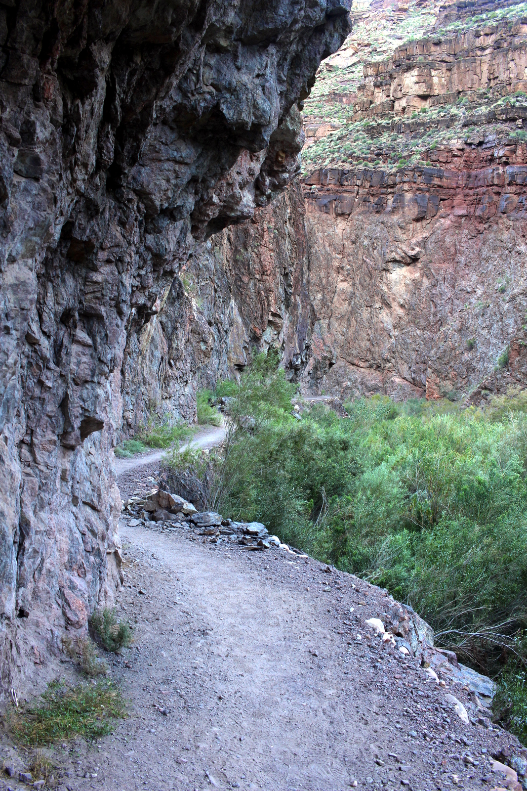
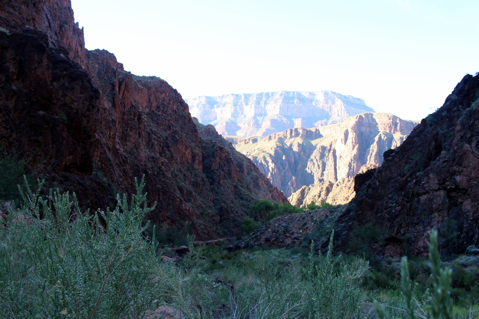
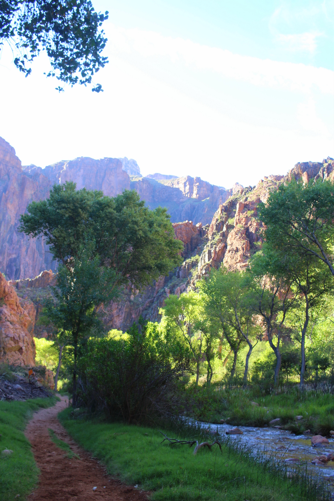
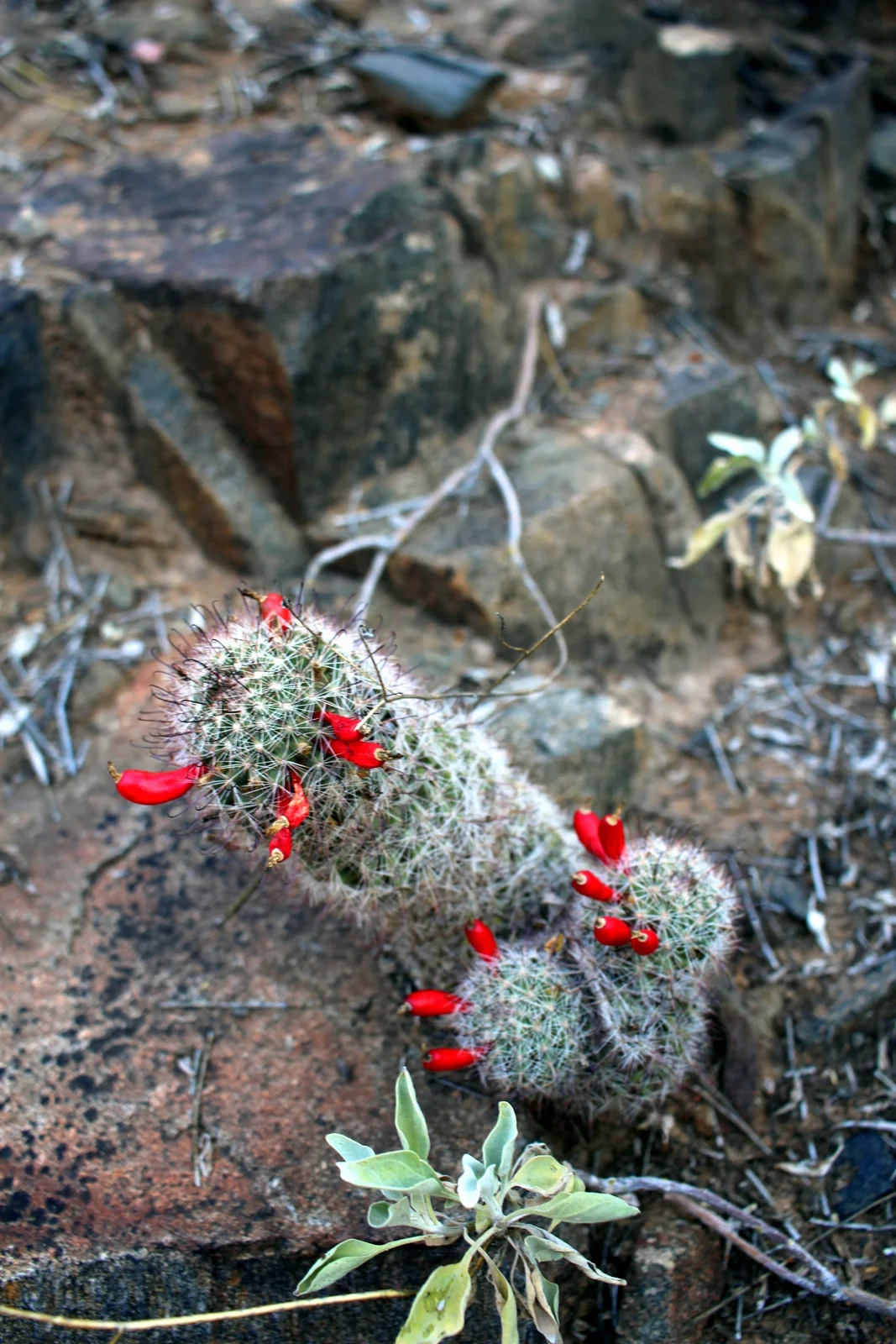
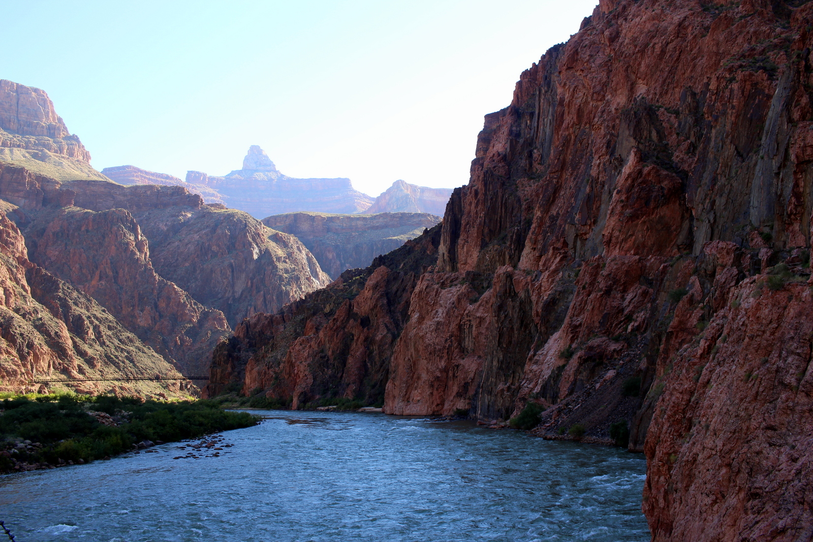
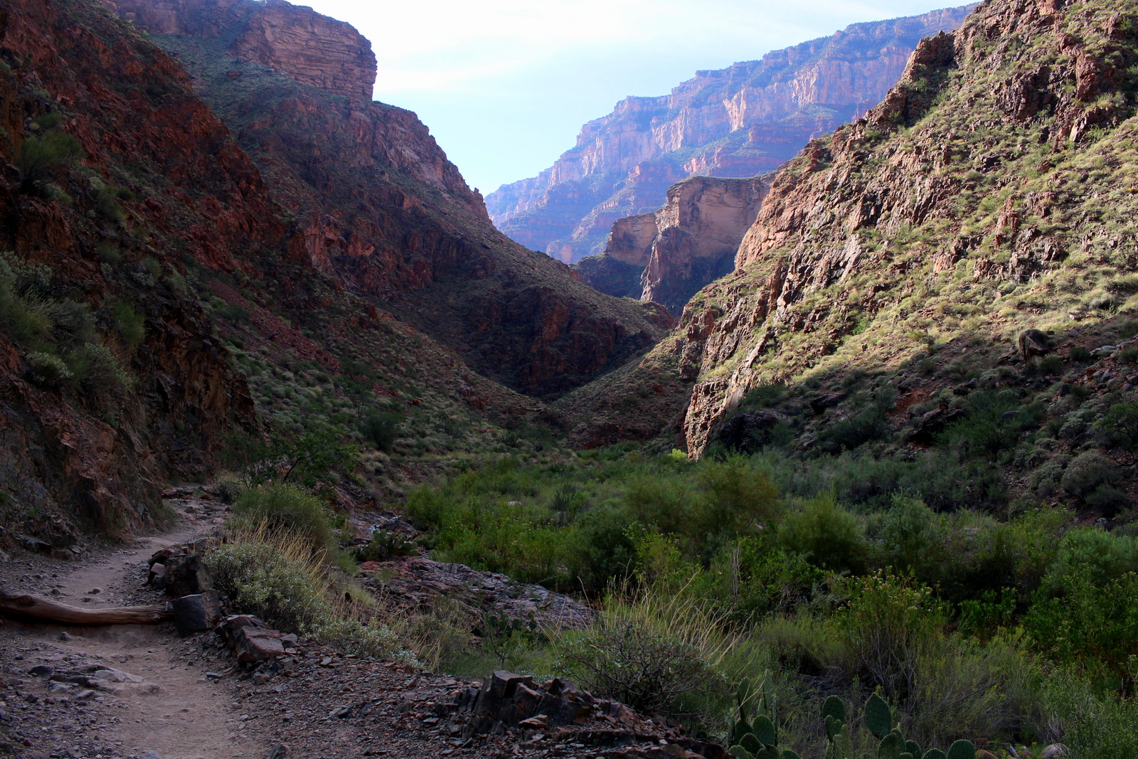
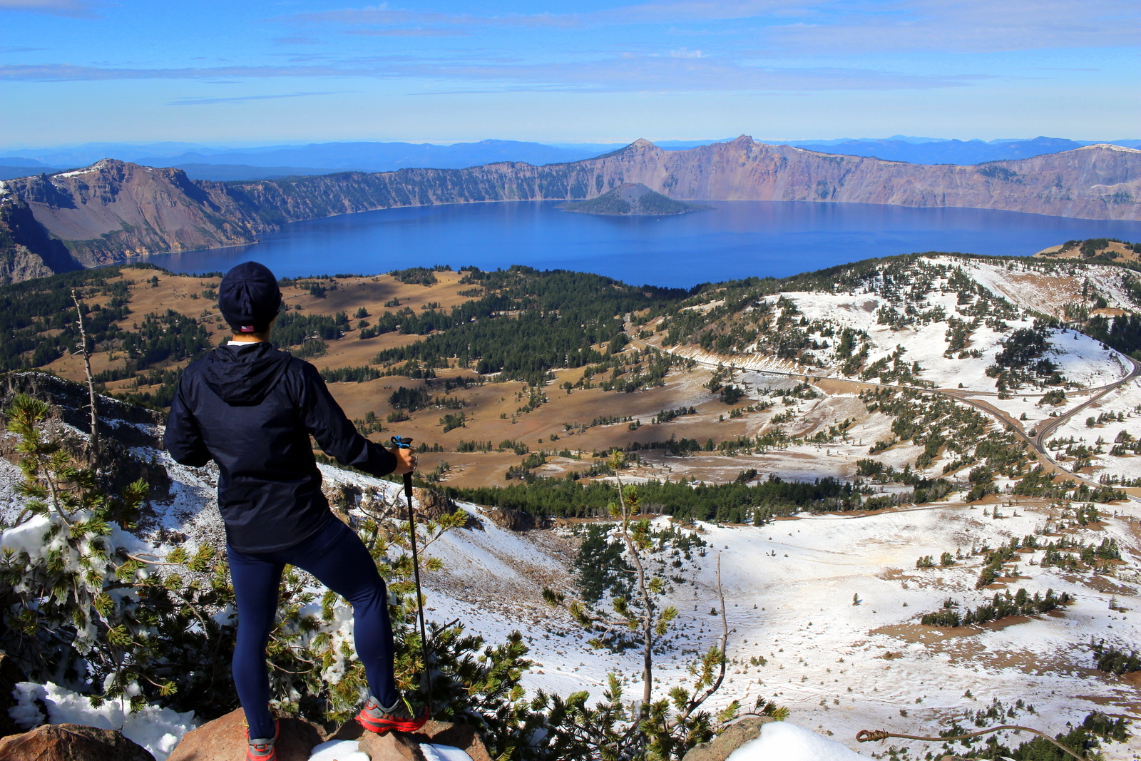
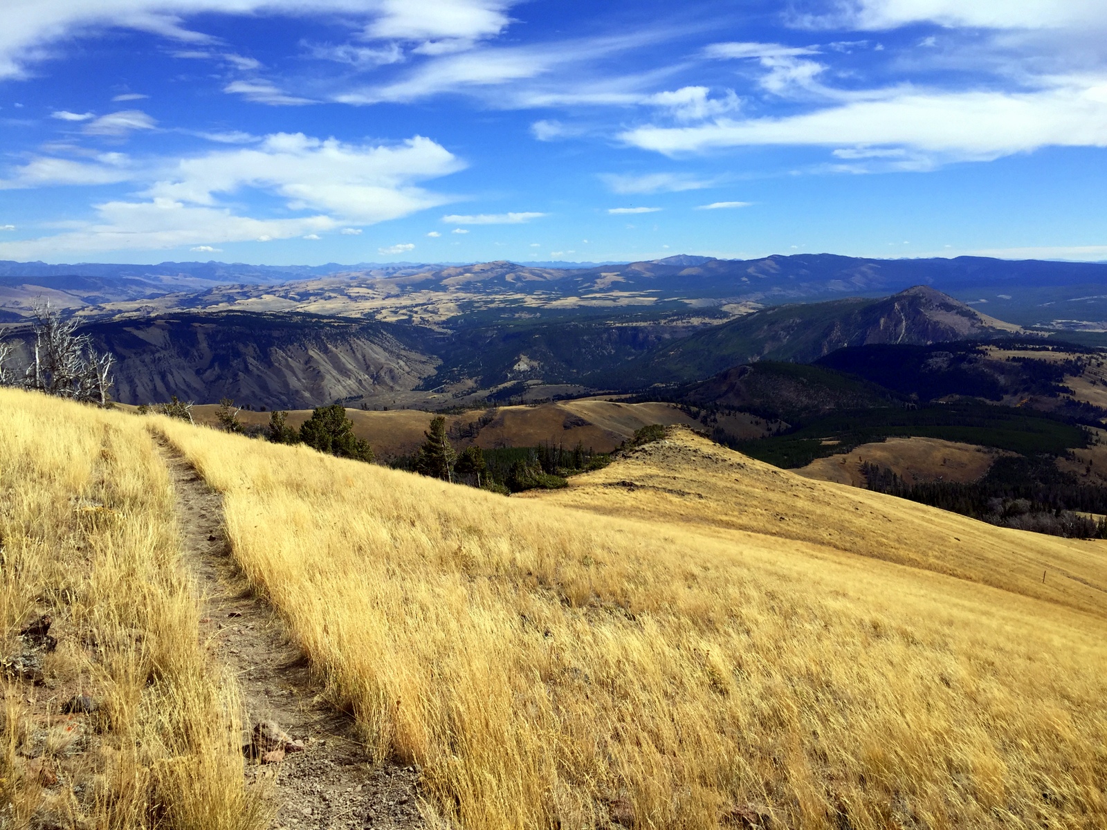
Today was two days before my attempt to run the Grand Canyon Rim-to-Rim. I wanted to take it easy. Because I'd arrived late to Zion the day before, I was doing Angels Landing this morning, before heading to Page, AZ to see the physics-defying Horseshoe Bend. I'd end the day early and stay at an Airbnb right below Grand Staircase-Escalante National Monument. I wanted to shower and sleep in a bed right before taking on the R2R.

I woke up super early--early enough so that I was at the shuttle bus at the Zion visitor center by 6:45 a.m. The first shuttle came around at 7 a.m., and I made sure I got onboard. There were a surprising number of hikers at this time. I guess it made sense; this morning was the first day of the fall season. During the summer, the first shuttle had left at 6 a.m. Now, people wanting to do some of the longer hikes (e.g., in the Narrows) would have one less hour to spend in the canyon. It would be imperative to get on the 7 a.m. shuttle.

After 20-30 minutes, we were at the Grotto stop. This was where the Angels Landing trailhead was. As soon as I got off the bus, I wasted no time. I deployed my trekking poles, tightened my fastpack, and immediately got into my running stride. I wanted to get out slightly in front of the pack of hikers that had already gotten onto the trail. But, critically, I also did not want to go at a hard--or even medium--pace; saving energy for the Grand Canyon was my biggest priority.

Yet I found my heart rate creeping up more than I'd hoped. It was simply too much of a thrill to see a tall platform way up above me. I really wanted to get up there--and fast.

I briskly ran the first 3/4 mile or so, which is almost entirely flat alongside the Virgin River. After that, though, the trail turned into a series of mean switchbacks. I knew that if I tried to run these, I'd be adding fatigue to my legs--the very fatigue I was trying to avoid two days before R2R. So I ended up power-hiking, and relying on my poles far more than I normally do. I looked down. Only one person was anywhere close to me. Everyone else had yet to even hit the switchbacks. And I wasn't even sweating.

But then I got to what's knowns as Walter's Wiggles. Walter Ruesh was Zion's first superintendent, and he created this switchback staircase to get up to Angels Landing. It looked a bit out of place, but I marveled at it from an engineering perspective.

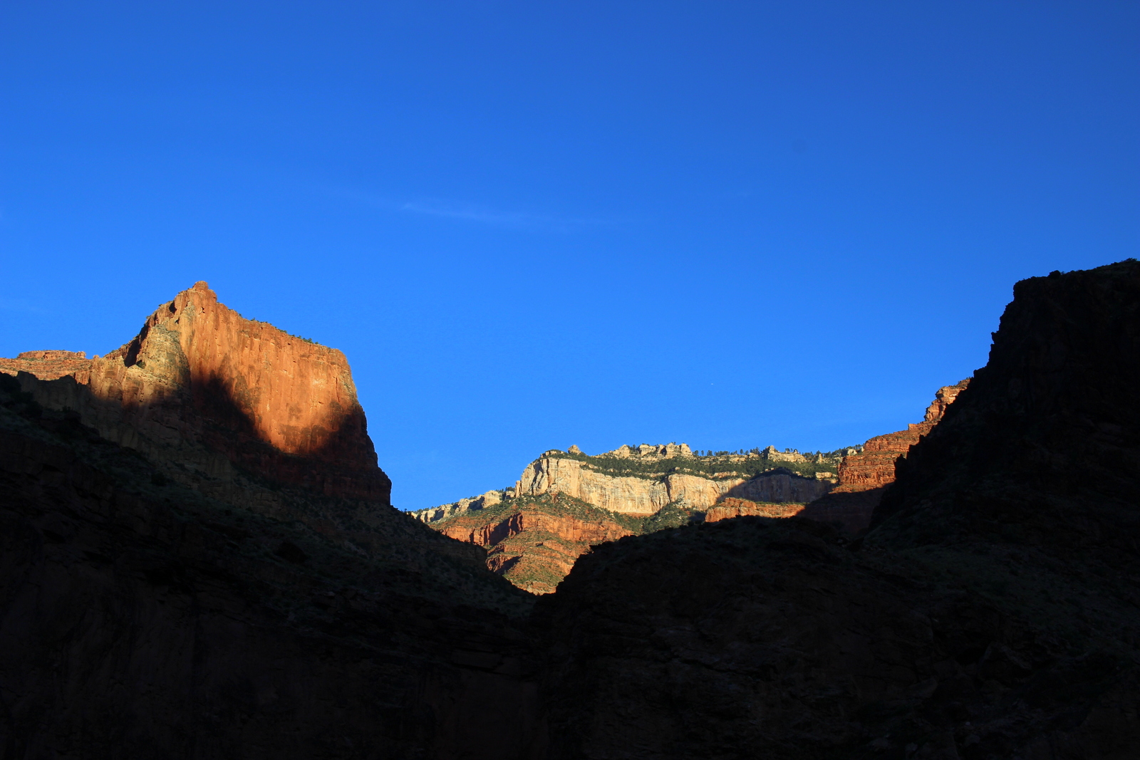
I was making good progress, and I knew that no one would catch me. In other words, I'd be the first one to the summit. But I also realized I had another thing to worry about--the sun. I wanted to be on top of Angels Landing before the sun's rays hit it. Basically, I wanted to watch the sun light up the canyon. As I continued the ascent, I could see the sun beginning to light up other parts of the canyon.

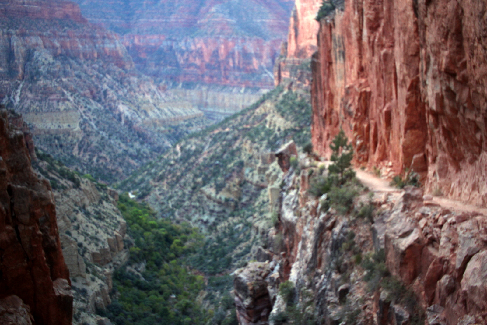
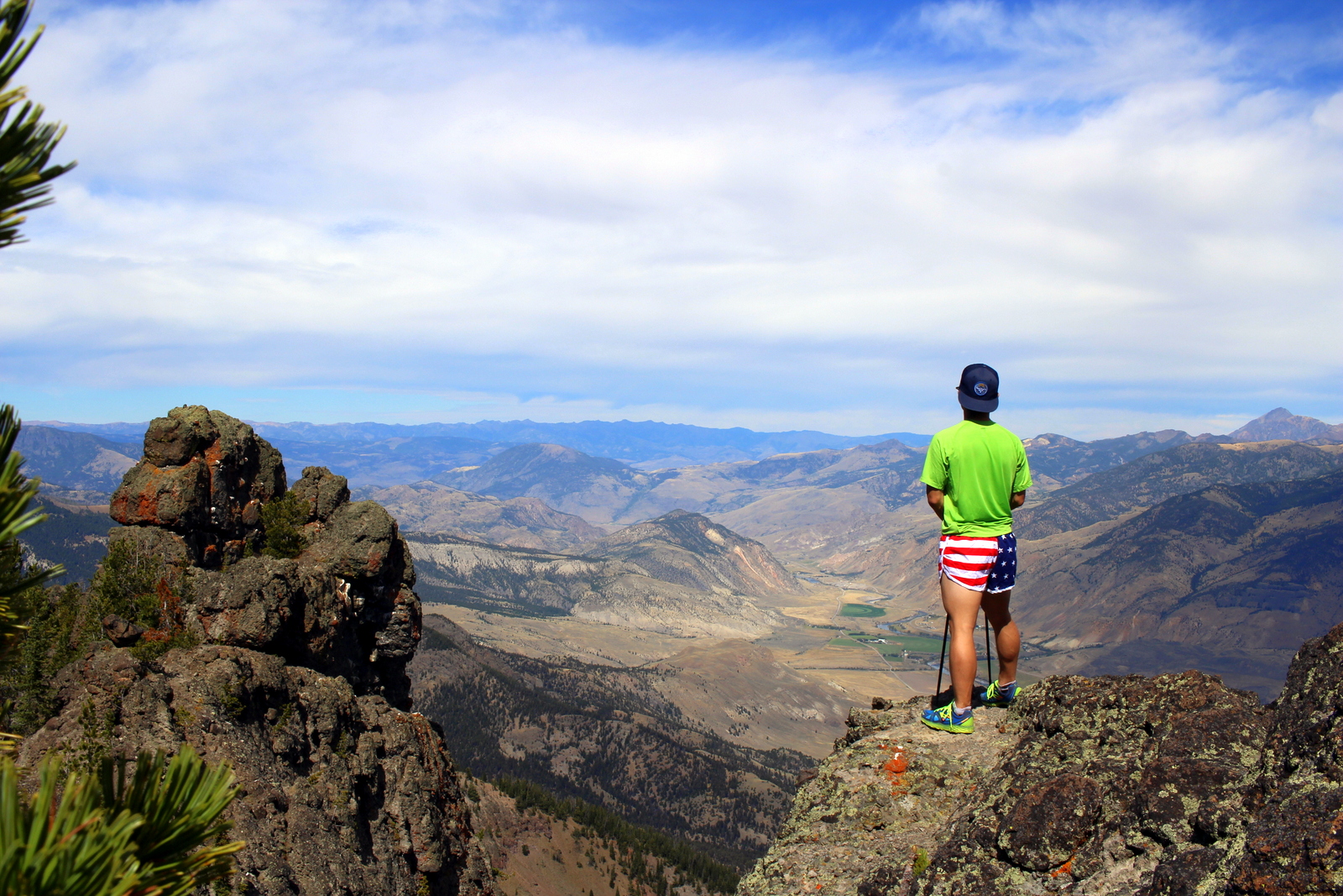
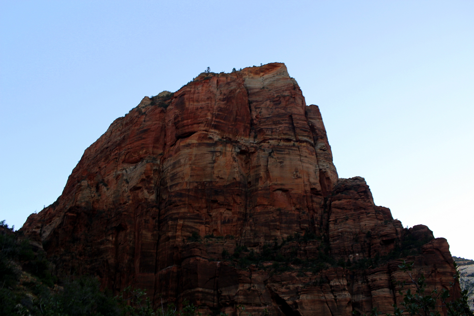
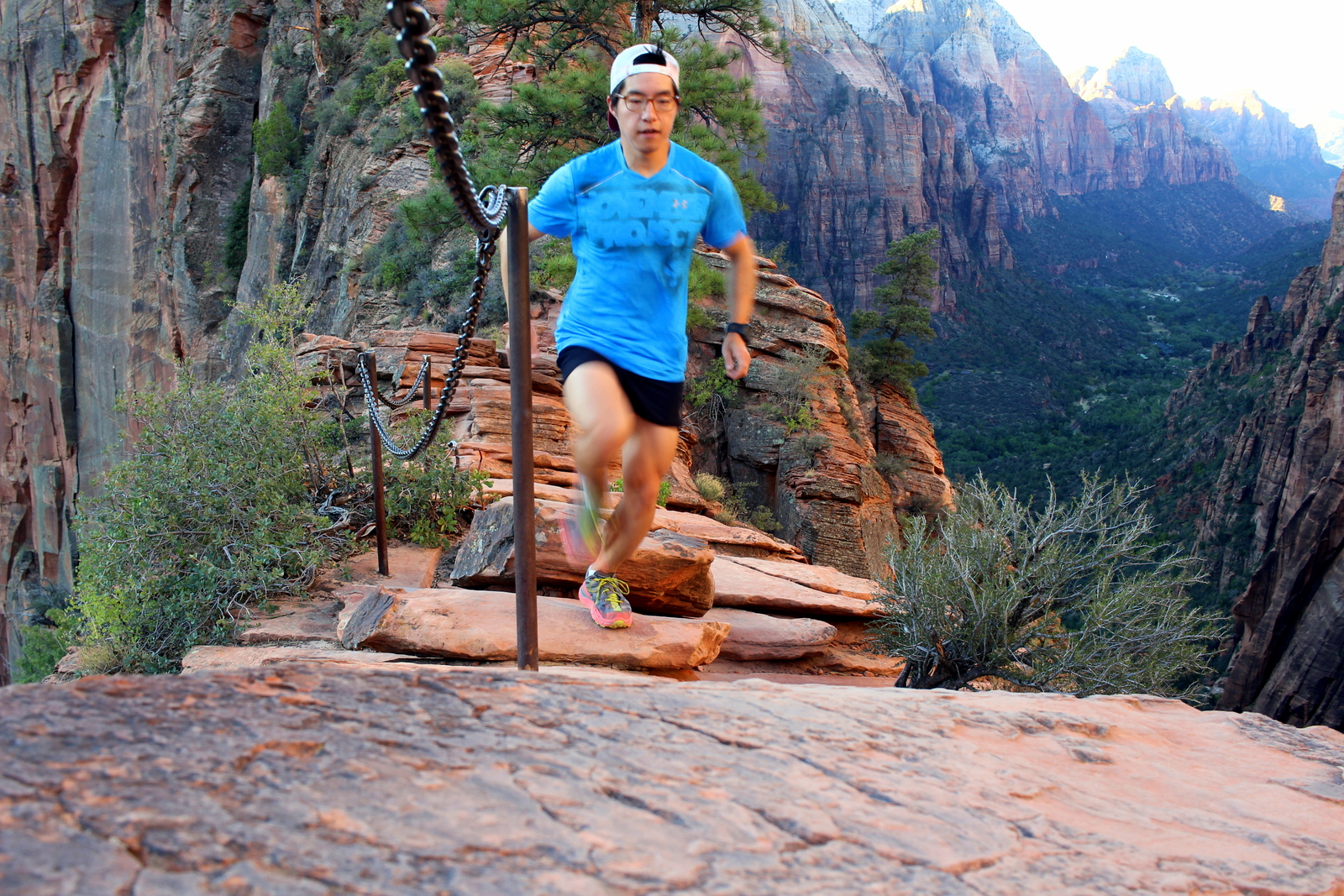
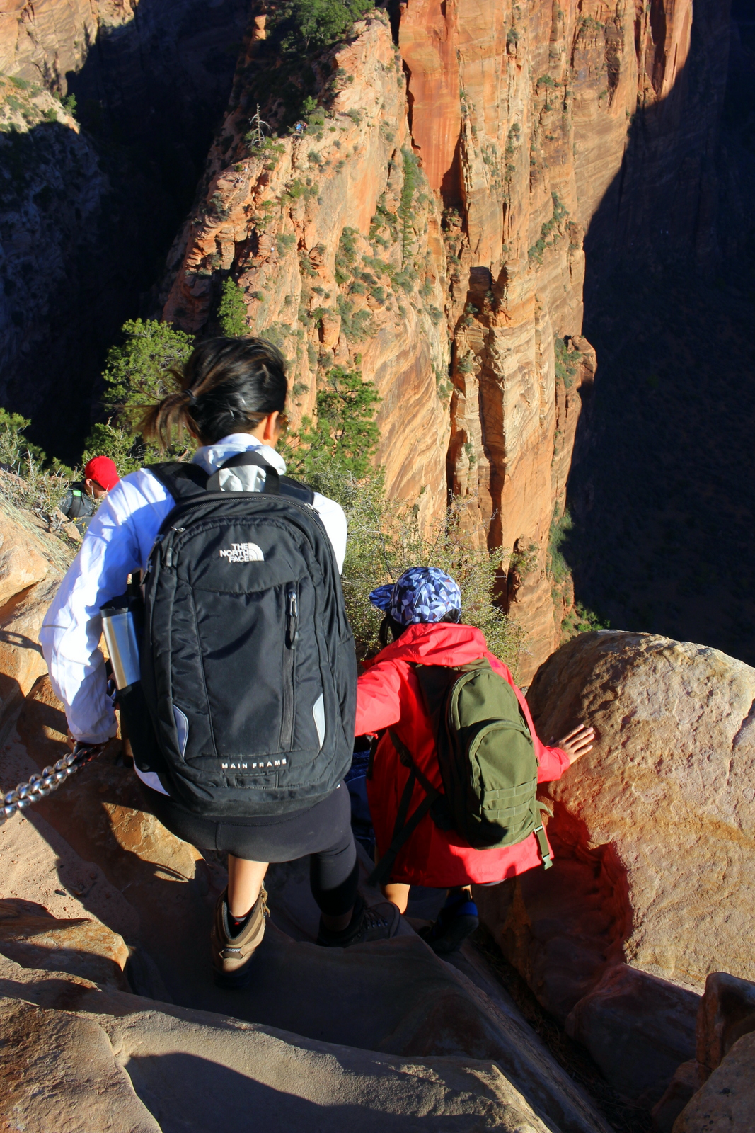
Soon enough, I reached the beginning of the notorious final half-mile stretch to the summit. This section has you crossing a narrow sandstone isthmus with a 1,200-foot drop on one side, and an 800-foot one on the other. The NPS had installed support chains that you could hold onto, but I had a feeling it would be as scary as people had said it would be.

When I began, I was definitely nervous. I was envisioning sections of the trail where you necessarily had to hold onto the chain. 

But as I ambled along, I realized that that wasn't the case. The chains were definitely helpful at every point in that segment of trail, but it was never, to my mind, necessary. And that just meant that I could let go from time to time. Of course, each time I let go, my palms started sweating.

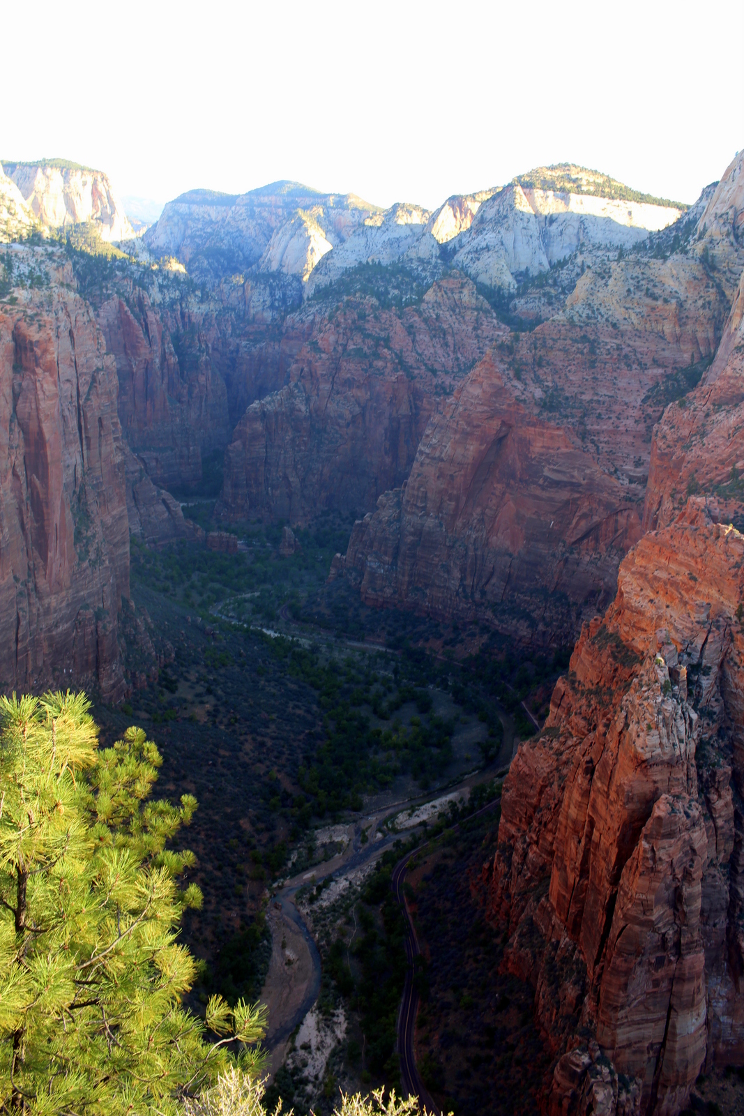
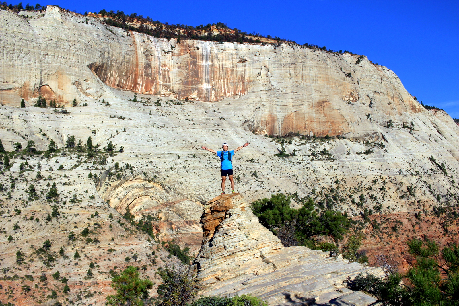
In 49 minutes, I'd comfortably made it to the summit. The sun was lighting the tops of the canyon walls, but it had yet to hit Angels Landing. I'd succeeded in beating the sun! I took in my first views of Zion from high above. It was as impressive as I'd heard.

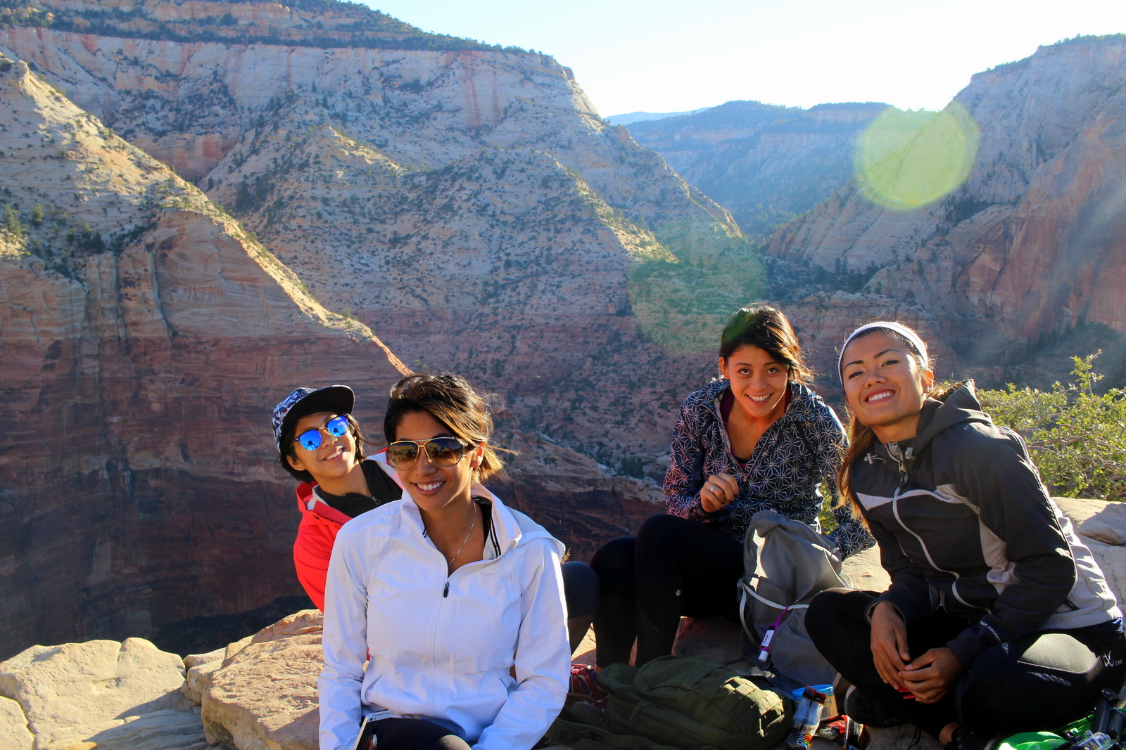
l forgot to mention, though, that I technically was not the first person to reach Angels Landing that morning. Benjamin Rusnak, one of the artists-in-residence in Zion; his wife; and a friend were already on the summit when I arrived. I couldn't figure out how they'd made it, since private cars can't drive on the canyon road. It turns out Rusnak's housing is right at the Grotto; they didn't need to wait for the shuttle. Another group of hikers were ahead of me on the trail, but I caught up and passed them. I was still confused as to how they got there. Let's just say they used creative means...

I spent a lot of time up there. One of the best parts of climbing mountains and getting up high is the time spent staying up. Looking down, you could see how effective the shuttle bus system was--there were no cars clogging the road, and the sole vehicle on the road was a shuttle bus.

Soon, Angels Landing was starting to fill up. The fit hikers trickled in, and then, all of a sudden, in the span of 10 minutes, a dozen more hikers made it. Naturally, it got noisier and less serene. But I guess that's the trade-off when you go on one of the most popular hikes in the entire NPS system.

There were also more than humans up at the summit. There were a bunch of chipmunks scurrying about, trying to catch falling crumbs from the bars that everyone was eating. They were pretty sneaky. I found one darting all around my pack (luckily he didn't get inside). At one point, I thought out loud that this place should be called "Chipmunks Landing". Several hikers from Australia laughed and agreed that that would be an entirely appropriate name.

There was also a fun little rock pyramid on the far end of Angels Landing. I climbed up it.

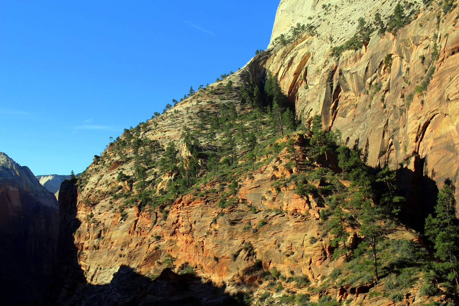
I was hoping to stay longer, but I did have one time constraint: I needed to check out of my campsite by 11 a.m. It would take time to descend, take the shuttle bus back to the visitor center, walk to my campsite, and break camp. So after about 45 minutes--too soon to see even one third of the canyon light up--I said goodbye to everyone I'd met at the top and headed back down. On the way down, I made sure to check out new views of the canyon. On this trip, I've been surprised numerous times by how I see different things and see things differently just by reversing direction.

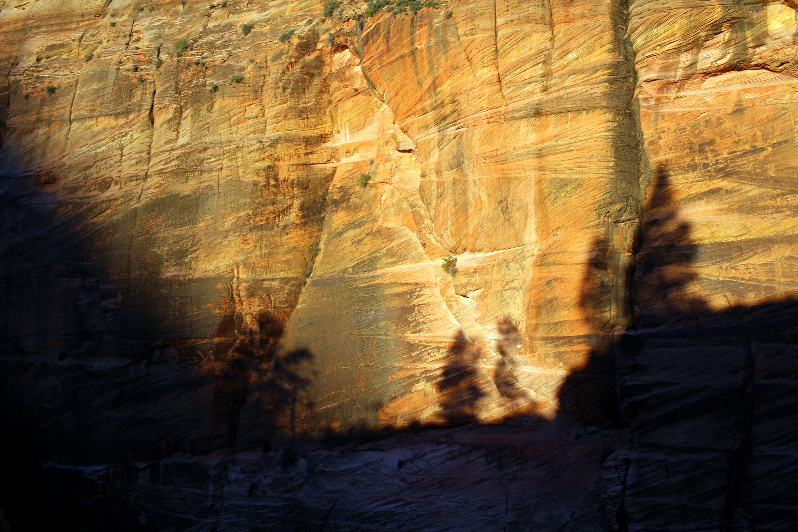
Another fun aspect of seeing the same thing again is how the time of day evolves and affects your view of the landscape. Shadows are one of the most obvious things that shift over the course of the day and dramatically alter one's perception of a landscape.

Height has an effect, too. On the way up, it was hard to get a sense of the scale of Walter's Wiggles. On the way down, they looked like an absurd human conveyor belt. I forgot to mention that, by the time I was back down on the Wiggles, the trail was packed. There were dozens and dozens of people slowly hiking up to Angels Landing. I was glad I'd gotten up there quickly--and left relatively early too.

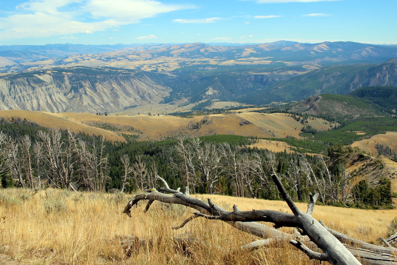
On the way back, I stopped at the museum and watched the park video (I figured I could sneak it in before needing to vacate my campsite). I learned more about the geology in the region and how the Zion Canyon formed out of the Colorado Plateau (this feature, by the way, was entirely new to me).

At 10:45 a.m., I was back at the Watchman Campground. I once again processed just how awesome the campsite's location was, and then I packed everything up and got ready to hit the road. Oh, I had a homework assignment to complete first, which involved taking a selfie, so I did that before leaving.

2015-09-27 10.45.51.jpg

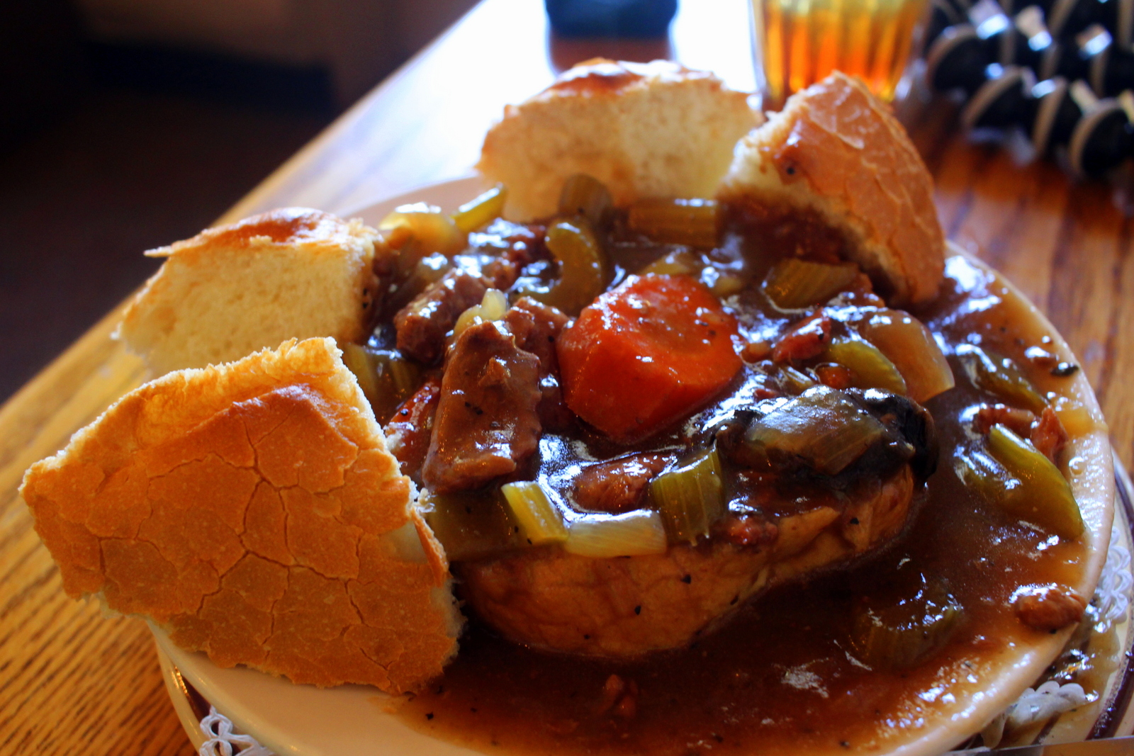
I realized that I hadn't eaten lunch. Normally, I would've just nommed on bars and snacks until I got to a town that had food. But today was not a normal day. It was two days before my R2R attempt. I needed to be fueling up--packing on the calories and just feeling well-fed at all times. I decided I'd backtrack towards Springdale and eat lunch there. I had a delicious wrap at a cafe there, but when it was time to enter and pass through the park to get onto the Zion - Mount Carmel Highway, I encountered an insane amount of traffic. I tried to imagine what Zion would be like if private cars had unlimited access to the canyon road. It would be a nightmare.

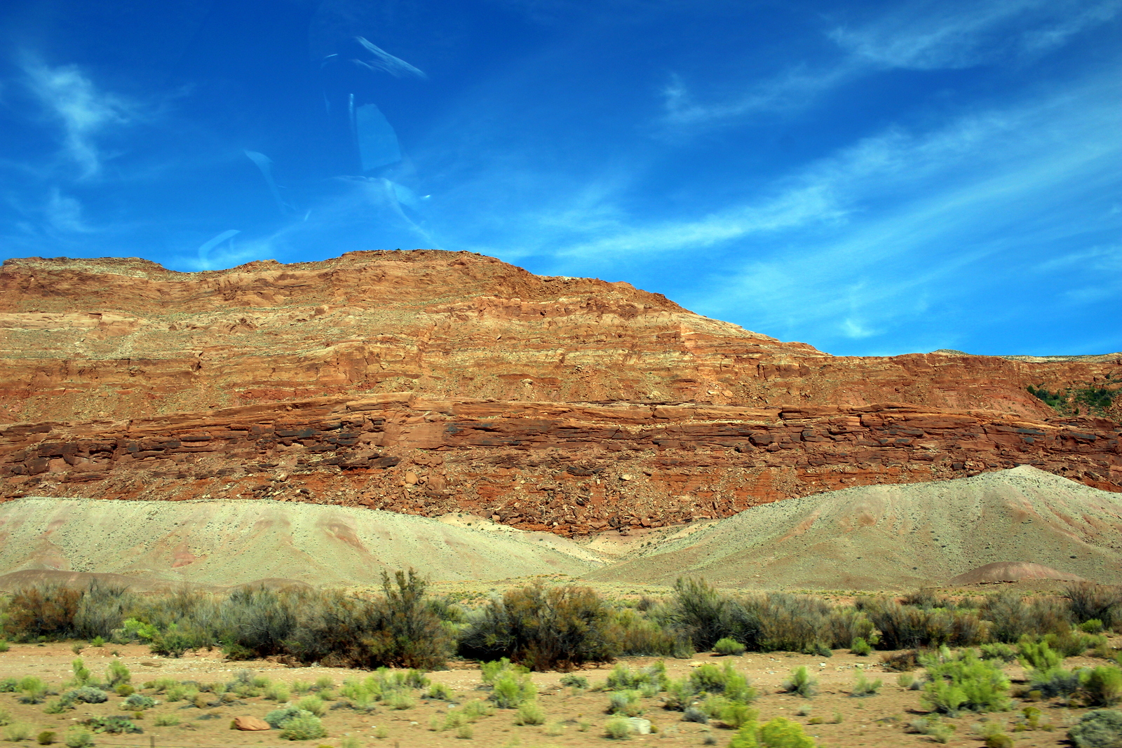
Eventually, I made it back into the park, and I proceeded onto the Mount Carmel Highway on the east side of the canyon. I've gotten really good at taking no-look, blind photos while driving.

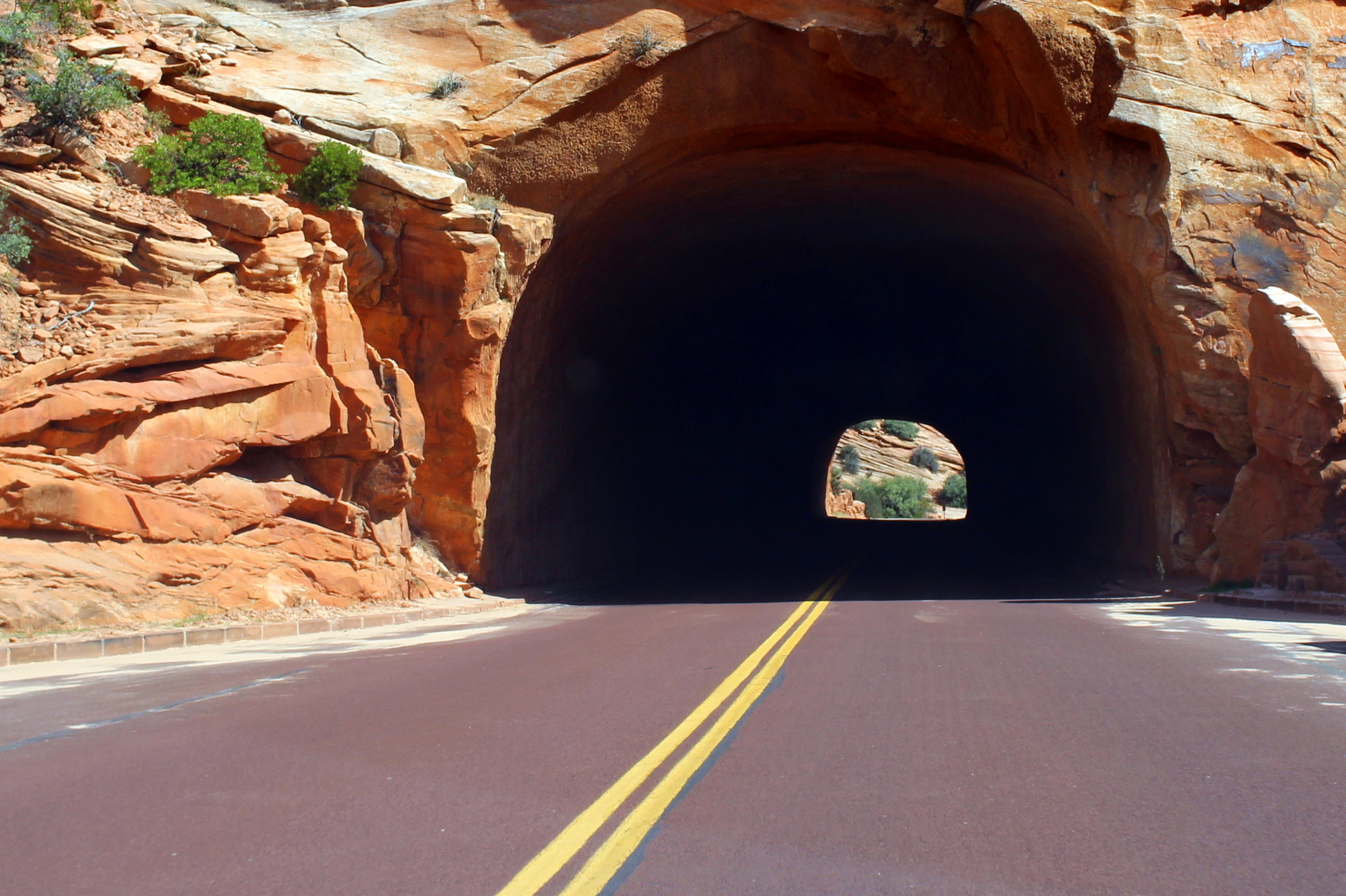
Soon, we entered the Zion-Mount Carmel Tunnel, which, when completed in 1930, was the longest of its kind in the U.S. It was an engineering feat, one made even more impressive by the various galleries that let drivers catch glimpses of the canyon while driving (perhaps a dangerous distraction?).

When I popped out on the other side of the tunnel, the whole landscape looked different. It just felt different.

I also saw my first bighorn sheep. They'd been eluding me all summer--I'd finally seen one!

I continued through smaller tunnel segments. This was a really scenic and fun drive--one of the best to date.

Almost at the end of the scenic highway, I came across a pullout spot right by Checkerboard Mesa. And then it hit me: this was the exact same spot where we'd finished the hike in the Barracks. I'd somehow made it out of the canyon and up to this pullout, where buses were waiting with endless supplies of water. In short, seeing this pullout brought back a lot of memories, both good and bad.

And then I was out on the open highway again, this time off to Page, AZ.

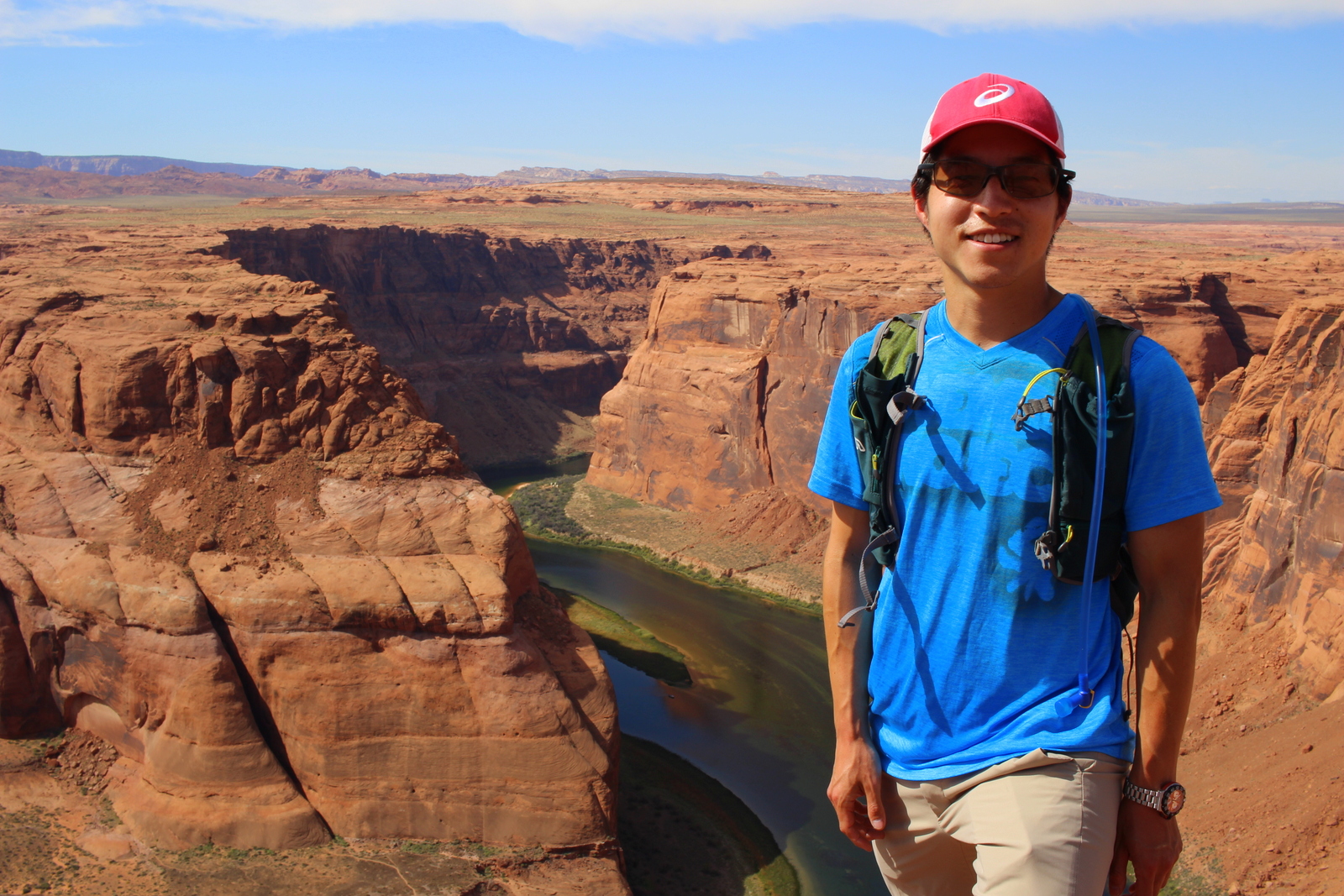
Just about the only thing worth doing in Page is visiting Horseshoe Bend in Glen Canyon National Recreation Area. This feature was simply stunning, jaw-droppingly so. I wanted to linger, but it was scorching out, and I didn't want to generate any more fatigue in advance of the R2R. So I left pretty quickly.

I made more one more stop before checking in at my Airbnb. That was Lake Powell. What's mind-boggling about Lake Powell is how much water there is in it, even though everything else in the area is parched. The lake shone--it almost glowed--in the strong sunlight.

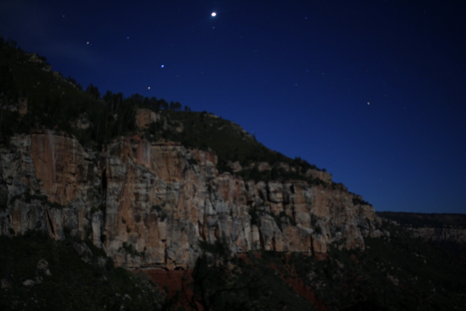
It was late afternoon now. I proceeded to my Airbnb and met my host, Janiece. After showering and unwinding for a couple hours, I realized that it was the night of the blood moon lunar eclipse. I sat on the porch to observe. I caught a glimpse of the eclipse as it was happening.

Unfortunately, as the eclipse continued, the clouds began rolling in and obstructing a clear view of the moon. So, when it actually turned blood orange, I could barely see it. It was an ironic end to the day. I was in one of the most isolated parts of an already isolated area, and therefore was in prime stargazing territory. But I ended up basically not being able to see much of the details of the eclipse. Sometimes that's just the way things work.

Day 33: Grand Canyon National Park, AZ (Rim-to-Rim) by Wookie Kim

Running the Rim-to-Rim in the Grand Canyon was not the longest, or the hardest, run I've ever done, but it was the most epic. (Remind me that I need to define what I mean by "epic", a word I've thrown around all summer but haven't fleshed out.) Maybe a narrative of my day will shed some light on why I say this.

I rose at 3:30 a.m. My goal was to be on the trailhead at some time between 4:30 and 5:00 a.m. I had to be on the South Rim by 1:30 p.m., because that was when the last Transcanyon Shuttle was departing back for the North Rim. If I missed that, I would be stuck in my running clothes 220 miles away from my car and campsite (and, yes, the North Rim and the South Rim are that far away by car!). I anticipated taking between 6 and 7 hours, but wanted to budget in even more time just to be safe. After all, strange things can happen in the canyon.

I expected to be the only person up at the ungodly hour of 3:30 a.m., but I was surprised to see several campsites with flashing headlamps. I guess it wasn't that surprising--there are day hikers who start the previous morning and finish after midnight, and there are other R2R runners like me. In fact, the ranger in the backcountry office had mentioned that on a pleasant weekend day, the NPS estimates that roughly 1,000 R2R runners hit the trails. Apparently, the number of R2R runners has grown rapidly--so rapidly that the NPS is tinkering with a permit system, something that has already been implemented for large-group runs.

I immediately set to making a hearty breakfast. I pulled out the big guns today--chocolate chip Birch Bender pancakes. These things are insanely delicious, and also pack a caloric punch. I also sipped a bottle of Tailwind, another crucial ingredient to my nutrition plan. I went to the bathroom, too. This, as before every big run I do, was a huge relief. At 4:15 a.m., just as I'd planned, I was ready to head to the trailhead.

I drove over about a mile to the North Kaibab trailhead. This was the sole route down into the canyon from the North Rim. On the other side, however, there were two routes up to the South Rim, the South Kaibab and the Bright Angel trails. I planned to take the Bright Angel trail, even though it was longer, because it, unlike the North Kaibab, had water spigots along the route. I wasn't going to risk climbing 7 miles out of a canyon, and after having already run 14 miles down to the river, without the opportunity to fill up water. All told, I'd be running 23.4 miles according to the map. Of course, one can never truly follow the trail at all times. Additional distance gets added here and there. I was anticipating a 24-mile day. 

At the trailhead, I made last-minute clothing choices. At the campground, it was in the mid-50s. Here, however, it was even colder, probably the high 40s. In fact, I was already starting to shiver. I didn't want to carry too much, if any, cold weather gear, but I decided I'd begin wearing gloves and my rain shell. The water-resistant shell provided just enough protection from the whooshing wind to stop my shivers. I'd also packed a space blanket, just in case it got really really cold. I was now ready to set off!

But I immediately encountered a problem I hadn't expected: I couldn't find the trail. It was still dark, and I couldn't see any signs or posts indicating where the trail began. I followed what looked like railings and almost headed down what looked to be the trail until I realized that it was labeled something else. I turned around and followed the same railings to the other end. It ended and the trail descended, and I with it. I was now on the North Kaibab, dropping into the Grand Canyon.

The initial miles were surprisingly slow. I'd already been planning to take it very easy going down to the bottom of the canyon. I didn't want to blow out my quads on the steep descent. I also didn't want to risk falling off the edge in the dark. Even with these two factors in mind, I moved at a snail's pace. I didn't realize just how difficult it was to navigate a bumpy, rocky, sandy trail in very low light. I wasn't able to use my peripheral vision to discern the obstacles ahead of me. I also had trouble perceiving the variations in depth due to the undulating trail. As a result, I stumbled frequently. Thankfully, I'd brought my trusty trekking poles. Any time I stumbled, I put my pole down to regain balance.

At 5:05 a.m., I realized I'd descended a good bit already. I could see the faint outline of the opposite wall of the side canyon I was descending. With the moonlight, and a 10-second exposure, I captured it.

Of course, everything around me was still dark. But seeing a glimpse of the canyon wall confirmed that what I was doing was very real. It was an odd feeling, not being able to tell where I was, but knowing that I was descending very rapidly into one of the grandest geological features in the world.

Eventually, I made it to the Supai Tunnel. I couldn't really even look at it, because it was so dark. But I felt good that 2 miles had gone by and I hadn't even noticed. At 5:45 a.m., I crossed my first bridge.  

Just before 6:00 a.m., I'd finally made it past the forested switchbacks and into the canyon  proper. It was still dark, but long exposures revealed the immensity of the canyon. The trail snaked along the canyon wall. It was impressive engineering, for sure.

As official sunrise (6:15 a.m.) approached, my visibility grew. I looked over my shoulder towards the North Rim. It finally hit me that this whole R2R thing was really happening. There would be no turning back now.

At 6:15 a.m., I was at Roaring Springs, 4.7 miles into my day. Roaring Springs roared exactly like its name. This was the source of all water to both rims. It was impressive to see it pouring out of the side of the canyon wall.

Even though it was now past official sunrise, the inner canyon was still very dark. Looking up, however, I could see the brightening sky. This contrast made this endeavor feel even more epic; while all the world was lighting up, I was deep in the bottom of a canyon, still wrapped in darkness.

By 6:30 a.m., it was getting ever-so-slightly brighter. I could finally see the inner canyon in all its glory. And it was truly glorious. I'd seen countless photos of the Grand Canyon from the sky or from the rim, but this was really my first view of the canyon from deep within--3,000 feet below the North Rim. It was an awesome feeling to be running the entire length of this side canyon down to the Colorado River, and then back up to the other side!

Being deep inside the canyon also meant that I could pick up on the plant life. The stream (was this the Little Colorado River?) that the trail followed provided ample water for lush vegetation.

By 6:30 a.m., I was snaking along the tall canyon walls. Each bend showed something new.

When I turned a bend at 6:36 a.m., I caught my first glimpse of the bottom of the South Rim. What made this moment so special was that the walls of the box canyon that I was descending still had not been lit by the sun. It looked as though someone were telling me exactly where I needed to go. Like a fly, I motioned for the lighted canyon wall.

Eventually, I passed Cottonwood Campground, where I refilled water for the first time all morning (the pump house water spigot was off--the pipe burst had, in fact, affected the water supply!), and took a short break. I was now just under 7 miles into my day. I still felt comfortable and completely in control. I now set to my next segment--the 7.2-mile stretch to Phantom Ranch at the bottom of the Colorado River. I'd been told that this stretch was flat and easy--a good place to pick up some speed. I began cruising, following the trail as it continued to snake along the canyon wall.

At 7:10 a.m., the inner canyon was still quite dark. But when I looked up, I could see the sun was creeping down the canyon walls.

I was determined to minimize my time in the scorching sun. It would already be scorching hot the deeper into the canyon I got. Yesterday, it had reached 104 at Phantom Ranch. Today, the high was 99, so it was slightly cooler. But that was still hot.

The final stretch to Phantom Ranch was a thrill. I felt like I was on a rollercoaster trail ride. The trail snaked in and out between the canyon wall and the stream below.  

At some point, I noticed what seemed like a water fountain. Then, I saw the pipe. Clearly, this water was not natural. It was probably water that was leaking from the burst pipe. I was glad I'd brought filtration, and that I'd started with--and maintained--a massive Camelbak reservoir.

As I ran, I also saw evidence of the canyon-forming process. Of course, the main force creating the Grand Canyon is water. The Colorado River (and other water sources) has been carving this canyon over many years. But water alone hasn't created this entire canyon. The walls have had to crumble in order for the canyon to widen. Here, I could see a rockslide of sorts. I was watching the Grand Canyon become even grander.

Really, there was just so much to see as I ran. As I said, every bend led me to something new to marvel at. By 8 a.m., I had a sense that I was almost to the very bottom of the Canyon. I could smell Phantom Ranch around the bend...

By 8:10 a.m., I'd made it to Phantom Ranch! I was now 14 miles in--well past the halfway mark, at least in terms of distance. Effort-wise, I was probably right at the halfway mark; the ascent would take far more effort than the descent I'd just completed.

Phantom Ranch is an oasis at the bottom of the canyon. There's a canteen, and several bunkhouses. It's an incredibly popular stopping point for R2R hikers--so popular that it sells out the first day of the season. 

I had an important task to complete here at Phantom Ranch: drop off the stack of postcards I'd written the day before. As I've mentioned, the post office at Phantom Ranch still packs out mail by mule. Apparently, it is the only post office that still uses mules. Mail that gets sent from here is stamped to indicate this unique carrying method. I'd written several dozen postcards, and I'd carried them down to the bottom of the canyon. I wasn't about to forget to send them! After buying a few extra stamps (I'd written so many that I'd ran out!), and a few postcards, I finally dropped all of them into the satchel. Hopefully, the mules are reliable and the postcards get to where they need to go. 

I also drank my secret weapon beverage--a can of Coke. Even though it is heavy for what it provides nutritionally, I always carry a can on long days. There's just something about Coke that is incredibly refreshing right in the middle of a hard day of running. The caffeine boost also doesn't hurt.

Just after 8:30 a.m., I was back on the trail, heading the last half-mile or so to the Colorado River itself. I could immediately tell why people loved Phantom Ranch. It was incredibly lush and peaceful. 

Right before reaching the Colorado, I saw a board with a missing person posting. This was a reminder that the Grand Canyon isn't to be underestimated. I knew that, even though I had roughly 10 miles left, I still needed to run conservatively and practice safe running.

Right by the post, I saw a unique sight. There was a cactus with what looked like red peppers growing right out of it. Was this some kind of symbiotic relationship? It was weird.

Finally, at 8:40 a.m.,I reached the true bottom of the canyon--the mighty Colorado River! The Silver Bridge was my route across and to the Bright Angel Trail. I crossed the bridge, fearful that it might collapse and the roaring river would sweep me away. Truly, looking down, you could see just how powerful this river was. I guess it now made at least some sense that this river could carve the Grand Canyon.

As I was dilly-dallying by the bridge, a father-son duo approached. I learned that the son was only 10 years old--and they had just come down the South Kaibab Trail and were planning to ascent back up the Bright Angel Trail. I couldn't believe that a 10-year-old was doing this hike (probably around 16 miles plus the canyon wall)! It turned out that the dad was a pretty serious ultrarunner. Go figure.

It was now 9 a.m., and I could sense that the sun was finally going to hit me dead on. I'd been incredibly lucky to have avoided the sun for most, if not all, of the morning so far. I knew that the sun would change the game. I put my camera away and decided it was time to ascend the Bright Angel Trail and get to the South Rim.

My next real target was the Indian Garden Campground. This, like Phantom Ranch, was an oasis in the canyon. But I had 4 miles of switchbacks to ascend before I got there. I set to work, power-hiking the steeps, and shuffling up the flatter inclines.

Climbs are always the most epic part of any run. The symbolism of the ascent is powerful. But the climb is also where the effort comes in. Not 15 minutes after I'd begun climbing, I looked back and could see that I was already beginning to rise up out of the bottom and up the canyon wall. I could see parts of the North Rim off in the distance. I'd conquered so much of the canyon already.

Every now and then, I'd look down to see what I'd climbed. The switchbacks, as always, are the most fun to look at. They make everything seem that much more badass. 

At each turn, I couldn't resist stopping to marvel at the distance I'd covered. The canyon walls drifted in and out all the way to the horizon. I simply couldn't get enough of these views.

Just before 10 a.m., I noticed a shift in the landscape. Everything seemed very, very green. I sensed that Indian Garden was very near, and that's because it was. There were a ton of hikers resting here. Some had been camping here, and others were simply stopping by. I filled up my water again. I was now 18.2 miles in, and it was time for the serious ascent to begin.

I had roughly 4.7 miles to go. In that distance, I'd climb over 3,000 feet back up to the South Rim. Believe it or not, this incline isn't insanely difficult. I'd done climbs on this trip that were far steeper. But the climb would be unrelenting. Moreover, much of it would be exposed to the sun. I could get hot, and my body could reach overexertion, very quickly. I prepared myself for a hell of a climb.

At 10:15 a.m., I was in the belly of the beast. I looked up and gazed at the layers of sedimentary rock that constituted the South Rim. I was climbing up to the top.

Now it was all about finding a good climbing rhythm. I used my trekking poles to tap one out, and I set one foot in front of the other almost as if I were marching. Each footstep was deliberate. I was moving right up the canyon wall. At 10:25 a.m., I looked back again. I was rising out of the narrow area and into the wider canyon. 

Soon, I was trailing a bunch of hikers. Now that I was getting closer to the rim, there were just more people around. Presumably, some had descended from the South Rim earlier that day and were hiking back out. It felt a little strange to be surrounded by so many people again. Aside from a dozen or so people I'd crossed paths with, I'd spent the entire morning practically alone. As I continued up the trail, the switchbacks got ridiculous, almost Escher-esque. This is what made Bright Angel so bright, I thought to myself. 

At 10:40 a.m., I was really really getting close. I'd told myself that as soon as I hit the 3-mile resthouse, I'd crank it up several notches. Basically, the run had been surprisingly easy so far. Granted, I'd chosen to run conservatively, but I honestly didn't expect to be so in control and fresh nearly 6 hours into my R2R. I knew I was very close to the top. There were throngs of people now. So if I passed out, someone would notice. I decided to treat the final 3-mile, 2,000-foot ascent as a hard tempo workout.

What this basically meant was that, for basically the first time all trip (remind me to write a post about running economy--something that has been critical to the success of my summer), I would let my heart rate soar way above the limits I usually set. Where 150 and maybe 155 beats per minute was my previous ceiling, I now opened myself up to whatever heart rate I could sustain for the roughly 45 minutes that it would take to get out of the canyon. I set to work. My lungs began to burn, and my legs were on the verge of cramping. I was basically running up a steep incline that most people were ambling along. I let the adrenaline carry me up the trail. I kept looking back over my shoulder, and I kept seeing an ever grander view of the canyon I'd come so close to completely conquering.

My heartrate was leveling out in the mid- to high-160s. With a fresh body, this would actually be quite low. But with 6 hours of R2R in my system, my body simply couldn't sustain an effort higher than that for very long. Ironically, I was forced to stop for a mule train--the first I'd seen all day.

At 11:05 a.m., I could sense that I was nearly there. Truthfully, it was very hard to tell how far I still had to go. It seemed that every time I thought I was there, I turned a switchback and saw a whole set of new switchbacks. In the shadows, you can see a new set.

Also, for the first time all day, I felt very emotional. I was almost in tears. It wasn't because of the pain of the run. Rather, I was so moved by what the day had provided that i simply didn't want R2R to end. I suddenly wished I were still at the bottom of the canyon, beginning the ascent once again. It was then that I decided I'd be back again one day--this time to run the Rim-to-Rim-to-Rim (AKA the R2R2R).  

At 11:12 a.m., I felt really, really close. My legs were burning up. I was now definitely feeling the fatigue. I told myself that this was where I got stronger as a runner--by pushing through the pain, no, creating pain where none had been before--so I had to keep pressing on. Looking back once again, I couldn't believe I hadn't made it out of the canyon yet. The North Rim is at a higher elevation than the South Rim, yet it looked like I'd already reached a point higher than the North Rim.

At 11:20 a.m., I knew I was close. I could practically see the end of the trail just a few hundred feet above me. I booked it. I was determined to empty the tank--to leave everything behind in the canyon. 

When I passed a sign for the Bright Angel Trail, though, I had to stop. This was an incredible trail, and had provided an incredible morning. I needed a photo with the sign.

And then I was making the final push. At roughly 11:30 a.m., I made it out of the Grand Canyon. I'd completed the Rim-to-Rim. Based on my Garmin GPS, it had taken 6 hours, 49 minutes, and 31 seconds. 

You'd think that I'd have been overcome with emotion at this point. But, really, I wasn't. More than anything, I was just happy. Happy that I'd conquered the Grand Canyon. Happy that I'd completely immersed myself in the immense, beautiful, and grand Grand Canyon. Happy that I'd ran an incredibly smart day, hydrating and eating like a pro. Happy that I'd made it to the South Rim with ample time to nom on food before getting into the shuttle back to the North Rim.

There were a bunch of people who were resting at the trailhead. A group had just finished a R2R hike that had taken 4 days. They couldn't believe I'd done it in just shy of 7 hours. They took photos and video for me. Then they took their own photos of me. Others did too. In the ultrarunning world, R2R is actually not that unique of a feat. But I guess to the average person, it's an otherworldly feat. 

I spent 30 minutes at the trailhead, just trying to wrap my head around the day. It had started with the thrill of running in complete darkness, it had continued with my relentless pursuit of the next bend in the canyon, and it had finished with a powerful push up the canyon wall. The 7 hours had passed by so quickly, and at the same time, it felt like I'd started eons ago.

I also read all the trailhead information--something that I hadn't done at the beginning because I couldn't find it. Of all the parks I've visited, the Grand Canyon definitely has the most serious set of warning signs around. 

At noon, I was ready to aide my body's recovery process. I went to the Bright Angel Lodge and sat down at the restaurant. I asked my server to give me the most filling meal on the menu. It was a stew. I demolished it. I then asked her what the most filling dessert was. It was a bread pudding. I demolished that too.

While waiting for my check, I noticed that my pack was covered in salt stains. I forgot to mention that, despite how comfortable the day had been overall, it had still been quite hot the entire time. I'd sweat a lot. I'd also excreted a lot of electrolytes. I was glad I'd brought--and taken--almost a dozen electrolyte pills throughout the day. Aside from the final tempo climb, I'd not once felt any sort of cramp or strain in any of my muscles. 

It was now 1:00 p.m., and I needed to check in for my 1:30 p.m. Transcanyon Shuttle ride back to the North Rim. This would be 220 miles, and would take almost 5 hours, because we would be driving to the easternmost point of the Grand Canyon and crossing the Navajo Bridge to get back to the other side. I laughed when I thought about Rob Krar, one of the top ultrarunners around. He held the records for both the R2R and the R2R2R. He could make a crossing in under 3 hours, and a double-crossing in under 7. Maybe he should start a piggy-back shuttle service for people who need to cross the canyon more rapidly.

Before packing myself into the van, I took one last look at the Grand Canyon from the South Rim. The sky was surprisingly free of haze. I could trace the Bright Angel Trail all the way down into the bottom of the canyon, and then I looked at the jagged inner side canyon that constituted the North Kaibab Trail. I had conquered all of it today. How amazing. 

The Transcanyon Shuttle added to my day. The entire van was filled with people who either had just finished, or were about to start, a R2R hike of some kind. Although there were no R2R runners, I felt a common bond with every passenger, because even an R2R hike is no small feat. We shared stories about our days, talked about past and future travels, and just had a surprisingly fun time. The 5 hours also took us through many more impressive sights, including various segments of the Grand Staircase, such as the Vermilion Cliffs.

Just after 6 p.m., we'd made it back to the North Rim. I got dropped off at the North Kaibab trailhead. In the daylight, I could easily see where the actual beginning of the North Kaibab trail was. I'd missed it completely because of the dark. I read the sign and decided it was time to shower and eat.

I was overjoyed that the North Rim had coin-operated showers. I was gross, covered in sand-soaked sweat, grime, and salt stains. After showering, I headed to the North Rim Lodge's saloon. For several hours, I drank celebratory Grand Canyon pilsners and IPAs while chatting with the bartender and others at the bar. I ate a roast beef sandwich, and then I ate some pizza.

By 8:30 p.m., I was getting sleepy. I headed back to my campsite in the North Rim Campground, put all my dirty clothes away, and cralwed into my tent. For the first time all trip, I went to bed without setting my alarm. I didn't care what was on the agenda tomorrow--I deserved a full night's rest, and I was about to get it. 

Day 22: Crater Lake National Park, OR by Wookie Kim

Yesterday's arrival in Crater Lake was a disappointment. I put faith in the law of averages that today would be different. It was.

I'd set my alarm for 5:30 a.m the night before. I was going all in. I'd either see the most beautiful sunrise from the rim of the crater, or I'd stand on that rim and shiver while the cold fog covered everything in sight.

I'd slept awfully. It was sub-freezing, and I just wasn't prepared for that. I woke up twice in the middle of the night, with my toes so cold and numb that I thought I might've gotten frostbite in my sleep. The second time, I went to my car and found all of my towels and fleeces and stuffed the bottom of my sleeping bag with them. It didn't help much.

5:30 rolled around, and I was up and out of my tent immediately. I wanted to see whether the early alarm had been worth it. I looked straight up into the sky. I saw the Milky Way. There were no clouds. I was stoked.

I broke camp faster than I've ever broken camp. Partly, I was excited to finally get to see Crater Lake. More importantly, it was that cold. I was also racing against time. The weather report had noted that official sunrise was 6:50 a.m. Even so, I had to drive the 20 minutes up to Rim Drive and around to the Watchman Overlook, a spectacular viewpoint on the west side of the rim. And, even if sunrise was officially 6:50, I knew from experience that most of the awe-inspiring colors came earlier than that.

I made it up to the rim at 6:18. This was my first view of Crater Lake. I could tell that this was an impressive sunrise in the making.

I made it to the Watchman Overlook and stood on the lookout point, staring out over the lake and to the sun rising over the hills to the east of Crater Lake. The lake looked serene--just like how I felt in that moment.

Other people had the same idea, and soon arrived where I'd been standing alone. I figured I'd get a shot with me in it. I was just a silhouette.

As the sun continued creeping up into the sky, the colors changed ever so slightly, but ever so beautifully. In fact, looking west, outside of the crater and over my car, the sky showed an incredible range of purplish-blue colors.

But the beauty shot was when the sun actually poked out from behind the hills and begin shining its rays into the crater.

This sunrise was incredible, one of the highlights of my trip so far, for sure. The colors continued to morph, both the lake's and the sky's. What was also awesome to see was how the area outside the crater's rim was covered with low-lying clouds. The crater was above all of that--thank goodness!

As the sun continued rising, the lake became bluer and bluer. Wizard Island--which is a volcano that formed within Crater Lake (which itself is a water-filled crater formed by the collapse of Mount Mazama roughly 7,700 years ago)--provided a mesmerizing silhouette in the middle of the blue. 

For fun, I took a photo of my favorite water bottle--I'd gotten it a year and a half ago, on my last visit to Portland, from Powell's, the best book store on earth.

Eventually, the sun had risen enough that the first rays began hitting the surface of the lake. That was cool.

It was now 7:15, and the best of the sunrise had passed. Because I was so cold, and didn't want to cook pancakes outdoors, I headed to the Crater Lake Lodge for hot breakfast. I then headed the trailhead for Mount Scott, the highest point in the park. I wanted to see the view from the summit.

On paper, the route wasn't particularly challenging. It was 5 miles out and back, with about 1,200 feet of elevation gain. By this point in the trip, I could do these routes in my sleep. But as soon as I began, I realized the ascent would be slightly more challenging than usual. Simply put, the trail was very snowy.

Two days earlier, it had snowed quite a bit. Yesterday, it had rained a good amount and the temps had stayed very low. So it was still around at 10 a.m. as I began.

I kept a comfortable pace going up. When I reached the first set of switchbacks, I turned around and looked at the view. It was awesome to see the lake from halfway up the mountain.

After about 45 minutes, I made it to the summit. And I saw this:

It was truly something. The layer of snow made the landscape that much more spectacular.

I spent 20 minutes at the summit taking it all in. I fiddled with some photos and videos, and even had a furry friend stop by to say hello.

I carefully made my way back down. To my surprise, most of the lower portion of the trail was completely snow-free--it had all melted within the last 90 minutes. I guess it made sense; this was snow on the west face of Mount Scott that had been in shadows for the early morning. Now that it was almost noon, the sun overhead could melt it with ease.

I felt content that I'd seen Crater Lake at sunrise and from high above. But as I drove around the rim, I was once again impressed by the deep blue color of the lake. I stopped for a picnic lunch at one of the pullout spots. I stared into the lake.

It's hard to get a sense of the scale of the lake. It was almost 6 miles wide, and almost 2,000 feet deep--one of the deepest in the world. I saw a small boat moored near the shore. That provides a sense of scale.

After eating lunch, I was ready to leave Crater Lake and head for Redwood National Park in northern California. On my way out, I noticed an area of the forest that had been hit hard by some of the forest fires in the region. The trees were shriveled up, and the earth was black ash. I pulled over to take a closer look. Some of the trees had big bulges in it (presumably because the fire had warped them?). Despite the devastation, I actually found the dead trees quite pretty. I don't know what that says about me.

I finally hit the road for Redwood. It was roughly 1 p.m.--the time I'd originally planned to be running in Redwood. I was half a day behind. But I eventually made it to northern California, and ended up running in Redwood that evening at dusk. This was a full day--one of the fullest, and most fulfilling, yet.

Day 13: Yellowstone National Park + Sepulcher Mountain by Wookie Kim

The can hissed and released a powerful, thick, reddish-orange plume exactly as it had been advertised. I was near the bottom of Sepulcher Mountain, in the northwest corner of Yellowstone National Park, and I was testing out my newly acquired bear spray. Every park ranger I spoke to seemed to think it was a bad idea to go solo in the backcountry in bear country. I wasn't about to not go. So the least I could do was be prepared.

But let's rewind to the beginning of the day. I woke up determined to have a better day than the day before (which I've already described as not so great). I'd decided not to run Electric Peak, but I had high hopes for the alternate: Sepulcher Mountain. This summit wasn't as high, but the ascent involved 4,000 feet of elevation gain over the course of 5 very steep miles. Thankfully, I'd chosen a loop, and the 7 miles back from the summit would be easier on the legs.

I made a quick breakfast (Birch Benders pancakes, obviously), before packing up and heading back down into the valley through Gardiner, the northern, Montana-based gateway to Yellowstone.

Gardiner is exactly what one might picture when one imagines a frontier town.

Gardiner is exactly what one might picture when one imagines a frontier town.

I made my way up the valley into the park and immediately to the Indian Creek campground--the site that had filled up by the time I'd arrived the day before--and snagged one of the open sites. Hah, I had a campsite in the park! I quickly set up my tent, changed into my gear, and headed to Mammoth Hot Springs, where I parked my car by the trailhead. I suppose the hot springs were pretty cool, too.

Mammoth Hot Springs.

Mammoth Hot Springs.

At around 11 a.m., I hit the trailhead. Immediately, I was in a deep, dark forest. Because I'd seen no one for the first 30 minutes, I figured now was a good time to test my bear spray. It was easier to deploy than I expected. Nevertheless, I practiced quick-drawing it from my fastpack's chest pocket. I'd heard plenty of stories of people getting mauled, despite having bear spray, because they either did not have it readily accessible (i.e., it was in their pack) or did not know how to deploy it immediately. I wasn't about to make that same mistake. I also knew that bears can run 50 yards in 3 seconds, so there would be no room for error. I practiced my quick-draw. I got pretty good at it. I had no way of timing it, but I think I had the safety off and pointed at the ghost bear within 1 second.

As I continued ascending through the forest, I grew excited. This was my first serious climb (though I suppose Harney Peak was pretty serious, too), and I was eager to experience my first epic view. Barely a mile in, I'd already passed through the forest and come into a burn area--the dead trees littered the meadow, which had no shade.

The ascent through the burn area was on pretty steep switchbacks. At one point, I looked back and saw how far I'd already climbed.

I got into a nice rhythm with my trekking poles. On the semi-steeps, I was able to make quick progress with one pole planted with each step. On the super-steeps, I double-poled up. (After using the Black Diamond Carbon Zs for the Twisted Branch, and the first 12 days of this trip, I simply can't imagine doing any serious trails without them.) Soon, the burn area was behind me, and I was back into a forest, this time on a ridge line.

I felt totally at ease throughout. It was a cool day, probably in the mid 60s, but windy enough so that it felt much cooler. So there was no worry about heat. Before I knew it, I was out of the forest, ascending very steep meadows. And then I saw my first glimpse of what I'd climbed by looking over to the northeast. In the valley below was Gardiner. You can almost see the little campground I slept at last night, by the creek to the upper-right of the picture.

Getting to see views like this is one reason why I run. The excitement grew. I knew I was less than a mile from the summit, but the slope felt like it only got steeper. I plodded along, still keeping my heart rate under control (surprisingly), and just chugging along. I then saw my destination through a gap in the trees.

I pushed for a few more minutes, before I came to the final ridgeline leading to the summit.

From here, it was all adrenaline. I crushed that last half mile or so to the summit. I'd made it to the summit in under 2 hours; if I'd wanted to, I could've finished the entire loop in 4. Yet, the park rangers had noted how "strenuous" this hike was, and how it would take 6 to 8 hours. I guess I'm in decent shape. When I reached the summit, I took some photos, emptied my shoes of rocks and sand, ate a KIND bar for a summit lunch (of course, this was not the only food I ate--I'm religious about eating ~200 calories every 45 minutes), and simply soaked it all in.

After spending around half an hour, I was ready to descend. But before I did, I looked over to my west and saw the peak that I'd originally planned to hit--Electric Peak. 

It was so grand. Given how easy Sepulcher Mountain had been, I had a pretty good feeling that Electric Peak would've been entirely doable. But I was still ultimately okay with not having made the attempt. I'm glad to have gotten my feet wet on solo hiking in bear country with something a little closer to the rest of humanity.

Now it was time to descend. Interestingly, the scenery on this side of the mountain was entirely different. It was mostly grassy meadows. Given that I could see for hundreds of yards, if not miles, I decided there'd be no risk in running the descents in the open fields. The only bears that could be hidden within were of the gummy or teddy variety.

When I was about 9 miles in, I reached an obstacle: a bison in my path. This had happened before. But this time, I was alone. I opted for the high ground, over and around him. He continued munching on grass while I tiptoed past him and back onto the trail.

Surprisingly, with 3 miles to go, I was out of water. One of the hardest things about rationing water using a Camelbak system is that you never know how much water you have left. I'd gone through the 70 ounces I started with way too quickly. I knew I had another hour at least, and it was getting hot in the valley. Most importantly, I had plans to do another serious climb the next day, and I didn't want to come out of this one dehydrated.

Thankfully, I'd brought my Sawyer water filter with me. But where was the water? As I descended, I finally came across a small stream. I dipped my water pouch into the water, screwed on the filter, and squeezed out some cool, clear creek water. It was so refreshing. It felt good to know that I could safely drink water (assuming I could find it) going forward.

The rest of the hike was uneventful. I descended back through cool forests. I let my bear bell jingle, and every now and then I hooted or yelped or ha-ha'ed into the forest to alert any bears to my presence. It all seemed stupid, but I'd rather seem stupid than accidentally ambush a bear and get mauled.

I popped back out by Mammoth Hot Springs. In 4.5 hours, I'd done the complete loop to the summit, around the other side, and back. What a day.

Wait, the day wasn't over! It was only 3:30, and there was plenty of sunlight left. I decided I'd do a driving tour of the upper portion of the figure eight-shaped Grand Loop Road. Simply put, Yellowstone is breathtaking. The focus for this segment of my driving tour was on the Grand Canyon of the Yellowstone. I stopped at all of the lookout points. Eventually, the sun began to set, right as I was making my way back to the campsite at Indian Creek that I'd managed to snag. I grinned when I saw that the "FULL" sign near the turnoff. Here are some photos from my driving tour in the late evening.