oregon

Day 22: Crater Lake National Park, OR by Wookie Kim

Yesterday's arrival in Crater Lake was a disappointment. I put faith in the law of averages that today would be different. It was.

I'd set my alarm for 5:30 a.m the night before. I was going all in. I'd either see the most beautiful sunrise from the rim of the crater, or I'd stand on that rim and shiver while the cold fog covered everything in sight.

I'd slept awfully. It was sub-freezing, and I just wasn't prepared for that. I woke up twice in the middle of the night, with my toes so cold and numb that I thought I might've gotten frostbite in my sleep. The second time, I went to my car and found all of my towels and fleeces and stuffed the bottom of my sleeping bag with them. It didn't help much.

5:30 rolled around, and I was up and out of my tent immediately. I wanted to see whether the early alarm had been worth it. I looked straight up into the sky. I saw the Milky Way. There were no clouds. I was stoked.

I broke camp faster than I've ever broken camp. Partly, I was excited to finally get to see Crater Lake. More importantly, it was that cold. I was also racing against time. The weather report had noted that official sunrise was 6:50 a.m. Even so, I had to drive the 20 minutes up to Rim Drive and around to the Watchman Overlook, a spectacular viewpoint on the west side of the rim. And, even if sunrise was officially 6:50, I knew from experience that most of the awe-inspiring colors came earlier than that.

I made it up to the rim at 6:18. This was my first view of Crater Lake. I could tell that this was an impressive sunrise in the making.

I made it to the Watchman Overlook and stood on the lookout point, staring out over the lake and to the sun rising over the hills to the east of Crater Lake. The lake looked serene--just like how I felt in that moment.

Other people had the same idea, and soon arrived where I'd been standing alone. I figured I'd get a shot with me in it. I was just a silhouette.

As the sun continued creeping up into the sky, the colors changed ever so slightly, but ever so beautifully. In fact, looking west, outside of the crater and over my car, the sky showed an incredible range of purplish-blue colors.

But the beauty shot was when the sun actually poked out from behind the hills and begin shining its rays into the crater.

This sunrise was incredible, one of the highlights of my trip so far, for sure. The colors continued to morph, both the lake's and the sky's. What was also awesome to see was how the area outside the crater's rim was covered with low-lying clouds. The crater was above all of that--thank goodness!

As the sun continued rising, the lake became bluer and bluer. Wizard Island--which is a volcano that formed within Crater Lake (which itself is a water-filled crater formed by the collapse of Mount Mazama roughly 7,700 years ago)--provided a mesmerizing silhouette in the middle of the blue. 

For fun, I took a photo of my favorite water bottle--I'd gotten it a year and a half ago, on my last visit to Portland, from Powell's, the best book store on earth.

Eventually, the sun had risen enough that the first rays began hitting the surface of the lake. That was cool.

It was now 7:15, and the best of the sunrise had passed. Because I was so cold, and didn't want to cook pancakes outdoors, I headed to the Crater Lake Lodge for hot breakfast. I then headed the trailhead for Mount Scott, the highest point in the park. I wanted to see the view from the summit.

On paper, the route wasn't particularly challenging. It was 5 miles out and back, with about 1,200 feet of elevation gain. By this point in the trip, I could do these routes in my sleep. But as soon as I began, I realized the ascent would be slightly more challenging than usual. Simply put, the trail was very snowy.

Two days earlier, it had snowed quite a bit. Yesterday, it had rained a good amount and the temps had stayed very low. So it was still around at 10 a.m. as I began.

I kept a comfortable pace going up. When I reached the first set of switchbacks, I turned around and looked at the view. It was awesome to see the lake from halfway up the mountain.

After about 45 minutes, I made it to the summit. And I saw this:

It was truly something. The layer of snow made the landscape that much more spectacular.

I spent 20 minutes at the summit taking it all in. I fiddled with some photos and videos, and even had a furry friend stop by to say hello.

I carefully made my way back down. To my surprise, most of the lower portion of the trail was completely snow-free--it had all melted within the last 90 minutes. I guess it made sense; this was snow on the west face of Mount Scott that had been in shadows for the early morning. Now that it was almost noon, the sun overhead could melt it with ease.

I felt content that I'd seen Crater Lake at sunrise and from high above. But as I drove around the rim, I was once again impressed by the deep blue color of the lake. I stopped for a picnic lunch at one of the pullout spots. I stared into the lake.

It's hard to get a sense of the scale of the lake. It was almost 6 miles wide, and almost 2,000 feet deep--one of the deepest in the world. I saw a small boat moored near the shore. That provides a sense of scale.

After eating lunch, I was ready to leave Crater Lake and head for Redwood National Park in northern California. On my way out, I noticed an area of the forest that had been hit hard by some of the forest fires in the region. The trees were shriveled up, and the earth was black ash. I pulled over to take a closer look. Some of the trees had big bulges in it (presumably because the fire had warped them?). Despite the devastation, I actually found the dead trees quite pretty. I don't know what that says about me.

I finally hit the road for Redwood. It was roughly 1 p.m.--the time I'd originally planned to be running in Redwood. I was half a day behind. But I eventually made it to northern California, and ended up running in Redwood that evening at dusk. This was a full day--one of the fullest, and most fulfilling, yet.

Day 21: Crater Lake National Park, OR by Wookie Kim

This day began slowly, and it ended slowly too. I'd spent the night at an Airbnb in Springfield, just over the Willamette River from Eugene. It was a rainy morning, and the hosts made a delicious breakfast for me. I felt lazy.

On my way out of the city to Crater Lake, I stopped by Pre's Rock, the rock ledge that Steve Prefontaine crashed into and died from when he was 24 years old.

Pre's Rock has become a place of pilgrimage for runners of all stripes. The site is covered with medals and memorabilia.

I decided to leave something: the medal the woman had given me at the summit of Table Mountain. (I knew that it might not be there long.)

Before.

Before.

After.

After.

From that quiet, residential street in Eugene, I drove for Crater Lake. It was a slow drive. I was feeling tired. Also, the sky was ominous. I had my fingers crossed that, magically, the weather up on the rim and inside the caldera would be better. It wasn't. Here was my first view of the park.

It was only 3 p.m., and I didn't know what I was going to do. I proceeded to the visitor center. At 4 p.m., they played a short video on Crater Lake. It was a full house--every single person who'd visited today was packed into the tiny auditorium.

I continued driving around the rim, hoping to catch a glimpse of the lake. I finally did. It was just a glimpse.

I felt disappointed. Crater Lake was the park for which I'd had the highest expectations. Before this trip, I'd never even heard of it. Once I learned about the high-altitude lake, I began to look forward to this visit. The fog was heavy, and there was freezing rain, too.

I had to make a bit of a strategic decision. Did I just say goodbye and drive straight out of the south entrance and sleep in an Airbnb en route to Redwood (my next destination)? Or did I set up camp in the freezing rain and hope for better weather tomorrow? I couldn't bear the thought of having driven all the way here only to see fog and rain and snow, so I decided I'd pitch a tent and try again tomorrow.

With lightning speed, I found a campsite and set up camp. It was only 5 p.m. at this point, and I had no idea how to spend my free time. I figured I'd eat an early dinner and go to bed early as well. There was a lodge with a cafe in it, so I ate there instead of cooking in the frigid outdoors. After chowing down on pot roast and a pizza, I settled in for the night. By 9 p.m., I was asleep.

My goal was to wake up at 5:30 a.m., break camp, and be at the Watchman Overlook by 6:15 to watch the sun rise over the east rim of Crater Lake. I went to bed dreaming the weather would turn.

Day 19: Mount St. Helens National Volcanic Monument, WA + Portland, OR by Wookie Kim

I think Washington State doesn't like me much. Yesterday's weather was absolutely miserable, and I'd spent 5+ hours on the Wonderland Trail wondering where Mount Rainier was. This morning, I broke camp early and made my way out of the park, only to turn a bend and see this.

I imagined what yesterday would've been like had snow and fog been replaced by light clouds and sun. I turned a few more bends, and saw another picturesque view of the mountain. It was at this point that I also grew jealous of my friends who'd either climbed (Julie D.!) or were planning to climb (Victoria B.!) Mount Rainier. I was determined to get out of the state.

But not without seeing Mount St. Helens. After all, I was in the area, and it was on the way to Portland, my next destination. I was barely over 100 miles away from that famous volcanic mountain, but I knew that many of those miles were on windy, mountain roads. It took almost 3 hours to go that distance. After popping out of the forest and getting my first view of the valley, my heart sunk. This was what I saw.

I'd already spent 2 hours driving deep into the forest, so I decided to continue to the end of the scenic road, which was another 10 miles up the valley. I secretly hoped that I'd drive high enough so that I'd be above the fog and clouds. I reached Windy Ridge and saw this.

I was done. Done with trying to see mountains. And, more importantly, done with the state of Washington. I was now Portland bound! I retraced my route, and continued along the windy forest road to the main highway. The drive was so long and there were so many windy turns that my wrists started getting sore from all the pushing and pulling of the steering wheel. 

Just 50 miles outside of Portland, Washington state redeemed itself. I passed through what I later learned was an unincorporated town called Yale. I stopped by Yale Park, marveled at Yale Reservoir, and even took a look at Yale School. (Can you guess where I went to school?)

Finally on good terms with Washington, I crossed over into Oregon state and into Portland. My friend, David Y., had already made arrangements for my arrival. The first thing I did was laundry. It's been almost 3 weeks and I've had zero opportunities to wash my clothes. I then washed my cookware, most of which was starting to get grimy. After showering, I decided to roam the streets a bit before David got back from work. I did the stereotypical Portland tourist things; I visited the Ace Hotel, took down an espresso from Stumptown Coffee Roasters, and stopped by Powell's. (I'd been to all these places before, but why not go again?)

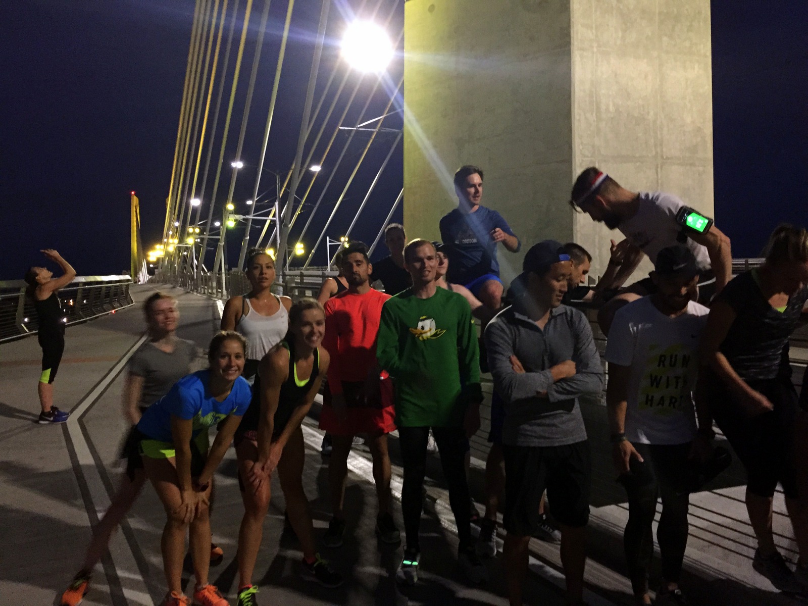
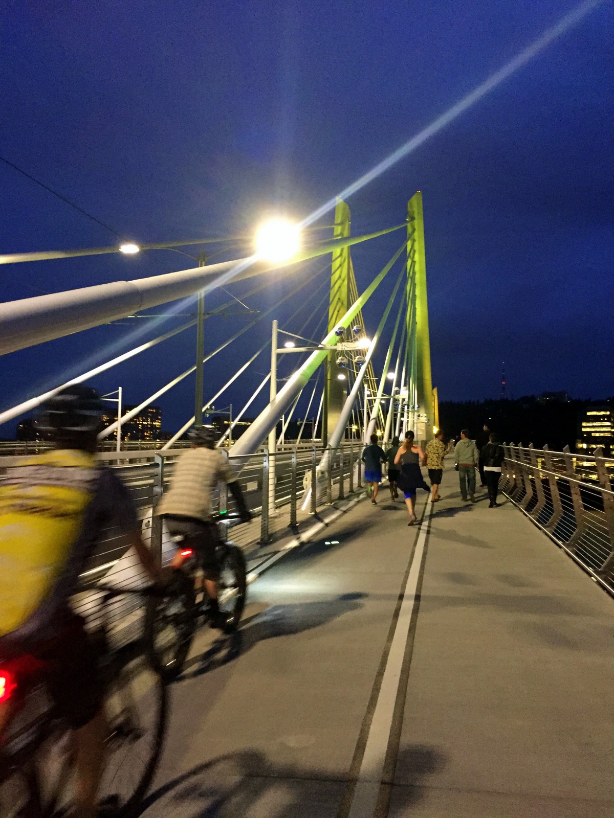
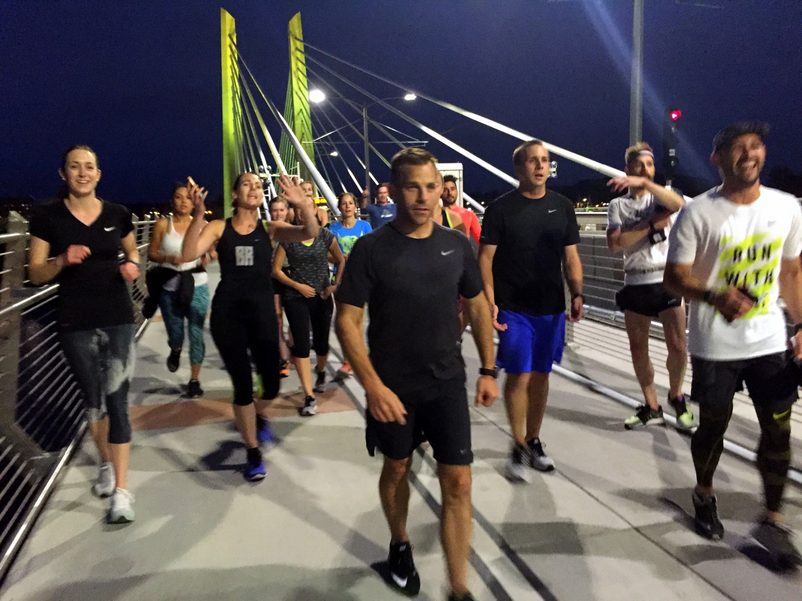
David arrived in the late afternoon. We caught up, got on a conference call regarding our high school, and then prepared for the run for the day: the Portland Stumprunners group run. The Stumprunners are the closest thing Portland has to November Project (query: why hasn't November Project established itself in this city?). A group of about 15 passionate, outdoorsy, runner types showed up at 7 p.m. outside the Peculiarium. Tonight's run destination was particularly cool; we ran to and across Tilikum Crossing, the new bridge across the Willamette River that allows everyone but drivers.

I had a blast. I think this was so for a number of reasons. First, I was running with a group again. I'd spent the last 2.5 weeks running alone. It was refreshing to run in a pack, and to chat with other like-minded runners. Second, I was running on flat road. My pace over the past few weeks has been incredibly slow. As just one example, I ran yesterday's 15 miles on the Wonderland at 19-minute pace. I couldn't even remember the last time I ran anything under 7:30 pace. It was nice to run unencumbered by dirt, rocks, and vertical. Third, as I've explained before, running is the best way to explore a new city. This was a workout, but it was a running tour, too. I got to see Portland in a new light (well, without light--it was after sunset).

We started at a relatively brisk pace, but casual enough so that we could chat. I hung with David and chatted with some of the runners. When we reached Tilikum Crossing, we stopped midway to take some group photos. From there, it was 4 miles back to the start. I decided I'd give my legs a spin, to rev the engine a little bit. The three of us in the front accelerated into a smooth but persistent pace. It was somewhat chilly, but I was now beginning to sweat. But it felt great. My legs were turning over quickly, and I could feel my stride lengthening as we picked up the pace. I was particularly surprised by our pace. We were cruising between 6:15 and 6:45 and I didn't even notice it. We'd done the last 3.5 miles at 6:35 pace--and it felt easy.

This little tempo piece at the end was reassuring. I'd spent part of the last few days wondering if all of this super-slow, super-long running would affect my ability to run fast. Lately, I'm lucky if I spend a couple miles under 9-minute pace. I know the rough terrain and the significantly higher time-on-feet account for some of that. But still. I wasn't sure I could run fast anymore. Tonight, I proved myself wrong. In fact, I think I'm getting into the best running shape I've been in for quite some time. I now plan to add a fall marathon to the calendar just to see what I can do on the road (on top of the Patapsco Valley 50K, which, seeing as it is "home turf", I want to crush).

After the run, a few of us met at Samurai Blue, a sushi joint on Mississippi Avenue. We nommed on sushi and beer, and chatted about Nike (practically everyone in Stumprunners appears to work at Nike). And after eating sushi, we ate ice cream, and continued chatting about Nike.

Then it was time to head home. I was staying at David's sweet new pad. I finished folding laundry, and we chatted about all of the things.

One of the other benefits of the group run was that I now know where I'll be running tomorrow. I'll begin by following David to the Nike campus for a quick tour. Then, I'll drive to Silver Falls State Park to do the Trail of Ten Falls. I'll make my way to Eugene to see the legendary Hayward Field (and maybe run a lap or two on it, if the cross country team will let me). And I'll end by setting up camp in either the Willamette or Deschutes National Forests.

Day 17: Boise, ID to Yakima, WA by Wookie Kim

Today was a driving day. I covered almost 400 miles from Boise, Idaho, to Yakima, Washington.

All along, I'd planned to spend today driving, not only to cover a lot of distance, but also to rest up for what I was hoping would be an uncomfortably long day on the 93-mile Wonderland Trail that encircles Mount Rainier. Specifically, I was thinking about doing a one-day 30-to-35 mile out-and-back.

But that plan changed. I have a cold. It's a minor one. But it's still a cold. And I can't risk testing my body's outer limits in this condition. So I've scrapped my plan. Instead of setting a specific distance target, I'm going to compromise by setting a time target. I'm planning to spend roughly 2.5 to 3 hours running out on the Wonderland. I'll then have plenty of time to get back--slow if I need to. It will still be a long day, but I won't be beholden to any specific distance.

I spent the first part of the drive annoyed by the change in plans. I really wanted to see as much of the Wonderland Trail as possible. But I quickly got over this feeling of resentment. I focused on just getting to Mount Rainier ASAP.
The drive was actually quite pleasant. There were few cars on the road. The route also followed the Oregon Trail, and I spent most of the day wondering how the early settlers traveled by oxen-pulled wagon across this dry expanse. It was really hard to grasp.

I also saw a vehicle from the 1960s, cruising along at 50 mph on an 80 mph highway. It was a sight to see.

When I stopped for lunch, I decided that I wasn't going to make it all the way to Mount Rainier National Park. More precisely, it wouldn't make sense to drive all the way there and try and find a campground in the dark. I decided I'd instead look up lodging options in Yakima, the city just outside of the park. I found an absolute gem on Airbnb.

The price? $60. Unbelievable, right? (This is partly why Airbnb is revolutionizing travel. Every Airbnb I've stayed at has been exceedingly memorable and surprisingly affordable.) The hosts--John and Barbara--were incredibly friendly and welcoming. I felt right at home. To top things off, they have over half a dozen cats, and two dogs to play with. After a couple weeks of camping, it was nice to have an evening unwinding in a place like this.

This kitten likes my backpack.  

This kitten likes my backpack.  

Tomorrow, I hit Mount Rainier National Park.