washington

Day 19: Mount St. Helens National Volcanic Monument, WA + Portland, OR by Wookie Kim

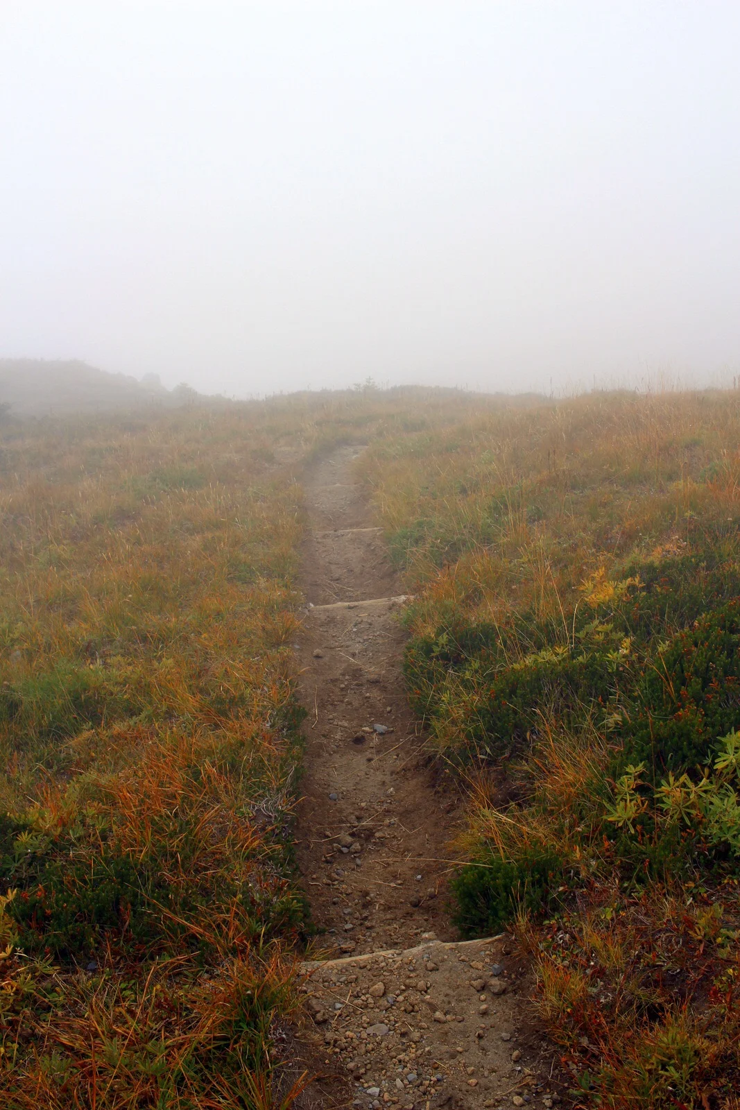
I think Washington State doesn't like me much. Yesterday's weather was absolutely miserable, and I'd spent 5+ hours on the Wonderland Trail wondering where Mount Rainier was. This morning, I broke camp early and made my way out of the park, only to turn a bend and see this.

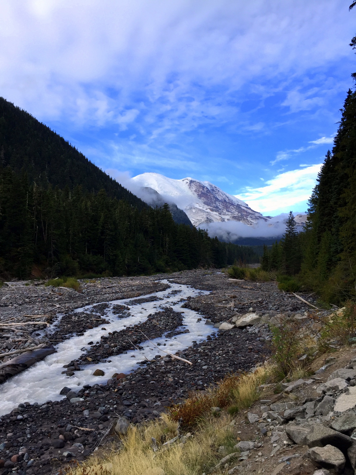
I imagined what yesterday would've been like had snow and fog been replaced by light clouds and sun. I turned a few more bends, and saw another picturesque view of the mountain. It was at this point that I also grew jealous of my friends who'd either climbed (Julie D.!) or were planning to climb (Victoria B.!) Mount Rainier. I was determined to get out of the state.

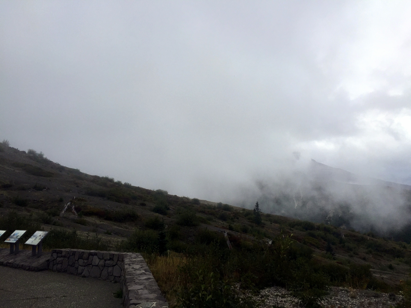
But not without seeing Mount St. Helens. After all, I was in the area, and it was on the way to Portland, my next destination. I was barely over 100 miles away from that famous volcanic mountain, but I knew that many of those miles were on windy, mountain roads. It took almost 3 hours to go that distance. After popping out of the forest and getting my first view of the valley, my heart sunk. This was what I saw.

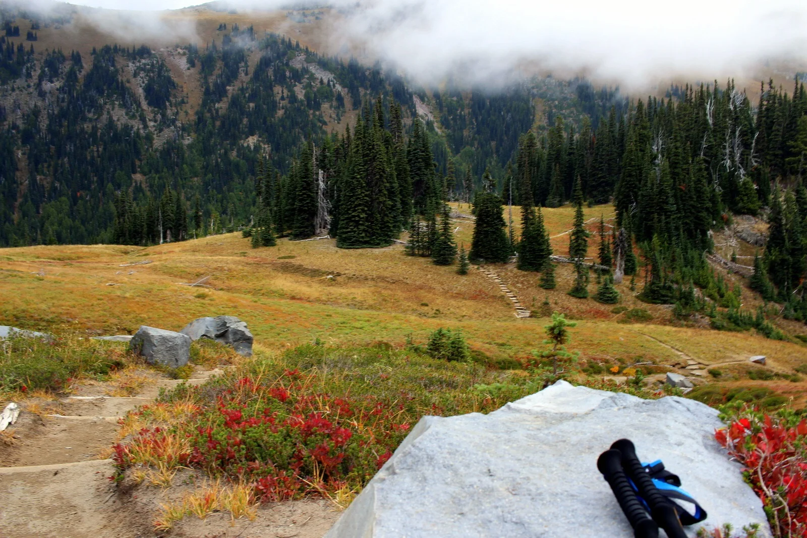
I'd already spent 2 hours driving deep into the forest, so I decided to continue to the end of the scenic road, which was another 10 miles up the valley. I secretly hoped that I'd drive high enough so that I'd be above the fog and clouds. I reached Windy Ridge and saw this.

I was done. Done with trying to see mountains. And, more importantly, done with the state of Washington. I was now Portland bound! I retraced my route, and continued along the windy forest road to the main highway. The drive was so long and there were so many windy turns that my wrists started getting sore from all the pushing and pulling of the steering wheel. 

Just 50 miles outside of Portland, Washington state redeemed itself. I passed through what I later learned was an unincorporated town called Yale. I stopped by Yale Park, marveled at Yale Reservoir, and even took a look at Yale School. (Can you guess where I went to school?)

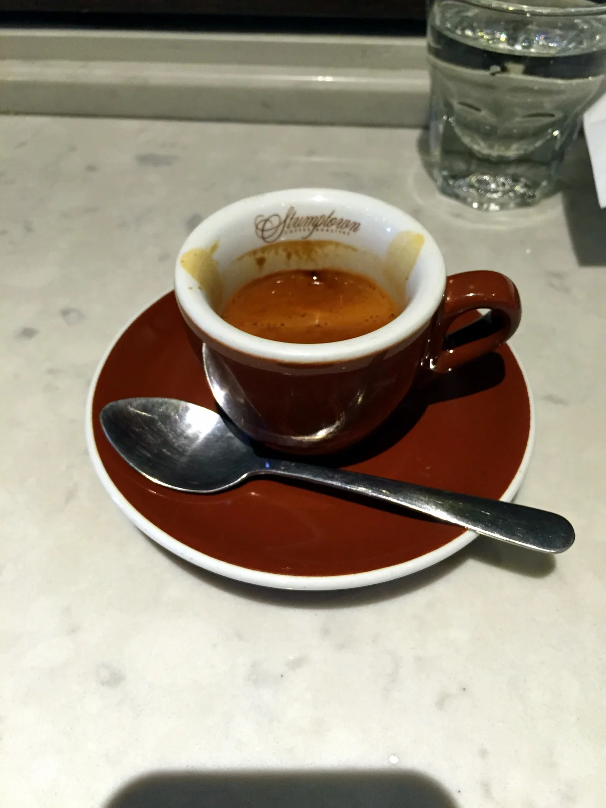
Finally on good terms with Washington, I crossed over into Oregon state and into Portland. My friend, David Y., had already made arrangements for my arrival. The first thing I did was laundry. It's been almost 3 weeks and I've had zero opportunities to wash my clothes. I then washed my cookware, most of which was starting to get grimy. After showering, I decided to roam the streets a bit before David got back from work. I did the stereotypical Portland tourist things; I visited the Ace Hotel, took down an espresso from Stumptown Coffee Roasters, and stopped by Powell's. (I'd been to all these places before, but why not go again?)

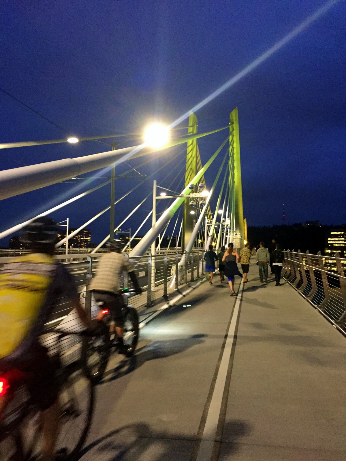
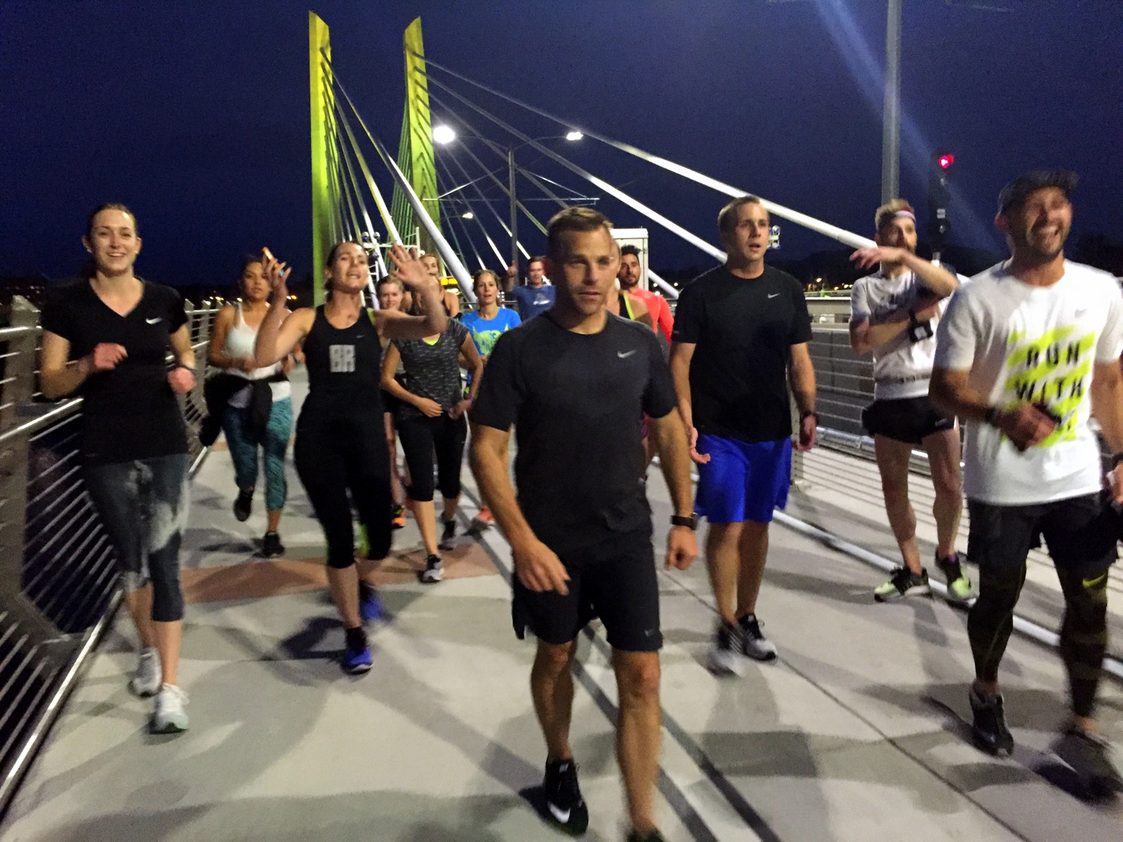
David arrived in the late afternoon. We caught up, got on a conference call regarding our high school, and then prepared for the run for the day: the Portland Stumprunners group run. The Stumprunners are the closest thing Portland has to November Project (query: why hasn't November Project established itself in this city?). A group of about 15 passionate, outdoorsy, runner types showed up at 7 p.m. outside the Peculiarium. Tonight's run destination was particularly cool; we ran to and across Tilikum Crossing, the new bridge across the Willamette River that allows everyone but drivers.

I had a blast. I think this was so for a number of reasons. First, I was running with a group again. I'd spent the last 2.5 weeks running alone. It was refreshing to run in a pack, and to chat with other like-minded runners. Second, I was running on flat road. My pace over the past few weeks has been incredibly slow. As just one example, I ran yesterday's 15 miles on the Wonderland at 19-minute pace. I couldn't even remember the last time I ran anything under 7:30 pace. It was nice to run unencumbered by dirt, rocks, and vertical. Third, as I've explained before, running is the best way to explore a new city. This was a workout, but it was a running tour, too. I got to see Portland in a new light (well, without light--it was after sunset).

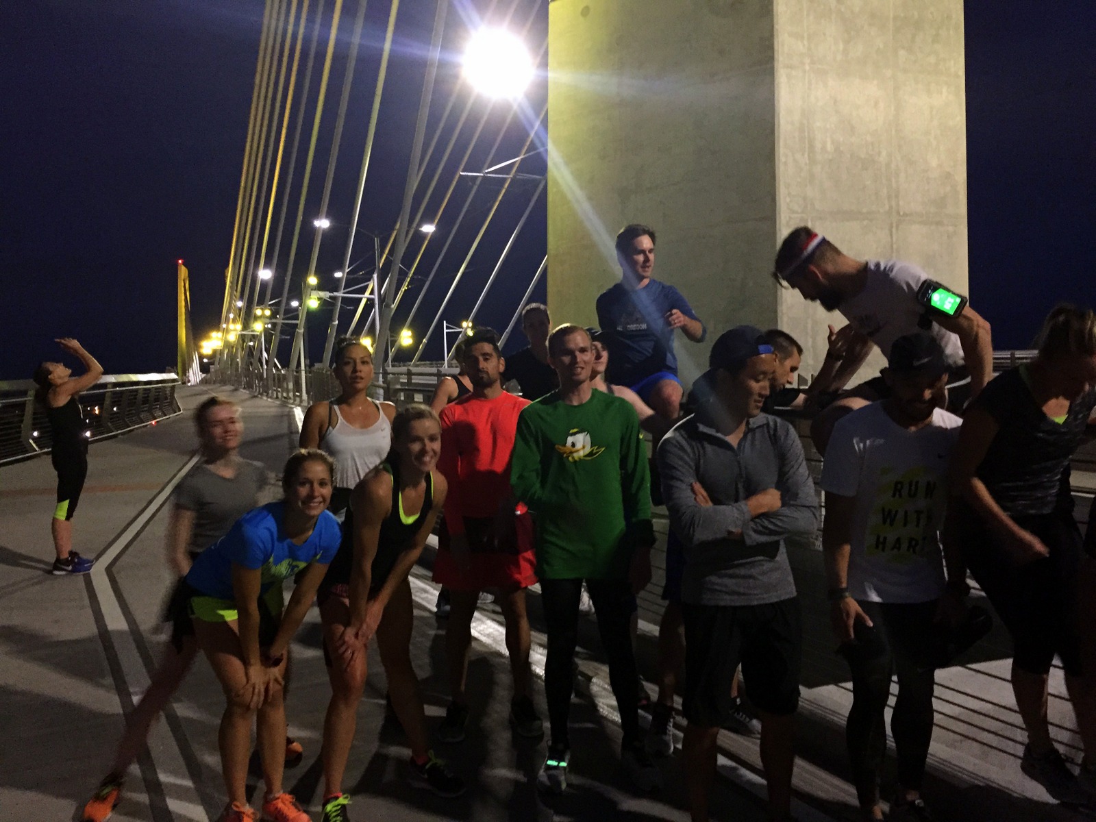
We started at a relatively brisk pace, but casual enough so that we could chat. I hung with David and chatted with some of the runners. When we reached Tilikum Crossing, we stopped midway to take some group photos. From there, it was 4 miles back to the start. I decided I'd give my legs a spin, to rev the engine a little bit. The three of us in the front accelerated into a smooth but persistent pace. It was somewhat chilly, but I was now beginning to sweat. But it felt great. My legs were turning over quickly, and I could feel my stride lengthening as we picked up the pace. I was particularly surprised by our pace. We were cruising between 6:15 and 6:45 and I didn't even notice it. We'd done the last 3.5 miles at 6:35 pace--and it felt easy.

This little tempo piece at the end was reassuring. I'd spent part of the last few days wondering if all of this super-slow, super-long running would affect my ability to run fast. Lately, I'm lucky if I spend a couple miles under 9-minute pace. I know the rough terrain and the significantly higher time-on-feet account for some of that. But still. I wasn't sure I could run fast anymore. Tonight, I proved myself wrong. In fact, I think I'm getting into the best running shape I've been in for quite some time. I now plan to add a fall marathon to the calendar just to see what I can do on the road (on top of the Patapsco Valley 50K, which, seeing as it is "home turf", I want to crush).

After the run, a few of us met at Samurai Blue, a sushi joint on Mississippi Avenue. We nommed on sushi and beer, and chatted about Nike (practically everyone in Stumprunners appears to work at Nike). And after eating sushi, we ate ice cream, and continued chatting about Nike.

Then it was time to head home. I was staying at David's sweet new pad. I finished folding laundry, and we chatted about all of the things.

One of the other benefits of the group run was that I now know where I'll be running tomorrow. I'll begin by following David to the Nike campus for a quick tour. Then, I'll drive to Silver Falls State Park to do the Trail of Ten Falls. I'll make my way to Eugene to see the legendary Hayward Field (and maybe run a lap or two on it, if the cross country team will let me). And I'll end by setting up camp in either the Willamette or Deschutes National Forests.

Day 18: Mount Rainier National Park by Wookie Kim

When I signed up to do the Wonderland Trail, I did not sign up for snow, bone-chilling winds, and heavy fog. This about sums up my day today on the Wonderland Trail--the 93-mile trail that encircles Mount Rainier.

image.jpg

I'd left Yakima at a decent hour, and managed to get to the wilderness center in the White River entrance by 10 a.m. I looked up trail conditions and asked the on-duty ranger about how difficult the trail was from Fryingpan Creek to Indian Bar. He said the trail was in great shape, and that I should be able to do it no problem. A little bit into our conversation, he received what appeared to be an urgent call. There was an ongoing incident, perhaps a fatality. I wished him luck and went on my way.

image.jpg

While driving to the White River campground, I could see very little. The fog had rolled in and covered everything in sight.

image.jpg

As I was arriving at the White River campground, I could see, far off in the distance, and ever so faint, Mount Rainier. I hoped that the sun would come out and kill the fog. 

image.jpg

I quickly set up my tent in a secluded area surrounded by tall trees. Cozy. 

image.jpg

By 11:15, I was at the trailhead, ready to run the famed Wonderland Trail. It was surprisingly cold. So much so, that I actually began my run with tights, windbreaker, and gloves. 

image.jpg

As has become typical practice, I began by proceeding through a forested section. The trail was wide and flat--perfect footing to start the day. 

image.jpg

I'd chosen a section that basically involved a 3,500-foot ascent right from the get-go. So there was very little running involved. Instead, I went up switchbacks through the forest.  I was getting hot. I shed my layers.

image.jpg

It's always fun to look down from above, and see how the trail switchbacks up a hill.

image.jpg

I eventually reached the end of the forested section and popped out into the famous Summerland area of the trail. This was a wide meadow, typically overflowing with colorful wildflowers. Apparently, because there was less snow this season, and because it was hotter this summer, the flowers had already bloomed and died. I saw the remnants (kind of like arriving two days too late to see the cherry blossoms in the Tidal Basin in D.C.). From Summerland, I could see the edges of Mount Rainier, shrouded by snow, fog, and clouds. 

image.jpg
image.jpg

Between Summerland and Indian Bar, hikers pass through Panhandle Gap, which is the highest point on the 93-mile trail. I began my ascent towards the Gap on wooden stairs.

image.jpg

I stopped by a stream to fill up water. After topping up, I realized my body felt somewhat rigid. As I continued hiking, I then noticed precipitation--it was snowing.

I'd not expected snow. I'd seen the fog, but I didn't realize that, inside that fog, there was also snow. Thankfully, not only had I brought a wind shell, but I'd also brought my thicker fleece. I quickly put that on and proceeded up to the Gap. 

image.jpg

I reached the gap, and all of a sudden, everything grew quiet. There was no wind, and almost no sound. All I could hear was the crunching of the dirt or rocks beneath my feet. The fog had rolled in even thicker by now, and visibility was decreasing. 

image.jpg

I became a little more cautious now. I was over 6 miles in, and wanted to see if I could make it to Indian Bar, but I also didn't want to get stuck in the cold (especially because I was still battling my own common cold), or in the creeping fog. The trail was easy enough to follow, so I continued, albeit slowly. 

image.jpg

This place felt eerie. I also felt a little bit like Beowulf, tiptoeing through barren land in search of Grendel. I was all alone, and all I could see was fog.

Eventually, I reached the end of Panhandle Gap. I began the 3-mile descent into Indian Bar. I soon realized that, each step I took down would be a step I'd have to take back up. I hadn't seen much in terms of scenery, and was starting to feel chilly. I decided I'd be better off turning around and heading back. So, after 7.5 miles, I turned around. 

image.jpg

The way down was easy. It got progressively warmer, and the fog got progressively less thick. I was able to get a clearer view of the Fryingpan Glacier (I think this is it). 

image.jpg

Right before reaching Summerland again, I was in what I could tell was the most scenic part of the trail--if only the fog were gone. The rocks were brilliantly colored, kind of like pastel-colored Fruity Pebbles.

image.jpg

I rested by the stream, rehydrated, and looked at the faint outline of Mount Rainier that I could see. 

image.jpg

I continued down to Summerland. I could immediately picture what this place would look like in full bloom. I decided that I would come back some day and run the entire 93-mile loop--in nice weather. 

image.jpg
image.jpg

The descent back to the trailhead was peaceful. I passed one group of hikers that asked me about the conditions up in Panhandle Gap. They were worried that the weather would only get worse tomorrow. I told them to wait. It couldn't get much worse. 

When I was only a mile from the trailhead, I noticed that a massive tree had fallen across the trail. This was not here when I started, so it had happened within the last couple hours. Seeing this made me realize just how important it is to be aware of one's surroundings. Normally when I run, I run with my iPod Shuffle. I was glad I'd not listened to music even one on this trip. 

image.jpg

I finished right around 4 p.m. It was a slow, peaceful day, and I hadn't quite seen the picture-perfect views that one expects from the Wonderland Trail. But it had turned out to be an exhilarating day navigating through snow and fog. I'd come off the trail a bit chilly, but otherwise felt completely fine. 

As I returned to my campsite, I noticed a blue bird on the side of the road. He seemed inquisitive, and kept squawking as I followed him around, trying to take a photo. 

image.jpg

The Wonderland Trail is aptly named. I had a great 15-mile day, but I ended the day with a lot to wonder about. 

Day 17: Boise, ID to Yakima, WA by Wookie Kim

Today was a driving day. I covered almost 400 miles from Boise, Idaho, to Yakima, Washington.

All along, I'd planned to spend today driving, not only to cover a lot of distance, but also to rest up for what I was hoping would be an uncomfortably long day on the 93-mile Wonderland Trail that encircles Mount Rainier. Specifically, I was thinking about doing a one-day 30-to-35 mile out-and-back.

But that plan changed. I have a cold. It's a minor one. But it's still a cold. And I can't risk testing my body's outer limits in this condition. So I've scrapped my plan. Instead of setting a specific distance target, I'm going to compromise by setting a time target. I'm planning to spend roughly 2.5 to 3 hours running out on the Wonderland. I'll then have plenty of time to get back--slow if I need to. It will still be a long day, but I won't be beholden to any specific distance.

I spent the first part of the drive annoyed by the change in plans. I really wanted to see as much of the Wonderland Trail as possible. But I quickly got over this feeling of resentment. I focused on just getting to Mount Rainier ASAP.

The drive was actually quite pleasant. There were few cars on the road. The route also followed the Oregon Trail, and I spent most of the day wondering how the early settlers traveled by oxen-pulled wagon across this dry expanse. It was really hard to grasp.

I also saw a vehicle from the 1960s, cruising along at 50 mph on an 80 mph highway. It was a sight to see.

When I stopped for lunch, I decided that I wasn't going to make it all the way to Mount Rainier National Park. More precisely, it wouldn't make sense to drive all the way there and try and find a campground in the dark. I decided I'd instead look up lodging options in Yakima, the city just outside of the park. I found an absolute gem on Airbnb.

The price? $60. Unbelievable, right? (This is partly why Airbnb is revolutionizing travel. Every Airbnb I've stayed at has been exceedingly memorable and surprisingly affordable.) The hosts--John and Barbara--were incredibly friendly and welcoming. I felt right at home. To top things off, they have over half a dozen cats, and two dogs to play with. After a couple weeks of camping, it was nice to have an evening unwinding in a place like this.

This kitten likes my backpack.  

This kitten likes my backpack.  

Tomorrow, I hit Mount Rainier National Park.