west

Day 22: Crater Lake National Park, OR by Wookie Kim

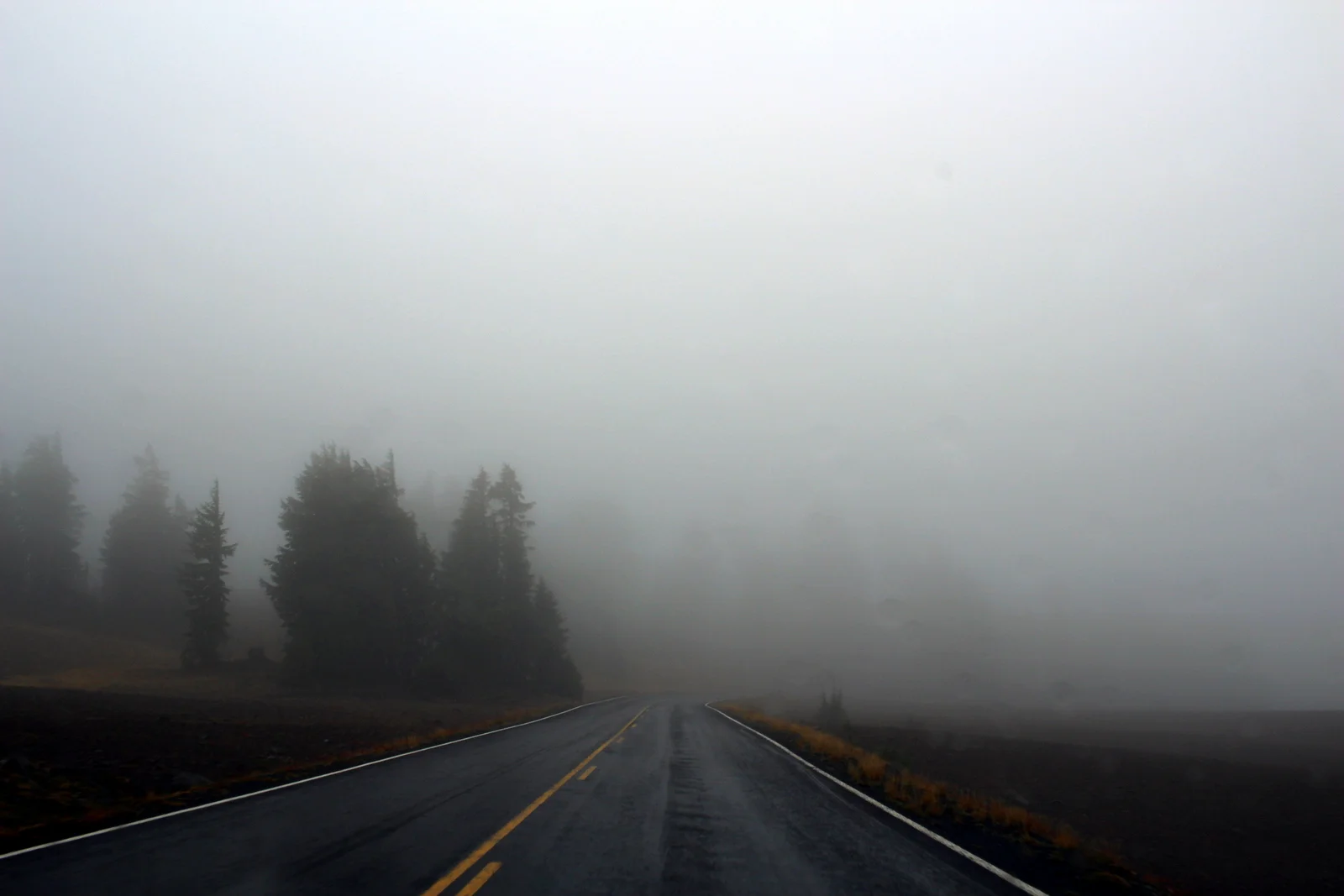
Yesterday's arrival in Crater Lake was a disappointment. I put faith in the law of averages that today would be different. It was.

I'd set my alarm for 5:30 a.m the night before. I was going all in. I'd either see the most beautiful sunrise from the rim of the crater, or I'd stand on that rim and shiver while the cold fog covered everything in sight.

I'd slept awfully. It was sub-freezing, and I just wasn't prepared for that. I woke up twice in the middle of the night, with my toes so cold and numb that I thought I might've gotten frostbite in my sleep. The second time, I went to my car and found all of my towels and fleeces and stuffed the bottom of my sleeping bag with them. It didn't help much.

5:30 rolled around, and I was up and out of my tent immediately. I wanted to see whether the early alarm had been worth it. I looked straight up into the sky. I saw the Milky Way. There were no clouds. I was stoked.

I broke camp faster than I've ever broken camp. Partly, I was excited to finally get to see Crater Lake. More importantly, it was that cold. I was also racing against time. The weather report had noted that official sunrise was 6:50 a.m. Even so, I had to drive the 20 minutes up to Rim Drive and around to the Watchman Overlook, a spectacular viewpoint on the west side of the rim. And, even if sunrise was officially 6:50, I knew from experience that most of the awe-inspiring colors came earlier than that.

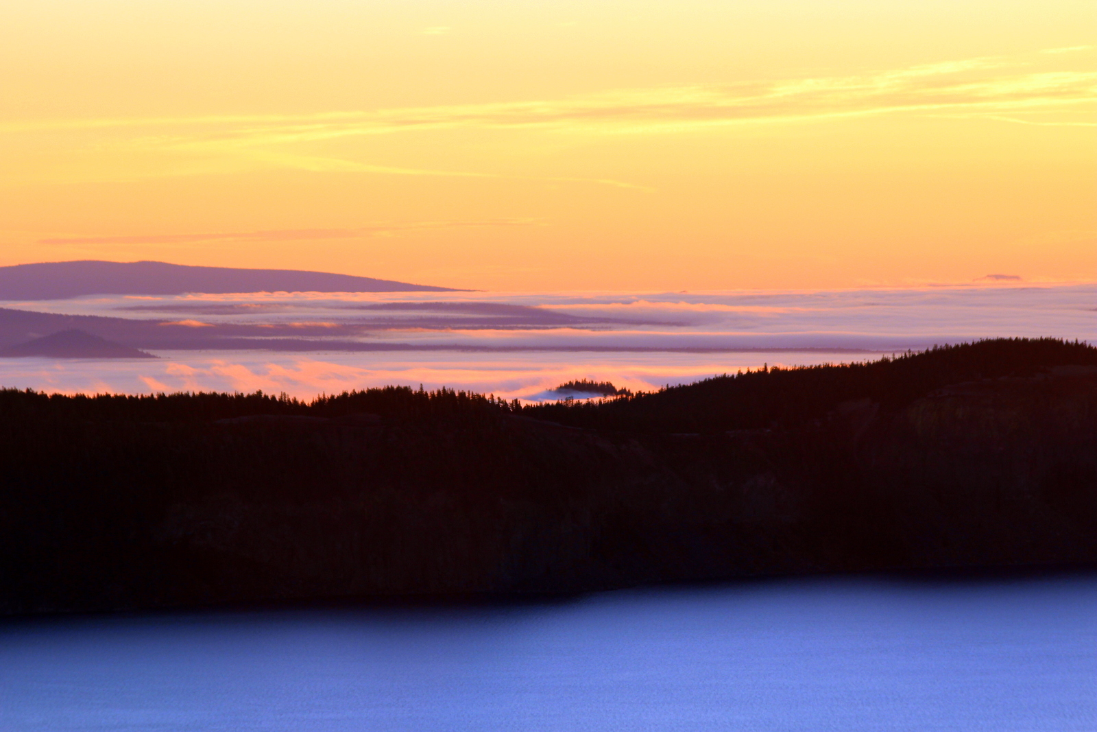
I made it up to the rim at 6:18. This was my first view of Crater Lake. I could tell that this was an impressive sunrise in the making.

I made it to the Watchman Overlook and stood on the lookout point, staring out over the lake and to the sun rising over the hills to the east of Crater Lake. The lake looked serene--just like how I felt in that moment.

Other people had the same idea, and soon arrived where I'd been standing alone. I figured I'd get a shot with me in it. I was just a silhouette.

As the sun continued creeping up into the sky, the colors changed ever so slightly, but ever so beautifully. In fact, looking west, outside of the crater and over my car, the sky showed an incredible range of purplish-blue colors.

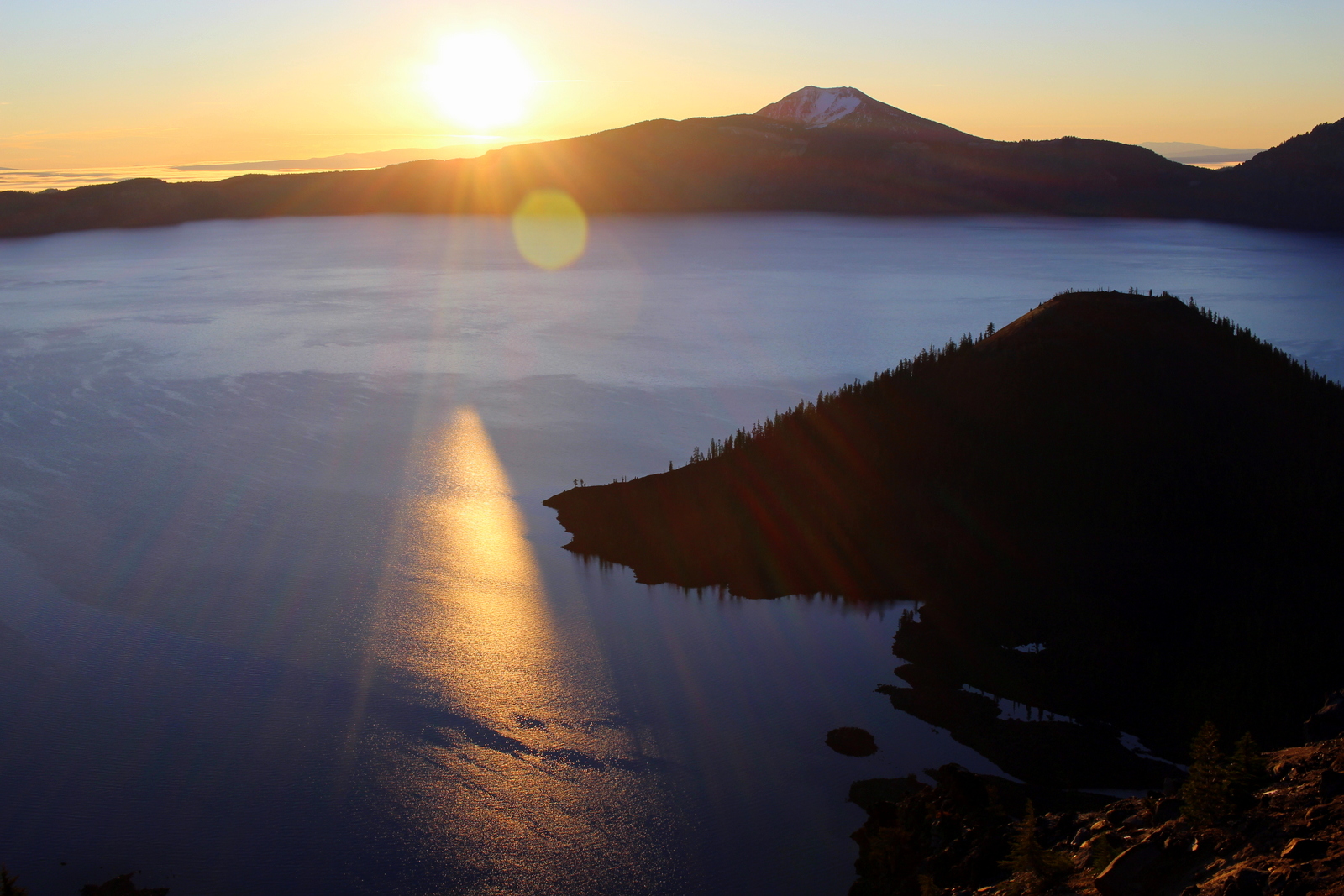
But the beauty shot was when the sun actually poked out from behind the hills and begin shining its rays into the crater.

This sunrise was incredible, one of the highlights of my trip so far, for sure. The colors continued to morph, both the lake's and the sky's. What was also awesome to see was how the area outside the crater's rim was covered with low-lying clouds. The crater was above all of that--thank goodness!

As the sun continued rising, the lake became bluer and bluer. Wizard Island--which is a volcano that formed within Crater Lake (which itself is a water-filled crater formed by the collapse of Mount Mazama roughly 7,700 years ago)--provided a mesmerizing silhouette in the middle of the blue. 

For fun, I took a photo of my favorite water bottle--I'd gotten it a year and a half ago, on my last visit to Portland, from Powell's, the best book store on earth.

Eventually, the sun had risen enough that the first rays began hitting the surface of the lake. That was cool.

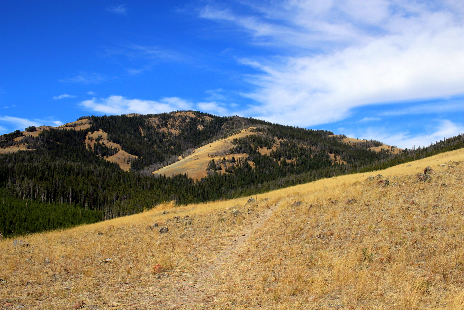
It was now 7:15, and the best of the sunrise had passed. Because I was so cold, and didn't want to cook pancakes outdoors, I headed to the Crater Lake Lodge for hot breakfast. I then headed the trailhead for Mount Scott, the highest point in the park. I wanted to see the view from the summit.

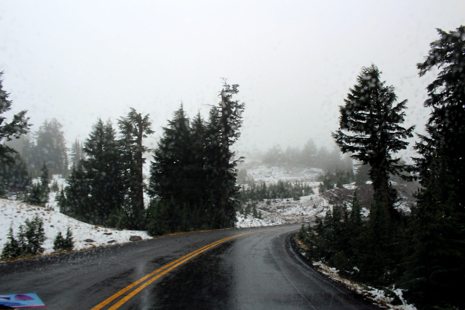
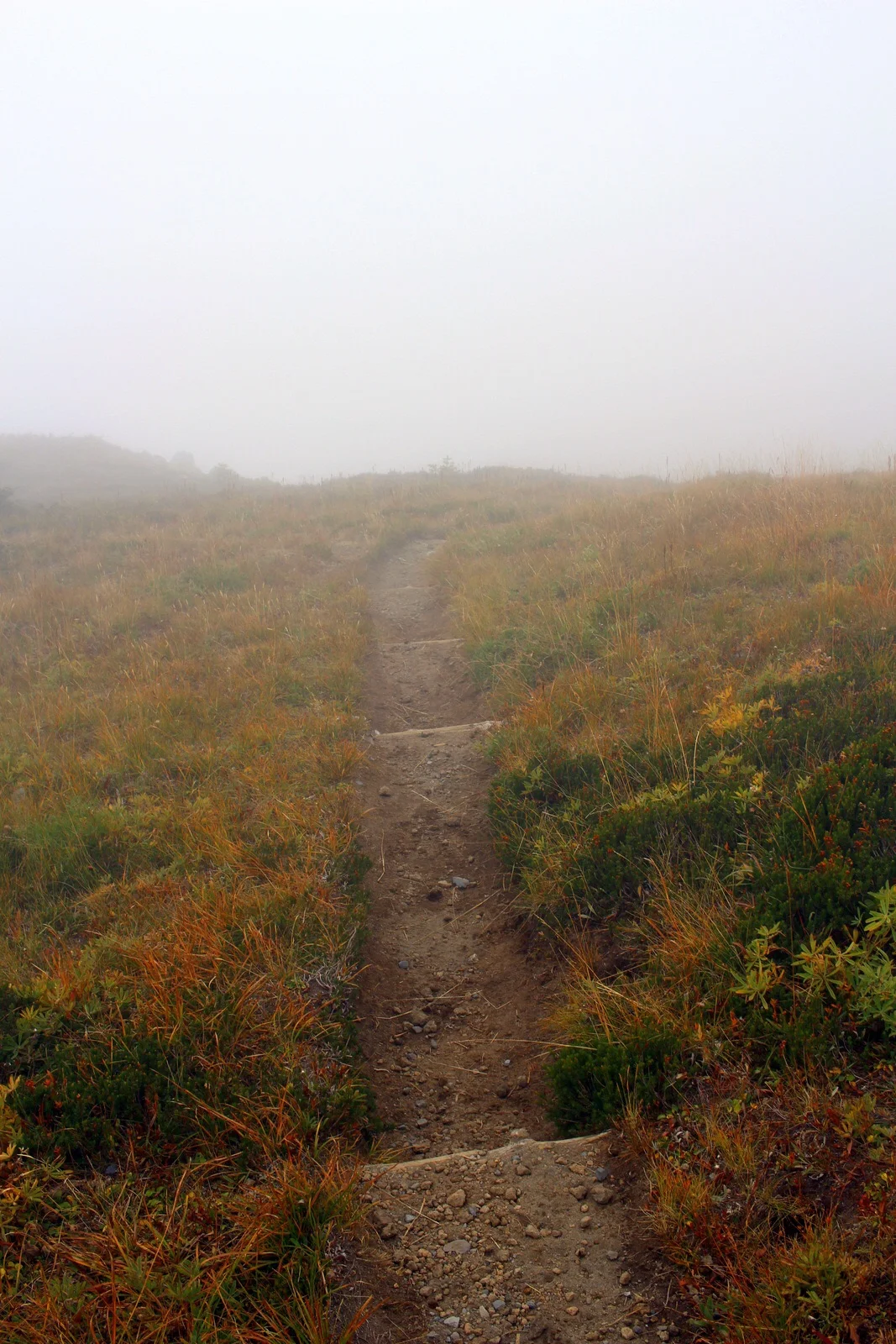
On paper, the route wasn't particularly challenging. It was 5 miles out and back, with about 1,200 feet of elevation gain. By this point in the trip, I could do these routes in my sleep. But as soon as I began, I realized the ascent would be slightly more challenging than usual. Simply put, the trail was very snowy.

Two days earlier, it had snowed quite a bit. Yesterday, it had rained a good amount and the temps had stayed very low. So it was still around at 10 a.m. as I began.

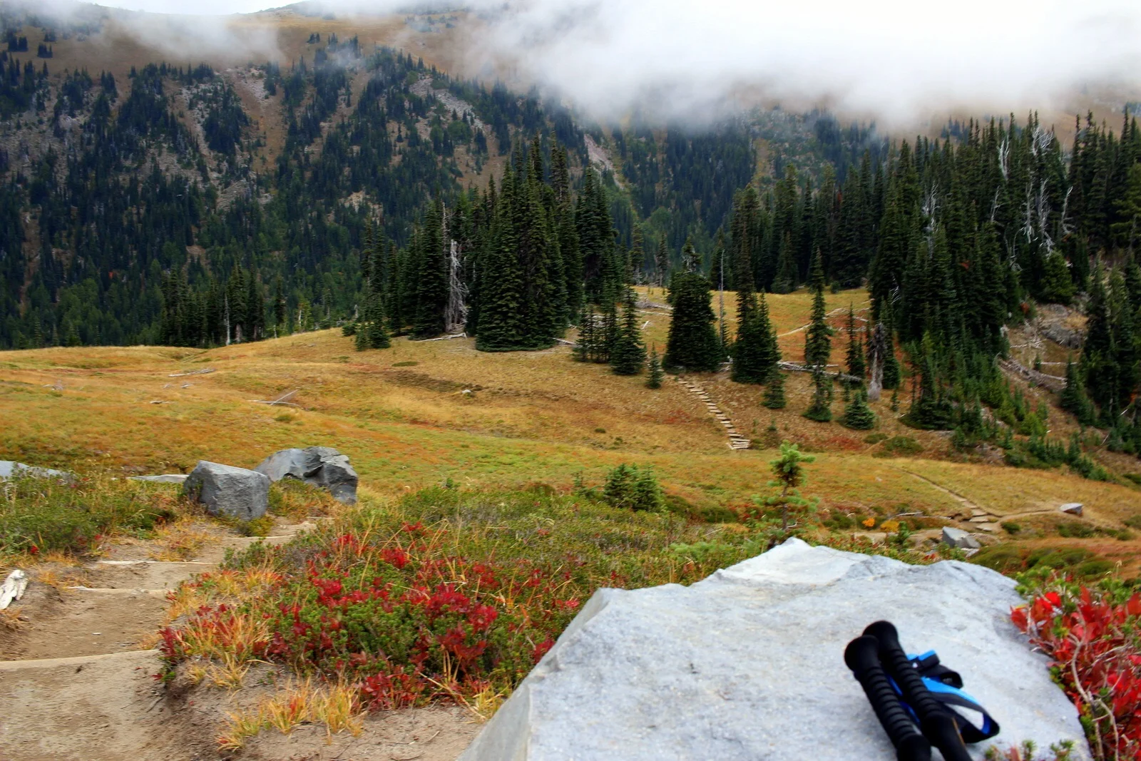
I kept a comfortable pace going up. When I reached the first set of switchbacks, I turned around and looked at the view. It was awesome to see the lake from halfway up the mountain.

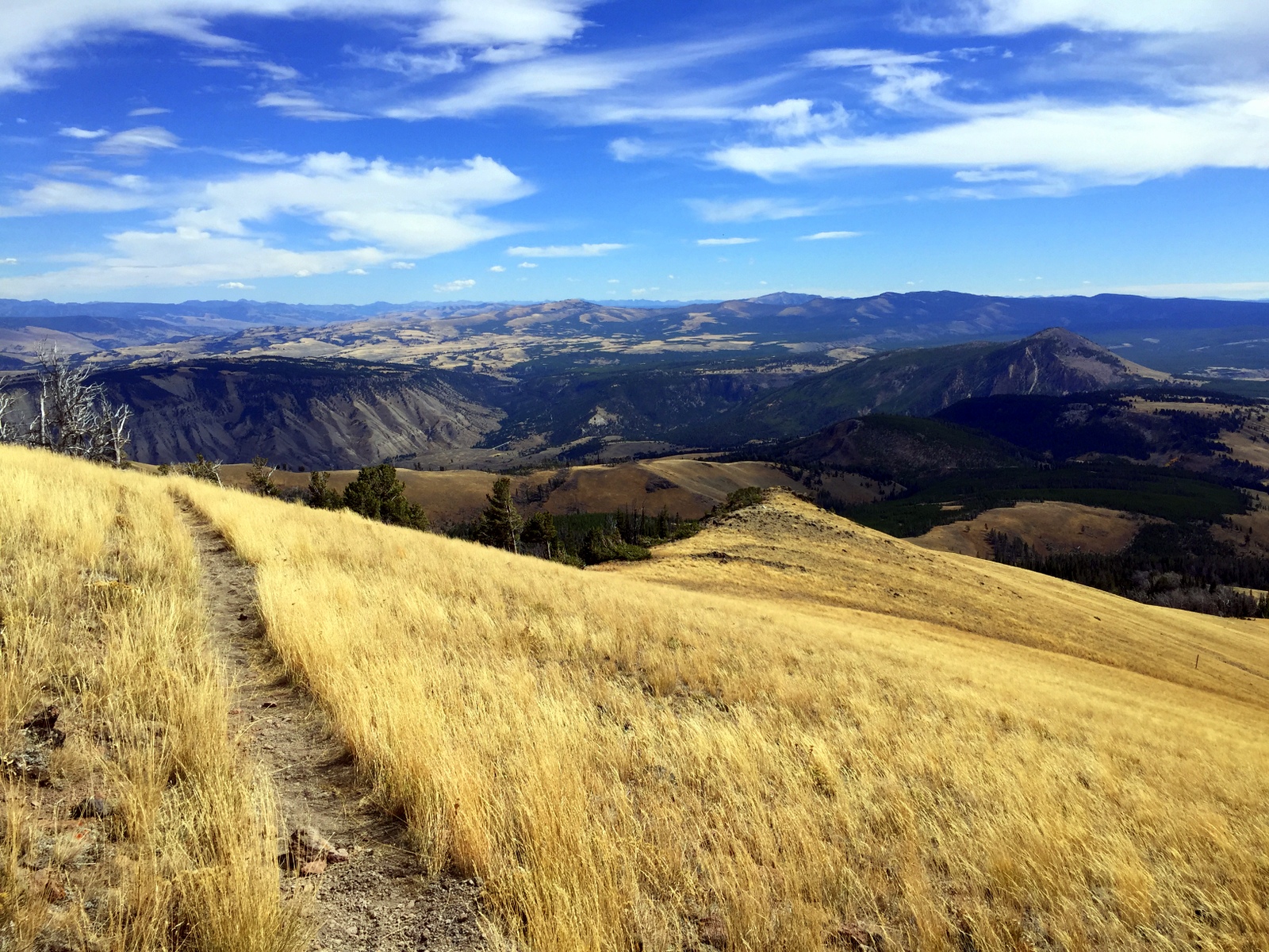
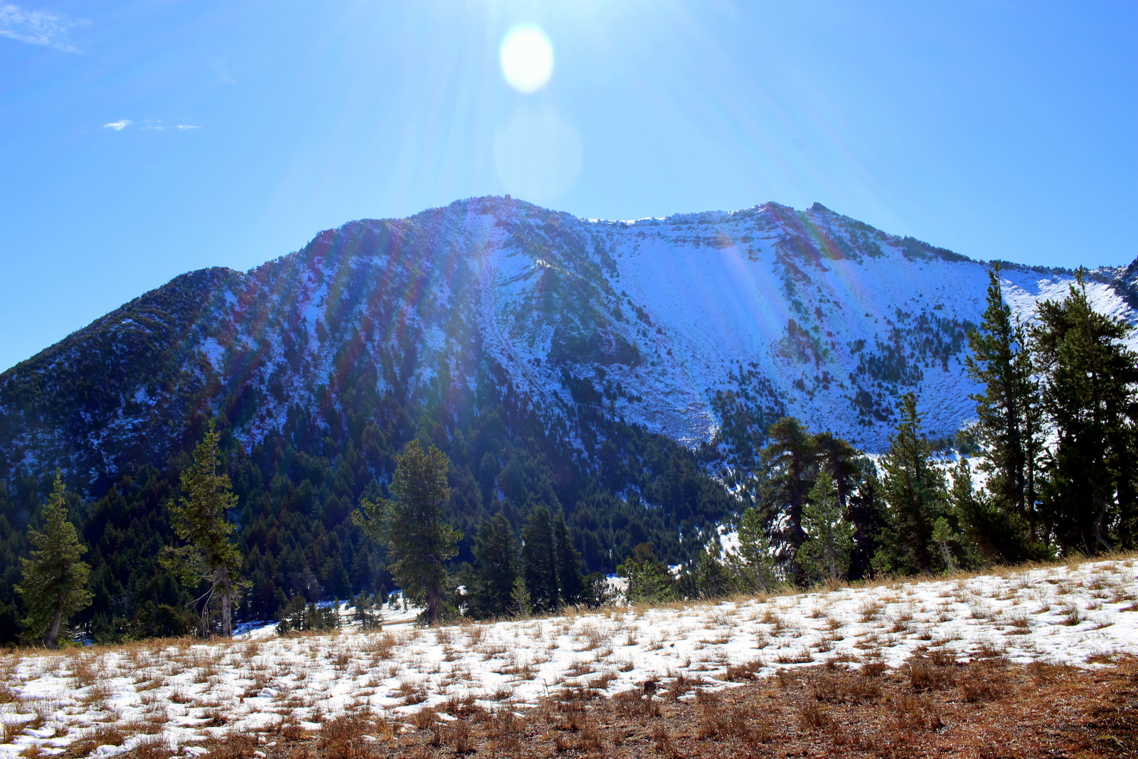
After about 45 minutes, I made it to the summit. And I saw this:

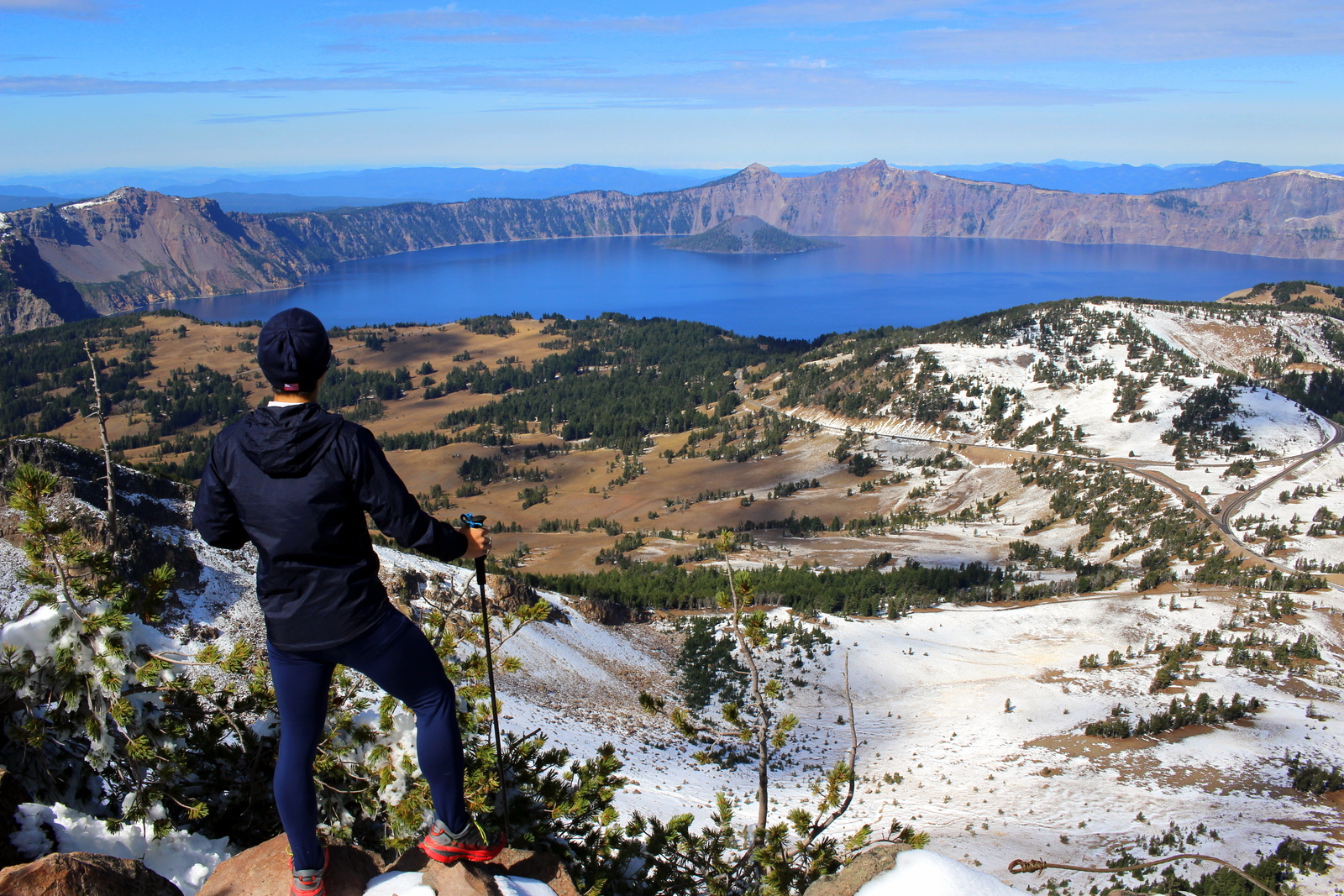
It was truly something. The layer of snow made the landscape that much more spectacular.

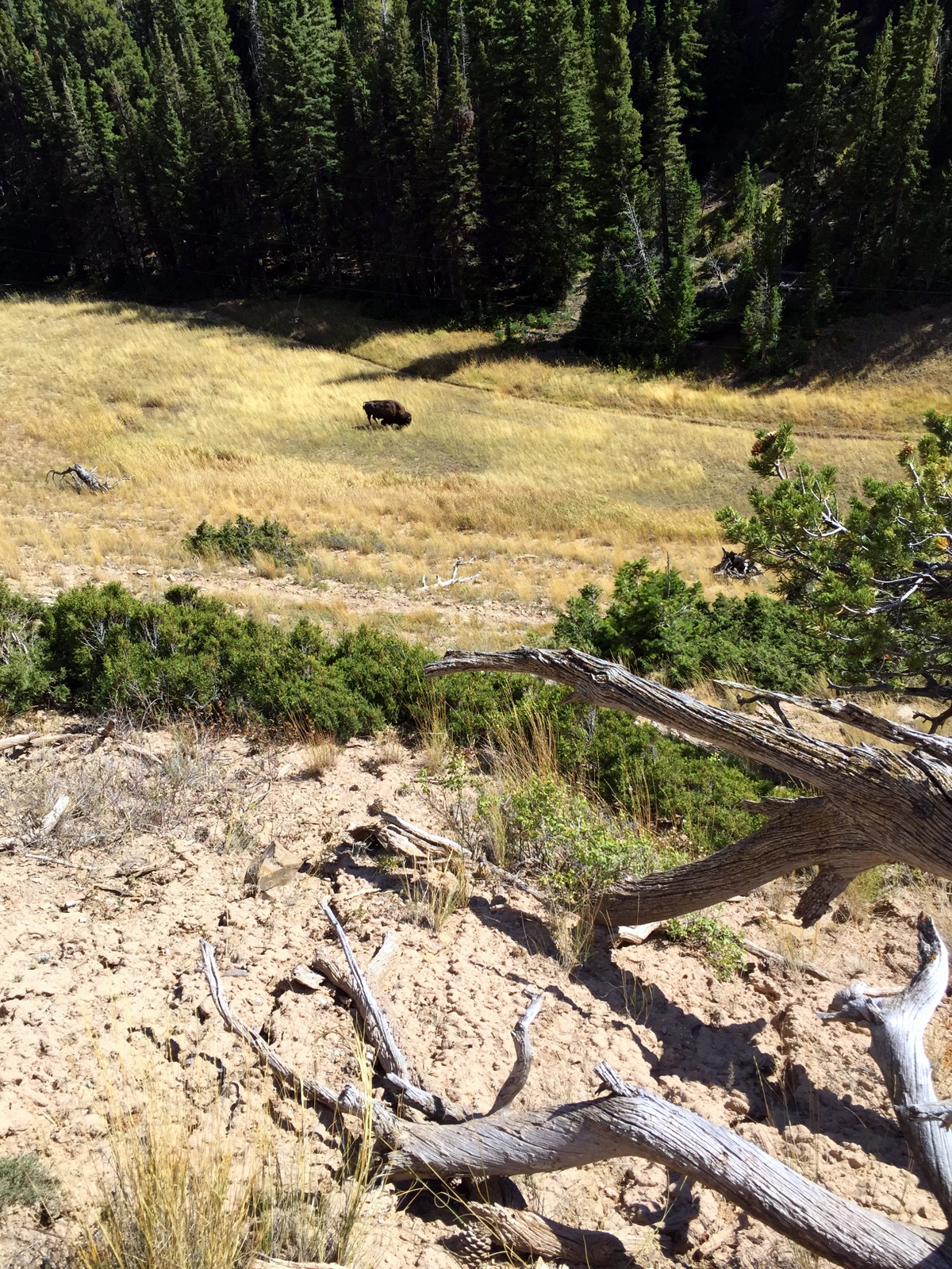
I spent 20 minutes at the summit taking it all in. I fiddled with some photos and videos, and even had a furry friend stop by to say hello.

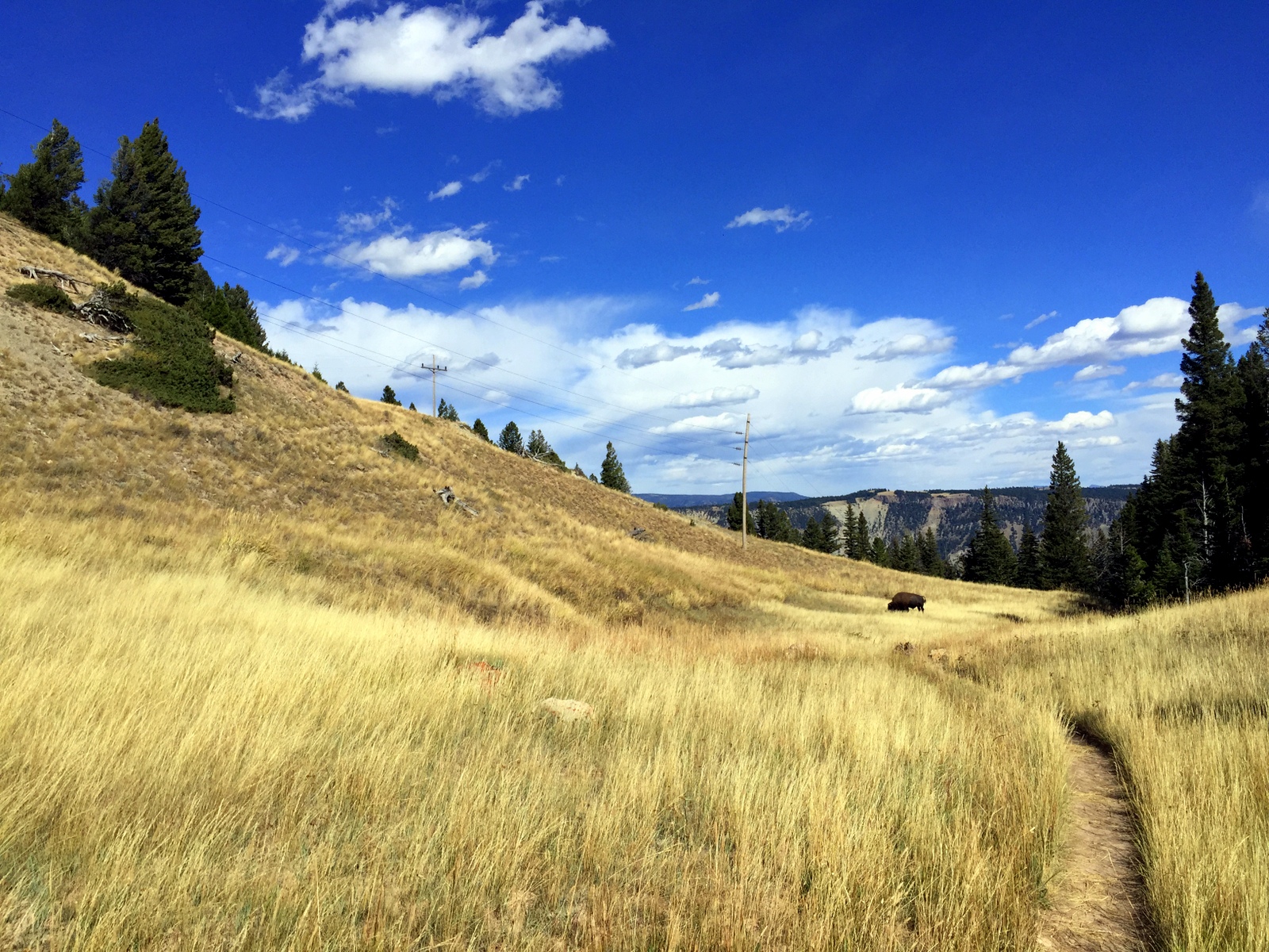
I carefully made my way back down. To my surprise, most of the lower portion of the trail was completely snow-free--it had all melted within the last 90 minutes. I guess it made sense; this was snow on the west face of Mount Scott that had been in shadows for the early morning. Now that it was almost noon, the sun overhead could melt it with ease.

I felt content that I'd seen Crater Lake at sunrise and from high above. But as I drove around the rim, I was once again impressed by the deep blue color of the lake. I stopped for a picnic lunch at one of the pullout spots. I stared into the lake.

It's hard to get a sense of the scale of the lake. It was almost 6 miles wide, and almost 2,000 feet deep--one of the deepest in the world. I saw a small boat moored near the shore. That provides a sense of scale.

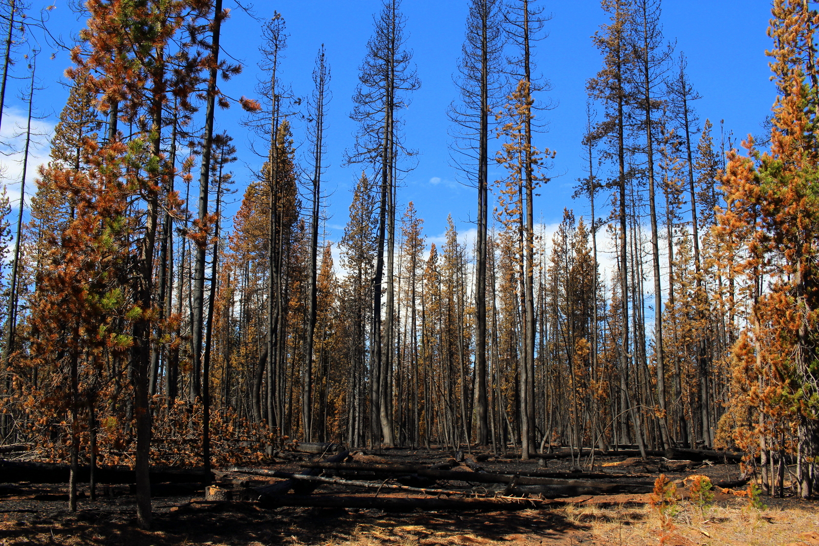
After eating lunch, I was ready to leave Crater Lake and head for Redwood National Park in northern California. On my way out, I noticed an area of the forest that had been hit hard by some of the forest fires in the region. The trees were shriveled up, and the earth was black ash. I pulled over to take a closer look. Some of the trees had big bulges in it (presumably because the fire had warped them?). Despite the devastation, I actually found the dead trees quite pretty. I don't know what that says about me.

I finally hit the road for Redwood. It was roughly 1 p.m.--the time I'd originally planned to be running in Redwood. I was half a day behind. But I eventually made it to northern California, and ended up running in Redwood that evening at dusk. This was a full day--one of the fullest, and most fulfilling, yet.

Day 21: Crater Lake National Park, OR by Wookie Kim

This day began slowly, and it ended slowly too. I'd spent the night at an Airbnb in Springfield, just over the Willamette River from Eugene. It was a rainy morning, and the hosts made a delicious breakfast for me. I felt lazy.

On my way out of the city to Crater Lake, I stopped by Pre's Rock, the rock ledge that Steve Prefontaine crashed into and died from when he was 24 years old.

Pre's Rock has become a place of pilgrimage for runners of all stripes. The site is covered with medals and memorabilia.

I decided to leave something: the medal the woman had given me at the summit of Table Mountain. (I knew that it might not be there long.)

Before.

Before.

After.

After.

From that quiet, residential street in Eugene, I drove for Crater Lake. It was a slow drive. I was feeling tired. Also, the sky was ominous. I had my fingers crossed that, magically, the weather up on the rim and inside the caldera would be better. It wasn't. Here was my first view of the park.

It was only 3 p.m., and I didn't know what I was going to do. I proceeded to the visitor center. At 4 p.m., they played a short video on Crater Lake. It was a full house--every single person who'd visited today was packed into the tiny auditorium.

I continued driving around the rim, hoping to catch a glimpse of the lake. I finally did. It was just a glimpse.

I felt disappointed. Crater Lake was the park for which I'd had the highest expectations. Before this trip, I'd never even heard of it. Once I learned about the high-altitude lake, I began to look forward to this visit. The fog was heavy, and there was freezing rain, too.

I had to make a bit of a strategic decision. Did I just say goodbye and drive straight out of the south entrance and sleep in an Airbnb en route to Redwood (my next destination)? Or did I set up camp in the freezing rain and hope for better weather tomorrow? I couldn't bear the thought of having driven all the way here only to see fog and rain and snow, so I decided I'd pitch a tent and try again tomorrow.

With lightning speed, I found a campsite and set up camp. It was only 5 p.m. at this point, and I had no idea how to spend my free time. I figured I'd eat an early dinner and go to bed early as well. There was a lodge with a cafe in it, so I ate there instead of cooking in the frigid outdoors. After chowing down on pot roast and a pizza, I settled in for the night. By 9 p.m., I was asleep.

My goal was to wake up at 5:30 a.m., break camp, and be at the Watchman Overlook by 6:15 to watch the sun rise over the east rim of Crater Lake. I went to bed dreaming the weather would turn.

Day 20: Silver Falls State Park, OR + Eugene, OR by Wookie Kim

Today was less about appreciating our national parks as it was a day to appreciate running culture.

Even though I'd gone to bed at 2 (David and I had lots to catch up on), I rose at 6:45, because I wanted to tag along with David and visit Nike's campus. After a cup of Chemex-brewed coffee and some delicious pastries from a bakery in the Pearl District, we were off to Beaverton. When we arrived, I was lucky enough to park next to the spot reserved for Michael Jordan.

I looked around and noticed that the section of the lot was filled with celebrity athletes--Dwayne Wade, Carlos Tevez, Kenenisa Bekele, Manny Pacquiao, Rafael Nadal.

David took me on a walking tour of the campus. I could immediately feel Nike's commitment to athletics while walking around the vast campus. Evidence of that commitment was visible, too--banners and plaques celebrating and memorializing past and present Nike athletes were everywhere.

Despite Nike's influence on sports generally, I was particularly interested in the visit because of Nike's role in giving birth to modern American running. Nike started out as a fledgling company that made track shoes in conjunction with legendary University of Oregon track coach Bill Bowerman. It's now the sports behemoth that it is because of that unique beginning.

In the main entrance, there was a brief exhibit on Nike's running past. I particularly enjoyed the segment on Steve Prefontaine. Every serious runner admires Pre, not only for his sheer athletic talent, but also for his work ethic and spirit--all of which were simply unrivaled when he was dominating the world's running scene in the 70s. I thought back to my high school cross country running days, when my teammates and I would quote Pre and watch "Without Limits" the night before races.

In fact, I was on my way to Eugene, Oregon, to pay tribute to him by seeing his storied hometown track, Hayward Field, and running on the jogging trail created in his memory, Pre's Trail. After another cup of coffee in Nike's cafeteria, I bade farewell to David.

I headed in Eugene's direction, but I wasn't about to go there without doing a beautiful trail first. On one of the Stumprunner runner's recommendation, I decided to run the Trail of Ten Falls at Silver Falls State Park.

I've already noted how we have so many national monuments that often go unseen. The same goes for state parks. In fact, for various reasons, there are probably state parks out there that are even more beautiful and awe-inspiring than some of the spaces managed by the National Park Service. I can say with confidence that Silver Falls ranks pretty high.

The loop I ran--the Trail of Ten Falls--was 9 miles. Along the way, I'd get to see ten different waterfalls. It was an incredible experience. For 90 minutes, I practically chased the sound of falling water. The falls were so close together, but each had distinct character. Here are photos of nine of the falls (I accidentally missed the spur trail for one of them!):

What was particularly impressive were the falls that had trails that cut under and behind. I thought about how this had formed. I also wondered how several other features reached their present form, like one giant boulder that lay in the middle of the river.

I'm glad I made the stop. The trail was really easy to run on, and had undulations that felt good for my feet. I was also testing the Nike Terra Kiger trail shoes that David had given me. They felt good--perfect for non-technical trails like this one.

I'd made the circuit in just under 90 minutes. When I met the park ranger who'd greeted me earlier, he'd said it would take 3-4 hours. I bumped into him as I was heading back to my car, and he asked me how long the run had taken. When I told him, he couldn't believe it. I told him I was a trail ultrarunner. He laughed.

I now proceeded for Eugene. On the way, I stopped at Burger King and chowed on a Double Whopper meal--my first in probably at least a decade. I normally don't eat that kind of fast food, but for this trip, I'm okay with it (more on nutrition later).

I arrived first at Hayward Field. This is the University of Oregon's historic track and field stadium. This was Prefontaine's home turf. In fact, the prestigious Prefontaine Classic is held each year at Hayward Field and is named for him. Sadly, I was unable to get inside the field, but I had to take a photo from outside the main gate.

I'd already done a run for the day, but I felt an itch to do more. Specifically, I decided I'd drive over the Willamette River to Alton Baker Park, home to "Pre's Trail"--a 4+ mile, woodchip trail created in Pre's memory. He'd always loved running on the soft surfaces he'd found while traveling in Europe, so he'd set into motion a plan to create a soft trail in Eugene. Sadly, he died before that happened under his watch.

The trail was soft and springy, and I made a comfortable pace around the park. For the first time all trip, I ran without my fastpack; I had nothing weighing me down. I thought about Prefontaine--his spirit, mostly--and imagined what it would be like to run alongside him. It was liberating.

After finishing my run, it was already 6 p.m. I'd made a decision to stay in the area using Airbnb again because it was supposed to rain at night. I drove over to Springfield, met my awesome hosts, showered, and hit main street's Plank Town Brewing for a couple flights of beer and a delicious meal to go with it.

Today felt different. It felt like a day to go back to one's roots. Prefontaine was one of my early running heroes. 40 years after his death, his spirit lives on.

Day 19: Mount St. Helens National Volcanic Monument, WA + Portland, OR by Wookie Kim

I think Washington State doesn't like me much. Yesterday's weather was absolutely miserable, and I'd spent 5+ hours on the Wonderland Trail wondering where Mount Rainier was. This morning, I broke camp early and made my way out of the park, only to turn a bend and see this.

I imagined what yesterday would've been like had snow and fog been replaced by light clouds and sun. I turned a few more bends, and saw another picturesque view of the mountain. It was at this point that I also grew jealous of my friends who'd either climbed (Julie D.!) or were planning to climb (Victoria B.!) Mount Rainier. I was determined to get out of the state.

But not without seeing Mount St. Helens. After all, I was in the area, and it was on the way to Portland, my next destination. I was barely over 100 miles away from that famous volcanic mountain, but I knew that many of those miles were on windy, mountain roads. It took almost 3 hours to go that distance. After popping out of the forest and getting my first view of the valley, my heart sunk. This was what I saw.

I'd already spent 2 hours driving deep into the forest, so I decided to continue to the end of the scenic road, which was another 10 miles up the valley. I secretly hoped that I'd drive high enough so that I'd be above the fog and clouds. I reached Windy Ridge and saw this.

I was done. Done with trying to see mountains. And, more importantly, done with the state of Washington. I was now Portland bound! I retraced my route, and continued along the windy forest road to the main highway. The drive was so long and there were so many windy turns that my wrists started getting sore from all the pushing and pulling of the steering wheel. 

Just 50 miles outside of Portland, Washington state redeemed itself. I passed through what I later learned was an unincorporated town called Yale. I stopped by Yale Park, marveled at Yale Reservoir, and even took a look at Yale School. (Can you guess where I went to school?)

Finally on good terms with Washington, I crossed over into Oregon state and into Portland. My friend, David Y., had already made arrangements for my arrival. The first thing I did was laundry. It's been almost 3 weeks and I've had zero opportunities to wash my clothes. I then washed my cookware, most of which was starting to get grimy. After showering, I decided to roam the streets a bit before David got back from work. I did the stereotypical Portland tourist things; I visited the Ace Hotel, took down an espresso from Stumptown Coffee Roasters, and stopped by Powell's. (I'd been to all these places before, but why not go again?)

David arrived in the late afternoon. We caught up, got on a conference call regarding our high school, and then prepared for the run for the day: the Portland Stumprunners group run. The Stumprunners are the closest thing Portland has to November Project (query: why hasn't November Project established itself in this city?). A group of about 15 passionate, outdoorsy, runner types showed up at 7 p.m. outside the Peculiarium. Tonight's run destination was particularly cool; we ran to and across Tilikum Crossing, the new bridge across the Willamette River that allows everyone but drivers.

I had a blast. I think this was so for a number of reasons. First, I was running with a group again. I'd spent the last 2.5 weeks running alone. It was refreshing to run in a pack, and to chat with other like-minded runners. Second, I was running on flat road. My pace over the past few weeks has been incredibly slow. As just one example, I ran yesterday's 15 miles on the Wonderland at 19-minute pace. I couldn't even remember the last time I ran anything under 7:30 pace. It was nice to run unencumbered by dirt, rocks, and vertical. Third, as I've explained before, running is the best way to explore a new city. This was a workout, but it was a running tour, too. I got to see Portland in a new light (well, without light--it was after sunset).

We started at a relatively brisk pace, but casual enough so that we could chat. I hung with David and chatted with some of the runners. When we reached Tilikum Crossing, we stopped midway to take some group photos. From there, it was 4 miles back to the start. I decided I'd give my legs a spin, to rev the engine a little bit. The three of us in the front accelerated into a smooth but persistent pace. It was somewhat chilly, but I was now beginning to sweat. But it felt great. My legs were turning over quickly, and I could feel my stride lengthening as we picked up the pace. I was particularly surprised by our pace. We were cruising between 6:15 and 6:45 and I didn't even notice it. We'd done the last 3.5 miles at 6:35 pace--and it felt easy.

This little tempo piece at the end was reassuring. I'd spent part of the last few days wondering if all of this super-slow, super-long running would affect my ability to run fast. Lately, I'm lucky if I spend a couple miles under 9-minute pace. I know the rough terrain and the significantly higher time-on-feet account for some of that. But still. I wasn't sure I could run fast anymore. Tonight, I proved myself wrong. In fact, I think I'm getting into the best running shape I've been in for quite some time. I now plan to add a fall marathon to the calendar just to see what I can do on the road (on top of the Patapsco Valley 50K, which, seeing as it is "home turf", I want to crush).

After the run, a few of us met at Samurai Blue, a sushi joint on Mississippi Avenue. We nommed on sushi and beer, and chatted about Nike (practically everyone in Stumprunners appears to work at Nike). And after eating sushi, we ate ice cream, and continued chatting about Nike.

Then it was time to head home. I was staying at David's sweet new pad. I finished folding laundry, and we chatted about all of the things.

One of the other benefits of the group run was that I now know where I'll be running tomorrow. I'll begin by following David to the Nike campus for a quick tour. Then, I'll drive to Silver Falls State Park to do the Trail of Ten Falls. I'll make my way to Eugene to see the legendary Hayward Field (and maybe run a lap or two on it, if the cross country team will let me). And I'll end by setting up camp in either the Willamette or Deschutes National Forests.

Day 18: Mount Rainier National Park by Wookie Kim

When I signed up to do the Wonderland Trail, I did not sign up for snow, bone-chilling winds, and heavy fog. This about sums up my day today on the Wonderland Trail--the 93-mile trail that encircles Mount Rainier.

image.jpg

I'd left Yakima at a decent hour, and managed to get to the wilderness center in the White River entrance by 10 a.m. I looked up trail conditions and asked the on-duty ranger about how difficult the trail was from Fryingpan Creek to Indian Bar. He said the trail was in great shape, and that I should be able to do it no problem. A little bit into our conversation, he received what appeared to be an urgent call. There was an ongoing incident, perhaps a fatality. I wished him luck and went on my way.

image.jpg

While driving to the White River campground, I could see very little. The fog had rolled in and covered everything in sight.

image.jpg

As I was arriving at the White River campground, I could see, far off in the distance, and ever so faint, Mount Rainier. I hoped that the sun would come out and kill the fog. 

image.jpg

I quickly set up my tent in a secluded area surrounded by tall trees. Cozy. 

image.jpg

By 11:15, I was at the trailhead, ready to run the famed Wonderland Trail. It was surprisingly cold. So much so, that I actually began my run with tights, windbreaker, and gloves. 

image.jpg

As has become typical practice, I began by proceeding through a forested section. The trail was wide and flat--perfect footing to start the day. 

image.jpg

I'd chosen a section that basically involved a 3,500-foot ascent right from the get-go. So there was very little running involved. Instead, I went up switchbacks through the forest.  I was getting hot. I shed my layers.

image.jpg

It's always fun to look down from above, and see how the trail switchbacks up a hill.

image.jpg

I eventually reached the end of the forested section and popped out into the famous Summerland area of the trail. This was a wide meadow, typically overflowing with colorful wildflowers. Apparently, because there was less snow this season, and because it was hotter this summer, the flowers had already bloomed and died. I saw the remnants (kind of like arriving two days too late to see the cherry blossoms in the Tidal Basin in D.C.). From Summerland, I could see the edges of Mount Rainier, shrouded by snow, fog, and clouds. 

image.jpg
image.jpg

Between Summerland and Indian Bar, hikers pass through Panhandle Gap, which is the highest point on the 93-mile trail. I began my ascent towards the Gap on wooden stairs.

image.jpg

I stopped by a stream to fill up water. After topping up, I realized my body felt somewhat rigid. As I continued hiking, I then noticed precipitation--it was snowing.

I'd not expected snow. I'd seen the fog, but I didn't realize that, inside that fog, there was also snow. Thankfully, not only had I brought a wind shell, but I'd also brought my thicker fleece. I quickly put that on and proceeded up to the Gap. 

image.jpg

I reached the gap, and all of a sudden, everything grew quiet. There was no wind, and almost no sound. All I could hear was the crunching of the dirt or rocks beneath my feet. The fog had rolled in even thicker by now, and visibility was decreasing. 

image.jpg

I became a little more cautious now. I was over 6 miles in, and wanted to see if I could make it to Indian Bar, but I also didn't want to get stuck in the cold (especially because I was still battling my own common cold), or in the creeping fog. The trail was easy enough to follow, so I continued, albeit slowly. 

image.jpg

This place felt eerie. I also felt a little bit like Beowulf, tiptoeing through barren land in search of Grendel. I was all alone, and all I could see was fog.

Eventually, I reached the end of Panhandle Gap. I began the 3-mile descent into Indian Bar. I soon realized that, each step I took down would be a step I'd have to take back up. I hadn't seen much in terms of scenery, and was starting to feel chilly. I decided I'd be better off turning around and heading back. So, after 7.5 miles, I turned around. 

image.jpg

The way down was easy. It got progressively warmer, and the fog got progressively less thick. I was able to get a clearer view of the Fryingpan Glacier (I think this is it). 

image.jpg

Right before reaching Summerland again, I was in what I could tell was the most scenic part of the trail--if only the fog were gone. The rocks were brilliantly colored, kind of like pastel-colored Fruity Pebbles.

image.jpg

I rested by the stream, rehydrated, and looked at the faint outline of Mount Rainier that I could see. 

image.jpg

I continued down to Summerland. I could immediately picture what this place would look like in full bloom. I decided that I would come back some day and run the entire 93-mile loop--in nice weather. 

image.jpg
image.jpg

The descent back to the trailhead was peaceful. I passed one group of hikers that asked me about the conditions up in Panhandle Gap. They were worried that the weather would only get worse tomorrow. I told them to wait. It couldn't get much worse. 

When I was only a mile from the trailhead, I noticed that a massive tree had fallen across the trail. This was not here when I started, so it had happened within the last couple hours. Seeing this made me realize just how important it is to be aware of one's surroundings. Normally when I run, I run with my iPod Shuffle. I was glad I'd not listened to music even one on this trip. 

image.jpg

I finished right around 4 p.m. It was a slow, peaceful day, and I hadn't quite seen the picture-perfect views that one expects from the Wonderland Trail. But it had turned out to be an exhilarating day navigating through snow and fog. I'd come off the trail a bit chilly, but otherwise felt completely fine. 

As I returned to my campsite, I noticed a blue bird on the side of the road. He seemed inquisitive, and kept squawking as I followed him around, trying to take a photo. 

image.jpg

The Wonderland Trail is aptly named. I had a great 15-mile day, but I ended the day with a lot to wonder about. 

Day 17: Boise, ID to Yakima, WA by Wookie Kim

Today was a driving day. I covered almost 400 miles from Boise, Idaho, to Yakima, Washington.

All along, I'd planned to spend today driving, not only to cover a lot of distance, but also to rest up for what I was hoping would be an uncomfortably long day on the 93-mile Wonderland Trail that encircles Mount Rainier. Specifically, I was thinking about doing a one-day 30-to-35 mile out-and-back.

But that plan changed. I have a cold. It's a minor one. But it's still a cold. And I can't risk testing my body's outer limits in this condition. So I've scrapped my plan. Instead of setting a specific distance target, I'm going to compromise by setting a time target. I'm planning to spend roughly 2.5 to 3 hours running out on the Wonderland. I'll then have plenty of time to get back--slow if I need to. It will still be a long day, but I won't be beholden to any specific distance.

I spent the first part of the drive annoyed by the change in plans. I really wanted to see as much of the Wonderland Trail as possible. But I quickly got over this feeling of resentment. I focused on just getting to Mount Rainier ASAP.

The drive was actually quite pleasant. There were few cars on the road. The route also followed the Oregon Trail, and I spent most of the day wondering how the early settlers traveled by oxen-pulled wagon across this dry expanse. It was really hard to grasp.

I also saw a vehicle from the 1960s, cruising along at 50 mph on an 80 mph highway. It was a sight to see.

When I stopped for lunch, I decided that I wasn't going to make it all the way to Mount Rainier National Park. More precisely, it wouldn't make sense to drive all the way there and try and find a campground in the dark. I decided I'd instead look up lodging options in Yakima, the city just outside of the park. I found an absolute gem on Airbnb.

The price? $60. Unbelievable, right? (This is partly why Airbnb is revolutionizing travel. Every Airbnb I've stayed at has been exceedingly memorable and surprisingly affordable.) The hosts--John and Barbara--were incredibly friendly and welcoming. I felt right at home. To top things off, they have over half a dozen cats, and two dogs to play with. After a couple weeks of camping, it was nice to have an evening unwinding in a place like this.

This kitten likes my backpack.  

This kitten likes my backpack.  

Tomorrow, I hit Mount Rainier National Park.

Day 16: Craters of the Moon National Monument, ID by Wookie Kim

I could see why the pioneers on the Oregon Trail avoided this place. For miles in every direction, all I could see was black lava. It was dark, desolate, and dry. I was at Craters of the Moon National Monument, in the Snake River Plain of Idaho (AKA middle of nowhere).

One of the beauties of this trip is that I cast my net widely, and decided to include national monuments and other sites operated by the National Park Service as destinations. We have 59 amazing national parks, but it's too easy to forget that we have hundreds if not thousands of other sites that are still protected by the National Park Service in some way. In fact, many of our national parks were once mere national monuments, before they were elevated to that grand "national park" status (I want to learn a little bit about how the designation system works--I don't really know how it all works).

I began the drive over from Alta, Wyoming, a little bittersweet. I was driving away from the mountains--the location of several challenging days. As I proceeded west, all I could see were plains. Pretty soon, I saw a small mountain off in the distance. I forget the name of it, but the early pioneers also used this as a beacon as they headed west along the Snake River.

I told the park rangers that I wanted to run easy today. Something with very minimal elevation gain (or loss). I'd spent 3 hard days in the mountains--climbing over 10,000 vertical feet--and my cold was getting worse. I needed an easy day. The ranger had just the trail for me: the Wilderness Trail. It was 4.5 miles out to the end on flat, soft, cinder, and very little elevation change. This was also in the Craters of the Moon Wilderness Area--the first designated wilderness area in our national park system. I'd have unrivalled solitude back here.

On my way over to the trailhead, I marveled at the lava that surrounded me. There were also cones and mounds that had sprouted out of the earth. I was glad I wasn't climbing any today.

I reached the trailhead, and read up on everything I needed to know. With my cold, I wanted to stay hydrated. I topped up my 100-oz Camelbak again, even though at 1 p.m. it was only in the high 70s--relatively cool for an inhospitable place like this.

And just like that, I was off! The beginning of the run had me go into a pretty thick lava field. This was part of a shorter loop that I could see many families liked. It was definitely what one would imagine when one thinks about running through a lava field.

Pretty soon, though, the landscape changed. The path was wide cinder--almost like a red carpet. It sure felt like one; the cinder absorbed my footstrikes and the absence of any obstacles made for easy running. This was just what I needed after several hard days in the mountains.

I was able to pick up a solid, steady pace--just over 9-minute miles. I followed the red carpet out into the wilderness. That red carpet disappeared from time to time. Following the trail was only slightly harder. But there were cairns to follow, and the path was pretty clear.

This wilderness area was certainly not what I imagined when I thought of Craters of the Moon. I saw very little black lava. But the feeling of solitude was immense. I was all by myself in a vast desert-like environment. Every now and then, I'd see patches of black lava, which reminded me where I actually was.

After over 4 miles, I was confused by why I hadn't reached the end of the trail. Had I gone off track again? I rounded a bend and saw a cinder mound off ahead of me. I figured that that was Sentinel Butte, the end of the marked Wilderness Trail.

As I got closer, I realized that this must be it--the mound rose up out of the plain, providing a perfect vantage point for a sentinel to see miles in every direction.

I noticed a human-trodden switchback trail up the butte. I figured I'd follow it up. It was steep and slippery, the lava rocks were like little ball bearings. Every step I took, my foot would slide back halfway down the mound. One step forward, half step back, one step forward, half step back. Here, you can kind of see the incline.

The view from the top was pretty spectacular. I found a father-son duo resting at the summit as well.

image.jpg

What was particularly pleasing about the view was the juxtaposition of all the different colors and environments. You had red cinder right in front of you, black lava interspersed with yellow and brown grasses, occasional greenery, the brown mountains off in the distance, and the clear blue sky above. Really, it was unique.

image.jpg

My feet took a break too. ​

image.jpg

On the way back, I grew tired. It was getting hot. I began rationing my water. I drained the 100-oz reservoir right before returning to the trailhead. The trail had been nice and flat. But I was beat.

Almost back to the trailhead.  

Almost back to the trailhead.  

Salt from my sweat.  

Salt from my sweat.  

I wasn't about to leave Craters of the Moon just yet. I'd been told about the caves that one could explore. I decided to take my headlamp and head into Boy Scout Cave.

image.jpg

It was pretty scary in there. There was no lighting except the light that you brought in. And there was no guide except a railing that you could hold onto as you passed through the initial crawl space. Inside, I looked around, like a cave explorer, using my headlamp for light, and also occasionally my iPhone. There were 4 other people inside with me. I led the way.

image.jpg
image.jpg

It was also very cold inside. We could see ice formations on the cave floor. Slippery! My hands began to get numb. Certainly, this was a nice respite from the dry heat on the surface. After reaching the end, we turned around and headed to the surface. It was hot--really hot.

Just outside the cave entrance.  

Just outside the cave entrance.  

image.jpg

And then, I was gone. I had many miles to cover. I drove straight west on route 20 straight into the setting sun. It was somewhat monotonous, but I enjoyed tracking the sun as it set off in the distance.

image.jpg
image.jpg

Eventually, it grew so red that I had to pull over and take a photo of it with my zoom lens.

image.jpg

And so ended another beautiful day exploring our national parks.

Day 15: Grand Teton National Park + Caribou-Targhee National Forest by Wookie Kim

Life is lived for these moments. Not the ones that you put in your resume, or find in a history book, but the ones you'll remember forever, and tell your grandchildren about over and over again until they beg you to stop. My moment today was summitting Table Mountain, a mountain on the Idaho side of the Teton Range, just a few miles west of the Grand Teton.

I woke up in Colter Bay in Grand Teton National Park. I'd slept like a rock. I'd been battling a minor cold for the last couple days, and, combined with the vertical I'd gained over the last few days, my body needed rest. I packed up my tent, and was too lazy and cold to fire up the Whisperlite. Instead, I went to the restaurant that was located within this campground (no wonder I paid $24!). I chose the buffet option, and proceeded to eat everything.

I then hit the road for the trailhead. Table Mountain's actually was outside Grand Teton National Park, on the Idaho side of the range, right near the Targhee ski resort. On the way down to Jackson, I saw my first sunrise views of the Grand Tetons. 

The Grand Teton. 

The Grand Teton. 

Apparently, what makes the Teton Range so spectacular is that it lacks any foothills; the mountains rise straight up from Jackson Hole. I stopped by the roadside over and over again to take photos.

image.jpg
image.jpg

Eventually, I made it the 30 miles to Jackson, a town that has a special place for me. For spring break my senior year of college, my best friends and I spent a week skiing at Jackson Hole. It was the best week of skiing I've ever had. Entering the town, I took a photo of the antler arch in the town square (there was some photo shoot going on). 

image.jpg

From Jackson, I crossed over the Teton Range and into Idaho. 30 miles later, I found myself on a gravel road ascending on Alta Ski Road back east towards the Teton Range. I could see the Grand Teton towering in the distance. 

image.jpg

After 6 bumpy miles, I made it to the trailhead and geared up. I wasn't taking any chances this time. I filled my Camelbak to capacity--100 oz--and topped up my reserve handheld bottle with Tailwind. I also had an assortment of snack items, including KIND bars, and Justin's almond butter (thank you for fueling me!).

image.jpg

And then I was off at almost exactly 11:30 a.m. There was no warm-up involved. The trail went immediately into switchbacks in a thick forest.

image.jpg

After about a half-mile of ascending, I finally came out into a flat meadow, and a sign indicating that I was in Caribou-Targhee National Forest. 

image.jpg

I'd told myself that with the 5,500 feet of vertical I'd ascended in the previous two days, I needed to start the day conservatively. I made it a point to cool my jets and not run or even power-hike, even though I felt strong. I came through the first mile in just under 20 minutes. 

As with every hike, the scenery was already changing.  

image.jpg

I trudged through the meadow and through forests, sometimes crossing over a stream on logs. 

image.jpg

Soon, I could see my destination on the horizon. Table Mountain is the little hump on the right side, under the lens flare. I realized I still had a long way to go before I got there. 

image.jpg

I continued pressing through the meadow. The trail started switchbacking out of control. I kept my pace conservative, and tapped out a rhythm with my trekking poles. I didn't breath hard once. 

image.jpg

Pretty soon, the ridge line rose above the tree line.  I'd be ascending up to the ridge on the right side and then making the final climb up to Table Mountain (out-of-picture to the left).

image.jpg

The meadow switchbacks wwere relentless, but the scenery was nice. 

image.jpg

The trail carved a clear path through the meadow and up to the ridge. 

image.jpg

I was almost out of the meadow area when I took a short break to refuel, rest the legs, and take in what I was about to conquer. 

image.jpg

Finally, I ascended the last switchback and was out on the exposed ridge. 

image.jpg

The trail followed the ridge line around. One mis-step and you were in for a serious tumble down into the canyon. 

image.jpg

This was the homestretch. I'd come around the ridge and the trail was practically leading straight to the summit. Adrenaline pumped again, and I actually decided to run a little just to see how I felt. I felt good, so kept at it. 

image.jpg

I looked over to my right and saw more of the Teton Range. 

image.jpg

I stopped running when the dirt trail turned to rocks. I was now trudging steadily upwards. 

image.jpg

At one point, I looked back to see how far I'd come. Basically, the switchbacks ended at the very end of the ridge line, to the center right of the photo. 

image.jpg

At some point, Table Mountain dropped out of sight. But I never lost sight of Grand Teton. Its summit is over 13,000 feet. 

image.jpg

The end of the forested ridge area meant the rocky, exposed final stretch. I was probably less than a mile away here, but the incline was challenging, and the terrain made moving difficult. 

image.jpg

There were plenty of hikers trudging along here. I passed by a half dozen. They were winded, and stopping every now and then for breaks. Again, I must be getting fit, because I didn't really need to stop at all.  

Several people were also descending, including this canine friend, who was a pleasure to play with as a break. 

image.jpg

Perhaps as an in-your-face gesture by Mothr Nature, about a half-mile from the top was a rocky minefield. These rocks were loose, and made for very treacherous footing. Again, I was grateful for my trekking poles, which made it relatively simple to cross.

image.jpg

And then I was there--the final half-mile. Despite the photo, it was impressively steep. For the first time all day, I resorted to taking 5-second breaks about every minute or so. I was also pulling down on my poles with my arms with full force, to lessen the load on my legs. I was trudging and trudging. 

image.jpg

I looked back down the ridge I'd come up. In the distance were several people I'd passed. Specks. 

image.jpg

And then I made it! To the summit of Table Mountain, 11,106 feet above sea level. Certainly not the tallest point I'd ever reached, but one of the most impressive vistas I've ever seen. From the table-like summit, I stared directly east where, just 2-3 miles away, were the Grand Tetons. 

image.jpg

The photos are deceptive. I'm actually standing on the edge of the summit here, even though it looks like I could walk back onto the dirt mound. That's thousands of feet away. 

image.jpg

Looking to the northeast, I could see Cascade Canyon, which I'd partially hiked into the day before (to reach Inspiration Point). I was finally getting a sense of the lay of the land. This area of the country is impressive. 

image.jpg

Other people at the summit explained the names of all the mountains. I just looked out at the rest of the Tetons in awe. 

image.jpg

These four from Idaho Falls were fun to talk to. One of them gave me the rest of her sandwich. It was delicious--exactly what I needed.  

image.jpg

To the north, you could see more of the Teton Range and also part of Yellowstone. 

image.jpg

The people at the top were all locals, and all had been up here many times. One woman brought a kite and tried to fly it. It was too windy. 

image.jpg

After chatting with everyone at the top for 45 minutes, I was beginning to get cold. I was wearing nothing but short shorts and a t-shirt (even though I had tights, a tech fleece, and a rain shell in my pack). I decided to descend. From the ridge line, I looked down at the upper half of the trail I was about to descend on.

image.jpg

It had taken 2:38 to reach the summit. I reached the trailhead in 1:27. Let's just say I ran down the mountain when I could (which was not very often). 

It was only 4 p.m. I thought the day would've taken at least until 6 p.m. (again, I can't trust the estimates from the guides I read--one said 11-12 hours, and 6-8 for strong hikers). I was, however, feeling tired, and wanted to chow down. The hiker with the dog had finished just a minute before me, and he recommended a bar in Driggs, the town from which I'd come up to the trailhead. 

While eating a buffalo burger, I decided that I deserved a shower and a hotel bed. I began searching on my phone for availability. But I discovered that all lodging options within 100 miles of Jackson were full! I was stunned. Labor Day was behind us, yet this place was still teeming with people. 

I was a little bit panicked, because I really didn't want to spend another night camping in a row. I asked the bartender if he had any ideas. It turned out that one of the servers managed a ski property that was vacant at the moment. For $90, I could stay there. I immediately pounced on the option and headed to the place.

image.jpg

Once again, I found myself driving east towards the Teton Range. 

image.jpg

It just so happened that this ski studio had a hot tub, with a view of the Grand Teton. After a long day (and set of days), I decided to treat myself to a relaxation session in the hot tub while the setting sun lit up the Grand Teton in reddish hues. 

image.jpg

After washing up, I opened up the little medallion that the kite-flyer at the summit had given me. I'd conquered Table (Rock?) Mountain. Even if this medallion disappears into the abyss that is my knick-knack drawer, I'll forever have the experience of this day etched into my memory. And, for that, I'm thankful.

image.jpg

Day 13: Yellowstone National Park + Sepulcher Mountain by Wookie Kim

The can hissed and released a powerful, thick, reddish-orange plume exactly as it had been advertised. I was near the bottom of Sepulcher Mountain, in the northwest corner of Yellowstone National Park, and I was testing out my newly acquired bear spray. Every park ranger I spoke to seemed to think it was a bad idea to go solo in the backcountry in bear country. I wasn't about to not go. So the least I could do was be prepared.

But let's rewind to the beginning of the day. I woke up determined to have a better day than the day before (which I've already described as not so great). I'd decided not to run Electric Peak, but I had high hopes for the alternate: Sepulcher Mountain. This summit wasn't as high, but the ascent involved 4,000 feet of elevation gain over the course of 5 very steep miles. Thankfully, I'd chosen a loop, and the 7 miles back from the summit would be easier on the legs.

I made a quick breakfast (Birch Benders pancakes, obviously), before packing up and heading back down into the valley through Gardiner, the northern, Montana-based gateway to Yellowstone.

Gardiner is exactly what one might picture when one imagines a frontier town.

Gardiner is exactly what one might picture when one imagines a frontier town.

I made my way up the valley into the park and immediately to the Indian Creek campground--the site that had filled up by the time I'd arrived the day before--and snagged one of the open sites. Hah, I had a campsite in the park! I quickly set up my tent, changed into my gear, and headed to Mammoth Hot Springs, where I parked my car by the trailhead. I suppose the hot springs were pretty cool, too.

Mammoth Hot Springs.

Mammoth Hot Springs.

At around 11 a.m., I hit the trailhead. Immediately, I was in a deep, dark forest. Because I'd seen no one for the first 30 minutes, I figured now was a good time to test my bear spray. It was easier to deploy than I expected. Nevertheless, I practiced quick-drawing it from my fastpack's chest pocket. I'd heard plenty of stories of people getting mauled, despite having bear spray, because they either did not have it readily accessible (i.e., it was in their pack) or did not know how to deploy it immediately. I wasn't about to make that same mistake. I also knew that bears can run 50 yards in 3 seconds, so there would be no room for error. I practiced my quick-draw. I got pretty good at it. I had no way of timing it, but I think I had the safety off and pointed at the ghost bear within 1 second.

As I continued ascending through the forest, I grew excited. This was my first serious climb (though I suppose Harney Peak was pretty serious, too), and I was eager to experience my first epic view. Barely a mile in, I'd already passed through the forest and come into a burn area--the dead trees littered the meadow, which had no shade.

The ascent through the burn area was on pretty steep switchbacks. At one point, I looked back and saw how far I'd already climbed.

I got into a nice rhythm with my trekking poles. On the semi-steeps, I was able to make quick progress with one pole planted with each step. On the super-steeps, I double-poled up. (After using the Black Diamond Carbon Zs for the Twisted Branch, and the first 12 days of this trip, I simply can't imagine doing any serious trails without them.) Soon, the burn area was behind me, and I was back into a forest, this time on a ridge line.

I felt totally at ease throughout. It was a cool day, probably in the mid 60s, but windy enough so that it felt much cooler. So there was no worry about heat. Before I knew it, I was out of the forest, ascending very steep meadows. And then I saw my first glimpse of what I'd climbed by looking over to the northeast. In the valley below was Gardiner. You can almost see the little campground I slept at last night, by the creek to the upper-right of the picture.

Getting to see views like this is one reason why I run. The excitement grew. I knew I was less than a mile from the summit, but the slope felt like it only got steeper. I plodded along, still keeping my heart rate under control (surprisingly), and just chugging along. I then saw my destination through a gap in the trees.

I pushed for a few more minutes, before I came to the final ridgeline leading to the summit.

From here, it was all adrenaline. I crushed that last half mile or so to the summit. I'd made it to the summit in under 2 hours; if I'd wanted to, I could've finished the entire loop in 4. Yet, the park rangers had noted how "strenuous" this hike was, and how it would take 6 to 8 hours. I guess I'm in decent shape. When I reached the summit, I took some photos, emptied my shoes of rocks and sand, ate a KIND bar for a summit lunch (of course, this was not the only food I ate--I'm religious about eating ~200 calories every 45 minutes), and simply soaked it all in.

After spending around half an hour, I was ready to descend. But before I did, I looked over to my west and saw the peak that I'd originally planned to hit--Electric Peak. 

It was so grand. Given how easy Sepulcher Mountain had been, I had a pretty good feeling that Electric Peak would've been entirely doable. But I was still ultimately okay with not having made the attempt. I'm glad to have gotten my feet wet on solo hiking in bear country with something a little closer to the rest of humanity.

Now it was time to descend. Interestingly, the scenery on this side of the mountain was entirely different. It was mostly grassy meadows. Given that I could see for hundreds of yards, if not miles, I decided there'd be no risk in running the descents in the open fields. The only bears that could be hidden within were of the gummy or teddy variety.

When I was about 9 miles in, I reached an obstacle: a bison in my path. This had happened before. But this time, I was alone. I opted for the high ground, over and around him. He continued munching on grass while I tiptoed past him and back onto the trail.

Surprisingly, with 3 miles to go, I was out of water. One of the hardest things about rationing water using a Camelbak system is that you never know how much water you have left. I'd gone through the 70 ounces I started with way too quickly. I knew I had another hour at least, and it was getting hot in the valley. Most importantly, I had plans to do another serious climb the next day, and I didn't want to come out of this one dehydrated.

Thankfully, I'd brought my Sawyer water filter with me. But where was the water? As I descended, I finally came across a small stream. I dipped my water pouch into the water, screwed on the filter, and squeezed out some cool, clear creek water. It was so refreshing. It felt good to know that I could safely drink water (assuming I could find it) going forward.

The rest of the hike was uneventful. I descended back through cool forests. I let my bear bell jingle, and every now and then I hooted or yelped or ha-ha'ed into the forest to alert any bears to my presence. It all seemed stupid, but I'd rather seem stupid than accidentally ambush a bear and get mauled.

I popped back out by Mammoth Hot Springs. In 4.5 hours, I'd done the complete loop to the summit, around the other side, and back. What a day.

Wait, the day wasn't over! It was only 3:30, and there was plenty of sunlight left. I decided I'd do a driving tour of the upper portion of the figure eight-shaped Grand Loop Road. Simply put, Yellowstone is breathtaking. The focus for this segment of my driving tour was on the Grand Canyon of the Yellowstone. I stopped at all of the lookout points. Eventually, the sun began to set, right as I was making my way back to the campsite at Indian Creek that I'd managed to snag. I grinned when I saw that the "FULL" sign near the turnoff. Here are some photos from my driving tour in the late evening.

Day 12: Yellowstone National Park, WY by Wookie Kim

It was bound to happen. Today was my first bad day of the trip.  Two things went wrong. I couldn't get a campsite inside the park. And I learned that I wouldn't be running Electric Peak--the tallest mountain in the Gallatin Range--as originally planned.

I left Sheridan, Wyoming, a town just to the east of Bighorn National Forest, in the late morning. I was headed for Yellowstone National Park. I knew I needed to get there ASAP if I wanted to snag a campsite. Aside from the fancy lodges, and some privately operated sites, all of the park's campsites are first-come, first-served. If you're not there early enough, you'll miss out. Given that Labor Day weekend was over, I expected that  the number of visitors in the park would have subsided somewhat. I was wrong.

Let's start with my drive. I had almost 300 miles to cover, including 60-some odd miles on a scenic byway through Bighorn. I completely underestimated how long the drive would take--and paid the price. 

I departed Sheridan at 10:15 a.m., after looking at the Yellowstone campground website, which has live updates on each site. Two campsites had already filled up by 9:30 a.m. But I saw that there were still 5-6 other campsites that had availability. The website helpfully also shows the time at which a given site filled up on the previous day. Because I was planning to run Electric Peak in the northwest corner of the park, I looked at the campsites in that area and noticed that most of them hadn't filled up until late in the afternoon yesterday--and that was Labor Day.  So I figured I'd be safe if I arrived in the early afternoon.

But I ended up moving very slowly. I guess part of my determination and focus--my with-it-ness--was gone today. I just took it easy, way too easy. I made frequent stops, to fill up gas; for a long (and delicious) lunch in Greybull, another frontier town; and even to put my car through a wash for 15 minutes (my car was gross). In Cody, the last major town before entering Yellowstone from the east, I stopped at an outdoors store to pick up bear spray. And when I began the drive into Yellowstone, I stopped at Buffalo Dam to take photos and just see the engineering marvel first-hand. 

All of this meant that I arrived at the east entrance to the park just before 4 p.m. I hadn't had cell signal for quite some time, so I didn't know what the status of the campgrounds was. But right at the east entrance was a board with all of that information. To my dismay, almost all of the campgrounds were already full! I couldn't believe it. I was, however, relieved to see that Indian Creek, in the northwest corner, still had vacancies. I asked the ranger at the entrance what he thought my chances were. He said he had no way of knowing, but that if I was serious about snagging a spot, I should head there ASAP. 

I did that--or tried to. Yellowstone is a massive park. It's larger than the states of Delaware and Rhode Island combined. Getting from the east entrance to Indian Creek is almost 70 miles of windy 35- to 45-mph roads. And the Grand Loop, the figure-eight road that connects the major regions of the park, was packed with cars. Moving quickly was impossible.

I was also distracted by all of the sights. I told myself that I'd have all day tomorrow and part of the morning Thursday to linger and truly explore the park. The priority first had to be finding a place to stay inside the park. But I kept stopping on the side of the road, taking photos of the wildlife (bison, elk, birds of various kinds). I even stopped in the visitor center at Fishing Bridge to see if there was any updated information on campgrounds. (There was none.)

After waiting for 30 minutes in a roadwork-caused, single-lane segment of the Grand Loop, I finally made it to Indian Creek at 6:15. The sign noted that the campground was full. I went in anyways, hoping that the sign was wrong. Unsurprisingly, it was right. I spoke to the host, and he noted that the site had filled up at 5:30. If I hadn't lingered all day, I would've been in fine!

I then considered my options. I could drive all the way to the south entrance of the park, where one campground still had availability. Or I could drive past the north entrance into Montana and stay in the border town of Gardiner.

I decided to head north. Gardiner was only 12 miles away. The south entrance was a good 2 hours away, maybe more. Because it was already getting close to dinner time, I decided I'd just bite the bullet and stay in a motel there. When I dropped down out of Yellowstone into the valley below, I realized that Gardiner was quite a small town. I immediately began to worry that all the lodging would be full, too.

Gardiner was completely sold out. I went into one inn, talked with the host, and learned that all the hotel and motel operators communicated with each other about availiability. Nothing was available now. She handed me a sheet of paper with lodging options listed for Livingston--a town that was almost 60 miles north! 

I couldn't believe it. I'd driven all day, and everything had fallen apart. I had driven into, and straight through the park. And I potentially needed to drive past the park for another 90 minutes. Thankfully, I learned about a primitive campground just outside the town. I hustled there and got a makeshift tent site--the host basically let me stay even though there were no real campsites left. 

So that explains the first way my day went bad. The other way is that I'm no longer running Electric Peak. In fact, I'm no longer running at all. I'll be hiking instead. Simply put, I underestimated not only the significance of being in bear country, but also my experience as an outdoorsman.

On the way out to Gardiner, I had stopped at the Mammoth Hot Springs visitor center. I talked to the ranger about my plans, and she was basically astonished by what I was proposing. She strongly recommended against doing Electric Peak solo, and she also strongly recommended against running at all. Bears are more likely to be surprised by runners. And bears can also view a running human as prey, which can set off a chase instinct.

The last thing I want to do is underestimate the power of the wild and get mauled by a bear. So I've decided that I'm not going to run--at all. I've also decided not to hike Electric Peak. Instead, I'll hike a mountain that doesn't go as far into the backcountry.

Sitting in this cowboy bar in Gardiner, I've had a lot of time to think about how today went. Frankly, missing out on a campsite was stupidity on my part. But I'm much more okay with the second "mishap". I'm not here to prove anything. Better to respect the wilderness. And the hike that I'll do instead (Sepulchre Mountain) will still let me experience the wonder that is Yellowstone. (Yes, this place is magical. ) Here's to tomorrow.