Life is lived for these moments. Not the ones that you put in your resume, or find in a history book, but the ones you'll remember forever, and tell your grandchildren about over and over again until they beg you to stop. My moment today was summitting Table Mountain, a mountain on the Idaho side of the Teton Range, just a few miles west of the Grand Teton.
I woke up in Colter Bay in Grand Teton National Park. I'd slept like a rock. I'd been battling a minor cold for the last couple days, and, combined with the vertical I'd gained over the last few days, my body needed rest. I packed up my tent, and was too lazy and cold to fire up the Whisperlite. Instead, I went to the restaurant that was located within this campground (no wonder I paid $24!). I chose the buffet option, and proceeded to eat everything.
I then hit the road for the trailhead. Table Mountain's actually was outside Grand Teton National Park, on the Idaho side of the range, right near the Targhee ski resort. On the way down to Jackson, I saw my first sunrise views of the Grand Tetons.

The Grand Teton.
Apparently, what makes the Teton Range so spectacular is that it lacks any foothills; the mountains rise straight up from Jackson Hole. I stopped by the roadside over and over again to take photos.


Eventually, I made it the 30 miles to Jackson, a town that has a special place for me. For spring break my senior year of college, my best friends and I spent a week skiing at Jackson Hole. It was the best week of skiing I've ever had. Entering the town, I took a photo of the antler arch in the town square (there was some photo shoot going on).

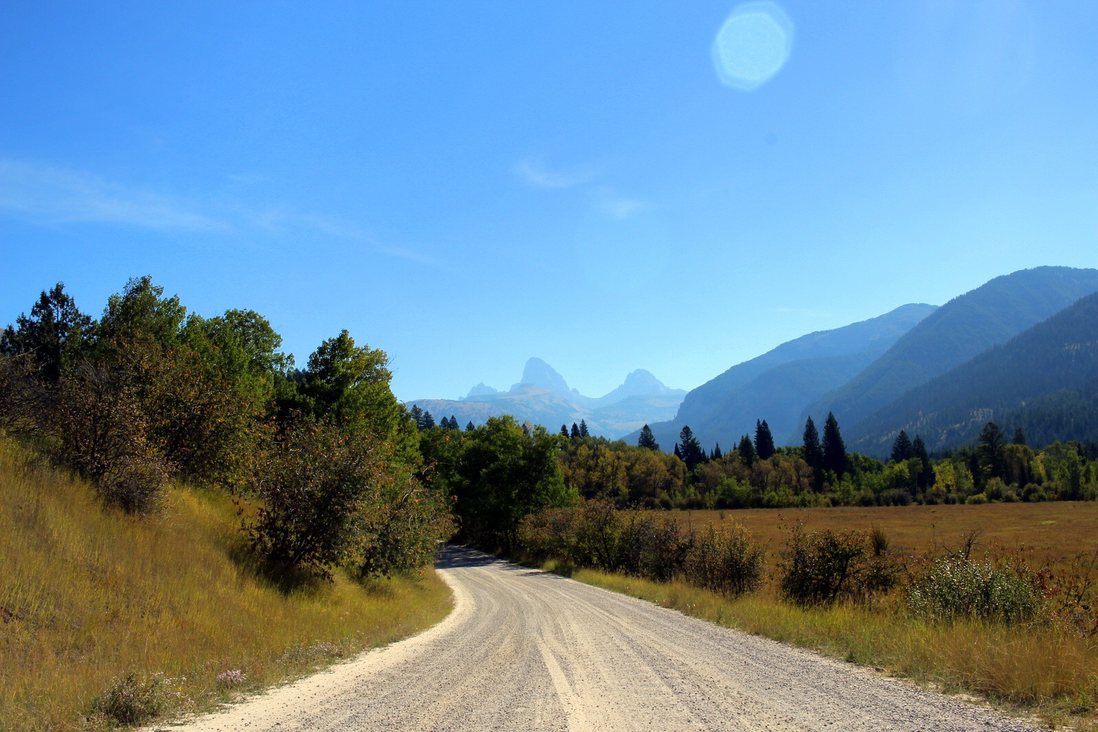
From Jackson, I crossed over the Teton Range and into Idaho. 30 miles later, I found myself on a gravel road ascending on Alta Ski Road back east towards the Teton Range. I could see the Grand Teton towering in the distance.
After 6 bumpy miles, I made it to the trailhead and geared up. I wasn't taking any chances this time. I filled my Camelbak to capacity--100 oz--and topped up my reserve handheld bottle with Tailwind. I also had an assortment of snack items, including KIND bars, and Justin's almond butter (thank you for fueling me!).

And then I was off at almost exactly 11:30 a.m. There was no warm-up involved. The trail went immediately into switchbacks in a thick forest.

After about a half-mile of ascending, I finally came out into a flat meadow, and a sign indicating that I was in Caribou-Targhee National Forest.

I'd told myself that with the 5,500 feet of vertical I'd ascended in the previous two days, I needed to start the day conservatively. I made it a point to cool my jets and not run or even power-hike, even though I felt strong. I came through the first mile in just under 20 minutes.
As with every hike, the scenery was already changing.

I trudged through the meadow and through forests, sometimes crossing over a stream on logs.

Soon, I could see my destination on the horizon. Table Mountain is the little hump on the right side, under the lens flare. I realized I still had a long way to go before I got there.

I continued pressing through the meadow. The trail started switchbacking out of control. I kept my pace conservative, and tapped out a rhythm with my trekking poles. I didn't breath hard once.

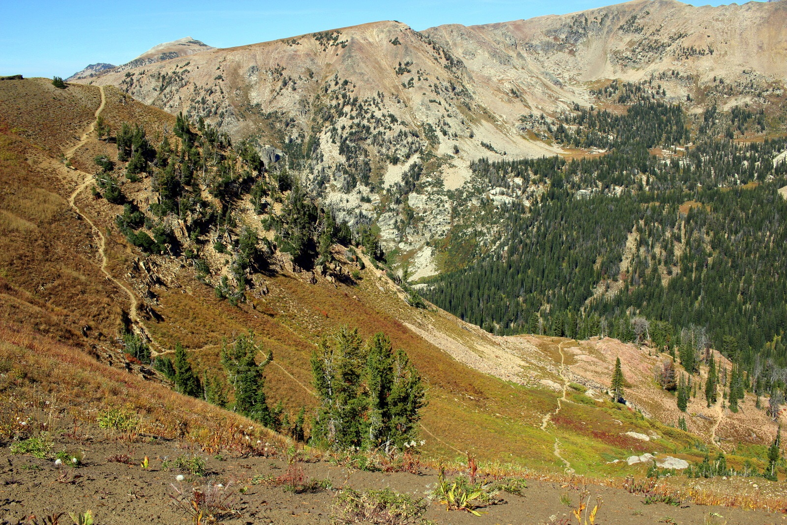
Pretty soon, the ridge line rose above the tree line. I'd be ascending up to the ridge on the right side and then making the final climb up to Table Mountain (out-of-picture to the left).

The meadow switchbacks wwere relentless, but the scenery was nice.

The trail carved a clear path through the meadow and up to the ridge.

I was almost out of the meadow area when I took a short break to refuel, rest the legs, and take in what I was about to conquer.

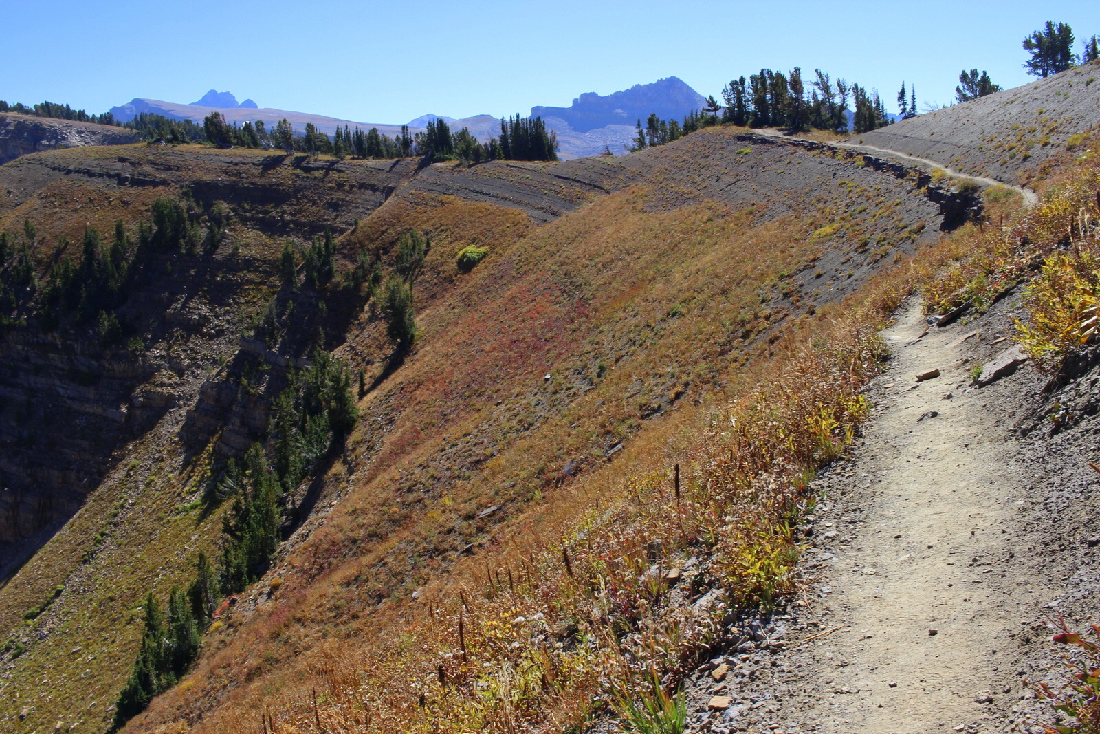
Finally, I ascended the last switchback and was out on the exposed ridge.

The trail followed the ridge line around. One mis-step and you were in for a serious tumble down into the canyon.
This was the homestretch. I'd come around the ridge and the trail was practically leading straight to the summit. Adrenaline pumped again, and I actually decided to run a little just to see how I felt. I felt good, so kept at it.

I looked over to my right and saw more of the Teton Range.

I stopped running when the dirt trail turned to rocks. I was now trudging steadily upwards.

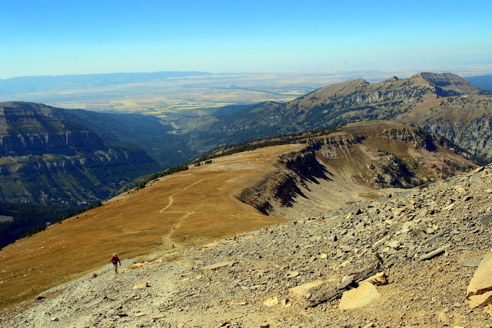
At one point, I looked back to see how far I'd come. Basically, the switchbacks ended at the very end of the ridge line, to the center right of the photo.
At some point, Table Mountain dropped out of sight. But I never lost sight of Grand Teton. Its summit is over 13,000 feet.
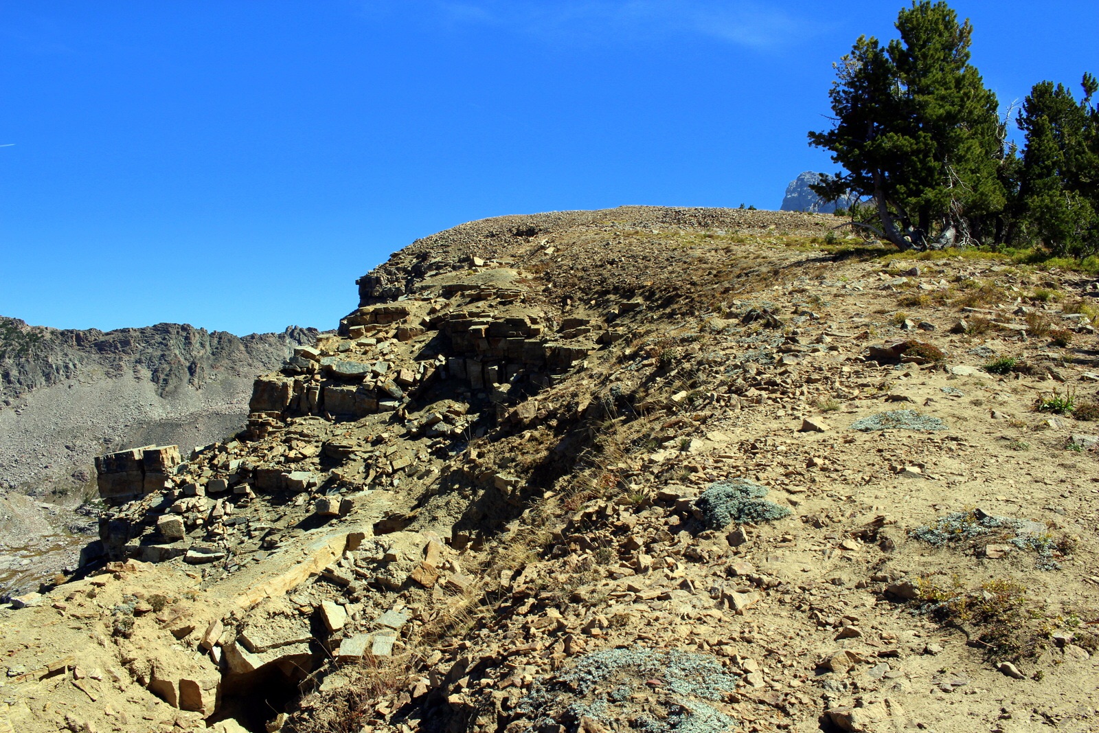
The end of the forested ridge area meant the rocky, exposed final stretch. I was probably less than a mile away here, but the incline was challenging, and the terrain made moving difficult.

There were plenty of hikers trudging along here. I passed by a half dozen. They were winded, and stopping every now and then for breaks. Again, I must be getting fit, because I didn't really need to stop at all.
Several people were also descending, including this canine friend, who was a pleasure to play with as a break.

Perhaps as an in-your-face gesture by Mothr Nature, about a half-mile from the top was a rocky minefield. These rocks were loose, and made for very treacherous footing. Again, I was grateful for my trekking poles, which made it relatively simple to cross.

And then I was there--the final half-mile. Despite the photo, it was impressively steep. For the first time all day, I resorted to taking 5-second breaks about every minute or so. I was also pulling down on my poles with my arms with full force, to lessen the load on my legs. I was trudging and trudging.

I looked back down the ridge I'd come up. In the distance were several people I'd passed. Specks.
And then I made it! To the summit of Table Mountain, 11,106 feet above sea level. Certainly not the tallest point I'd ever reached, but one of the most impressive vistas I've ever seen. From the table-like summit, I stared directly east where, just 2-3 miles away, were the Grand Tetons.

The photos are deceptive. I'm actually standing on the edge of the summit here, even though it looks like I could walk back onto the dirt mound. That's thousands of feet away.

Looking to the northeast, I could see Cascade Canyon, which I'd partially hiked into the day before (to reach Inspiration Point). I was finally getting a sense of the lay of the land. This area of the country is impressive.

Other people at the summit explained the names of all the mountains. I just looked out at the rest of the Tetons in awe.

These four from Idaho Falls were fun to talk to. One of them gave me the rest of her sandwich. It was delicious--exactly what I needed.

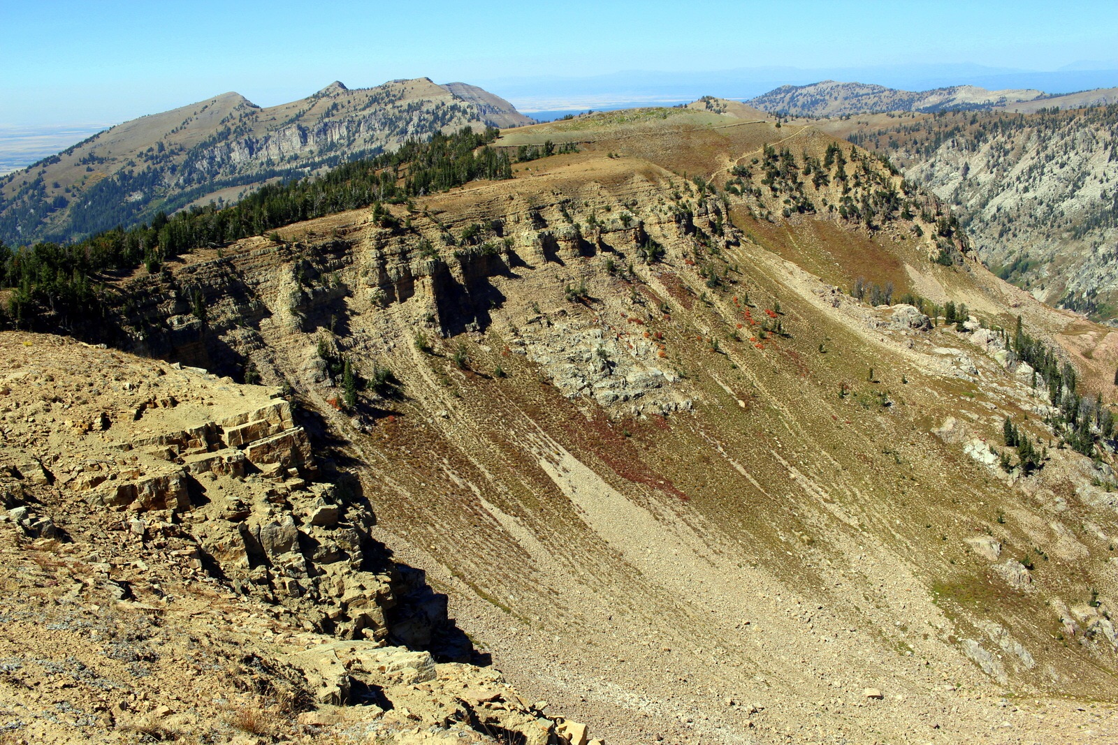
To the north, you could see more of the Teton Range and also part of Yellowstone.

The people at the top were all locals, and all had been up here many times. One woman brought a kite and tried to fly it. It was too windy.

After chatting with everyone at the top for 45 minutes, I was beginning to get cold. I was wearing nothing but short shorts and a t-shirt (even though I had tights, a tech fleece, and a rain shell in my pack). I decided to descend. From the ridge line, I looked down at the upper half of the trail I was about to descend on.
It had taken 2:38 to reach the summit. I reached the trailhead in 1:27. Let's just say I ran down the mountain when I could (which was not very often).
It was only 4 p.m. I thought the day would've taken at least until 6 p.m. (again, I can't trust the estimates from the guides I read--one said 11-12 hours, and 6-8 for strong hikers). I was, however, feeling tired, and wanted to chow down. The hiker with the dog had finished just a minute before me, and he recommended a bar in Driggs, the town from which I'd come up to the trailhead.
While eating a buffalo burger, I decided that I deserved a shower and a hotel bed. I began searching on my phone for availability. But I discovered that all lodging options within 100 miles of Jackson were full! I was stunned. Labor Day was behind us, yet this place was still teeming with people.
I was a little bit panicked, because I really didn't want to spend another night camping in a row. I asked the bartender if he had any ideas. It turned out that one of the servers managed a ski property that was vacant at the moment. For $90, I could stay there. I immediately pounced on the option and headed to the place.

Once again, I found myself driving east towards the Teton Range.

It just so happened that this ski studio had a hot tub, with a view of the Grand Teton. After a long day (and set of days), I decided to treat myself to a relaxation session in the hot tub while the setting sun lit up the Grand Teton in reddish hues.

After washing up, I opened up the little medallion that the kite-flyer at the summit had given me. I'd conquered Table (Rock?) Mountain. Even if this medallion disappears into the abyss that is my knick-knack drawer, I'll forever have the experience of this day etched into my memory. And, for that, I'm thankful.
