Today's destination was Big Bend National Park, in an isolated part of West Texas on the border with Mexico. Along the way, I would stop by the artsy desert town of Marfa. Once inside Big Bend, I would make a beeline for the Chisos Basin, where I'd set up camp and then run up to the South Rim to catch views of the Chihuahuan Desert surrounding the mountains. And then I would fall asleep under the brilliant night sky.
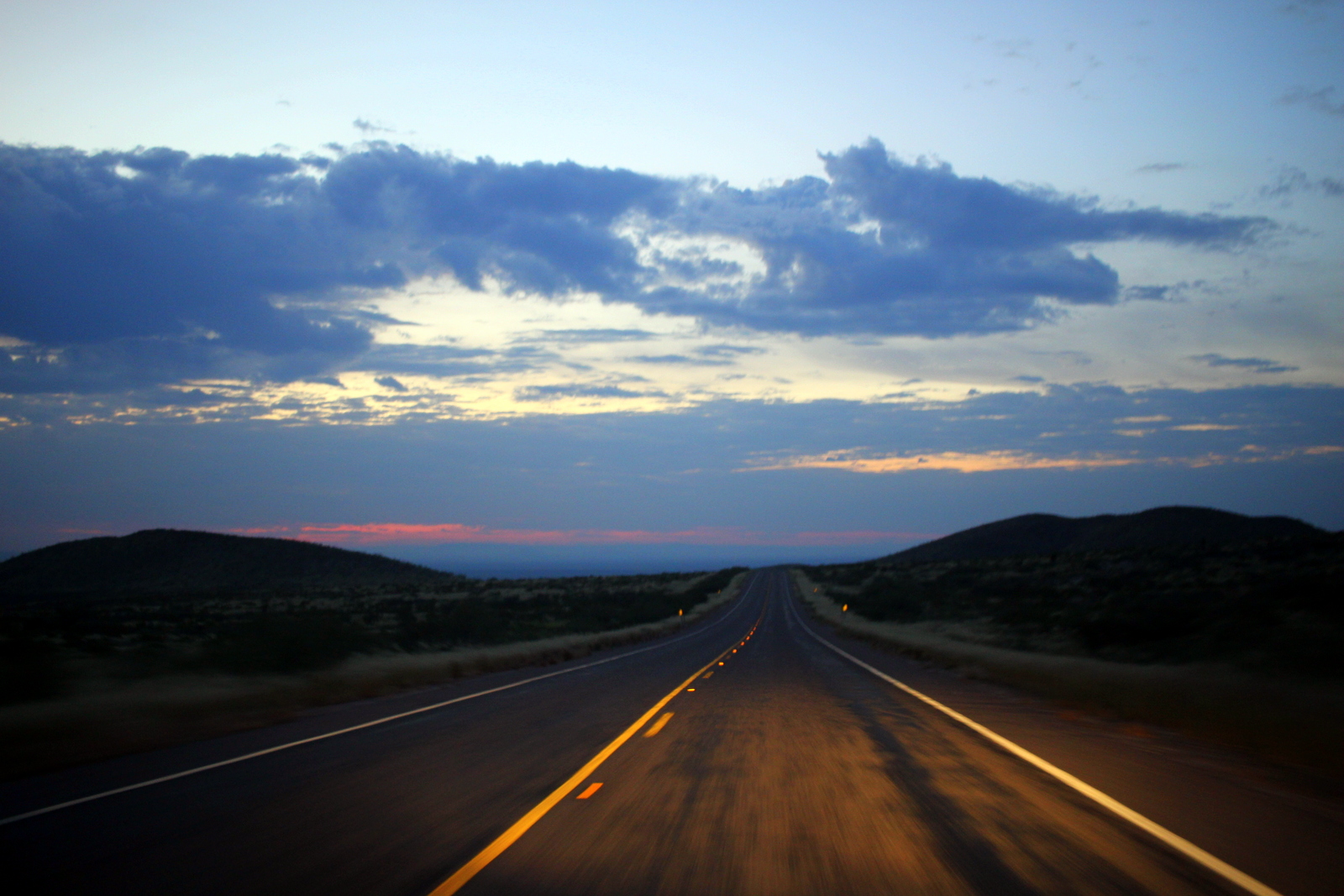
It takes discipline to hit the road before the sun rises, but I've loved pre-dawn driving every time I've done it. It is just so peaceful. I had good reason today; my plan was to meet Lowell R., a high school friend who was coming from Midland, TX, at the Chisos Basin in Big Bend by 1 p.m. I left the campground at 5:40 a.m. and cruised in the dark on the open road.

At 6:40 a.m., the sun was beginning to rise. This is when the feeling of peace peaks. It felt so good to drive alone on the highway as the world around me started to wake up.
I had plans to stop in Marfa, TX, an odd town that has developed into a little bit of an artists' haven. I really only had one thing I wanted to see there: Prada Marfa. This is an art installation on the side of US 90 that resembles a Prada store--except that it's just a facade. The Prada company supported the project, and even donated real Prada goods to be put on display inside the store. But, since installing Prada Marfa in 2005, the artists have stuck to their plan of letting the store disintegrate over time into the desert. Totally weird, but totally worth seeing, especially because it was on the way to Big Bend.
Because cell service was spotty, and I didn't know where exactly the installation was located, my plan was to just drive into Marfa and ask a local. About 40 miles from Marfa, though, I saw a flash of white on my right side. I looked over my right shoulder and swore I saw a building that said Prada on it. How could this be? I was still a few miles from Valentine, and another 30 miles from Marfa. Was this a fake? It was just after 7 a.m., so almost no cars were on the road. I U-turned in the middle of the highway and drove back. Clearly, this was it.

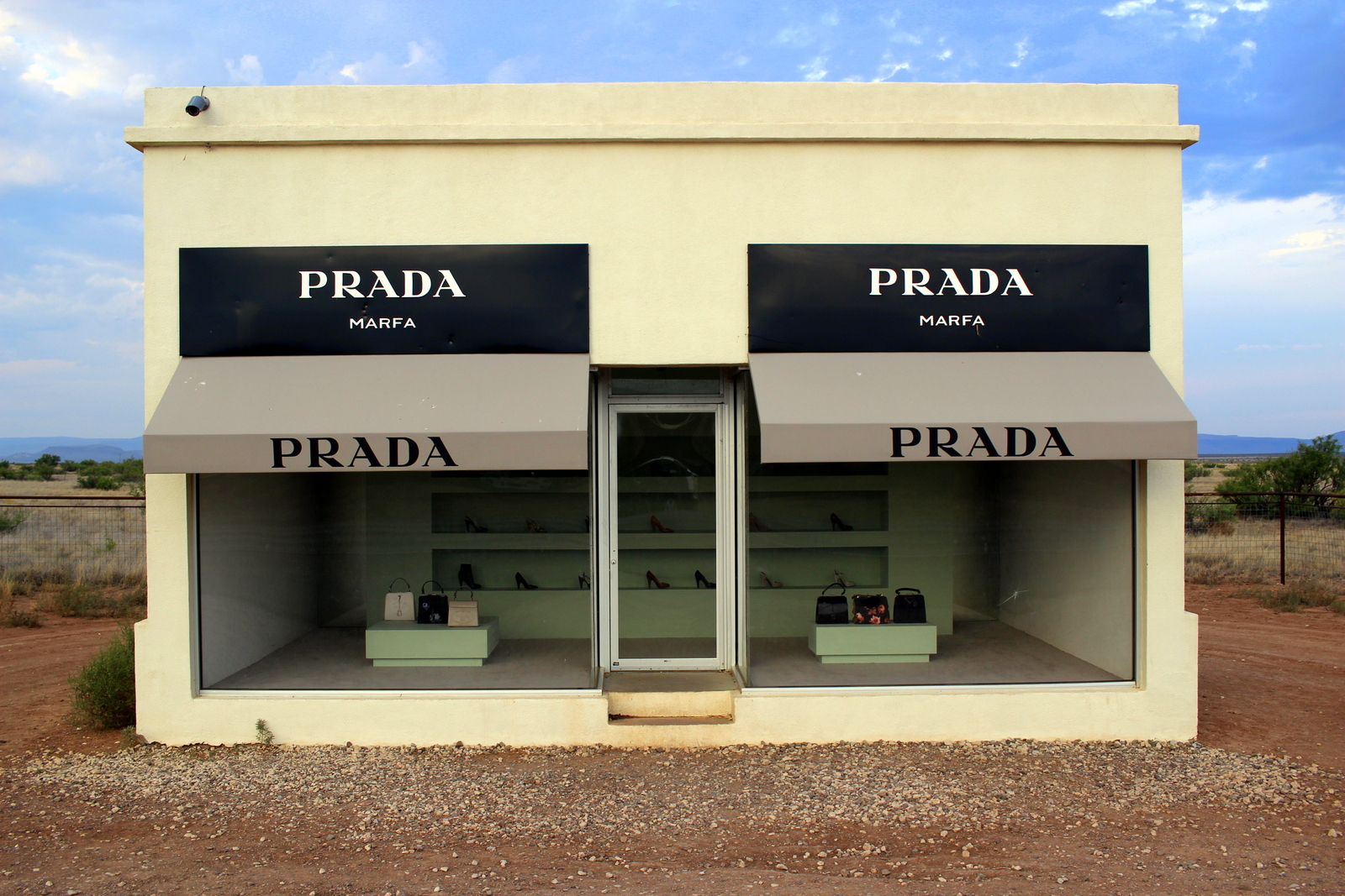
I got out of my car and came in for a closer look. As I'd read, the store did have Prada goods inside.

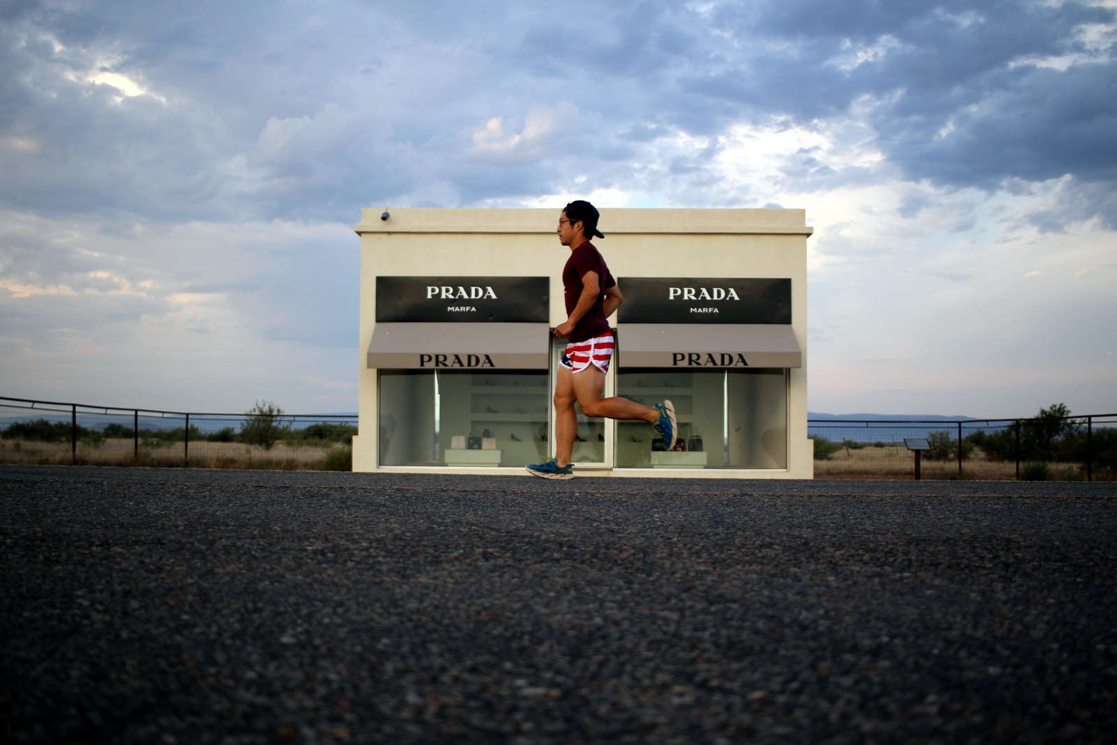
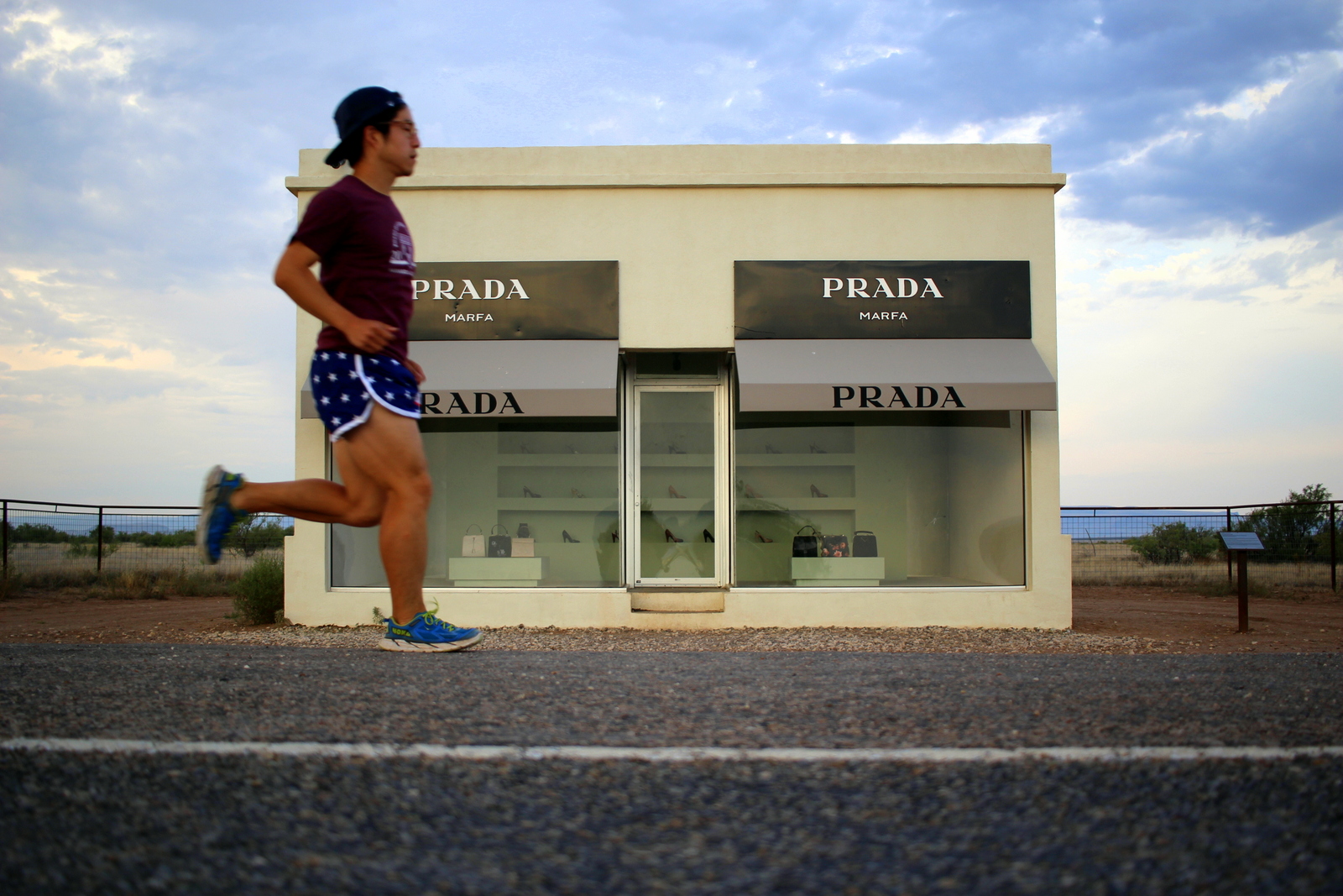
I figured I needed a couple photos in front of the store. I took photos by placing my camera at several points on the shoulders of the highway, but I soon realized that the best vantage point was right in the middle of the highway, and I wanted to give that kind of shot a try. So, I looked down the highway in both directions for cars and, once I saw the coast was clear, set my camera down, hit the timer, and ran across the shot. Here are photos from different perspectives.
What a strange place. But Marfa got only stranger. By the time I'd actually arrived in town, I was ready for breakfast, and proceeded to Buns N' Roses. While finishing up my meal, I got a call from Lowell. He was en route, but had pulled over a couple times to throw up. Last weekend, he'd broken a rib in a dirt bike crash. His recently prescribed pain meds hadn't gone well with some alcohol he'd drank last night. He had to bail.
I told him that he'd clearly made the right choice. It was still a bummer. Lowell had planned out a pretty awesome 24 hours for me. Also, I was going to ditch the running pack and simply go on an overnight backpacking trip with him. It would've been a nice change of pace, and an opportunity to camp under the night sky from atop the rim of the Chisos Mountains. But obviously Lowell was in no shape to continue driving, let alone put on a heavy pack and go on a strenuous hike into the mountains. As a compromise, I learned that I'd have to drive through Midland on the way to Dallas the following day. I'd try and stop by for lunch in Midland.
Because I now had more time, I decided I'd stop at one more place in Marfa: the Chinati Foundation. This is one of Marfa's primary art museums. Most of the works are viewable only on a guided tour, but since I didn't have the time to wait for the next one, I went on a self-guided tour of the concrete works in the field.

They were what you'd expect from modern art these days...

Basically, Donald Judd put together a series of concrete structures shaped in a variety of geometrical forms and patterns.
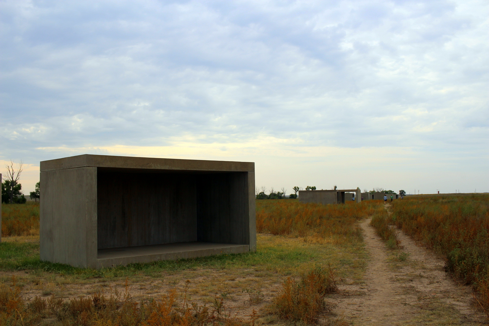
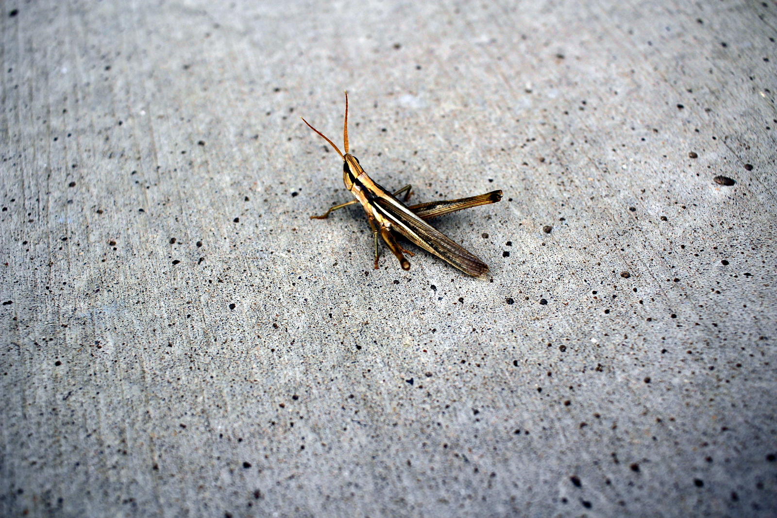
There were signs telling visitors not to step on the works. But I guess those rules didn't apply to grasshoppers.
Having had my fill of Marfa art, I decided I'd head for Big Bend and hit the trails ASAP. As I was driving through town, though, I saw Marfa Book Co. down a side street. I'd heard about this place, and like any good bibliophile, decided I needed to stop. It was cool in there, but I already had a loaded car, so chose not to buy anything.

What an interesting town. I'm not sure I needed more than the 90 minutes I'd spent there, but at the same time I could understand the appeal for artists and other tourists. I passed Marfa's water tower and said goodbye.

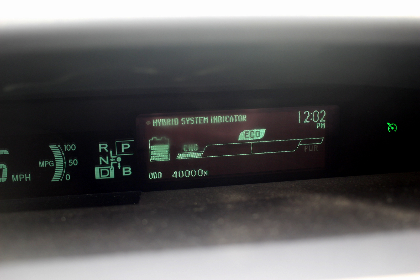
At noon, I hit a milestone: 40,000 miles in my Prius. I got my driver's license in 2010, and have only driven this car my entire life. Looking at my trip odometer, I noticed that I'd also broken 8,000 miles. In other words, in less than 40 days, I'd basically driven the distance I'd typically drive in a year. Wow.
I made it to the entrance to Big Bend just before 2 p.m. I still had many miles to go inside, but it was good to finally see the NPS sign.

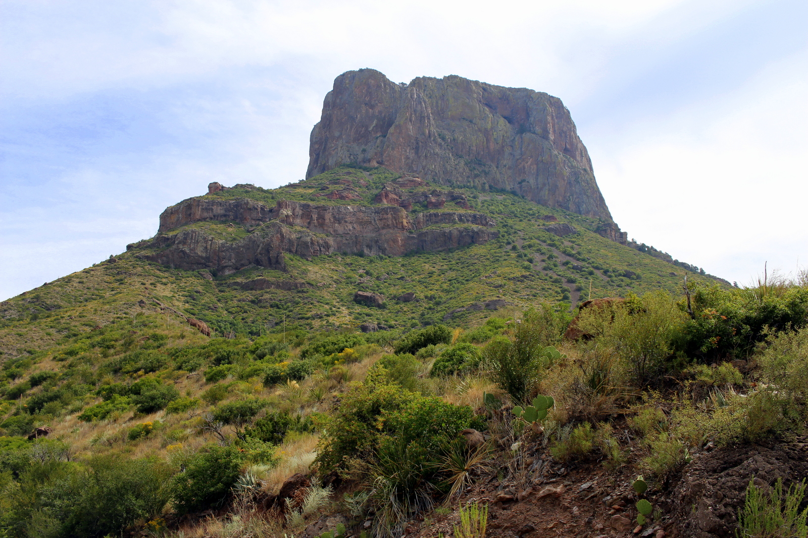
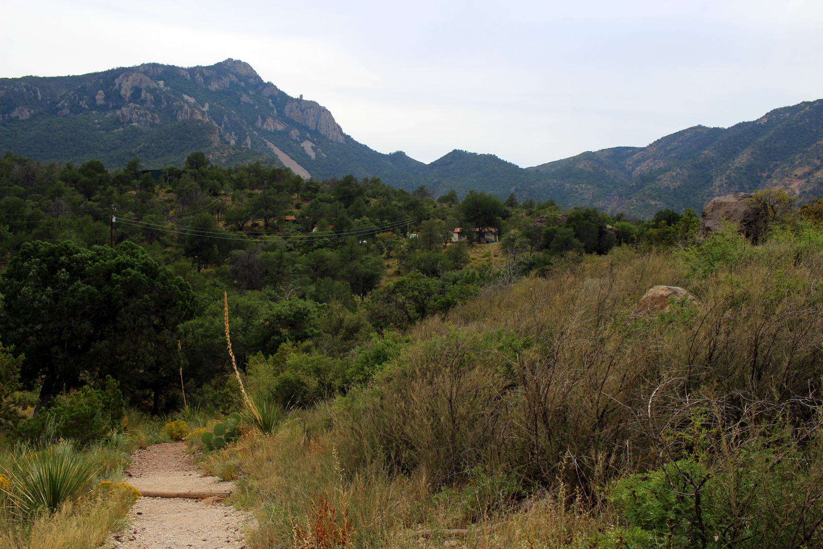
After driving for a while across the very flat desert terrain, I noticed mountains rising up out of the desert in the distance. I figured these were the Chisos Mountains. My plan was to drive right into the Chisos Basin, snag a campsite there, and then run the Pinnacles Trail up to the South Rim to catch the sunset.

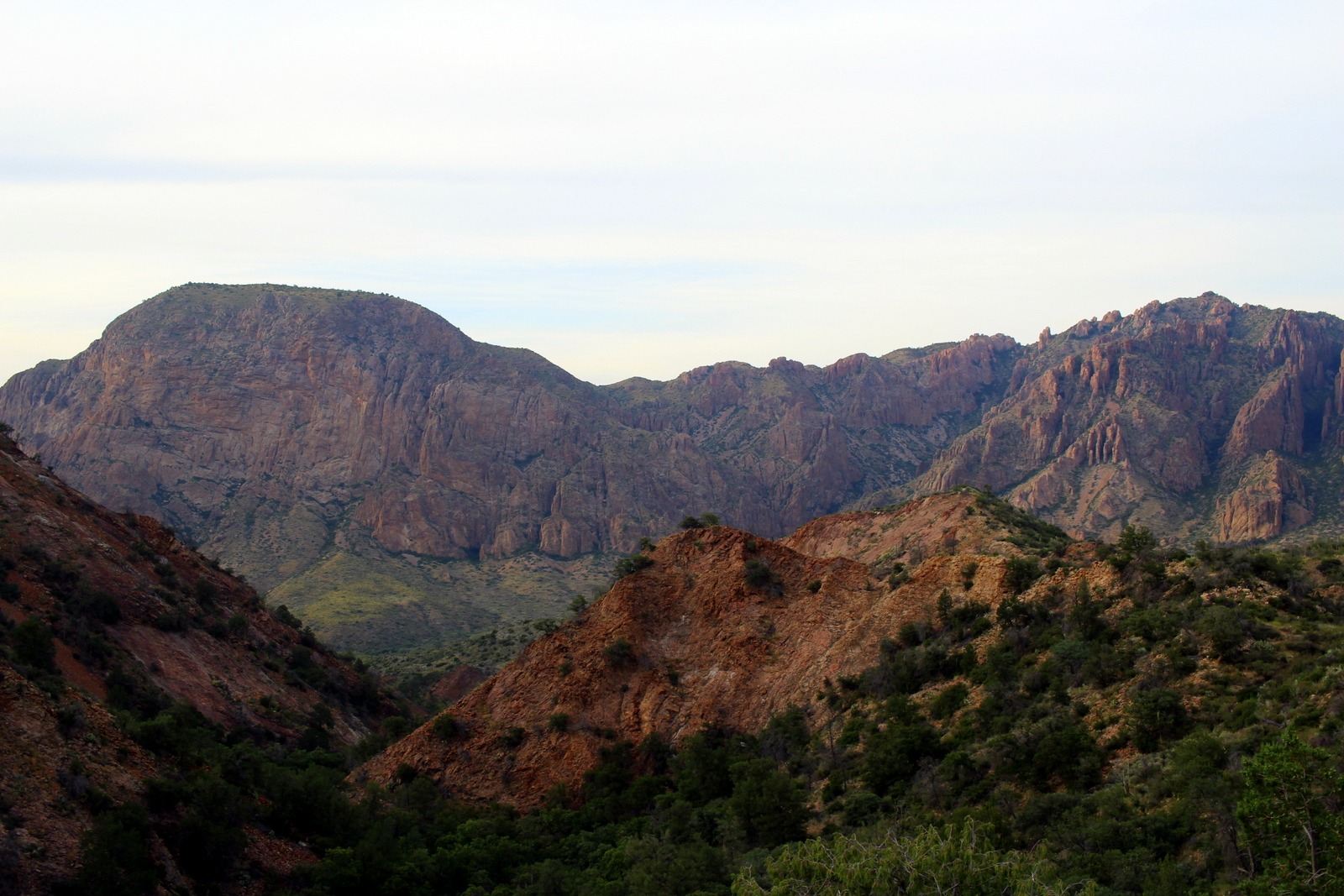
I finally got to the Basin at 3:30 p.m. It was an incredible place. The Chisos Mountains are an example of what are called "sky islands"--isolated mountains surrounded by radically different lowland environments (here, the Chihuahuan Desert). As a result, they provide a bit of an oasis for a lot of wildlife and plant life. The Chisos also have steep and jagged rock faces. In the basin, you could see these faces in every direction.
I hit the trailhead just before 4 p.m. My route today was the Pinnacles Trail up to the South Rim and back. This would be at least 12 miles roundtrip, with almost 3,000 feet of elevation gain, so it wouldn't be an easy run (plus, I'd just run hard up to the top of Guadalupe Peak the day before), but I was determined to get up and down before the sun set at 7 p.m.
The trail ascended at a more gradual, but still steep, rate. I guess I'd been tackling some very steep trails recently, so a merely "steep" trail didn't feel too bad. I made good progress, proceeding up into the peaks of the Chisos.

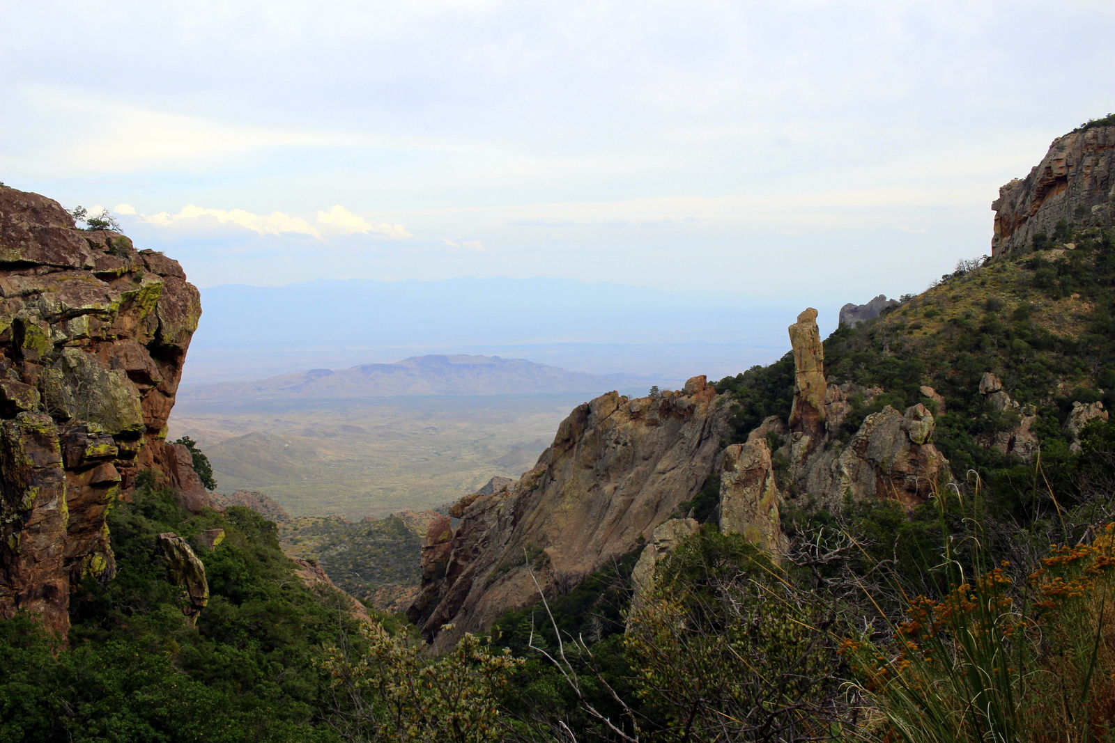
About an hour in, I'd gotten far enough over the peaks, that I was looking through a gap into the Chihuahuan Desert that surrounded the Chisos. I believe this area is called the Window, which is named so for obvious reasons.
Interestingly, after passing the Window, the trail took me back in between the peaks, and into a moist woodland area. Here, the trees were lush, and I noticed I was following some kind of stream that flowed gently between the peaks. This was not what I'd imagined when I'd thought of the desert.

The weird landscape continued. This was some kind of river corridor--an oasis--right in the middle of the mountains in the middle of a desert. It was pretty incredible to think about.

At 5:30 p.m., I finally hit the South Rim. The view was breathtaking, not because of the aesthetics, but because the contrast was so stark--between the tall, rocky, powerful Chisos above, and the barren, bumpy desert below. It was breezy on the rim, so I put my pack down and let my sweat dry up.
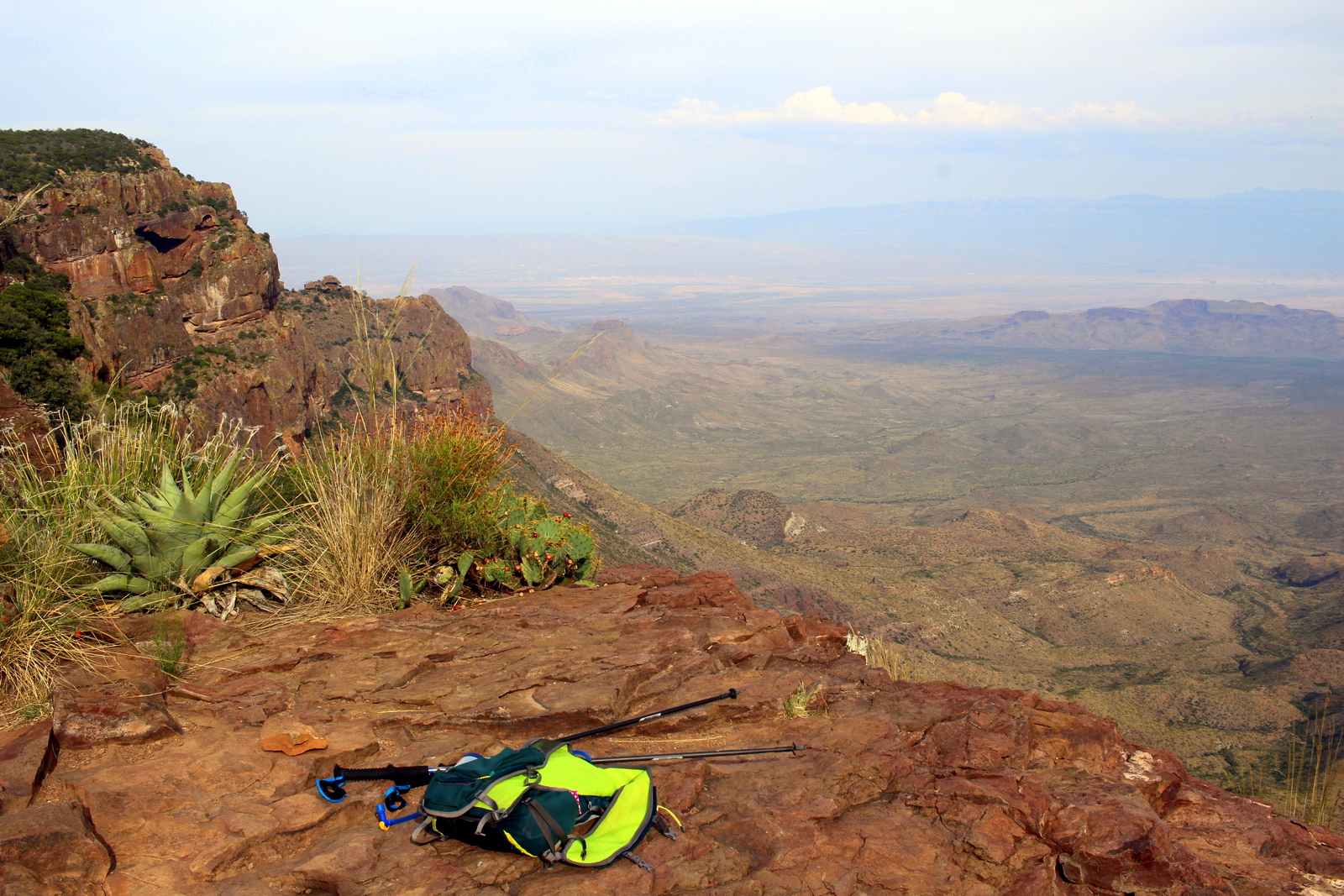
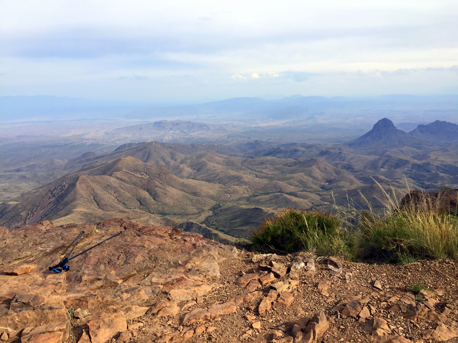
Every direction provided a new set of contrasts. The haze limited how far I could see, but it also provided a contrast in sharpness between things far away from and things close to me.
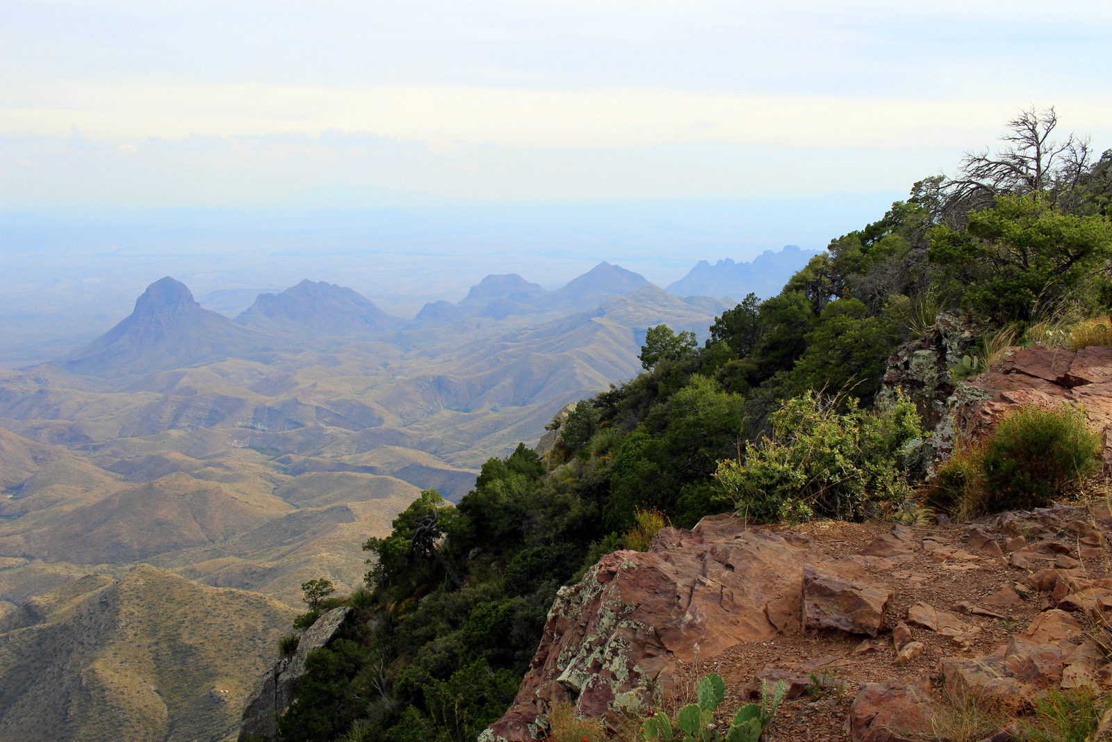
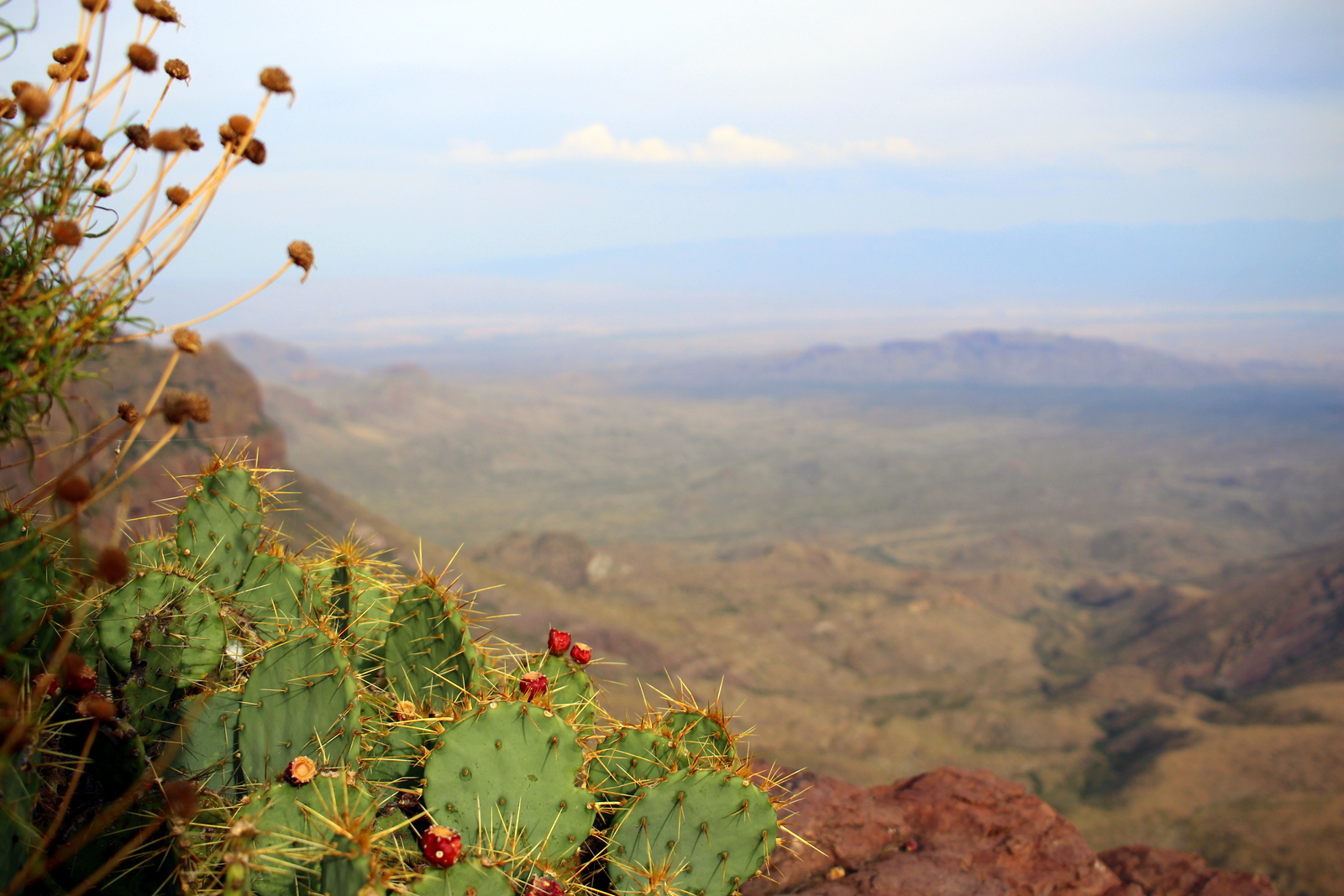
It was interesting, too, to see cactus--the plant that everyone associates with desert environments--up in high altitude.
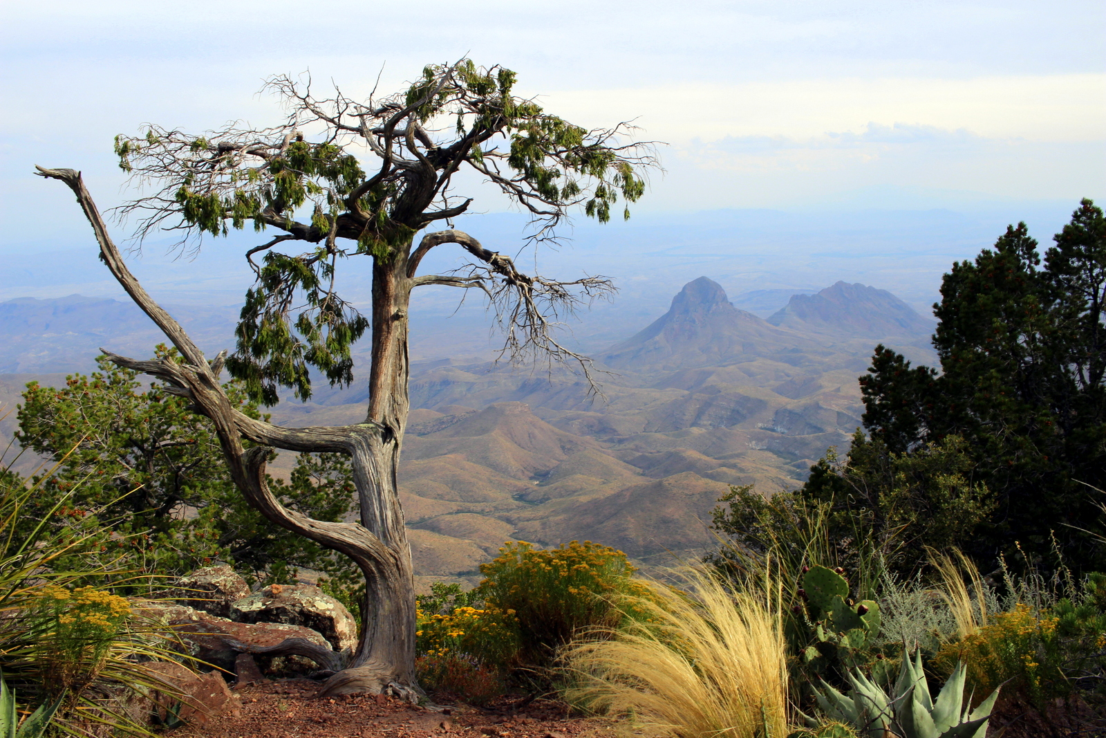
And then there was this lone tree, sitting upright on the edge of the rim, with the best view in town.
I've loved seeing the extreme on this trip. It's the extremes on the spectrum that always have the most power to wow. Here, towards the southeast, the cliff face dropped off almost vertically. Am I not right that this looks very much like Pride Rock from the Lion King?


And then I was on my way back to the Basin. At the top, I'd learned that there was a different route down--the Laguna Meadows Trail--that would still take me to the same trailhead. I preferred to see new landscapes, so I headed that way around the Southeast Rim and down. Along the way, I saw some very colorful and pretty wildflowers.

As I got closer to the Basin, the foothills (?) that I'd been looking down on from the rim seemed more at eye level. I was crashing back down to earth.

Just before 6:30 p.m., I'd made it back to the Chisos Basin. I looked up to see what I'd conquered today. It had been a solid afternoon.
Of course, by now, with almost 40 days on the road, and dozens of hours running on tough, technical trails, my feet have taken a pretty hard beating. I haven't had anything serious--no injuries or pains--but I've been dealing with nuisances like blisters and calluses. One blister on the side of my left big toe was acting up today. (Please ignore my very clean and healthy toes...)

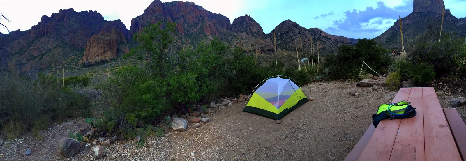
I made it back to the campground and cooked up a quick dinner. I planned to catch tonight's ranger talk on raptors. I liked my campsite for the evening--I was surrounded by the Chisos.
I learned a lot at the ranger talk. I now know what raptors are; they're carnivorous birds of prey that have "3 sharps": eyesight, beaks (used to tear apart food), and talons (used to kill prey). I also learned that Big Bend is the best place in the country to go birding. It has the most species of birds of any national park. Too bad I'm not so good at distinguishing birds.
I returned to my campsite in the dark. When I looked up, I noticed how bright the night sky was. Big Bend is as isolated as places get in the lower 48. It lies on the Mexican border, and the nearest big city airport is over 5 hours away. This makes for a truly wild--and dark--place. In fact, Big Bend is one of only fourteen gold-tier international dark sky parks in the world. Using my very basic camera, and nothing but a couple rocks to prop it up at an angle, I started to tinker with shots of the night sky. I ended up capturing a brilliant night sky, but it was mostly washed out (too high of an ISO setting, or maybe too long of an exposure?). I'd never done night sky photography, so I was really just playing around with settings and seeing what showed up on the screen.

Eventually, I realized that shooting the night sky exclusively was missing part of the beauty of the area. I needed some contrast, and the jagged peaks of the Chisos would provide it. So I took several more 30-second exposures, and managed to catch a couple shots like this. Incredible.

I ended up sleeping under the stars, without my rain fly. I kept my eyes open until the clouds rolled in and blocked my view of the universe. At around 3 a.m., the clouds opened up and rained on me in my exposed tent. I scrambled to put my rain fly on and then fell right back asleep. I was wet, and a bit cold, but I thought to myself how it was all worth it.