I drove only 200 miles today, which meant I could do more exploring. That also allowed me to visit two national parks in two different states and still enjoy an evening camped out under the stars. This was my kind of day.
The best days are the ones that start with a good meal. Since arriving in the southwest, I've eaten almost exclusively Mexican food. Nutritionally, I just can't find a better package anywhere. Plus, finding small mom and pop places has meant that I can get a lot to eat for not very much money. On the way to Carlsbad Caverns National Park in New Mexico, I stopped in the town of Artesia to dine at La Herradura. It hit the spot.

One of the fun parts about driving in a Prius is that you get to see all the numbers while you drive. It seems like a small thing, but it probably changed lots of drivers' habits--for the better. By knowing how your car is working, in the moment, you're much more likely to drive in safer, and more economical way. The beauty about starting your day in the mountains is that you can drive over 50 miles at 96.3 miles per gallon.

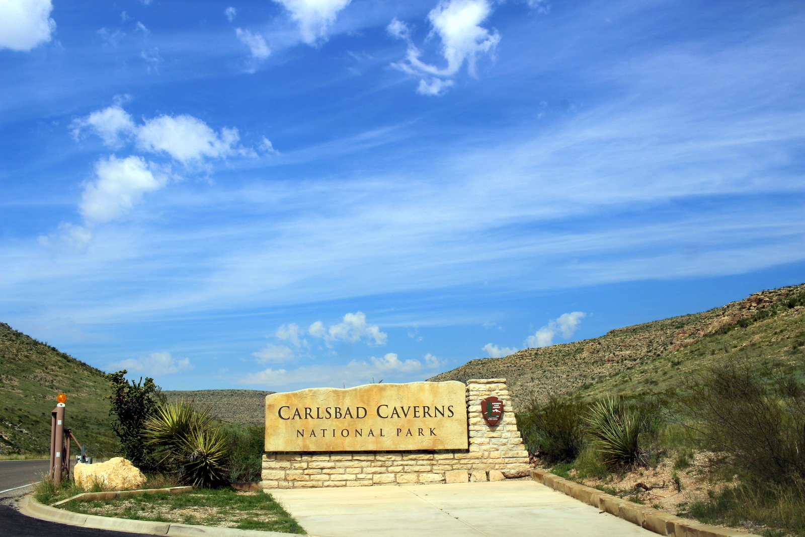
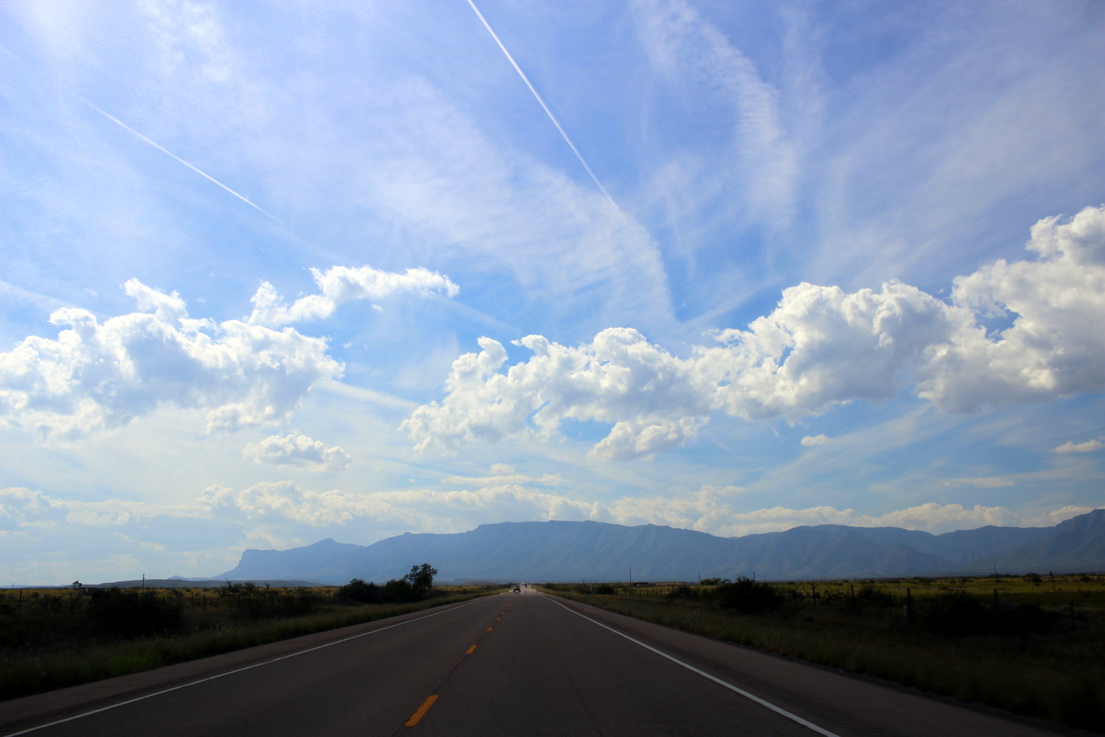
I made it to Carlsbad Caverns National Park by 1 p.m. This trip's theme has been running, so this park didn't really fit (though there are a few above-ground trails). Still, I couldn't pass up a chance to stop by and see what this place was about. The above-ground drive into the park and to the visitor center was impressive. The blue skies with white, wispy clouds helped.
As with most of our parks, there was evidence of prior eras everywhere. Here was a set of Civilian Conservation Corps buildings. The CCC, which FDR created as part of the New Deal, did a lot in the early 20th century to beef up our nation's infrastructure.

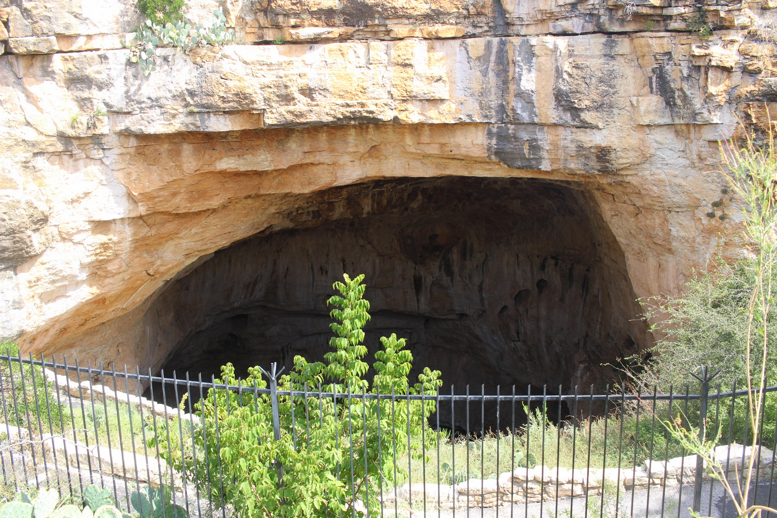
I was determined to get in and out of the caves relatively quickly. After all, I still had another national park to visit the very same day, and I wanted to hit the highlight of that park (i.e., Guadalupe Peak, the highest point in Texas). I decided I'd do a self-guided tour into the Natural Entrance and down to the Big Room. At the bottom, I'd just take the elevator back up to the surface.
The Natural Entrance was large--far larger than any natural entrance I'd seen (I've visited two other cave systems on this trip). I could see why Carlsbad Caverns was so popular.
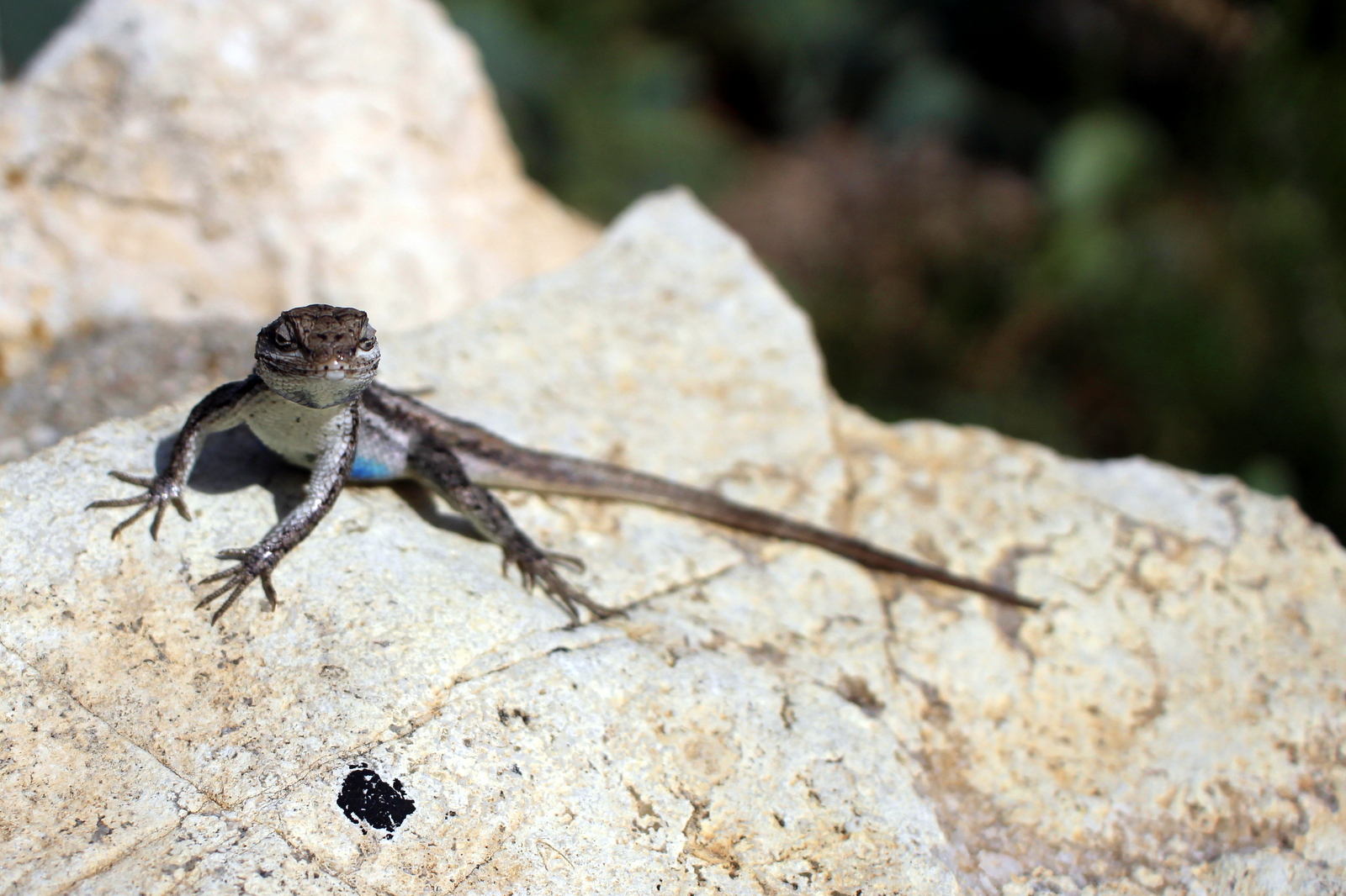
Before entering, I happened across a small lizard who'd just snagged a fly to eat. I was able to get pretty close to him. He didn't seem bothered by me.
And then I proceeded into the cave, beginning on steep switchbacks. I was surprised because I saw dozens of bats flitting from one side of the cave to the other. We're not supposed to take photos of bats (also, they were flying so fast that I don't think my simple camera could capture them), so I don't have any photos of them.


There were a lot of impressive features in the cave. I also was blown away by the scale of the cave. Each "room" was massive--far larger than the other caves I'd seen.

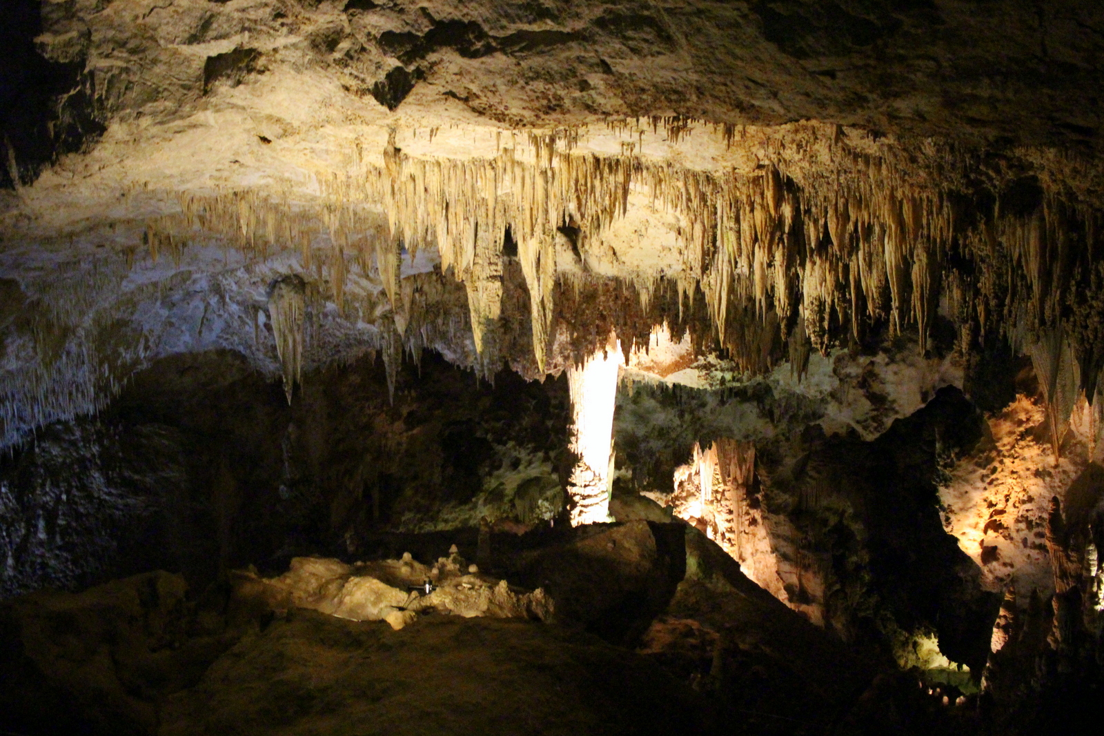
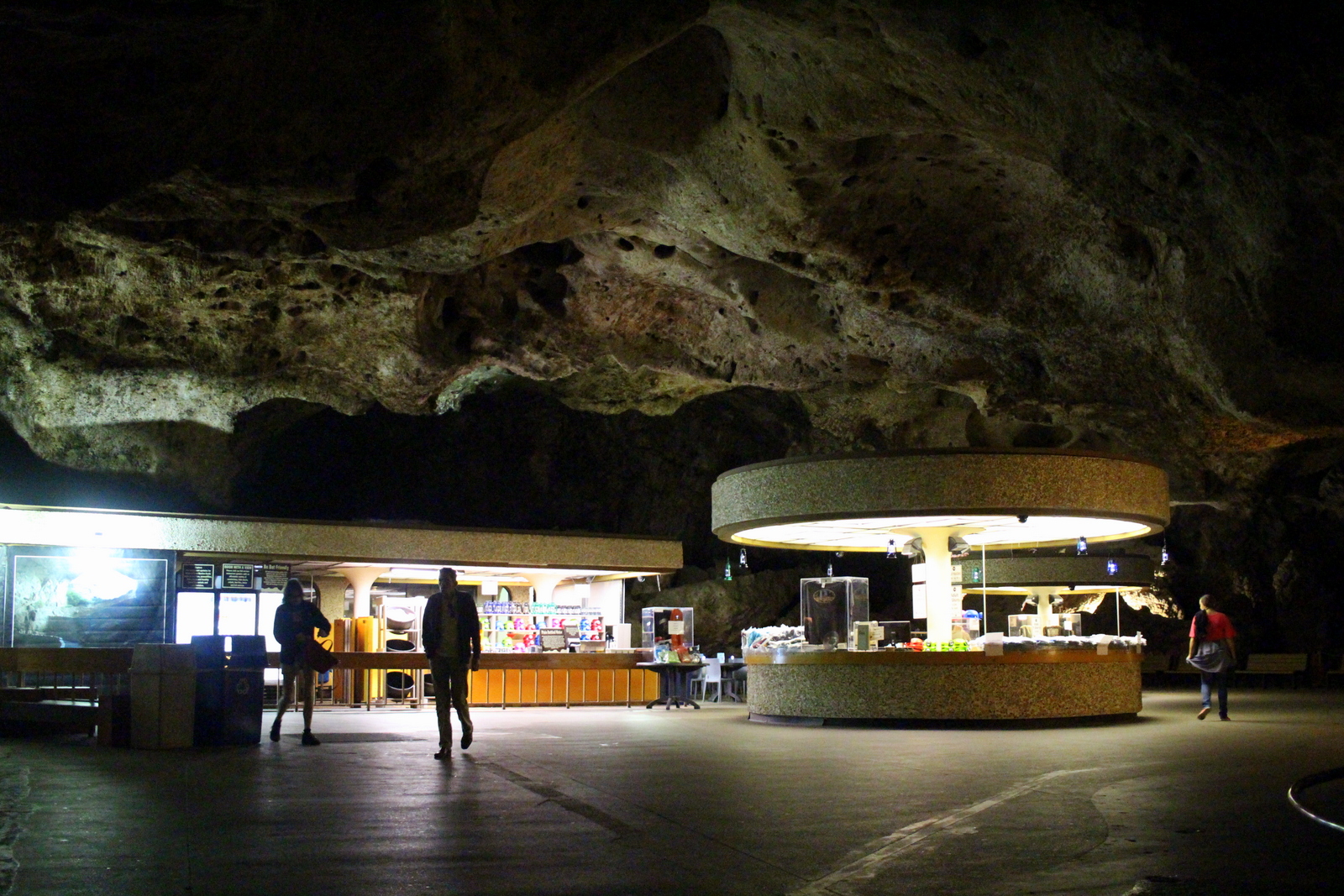
1.25 miles and negative 800 feet later, I was at the bottom. It was funny to see a small concession stand built right near the Big Room (i.e., the biggest chamber of the cave).
Then it was time to cross into my next state--Texas. Guadalupe Mountains National Park was my destination. Thankfully, it wasn't that far. I think it was under 40 miles from Carlsbad Caverns.
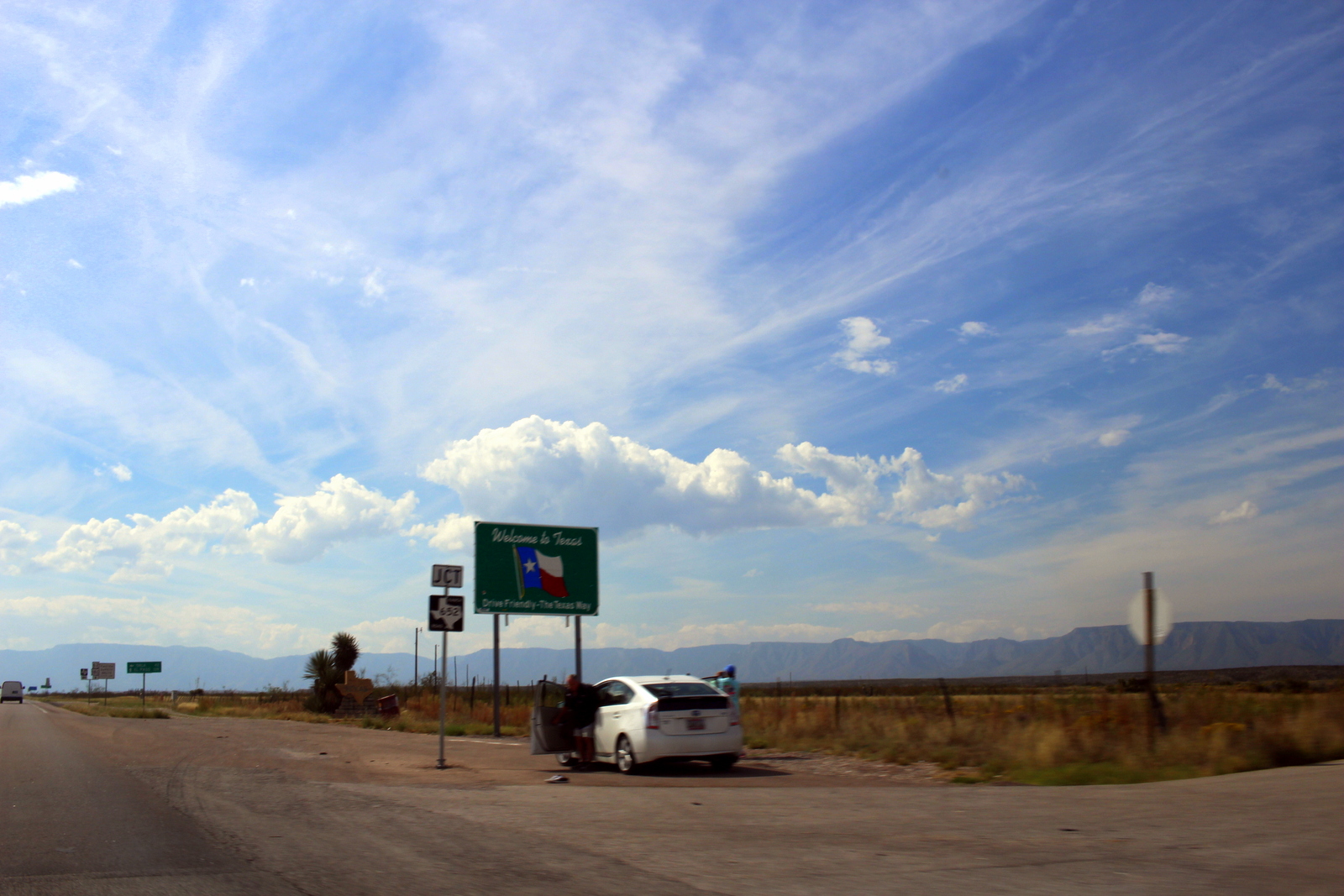
The Guadalupe Mountains abruptly rise up out of the desert. They are "sky islands"--isolated mountains surrounded by radically different lowland environments (here, the desert). The final few miles to the visitor center show this.
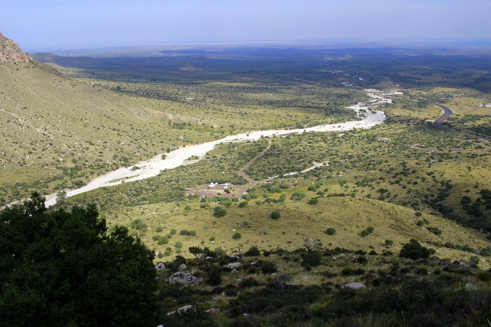
It was almost 4 p.m. when I arrived at the visitor center. One aspect of the park that makes it unique is that, unlike most other parks, Guadalupe Mountains doesn't have any roads going into or through the park. Moreover, there are no real "points of interest" on the highway outside the mountains. As a result, anyone who wants to see much of anything has to actually get out of his or her car and hike (or run) in. This was exactly my kind of park--one that forced you to get on your feet and explore.
Here, I was determined to push for the summit of Guadalupe Peak. The trail was 8 miles roundtrip, and involved 3,000 feet of elevation gain. It would certainly be tough, especially in the desert heat, but I couldn't pass up an opportunity to cross off another "highest point in in the state". So I filled up my Camelbak and set off.

The ranger I spoke to at the visitor center was skeptical that I'd finish before sunset. She mentioned how the brochure lists the hike as taking 6-8 hours, but that a fit person could finish in 4 hours. I told her I was expecting to finish in about 3. She didn't believe me. I figured I'd show her that it could be done.
As a result, I suppose I was more conscious of my time on this run. I decided I'd take photos of my view at specified times. 15 minutes in, I was already way above the trailhead parking lot.
At the 30-minute mark, the parking lot was even more distant.
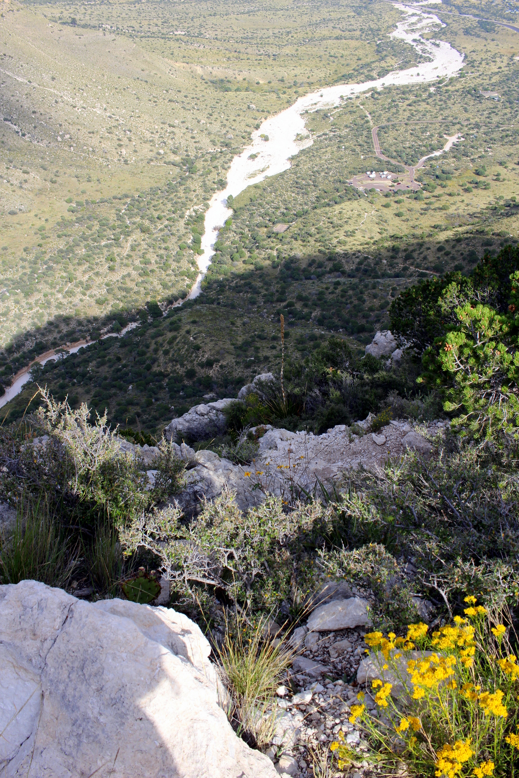
And an hour in, I'd made it "around the bend" and was looking up to the final face of the peak. From here, I couldn't even see where I'd come from.
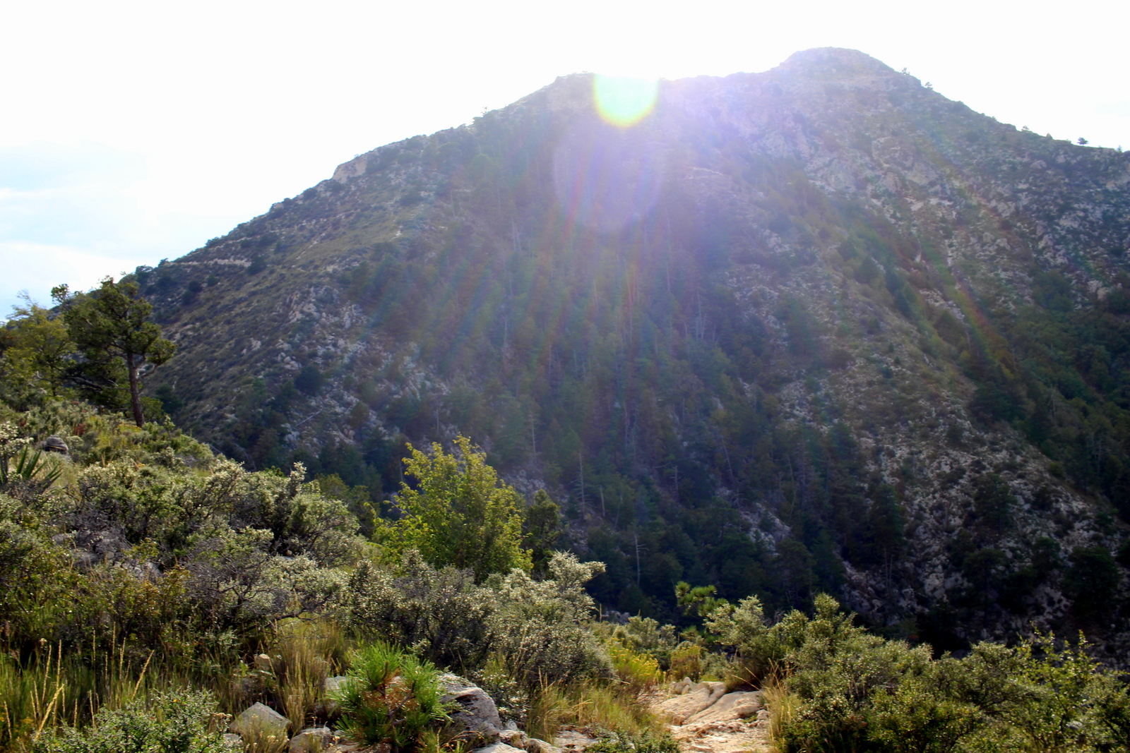
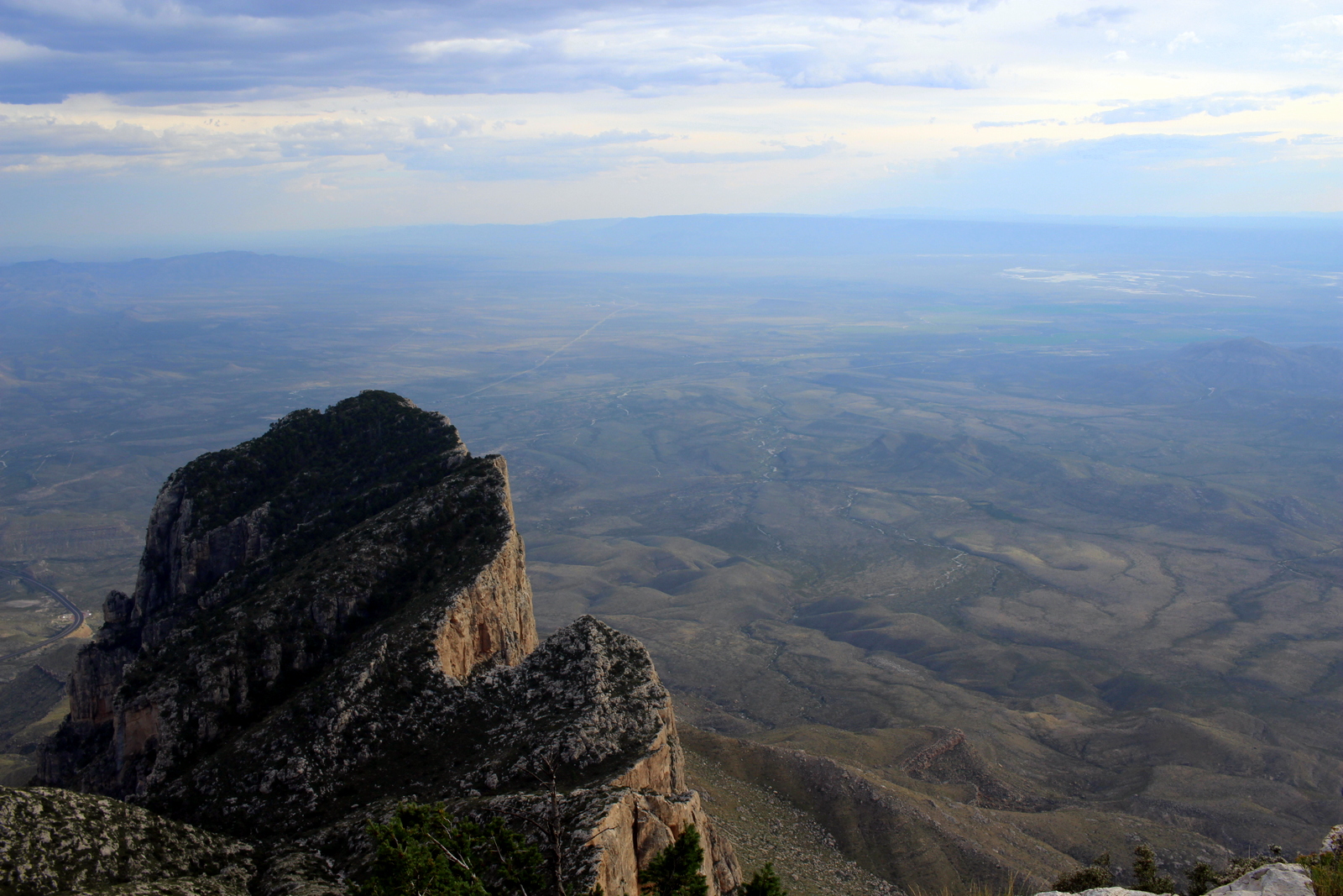
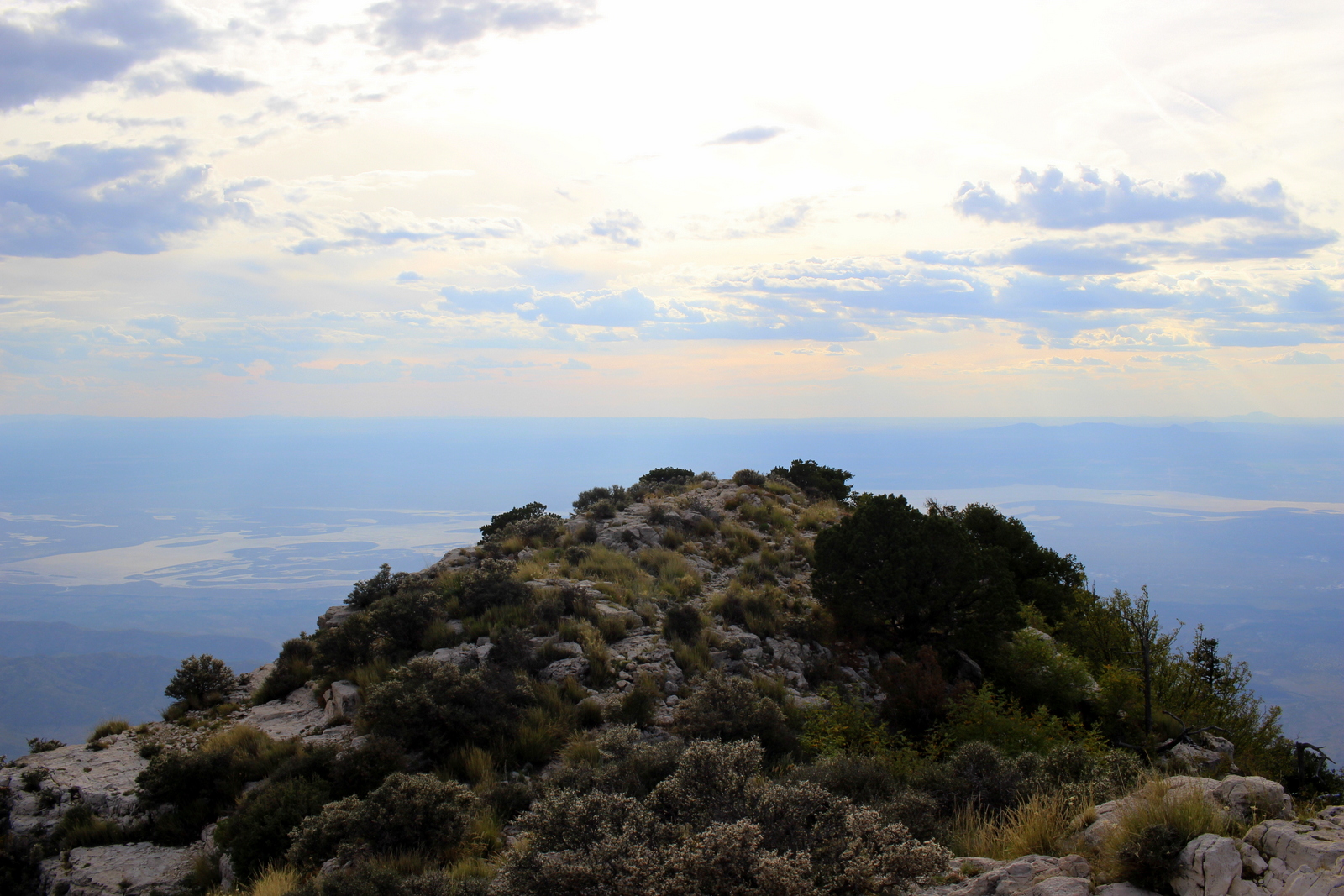
As I neared the summit, the views became awesome. The contrast between the Chihuahuan Desert below and the Guadalupe Mountains I was on was stark.

One of the highlights of the park is El Capitan, which is the signature peak of West Texas.
I continued charging up to the summit. I obviously couldn't "run" all of it. But I managed to run most of it.
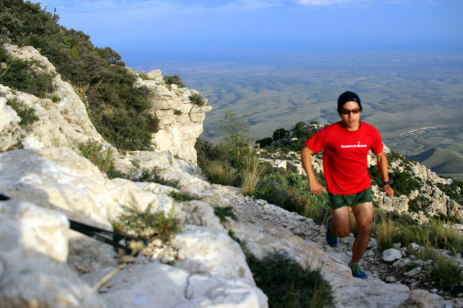
Finally, I made it to the summit, 8,751 feet above sea level and the highest point in Texas. It had taken 1 hour and 13 minutes. I'd easily break 3 hours. In fact, I'd probably break 2 hours if I ran at a decent pace on the descent.

There's a monument here to signify this high point. And there's also a register in which you can write a note and see all the thousands of people who've summitted before you.

At the top, I met a group of hikers from Oklahoma City. As I gazed at the desert expanse below, I chatted with them. After 30 minutes of taking it all in, I decided to descend back to the trailhead and to return to my campsite. I wanted to eat dinner and catch the evening's ranger talk (which ended up not happening). Even at a comfortable descending pace, I managed to get down in just over 45 minutes. Excluding the time spent enjoying the views at the summit, I'd taken just a tad over 2 hours to cover the trail.
The descents are actually the least enjoyable part of a mountain run. You'd think that it takes less effort, but even so, the descent is often the most hazardous. Because you have gravity working with you, you're more likely to lose control of your speed. As a result, you might screw up your footing, or make other missteps. Also, it's hard to leave the summit because everything generally becomes less spectacular. By descending, you're really coming back "down to earth"--and sometimes you don't want to do that.

I camped in the Pine Springs Campground at the base of the mountain. I was a little upset that the ranger talk didn't happen. But instead I sat under the dark night sky and looked at the stars.