losangeles

Day 27: Los Angeles, CA by Wookie Kim

The weather in southern California has been incredibly hot recently. I was planning to attempt the Rim-to-Rim Run in the Grand Canyon on Tuesday, so I decided I'd take today as easy as possible, and maybe even forego running altogether.

In the morning, Molly took me to a delicious breakfast spot, where I nommed on a huge breakfast sandwich and we sipped our refreshing Vietnamese iced coffees. I couldn't keep her all day, so she went her way and I went mine.

And my way today would be the Hollywood sign. I mean, why not, right? I'd looked up the various routes up to the sign and determined that I wanted to do the shortest distance, even if that meant the steepest climb. Given that the temps were hovering in the mid-90s, I simply wanted to reduce the time I spent outside baking in the sun. I opted for the trail to the Wisdom Tree and Cahuenga Peak.

I drove up into a posh hillside neighborhood in search of the trailhead. I got lost and had to ask a group of babysitters where I was supposed to go. They redirected me. Interestingly, this route has been known to disappoint. The trail goes up and above the Hollywood sign, but it only lets you see it from behind. There was ample warning of this at the trailhead (and ample graffiti).

As I was getting ready to start, I noticed another runner getting ready to go, too. I decided to ask her for advice on the trail. I learned that Maria was recovering from a hip injury, and that the incline of this hike was good for that. At this point, it was scorching, and I hadn't properly rehydrated from the day before (beer generally doesn't help). I made the decision not to run today. I'd just hike. It was fun chatting with Maria, so we hiked together.

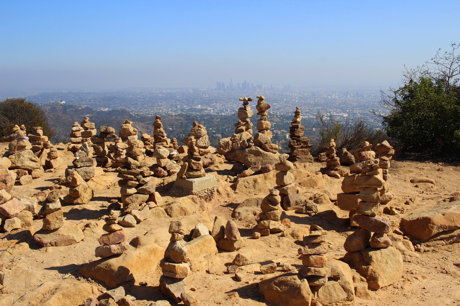
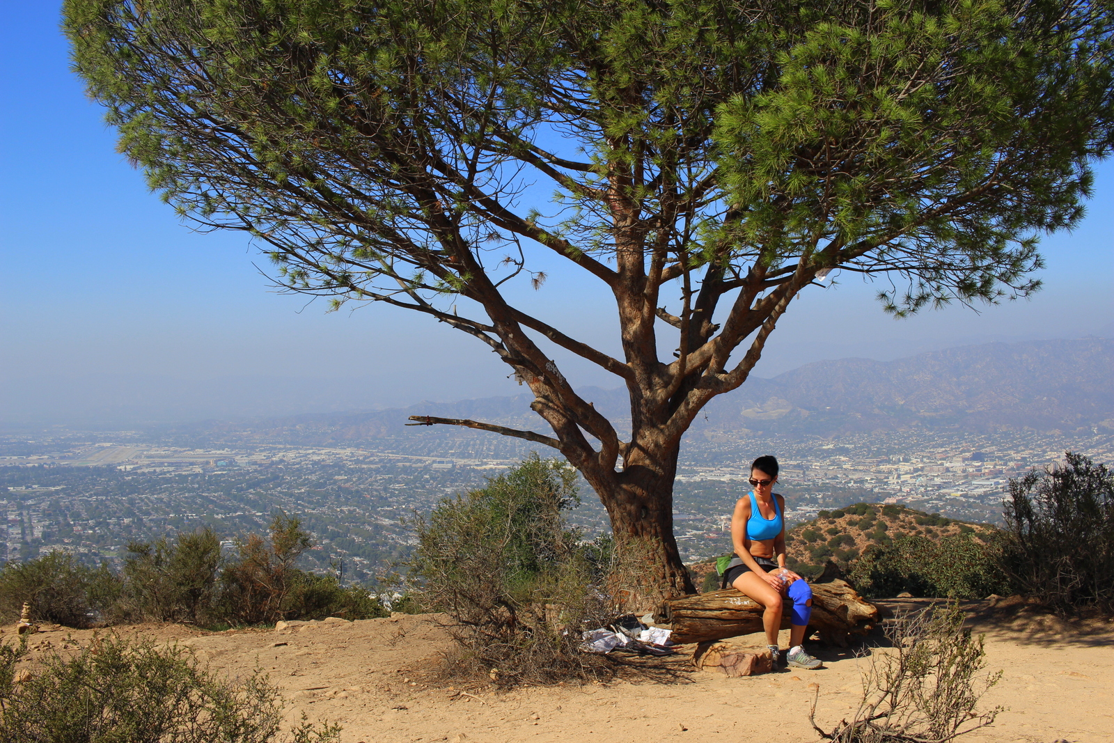
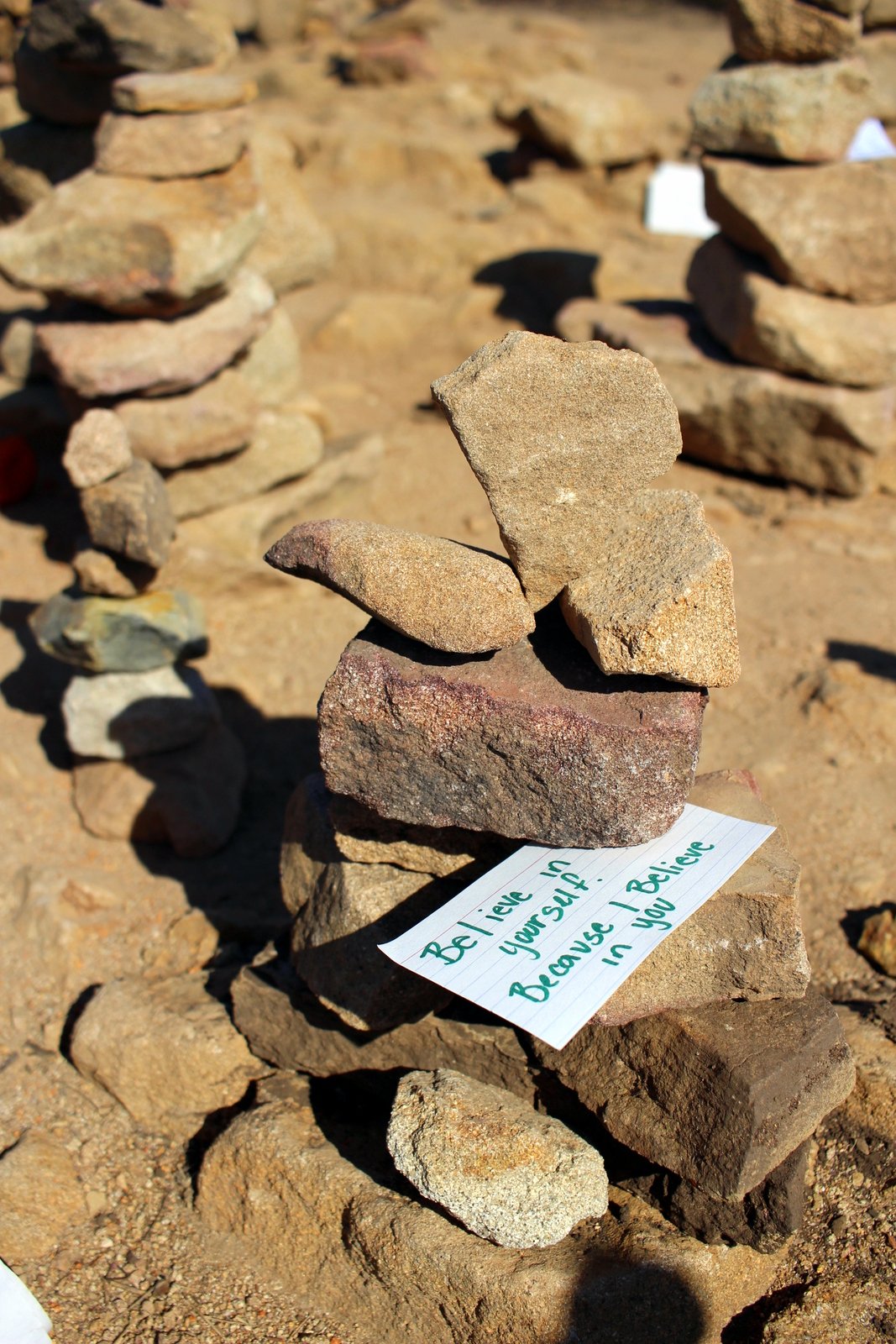
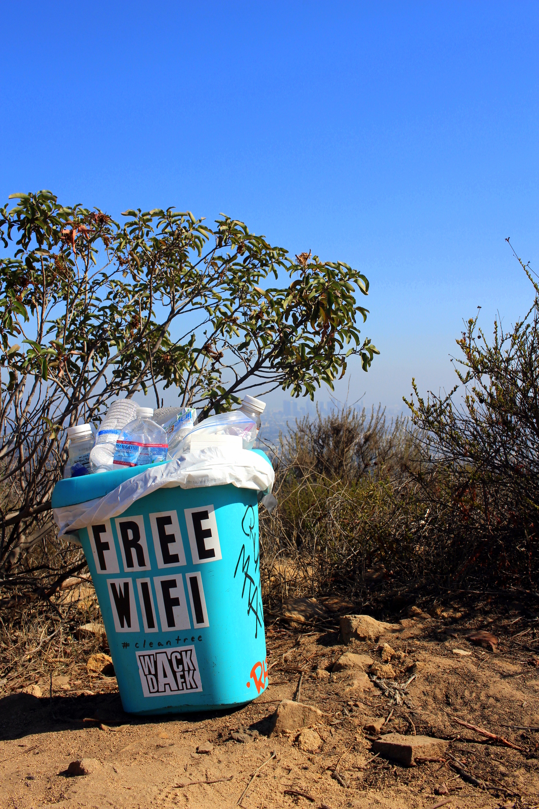
The hike was surprisingly rugged and steep. The first 3/4 of a mile had the majority of the ascent. I think it was somewhere close to 800 vertical feet in that span. A mile or so in, we made it to the Wisdom Tree, which has become somewhat of an icon in the region for being the only tree to survive a 2007 wildfire. Hikers leave all kinds of cairns and notes with wishes and hopes and dreams. There is also a geocaching box in which people write messages as well. And, of course, there's free wifi at the top.

After a brief water break, Maria and I continued. Maria hadn't made it to the Hollywood sign since her injury, and she was determined to make it today. I gave her my trekking poles, telling her that they were tremendously helpful in maintaining balance and redistributing weight as needed. Ahead was Cahuenga Peak and, slightly below the communications tower, the back-side of the Hollywood sign.

On the final half-mile along the ridgeline, Maria pointed out a few landmarks. To our left, there was a cemetery where a lot of celebrities were buried.

The hike had started out really hot. But up here, the wind kept us cool. We finally reached the top and got our first close-up of the sign--from behind.

The day was hazy, so you couldn't really see that far. But it was still great to see the scale of L.A.--this is a huge city!

Hikers can't really get any closer to the sign than this. There's a fence and excessive signage that makes this clear. There are security cameras all over the mountain, and even on the letters. Trespassing is an easy way to send a police helicopter your way. As much as I wanted to go see the sign up close, I wasn't about to tick anyone off.

We turned around and carefully descended back to the trailhead and our cars. I'd enjoyed having Maria for company, and I learned more about what she did in the area. Turns out she was an actress, comedian, and improv artist.

It was now late afternoon, and I had a couple hours to kill before meeting my next friend for dinner. I decided I'd drive around in the hills and see if I could catch a glimpse of the sign from the front. I drove slowly through Hollywoodland and finally caught it through some palm trees.

I continued and eventually found myself in Lake Hollywood Park. There were a ton of tourists here, and I looked behind and immediately knew why. There was a great unobstructed view of the sign.

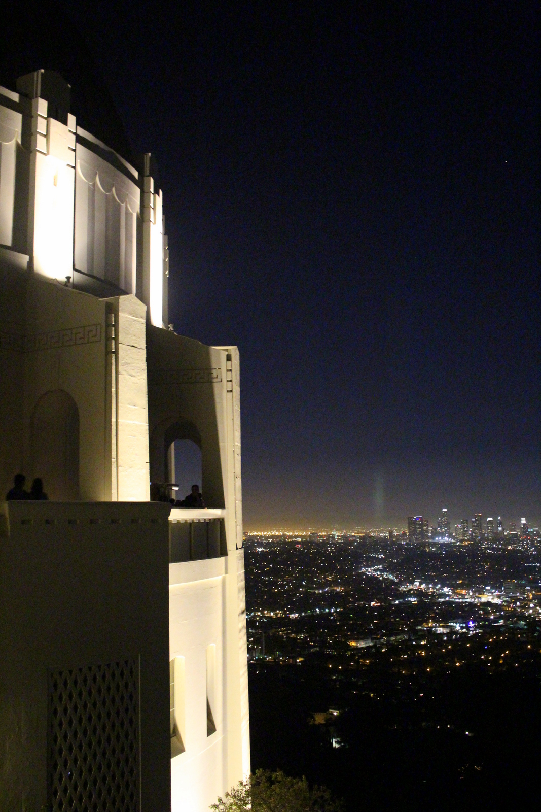
It was now almost 5 p.m., and I didn't want to take any chances with rush-hour traffic, so I headed towards Mohawk Bend, the evening's dinner spot. I met Caitlin H., a great friend from law school who was out here for the year clerking for a judge, and caught up with her. After dinner, we decided to head up towards Griffith Observatory, which is known for its panoramic views of the city.

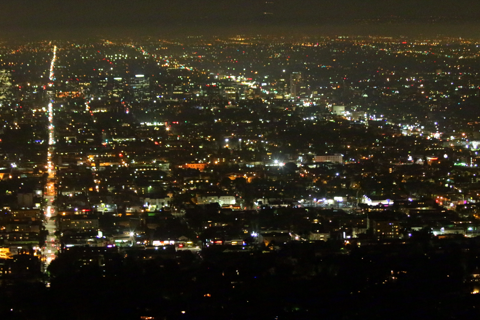
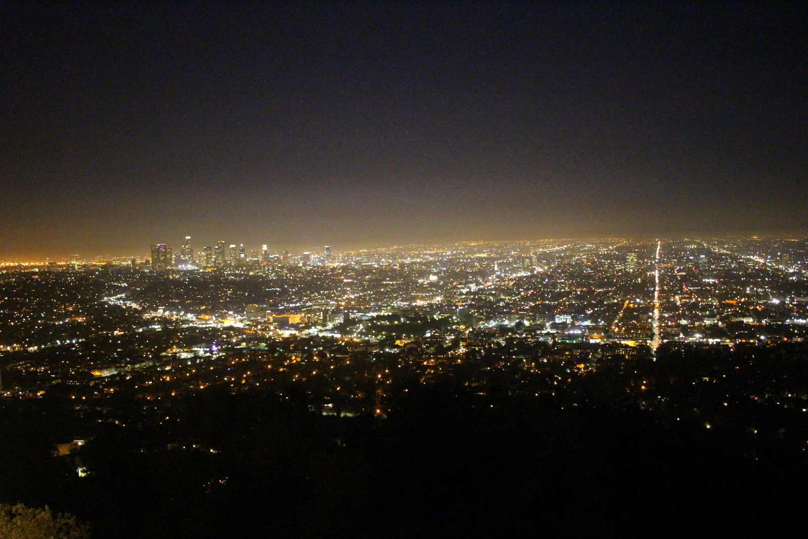
The views were great. I love seeing cityscapes at night. You really get a sense not only of a city's scale, but also its activity (measured by the intensity of light in various regions).

It was a clear night, and the moon was particularly easy to see. I managed to hold my camera steady (it helps to have a built-in image stabilizer) and capture a few clear shots.

We didn't realize that the observatory itself was much more like a museum. There were exhibits on the universe, space, the solar system, and everything else related to astronomy. By the way, it was 9:30 p.m. on a Wednesday night and it was absolutely packed.

The best views were on the viewing terrace. Everyone was taking photos there. Caitlin and I asked a tourist with less-than-steady hands to take a photo of us before we headed back to her place in Burbank.

My first full day in Los Angeles involved no running, but it was a refreshing break--one sorely needed especially as I head into what I believe will be my most epic 10-day block yet.

Day 26: Channel Islands National Park, CA by Wookie Kim

We were pulling away from the mainland. It was a strange feeling. When I think of "national parks" I don't think of islands. But I was en route to Channel Islands National Park, one of our island-based parks.

The Channel Islands are a set of eight islands off the coast of southern California, of which five constitute Channel Islands National Park. The only way to get to the park is by ferries that leave from the coastal cities of Oxnard or Ventura, or plane. I'd decided to take the ferry to Santa Cruz, the largest island. As we were leaving the pier, we came across a buoy and saw several resting seals (sea lions?).

The sky was overcast, so I was a little wary of my day out on the island. But as we progressed away from the mainland, the sky cleared up, and the water turned bluer. It was turning out to be a nice day, albeit a hot one.

Finally, after just over an hour, we arrived at Scorpion Beach on Santa Cruz. The water was crystal clear. (I would later find out that it was crystal clean, too.)

I began in the visitor center, and looked at the scale model of the island. My plan was to ascend out of the beach and descend back over the other side of the ridge into Smugglers Cove. I heard the beach there was beautiful--a perfect place to touch the Pacific Ocean for the first time on this trip. The route was supposed to be 7 miles out and back. Given that it was 11 a.m., and the boat back to the mainland departed at 4 p.m., every day-tripper on my boat decided to go on a shorter hike, on the other side of the beach. Alone, I began heading up the dirt road towards Smugglers Cove.

Within 15 minutes, I was up on top of the small ridge. I could see the ocean, as well as Anacapa Island, also a part of the park.

From there, I turned inland, following a dirt road. I was a bit surprised; I'd not expected the island to look this barren.

Eventually, I made it over the ridge and found myself looking into Smugglers Canyon. I'd now descend to Smugglers Cove, which was at the bottom of the v-shaped notch on the right edge below.

I love fast descents. This one was fast. The decline was relatively modest, but still steep enough to fly. The trail was mostly dirt, with very few obstacles. I cruised down into the cove. A few seniors from the University of Santa Barbara were there, playing in the surf. I'd seen the Pacific almost a week ago, but hadn't yet touched the ocean, so I decided it would be a great opportunity to swim (and cool off--it had been an incredibly hot traverse). I was a bit worried about swimming in the ocean, because the salt and sand greatly increases the risk of chafing. Ironically, that aspect of the dip turned out to be fine. Stupidly, in hopping on some of the sharp rocks, I split open the skin on the bottom of my foot on one rock. Thankfully, it was pretty shallow. I cleaned the sand out from under my skin, and hoped that nothing worse would come of that misstep. The water was refreshing.

It was now past noon. After snacking on some food I'd brought (Channel Islands is unique in that you have to bring everything you'll need--aside from a couple pit toilets and a water spigot, there are no facilities on the island), I decided I was going to try and reach Montanon Ridge, one of the high points of the island, and the perfect place to see 360-degree views. It was a hot, sunny day, so I decided I'd run the rest of the day without my shirt. Shirtless, I began the ascent out of Smugglers Cove and continued up the ridge. The ascent was not insanely steep, but it got more taxing the closer I got to the ridgeline. 

I finally reached the ridge. On the other side of the ridge was fog and clouds. I loved being high up and seeing the mist flow over the top of the mountain and dissipate on my side of the island. I looked back to where I'd come from.

It was now getting really hot, and I was also out of water. So I decided I'd head back towards the beach, rehydrate, and also spend the hour before the ferry left cooling off at Scorpion Beach. On the way back, I saw a couple island foxes foraging for food. They were super cute, and didn't really mind my presence.

I made it back to the beach and found that most everyone was gathered there. People were chilling on the shore, splashing around in the water, snorkeling, kayaking, or stand-up paddleboarding. My core body temperature had risen--I could really feel the blood pulsing through my veins--and I used this time as an opportunity for a cool bath in the ocean. It was the perfect end to a great day on the island.

We loaded up and left promptly at 4 p.m. The return voyage included a special surprise. The captain had mentioned he had seen a pod of dolphins on the way over here. We would try and catch them on the way back to the mainland.

Not 10 minutes into our trip, we spotted our first dolphins. I scrambled to catch a glimpse, thinking that it would be hard to see them. I slightly regretted not bringing any other lens but my 24mm prime lens, which is meant for landscapes and has no zoom. 

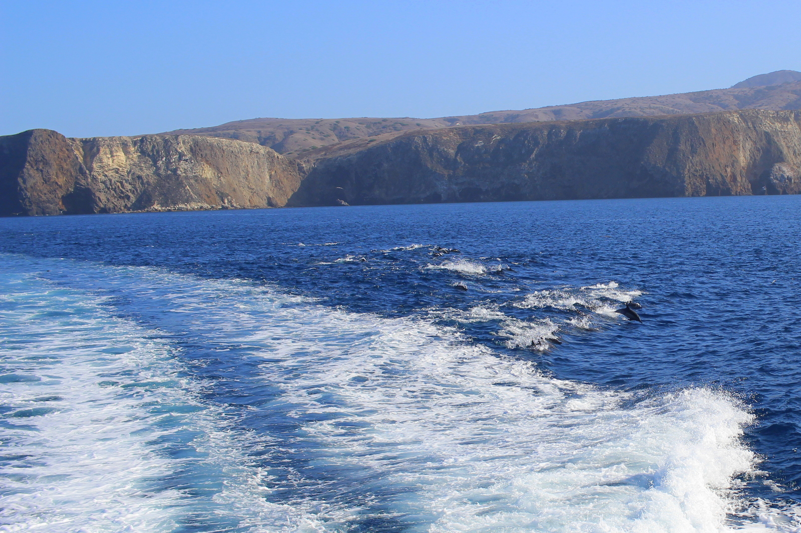
What I didn't realize was that we eventually swam right over the pod--and that the pod included roughly 1,000 dolphins! They were like a swarm around our boat. Seeing all these dolphins frolicking in the ocean around us really brought a smile to my face.

Things only got better. The captain said he would create a wake, and that the dolphins would surf in that wake. Sure enough, as the captain sped up, we could see the more athletic dolphins surfing the wake created by the ferry. They jumped in and out, in and out. Again, I was smiling.

2015-09-22 17.17.00.jpg

I love moments like these. The ones that are so memorable but were completely spontaneous and unplanned. I'd had absolutely no expectations that I'd see any marine animals on the boat ride. And I'd gone whale watching and whatnot before. But seeing the thousand-strong pod was one of the coolest things I'd seen while on a boat.

We eventually docked in Ventura just past 5 p.m. I got into my car and booked it into Los Angeles. I was heading in to the city to stay with my friend, Molly Mitchell (of @meandmyboifriend fame). The traffic was wretched. I realized that L.A. was not the city for me. It was so spread out, and so car-filled, that I felt lost the entire time I was driving into the city. I was thankful for Google Maps.

After showering at Molly's (and realizing that running shirtless was a bad idea!), we headed out on Sunset Boulevard for burgers and, most importantly, churro ice cream sandwiches from Churro Borough. They were incredible.

It was another fulfilling day, this time in L.A. (rhyme intended!).