Day 17: Boise, ID to Yakima, WA by Wookie Kim

Today was a driving day. I covered almost 400 miles from Boise, Idaho, to Yakima, Washington.

All along, I'd planned to spend today driving, not only to cover a lot of distance, but also to rest up for what I was hoping would be an uncomfortably long day on the 93-mile Wonderland Trail that encircles Mount Rainier. Specifically, I was thinking about doing a one-day 30-to-35 mile out-and-back.

But that plan changed. I have a cold. It's a minor one. But it's still a cold. And I can't risk testing my body's outer limits in this condition. So I've scrapped my plan. Instead of setting a specific distance target, I'm going to compromise by setting a time target. I'm planning to spend roughly 2.5 to 3 hours running out on the Wonderland. I'll then have plenty of time to get back--slow if I need to. It will still be a long day, but I won't be beholden to any specific distance.

I spent the first part of the drive annoyed by the change in plans. I really wanted to see as much of the Wonderland Trail as possible. But I quickly got over this feeling of resentment. I focused on just getting to Mount Rainier ASAP.

The drive was actually quite pleasant. There were few cars on the road. The route also followed the Oregon Trail, and I spent most of the day wondering how the early settlers traveled by oxen-pulled wagon across this dry expanse. It was really hard to grasp.

I also saw a vehicle from the 1960s, cruising along at 50 mph on an 80 mph highway. It was a sight to see.

When I stopped for lunch, I decided that I wasn't going to make it all the way to Mount Rainier National Park. More precisely, it wouldn't make sense to drive all the way there and try and find a campground in the dark. I decided I'd instead look up lodging options in Yakima, the city just outside of the park. I found an absolute gem on Airbnb.

The price? $60. Unbelievable, right? (This is partly why Airbnb is revolutionizing travel. Every Airbnb I've stayed at has been exceedingly memorable and surprisingly affordable.) The hosts--John and Barbara--were incredibly friendly and welcoming. I felt right at home. To top things off, they have over half a dozen cats, and two dogs to play with. After a couple weeks of camping, it was nice to have an evening unwinding in a place like this.

This kitten likes my backpack.  

This kitten likes my backpack.  

Tomorrow, I hit Mount Rainier National Park.

Day 16: Craters of the Moon National Monument, ID by Wookie Kim

I could see why the pioneers on the Oregon Trail avoided this place. For miles in every direction, all I could see was black lava. It was dark, desolate, and dry. I was at Craters of the Moon National Monument, in the Snake River Plain of Idaho (AKA middle of nowhere).

One of the beauties of this trip is that I cast my net widely, and decided to include national monuments and other sites operated by the National Park Service as destinations. We have 59 amazing national parks, but it's too easy to forget that we have hundreds if not thousands of other sites that are still protected by the National Park Service in some way. In fact, many of our national parks were once mere national monuments, before they were elevated to that grand "national park" status (I want to learn a little bit about how the designation system works--I don't really know how it all works).

I began the drive over from Alta, Wyoming, a little bittersweet. I was driving away from the mountains--the location of several challenging days. As I proceeded west, all I could see were plains. Pretty soon, I saw a small mountain off in the distance. I forget the name of it, but the early pioneers also used this as a beacon as they headed west along the Snake River.

I told the park rangers that I wanted to run easy today. Something with very minimal elevation gain (or loss). I'd spent 3 hard days in the mountains--climbing over 10,000 vertical feet--and my cold was getting worse. I needed an easy day. The ranger had just the trail for me: the Wilderness Trail. It was 4.5 miles out to the end on flat, soft, cinder, and very little elevation change. This was also in the Craters of the Moon Wilderness Area--the first designated wilderness area in our national park system. I'd have unrivalled solitude back here.

On my way over to the trailhead, I marveled at the lava that surrounded me. There were also cones and mounds that had sprouted out of the earth. I was glad I wasn't climbing any today.

I reached the trailhead, and read up on everything I needed to know. With my cold, I wanted to stay hydrated. I topped up my 100-oz Camelbak again, even though at 1 p.m. it was only in the high 70s--relatively cool for an inhospitable place like this.

And just like that, I was off! The beginning of the run had me go into a pretty thick lava field. This was part of a shorter loop that I could see many families liked. It was definitely what one would imagine when one thinks about running through a lava field.

Pretty soon, though, the landscape changed. The path was wide cinder--almost like a red carpet. It sure felt like one; the cinder absorbed my footstrikes and the absence of any obstacles made for easy running. This was just what I needed after several hard days in the mountains.

I was able to pick up a solid, steady pace--just over 9-minute miles. I followed the red carpet out into the wilderness. That red carpet disappeared from time to time. Following the trail was only slightly harder. But there were cairns to follow, and the path was pretty clear.

This wilderness area was certainly not what I imagined when I thought of Craters of the Moon. I saw very little black lava. But the feeling of solitude was immense. I was all by myself in a vast desert-like environment. Every now and then, I'd see patches of black lava, which reminded me where I actually was.

After over 4 miles, I was confused by why I hadn't reached the end of the trail. Had I gone off track again? I rounded a bend and saw a cinder mound off ahead of me. I figured that that was Sentinel Butte, the end of the marked Wilderness Trail.

As I got closer, I realized that this must be it--the mound rose up out of the plain, providing a perfect vantage point for a sentinel to see miles in every direction.

I noticed a human-trodden switchback trail up the butte. I figured I'd follow it up. It was steep and slippery, the lava rocks were like little ball bearings. Every step I took, my foot would slide back halfway down the mound. One step forward, half step back, one step forward, half step back. Here, you can kind of see the incline.

The view from the top was pretty spectacular. I found a father-son duo resting at the summit as well.

image.jpg

What was particularly pleasing about the view was the juxtaposition of all the different colors and environments. You had red cinder right in front of you, black lava interspersed with yellow and brown grasses, occasional greenery, the brown mountains off in the distance, and the clear blue sky above. Really, it was unique.

image.jpg

My feet took a break too. ​

image.jpg

On the way back, I grew tired. It was getting hot. I began rationing my water. I drained the 100-oz reservoir right before returning to the trailhead. The trail had been nice and flat. But I was beat.

Almost back to the trailhead.  

Almost back to the trailhead.  

Salt from my sweat.  

Salt from my sweat.  

I wasn't about to leave Craters of the Moon just yet. I'd been told about the caves that one could explore. I decided to take my headlamp and head into Boy Scout Cave.

image.jpg

It was pretty scary in there. There was no lighting except the light that you brought in. And there was no guide except a railing that you could hold onto as you passed through the initial crawl space. Inside, I looked around, like a cave explorer, using my headlamp for light, and also occasionally my iPhone. There were 4 other people inside with me. I led the way.

image.jpg
image.jpg

It was also very cold inside. We could see ice formations on the cave floor. Slippery! My hands began to get numb. Certainly, this was a nice respite from the dry heat on the surface. After reaching the end, we turned around and headed to the surface. It was hot--really hot.

Just outside the cave entrance.  

Just outside the cave entrance.  

image.jpg

And then, I was gone. I had many miles to cover. I drove straight west on route 20 straight into the setting sun. It was somewhat monotonous, but I enjoyed tracking the sun as it set off in the distance.

image.jpg
image.jpg

Eventually, it grew so red that I had to pull over and take a photo of it with my zoom lens.

image.jpg

And so ended another beautiful day exploring our national parks.

Day 15: Grand Teton National Park + Caribou-Targhee National Forest by Wookie Kim

Life is lived for these moments. Not the ones that you put in your resume, or find in a history book, but the ones you'll remember forever, and tell your grandchildren about over and over again until they beg you to stop. My moment today was summitting Table Mountain, a mountain on the Idaho side of the Teton Range, just a few miles west of the Grand Teton.

I woke up in Colter Bay in Grand Teton National Park. I'd slept like a rock. I'd been battling a minor cold for the last couple days, and, combined with the vertical I'd gained over the last few days, my body needed rest. I packed up my tent, and was too lazy and cold to fire up the Whisperlite. Instead, I went to the restaurant that was located within this campground (no wonder I paid $24!). I chose the buffet option, and proceeded to eat everything.

I then hit the road for the trailhead. Table Mountain's actually was outside Grand Teton National Park, on the Idaho side of the range, right near the Targhee ski resort. On the way down to Jackson, I saw my first sunrise views of the Grand Tetons. 

The Grand Teton. 

The Grand Teton. 

Apparently, what makes the Teton Range so spectacular is that it lacks any foothills; the mountains rise straight up from Jackson Hole. I stopped by the roadside over and over again to take photos.

image.jpg
image.jpg

Eventually, I made it the 30 miles to Jackson, a town that has a special place for me. For spring break my senior year of college, my best friends and I spent a week skiing at Jackson Hole. It was the best week of skiing I've ever had. Entering the town, I took a photo of the antler arch in the town square (there was some photo shoot going on). 

image.jpg

From Jackson, I crossed over the Teton Range and into Idaho. 30 miles later, I found myself on a gravel road ascending on Alta Ski Road back east towards the Teton Range. I could see the Grand Teton towering in the distance. 

image.jpg

After 6 bumpy miles, I made it to the trailhead and geared up. I wasn't taking any chances this time. I filled my Camelbak to capacity--100 oz--and topped up my reserve handheld bottle with Tailwind. I also had an assortment of snack items, including KIND bars, and Justin's almond butter (thank you for fueling me!).

image.jpg

And then I was off at almost exactly 11:30 a.m. There was no warm-up involved. The trail went immediately into switchbacks in a thick forest.

image.jpg

After about a half-mile of ascending, I finally came out into a flat meadow, and a sign indicating that I was in Caribou-Targhee National Forest. 

image.jpg

I'd told myself that with the 5,500 feet of vertical I'd ascended in the previous two days, I needed to start the day conservatively. I made it a point to cool my jets and not run or even power-hike, even though I felt strong. I came through the first mile in just under 20 minutes. 

As with every hike, the scenery was already changing.  

image.jpg

I trudged through the meadow and through forests, sometimes crossing over a stream on logs. 

image.jpg

Soon, I could see my destination on the horizon. Table Mountain is the little hump on the right side, under the lens flare. I realized I still had a long way to go before I got there. 

image.jpg

I continued pressing through the meadow. The trail started switchbacking out of control. I kept my pace conservative, and tapped out a rhythm with my trekking poles. I didn't breath hard once. 

image.jpg

Pretty soon, the ridge line rose above the tree line.  I'd be ascending up to the ridge on the right side and then making the final climb up to Table Mountain (out-of-picture to the left).

image.jpg

The meadow switchbacks wwere relentless, but the scenery was nice. 

image.jpg

The trail carved a clear path through the meadow and up to the ridge. 

image.jpg

I was almost out of the meadow area when I took a short break to refuel, rest the legs, and take in what I was about to conquer. 

image.jpg

Finally, I ascended the last switchback and was out on the exposed ridge. 

image.jpg

The trail followed the ridge line around. One mis-step and you were in for a serious tumble down into the canyon. 

image.jpg

This was the homestretch. I'd come around the ridge and the trail was practically leading straight to the summit. Adrenaline pumped again, and I actually decided to run a little just to see how I felt. I felt good, so kept at it. 

image.jpg

I looked over to my right and saw more of the Teton Range. 

image.jpg

I stopped running when the dirt trail turned to rocks. I was now trudging steadily upwards. 

image.jpg

At one point, I looked back to see how far I'd come. Basically, the switchbacks ended at the very end of the ridge line, to the center right of the photo. 

image.jpg

At some point, Table Mountain dropped out of sight. But I never lost sight of Grand Teton. Its summit is over 13,000 feet. 

image.jpg

The end of the forested ridge area meant the rocky, exposed final stretch. I was probably less than a mile away here, but the incline was challenging, and the terrain made moving difficult. 

image.jpg

There were plenty of hikers trudging along here. I passed by a half dozen. They were winded, and stopping every now and then for breaks. Again, I must be getting fit, because I didn't really need to stop at all.  

Several people were also descending, including this canine friend, who was a pleasure to play with as a break. 

image.jpg

Perhaps as an in-your-face gesture by Mothr Nature, about a half-mile from the top was a rocky minefield. These rocks were loose, and made for very treacherous footing. Again, I was grateful for my trekking poles, which made it relatively simple to cross.

image.jpg

And then I was there--the final half-mile. Despite the photo, it was impressively steep. For the first time all day, I resorted to taking 5-second breaks about every minute or so. I was also pulling down on my poles with my arms with full force, to lessen the load on my legs. I was trudging and trudging. 

image.jpg

I looked back down the ridge I'd come up. In the distance were several people I'd passed. Specks. 

image.jpg

And then I made it! To the summit of Table Mountain, 11,106 feet above sea level. Certainly not the tallest point I'd ever reached, but one of the most impressive vistas I've ever seen. From the table-like summit, I stared directly east where, just 2-3 miles away, were the Grand Tetons. 

image.jpg

The photos are deceptive. I'm actually standing on the edge of the summit here, even though it looks like I could walk back onto the dirt mound. That's thousands of feet away. 

image.jpg

Looking to the northeast, I could see Cascade Canyon, which I'd partially hiked into the day before (to reach Inspiration Point). I was finally getting a sense of the lay of the land. This area of the country is impressive. 

image.jpg

Other people at the summit explained the names of all the mountains. I just looked out at the rest of the Tetons in awe. 

image.jpg

These four from Idaho Falls were fun to talk to. One of them gave me the rest of her sandwich. It was delicious--exactly what I needed.  

image.jpg

To the north, you could see more of the Teton Range and also part of Yellowstone. 

image.jpg

The people at the top were all locals, and all had been up here many times. One woman brought a kite and tried to fly it. It was too windy. 

image.jpg

After chatting with everyone at the top for 45 minutes, I was beginning to get cold. I was wearing nothing but short shorts and a t-shirt (even though I had tights, a tech fleece, and a rain shell in my pack). I decided to descend. From the ridge line, I looked down at the upper half of the trail I was about to descend on.

image.jpg

It had taken 2:38 to reach the summit. I reached the trailhead in 1:27. Let's just say I ran down the mountain when I could (which was not very often). 

It was only 4 p.m. I thought the day would've taken at least until 6 p.m. (again, I can't trust the estimates from the guides I read--one said 11-12 hours, and 6-8 for strong hikers). I was, however, feeling tired, and wanted to chow down. The hiker with the dog had finished just a minute before me, and he recommended a bar in Driggs, the town from which I'd come up to the trailhead. 

While eating a buffalo burger, I decided that I deserved a shower and a hotel bed. I began searching on my phone for availability. But I discovered that all lodging options within 100 miles of Jackson were full! I was stunned. Labor Day was behind us, yet this place was still teeming with people. 

I was a little bit panicked, because I really didn't want to spend another night camping in a row. I asked the bartender if he had any ideas. It turned out that one of the servers managed a ski property that was vacant at the moment. For $90, I could stay there. I immediately pounced on the option and headed to the place.

image.jpg

Once again, I found myself driving east towards the Teton Range. 

image.jpg

It just so happened that this ski studio had a hot tub, with a view of the Grand Teton. After a long day (and set of days), I decided to treat myself to a relaxation session in the hot tub while the setting sun lit up the Grand Teton in reddish hues. 

image.jpg

After washing up, I opened up the little medallion that the kite-flyer at the summit had given me. I'd conquered Table (Rock?) Mountain. Even if this medallion disappears into the abyss that is my knick-knack drawer, I'll forever have the experience of this day etched into my memory. And, for that, I'm thankful.

image.jpg

Day 13: Yellowstone National Park + Sepulcher Mountain by Wookie Kim

The can hissed and released a powerful, thick, reddish-orange plume exactly as it had been advertised. I was near the bottom of Sepulcher Mountain, in the northwest corner of Yellowstone National Park, and I was testing out my newly acquired bear spray. Every park ranger I spoke to seemed to think it was a bad idea to go solo in the backcountry in bear country. I wasn't about to not go. So the least I could do was be prepared.

But let's rewind to the beginning of the day. I woke up determined to have a better day than the day before (which I've already described as not so great). I'd decided not to run Electric Peak, but I had high hopes for the alternate: Sepulcher Mountain. This summit wasn't as high, but the ascent involved 4,000 feet of elevation gain over the course of 5 very steep miles. Thankfully, I'd chosen a loop, and the 7 miles back from the summit would be easier on the legs.

I made a quick breakfast (Birch Benders pancakes, obviously), before packing up and heading back down into the valley through Gardiner, the northern, Montana-based gateway to Yellowstone.

Gardiner is exactly what one might picture when one imagines a frontier town.

Gardiner is exactly what one might picture when one imagines a frontier town.

I made my way up the valley into the park and immediately to the Indian Creek campground--the site that had filled up by the time I'd arrived the day before--and snagged one of the open sites. Hah, I had a campsite in the park! I quickly set up my tent, changed into my gear, and headed to Mammoth Hot Springs, where I parked my car by the trailhead. I suppose the hot springs were pretty cool, too.

Mammoth Hot Springs.

Mammoth Hot Springs.

At around 11 a.m., I hit the trailhead. Immediately, I was in a deep, dark forest. Because I'd seen no one for the first 30 minutes, I figured now was a good time to test my bear spray. It was easier to deploy than I expected. Nevertheless, I practiced quick-drawing it from my fastpack's chest pocket. I'd heard plenty of stories of people getting mauled, despite having bear spray, because they either did not have it readily accessible (i.e., it was in their pack) or did not know how to deploy it immediately. I wasn't about to make that same mistake. I also knew that bears can run 50 yards in 3 seconds, so there would be no room for error. I practiced my quick-draw. I got pretty good at it. I had no way of timing it, but I think I had the safety off and pointed at the ghost bear within 1 second.

As I continued ascending through the forest, I grew excited. This was my first serious climb (though I suppose Harney Peak was pretty serious, too), and I was eager to experience my first epic view. Barely a mile in, I'd already passed through the forest and come into a burn area--the dead trees littered the meadow, which had no shade.

The ascent through the burn area was on pretty steep switchbacks. At one point, I looked back and saw how far I'd already climbed.

I got into a nice rhythm with my trekking poles. On the semi-steeps, I was able to make quick progress with one pole planted with each step. On the super-steeps, I double-poled up. (After using the Black Diamond Carbon Zs for the Twisted Branch, and the first 12 days of this trip, I simply can't imagine doing any serious trails without them.) Soon, the burn area was behind me, and I was back into a forest, this time on a ridge line.

I felt totally at ease throughout. It was a cool day, probably in the mid 60s, but windy enough so that it felt much cooler. So there was no worry about heat. Before I knew it, I was out of the forest, ascending very steep meadows. And then I saw my first glimpse of what I'd climbed by looking over to the northeast. In the valley below was Gardiner. You can almost see the little campground I slept at last night, by the creek to the upper-right of the picture.

Getting to see views like this is one reason why I run. The excitement grew. I knew I was less than a mile from the summit, but the slope felt like it only got steeper. I plodded along, still keeping my heart rate under control (surprisingly), and just chugging along. I then saw my destination through a gap in the trees.

I pushed for a few more minutes, before I came to the final ridgeline leading to the summit.

From here, it was all adrenaline. I crushed that last half mile or so to the summit. I'd made it to the summit in under 2 hours; if I'd wanted to, I could've finished the entire loop in 4. Yet, the park rangers had noted how "strenuous" this hike was, and how it would take 6 to 8 hours. I guess I'm in decent shape. When I reached the summit, I took some photos, emptied my shoes of rocks and sand, ate a KIND bar for a summit lunch (of course, this was not the only food I ate--I'm religious about eating ~200 calories every 45 minutes), and simply soaked it all in.

After spending around half an hour, I was ready to descend. But before I did, I looked over to my west and saw the peak that I'd originally planned to hit--Electric Peak. 

It was so grand. Given how easy Sepulcher Mountain had been, I had a pretty good feeling that Electric Peak would've been entirely doable. But I was still ultimately okay with not having made the attempt. I'm glad to have gotten my feet wet on solo hiking in bear country with something a little closer to the rest of humanity.

Now it was time to descend. Interestingly, the scenery on this side of the mountain was entirely different. It was mostly grassy meadows. Given that I could see for hundreds of yards, if not miles, I decided there'd be no risk in running the descents in the open fields. The only bears that could be hidden within were of the gummy or teddy variety.

When I was about 9 miles in, I reached an obstacle: a bison in my path. This had happened before. But this time, I was alone. I opted for the high ground, over and around him. He continued munching on grass while I tiptoed past him and back onto the trail.

Surprisingly, with 3 miles to go, I was out of water. One of the hardest things about rationing water using a Camelbak system is that you never know how much water you have left. I'd gone through the 70 ounces I started with way too quickly. I knew I had another hour at least, and it was getting hot in the valley. Most importantly, I had plans to do another serious climb the next day, and I didn't want to come out of this one dehydrated.

Thankfully, I'd brought my Sawyer water filter with me. But where was the water? As I descended, I finally came across a small stream. I dipped my water pouch into the water, screwed on the filter, and squeezed out some cool, clear creek water. It was so refreshing. It felt good to know that I could safely drink water (assuming I could find it) going forward.

The rest of the hike was uneventful. I descended back through cool forests. I let my bear bell jingle, and every now and then I hooted or yelped or ha-ha'ed into the forest to alert any bears to my presence. It all seemed stupid, but I'd rather seem stupid than accidentally ambush a bear and get mauled.

I popped back out by Mammoth Hot Springs. In 4.5 hours, I'd done the complete loop to the summit, around the other side, and back. What a day.

Wait, the day wasn't over! It was only 3:30, and there was plenty of sunlight left. I decided I'd do a driving tour of the upper portion of the figure eight-shaped Grand Loop Road. Simply put, Yellowstone is breathtaking. The focus for this segment of my driving tour was on the Grand Canyon of the Yellowstone. I stopped at all of the lookout points. Eventually, the sun began to set, right as I was making my way back to the campsite at Indian Creek that I'd managed to snag. I grinned when I saw that the "FULL" sign near the turnoff. Here are some photos from my driving tour in the late evening.

Day 12: Yellowstone National Park, WY by Wookie Kim

It was bound to happen. Today was my first bad day of the trip.  Two things went wrong. I couldn't get a campsite inside the park. And I learned that I wouldn't be running Electric Peak--the tallest mountain in the Gallatin Range--as originally planned.

I left Sheridan, Wyoming, a town just to the east of Bighorn National Forest, in the late morning. I was headed for Yellowstone National Park. I knew I needed to get there ASAP if I wanted to snag a campsite. Aside from the fancy lodges, and some privately operated sites, all of the park's campsites are first-come, first-served. If you're not there early enough, you'll miss out. Given that Labor Day weekend was over, I expected that  the number of visitors in the park would have subsided somewhat. I was wrong.

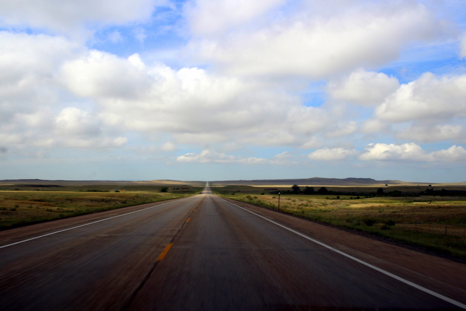
Let's start with my drive. I had almost 300 miles to cover, including 60-some odd miles on a scenic byway through Bighorn. I completely underestimated how long the drive would take--and paid the price. 

I departed Sheridan at 10:15 a.m., after looking at the Yellowstone campground website, which has live updates on each site. Two campsites had already filled up by 9:30 a.m. But I saw that there were still 5-6 other campsites that had availability. The website helpfully also shows the time at which a given site filled up on the previous day. Because I was planning to run Electric Peak in the northwest corner of the park, I looked at the campsites in that area and noticed that most of them hadn't filled up until late in the afternoon yesterday--and that was Labor Day.  So I figured I'd be safe if I arrived in the early afternoon.

But I ended up moving very slowly. I guess part of my determination and focus--my with-it-ness--was gone today. I just took it easy, way too easy. I made frequent stops, to fill up gas; for a long (and delicious) lunch in Greybull, another frontier town; and even to put my car through a wash for 15 minutes (my car was gross). In Cody, the last major town before entering Yellowstone from the east, I stopped at an outdoors store to pick up bear spray. And when I began the drive into Yellowstone, I stopped at Buffalo Dam to take photos and just see the engineering marvel first-hand. 

All of this meant that I arrived at the east entrance to the park just before 4 p.m. I hadn't had cell signal for quite some time, so I didn't know what the status of the campgrounds was. But right at the east entrance was a board with all of that information. To my dismay, almost all of the campgrounds were already full! I couldn't believe it. I was, however, relieved to see that Indian Creek, in the northwest corner, still had vacancies. I asked the ranger at the entrance what he thought my chances were. He said he had no way of knowing, but that if I was serious about snagging a spot, I should head there ASAP. 

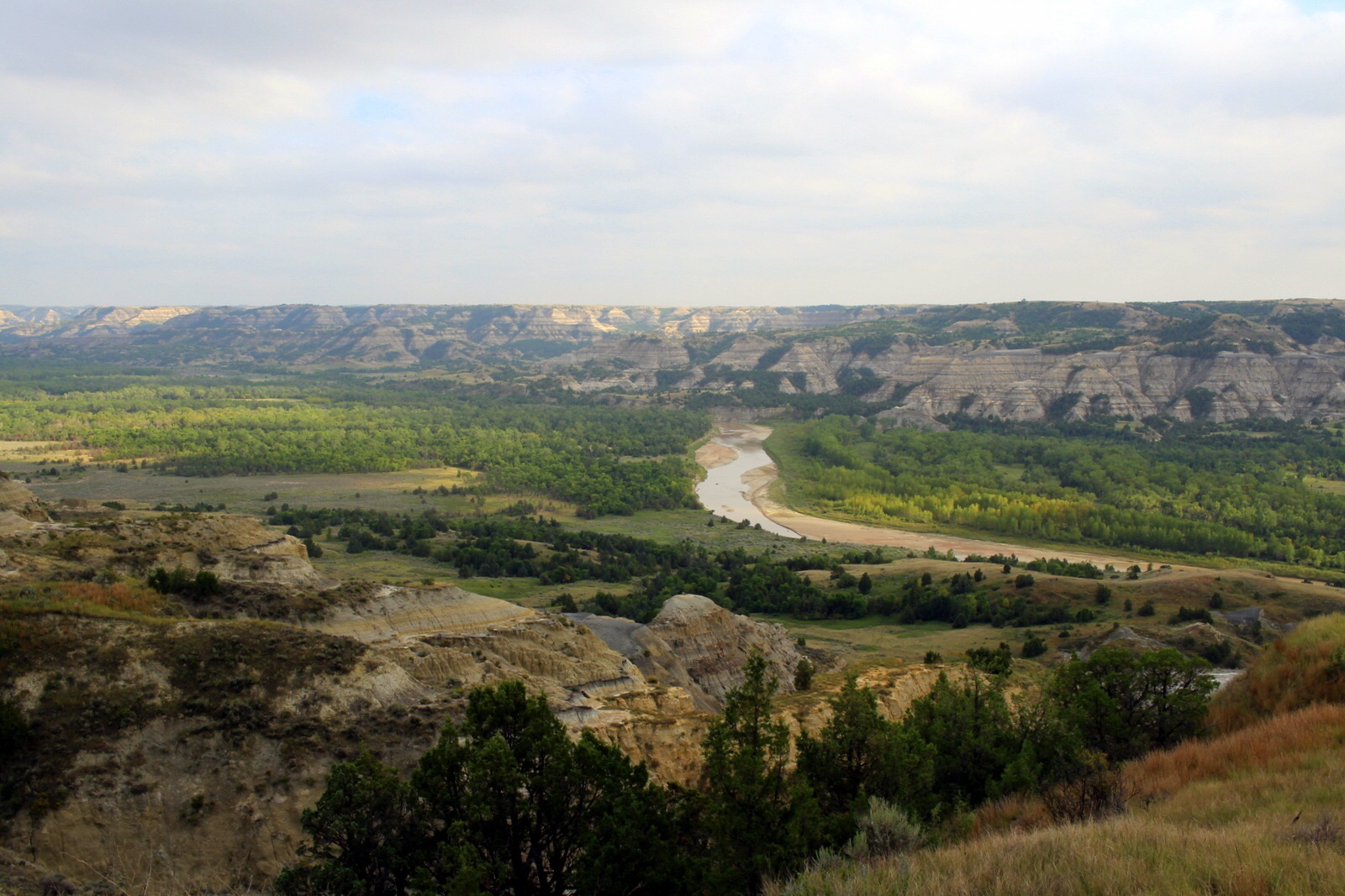
I did that--or tried to. Yellowstone is a massive park. It's larger than the states of Delaware and Rhode Island combined. Getting from the east entrance to Indian Creek is almost 70 miles of windy 35- to 45-mph roads. And the Grand Loop, the figure-eight road that connects the major regions of the park, was packed with cars. Moving quickly was impossible.

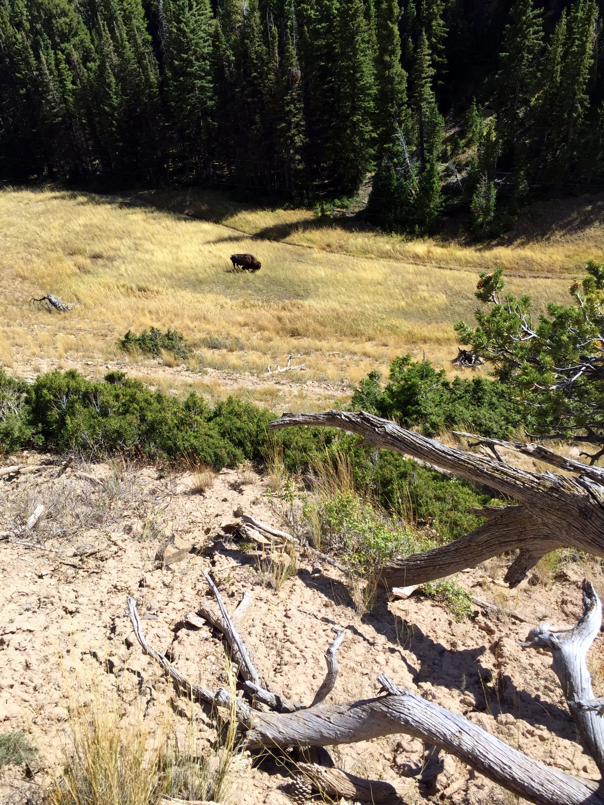
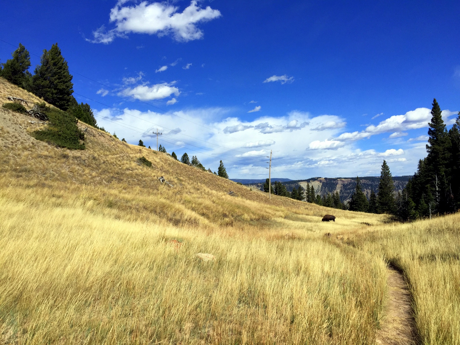
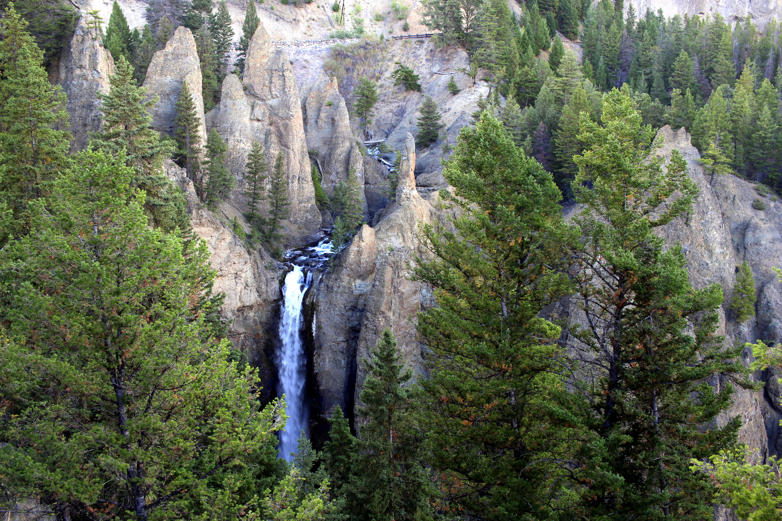
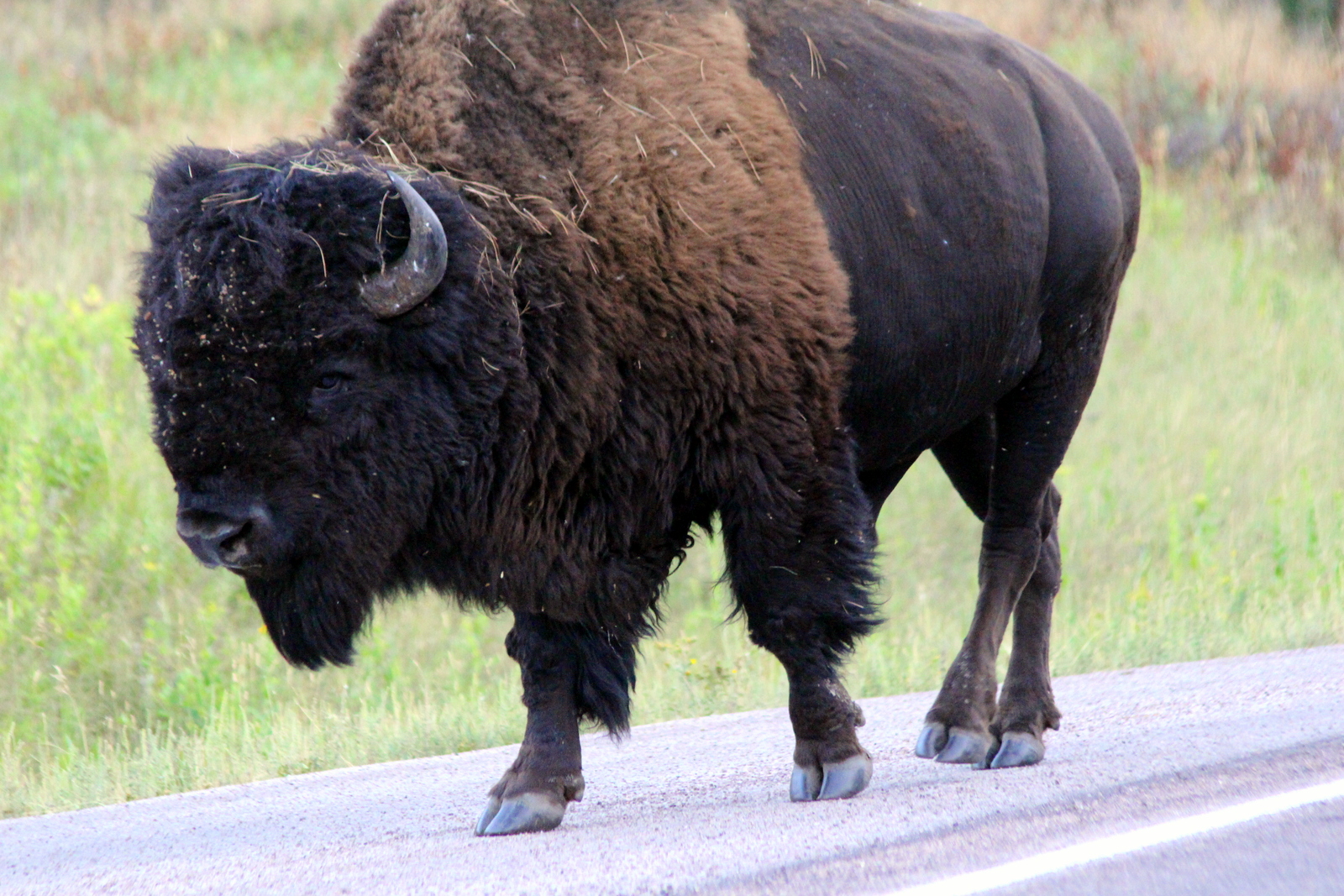
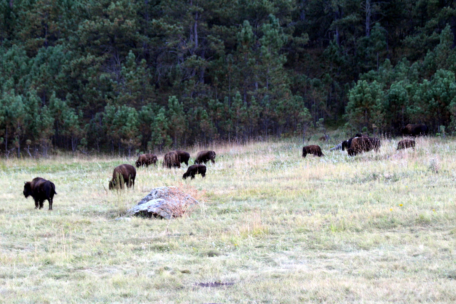
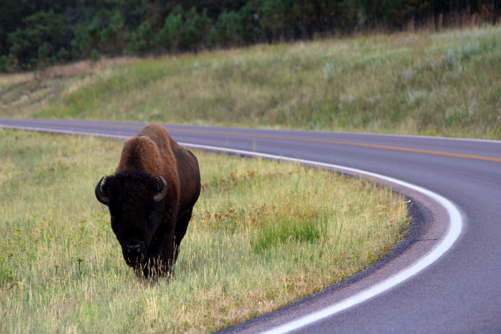
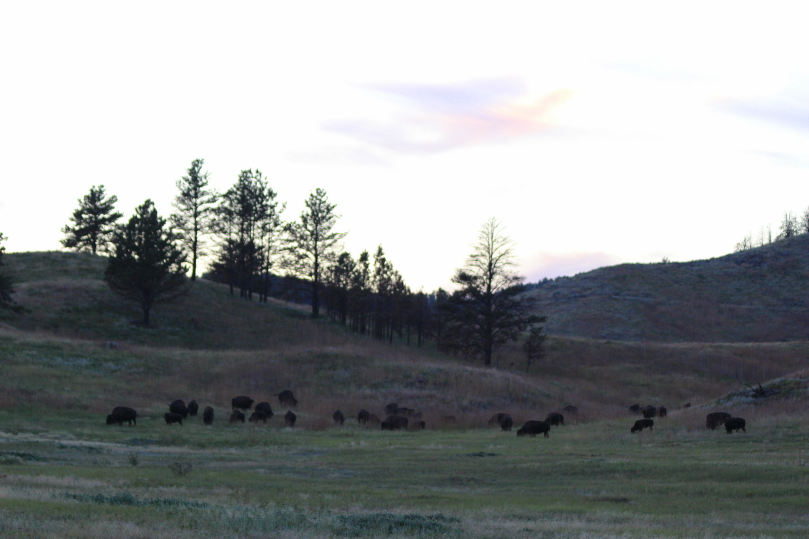
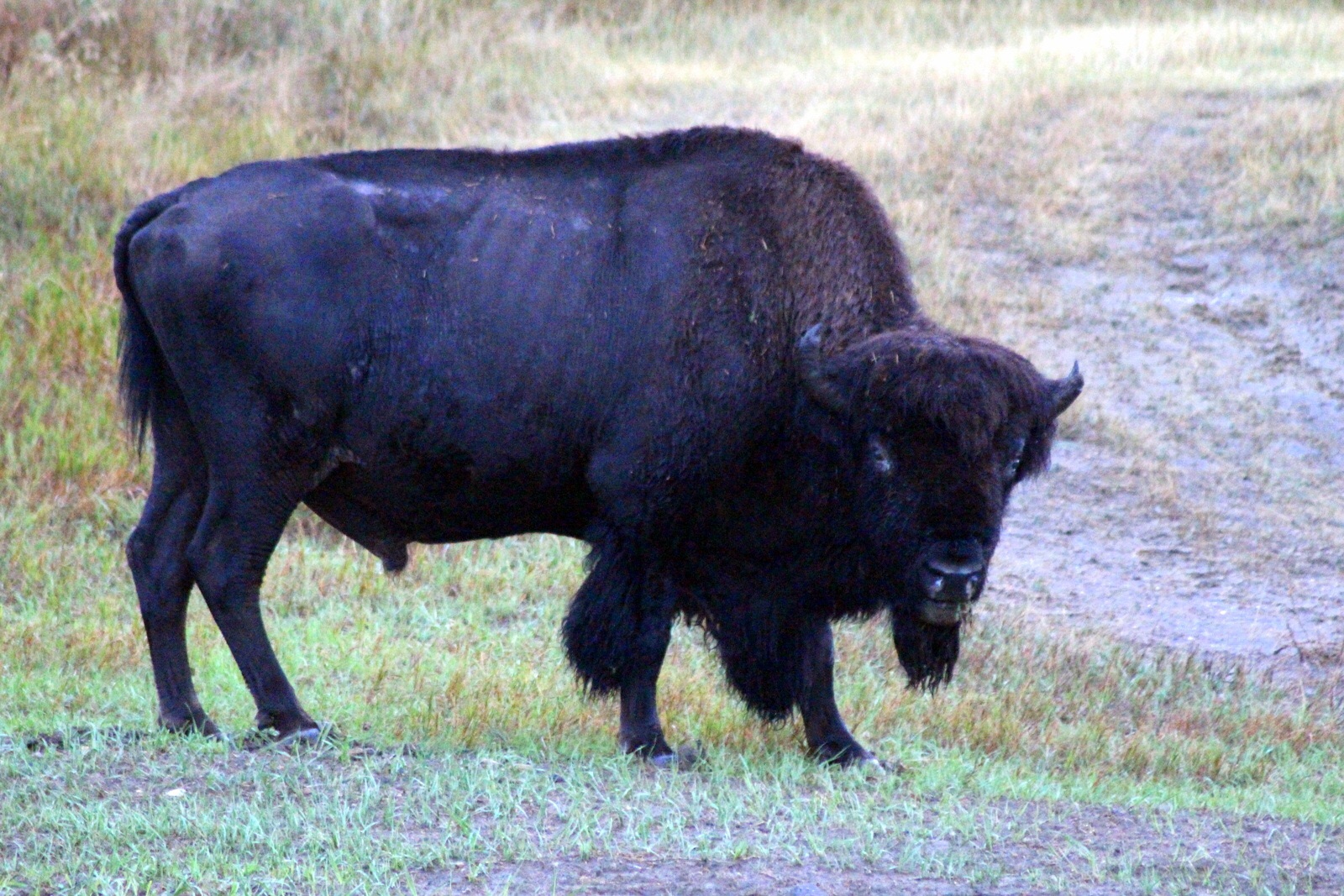
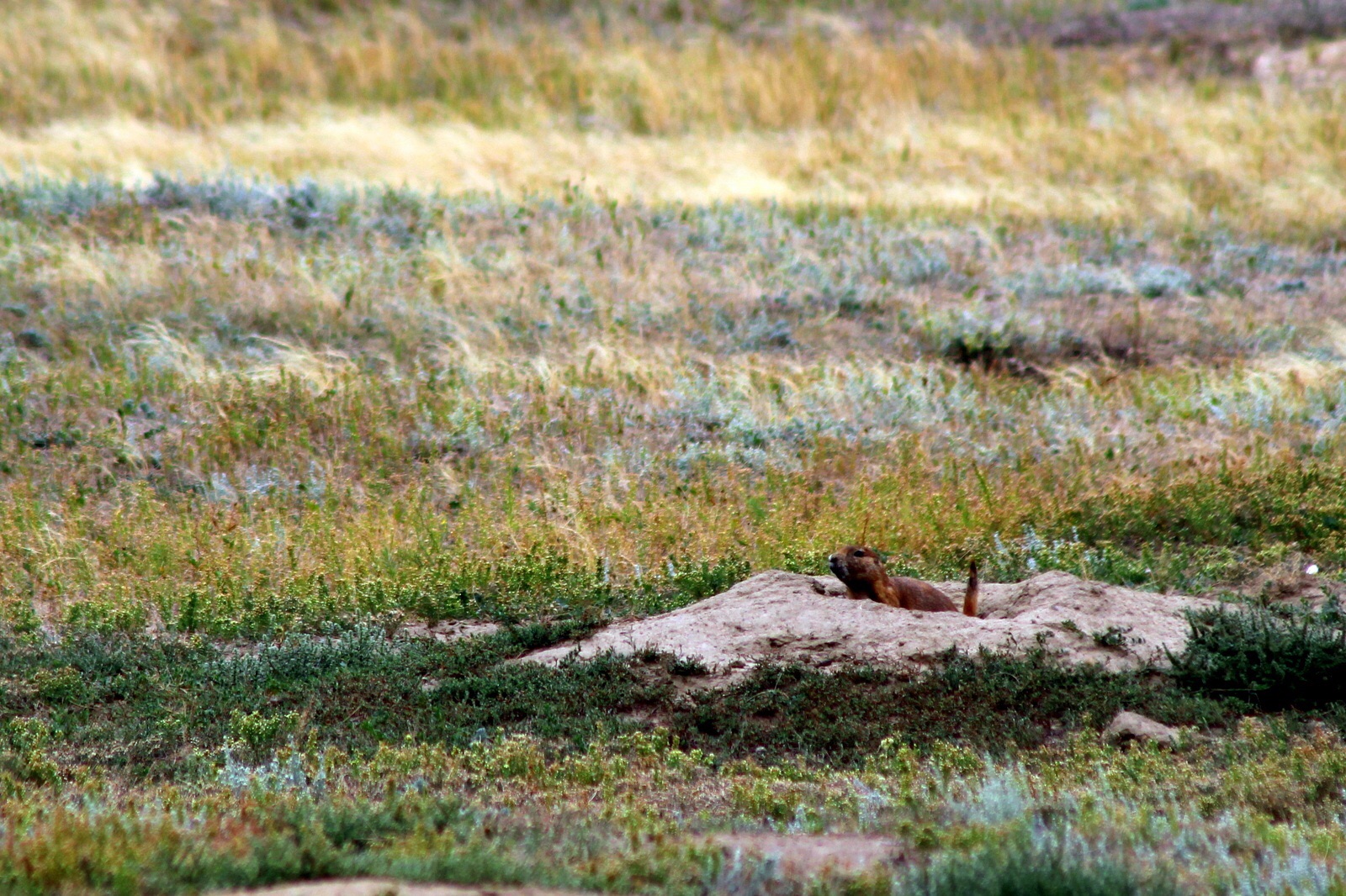
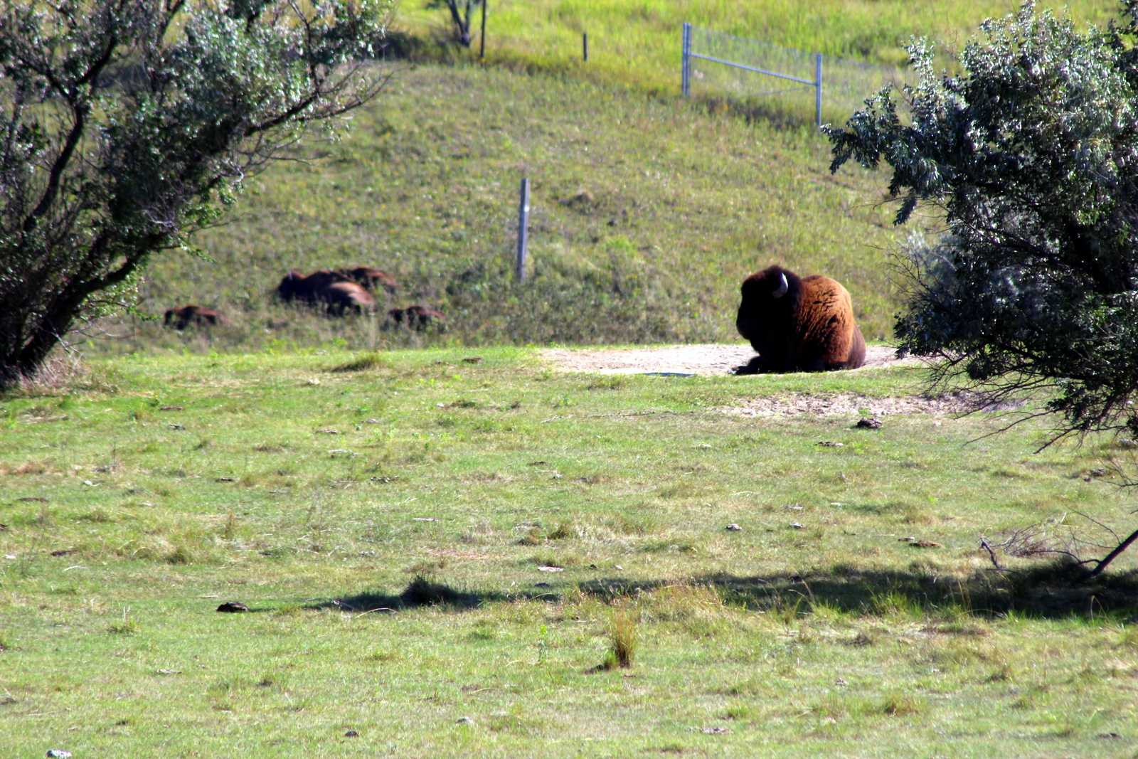
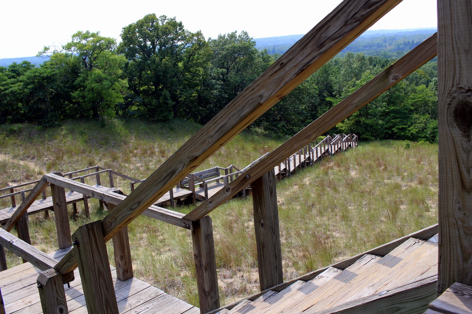
I was also distracted by all of the sights. I told myself that I'd have all day tomorrow and part of the morning Thursday to linger and truly explore the park. The priority first had to be finding a place to stay inside the park. But I kept stopping on the side of the road, taking photos of the wildlife (bison, elk, birds of various kinds). I even stopped in the visitor center at Fishing Bridge to see if there was any updated information on campgrounds. (There was none.)

After waiting for 30 minutes in a roadwork-caused, single-lane segment of the Grand Loop, I finally made it to Indian Creek at 6:15. The sign noted that the campground was full. I went in anyways, hoping that the sign was wrong. Unsurprisingly, it was right. I spoke to the host, and he noted that the site had filled up at 5:30. If I hadn't lingered all day, I would've been in fine!

I then considered my options. I could drive all the way to the south entrance of the park, where one campground still had availability. Or I could drive past the north entrance into Montana and stay in the border town of Gardiner.

I decided to head north. Gardiner was only 12 miles away. The south entrance was a good 2 hours away, maybe more. Because it was already getting close to dinner time, I decided I'd just bite the bullet and stay in a motel there. When I dropped down out of Yellowstone into the valley below, I realized that Gardiner was quite a small town. I immediately began to worry that all the lodging would be full, too.

Gardiner was completely sold out. I went into one inn, talked with the host, and learned that all the hotel and motel operators communicated with each other about availiability. Nothing was available now. She handed me a sheet of paper with lodging options listed for Livingston--a town that was almost 60 miles north! 

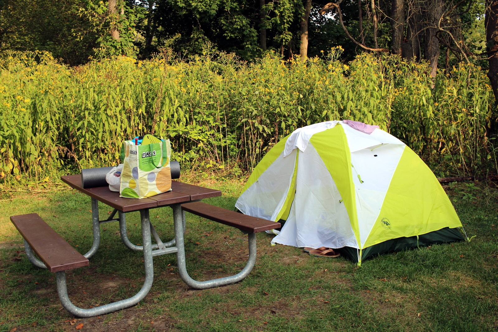
I couldn't believe it. I'd driven all day, and everything had fallen apart. I had driven into, and straight through the park. And I potentially needed to drive past the park for another 90 minutes. Thankfully, I learned about a primitive campground just outside the town. I hustled there and got a makeshift tent site--the host basically let me stay even though there were no real campsites left. 

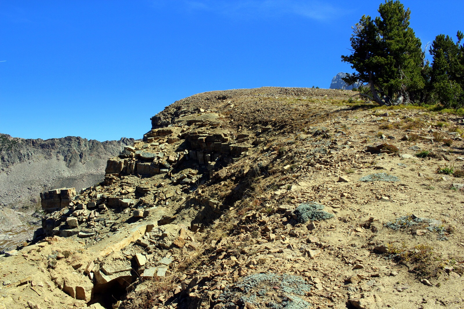
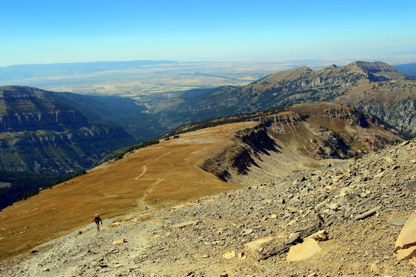
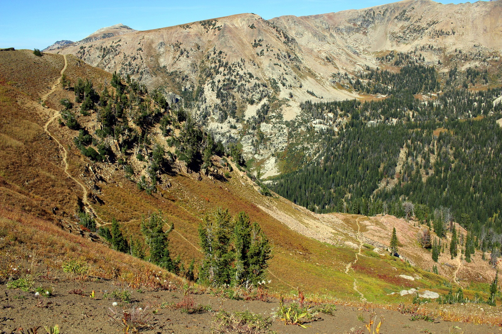
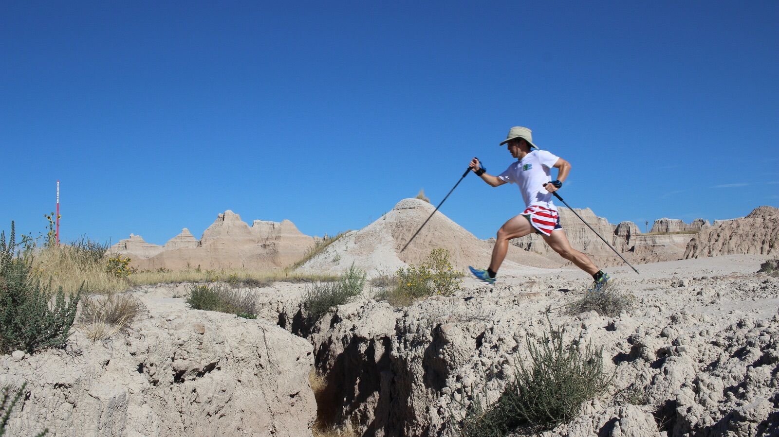
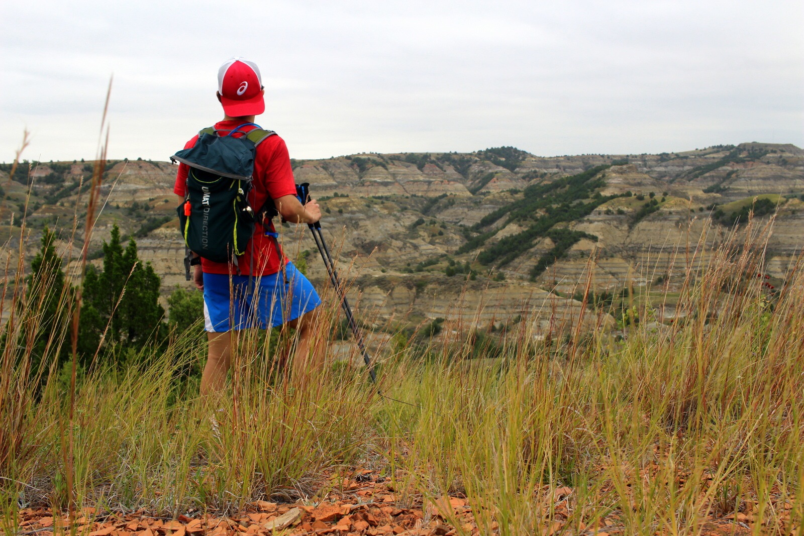
So that explains the first way my day went bad. The other way is that I'm no longer running Electric Peak. In fact, I'm no longer running at all. I'll be hiking instead. Simply put, I underestimated not only the significance of being in bear country, but also my experience as an outdoorsman.

On the way out to Gardiner, I had stopped at the Mammoth Hot Springs visitor center. I talked to the ranger about my plans, and she was basically astonished by what I was proposing. She strongly recommended against doing Electric Peak solo, and she also strongly recommended against running at all. Bears are more likely to be surprised by runners. And bears can also view a running human as prey, which can set off a chase instinct.

The last thing I want to do is underestimate the power of the wild and get mauled by a bear. So I've decided that I'm not going to run--at all. I've also decided not to hike Electric Peak. Instead, I'll hike a mountain that doesn't go as far into the backcountry.

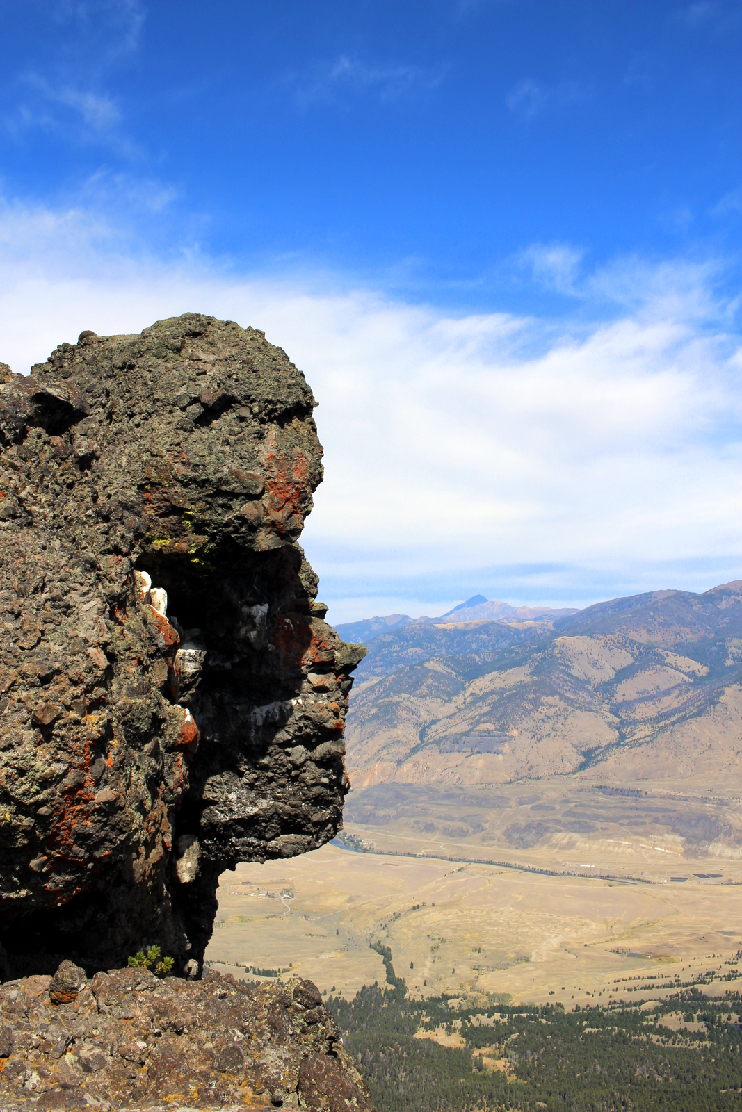
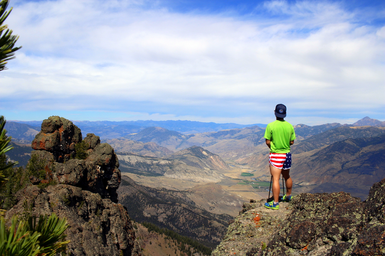
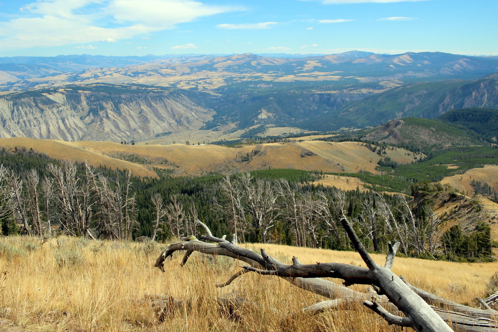
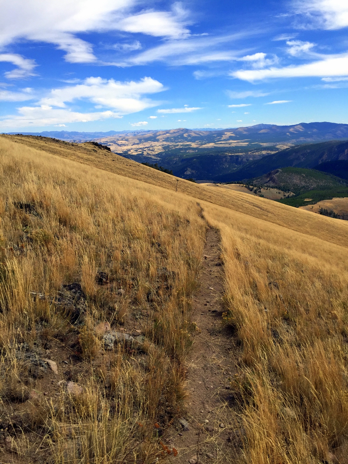
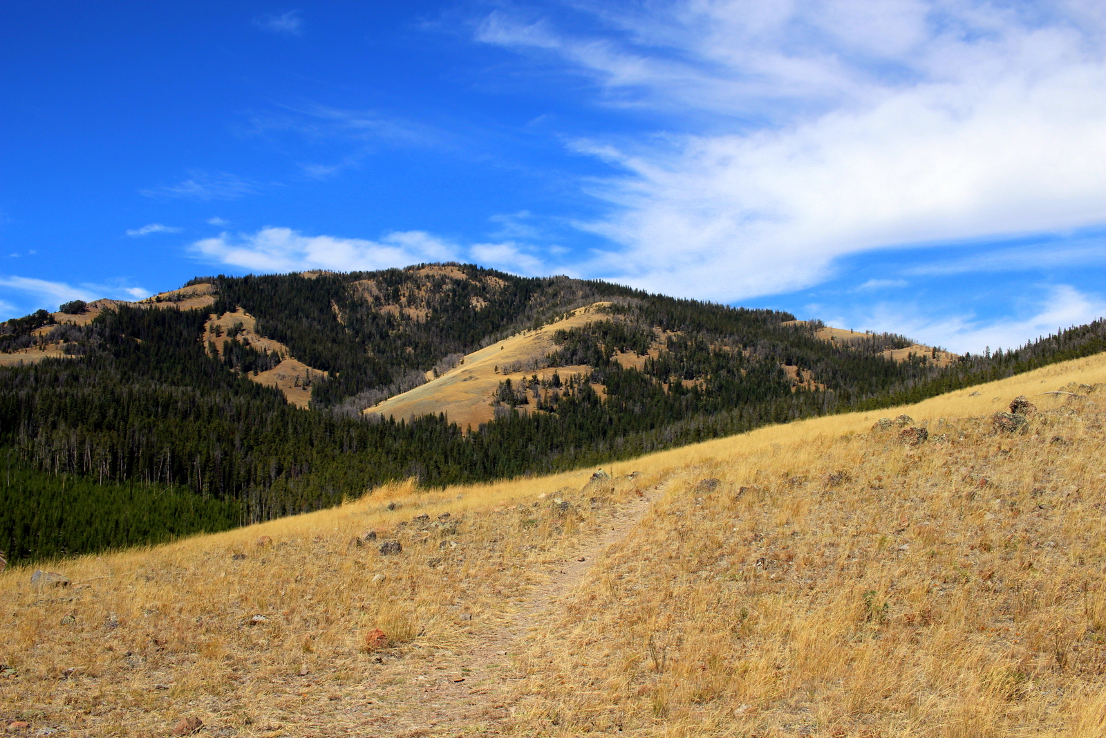
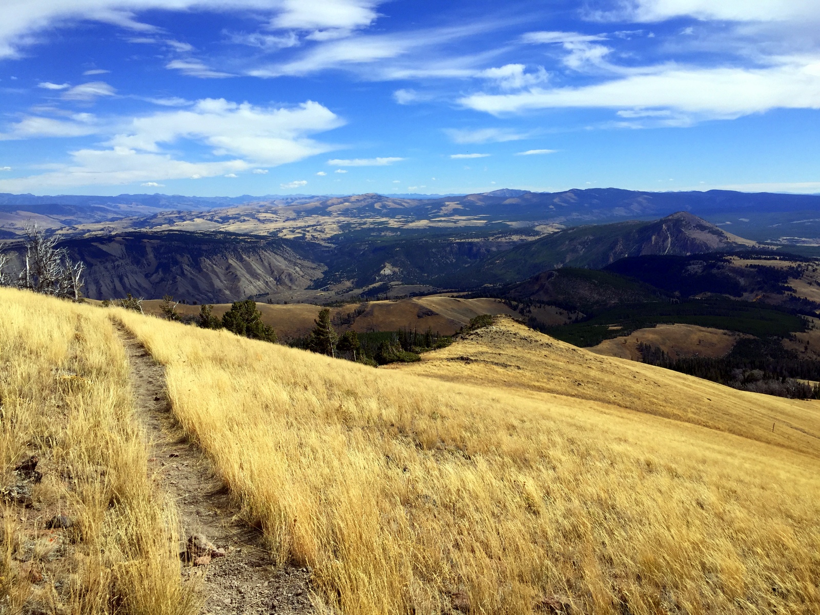
Sitting in this cowboy bar in Gardiner, I've had a lot of time to think about how today went. Frankly, missing out on a campsite was stupidity on my part. But I'm much more okay with the second "mishap". I'm not here to prove anything. Better to respect the wilderness. And the hike that I'll do instead (Sepulchre Mountain) will still let me experience the wonder that is Yellowstone. (Yes, this place is magical. ) Here's to tomorrow.

Day 10: Mount Rushmore National Monument + Harney Peak by Wookie Kim

The landscape changes rapidly as you head west. Badlands turn into prairie, and prairie turns into forest. On this morning, I entered Black Hills National Forest, expecting to make only a quick pit stop at Mount Rushmore, before continuing down to Wind Cave National Park. I ditched that plan, and decided to run to the highest point in the state of South Dakota--Harney Peak.

I began with Mount Rushmore. To be frank, I wasn't particularly interested in visiting this monument. Sure, it'd be impressive to see, but this trip is about running in our parks, not trying to avoid getting knocked over by tourists. Sure enough, when I arrived at 10:30 a.m., expecting to have beaten the majority of the Labor Day crowd, the throngs were already milling about.

I took the obligatory photos while jog-walking the Presidential Trail to get a closer look. I made it back to the amphitheater for a brief ranger talk on President Roosevelt.

By this point, it was already almost noon. My original plan was to head to Wind Cave. But a ranger had mentioned that Harney Peak was just a few miles down the road. I decided I'd run it.

There are two approaches to Harney Peak. One is 3.5 miles one way with 1,100 feet of elevation gain on a relatively easy trail. The other is closer to 6 miles, with 2,200 feet gained on a rugged trail. Obviously, I chose the latter (I subscribe to the doctrine of "The Strenuous Life").

I've always loved climbing. Whether on bike or foot, it feels amazing to reach a summit or crest a hill. Climbing is hard work, and can put you in a world of hurt. But it--both the journey and the summit--is always worth it.

I began, as always, by carefully reviewing the posted information, and orienting myself on the trail map. I have a pretty good habit of getting lost, but my compass has always helped me get back where I need to be.

And then I was off. Pretty soon, I thought I could see where I was headed.

I got into a steady rhythm, power-hiking up the inclines, and running the flats and the dips. I was getting closer.

The trees started thinning out as well.

But when I followed the trail that rounded what I thought was the summit, I noticed that there was a whole expanse that I hadn't seen from the bottom. I paused to catch my breath and stare out into the Black Hills.

I followed the ridge line, and then realized that I could now see the summit--there clearly was an observation tower at the top.

Right at this point, a couple was descending back down the trail. When I passed them, the man said, "You're almost there--it's about 30 minutes from here." I chuckled to myself. 30 minutes? More like 10! (It turns out it took me 12 more minutes to get to the top.) There were a lot of people up at the top. It was a picture-perfect day, with cool temps of 60 on the summit and 70 further below, so I wasn't surprised.

2015-09-06 16.03.34.jpg

I took my obligatory summit photo, which also conveniently served as a way for the winds to dry off the sweat on my shirt.

I looked down from the top and decided it was time to start descending. I hadn't realized it, but I'd just spent an hour at the summit, and the day was about to disappear if I stayed longer than that. So I began descending--and quickly!

This was an unplanned detour. But it was so worth it. Life is generally better with a plan. But sometimes you have to learn when to stray from the plan and act spontaneously.

By now, I was past even the time I'd thought I'd be arriving at Wind Cave. It was a short drive away, but I opted to take the Needles Highway, known for its granite towers and pillars. I drove very slowly, not only to see the scenery, but also because the road was windy.

There were also several single-lane tunnels through the granite. The highlight was the Needle's Eye, a narrow one-lane slit that cars somehow passed through.

I made it through unscathed. I stopped at a turnout to take a photo of the dramatic landscape. But I also decided to pay photographic tribute to a silent partner in this entire endeavor: my car.

I finally made it out of the Needles Highway and back onto the road through Custer State Park. Because it was past 7 p.m. now, I began seeing more wildlife coming out to eat. There were lots of bison, both on the roadside, but also out in the prairies.

I also saw a pack of pronghorn nomming on the grass close to the highway.

As the sun set over the hills while I arrived at my campground in the ponderosa pine forest, I felt thankful for another amazing day out in our parks.

On blogging. by Wookie Kim

Very quickly, blogging while on the road has become just as central a part of what I'm doing this summer. The response to my trip has been wonderful to see. 10 days in, and this site has had almost 10,000 page views from several thousand unique visitors. I'm encouraged that people are getting a glimpse into my journey, but, more importantly, I hope that what I document will help show just how magical our national parks are. They simply are not to be missed.

One question that might be on a reader's mind is how I actually go about blogging while on the road. I've literally found my first wifi hotspot on this entire trip (excluding my one night in Chicago at my friend's and my one night in a motel in Bismarck, ND). Early on, there were certainly plenty of Starbuckses, but I never had the time to stop and pull out my laptop. Daylight time is precious to me, so if I'm inside a coffee shop instead of out on the trails, I feel like I'm wasting time. So, how do I do it?

Here's my process. In the morning, I break camp and hit the road. While driving, I use a car power inverter to recharge anything that needs charging. I always prioritize my portable battery pack (made by Jackery), because this ensures that I can have 2-3 full charges of my iPhone. But I also charge my laptop, my Garmin GPS watch, and my spare camera battery. I often go through very extended portions of the day with absolutely no cell signal. The beauty of the iPhone is that it still tracks your blue dot through GPS. So if I've preloaded a map or route, I can roughly see where I am and where I should be headed.

When I arrive at a trailhead, I kind of put all of this to the side. I always bring my camera--a compact Canon SL1, with a very shallow 22mm prime lens. Because the body is already so small, this set-up is perfect for running. If I want to--and occasionally I do--I can actually run while holding the lightweight camera in one hand. It's just like holding a hand-held water bottle. For runs where I know I want some more camera firepower, I consider bringing my telephoto lens. This is how I've gotten such great close-ups of wildlife. But bringing that lens comes at the expense of a heavier pack. I need to have a pretty good reason to bring it.

To avoid feeling schizophrenic on the trails, I break up my run into chunks. I begin with the camera put away. I run as freely as I'd like, just getting a feel for the land, and soaking it all in. Eventually, when I reach my first picturesque segment, I pull out my camera and make frequent stops. Of course, magical things happen on each run. Even if I'm in a groove, I'll stop to take a photo. Interestingly, these photo breaks are very good short recovery periods from running.

After a day out on the trails, I'm usually making my way to a campsite, hopefully somewhere very nearby. Once I arrive, I set up camp, cook dinner, and relax for a bit. And it's after that period that I make the blogging magic happen. I begin by taking my SD card out of my camera and into my laptop. From my laptop, I can cull the photos that I want to include in the blog. But if I don't have wifi, how do I get those photos online? The answer is that I use my iPhone. Squarespace has a mobile app. It's pretty barebones, but allows you to post text and images. And that's really all that I need. To get the photos onto my iPhone, I use iTunes photo-syncing feature.

Once the photos are on my phone, I begin writing the blog post. You're probably wondering how I'm able to type such long posts using only my iPhone. Again, the reality is that I have technology on my side. I've always had a Bluetooth keyboard for my smaller devices. I brought that keyboard along with me now. I'm so glad I did. It is that keyboard that lets me type just as if I'm using a regular computer. So, I type up a post, add in some images (because words can do only so much), and prepare to post it. If I'm in an area with cell service, I'll publish it right then and there through my phone. If not, I'll wait until I reach a point the following day where I do have cell signal. (For instance, I'm actually at the Wind Cave Visitor Center right this moment, and I've found my first free wifi hotspot, so I'm actually using internet on my laptop.)

The Jackery iPhone battery pack, good for 2-3 charges, and a bunch of maps, good for the many places where I've had no cell service.

The Jackery iPhone battery pack, good for 2-3 charges, and a bunch of maps, good for the many places where I've had no cell service.

Why do I even bother? Well, I've realized that part of what makes this blog interesting is that it unfolds somewhat in real time. Many people have told me how they enjoy living vicariously through me and my blog. To make that vicarious experience as real as possible, I'm doing my best to share bits and pieces of my progress each day, while on the go, instead of waiting until I next hit a coffee shop (in this area of the country, potentially never), and dump everything at once.

I've already violated my principle and have spent 30 minutes here inside this air-conditioned visitor center in Wind Cave National Park. I just went on a cool tour of the cave system. It's now time to gear up and run some of the trails on the surface. And then I hit the road again, this time for Bighorn National Forest.

Day 9: Badlands National Park, SD by Wookie Kim

I slept very little the night before I left at sunrise for Badlands National Park. At around 3 a.m. in the Juniper Campground at Theodore Roosevelt National Park, I awoke to one of the loudest thunderstorms I've ever heard. The rain was pouring down and shaking my tent to no end. Every now and then, my tent would light up as the lightning bolts flashed across the sky.

I started panicking. What if I hadn't put my rain fly on properly? What if my tent was leaking? Bleary-eyed, I put on my head lamp and surveyed the inside of my tent. Everything seemed fine. But the rain kept pounding down, and I was convinced that my campsite might flood. I don't remember when the rain stopped, but I didn't sleep a wink until then.

At about 5:30, I was up. I knew I had a long day of driving to get to Badlands. My tent was in a muddy mess. I decided to forego cooking breakfast there. I just wanted to get out of the bog that my campsite had become. I tried my best to scrape off the mud from my tent before packing it, but it was hopeless (even today, 2 days later, the tent is still covered in dried mud). I was exhausted, hungry, and in need of caffeine.

I set off for South Dakota at 5:55 not in the highest of spirits. As I was taking the road out of the park, however, I immediately noticed a large brown animal grazing just off the side of the road. It was a bison.

A bison having a more pleasant morning. 

A bison having a more pleasant morning. 

It was fun to drive by him and have him look up at me. It was almost like we were sharing the morning--and the park. Not a soul stirred at this hour. (Theodore Roosevelt is already one of the least visited national parks. But I was also in the North Unit, which, due to being 70 miles away from the main highway,  is far less popular than the South Unit.)

I hit the road and cruised south. Though I'd started the morning in rough fashion, the scenery lifted my spirits. And I also can't discount how uplifting it is to drive on an open road. 

image.jpg

When I finally entered South Dakota, I saw, for the first time in my life, signs showing 80 mph as the speed limit. I took advantage of this opportunity to pass the miles quickly.

image.jpg

After cooking pancakes at a roadside rest stop outside of Sturgis, I was within 2 hours of the park. In the final stretch, I saw dozens of advertisements for the "Wall Drug Store." They touted their 5-cent coffee. I'd also heard that their donuts were good. So I figured I'd stop by.

image.jpg

The inside was a tourist trap. But it was still fun to see what paraphernalia people could get. I saw a veteran hanging out by "The Travelers Chapel." He didn't mind that I took a shot of him. 

image.jpg

I bought a couple of Wall's famous donuts--one for now, and one as a post-run treat--and pressed onwards to the park. 

The landscape changed almost instantly. Up from the prairie were beautiful layered badland buttes. I had to stop by the road and take my first photos. 

image.jpg
image.jpg

The park was teeming with people. It was then that I realized that it was Labor Day Weekend--I'd lost track of the days. I soon realized that there was a chance that I wouldn't be able to get a campsite inside the park. The campground had around 80 sites, but would I be able to get one of them? I made it a point to get there ASAP. 

image.jpg

I'm glad I proceeded straight to the campground. When I arrived, only 2 sites were still open. I took one of them. It was already well past 2 p.m., and the sun was beating down on the prairie. I knew I needed to get out on the trails as soon as possible. My goal was to run every marked trail in the park, starting on Castle, proceeding to Saddle Pass, returning on Medicine Root, and then completing the Window, Door, and Notch trails. I quickly set up my tent, changed into running gear (including my Tilley hat--such an essential for the sun), and headed to the trailhead. 

image.jpg

Because I was going backcountry on a very hot day, I was worried about safety. I made sure to sign every backcountry register I could find. 

image.jpg

Almost immediately after setting off, I saw my first signs of movement in the badlands. It was a desert bunny. He was super cute, and let me move quite close to him. 

image.jpg

The trail needled out into the prairie and back towards the buttes, like a sine curve. The contrasts were wonderful, especially with a clear blue sky. 

image.jpg
image.jpg
image.jpg

It was an impressive environment. This felt far more dry and desert-like than the badlands of Theodore Roosevelt. Speaking of Theodore Roosevelt, I made sure to track the trail at all times. Compared to the ridiculousness of the Buckhorn Trail in Theodore Roosevelt, the Castle Trail was incredibly easy to follow--all you had to do was look for the red stakes, which were placed frequently along the trail. 

image.jpg

As I criss-crossed the badlands, I came across a little ravine. It was relatively narrow, and I thought I'd have a little bit of fun. So I decided to jump it. 

Building speed.

Building speed.

Lifting off.

Lifting off.

Getting air. 

Getting air. 

Landing. 

Landing. 

That was fun, dangerous, and worth it. Teddy Roosevelt would've been proud. 

I continued until I reached Saddle Pass. I noticed that there was a rock spire that one could climb. So I scrambled up it to get to this vista.  Boy, was it incredible.

image.jpg
image.jpg
image.jpg

I then reached the end of the 6-mile one-way Castle Trail. I turned around and headed back, but this time took the Medicine Root Trail, which veers out further into the prairie than the Castle. A couple hikers warned me that they'd heard a rattlesnake 10 minutes in front of me. I took that as a sign that I should slow down my speed. Given the heat, my heart rate was already starting to spike above where I wanted it to be. So I settled into a very appropriate desert pace--a steady, light-footed canter.

I made it back to the trailhead. From there, I branched out to see the Door, Window, and Notch Trails. They were very similar to what I'd already seen. 

By this time, the sun was starting to set. I made it back to my campsite and gazed at the sun setting behind the tall grass in the prairies to our west. 

image.jpg

It felt somewhat odd to have 80 or so campsites right in the middle of this expanse. I took a few photos to try and capture the juxtaposition of man and nature. 

image.jpg

I had an excellent night sitting beneath the stars and taking in the cool badlands air. I went to bed utterly at peace.

Unfortunately, that peace was broken by the wind. It grew out of control at roughly 2:30 a.m. This was far worse than the thunderstorm. The tent walls whipped back and forth, and the base of the tent on the windward side actually began lifting up. I shifted all of my bags and even my own body to the windward side. It was terrifying. I realized I needed to reinforce the tent if I were to ever hope to fall back asleep.

I stepped out of my tent to the whipping winds. The winds had been so strong that two corners of my tent stakes had come undone, and my guy lines were nowhere near taut enough. Not knowing how to prevent me and my tent from blowing off into the badlands like a tumbleweed, I frustratedly tried to load up a YouTube tutorial on how to set up a tent in strong wind.  I finally got enough of the video loaded for me to realize that I'd been tying the guy lines wrong. Determined to stabilize my tent, I redid all of the guy lines and, this time, properly used the tensioner to make the lines taut. I looked up around me, and noticed that half the campground was also awake frantically scrambling to keep their tents on earth. It was a sight to see.

I returned to my tent and closed my eyes. The whipping of the tent walls was less intense, but the noise was still out of control. I didn't sleep well. 

But that's okay. Because when I woke up before 6 a.m. from the whipping winds, I looked outside and saw this. 

image.jpg

Realizing that this was a special sunrise that was occuring, I rushed out to the prairie to find a good place to watch the rising sun.

 After cooking pancakes and making coffee, I hit the road again. A few miles from my campsite, I came across Interior, population 67.  I didn't stop.

On the challenge. by Wookie Kim

Part of what makes this trip so thrilling for me is how logistically challenging it's been. Actually, to be entirely honest, I'm amazed that I've been able to do what I've done so far in this first full week.

Since hitting the road on my own on Monday, I've driven 2,202 miles. In that same time, I've also run over 43 hard trail miles. And I've also done a good bit of unplanned sightseeing along the way. You'd think that with all of this driving and running I've been doing, I'd have no time to relax, right?

Right. I've had basically no relaxation time. Each day, I'm up way before the sun rises, and I'm several hours into my drive when most people are still starting their morning routines. I then cruise into the national park visitor center around lunch time, talk to the rangers about what I need to know, and then set off on a trail. Between 3-7 hours later, I'm back, hurrying to set up camp before the sun sets, cooking dinner as fast as I can (my body needs substantial food immediately), cleaning up, and then trying to resort my car in preparation for the next day.

Looking back on my daily routine for the last 5 days, I chuckle every time I think of the valise stuffed with books that I brought along. I probably have 20-some books in there, several of which are over a thousand pages. I thought I'd knock off a book every 2-3 days. I'm now thinking I'd be lucky if I read 5. 

One might wonder why I'm in such a hurry--why, in God's name, I won't just take a chill pill, slow down, savor the moments that I have out here in the wild. This is an understandable criticism. Typically, one would hope that a person seeking to connect with nature would do exactly that--just be.

Unfortunately (or fortunately), this is not a typical trip. I have no qualms with rushing across the country at lightning speed. That's within the scope of what I'm trying to do--visit every single state I have yet to visit, run epic runs in as many national parks as I can along the way, and do all of this in a limited amount of time, Because I've chosen to prioritize the grand scale of my trip, I can't savor every moment. And I'm simply okay with that.

But getting back to the challenge. It has been an exhilarating 5 days on the road. Each day feels like the next stage in a multi-week adventure race. As soon as my alarm goes off at around 5:30 a.m., I'm immediately up and about, trying to accomplish all the tasks I need to get done before I can hit the road. 

My stopwatch has been a critical friend in this regard. I've begun to time all of my daily tasks, to figure out where I'm wasting and where I'm saving time. For example, I've slowly been whittling away the time it takes for me to: (1) set up my tent and sleeping arrangements, (2) get my Whisperlite stove up and running (the past two times I've been able to prime and light it with one try--my first time, it took me almost an hour to get the stove working!), (3) cook breakfast, and (4) break camp. If it's been only 5 nights and I'm already improving this much, I'm going to be an expert by the end of this summer.

Another aspect that I find rewarding is that I always have to think two steps ahead. Particularly when I'm doing this trip solo, and particularly when I've set out on an aggresive schedule, I really have no time to idle. In fact, I've realized that this trip will quickly grind to a halt if I focus only on the step immediately in front of me. (Interestingly, this same philosophy applies to my trail running: if I'm looking right down at my feet, I'm almost definitely going to misstep or hit something; if I'm scanning 20-30 yards ahead, I can plan for every obstacle as I approach each one.)

So I'm constantly thinking about ways to improve my routine--to set myself up for all the steps ahead of me, and not just the one immediately in front of me. What can I do each morning that will set me up better for what I do each evening? How can I arrange my campsite so that it is easiest to break down when I stumble around in the pre-dawn light?

The single biggest change in my routine over the last couple nights has been the amount of stuff I lug out of my car to my campsite. My first night, I practically unloaded my entire car. When morning came around, I had to lug everything back through the morning dew. It was such a waste of time! Now, I take the bare minimum. At my car, I measure out the food I want to cook, the things I'll need in my tent, and the other amenities of camp life. The rest stays in the car.

Interestingly, through this process, I've also learned that taking shortcuts can end up being a huge time waster. Taking the time to do things right the first time around generally leads to a better outcome than haphazardly rushing through a task. For example, I've tried to speed pack my sleeping pad and my tent. But when I've tried that, the items often aren't packed tight enough, so they don't fit into the stuff sacks or into my duffel bag. I have to start over again. That's more time wasted. 

In short, let's just say I had far too rosy of a picture of how leisurely life on the road would be.

I'm sure there are many people out there--one might call them camping or outdoors "purists"--who look down on what I'm doing. My response? I really don't care. So far, this trip has been an incredible experience--one that has challenged me in so many ways, and taught me so much. Despite the speed with which I'm covering all these distances, I can say for a fact that I've been communing with the wild and feeling an almost otherworldly sensation on each run. In fact, if the trip were to end tomorrow, I'd still walk away convinced that setting out on this crazy adventure was one of the best decisions of my life.

Despite my love for the challenges that each new day presents, I'm happy to report that tonight I can and will idle. Tonight is the first night that I've actually cooked and eaten dinner, cleaned and packed everything away before the sun has completely disappeared. It's now just after 9 p.m. here inside Badlands National Park, and all I can see when I look up are the stars illuminating the night sky. With that, I'm going to go savor the moment while I can. Because tomorrow, I'm back at it again.

Day 8: Theodore Roosevelt National Park, ND by Wookie Kim

My first big run--in Theodore Roosevelt National Park--didn't go as planned. I got lost in the backcountry. And the NPS rangers helped me get out. Let me explain.

My original plan was to tackle the Achenbach Trail, a challenging 18-mile loop in a remote area of the park. On the 2.5-hour drive from Bismarck to the park's North Unit, however, the sky looked ominous. I'd checked, and the weather forecast called for thunderstorms. If that were the case, I simply didn't want to risk being backcountry by myself on such a challenging trail. 

The sky wasn't ominous all day. A double rainbow.  

The sky wasn't ominous all day. A double rainbow.  

When I arrived at the visitor center, the ranger confirmed my intuition. He recommended against running the Achenbach. Not only did it require two river crossings, which could get dangerously high in storm conditions, but it also had a significant amount of bentonite clay. I didn't quite understand the physical properties of this clay, but apparently when it gets wet, it is so slick that it feels like an ice skating rink. If I were to go on the Achenbach and it rained, I would risk being stuck in an extremely remote area with a very treacherous trail.

There was absolutely no question what I was going to do: anything but the Achenbach. I know that safety came first. I'm a greenhorn when it comes to backcountry navigation. I wasn't going to risk anything, especially on my first day doing a serious run. I've also been following the principle of building up gradually, so I knew that I wanted to do something simpler first.

The ranger suggested the Buckhorn Trail, an 11.2-mile loop that covered most of the park and included a couple prairie dog towns, and possibly also the Caprock Coulee Trail, a short 4.5-mile loop that covered some of the best vistas in the park. I opted to do both, and I decided to begin with the Buckhorn.

Right from the get-go, I was having trouble following the trail. The ranger in the visitor center had warned me that following any trails would be difficult in this park. Specifically, the bison had a tendency to create their own trails. And, to the human eye, a bison-created trail looked identical to a human-created trail. (In fact, I later learned that some bison trails seem more like "real" trails than the actual trail itself!)

Bison poop.  

Bison poop.  

Bentonite clay.  

Bentonite clay.  

Because the Buckhorn began in a very narrow patch of land between the park's main road and the Little Missouri River, I wasn't too worried about going off-trail. As long as I kept the road to the north, and the river to the south, of me, I knew that I'd be fine just generally proceeding east. As a result, the first 4 miles or so were of no real concern. I took time to explore the ecosystem where the buckhorn used to roam. I marveled at the sedimentary layers of the badlands buttes--the patterns are so naturally pleasing. I also noticed ubiquitous evidence that bison were around--fresh bison poop. And I found patches of bentonite clay, which I could easily envision getting extremely slick when wet.

Eventually, I popped back over the main road to the beginning of the backcountry portion of the Buckhorn Trail. I still felt very comfortable, and let myself push up a narrow trail as it ascended gradually. I passed through a wooded area, before reaching my first scenic point. It was amazing to take everything in from high up above.

Running through the woods.  

Running through the woods.  

My first overlook.  

My first overlook.  

After about 2 hours and 8 miles, I had ascended way up above the buttes and had come out onto a grassy prairie. Imagine a grassy field that extended into the horizon along 270 degrees. I continued following the trail posts until--well, until I could no longer see either where the trail continued or the next trail post. At this point, I took out my map and compass to assess the situation. Several times, I ventured out before backtracking, realizing I'd not gone down the right trail. When I came back to the original post, I noticed that a trail continued back down the buttes. I followed that trail, dropping back down into the valley. Then, oddly, I passed 3 water troughs and a fenced section. I suspected that this was not part of the main trail and that I'd come across some kind of service or maintenance area (I later learned these troughs were for the bison). I continued anyways. Eventually, I found myself descending quickly again, and the views, again, were incredible. WAIT. This view was almost exactly as incredible as the one I'd already seen. And then it hit me: I was going in reverse down the trail I had originally come up.

At this point, I panicked a tad. My legs were fresh, I had lots of water and food, and I even had cell service high up on the prairie, but I just felt uneasy knowing that I'd somehow U-turned without even realizing it. Making this kind of mistake once would be fine. But if I kept doing this, I could get stuck out here. 

I took out my compass and figured out which general direction I needed to follow. I quickly realized that my original direction was correct. But I still couldn't, for the life of me, explain why I had done a loop and ended up retracing my steps. I knew I had to go out onto the prairie so I continued back in the original direction again, more determined than ever to find the right trail. 

Again, this proved extremely difficult. Every time I found a post, I could find no clear trail. Any time I thought I'd found a clear trail, I'd follow it for a few hundred yards and then it would disappear into tall prairie grass. I knew it couldn't be the case that the trail would take us into such tall grass. So I'd retrace my steps and try again. This was a labyrinth game, except I was criss-crossing the prairie. 

Following one of these paths, I noticed a prairie dog town on my right. I thought I could use the town to reorient myself, because the map noted two such towns. But when I looked at the map, I realized that both towns were supposed be on my left. This town was on my right. How? Again, I was utterly perplexed. Meanwhile, the prairie dogs just sat there, yapping away with their mating calls and poking their heads out every now and then to taunt me. 

Prairie dogs.  

Prairie dogs.  

At this point, I'd spent almost an hour in the exact same spot venturing out on various trails, realizing that they were false, and then returning to my starting point. I still had plenty of water, and it was a cool, overcast day, but I knew I didn't want to do this all day.

Realizing that I had cell signal, I decided to call the ranger station. The ranger I'd spoken to earlier got on the line. He tried to determine where I was and helped walk me through my route. With his help, I realized where I'd gone wrong. Past one of the posts, there was a very faint trail in some brush that I was supposed to follow. This trail was much more faint than the two other "trails" I'd attempted to follow. Those trails were created by bison. But now that he mentioned it, I could see that this was a trail nonetheless. I thanked the ranger, hung up, and pushed onward.

I reached the next post a few hundred yards away. But, again, the trail seemed to disappear. And, the only things crisscrossing the post were trails that went in the wrong direction relative to where I knew was supposed to be going. I strongly suspected that it was going in the wrong direction, but one trail was so clearly stamped down that I figured it must be the right one. I followed it, again breaking into a fast clip across the flat prairie.  I crossed over a dry stream bed and, within minutes, found myself at the park's fence. I was at the boundary. Beyond, I could see the highway. I knew I was supposed to come close to the northern border, but I didn't think I'd actually hit the border. I again called up the ranger station. He said I shouldn't be at the fence, even though it was possible to see the fence from the trail. After trying to figure things out, he said that I should just wait there. He'd send a ranger to meet me.

15 minutes later, I saw a white truck cruising on a road in the distance toward me. It was a ranger. Given the difficulties I'd been having, he suggested I just cut my losses and hop back in with him. I wasn't out here to prove anything. And, more than anything, I was sick of wasting time tracking the trail, and wanted to get back onto a different part of the park. So I hopped in.

Back inside the park, I met with the head ranger, John Heiser (he's been at this park for 42 years!). He wanted to know where things had gone wrong. I sheepishly waited for him to scold me. Interestingly, he was very friendly and understanding about the situation, and did no scolding of any sort. He just wanted to get the facts, walk through what happened, and provide tips for future runs. He was like a military commander doing a post-mortem analysis.

John Heiser, certified badass.  

John Heiser, certified badass.  

I explained everything that had happened and he nodded along with me. He pointed out how tough it was to navigate this trail. This park is one of the least-visited, and some of these backcountry trails get very limited use. So the trails are already incredibly faint due to the lack of consistent human foot traffic. To make matters worse, the bison, as already noted, create their own trails--ones that are indistinguishable from, and oftentimes even more real-looking than, the actual trail. Heavy summer rains that had led to overgrown grass didn't help with trail post visibility. All in all, he commended me for cutting my losses and calling the ranger station for guidance, instead of pressing on when I knew something was off.

John also explained some other principles of following a trail. I should generally be able to see the next post from the current post. Unless it was plainly obvious, when I reached a post, I was to continue in the same direction. And using my compass to verify my course was a prudent thing to do regularly. He noted how even some of the newer rangers had gotten lost in the very section I'd gotten lost in.  (I later discovered that my neighbors at my campsite--lawyers from Canada--also started on the Buckhorn this afternoon and got completely lost and ended up popping out onto the road far from where they were supposed to.) 

John also explained good trail selection practice. He said that, in every new park I visited, I should always start off by "testing" an easy trail to "get a feel for the land." Every ecosystem had unique challenges. And those challenges couldn't be taken lightly. Here, the challenge was the misleading bison trails and the very faint actual trail (also, in wet conditions, the bentonite clay). Other parks would have their own challenges, and it was better to try them out first before pushing out too far.

After this mini-lesson, I told John how demoralized and discouraged I'd now become. This was meant to be my first epic run. And it had ended somewhat miserably, and in failure. To be clear, at no point was I in panic mode. I had plenty of food and water, and also knew that I could reverse course and return to the main road the way I'd come in. But it was disconcerting that I was unable to complete what was already my "second-choice" trail. More importantly, if I couldn't do this, how could I continue to do some of the other trails I've selected in other parks?

John disagreed with my dour assessment. He noted how smart I'd been in using my compass, in trying to retrace my steps, and, ultimately, in calling NPS. He also made it clear that this would be the hardest trail to follow, by far, in the national parks I was visiting. The bison create such incredibly realistic trails, that it's practically impossible not to get lost up here. He asked where I was going next, and he nodded along--all of the trails in those parks would be infinitely easier to follow.

After this 20-minute debriefing, John suggested I continue with the Caprock Coulee Trail anyways. He said it was nowhere near as difficult to follow, and that I should be able to do it no problem. And the vista had spectacular views that I couldn't miss. It was still the early afternoon, so I figured why not. Perhaps this could lift my spirits, and my self-confidence, after the Buckhorn Trail mishap. 

I thanked all of the rangers I spoke to, and drove over to the trailhead for Caprock Coulee. As I was about to set off onto the trail, John's truck pulled into the lot. He told me again not to worry about what had happened earlier and to have fun out there. I thanked him again and was about to set off when another car pulled in, and a trio of women popped out. Before I could leave, John told them about my earlier mishap, and joked about how they shouldn't follow me. That was funny. I said hello to the trio and set off.

Nat, Ruth-Ann, and Megan. 

Nat, Ruth-Ann, and Megan. 

The Caprock Coulee Trail began with a gradual ascent. I didn't want my heart rate to go too high, so I kept it easy. Right as I was reentering my running groove, I noticed movement in the corner of my eye. There, a hundred yards away, was a bison, standing watch over the trail (like the troll guarding the bridge from that one fairytale).

The bison watching over the path.  

The bison watching over the path.  

​I immediately stopped and walked backwards away from the bison. I knew how dangerous bison were--I'd heard about the people who'd been killed this summer from trying to take selfies with them--and the rangers had noted that they have a top speed of 30 mph and can jump over 6-foot fences. I knew this beast was not worth messing with.

Cleaning off dirt? 

Cleaning off dirt? 

The bison seems uninterested.  

The bison seems uninterested.  

So, from afar, I took photos. Here, he was cleaning off some dirt (even though it looks like he's stomping). I waited 15 minutes, and he was still standing there, staring me down. Eventually, the trio of women caught up with me. After waiting several more minutes together, we decided we'd try to climb up the hill and around the bison. We scrambled up some dusty section, traversed 50 feet above the bison, and then descended behind him. We had successfully navigated around a bison!

At this point, I felt like my run had been foiled again. I simply was no longer in the mood to run. Also, the ladies were good company, so I decided I'd hike with them for the remainder of the loop.

The bison in our rear view mirror.  

The bison in our rear view mirror.  

I'm glad I continued, and with them. We climbed up and up and reached some spectacular ridges. At one point, we looked back down and saw that the bison was still exactly where we'd left it.

The bison is ruler of this kingdom.  

The bison is ruler of this kingdom.  

The views only got more spectacular.

Amazing view.  

Amazing view.  

Ruth-Ann at River Bend.  

Ruth-Ann at River Bend.  

Megan at River Bend.  

Megan at River Bend.  

I took the women's photos, and they took mine. We eventually reached the River Bend Outlook. This, too, was impressive. We munched on some snacks, took some more photos, and expressed our love for the park. We then proceeded to finish the trail. 

River Bend Outlook. Too bad it was overcast.  

River Bend Outlook. Too bad it was overcast.  

The patterns are mesmerizing.  

The patterns are mesmerizing.  

I'd spent from roughly 11:30 a.m. to 6:00 p.m. out on the trails in one form or another. I'd only covered 15 miles or so, but those were very slow, hard miles. Despite the hitches, it was a great day. It was also an important learning day. I learned that I really can't underestimate the wilderness. All of my fitness means nothing if I get lost.

Going forward, I'm going to be even more inquisitive at visitor centers to make sure I'm equipped with all the knowledge I need to know to navigate the unique aspects of each park. I'll take each day as an opportunity to become an even better outdoorsperson. And I'll continue running wild and free, with and alongside buffalo. 

Simple but delicious.  

Simple but delicious.  

I had a peaceful evening in a campsite in a juniper forest. I cooked a simple but hearty dinner--spaghetti with black beans,canned tuna, and a crapload of coconut oil. Next stop: Badlands National Park in South Dakota. 

Day 7: Bismarck, ND by Wookie Kim

In the last 4 days, I've driven over 1,600 miles. And today was my first pure driving day. I drove 460 miles from Afton State Park, which is just east of the Twin Cities in Minnesota, to Bismarck, a city in south-central North Dakota.  (Note: I recognize that I've skipped Day 6--I'll come back to it when I have time).

You might wonder why I'd spend an entire day driving. All along, that was my intention. One of the biggest priorities for me during this trip has been to hit our national parks. But the reality is that the vast majority of our national parks are west of the Mississippi. As interesting as Cuyahoga Valley National Park was, I know that it pales in comparison to what I'm going to get to see in some of the upcoming parks (Theodore Roosevelt, Badlands, Yellowstone, Grand Teton, etc.). Given my time constraints, I wanted to get out west as quickly as possible. This has meant several long days of driving.

Another important reason for only driving today is that I'm still in recovery mode from my trail 100K. Ultrarunners generally use the guideline of "one day off running for every 10 miles raced." Some even say that for a particularly hard race, you should take a day off for every 10 kilometers raced. So I should ideally be taking roughly 10 days of recovery. I recognize that I'm not completely following this rule-of-thumb. Even though I took several rest days (including some active recovery in the form of easy hiking), I could probably use a little more rest. Today was one more solid rest day.

Also, the driving was actually not as bad as it sounds. I quickly realized that there are lots of things that I like about driving. What I despise, though, is traffic. In the cities where I live, driving and traffic go hand in hand. So it's natural to have a tendency to dislike driving.

But out in the open farm country, where the speed limit is 75 mph, and you have driving directions as simple as "turn right onto I-94 and proceed 410 miles", driving actually becomes fun. It's stress-free, because you don't have to constantly worry about which asshole is going to swerve in front of you, or which pedestrian is going to mindlessly walk into your path. I also use this time to listen: to upbeat road-trip music, to the Revolutions Podcast (right now, I'm learning about the English Civil Wars), to nothing but the sound of my wheels roaring across the open road.

I also look around. The open road shows us the vastness of our country. Being on the open road also means that I'll inevitably stumble across interesting sights. This bison, for example:

Sometimes, you also see things that remind you of your friends (thinking of you, Sam, Henry, and Nick!):

Sometimes, you see a giant buffalo and want to run alongside it:

And sometimes, you just want to eat that very buffalo (the bison burger was quite delicious--the Big Chief Travel Plaza serves up a solid one):

And, sometimes, if you're really, really lucky, you might actually see a live bison resting for the afternoon:

After several stops, I arrived in Bismarck at 6 p.m. I filled up my almost-empty gas tank, and began shopping around for the motel with the lowest price (because when spending $0-20 on campsites, even the cheapest of motels seems exorbitantly expensive). Why a motel? Because I'm spending the next 10 or so days in our parks, and because I needed to plan ahead a little, I wanted to spend a night under a roof with wifi. I found America's Best Value Inn (no, really, the hotel is literally called "America's Best Value Inn"), and decided that it had the lowest price--and "best value"--in town. It has air conditioning and a bed, and no bugs. I can't complain.

Tomorrow, I hit my first big trail run. The Achenbach Trail (and possibly the Upper Caprock Coulee Trail) in Theodore Roosevelt National Park. Let's do this.

Day 5: Indiana Dunes National Lakeshore, IN + Chicago, IL by Wookie Kim

I'm a day behind, but better late than never.

Tuesday morning was a little rushed, because I knew I had a lot to cover: I needed to drive 310 miles to Indiana Dunes National Lakeshore; explore the dunes; drive another 60 miles into Chicago; and meet my friend for a night out on the town.

I was able to break camp quickly and efficiently, but the part that took longer than I imagined was walking back with my gear to the parking lot, which was almost a mile away. I ended up leaving just before 8:30, which ultimately wasn't too late.  The morning drive was, all in all, pleasant. By 11:30, I'd entered Indiana. And, by 1:30, I was at the visitor center.

A caterpillar greeted me at the visitor center. 

A caterpillar greeted me at the visitor center. 

Naturally, I spoke to a ranger first. She talked me into doing two things: complete the 3-dune challenge, and hike to the Beach House Blowout. Normally, the 4-5 miles involved would've been a breeze. But I had to deal with two obstacles: the sand, and my lingering fatigue from the 100K. I simply didn't want to overstress my body by running again too soon. And tractionless sand wouldn't be a good running surface anyways.

I first set out for the 3-dune challenge. This was a 1.5-mile loop that ascended 3 sand dune "mountains." Quotation marks are necessary because the maximum elevation was something like 190 feet above sea level--not entirely deserving of mountain status.

Trailhead for the 3-dune challenge. 

Trailhead for the 3-dune challenge. 

But this hike was no breeze (moreover, there was no breeze on this hike, and it was insanely hot). What made it challenging was the sand. It was hard to gain traction as I was ascending the dune slopes, some of which were quite steep.

Ascending a dune.

Ascending a dune.

I went up and down, up and down, and then up one last time to the last sand dune's summit. From there, an easy exit appeared: 

Sand-less stairway. 

Sand-less stairway. 

Given that I have many epic runs ahead of me, I didn't want to burn any more energy while still recovering from Twisted Branch. I opted for the stairs. 

Having completed the 3-dune challenge, I turned to the next trail leading to the sand dune "blowout". I don't know how to describe what a blowout is, but it's kind of what you'd expect. My friend likened it to a "bowl" on a ski mountain--a wide open area that leads to a ridge.

Little did I know that the trail leading to the blowout would have so many trees. In fact, I learned that the region is home to one of the few remaining oak tree savannas in the country. I was impressed by the sheer size of some of these trees.

A big oak. 

A big oak. 

As impressive was the depth of the savanna--the trees seemed to extend endlessly into the distance. I tried to capture that depth on camera. 

The deep oak savanna. 

The deep oak savanna. 

But more than anything, it was just really pretty in the savanna--the trees were beautiful to see.

Oaks in the oak savanna. 

Oaks in the oak savanna. 

Interestingly, the density of the trees varied as I walked. And a higher density altered the feel of the savanna--everything just felt darker.

Denser, darker oak savanna. 

Denser, darker oak savanna. 

Thankfully, the footing here was better. Instead of soft sand, the trail was harder-packed, but still not entirely firm, sand. But the trek was worth it, because after about 30 minutes, and after one dune ascent out of the forest, I made it to the blowout.

The view from the top of the Beach House Blowout. 

The view from the top of the Beach House Blowout. 

The color of Lake Michigan was spectacular. I never wouldn't imagined that a lake could have that hue of blue. It was almost tropical-looking. Part of me wanted to trek down to the water for a dip. Another part of me knew that I would hate myself on the hike back up--and through sand. I opted to skip the descent. This was a good call. 

On the way back to the visitor center, I took out my telephoto lens and focused on finding critters. The only thing I saw was a squirrel, scampering around in the low brush.

Squirrel friend in the forest. 

Squirrel friend in the forest. 

But that was literally all the wildlife I saw on the hike. Actually, I didn't even see a single human while hiking, either, which made for a peaceful walk. 

Eventually I saw a bunch of birds. 

Bird one. (I know very little about birds.) 

Bird one. (I know very little about birds.) 

Bird two. 

Bird two. 

Bird three. 

Bird three. 

The kicker is that I took these photos by the nature center, which puts out food to attract the birds, squirrels, and chipmunks. I'd like to think I spotted them in the wild on my own.

By now, it was 4 p.m. and I was ready to head into Chicago. I arrived just after 5:30, parked my car near my friend Laura P.'s house, and then went to meet her at Millenium Park for the final Summer Film Series screening.  The movie? The Breakfast Club (which I had no idea was older than I am!).

The crowds at the Pritzker Pavilion. 

The crowds at the Pritzker Pavilion. 

Before the movie began, though, I had to take the obligatory photo in front of the "bean"--Anish Kapoor's Cloud Gate. 

Melding parts of the Chicago skyline. 

Melding parts of the Chicago skyline. 

I've seen Kapoor's works in other modern art museums (including one in Seoul), and I always come away impressed by his creativity. 

Anyways, Laura and I caught up while watching bits and pieces of the movie and chatting with some of her coworkers. The movie was a hoot, and we certainly saw it in a different light. I guess the passage of time helps see old things differently.

Before we knew it, the movie was over. 

The end of the movie. 

The end of the movie. 

Before heading back to Laura's, I had the chance to visit her office in the Prudential Building. Seeing the city from above at night gave me a good sense of the scale of this city--it is massive. 

Chicago's grid. 

Chicago's grid. 

Tomorrow (Day 7) is a driving day. I'm currently in my 7th state (Minnesota), but I need to make it as far into North Dakota as possible tomorrow because Friday is when I run Theodore Roosevelt National Park. Here's to a good night's rest for a good day of driving.

Day 4: Cuyahoga Valley National Park, OH by Wookie Kim

You may not believe this, but I'm posting this from inside my tent in a backcountry campsite in Cuyahoga Valley National Park. I'll explain my technology set-up later (and I'll also explain why I'm not really even attempting to "unplug" from society during this trip), but, for now, I wanted to share some thoughts and some sights from my first solo day on the road.

I left Baltimore at 9:30 a.m. That was 3.5 hours after I'd planned to leave. I got back later than expected last night from upstate New York. Obviously resting and recovering from Twisted Branch was important. So I slept in and left late. 

That ended up being fine, because the day couldn't have been more perfect. I made good progress in my Prius, and arrived in Cuyahoga Valley National Park at around 4 p.m. The first thing I did was stop by the visitor center. Naturally, the Ranger was incredibly friendly, and gave me several trail suggestions. I told her I'd just run a 100-kilometer trail race, and that I wanted to do some easy recovery hiking. She immediately suggested that I watch the sunset at the Ledges Outlook. I also asked her if I should visit Brandywine Falls. She said "yes, definitely! But just so you know, you're going up and down a big hill to get there..."

I decided to set up camp before setting out onto the trails. Tonight, after all, is the first night in my entire life that I've camped alone. The last thing that I wanted was to have to set up in the dark. So I hustled over to the Stanford House campsite, where I'd booked a spot. By 5 p.m., I'd set up my tent, and brought all the gear I needed to cook dinner. 

My campsite.

My campsite.

WIth the knowledge that I had shelter for the day, I proceeded 1.7 miles down the Stanford Trail. The trail was peaceful, and, given that I had absolutely no plans to run today, I lingered and took photos. Also, despite the Ranger's warning, the "hill" that I had to climb was a joke--I climbed probably 100 of those on Saturday! Still, going downhill stressed the quads. I'm glad I opted not to run today (I plan to take tomorrow off from running too). 

Experimenting with depth of field. 

Experimenting with depth of field. 

Shot from ground level. 

Shot from ground level. 

Eventually, I made it to the Brandywine Falls. It was certainly fun to see, but I can't say it took my breath away. I decided to see if I could come away with a couple good photos. I wanted to capture the blur of the falling water, and I also wanted to test out my travel tripod. The results are below.

Brandywine Falls--kind of blurry, right? I tried. 

Brandywine Falls--kind of blurry, right? I tried. 

Testing out my Joby GorillaPod. It worked. 

Testing out my Joby GorillaPod. It worked. 

Seeing that it was already 6:15, and that the Ranger told me I should be on the Ledges Overlook by 7:30, I speedwalked back to the parking lot. I stopped to take a close-up of a flower along the way.

Having taken the REI one-day outdoor photography class, I now love manipulating depth of field. 

Having taken the REI one-day outdoor photography class, I now love manipulating depth of field. 

I made it over to the Ledges Overlook by 7:00. The sun had not yet set. But people were already gathered, including some canine friends as well.

On the Ledges Overlook. 

On the Ledges Overlook. 

I didn't want to miss the sunset, but I also didn't want to miss seeing the rock cliffs that make the Ledges Trail one of the must-dos of this park. So I descended briefly to see what i could find.

Moss-covered rocks. 

Moss-covered rocks. 

Time passed too quickly, and I realized the forest was already getting dark! I scampered back up the trail to get back to the Overlook. And there was the sun, setting the evening sky on fire with an orange glow. I watched in awe as it continued to set. Realizing how quickly it was disappearing into the horizon, I decided I'd try to capture it on camera. Its color had turned red by this point, but was just as incredible to see. Here's my best photo. 

The setting sun at Ledges Overlook. 

The setting sun at Ledges Overlook. 

By this point, I was surrounded by people. There were couples, families, solo hikers, runners--all manner of people. All were here to witness something worth witnessing--a spectacular setting sun.

Watching the sunset. 

Watching the sunset. 

It was now approaching 8:30. I returned to my campsite and realized it was pitch black. After a failed attempt to start my Whisperlite camping stove, I finally succeeded in getting that burning blue flame going.

A flame in the dark--success!

A flame in the dark--success!

I cooked a quick pot of mac and cheese, opened a can of tuna, and rounded out my meal with some grape tomatoes I'd had in my fridge when I left Baltimore this morning. It was a surprisingly healthy meal. I'm well on my way to recovery from the 100K.

Tomorrow, I head to Indiana Dunes National Lakeshore before spending the night in Chicago (one of six urban friend-stops I'll be making this trip). I'm hoping I wake up naturally, but I've set my alarm for 6 a.m. just in case. I have no time to waste!

My first 100K by Wookie Kim

Today is technically the third day of my road trip. But I'm actually back in Baltimore tonight. I spent Friday and Saturday up in the Finger Lakes region of upstate New York running the inaugural Twisted Branch Trail Run, a 102-kilometer race from Lake Canandaigua to Lake Keuka. I finished the race in 15 hours, 8 minutes, and 2 seconds. In that time, I gained 11,004 vertical feet. This was my first 100K, and my first serious trail race. (I use the word "I", but the reality is that this was a team effort. Jeremy L., my unflappable running partner, ran with me the entire time; we even crossed the finish line holding hands.)

That I would begin the trip with my first ever 100-kilometer race, and my first serious trail race is a little ridiculous. This was not how I had originally planned things out. My original plan was to leave for the trip on Labor Day, so that I'd have one full week to recover from the race. But scheduling complications on the back end (i.e. relating to moving into my new apartment in DC), required that I start the trip tomorrow if I wanted to maintain the scale and scope of the trip.

I'm happy to report that the race went remarkably well--and that I'm still ready to go tomorrow. I've talked about execution before, and I can legitimately say that this was the most perfectly executed race of my life. It was also, by far, the longest and most challenging physical and mental feat I've ever accomplished. (Note: it was not the most painful--that award goes to the 2014 JFK 50-Mile, my first ever 50-miler, and my first--and last--time that I'll ever sprain my ankle 20 miles into the race and decide to run the last 30 miles anyways.)

I don't have time for a full race report tonight, since a lot needs to be done before I hit the road again tomorrow morning. But I'll share one video clip that captures just part of the craziness that was the Twisted Branch Trail Run. Below is a video I took of a segment of the course at around mile 32. This was certainly a nuisance to run through, but it was nowhere near the hardest terrain we covered during the race. That says something, I think.

 Tomorrow, my lease is truly up, and the parks of America become my home for the next 40+ days. First destination: Cuyahoga Valley National Park. Here goes nothing.

On execution by Wookie Kim

Today is technically the start of my road trip, but I don't really see it that way because I'll actually be back in Baltimore Sunday evening. Today, I'm headed to the Finger Lakes region in upstate New York for the inaugural Twisted Branch Trail Run, which begins at 5 a.m. tomorrow. The Twisted Branch is a 102-kilometer (63.7-mile) trail race with almost 11,000 feet of vertical ascent. It's going to be a hard day. I've been anticipating this day for almost three-quarters of a year now. And, with 16 hours to go, I'm ready.

There's obviously a lot of training that went into this race. But from here on out--that is, until I cross the finish line at mile 64--all I'm thinking about is execution. Prior planning and training only go so far. All the miles I've logged, all the sacrifices I've made up until now--they all mean nothing if I don't execute on race day. Execution, in short, is everything.

For the last couple weeks, I've been working on execution by tinkering with my race plan. I always start with a course elevation profile. I annotate that profile with significant geographical features, general milestones, and aid station locations. I write down numbers so I know exactly where I'll be and when. The plan also incorporates my notes on the race-day principles that I'll do my best to adhere to. I've been looking at--and will continue to look at--this one-pager over and over again today. 

My Twisted Branch race plan.  

The race plan might seem unnecessarily detailed. But this single sheet of paper does so much, not only to remind me of what lies ahead tomorrow, but also to prepare me mentally for what is bound to be an extremely challenging, but incredibly fulfilling, day out on the trails.

The Twisted Branch Trail Run marks the start of my running road trip. I couldn't have asked for a better challenge to kick things off. I am ready.

Fueling up. by Wookie Kim

My recurring nightmare has me twisting or spraining an ankle, but the bigger stressor--and the tougher day-to-day challenge--is ensuring that I eat well, and eat enough, throughout the trip. There's little left to do. I'm done packing. I'm done gearing up. All that's left, really, is gathering food.

While I have a decent amount of food stockpiled, and have a rough food plan set out, there are still too many unknowns such that predicting my food needs has been quite difficult. For one, I don't know how many miles I'll actually be running each day. I've picked tentative trails and routes for each park, but I don't yet know whether the mileage I'm setting for myself (15-35 miles of trails per day) is sustainable. Even if it is sustainable for a few days, can I do it for a few weeks? I also don't know how much of a "setback" the 100K trail race will be. I'll need at least a few days of recovery after that race, but how much, exactly, will I need? These are all things I'll have to play by ear. Depending on how these all play out, I'll have to adapt my diet and caloric intake accordingly.

Luckily, I have help when it comes to fueling. Three absolutely wonderful companies are supporting me with food. Here's a little bit about each, and why I think these foods will contribute greatly to the success of this trip.

*   *   *   *   *

First is Birch Benders Micro-Pancakery. They make out-of-control, bonkers-delicious organic pancakes. They sent me a case each of six different flavors: original, six grain cinnamon, chocolate chip, gluten free, paleo, and protein. Unlike other companies, Birch Benders makes flavors that actually taste substantially different and use varying ingredients. No two pancakes are the same.

All the tools one needs to make these pancakes (measuring cup optional).

All the delicious flavors Birch Benders sent me.

Birch Benders pancakes are going to be the core of my on-the-road breakfast routine. Each morning, the first thing I'm going to do is make these pancakes (and then, of course, a cup of coffee). What makes Birch Benders so amazing is that, to get your pancake mix ready, all you have to do is add water and stir it up. A few minutes on the pan, and you have mouthwatering-ly good pancakes. Stacks on stacks of them. These pancakes are super quick, nutritious, and hearty--everything I need to start my day. I trust in Birch Benders to fuel me up strong.

*   *   *   *   *

Second is KIND Snacks. They make similarly out-of-control, bonkers-delicious bars and granola. What makes KIND stand out is the quality of their ingredients. This is top-notch stuff that's inside each of these bars. Moreover, the flavors are as varied as they are delicious. Dark chocolate almond mocha, roasted jalapeno, Thai sweet chili. It's almost overwhelming. KIND was kind enough to send me three boxes of bars--a bunch of standard bars, strong & kind bars, and healthy grains bars and clusters--as well as some #swag.

KIND Snacks galore! (I was too lazy to take this out of the car.)

I see KIND as the core mid-run and mid-day snack. Not only are these things delicious, but they go down easily while on the run. The varied flavors add just enough "spice" to make fueling on the go fun. I also can't complain about the food composition--it's got a very even balance of carbs, fats, and protein. Perfect for long slow distance. I can't wait to be nomming on these soon.

*   *   *   *   *

Third, and certainly not least, is Justin's. Not many people immediately recognize the company when you first ask "do you know Justin's?" But once you mention "nut butter" or "almond butter", that initial look of confusion transforms to true understanding. The name recognition might not be there, but Justin's makes, hands down, the best nut butter products on the market. I've always loved their maple almond and honey almond butters. They've sent me 3 cases (3 appears to be a special number today) of delicious fatty nut butter goodness. (I don't yet have them--they're actually sending them to my first friend-stop in Chicago.)

I didn't take this photo, but this packaging is reason enough to go out and get some.

I couldn't think of a better-tasting way to up my fat, protein, and overall caloric intake. Nut butter is always a great healthy complement to many foods. But to have the option of eating nut butter that tastes heavenly is a real privilege. Moreover, I'm receiving their nut butter in the form of 1.15oz squeeze packs. These will be incredibly convenient to eat and use while on the run. I won't have to stop, pull out a jar, unscrew that jar, pull out my knife, scoop some nut butter, etc.--I'll simply tear and squeeze.

*   *   *   *   *

I'm really thankful for the support Birch Benders, KIND, and Justin's are providing. As an added bonus, these are companies with incredible origin stories, values, and people (thanks Matt L., Lizzi A., Christina B., and Garrison J.!).

I'll end by noting that I was not asked by anyone to make any sort of plug for any of these foods. Everything above is my honest, unfiltered opinion. As the summer progresses, I'll be providing updates on how these foods stand the test of time. Until then, I'll be nomming away!

On solo camping by Wookie Kim

As excited as I am by all the running I'm about to do, there's another aspect of the trip that I'm eager to experience: solo camping.

Indeed, this trip is as much about immersing myself in the natural world as it is about traveling and running the country. I explicitly chose to avoid traditional lodging because I want to be, by night, where I'll be by day--in the wild. Also, the idea of going it alone seemed attractive, not because it would prove that I can, in fact, manage it, but rather because I anticipate learning things that one can learn only when alone in Nature. Having space to myself to reflect, and to take everything in, just seems incredibly appealing.

While I've gone camping a good number of times in my life, I've always done that as part of a group. That has also always meant that I could free-ride on the expertise and labor of others. Sure, I'd pitch in, but I never took the lead on anything. So I never really "learned" all that one would need to know to camp--let alone camp solo. Over the course of this trip, I hope to overcome that deficit. As with everything I'm doing on this trip, I'm taking things in steps.

The first step is to acquire the gear. I've done that. After talking things over with several experienced outdoorspeople (thanks Victoria B., Garrett M., and Lucas M-B!), and after several REI visits, I finally bought everything I needed (note: it wasn't cheap).

The next step is to familiarize myself with that gear in a controlled environment. Even if I theoretically have everything I need, I may not know whether I can "work" with what I have. Can I properly set up my tent by myself? Do I know how the ResQLink system works? Etc. I'm still 2 days away from hitting the road, but I've at least answered the first question. Yes I can.

Experienced and non-experienced campers alike may laugh at the above. How hard can it be to set up a tent? The answer? Really not that hard. But until I've done it with my own two hands, I can't be certain. And if I'm not certain, well, that means I'm taking another risk that probably need not be taken. 

Next, I'll take this into a semi-controlled environment. In advance of the Twisted Branch 100K, I'll be camping with Jeremy L. and Lisa P. at a county park near Naples, NY. There, I'll be outdoors, in a campsite, with all my gear. I'll truly be able to test out, in the elements, my home for the next 45 days. I'll also be able to try my hand at cooking food using my Whisperlite camp stove--another essential skill. If something goes wrong, I'll let Jeremy or Lisa (help me) figure things out. And then I'll keep practicing until I reach mastery. Again, the tasks I intend to be able to complete are easy in the grand scheme of things. But I won't leave upstate New York until I feel confident that I know the very basics of setting up camp.

From there, I'll gradually add layers of complexity as the trip progresses. On my first day alone, for instance, I'll be at a "backcountry" site in the very tame Cuyahoga Valley National Park. I'll be relatively close to a major road, but I'll have none of the amenities that proximity to civilization usually provides (i.e., no water, no electricity, etc.). Moreover, I'll have to "leave no trace." And so on. The hope is that, by the end of the trip, I'll be comfortable setting up camp anywhere and in any conditions.

*   *   *   *   *

With just over 50 hours to go until the start of the most epic race of my life, I'm continuing to taper. I'm running almost nothing (I've run <10 miles this week), eating like a pig, drinking water like a camel, and, most importantly, resting like a sloth. It's all a little uncomfortable, but that's part of the process. On that note, it's time to test out my sleeping arrangements in a very-controlled, air-conditioned, environment. Goodnight!

On preparation and risk. by Wookie Kim

A full week separates the day I finished my last job and my departure date this Friday. I thought I'd have time to relax, but this week has been busy with final preparations.

I've already completed a lot of the prep. I've finalized my overall route. I've mapped out a detailed plan for the first 10 days of the trip (each day's plan includes a clear understanding of how far and how long I'll drive, where I'm driving to, what trail(s) I plan to run, how long I'll run, where I'm setting up camp, and other considerations to keep in mind). I've gone to REI twice to gather all the gear I'll need (e.g., tent, sleeping pad, stove, safety kit). I've been double-checking my list of gear. And I've (mostly) finished packing up my apartment.

But there's so much more that I still have to do before I leave. I need to track down some final gear items (read: I need to go to REI again). I need to finish packing up my apartment. For my parents' sake, I need to finalize a safety plan. I need to stock up on food and water. I need to say goodbye to my friends in Baltimore.

Another thing I need to do--and am doing at this very moment--is tune up my car. I'm currently sitting in the waiting room of my car dealership, waiting for a mechanic to fix up a variety of things with my car. As a general matter, my car has been in very good shape. I probably didn't need to come in today. But I'm glad I did. It turns out that these issues could've create unexpected problems while on the road (most importantly, my brake pads were in bad shape and needed replacement).

The underside of my car.

The underside of my car.

That brings me to an important topic: risk. This trip is filled with risks. I might fall on the trail. I might run out of gas in an area with no cell service. I might bonk in the backcountry. I might encounter a bear. In short, a lot of things can--and will--go wrong. (Unsurprisingly, my parents have pleaded with me not to go--my mother even suggested she'd come with me!)

But that's okay. Kilian Jornet, one of the world's best ultrarunners (and my running idol), once said:

Life isn't something to be preserved or protected. It's to be explored and lived to the fullest. And to make the most of it, we need to be in the mountains. We need to be here, and if we pay such a high price at times, it's because we're really making the most of life.

Running America will be risky, but by doing it, I'm exploring--and making the most of--life.

At the same time, what's not okay is bearing unnecessary risk. I'm passively accepting the things I can't control (e.g., the weather), but I'm doing a lot to reduce the risks I can feasibly control.

By way of example, here's how I'm dealing with my single-biggest fear: twisting my ankle on the trail. With all the miles I'll be running, I'm bound to take a wrong step at some point. But I've taken multiple steps to reduce the chance that I take that wrong step. First, I got trail shoes with impeccable traction (the Hoka One One Speedgoat--they're amazing!). I'll be sure to use these on especially technical trails. Second, I bought lightweight trekking poles (the Black Diamond Distance Carbon Z--also amazing!). I've used poles on hikes before, but never while running. Following the lead of Sage Canaday, I'm going to use these poles to maintain balance, and give me extra support while climbing. Finally, if these two prophylactics fail, I have a ResQLink personal locator beacon (generously borrowed from Lucas M-B!), which I can deploy in an ultimate crisis situation. Of course, I hope absolutely nothing happens to my ankle (except get stronger). But I can't count on that happening, and need to be prepared for every scenario.

I'm going to continue getting ready (i.e., continue waiting in the waiting room), but if you have other risk-reduction tips, please share them here!


On photography. by Wookie Kim

I'm documenting this trip not only in words, but also in photos.

Photos are incredibly powerful carriers of meaning and emotion. And they carry that meaning in a medium that requires almost no mental bandwidth to understand. In the time it would take me to read a written description of what's in a photo, I can "process"--that is, draw meaning from--dozens of photos.

This makes photos incredibly useful in documenting one's personal history. I value knowing about my past, and photos are the primary way that I keep tabs on that past. To me, a photo gallery is a visual distillation of an era of my life. A quick scan of my eyes through a folder of photos on my hard drive lets me re-see the things I've seen, and re-live the experiences I've had. In a sense, then, the fact that I plan to take lots of photos is not so much a decision as an impulse to preserve memories for later.

I also feel a separate sense of obligation to take awesome photos on this trip. I plan to be in some of the most beautiful and awe-inspiring areas of this country. I simply can't go to these places without taking the time to capture and communicate what those areas look and feel like to others. Photos are the perfect way to do that. Obviously, a lot of the running that I'll do will be in heavily trafficked areas of heavily trafficked parks. Any photos I take there are far more likely to be run-of-the-mill. But I think I'll also reach some more remote areas of some less-frequented parks. In those areas, I might have the opportunity to capture something unique.

To do a better job at documenting this trip, I decided to take photography a little more seriously--I signed up for an REI outdoor photography class. You see, my entire life, my photography repertoire has included two skills: (1) point and (2) shoot. Last December, I got my first DSLR (a Canon SL1) and immediately began expanding my repertoire--by exactly zero skills. Even though I had all these fancy dials and buttons to touch, I actually touched none of them (except "Auto" mode, which obviously came in clutch!). I wanted to touch some buttons and turn some dials this trip, but I didn't know how. That's where REI's fantastic Outdoor School came in.

I couldn't have been more impressed by the class, which took place this weekend in Pohick Bay Regional Park. For almost 8 hours, our instructor, Ward Morrison, taught me and six other budding photographers the building blocks of photography. We started with the three basic settings that determine a photo's exposure--aperture, shutter speed, and film speed. I'd always seen all manner of these numbers flashing on my screen, but I never really took the time to truly understand what they meant, and how to adjust them to my shooting needs. Today, I actually began the process of learning those principles.

After 4 hours of guided instruction on photo theory and a quick lunch break, we took to the trails to put our new-found knowledge to the test. Below are some of the photos I took, after applying what I'd learned from Ward. Objectively speaking, they're pretty ordinary. But I'm incredibly proud of them because, for the first time ever, I took all of these photos in "Manual" mode only. I never thought I'd be able to say it, but I now actually feel comfortable turning that dial to "Manual" and taking photos! I'm still terrible at practically everything, but I have 45 days to begin figuring this whole photography thing out. Of course, all of this also means I'll spend the trip in a perpetual quest for the perfect shot. I hope I find one.

The idea. by Wookie Kim

Everything starts with an idea. This spring, an idea was born: I would run America.

I didn't want so much to run continuously from one coast to the other. Rather, I wanted to visit by car the parts of America I hadn't yet visited, but stop along the way and run. Particularly, I wanted to run in our national parks. The hope was that I'd spend the summer learning--about those very parks, about the awesomeness of Nature, about living by myself, about myself. I wanted this to be a challenge, but a fun one still. And--no matter what--I wanted to be safe, and return home in one piece. That was the idea.

The idea came about naturally. It was really just a combination of things.

Last fall, I ran my first ultramarathon, a 50-mile trail race in western Maryland. In preparing for that race (the most challenging one of my life), I began spending more time on dirt trails and in parks, instead of on the paved city roads that I'd been so accustomed to.

At the same time, I discovered that, between the end of my current job and the start of my next job, I'd have almost two full months off. This was a substantial block of time all to myself--with no commitments, no burdens, nothing I needed to do. I needed to spend that time wisely.

I knew I'd spend part of that time traveling, but the question was where. The answer was obvious. Nine summers ago, I biked from one coast to the other. That was, without a doubt, the best summer of my life. I wanted to recreate the way I felt that summer. But I would do things a little differently: I would cover different ground, using a different mode of transportation. So, instead of biking east-to-west straight through the center of the country, I would hop in my car, hug the perimeter, and run when I could.

But this trip had to be a challenge. It couldn't be a run-of-the-mill road trip. I needed to be taking risks, testing limits, feeling uncomfortable. It's through challenges, after all, that we live. So I decided to set a goal of hitting as many national parks (and monuments and state parks) as I could. And, in each, I set out to do an epic run. I mapped a 45-day itinerary, and mapped out (almost) 45 runs. I decided I'd reach mountain summits (e.g. Yellowstone's Electric Peak, which tops out at 11,000 feet), and canyon valleys (e.g., the Grand Canyon Rim-to-Rim), and everything in between.

I also needed something to counterbalance the time that I'd spend speeding across the country in my Prius. I needed to leave time to take things easy. I'd do that by camping, on my own (for the first time ever), in the wild, with a great big valise full of books to read where it's peaceful. I figured I'd document things along the way. So that became part of the plan, too.

That was how the idea came about. On Friday, August 28, I leave Baltimore and the idea becomes real.

The route.