midwest

Race Report: Twisted Branch Trail Run by Wookie Kim

I began this trip with a bang. On day 2, I ran the inaugural Twisted Branch Trail Run--a grueling 100K in the Finger Lakes Region of upstate New York. Normally, I log my race reports on my sport-tracking website. For those who are curious about what my first 100K trail race experience was like, I'm sharing my race report below. I drafted most of it in the days after the race, but I'm only now finishing it. (For the number nerds, here's my Strava data.)

The short version is that I executed one of the best races of my life. I focused on effort (using heart rate as an objective proxy), instead of time or pace, and that (unsurprisingly) led to an outcome that beat my wildest expectations. In just under 15 hours and 8 minutes, I (and my running partner, Jeremy L.) covered 64.5 miles of tough trails. The course had six major hill climbs, including three that were 1,000+ feet. In total, we gained 11,000 vertical feet. From an objective standpoint, this was physiologically the hardest athletic event I've ever done--by a good bit. The Ironman was certainly challenging, but took more than 3 hours less. It also let me use three different muscle groups; with this trail ultra, my legs--and only my legs--took the beating from wire to wire. I'm now well into my transformation from a road runner to a trail ultra runner and I couldn't be happier. Here's to future trail ultras!

Pre-race.

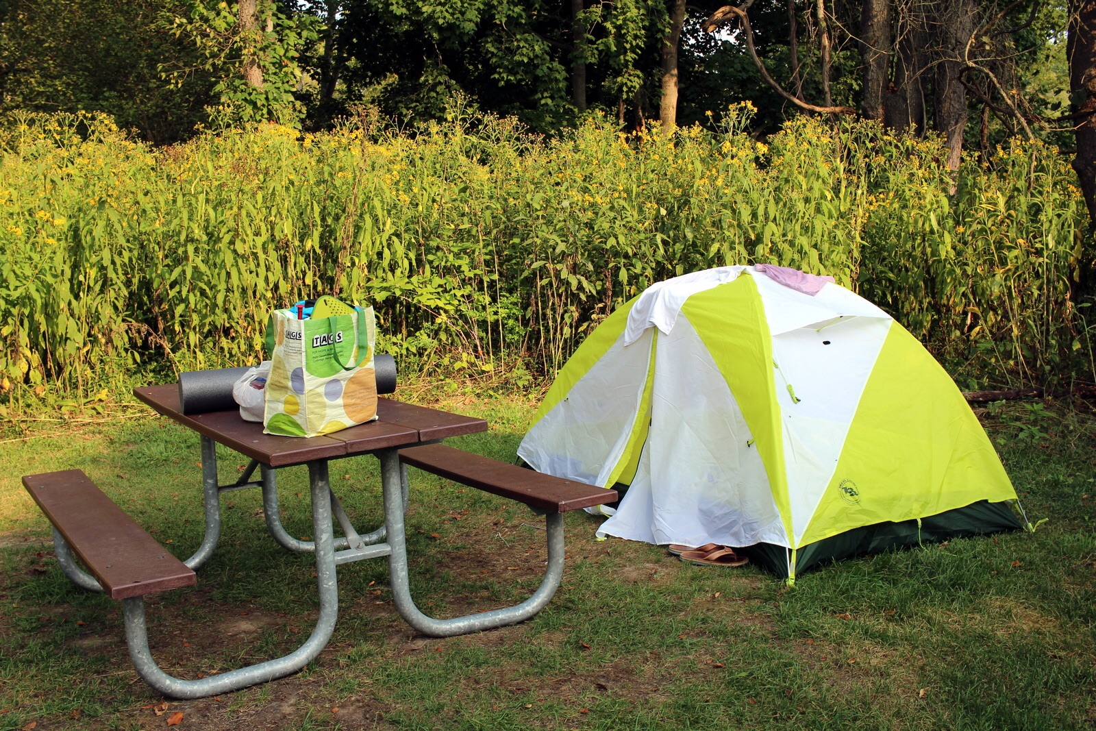
I arrived at the Ontario County Park campground at 12:30 a.m.--a mere 2.5 hours before my alarm was set to go off. Jeremy had already set up my tent, so I immediately passed out. 2.5 hours later, it was 3:00 a.m. and it was time to wake up. I ate 4 slices of white bread with peanut butter to get the digestive system going. I started drinking Tailwind and water to top up my hydration level. Despite the craziness of what was about to happen, I felt very calm. It was a cool morning, and I opted to wear my running pants and fleece while waiting around.

Before we knew it, it was 4:40 a.m., and we needed to proceed to the start. We quickly checked in at the registration table, which had coffee available. Because I'd not made my own, I decided I'd take a small cup. It was exactly what I needed to kickstart my race-day engine. A few minutes before 5 a.m., the RD made a few announcements. I honestly wasn't paying much attention. He directed us to the start line and, at 5 a.m. sharp, the roughly 90 entrants were off!

First half.

Jeremy and I set off into the forest in pitch black. We had our headlamps to light the path in front of us. I'd done a good bit of running at night, but that was almost always on the road or on very easy terrain. This was my first time running technical trails in the dark. It was challenging, to say the least, and required every bit of attention I could give. I tried to use my sense of hearing to listen, like a bat, for what was ahead of me.

After descending through a root-filled forest, we immediately found ourselves climbing a hill. My heart rate bumped above 150 bpm, so I made sure to ease off the gas. My goal going into this race was to target 145 bpm, with a hard stop at 150 bpm. That is, if I went above 150, I would back off until my heart rate dropped below that level. And if I dropped under 145, I wouldn't really change anything, as long as I was feeling comfortable. 

The hills required a lot of fine-tuning of my effort level. Almost as soon as a climb started, my heart rate would shoot up. I would then slow down to a power-hike, and sometimes even a walk, until my heart rate settled. I knew that discipline and patience early on would pay off enormously in the second half. It felt slow, but slow was fine, at least for now. Jeremy stayed close by throughout, and we worked our way forward in what was still a very tight pack. The pack was both annoying and helpful. Annoying because we kept overlapping. Helpful because there was a continuous path of light that we could follow ahead.

At mile 6, we reached our first aid station. It was a quick stop. The sun had not yet risen, and everything was very peaceful. But we made sure not to rush through the aid stations. I refilled my Camelbak to about the 32-ounce mark. We pressed on. At about mile 9.5, we reached our first serious descent. We dropped almost 1,000 feet down from Clement Road to Naples Creek (Aid Station 2). It was fast.

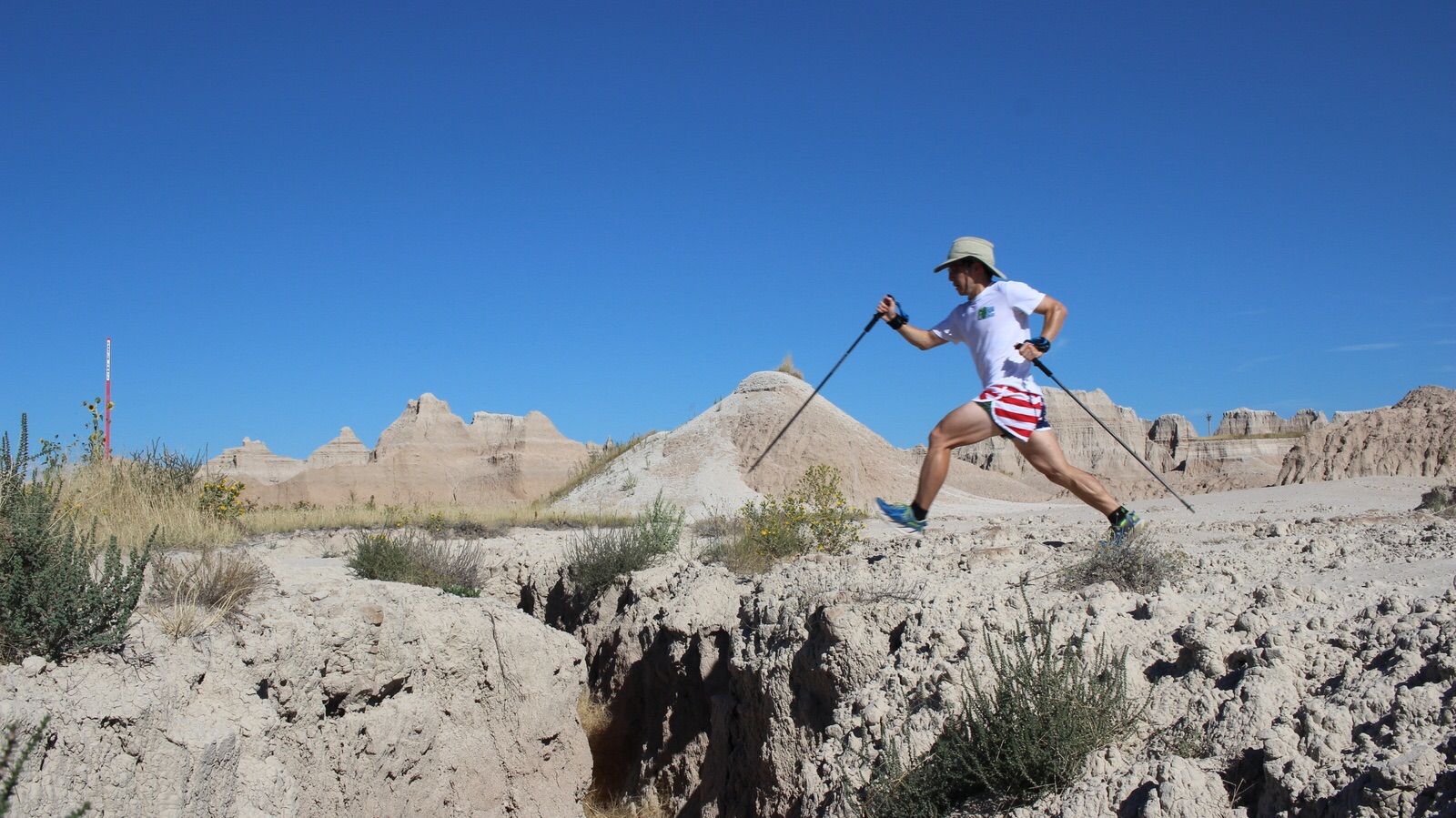
Lisa was at Naples Creek. At this point, Jeremy and I were both feeling really strong. We stopped to refuel, and told Lisa how we were doing, before heading back into the forest. Once inside, we continued to press onwards, I focusing on setting a conservative heart rate-based pace, Jeremy focused on staying close to me. Almost immediately, we hit our first big 1,200-foot climb for the day. Because I was carrying my trekking poles, I deployed them and immediately began pole-planting uphill in a cross-country ski-like way. I could feel the pull in my triceps, but knew that it was better to tire out my arms if I could spare the legs a bit in exchange.

We reached the summit of that hill, and then almost immediately dropped into another 500-foot descent. I bombed down this one, letting my legs turn over quickly, and planting my trekking poles like the downhill ski racer that I used to be. It felt almost like slalom skiing through trees and over roots. The hills were relentless. At the bottom of this one, we passed the 16-mile mark and immediately began climbing Brink Hill, another 650-foot climb. Once we summitted, we popped out of the forest and onto a road for a bit. This was a welcome relief. Running on roads is so much easier, and faster, than running on trails (we would keep an easy 8:00-minute pace on flat roads, but that would be slower than 11:00-minute pace on the trails).

Pretty soon, though, we began another bomber descent. This was by far the steepest descent we'd done so far. I had to do a lot to keep from running into trees, or tripping over roots. Any time there was an obstacle--like a big branch, a stump, or a web of roots--I double-planted my poles and hurdled over as if I were on crutches. (This was a pretty nifty technique, and would come in very handy later in the race, when my feet were so heavy that I was dragging them like one of those sea-bottom trawling devices.) At some point, we were on the forest floor, and we made quick progress on the flat, open surface. That was a nice respite.

At the bottom of this ridiculous descent, we found ourselves at Italy Valley (Aid Station 4)--22.6 miles in. This was where I started cramping. Specifically, my right calf seized up. I knew that this was due to the electrolyte imbalance--what's called "hyponatremia". Basically, I recognized I'd been drinking too much straight water, and not enough foods or drinks with salts. My blood cells didn't have enough electrolytes, and therefore my muscles weren't firing properly because they had no medium through which to send signals from the brain. I decided to pop 5 Endurolyte tablets, partly to overcompensate, but also because I knew I genuinely needed that much. A supporter helped me stretch out my calf. I made sure to put down more food. We were only 5 hours in. I couldn't already be cramping!

We left Italy Valley and began our second 1,000-plus-foot climb. I frankly don't even remember this one. I was still feeling comfortable at this point, but we just had so many hills that it's almost impossible to distinguish them, even if they're particularly big like this one. When we finally reached the top, we realized that we'd basically done a full trail marathon. It had been just under 5.5 hours. It was crazy to think that this was my slowest marathon by almost 2 hours--and we still had another 1.5 trail marathons to go. As we ran along the top, another photographer was there, waiting by an opening in the trees. It was awesome to see the where we had come from (hint: really far).

After descending again, we found ourselves at Italy Turnpike (Aid Station 5)--29.3 miles into the race. We were basically at the halfway point. But we didn't treat this as the halfway point; mentally, we wanted the next aid station at mile 35.6 to serve as the halfway point. It was better for morale to think that our second half was shorter than our first. Somewhere near Italy Turnpike, I signaled to the photographer that things were going well.

Someone told us that the next stretch to the "halfway" point didn't have any major hills. That was true. But what it had instead was ridiculously technical terrain. We had to tiptoe carefully through webs of roots; navigate several mud patches; plow through tall, thick grass (which cut up our ankles and shins); and even hack our way through a full cornfield!

At one point of the inaugural Twisted Branch Trail Run, between aid stations 5 and 6 (miles 29.3 and 35.6), runners literally had to hack a path through a cornfield. This was not even the most challenging terrain runners encountered, but it was perhaps the most unique.

After what seemed like an endless 6.3-mile stretch, we reached Patch Road (Aid Station 6)--our halfway point. This was in front of a log cabin in the woods. A musician was strumming his guitar as Jeremy and I sat in camp chairs pouring cups of ice water over our heads and refilling and refueling. It seems stupid to soak yourself in water, but the ice water was critical to regulating core temperature. By this point, my system was fully revved up and burning full steam--after all, we were 7 hours and 45 minutes into the race!--so I ate everything in sight. Lay's potato chips were my secret weapon. But I took cup-fulls of Coke and peanut butter-filled pretzels as well. And, of course, I took bars and gels for the trails.

We had covered 35.6 miles in 7:45--or just over 13:00-minute pace. We quickly realized that there was no way in hell we would be crossing the finish line in 13 hours (what we'd initially estimated). Even 14 hours seemed unlikely. At this point, 14:30 was our rough time estimate, assuming things continued to go well.

Second half.

All that separated us from our next aid station was a 4.2-mile stretch. This was the shortest stretch of the race, yet it felt like an eternity. We were now approaching mile 40. In this stretch, the rollers were deceptively challenging. We also had one pretty rocky downhill section that challenged the ankles--and our balance.

From here it was all mental. Really, it was all about putting one foot in front of the other--and doing so in a way that overcame whatever obstacles lay in our path. At this point in the race, our leg muscles were so fatigued that we would barely be lifting them with each step. As a result, I kept stubbing my toes on roots, almost face-planting. Luckily, I would prevent a fall by planting my poles instinctively. That did not do anything for my toes, though. My left toes, in particular, got battered to no end. I was wearing the Hoka Cliftons, which is a road shoe and not really meant for trails. I told myself I'd change out into my Hoka Speedgoats soon. As we navigated the tighter forest section, I could smell Bud Valley, our next aid station.

Finally, we reached Bud Valley (Aid Station 7) at mile 39.8. We entered the aid station with Katie, who we had been playing leapfrog with throughout the day. We would generally catch her between aid stations, but she would spend very little time in each aid station and set off several minutes ahead of us. Even though we worked at different rates, it was fun to see her from time to time, and to exchange thoughts about how our races were going. (Katie ended up finishing over 20 minutes before us--seems like her strategy worked!)

I realized that I wasn't cramping at all. The electrolyte pills (Hammer Endurolytes, to be precise) were doing their magic. I shared some with Jeremy to ward off any cramps for the next 20-mile block.

It was absolutely bonkers ridiculous that we still had almost a trail marathon left to run! This was a pretty "dark" part of our race; it was a real challenge just to keep running. To counteract the darkness, Jeremy and I deployed the "aid station-to-aid station" goal-setting process. We broke the race down into aid station segments, instead of thinking about the total distance remaining (which was incomprehensible). So coming out of Bud Valley, all we thought about was hitting Glenbrooke Road. The elevation profile doesn't show anything larger than a roughly 600-foot climb, but the ups and downs (literally, of the terrain) were relentless, and gave our legs absolutely no rest. We had our mental ups and downs as well. For a while, I thought we were cruising. Then, I felt like I was at the bottom of a bottomless pit--the run was that torturous. At times, I felt hollow, like a ghost.

One of our most effective strategies to traverse the remaining distance was also the most simple: alternate running with walking. Because I was wearing my Garmin GPS watch, I could track our distance down to the hundredth of a mile. We'd pick a run interval distance, and then a walk interval distance. Depending on how fatigued we were in the moment, we'd alter the run-walk ratio. When feeling relatively fresh, we'd run 0.25 miles and walk 0.10 miles. At our worst, we'd run 0.10 miles and walk 0.20. In retrospect, it is wild to think about how much our "freshness level" fluctuated, not only over the course of the entire race, but even within the span of a few minutes.

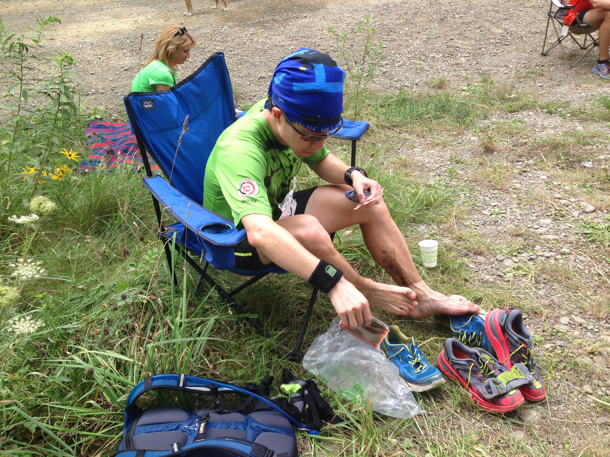
We hit Glenbrooke Road (Aid Station 8) and, as planned, I changed out of my soaked and muddy Hoka Cliftons into my fresh Hoka Speedgoats. Because I was raising my feet less as I was getting more and more fatigued, I was also stubbing my toes more. I knew a few more of my toenails would fall off after this day. Changing shoes was a really good decision (The Cliftons, being road shoes, have minimal to no toebox protection, while the Speedgoats have decent protection), even though it meant wasting a few minutes.

We knew at this point that there was no turning back. We'd made it almost 47 miles, and we weren't about to quit now. We jumped back into the forest and pressed on toward BHB, the penultimate aid station. These were tough miles, and they were also blurry miles. It's hard figuring piecing together what happened from mile to mile. All I know is that we ran them.

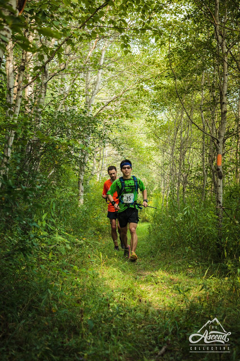
At some point en route to BHB, we entered what felt like an enchanted forest. Though Jeremy didn't want to stop (he feared we'd lose what little momentum we had), I insisted that we take some photos. After all, we had no time goals today. We just wanted to finish, so why not take a little time to slow down?

We hit BHB (Aid Station 8) and were surprised by what we found. First, the station was an oasis in the middle of nowhere.  Second, the couple manning the station were in very high spirits. Third, the theme for the station was Irish culture. There were four-leaf clovers and leprechauns. It felt a little bit like Halloween. The display was tacky, but provided perfectly timed comedic relief. We needed any sort of boost we could get to carry us through to the finish.

I don't know exactly where this was taken, but the photographer caught us one last time between Bud Valley and the finish line (Jeremy looks a bit tired).

We were now en route to the last aid station, in the town center of Urbana, which would give us one last time to see Lisa before our final epic 1,000-foot ascent of what I believe is called Brewers Hill. In the 5-mile stretch between BHB and Urbana, we came across a section where we were running on abandoned train tracks. It wasn't hard to maintain footing here, but it was just one more type of terrain that had been thrown at us, and I chuckled at the absurdity of the course's terrain.

We made it to Urbana with no hitches. I was absolutely starving. There was a tray of bacon on the table with about 6 slices left. I took two and scarfed them down. They were so salty and tasty. I asked the volunteers if I could have another one. They said "definitely!" I took a third. Again, it tasted so good. They egged me on: "take them all!" So I stuffed the remaining three thick, juicy slices into my mouth. (Spoiler: I had no stomach problems after this.) I felt a little bit bad for the people behind me, but I assumed they'd be making more bacon for those folks.

It was now almost 7 p.m., and we still had the 4.5 miles and the final charge up and down the 1,000-foot hill to go. We'd definitely be finishing in the dark, so we put our headlamps back on, smiled for the camera one last time, and made for the very big hill in front of us.

2015-08-29 18.45.31.jpg

We got lost (for probably the tenth time all day) trying to find the trail over the hill. While retracing our steps, we noticed that a pair of runners was closing in on us. We could tell that they were picking up the pace; very clearly, they wanted to catch us. I don't know what it is about me and racing, but, even though I'd told myself that I needed to run conservatively (after all, I was about to spend another 40 days doing epic runs all across the country), I couldn't help but feel the urge to resist their surge and maintain our lead into the finish.

The final climb was one of the steepest we'd seen all day. There was no way we'd be running this; power-hiking was as fast as we could go. The pitch was so steep that sometimes I'd take a step and almost fall backwards (I was also incredibly fatigued, so that probably contributed to my lack of balance). We climbed slowly, but with determination, and at a steady rhythm. We reached a section with switchbacks and, as we snaked up the hill, we could see the pair of runners behind us--running! Over the next few minutes, the pair got closer and closer. At one point, they were just one full switchback below us. We could hear them panting as they closed the gap. We remained disciplined and kept to a slower, but more sustainable, power hike. Soon, they completely lost steam. We dusted them well before we reached the top of the ascent, and then they were goners.

At the top, we realized that we still had several miles left down the other side of the hill. It was getting dark, so the light from our headlamps was essential. This was a surprisingly treacherous part of the race. The darkness and the leg fatigue made it hard to get over the roots and rocks on the trail. Multiple times, I nearly fell. My trekking poles saved me each time.

We now knew we were finishing; the only question was how soon. We decided to kick things up a notch and finish strong. Where we'd normally be keeping 14-minute pace, we pushed hard and maintained 11-minute pace for the last 3 miles. We were making a hard effort, but we weren't redlining at all.

It was now very dark, especially because we were in a thick forest. Coming down the hill, we could hear the bells and cheering at the finish line. It sounded close, but we couldn't see anything yet, so we knew we had to maintain our composure and descend safely. The worst end to this day would be to trip and fall and seriously hurt ourselves. Finally, just a few minutes after 8 p.m., we emerged from the forest and crossed our last road. We were now on the final stretch into the finish line chute.

In that final few hundred yards, I had flashbacks of the day, and the individual moments that had gone so well. We'd covered such an insane distance, and such an immense variety of terrain, that I was almost moved to tears (this is a pattern: I get emotional with these things). In the final sprint, Jeremy and I joined hands and raised them. We crossed the finish line in 15 hours, 7 minutes, and 52 seconds. We were done.

Post-race.

Upon crossing the finish line, I was in mild shock. Not anything bad. Just a feeling of awe that we'd just conquered an epic course--one that had taken us up and down the equivalent of ascending and descending the Empire State Building 9 times! We'd run through mud patches, rock piles, fresh cornfields, singletrack, streams--you name it.

Despite this, we both felt surprisingly good. For the first time in a while, we'd run a race without thinking about a specific time goal. Instead, we'd followed our heart rates (well, technically mine) and just run a solid, consistent effort without thinking about our exact pace or time. And, unsurprisingly, that strategy likely led to a far better outcome than if we'd said to ourselves that we, for instance, wanted to break 15 hours. Had we employed that kind of strategy, we probably would've burned ourselves too early and ended up DNFing as well.

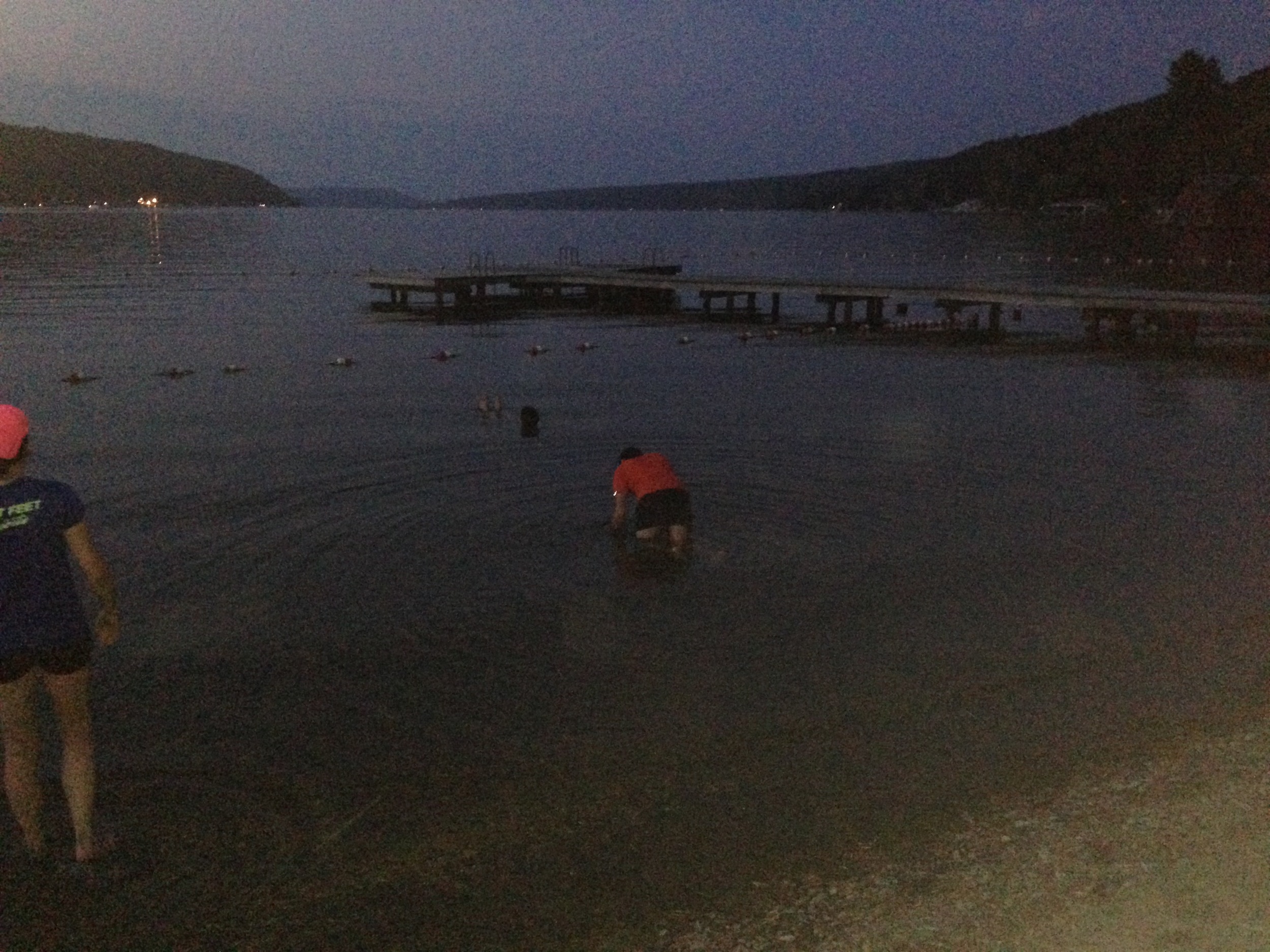
There were a lot of great things about the finish line amenities. We didn't get medals. I'm a little bit tired of race medals. After the first dozen, they lose their allure. They're also pretty useless, except perhaps as paperweights. Here, on the other hand, we had beautiful, hand-crafted ceramic mugs as mementos. The food was also excellent--there was a real pasta station serving basic pasta, sauce, and bread. Refueling immediately would reduce recovery time. Finally, we were close to a large body of water (Keuka Lake). A cool-off dip was in order (I'm submerged in the back, Jeremy is in the middle, and Katie is to the bottom left).

Jeremy and I finished tied for 16th overall (the official results don't reflect this, but we crossed the line together). We both felt incredibly proud of what we'd done that day. We later learned just how hard of a race, and course, this was. Only 47 runners would end up finishing the race; over 30 starters did not finish (they "DNFed"). Looking at the race history of the race winner, Daven Oskvig, also confirms how hard the race was. Daven normally wins every ultra race he enters, and his past 100K times are in the 8:30 to 9:00 range. Unsurprisingly, Daven won again (by almost 25 minutes) but his time was 11:45--over 35% slower than his typical times.

The experience of training for this race has shown me, more than anything, that I really love trail running. It was obviously also fun to do an even longer ultra race than the JFK 50 Mile, which I'd run last November. I'm not sure I want to go any further than the 100K distance. Jeremy, on the other hand, has been tactfully and not-so-tactfully dropping hints about "our 100 miler next year ;)" (this is a real text message). I don't think I'm ready to take on that challenge just yet (the leap from 100K to 100 miles is a 60% increase in distance!), but I'm at the very least intrigued.

For the time being, I'm going to try my best to get out onto the trails in the DC area, and keep the running fire going. Happy trails!

Day 6: Effigy Mounds National Monument, IA + Afton State Park, MN by Wookie Kim

I began the day with the luxury of being able to use a real kitchen. I was at my friend Laura's place in Chicago. I'd been on a streak of making Birch Benders pancakes, so why not extend that streak? And why not add in some Justin's almond butter? Laura, coincidentally, is from Vermont, so we had excellent maple syrup to round out our breakfast.

Today, I was headed for Effigy Mounds National Monument, just across the Wisconsin border in Iowa, on the same latitude as Madison. As I drove through Wisconsin, I thought about stopping to try cheese. I really didn't have time though. Instead, I compromised by stopping in Mt. Horeb, a town that appeared to be themed around trolls. I stopped in Grumpy Troll Brewing for some pre-run nutrition. This was, after all, my first real run since running the Twisted Branch 100K only a few days earlier. I needed all the fat, protein, and carbohydrates I could get.

I ordered a bunch of boneless wings, and a flight of beer.

I then consumed all of it.

I was fueled to run! A couple hours later, I'd arrived at the visitor center in Effigy Mounds. One of the rangers helped me figure out which trail to explore. He recommended the North Unit because it had more scenic views, though it had fewer effigy mounds to see.

What's an effigy mound, you ask? I had no idea what it was either, but now I know. It's a mound of earth shaped in the form of something else. Some mounds would be geometrical shapes, like cones and lines. Others would be in the form of animals including most notably, bears. Native Americans living in the area had built these mounds for religious regions. Effigy Mounds National Monument was unique because it contained a significant proportion of extant effigy mounds.

I began my run. The trail was soft--the perfect surface to run on after a hard ultramarathon.

The trail quickly turned into gradual switchbacks away from the visitor center. I walked these.

As I ascended, the forest would open up every now and then, and I could see some of the effigy mounds, even if they were hard to spot.

I reached the first lookout point. I could see the Mississippi River and, across from it, Wisconsin.

There was also a pretty humorous (and overly dramatic) warning sign.

Because there were no observation towers, it was actually quite hard to see the effigy mounds properly. After struggling to identify several mounds, I gave up. I decided to run to the vista at the end of the trail--Hanging Rock.

A couple miles later, I was there. It was cloudy out, so the view wasn't incredibly picturesque, but it was nice to see the grand Mississippi.

I knew I still had a long way to drive before getting to my campsite for the night. I was headed for Afton State Park in Minnesota, just east of the Twin Cities. I hustled back to the visitor center.

On the way up to Afton, I took US-61 along the banks of the Mississippi. It was a beautiful, windy drive. As the sun began to set, I couldn't resist pulling over and trying to capture it.

I ended up arriving at Afton long after the sun had set. I hadn't realized that my campsite was a remote backcountry hike-in site. It was over a mile from the nearest parking lot, and involved several hundred feet of elevation gain. Being the camping novice, I stupidly decided to bring practically everything in my car. Moreover, because it was dark, I couldn't tell exactly which trail I was supposed to follow (try telling me you can follow this ridiculous map!), so I ended up taking a wrong turn. As a result, I trudged an extra 1.5 miles with all of my unnecessary gear. It took me over an hour to get to my campsite. I was drenched in sweat, dotted with mosquito bites, and covered in red marks from all the straps on the bags I was carrying. I learned my lesson that night: when camping, pack light.

Day 10: Mount Rushmore National Monument + Harney Peak by Wookie Kim

The landscape changes rapidly as you head west. Badlands turn into prairie, and prairie turns into forest. On this morning, I entered Black Hills National Forest, expecting to make only a quick pit stop at Mount Rushmore, before continuing down to Wind Cave National Park. I ditched that plan, and decided to run to the highest point in the state of South Dakota--Harney Peak.

I began with Mount Rushmore. To be frank, I wasn't particularly interested in visiting this monument. Sure, it'd be impressive to see, but this trip is about running in our parks, not trying to avoid getting knocked over by tourists. Sure enough, when I arrived at 10:30 a.m., expecting to have beaten the majority of the Labor Day crowd, the throngs were already milling about.

I took the obligatory photos while jog-walking the Presidential Trail to get a closer look. I made it back to the amphitheater for a brief ranger talk on President Roosevelt.

By this point, it was already almost noon. My original plan was to head to Wind Cave. But a ranger had mentioned that Harney Peak was just a few miles down the road. I decided I'd run it.

There are two approaches to Harney Peak. One is 3.5 miles one way with 1,100 feet of elevation gain on a relatively easy trail. The other is closer to 6 miles, with 2,200 feet gained on a rugged trail. Obviously, I chose the latter (I subscribe to the doctrine of "The Strenuous Life").

I've always loved climbing. Whether on bike or foot, it feels amazing to reach a summit or crest a hill. Climbing is hard work, and can put you in a world of hurt. But it--both the journey and the summit--is always worth it.

I began, as always, by carefully reviewing the posted information, and orienting myself on the trail map. I have a pretty good habit of getting lost, but my compass has always helped me get back where I need to be.

And then I was off. Pretty soon, I thought I could see where I was headed.

I got into a steady rhythm, power-hiking up the inclines, and running the flats and the dips. I was getting closer.

The trees started thinning out as well.

But when I followed the trail that rounded what I thought was the summit, I noticed that there was a whole expanse that I hadn't seen from the bottom. I paused to catch my breath and stare out into the Black Hills.

I followed the ridge line, and then realized that I could now see the summit--there clearly was an observation tower at the top.

Right at this point, a couple was descending back down the trail. When I passed them, the man said, "You're almost there--it's about 30 minutes from here." I chuckled to myself. 30 minutes? More like 10! (It turns out it took me 12 more minutes to get to the top.) There were a lot of people up at the top. It was a picture-perfect day, with cool temps of 60 on the summit and 70 further below, so I wasn't surprised.

2015-09-06 16.03.34.jpg

I took my obligatory summit photo, which also conveniently served as a way for the winds to dry off the sweat on my shirt.

I looked down from the top and decided it was time to start descending. I hadn't realized it, but I'd just spent an hour at the summit, and the day was about to disappear if I stayed longer than that. So I began descending--and quickly!

This was an unplanned detour. But it was so worth it. Life is generally better with a plan. But sometimes you have to learn when to stray from the plan and act spontaneously.

By now, I was past even the time I'd thought I'd be arriving at Wind Cave. It was a short drive away, but I opted to take the Needles Highway, known for its granite towers and pillars. I drove very slowly, not only to see the scenery, but also because the road was windy.

There were also several single-lane tunnels through the granite. The highlight was the Needle's Eye, a narrow one-lane slit that cars somehow passed through.

I made it through unscathed. I stopped at a turnout to take a photo of the dramatic landscape. But I also decided to pay photographic tribute to a silent partner in this entire endeavor: my car.

I finally made it out of the Needles Highway and back onto the road through Custer State Park. Because it was past 7 p.m. now, I began seeing more wildlife coming out to eat. There were lots of bison, both on the roadside, but also out in the prairies.

I also saw a pack of pronghorn nomming on the grass close to the highway.

As the sun set over the hills while I arrived at my campground in the ponderosa pine forest, I felt thankful for another amazing day out in our parks.

On blogging. by Wookie Kim

Very quickly, blogging while on the road has become just as central a part of what I'm doing this summer. The response to my trip has been wonderful to see. 10 days in, and this site has had almost 10,000 page views from several thousand unique visitors. I'm encouraged that people are getting a glimpse into my journey, but, more importantly, I hope that what I document will help show just how magical our national parks are. They simply are not to be missed.

One question that might be on a reader's mind is how I actually go about blogging while on the road. I've literally found my first wifi hotspot on this entire trip (excluding my one night in Chicago at my friend's and my one night in a motel in Bismarck, ND). Early on, there were certainly plenty of Starbuckses, but I never had the time to stop and pull out my laptop. Daylight time is precious to me, so if I'm inside a coffee shop instead of out on the trails, I feel like I'm wasting time. So, how do I do it?

Here's my process. In the morning, I break camp and hit the road. While driving, I use a car power inverter to recharge anything that needs charging. I always prioritize my portable battery pack (made by Jackery), because this ensures that I can have 2-3 full charges of my iPhone. But I also charge my laptop, my Garmin GPS watch, and my spare camera battery. I often go through very extended portions of the day with absolutely no cell signal. The beauty of the iPhone is that it still tracks your blue dot through GPS. So if I've preloaded a map or route, I can roughly see where I am and where I should be headed.

When I arrive at a trailhead, I kind of put all of this to the side. I always bring my camera--a compact Canon SL1, with a very shallow 22mm prime lens. Because the body is already so small, this set-up is perfect for running. If I want to--and occasionally I do--I can actually run while holding the lightweight camera in one hand. It's just like holding a hand-held water bottle. For runs where I know I want some more camera firepower, I consider bringing my telephoto lens. This is how I've gotten such great close-ups of wildlife. But bringing that lens comes at the expense of a heavier pack. I need to have a pretty good reason to bring it.

To avoid feeling schizophrenic on the trails, I break up my run into chunks. I begin with the camera put away. I run as freely as I'd like, just getting a feel for the land, and soaking it all in. Eventually, when I reach my first picturesque segment, I pull out my camera and make frequent stops. Of course, magical things happen on each run. Even if I'm in a groove, I'll stop to take a photo. Interestingly, these photo breaks are very good short recovery periods from running.

After a day out on the trails, I'm usually making my way to a campsite, hopefully somewhere very nearby. Once I arrive, I set up camp, cook dinner, and relax for a bit. And it's after that period that I make the blogging magic happen. I begin by taking my SD card out of my camera and into my laptop. From my laptop, I can cull the photos that I want to include in the blog. But if I don't have wifi, how do I get those photos online? The answer is that I use my iPhone. Squarespace has a mobile app. It's pretty barebones, but allows you to post text and images. And that's really all that I need. To get the photos onto my iPhone, I use iTunes photo-syncing feature.

Once the photos are on my phone, I begin writing the blog post. You're probably wondering how I'm able to type such long posts using only my iPhone. Again, the reality is that I have technology on my side. I've always had a Bluetooth keyboard for my smaller devices. I brought that keyboard along with me now. I'm so glad I did. It is that keyboard that lets me type just as if I'm using a regular computer. So, I type up a post, add in some images (because words can do only so much), and prepare to post it. If I'm in an area with cell service, I'll publish it right then and there through my phone. If not, I'll wait until I reach a point the following day where I do have cell signal. (For instance, I'm actually at the Wind Cave Visitor Center right this moment, and I've found my first free wifi hotspot, so I'm actually using internet on my laptop.)

The Jackery iPhone battery pack, good for 2-3 charges, and a bunch of maps, good for the many places where I've had no cell service.

The Jackery iPhone battery pack, good for 2-3 charges, and a bunch of maps, good for the many places where I've had no cell service.

Why do I even bother? Well, I've realized that part of what makes this blog interesting is that it unfolds somewhat in real time. Many people have told me how they enjoy living vicariously through me and my blog. To make that vicarious experience as real as possible, I'm doing my best to share bits and pieces of my progress each day, while on the go, instead of waiting until I next hit a coffee shop (in this area of the country, potentially never), and dump everything at once.

I've already violated my principle and have spent 30 minutes here inside this air-conditioned visitor center in Wind Cave National Park. I just went on a cool tour of the cave system. It's now time to gear up and run some of the trails on the surface. And then I hit the road again, this time for Bighorn National Forest.

Day 9: Badlands National Park, SD by Wookie Kim

I slept very little the night before I left at sunrise for Badlands National Park. At around 3 a.m. in the Juniper Campground at Theodore Roosevelt National Park, I awoke to one of the loudest thunderstorms I've ever heard. The rain was pouring down and shaking my tent to no end. Every now and then, my tent would light up as the lightning bolts flashed across the sky.

I started panicking. What if I hadn't put my rain fly on properly? What if my tent was leaking? Bleary-eyed, I put on my head lamp and surveyed the inside of my tent. Everything seemed fine. But the rain kept pounding down, and I was convinced that my campsite might flood. I don't remember when the rain stopped, but I didn't sleep a wink until then.

At about 5:30, I was up. I knew I had a long day of driving to get to Badlands. My tent was in a muddy mess. I decided to forego cooking breakfast there. I just wanted to get out of the bog that my campsite had become. I tried my best to scrape off the mud from my tent before packing it, but it was hopeless (even today, 2 days later, the tent is still covered in dried mud). I was exhausted, hungry, and in need of caffeine.

I set off for South Dakota at 5:55 not in the highest of spirits. As I was taking the road out of the park, however, I immediately noticed a large brown animal grazing just off the side of the road. It was a bison.

A bison having a more pleasant morning. 

A bison having a more pleasant morning. 

It was fun to drive by him and have him look up at me. It was almost like we were sharing the morning--and the park. Not a soul stirred at this hour. (Theodore Roosevelt is already one of the least visited national parks. But I was also in the North Unit, which, due to being 70 miles away from the main highway,  is far less popular than the South Unit.)

I hit the road and cruised south. Though I'd started the morning in rough fashion, the scenery lifted my spirits. And I also can't discount how uplifting it is to drive on an open road. 

image.jpg

When I finally entered South Dakota, I saw, for the first time in my life, signs showing 80 mph as the speed limit. I took advantage of this opportunity to pass the miles quickly.

image.jpg

After cooking pancakes at a roadside rest stop outside of Sturgis, I was within 2 hours of the park. In the final stretch, I saw dozens of advertisements for the "Wall Drug Store." They touted their 5-cent coffee. I'd also heard that their donuts were good. So I figured I'd stop by.

image.jpg

The inside was a tourist trap. But it was still fun to see what paraphernalia people could get. I saw a veteran hanging out by "The Travelers Chapel." He didn't mind that I took a shot of him. 

image.jpg

I bought a couple of Wall's famous donuts--one for now, and one as a post-run treat--and pressed onwards to the park. 

The landscape changed almost instantly. Up from the prairie were beautiful layered badland buttes. I had to stop by the road and take my first photos. 

image.jpg
image.jpg

The park was teeming with people. It was then that I realized that it was Labor Day Weekend--I'd lost track of the days. I soon realized that there was a chance that I wouldn't be able to get a campsite inside the park. The campground had around 80 sites, but would I be able to get one of them? I made it a point to get there ASAP. 

image.jpg

I'm glad I proceeded straight to the campground. When I arrived, only 2 sites were still open. I took one of them. It was already well past 2 p.m., and the sun was beating down on the prairie. I knew I needed to get out on the trails as soon as possible. My goal was to run every marked trail in the park, starting on Castle, proceeding to Saddle Pass, returning on Medicine Root, and then completing the Window, Door, and Notch trails. I quickly set up my tent, changed into running gear (including my Tilley hat--such an essential for the sun), and headed to the trailhead. 

image.jpg

Because I was going backcountry on a very hot day, I was worried about safety. I made sure to sign every backcountry register I could find. 

image.jpg

Almost immediately after setting off, I saw my first signs of movement in the badlands. It was a desert bunny. He was super cute, and let me move quite close to him. 

image.jpg

The trail needled out into the prairie and back towards the buttes, like a sine curve. The contrasts were wonderful, especially with a clear blue sky. 

image.jpg
image.jpg
image.jpg

It was an impressive environment. This felt far more dry and desert-like than the badlands of Theodore Roosevelt. Speaking of Theodore Roosevelt, I made sure to track the trail at all times. Compared to the ridiculousness of the Buckhorn Trail in Theodore Roosevelt, the Castle Trail was incredibly easy to follow--all you had to do was look for the red stakes, which were placed frequently along the trail. 

image.jpg

As I criss-crossed the badlands, I came across a little ravine. It was relatively narrow, and I thought I'd have a little bit of fun. So I decided to jump it. 

Building speed.

Building speed.

Lifting off.

Lifting off.

Getting air. 

Getting air. 

Landing. 

Landing. 

That was fun, dangerous, and worth it. Teddy Roosevelt would've been proud. 

I continued until I reached Saddle Pass. I noticed that there was a rock spire that one could climb. So I scrambled up it to get to this vista.  Boy, was it incredible.

image.jpg
image.jpg
image.jpg

I then reached the end of the 6-mile one-way Castle Trail. I turned around and headed back, but this time took the Medicine Root Trail, which veers out further into the prairie than the Castle. A couple hikers warned me that they'd heard a rattlesnake 10 minutes in front of me. I took that as a sign that I should slow down my speed. Given the heat, my heart rate was already starting to spike above where I wanted it to be. So I settled into a very appropriate desert pace--a steady, light-footed canter.

I made it back to the trailhead. From there, I branched out to see the Door, Window, and Notch Trails. They were very similar to what I'd already seen. 

By this time, the sun was starting to set. I made it back to my campsite and gazed at the sun setting behind the tall grass in the prairies to our west. 

image.jpg

It felt somewhat odd to have 80 or so campsites right in the middle of this expanse. I took a few photos to try and capture the juxtaposition of man and nature. 

image.jpg

I had an excellent night sitting beneath the stars and taking in the cool badlands air. I went to bed utterly at peace.

Unfortunately, that peace was broken by the wind. It grew out of control at roughly 2:30 a.m. This was far worse than the thunderstorm. The tent walls whipped back and forth, and the base of the tent on the windward side actually began lifting up. I shifted all of my bags and even my own body to the windward side. It was terrifying. I realized I needed to reinforce the tent if I were to ever hope to fall back asleep.

I stepped out of my tent to the whipping winds. The winds had been so strong that two corners of my tent stakes had come undone, and my guy lines were nowhere near taut enough. Not knowing how to prevent me and my tent from blowing off into the badlands like a tumbleweed, I frustratedly tried to load up a YouTube tutorial on how to set up a tent in strong wind.  I finally got enough of the video loaded for me to realize that I'd been tying the guy lines wrong. Determined to stabilize my tent, I redid all of the guy lines and, this time, properly used the tensioner to make the lines taut. I looked up around me, and noticed that half the campground was also awake frantically scrambling to keep their tents on earth. It was a sight to see.

I returned to my tent and closed my eyes. The whipping of the tent walls was less intense, but the noise was still out of control. I didn't sleep well. 

But that's okay. Because when I woke up before 6 a.m. from the whipping winds, I looked outside and saw this. 

image.jpg

Realizing that this was a special sunrise that was occuring, I rushed out to the prairie to find a good place to watch the rising sun.

 After cooking pancakes and making coffee, I hit the road again. A few miles from my campsite, I came across Interior, population 67.  I didn't stop.

On the challenge. by Wookie Kim

Part of what makes this trip so thrilling for me is how logistically challenging it's been. Actually, to be entirely honest, I'm amazed that I've been able to do what I've done so far in this first full week.

Since hitting the road on my own on Monday, I've driven 2,202 miles. In that same time, I've also run over 43 hard trail miles. And I've also done a good bit of unplanned sightseeing along the way. You'd think that with all of this driving and running I've been doing, I'd have no time to relax, right?

Right. I've had basically no relaxation time. Each day, I'm up way before the sun rises, and I'm several hours into my drive when most people are still starting their morning routines. I then cruise into the national park visitor center around lunch time, talk to the rangers about what I need to know, and then set off on a trail. Between 3-7 hours later, I'm back, hurrying to set up camp before the sun sets, cooking dinner as fast as I can (my body needs substantial food immediately), cleaning up, and then trying to resort my car in preparation for the next day.

Looking back on my daily routine for the last 5 days, I chuckle every time I think of the valise stuffed with books that I brought along. I probably have 20-some books in there, several of which are over a thousand pages. I thought I'd knock off a book every 2-3 days. I'm now thinking I'd be lucky if I read 5. 

One might wonder why I'm in such a hurry--why, in God's name, I won't just take a chill pill, slow down, savor the moments that I have out here in the wild. This is an understandable criticism. Typically, one would hope that a person seeking to connect with nature would do exactly that--just be.

Unfortunately (or fortunately), this is not a typical trip. I have no qualms with rushing across the country at lightning speed. That's within the scope of what I'm trying to do--visit every single state I have yet to visit, run epic runs in as many national parks as I can along the way, and do all of this in a limited amount of time, Because I've chosen to prioritize the grand scale of my trip, I can't savor every moment. And I'm simply okay with that.

But getting back to the challenge. It has been an exhilarating 5 days on the road. Each day feels like the next stage in a multi-week adventure race. As soon as my alarm goes off at around 5:30 a.m., I'm immediately up and about, trying to accomplish all the tasks I need to get done before I can hit the road. 

My stopwatch has been a critical friend in this regard. I've begun to time all of my daily tasks, to figure out where I'm wasting and where I'm saving time. For example, I've slowly been whittling away the time it takes for me to: (1) set up my tent and sleeping arrangements, (2) get my Whisperlite stove up and running (the past two times I've been able to prime and light it with one try--my first time, it took me almost an hour to get the stove working!), (3) cook breakfast, and (4) break camp. If it's been only 5 nights and I'm already improving this much, I'm going to be an expert by the end of this summer.

Another aspect that I find rewarding is that I always have to think two steps ahead. Particularly when I'm doing this trip solo, and particularly when I've set out on an aggresive schedule, I really have no time to idle. In fact, I've realized that this trip will quickly grind to a halt if I focus only on the step immediately in front of me. (Interestingly, this same philosophy applies to my trail running: if I'm looking right down at my feet, I'm almost definitely going to misstep or hit something; if I'm scanning 20-30 yards ahead, I can plan for every obstacle as I approach each one.)

So I'm constantly thinking about ways to improve my routine--to set myself up for all the steps ahead of me, and not just the one immediately in front of me. What can I do each morning that will set me up better for what I do each evening? How can I arrange my campsite so that it is easiest to break down when I stumble around in the pre-dawn light?

The single biggest change in my routine over the last couple nights has been the amount of stuff I lug out of my car to my campsite. My first night, I practically unloaded my entire car. When morning came around, I had to lug everything back through the morning dew. It was such a waste of time! Now, I take the bare minimum. At my car, I measure out the food I want to cook, the things I'll need in my tent, and the other amenities of camp life. The rest stays in the car.

Interestingly, through this process, I've also learned that taking shortcuts can end up being a huge time waster. Taking the time to do things right the first time around generally leads to a better outcome than haphazardly rushing through a task. For example, I've tried to speed pack my sleeping pad and my tent. But when I've tried that, the items often aren't packed tight enough, so they don't fit into the stuff sacks or into my duffel bag. I have to start over again. That's more time wasted. 

In short, let's just say I had far too rosy of a picture of how leisurely life on the road would be.

I'm sure there are many people out there--one might call them camping or outdoors "purists"--who look down on what I'm doing. My response? I really don't care. So far, this trip has been an incredible experience--one that has challenged me in so many ways, and taught me so much. Despite the speed with which I'm covering all these distances, I can say for a fact that I've been communing with the wild and feeling an almost otherworldly sensation on each run. In fact, if the trip were to end tomorrow, I'd still walk away convinced that setting out on this crazy adventure was one of the best decisions of my life.

Despite my love for the challenges that each new day presents, I'm happy to report that tonight I can and will idle. Tonight is the first night that I've actually cooked and eaten dinner, cleaned and packed everything away before the sun has completely disappeared. It's now just after 9 p.m. here inside Badlands National Park, and all I can see when I look up are the stars illuminating the night sky. With that, I'm going to go savor the moment while I can. Because tomorrow, I'm back at it again.

Day 8: Theodore Roosevelt National Park, ND by Wookie Kim

My first big run--in Theodore Roosevelt National Park--didn't go as planned. I got lost in the backcountry. And the NPS rangers helped me get out. Let me explain.

My original plan was to tackle the Achenbach Trail, a challenging 18-mile loop in a remote area of the park. On the 2.5-hour drive from Bismarck to the park's North Unit, however, the sky looked ominous. I'd checked, and the weather forecast called for thunderstorms. If that were the case, I simply didn't want to risk being backcountry by myself on such a challenging trail. 

The sky wasn't ominous all day. A double rainbow.  

The sky wasn't ominous all day. A double rainbow.  

When I arrived at the visitor center, the ranger confirmed my intuition. He recommended against running the Achenbach. Not only did it require two river crossings, which could get dangerously high in storm conditions, but it also had a significant amount of bentonite clay. I didn't quite understand the physical properties of this clay, but apparently when it gets wet, it is so slick that it feels like an ice skating rink. If I were to go on the Achenbach and it rained, I would risk being stuck in an extremely remote area with a very treacherous trail.

There was absolutely no question what I was going to do: anything but the Achenbach. I know that safety came first. I'm a greenhorn when it comes to backcountry navigation. I wasn't going to risk anything, especially on my first day doing a serious run. I've also been following the principle of building up gradually, so I knew that I wanted to do something simpler first.

The ranger suggested the Buckhorn Trail, an 11.2-mile loop that covered most of the park and included a couple prairie dog towns, and possibly also the Caprock Coulee Trail, a short 4.5-mile loop that covered some of the best vistas in the park. I opted to do both, and I decided to begin with the Buckhorn.

Right from the get-go, I was having trouble following the trail. The ranger in the visitor center had warned me that following any trails would be difficult in this park. Specifically, the bison had a tendency to create their own trails. And, to the human eye, a bison-created trail looked identical to a human-created trail. (In fact, I later learned that some bison trails seem more like "real" trails than the actual trail itself!)

Bison poop.  

Bison poop.  

Bentonite clay.  

Bentonite clay.  

Because the Buckhorn began in a very narrow patch of land between the park's main road and the Little Missouri River, I wasn't too worried about going off-trail. As long as I kept the road to the north, and the river to the south, of me, I knew that I'd be fine just generally proceeding east. As a result, the first 4 miles or so were of no real concern. I took time to explore the ecosystem where the buckhorn used to roam. I marveled at the sedimentary layers of the badlands buttes--the patterns are so naturally pleasing. I also noticed ubiquitous evidence that bison were around--fresh bison poop. And I found patches of bentonite clay, which I could easily envision getting extremely slick when wet.

Eventually, I popped back over the main road to the beginning of the backcountry portion of the Buckhorn Trail. I still felt very comfortable, and let myself push up a narrow trail as it ascended gradually. I passed through a wooded area, before reaching my first scenic point. It was amazing to take everything in from high up above.

Running through the woods.  

Running through the woods.  

My first overlook.  

My first overlook.  

After about 2 hours and 8 miles, I had ascended way up above the buttes and had come out onto a grassy prairie. Imagine a grassy field that extended into the horizon along 270 degrees. I continued following the trail posts until--well, until I could no longer see either where the trail continued or the next trail post. At this point, I took out my map and compass to assess the situation. Several times, I ventured out before backtracking, realizing I'd not gone down the right trail. When I came back to the original post, I noticed that a trail continued back down the buttes. I followed that trail, dropping back down into the valley. Then, oddly, I passed 3 water troughs and a fenced section. I suspected that this was not part of the main trail and that I'd come across some kind of service or maintenance area (I later learned these troughs were for the bison). I continued anyways. Eventually, I found myself descending quickly again, and the views, again, were incredible. WAIT. This view was almost exactly as incredible as the one I'd already seen. And then it hit me: I was going in reverse down the trail I had originally come up.

At this point, I panicked a tad. My legs were fresh, I had lots of water and food, and I even had cell service high up on the prairie, but I just felt uneasy knowing that I'd somehow U-turned without even realizing it. Making this kind of mistake once would be fine. But if I kept doing this, I could get stuck out here. 

I took out my compass and figured out which general direction I needed to follow. I quickly realized that my original direction was correct. But I still couldn't, for the life of me, explain why I had done a loop and ended up retracing my steps. I knew I had to go out onto the prairie so I continued back in the original direction again, more determined than ever to find the right trail. 

Again, this proved extremely difficult. Every time I found a post, I could find no clear trail. Any time I thought I'd found a clear trail, I'd follow it for a few hundred yards and then it would disappear into tall prairie grass. I knew it couldn't be the case that the trail would take us into such tall grass. So I'd retrace my steps and try again. This was a labyrinth game, except I was criss-crossing the prairie. 

Following one of these paths, I noticed a prairie dog town on my right. I thought I could use the town to reorient myself, because the map noted two such towns. But when I looked at the map, I realized that both towns were supposed be on my left. This town was on my right. How? Again, I was utterly perplexed. Meanwhile, the prairie dogs just sat there, yapping away with their mating calls and poking their heads out every now and then to taunt me. 

Prairie dogs.  

Prairie dogs.  

At this point, I'd spent almost an hour in the exact same spot venturing out on various trails, realizing that they were false, and then returning to my starting point. I still had plenty of water, and it was a cool, overcast day, but I knew I didn't want to do this all day.

Realizing that I had cell signal, I decided to call the ranger station. The ranger I'd spoken to earlier got on the line. He tried to determine where I was and helped walk me through my route. With his help, I realized where I'd gone wrong. Past one of the posts, there was a very faint trail in some brush that I was supposed to follow. This trail was much more faint than the two other "trails" I'd attempted to follow. Those trails were created by bison. But now that he mentioned it, I could see that this was a trail nonetheless. I thanked the ranger, hung up, and pushed onward.

I reached the next post a few hundred yards away. But, again, the trail seemed to disappear. And, the only things crisscrossing the post were trails that went in the wrong direction relative to where I knew was supposed to be going. I strongly suspected that it was going in the wrong direction, but one trail was so clearly stamped down that I figured it must be the right one. I followed it, again breaking into a fast clip across the flat prairie.  I crossed over a dry stream bed and, within minutes, found myself at the park's fence. I was at the boundary. Beyond, I could see the highway. I knew I was supposed to come close to the northern border, but I didn't think I'd actually hit the border. I again called up the ranger station. He said I shouldn't be at the fence, even though it was possible to see the fence from the trail. After trying to figure things out, he said that I should just wait there. He'd send a ranger to meet me.

15 minutes later, I saw a white truck cruising on a road in the distance toward me. It was a ranger. Given the difficulties I'd been having, he suggested I just cut my losses and hop back in with him. I wasn't out here to prove anything. And, more than anything, I was sick of wasting time tracking the trail, and wanted to get back onto a different part of the park. So I hopped in.

Back inside the park, I met with the head ranger, John Heiser (he's been at this park for 42 years!). He wanted to know where things had gone wrong. I sheepishly waited for him to scold me. Interestingly, he was very friendly and understanding about the situation, and did no scolding of any sort. He just wanted to get the facts, walk through what happened, and provide tips for future runs. He was like a military commander doing a post-mortem analysis.

John Heiser, certified badass.  

John Heiser, certified badass.  

I explained everything that had happened and he nodded along with me. He pointed out how tough it was to navigate this trail. This park is one of the least-visited, and some of these backcountry trails get very limited use. So the trails are already incredibly faint due to the lack of consistent human foot traffic. To make matters worse, the bison, as already noted, create their own trails--ones that are indistinguishable from, and oftentimes even more real-looking than, the actual trail. Heavy summer rains that had led to overgrown grass didn't help with trail post visibility. All in all, he commended me for cutting my losses and calling the ranger station for guidance, instead of pressing on when I knew something was off.

John also explained some other principles of following a trail. I should generally be able to see the next post from the current post. Unless it was plainly obvious, when I reached a post, I was to continue in the same direction. And using my compass to verify my course was a prudent thing to do regularly. He noted how even some of the newer rangers had gotten lost in the very section I'd gotten lost in.  (I later discovered that my neighbors at my campsite--lawyers from Canada--also started on the Buckhorn this afternoon and got completely lost and ended up popping out onto the road far from where they were supposed to.) 

John also explained good trail selection practice. He said that, in every new park I visited, I should always start off by "testing" an easy trail to "get a feel for the land." Every ecosystem had unique challenges. And those challenges couldn't be taken lightly. Here, the challenge was the misleading bison trails and the very faint actual trail (also, in wet conditions, the bentonite clay). Other parks would have their own challenges, and it was better to try them out first before pushing out too far.

After this mini-lesson, I told John how demoralized and discouraged I'd now become. This was meant to be my first epic run. And it had ended somewhat miserably, and in failure. To be clear, at no point was I in panic mode. I had plenty of food and water, and also knew that I could reverse course and return to the main road the way I'd come in. But it was disconcerting that I was unable to complete what was already my "second-choice" trail. More importantly, if I couldn't do this, how could I continue to do some of the other trails I've selected in other parks?

John disagreed with my dour assessment. He noted how smart I'd been in using my compass, in trying to retrace my steps, and, ultimately, in calling NPS. He also made it clear that this would be the hardest trail to follow, by far, in the national parks I was visiting. The bison create such incredibly realistic trails, that it's practically impossible not to get lost up here. He asked where I was going next, and he nodded along--all of the trails in those parks would be infinitely easier to follow.

After this 20-minute debriefing, John suggested I continue with the Caprock Coulee Trail anyways. He said it was nowhere near as difficult to follow, and that I should be able to do it no problem. And the vista had spectacular views that I couldn't miss. It was still the early afternoon, so I figured why not. Perhaps this could lift my spirits, and my self-confidence, after the Buckhorn Trail mishap. 

I thanked all of the rangers I spoke to, and drove over to the trailhead for Caprock Coulee. As I was about to set off onto the trail, John's truck pulled into the lot. He told me again not to worry about what had happened earlier and to have fun out there. I thanked him again and was about to set off when another car pulled in, and a trio of women popped out. Before I could leave, John told them about my earlier mishap, and joked about how they shouldn't follow me. That was funny. I said hello to the trio and set off.

Nat, Ruth-Ann, and Megan. 

Nat, Ruth-Ann, and Megan. 

The Caprock Coulee Trail began with a gradual ascent. I didn't want my heart rate to go too high, so I kept it easy. Right as I was reentering my running groove, I noticed movement in the corner of my eye. There, a hundred yards away, was a bison, standing watch over the trail (like the troll guarding the bridge from that one fairytale).

The bison watching over the path.  

The bison watching over the path.  

​I immediately stopped and walked backwards away from the bison. I knew how dangerous bison were--I'd heard about the people who'd been killed this summer from trying to take selfies with them--and the rangers had noted that they have a top speed of 30 mph and can jump over 6-foot fences. I knew this beast was not worth messing with.

Cleaning off dirt? 

Cleaning off dirt? 

The bison seems uninterested.  

The bison seems uninterested.  

So, from afar, I took photos. Here, he was cleaning off some dirt (even though it looks like he's stomping). I waited 15 minutes, and he was still standing there, staring me down. Eventually, the trio of women caught up with me. After waiting several more minutes together, we decided we'd try to climb up the hill and around the bison. We scrambled up some dusty section, traversed 50 feet above the bison, and then descended behind him. We had successfully navigated around a bison!

At this point, I felt like my run had been foiled again. I simply was no longer in the mood to run. Also, the ladies were good company, so I decided I'd hike with them for the remainder of the loop.

The bison in our rear view mirror.  

The bison in our rear view mirror.  

I'm glad I continued, and with them. We climbed up and up and reached some spectacular ridges. At one point, we looked back down and saw that the bison was still exactly where we'd left it.

The bison is ruler of this kingdom.  

The bison is ruler of this kingdom.  

The views only got more spectacular.

Amazing view.  

Amazing view.  

Ruth-Ann at River Bend.  

Ruth-Ann at River Bend.  

Megan at River Bend.  

Megan at River Bend.  

I took the women's photos, and they took mine. We eventually reached the River Bend Outlook. This, too, was impressive. We munched on some snacks, took some more photos, and expressed our love for the park. We then proceeded to finish the trail. 

River Bend Outlook. Too bad it was overcast.  

River Bend Outlook. Too bad it was overcast.  

The patterns are mesmerizing.  

The patterns are mesmerizing.  

I'd spent from roughly 11:30 a.m. to 6:00 p.m. out on the trails in one form or another. I'd only covered 15 miles or so, but those were very slow, hard miles. Despite the hitches, it was a great day. It was also an important learning day. I learned that I really can't underestimate the wilderness. All of my fitness means nothing if I get lost.

Going forward, I'm going to be even more inquisitive at visitor centers to make sure I'm equipped with all the knowledge I need to know to navigate the unique aspects of each park. I'll take each day as an opportunity to become an even better outdoorsperson. And I'll continue running wild and free, with and alongside buffalo. 

Simple but delicious.  

Simple but delicious.  

I had a peaceful evening in a campsite in a juniper forest. I cooked a simple but hearty dinner--spaghetti with black beans,canned tuna, and a crapload of coconut oil. Next stop: Badlands National Park in South Dakota. 

Day 7: Bismarck, ND by Wookie Kim

In the last 4 days, I've driven over 1,600 miles. And today was my first pure driving day. I drove 460 miles from Afton State Park, which is just east of the Twin Cities in Minnesota, to Bismarck, a city in south-central North Dakota.  (Note: I recognize that I've skipped Day 6--I'll come back to it when I have time).

You might wonder why I'd spend an entire day driving. All along, that was my intention. One of the biggest priorities for me during this trip has been to hit our national parks. But the reality is that the vast majority of our national parks are west of the Mississippi. As interesting as Cuyahoga Valley National Park was, I know that it pales in comparison to what I'm going to get to see in some of the upcoming parks (Theodore Roosevelt, Badlands, Yellowstone, Grand Teton, etc.). Given my time constraints, I wanted to get out west as quickly as possible. This has meant several long days of driving.

Another important reason for only driving today is that I'm still in recovery mode from my trail 100K. Ultrarunners generally use the guideline of "one day off running for every 10 miles raced." Some even say that for a particularly hard race, you should take a day off for every 10 kilometers raced. So I should ideally be taking roughly 10 days of recovery. I recognize that I'm not completely following this rule-of-thumb. Even though I took several rest days (including some active recovery in the form of easy hiking), I could probably use a little more rest. Today was one more solid rest day.

Also, the driving was actually not as bad as it sounds. I quickly realized that there are lots of things that I like about driving. What I despise, though, is traffic. In the cities where I live, driving and traffic go hand in hand. So it's natural to have a tendency to dislike driving.

But out in the open farm country, where the speed limit is 75 mph, and you have driving directions as simple as "turn right onto I-94 and proceed 410 miles", driving actually becomes fun. It's stress-free, because you don't have to constantly worry about which asshole is going to swerve in front of you, or which pedestrian is going to mindlessly walk into your path. I also use this time to listen: to upbeat road-trip music, to the Revolutions Podcast (right now, I'm learning about the English Civil Wars), to nothing but the sound of my wheels roaring across the open road.

I also look around. The open road shows us the vastness of our country. Being on the open road also means that I'll inevitably stumble across interesting sights. This bison, for example:

Sometimes, you also see things that remind you of your friends (thinking of you, Sam, Henry, and Nick!):

Sometimes, you see a giant buffalo and want to run alongside it:

And sometimes, you just want to eat that very buffalo (the bison burger was quite delicious--the Big Chief Travel Plaza serves up a solid one):

And, sometimes, if you're really, really lucky, you might actually see a live bison resting for the afternoon:

After several stops, I arrived in Bismarck at 6 p.m. I filled up my almost-empty gas tank, and began shopping around for the motel with the lowest price (because when spending $0-20 on campsites, even the cheapest of motels seems exorbitantly expensive). Why a motel? Because I'm spending the next 10 or so days in our parks, and because I needed to plan ahead a little, I wanted to spend a night under a roof with wifi. I found America's Best Value Inn (no, really, the hotel is literally called "America's Best Value Inn"), and decided that it had the lowest price--and "best value"--in town. It has air conditioning and a bed, and no bugs. I can't complain.

Tomorrow, I hit my first big trail run. The Achenbach Trail (and possibly the Upper Caprock Coulee Trail) in Theodore Roosevelt National Park. Let's do this.

Day 5: Indiana Dunes National Lakeshore, IN + Chicago, IL by Wookie Kim

I'm a day behind, but better late than never.

Tuesday morning was a little rushed, because I knew I had a lot to cover: I needed to drive 310 miles to Indiana Dunes National Lakeshore; explore the dunes; drive another 60 miles into Chicago; and meet my friend for a night out on the town.

I was able to break camp quickly and efficiently, but the part that took longer than I imagined was walking back with my gear to the parking lot, which was almost a mile away. I ended up leaving just before 8:30, which ultimately wasn't too late.  The morning drive was, all in all, pleasant. By 11:30, I'd entered Indiana. And, by 1:30, I was at the visitor center.

A caterpillar greeted me at the visitor center. 

A caterpillar greeted me at the visitor center. 

Naturally, I spoke to a ranger first. She talked me into doing two things: complete the 3-dune challenge, and hike to the Beach House Blowout. Normally, the 4-5 miles involved would've been a breeze. But I had to deal with two obstacles: the sand, and my lingering fatigue from the 100K. I simply didn't want to overstress my body by running again too soon. And tractionless sand wouldn't be a good running surface anyways.

I first set out for the 3-dune challenge. This was a 1.5-mile loop that ascended 3 sand dune "mountains." Quotation marks are necessary because the maximum elevation was something like 190 feet above sea level--not entirely deserving of mountain status.

Trailhead for the 3-dune challenge. 

Trailhead for the 3-dune challenge. 

But this hike was no breeze (moreover, there was no breeze on this hike, and it was insanely hot). What made it challenging was the sand. It was hard to gain traction as I was ascending the dune slopes, some of which were quite steep.

Ascending a dune.

Ascending a dune.

I went up and down, up and down, and then up one last time to the last sand dune's summit. From there, an easy exit appeared: 

Sand-less stairway. 

Sand-less stairway. 

Given that I have many epic runs ahead of me, I didn't want to burn any more energy while still recovering from Twisted Branch. I opted for the stairs. 

Having completed the 3-dune challenge, I turned to the next trail leading to the sand dune "blowout". I don't know how to describe what a blowout is, but it's kind of what you'd expect. My friend likened it to a "bowl" on a ski mountain--a wide open area that leads to a ridge.

Little did I know that the trail leading to the blowout would have so many trees. In fact, I learned that the region is home to one of the few remaining oak tree savannas in the country. I was impressed by the sheer size of some of these trees.

A big oak. 

A big oak. 

As impressive was the depth of the savanna--the trees seemed to extend endlessly into the distance. I tried to capture that depth on camera. 

The deep oak savanna. 

The deep oak savanna. 

But more than anything, it was just really pretty in the savanna--the trees were beautiful to see.

Oaks in the oak savanna. 

Oaks in the oak savanna. 

Interestingly, the density of the trees varied as I walked. And a higher density altered the feel of the savanna--everything just felt darker.

Denser, darker oak savanna. 

Denser, darker oak savanna. 

Thankfully, the footing here was better. Instead of soft sand, the trail was harder-packed, but still not entirely firm, sand. But the trek was worth it, because after about 30 minutes, and after one dune ascent out of the forest, I made it to the blowout.

The view from the top of the Beach House Blowout. 

The view from the top of the Beach House Blowout. 

The color of Lake Michigan was spectacular. I never wouldn't imagined that a lake could have that hue of blue. It was almost tropical-looking. Part of me wanted to trek down to the water for a dip. Another part of me knew that I would hate myself on the hike back up--and through sand. I opted to skip the descent. This was a good call. 

On the way back to the visitor center, I took out my telephoto lens and focused on finding critters. The only thing I saw was a squirrel, scampering around in the low brush.

Squirrel friend in the forest. 

Squirrel friend in the forest. 

But that was literally all the wildlife I saw on the hike. Actually, I didn't even see a single human while hiking, either, which made for a peaceful walk. 

Eventually I saw a bunch of birds. 

Bird one. (I know very little about birds.) 

Bird one. (I know very little about birds.) 

Bird two. 

Bird two. 

Bird three. 

Bird three. 

The kicker is that I took these photos by the nature center, which puts out food to attract the birds, squirrels, and chipmunks. I'd like to think I spotted them in the wild on my own.

By now, it was 4 p.m. and I was ready to head into Chicago. I arrived just after 5:30, parked my car near my friend Laura P.'s house, and then went to meet her at Millenium Park for the final Summer Film Series screening.  The movie? The Breakfast Club (which I had no idea was older than I am!).

The crowds at the Pritzker Pavilion. 

The crowds at the Pritzker Pavilion. 

Before the movie began, though, I had to take the obligatory photo in front of the "bean"--Anish Kapoor's Cloud Gate. 

Melding parts of the Chicago skyline. 

Melding parts of the Chicago skyline. 

I've seen Kapoor's works in other modern art museums (including one in Seoul), and I always come away impressed by his creativity. 

Anyways, Laura and I caught up while watching bits and pieces of the movie and chatting with some of her coworkers. The movie was a hoot, and we certainly saw it in a different light. I guess the passage of time helps see old things differently.

Before we knew it, the movie was over. 

The end of the movie. 

The end of the movie. 

Before heading back to Laura's, I had the chance to visit her office in the Prudential Building. Seeing the city from above at night gave me a good sense of the scale of this city--it is massive. 

Chicago's grid. 

Chicago's grid. 

Tomorrow (Day 7) is a driving day. I'm currently in my 7th state (Minnesota), but I need to make it as far into North Dakota as possible tomorrow because Friday is when I run Theodore Roosevelt National Park. Here's to a good night's rest for a good day of driving.

Day 4: Cuyahoga Valley National Park, OH by Wookie Kim

You may not believe this, but I'm posting this from inside my tent in a backcountry campsite in Cuyahoga Valley National Park. I'll explain my technology set-up later (and I'll also explain why I'm not really even attempting to "unplug" from society during this trip), but, for now, I wanted to share some thoughts and some sights from my first solo day on the road.

I left Baltimore at 9:30 a.m. That was 3.5 hours after I'd planned to leave. I got back later than expected last night from upstate New York. Obviously resting and recovering from Twisted Branch was important. So I slept in and left late. 

That ended up being fine, because the day couldn't have been more perfect. I made good progress in my Prius, and arrived in Cuyahoga Valley National Park at around 4 p.m. The first thing I did was stop by the visitor center. Naturally, the Ranger was incredibly friendly, and gave me several trail suggestions. I told her I'd just run a 100-kilometer trail race, and that I wanted to do some easy recovery hiking. She immediately suggested that I watch the sunset at the Ledges Outlook. I also asked her if I should visit Brandywine Falls. She said "yes, definitely! But just so you know, you're going up and down a big hill to get there..."

I decided to set up camp before setting out onto the trails. Tonight, after all, is the first night in my entire life that I've camped alone. The last thing that I wanted was to have to set up in the dark. So I hustled over to the Stanford House campsite, where I'd booked a spot. By 5 p.m., I'd set up my tent, and brought all the gear I needed to cook dinner. 

My campsite.

My campsite.

WIth the knowledge that I had shelter for the day, I proceeded 1.7 miles down the Stanford Trail. The trail was peaceful, and, given that I had absolutely no plans to run today, I lingered and took photos. Also, despite the Ranger's warning, the "hill" that I had to climb was a joke--I climbed probably 100 of those on Saturday! Still, going downhill stressed the quads. I'm glad I opted not to run today (I plan to take tomorrow off from running too). 

Experimenting with depth of field. 

Experimenting with depth of field. 

Shot from ground level. 

Shot from ground level. 

Eventually, I made it to the Brandywine Falls. It was certainly fun to see, but I can't say it took my breath away. I decided to see if I could come away with a couple good photos. I wanted to capture the blur of the falling water, and I also wanted to test out my travel tripod. The results are below.

Brandywine Falls--kind of blurry, right? I tried. 

Brandywine Falls--kind of blurry, right? I tried. 

Testing out my Joby GorillaPod. It worked. 

Testing out my Joby GorillaPod. It worked. 

Seeing that it was already 6:15, and that the Ranger told me I should be on the Ledges Overlook by 7:30, I speedwalked back to the parking lot. I stopped to take a close-up of a flower along the way.

Having taken the REI one-day outdoor photography class, I now love manipulating depth of field. 

Having taken the REI one-day outdoor photography class, I now love manipulating depth of field. 

I made it over to the Ledges Overlook by 7:00. The sun had not yet set. But people were already gathered, including some canine friends as well.

On the Ledges Overlook. 

On the Ledges Overlook. 

I didn't want to miss the sunset, but I also didn't want to miss seeing the rock cliffs that make the Ledges Trail one of the must-dos of this park. So I descended briefly to see what i could find.

Moss-covered rocks. 

Moss-covered rocks. 

Time passed too quickly, and I realized the forest was already getting dark! I scampered back up the trail to get back to the Overlook. And there was the sun, setting the evening sky on fire with an orange glow. I watched in awe as it continued to set. Realizing how quickly it was disappearing into the horizon, I decided I'd try to capture it on camera. Its color had turned red by this point, but was just as incredible to see. Here's my best photo. 

The setting sun at Ledges Overlook. 

The setting sun at Ledges Overlook. 

By this point, I was surrounded by people. There were couples, families, solo hikers, runners--all manner of people. All were here to witness something worth witnessing--a spectacular setting sun.

Watching the sunset. 

Watching the sunset. 

It was now approaching 8:30. I returned to my campsite and realized it was pitch black. After a failed attempt to start my Whisperlite camping stove, I finally succeeded in getting that burning blue flame going.

A flame in the dark--success!

A flame in the dark--success!

I cooked a quick pot of mac and cheese, opened a can of tuna, and rounded out my meal with some grape tomatoes I'd had in my fridge when I left Baltimore this morning. It was a surprisingly healthy meal. I'm well on my way to recovery from the 100K.

Tomorrow, I head to Indiana Dunes National Lakeshore before spending the night in Chicago (one of six urban friend-stops I'll be making this trip). I'm hoping I wake up naturally, but I've set my alarm for 6 a.m. just in case. I have no time to waste!