photography

Day 25: Big Sur, CA + Santa Barbara, CA by Wookie Kim

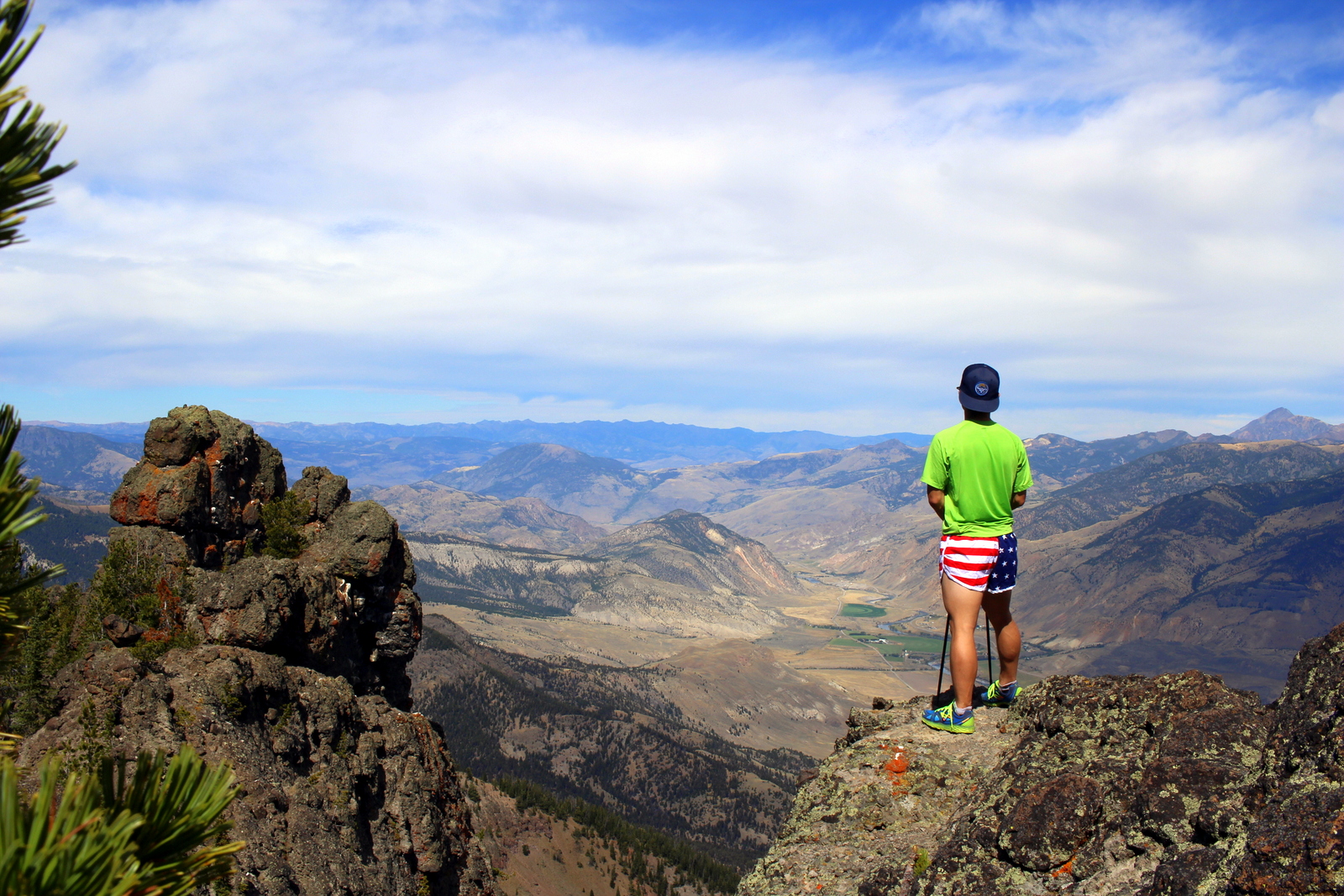
Having spent my planned rest day yesterday sweating and cranking up hills, I decided I'd really take it easy today. This was partly out of necessity. My next destination was Channel Islands National Park, and I needed to be at the ferry pier by 8 a.m. the next day in Ventura, a city just west of Los Angeles. I was also planning to drive along the Pacific Coast Highway through Big Sur and knew that the windy coastal roads would make for slow progress. I had almost 400 miles ahead of me. It would be a long day.

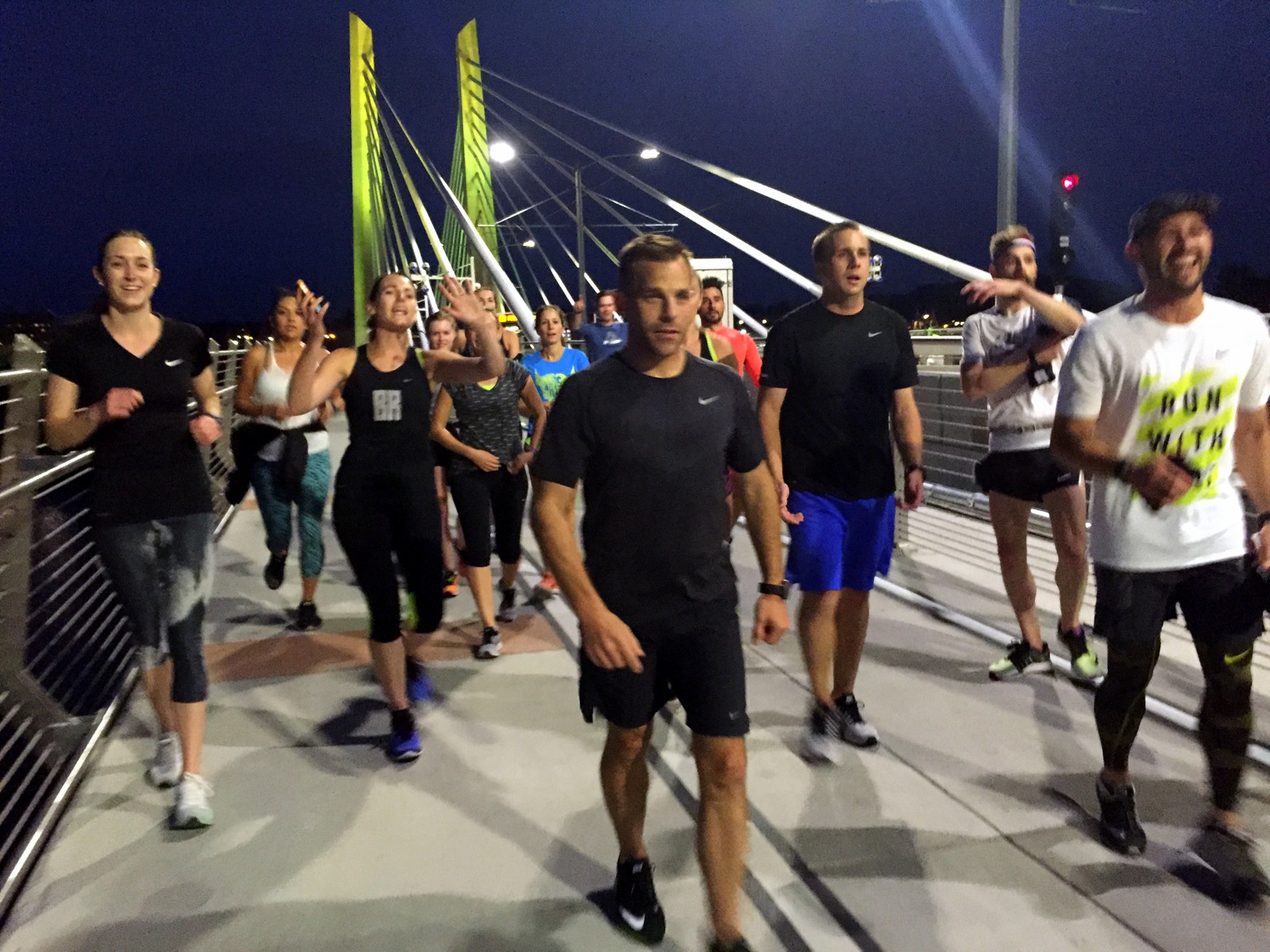
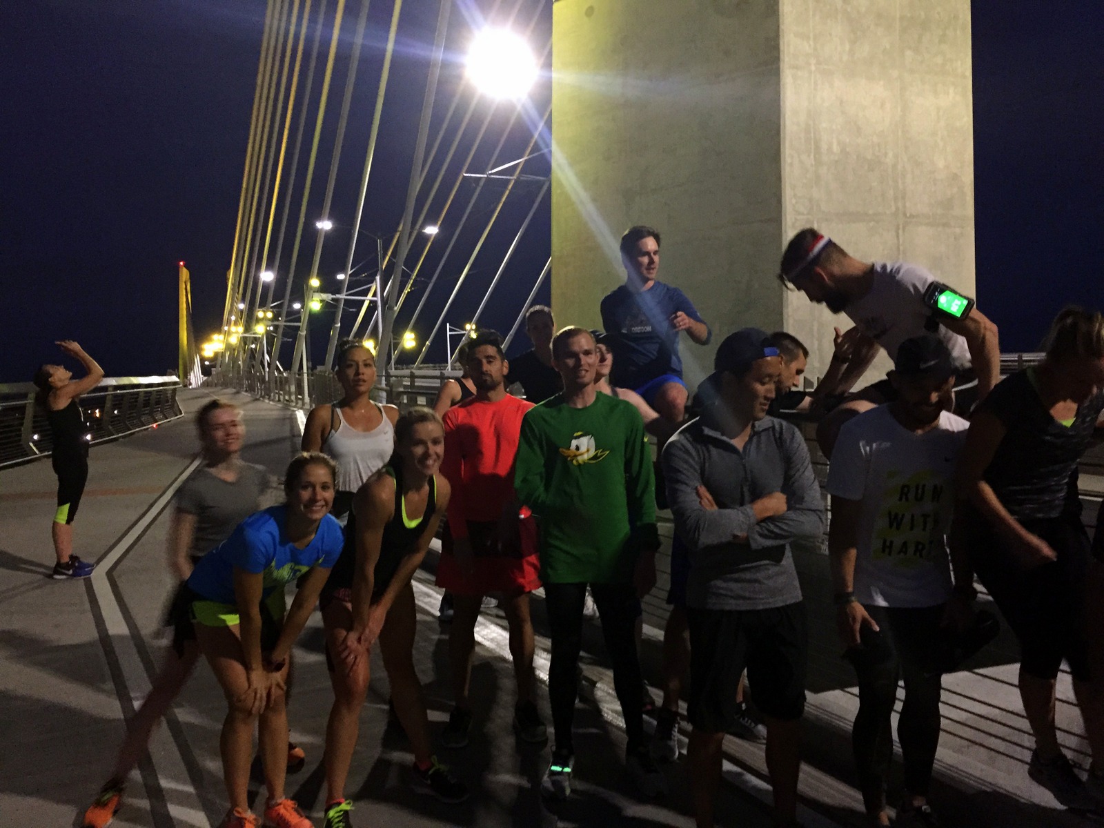
But that didn't mean I wouldn't run. I'd stayed out late last night, catching up with friends, so it would've been nice to sleep in and just hit the road. But I chose to wake up at 5:30 a.m. and make my way over to Fort Mason to catch a workout, a gorgeous sunrise, and breakfast with the November Project SF tribe.

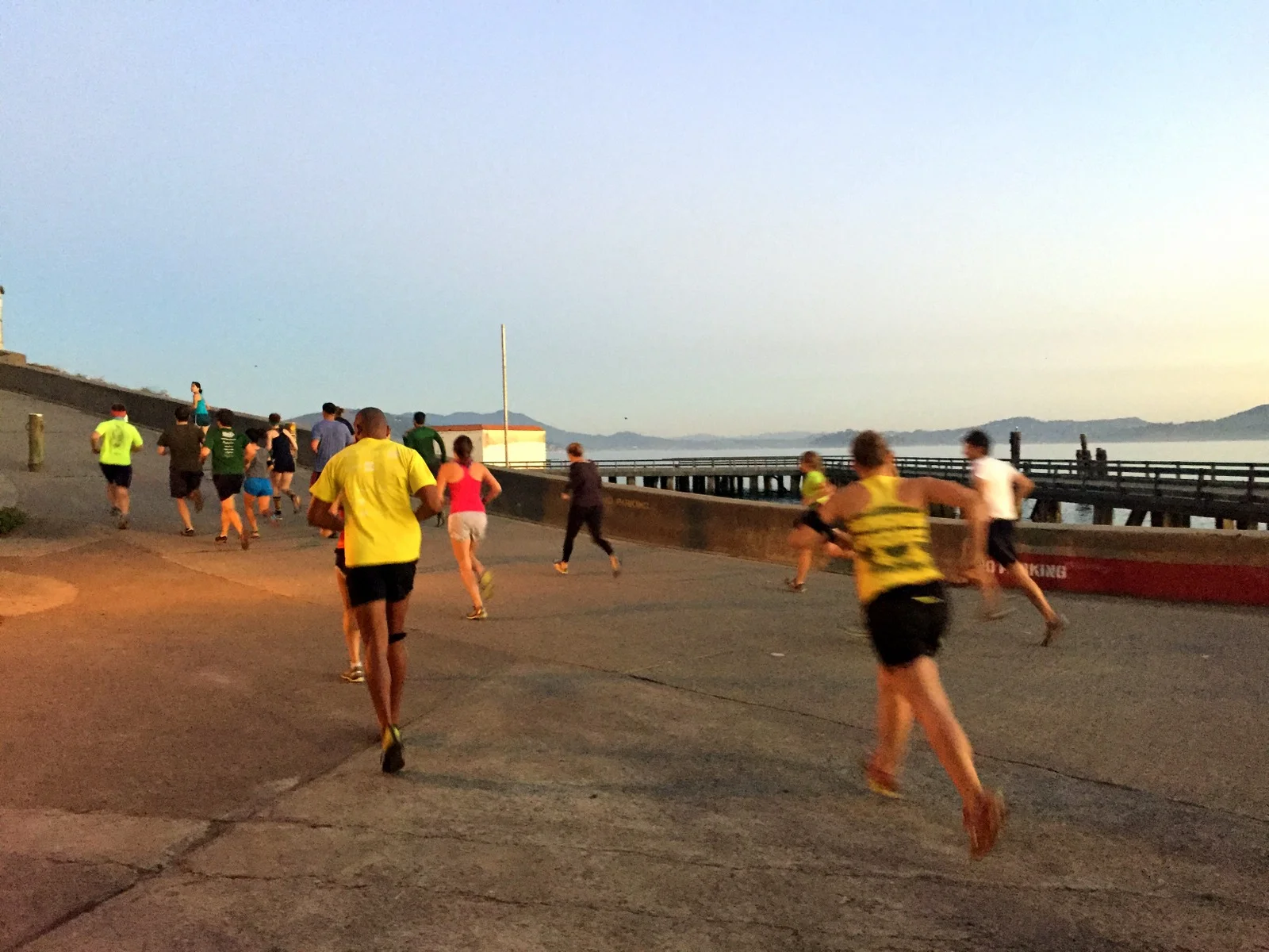
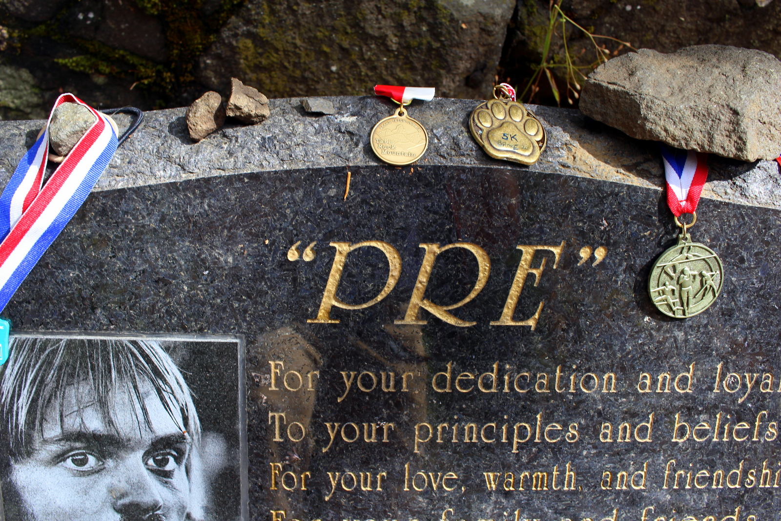
November Project has been an amazing part of my life over the past few years. I started working out with the Boston tribe, and then ended up with the Baltimore tribe this past year. The workouts are always great, but the camaraderie and community--AKA the people--is what makes NP so special. I felt completely at home during the workout, and had one of the coleaders, Paddy Ó Laoghaire, to thank for being so welcoming.

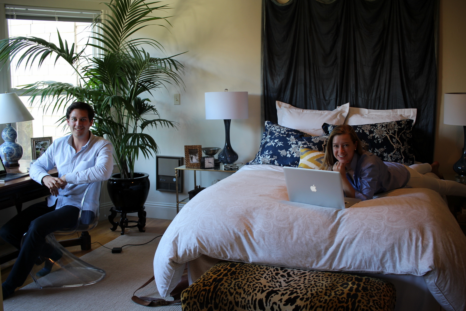
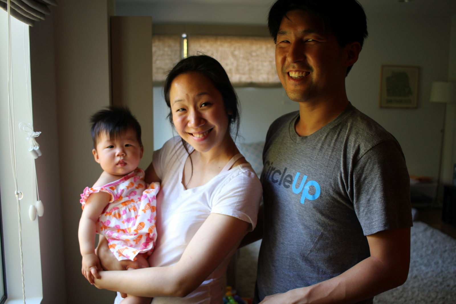
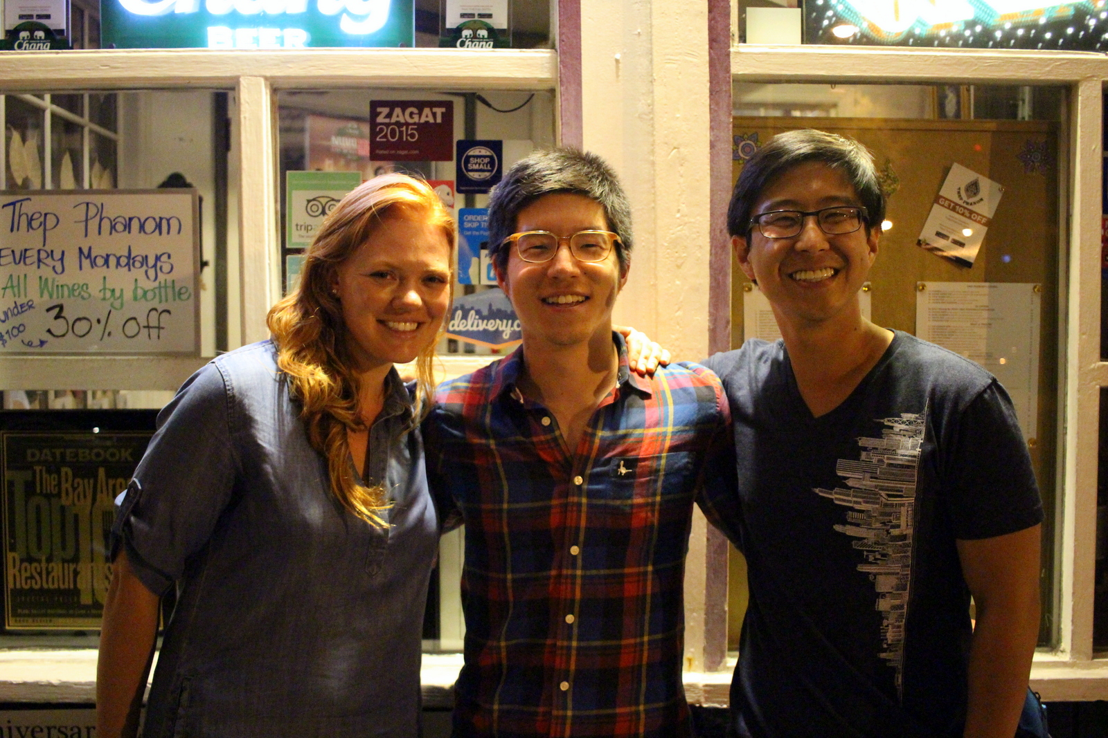
After returning to my friends' place to shower, I headed over to the Mission to visit Clever, a company that my friend, Dan Carroll, co-founded a few years ago. Clever has been revolutionizing the way teachers, schools, and school districts manage student data. In fact, just that morning, the New York Times had published a piece on the company and, as I arrived at the (gorgeous new) office, Dan was waiting in the reception area tapping out a Facebook post that shared the article. Dan gave me a tour of the office, and we chatted about the latest things Clever was pursuing and my trip. At 11, Dan had to leave for a meeting--and I needed to hit the road--so we parted ways. But not before I snagged a Clever t-shirt!

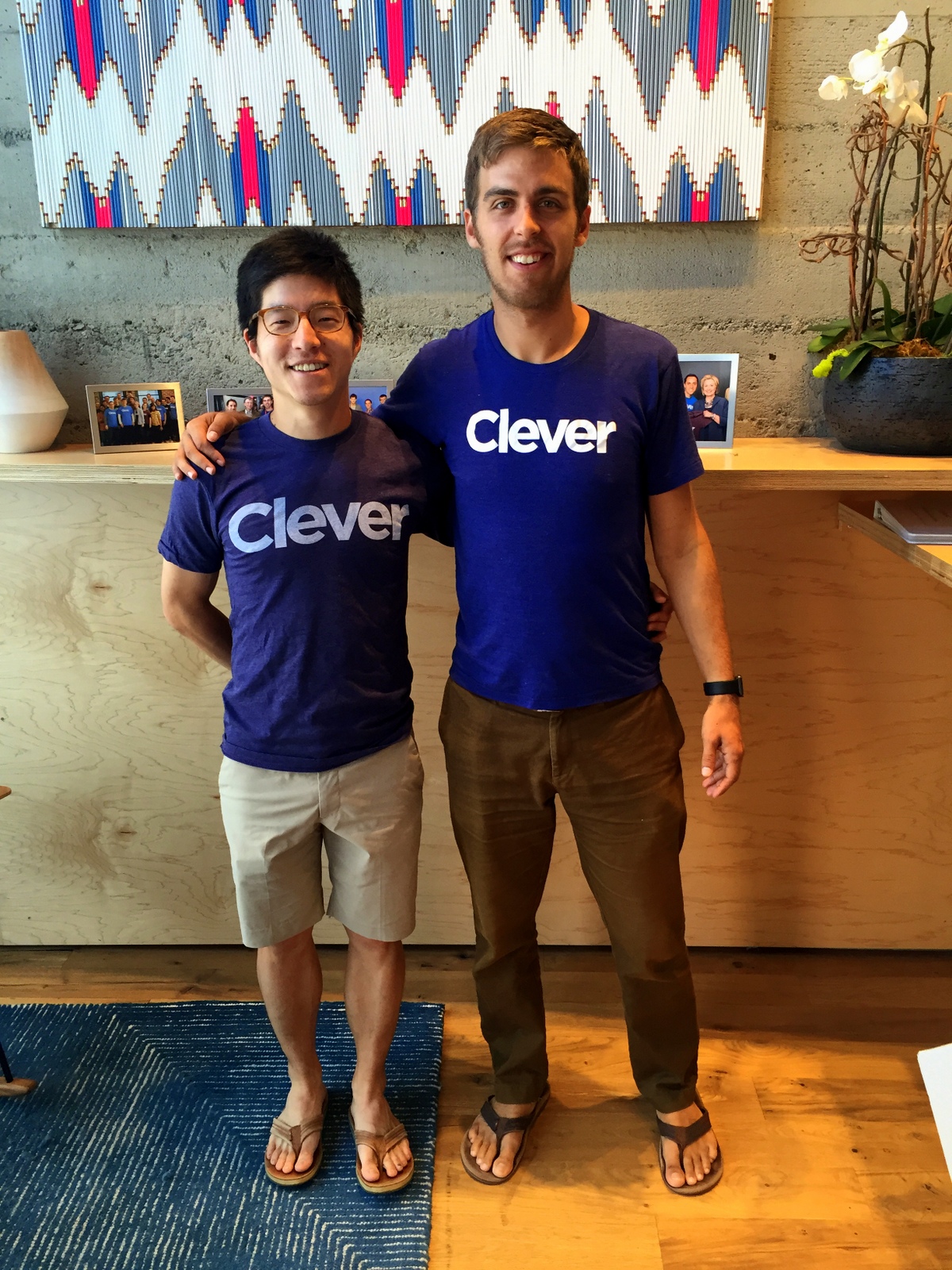
It's always inspiring to learn more about people and organizations that are doing great things. Dan and the Clever crew are certainly in that category. I was glad I'd visited.

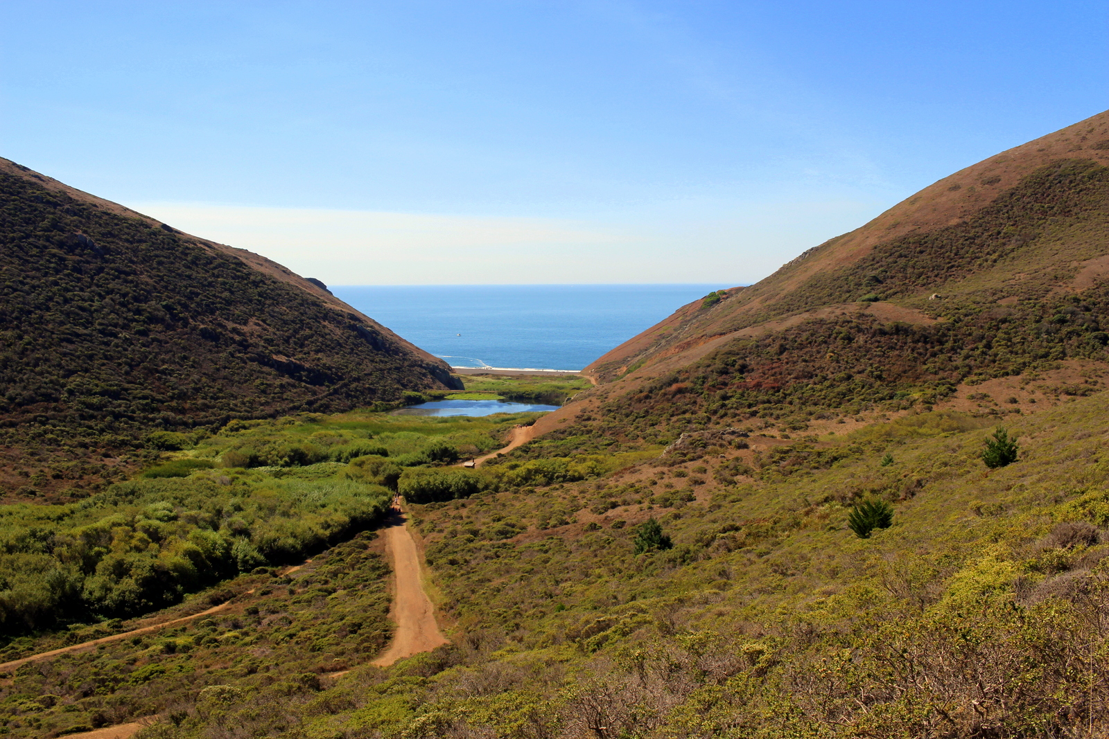
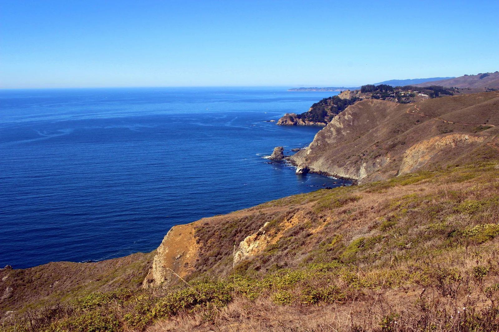
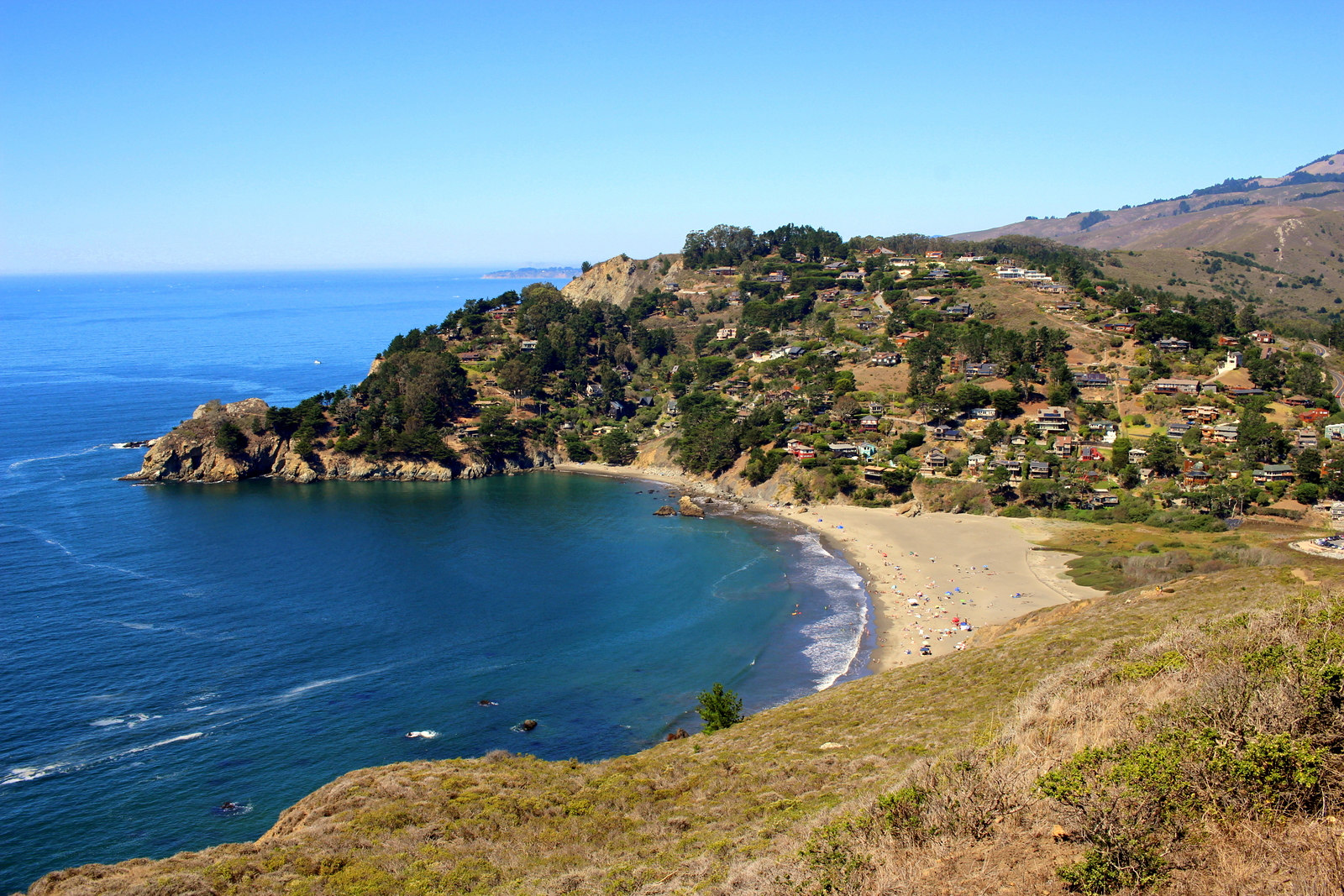
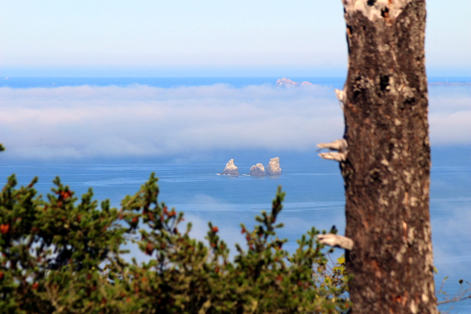
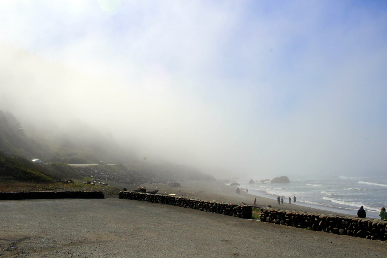
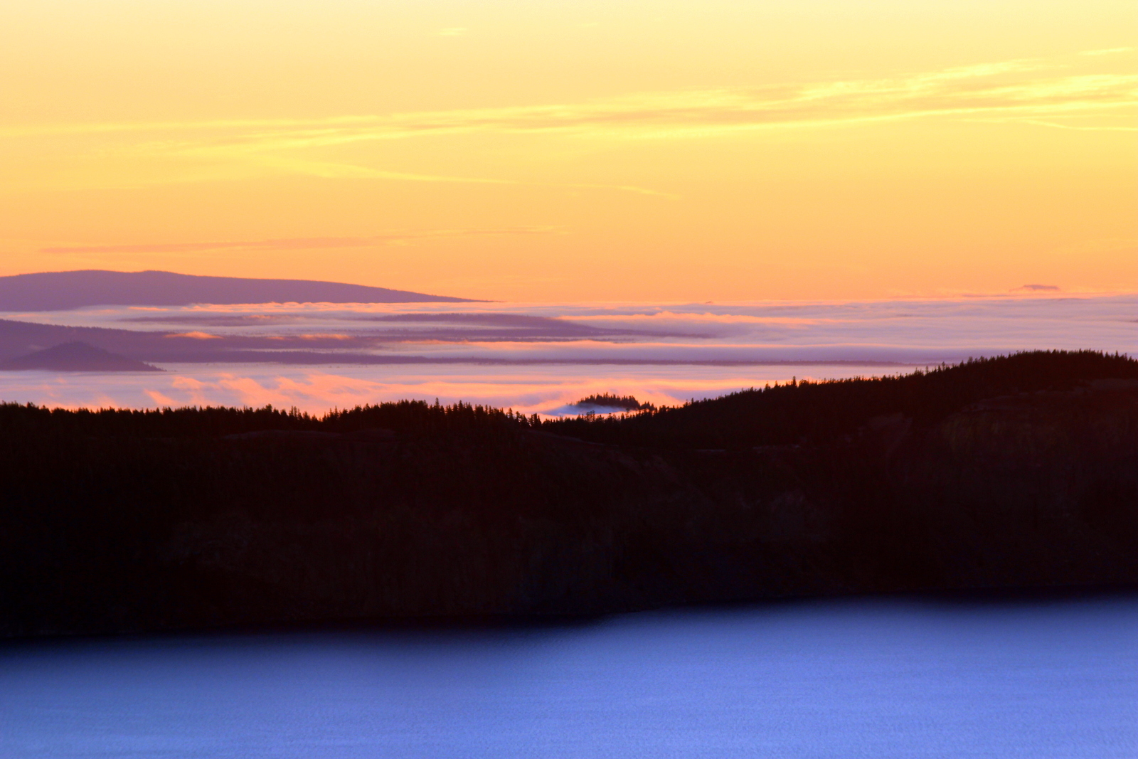
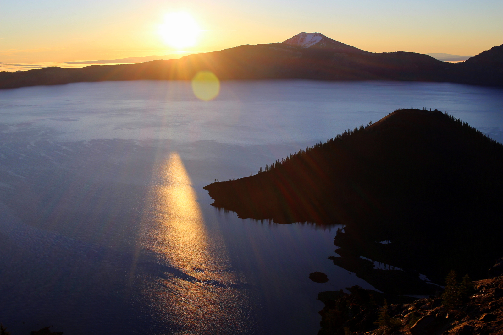
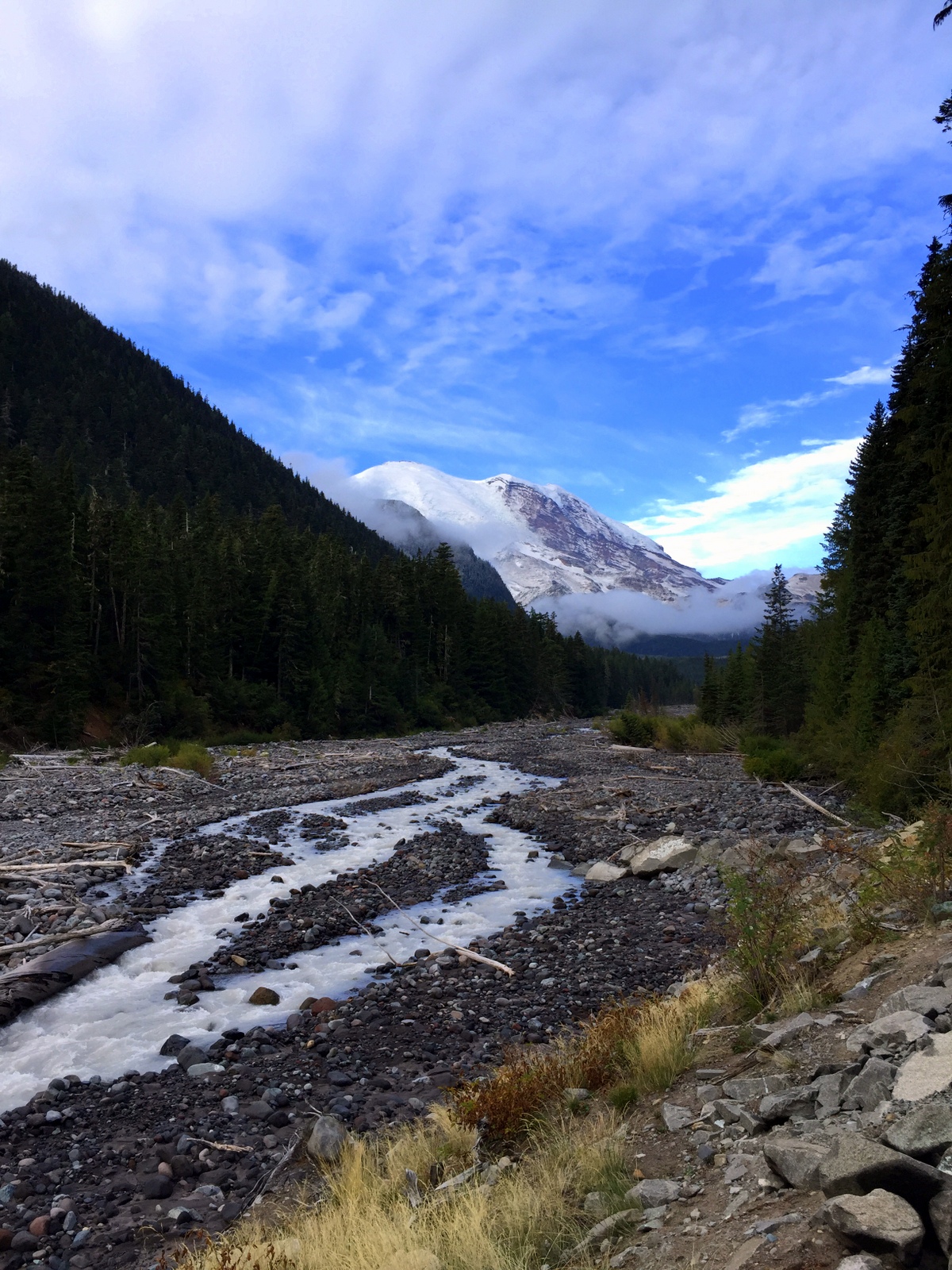
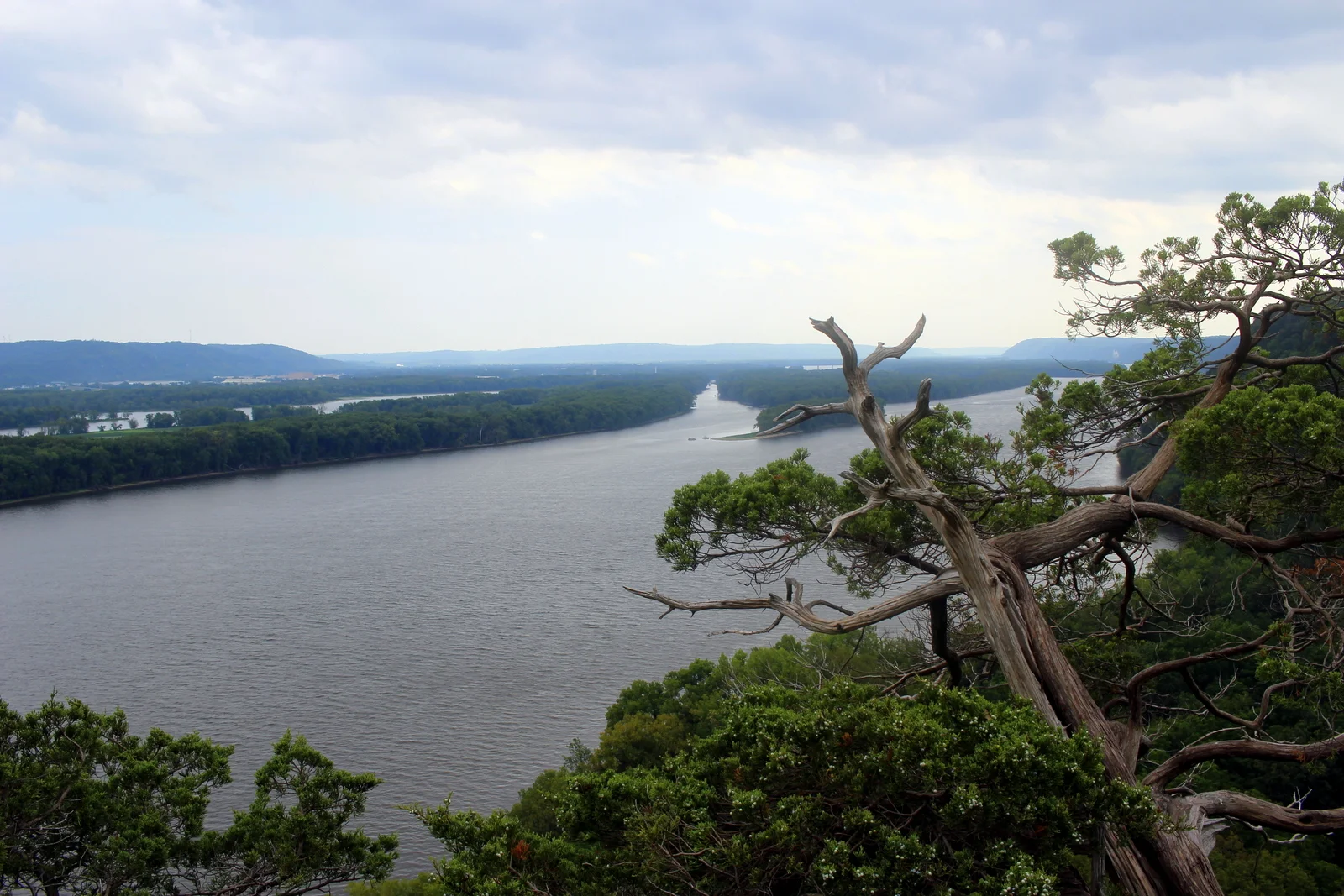
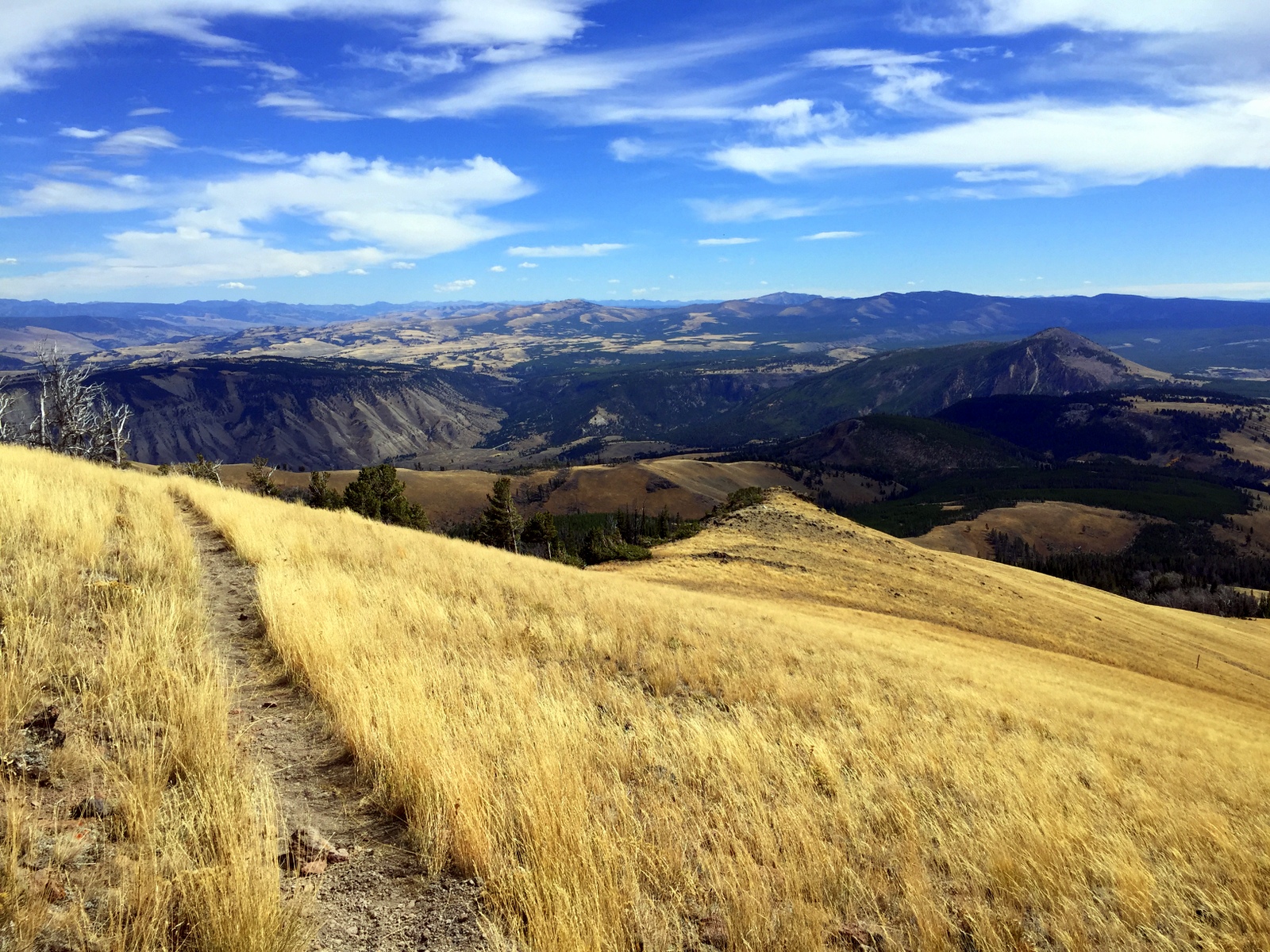
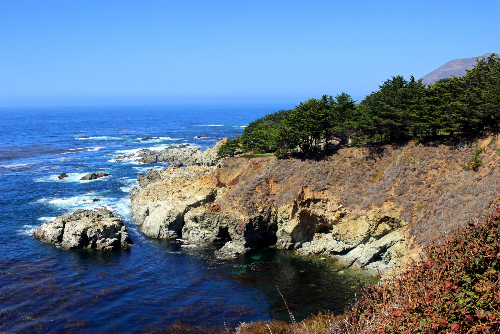
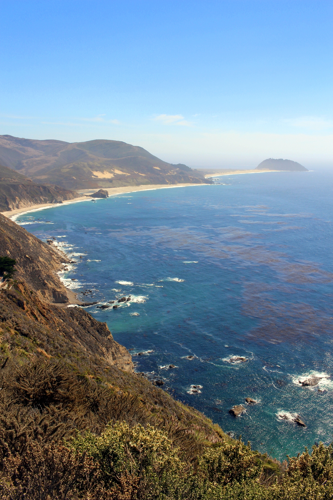
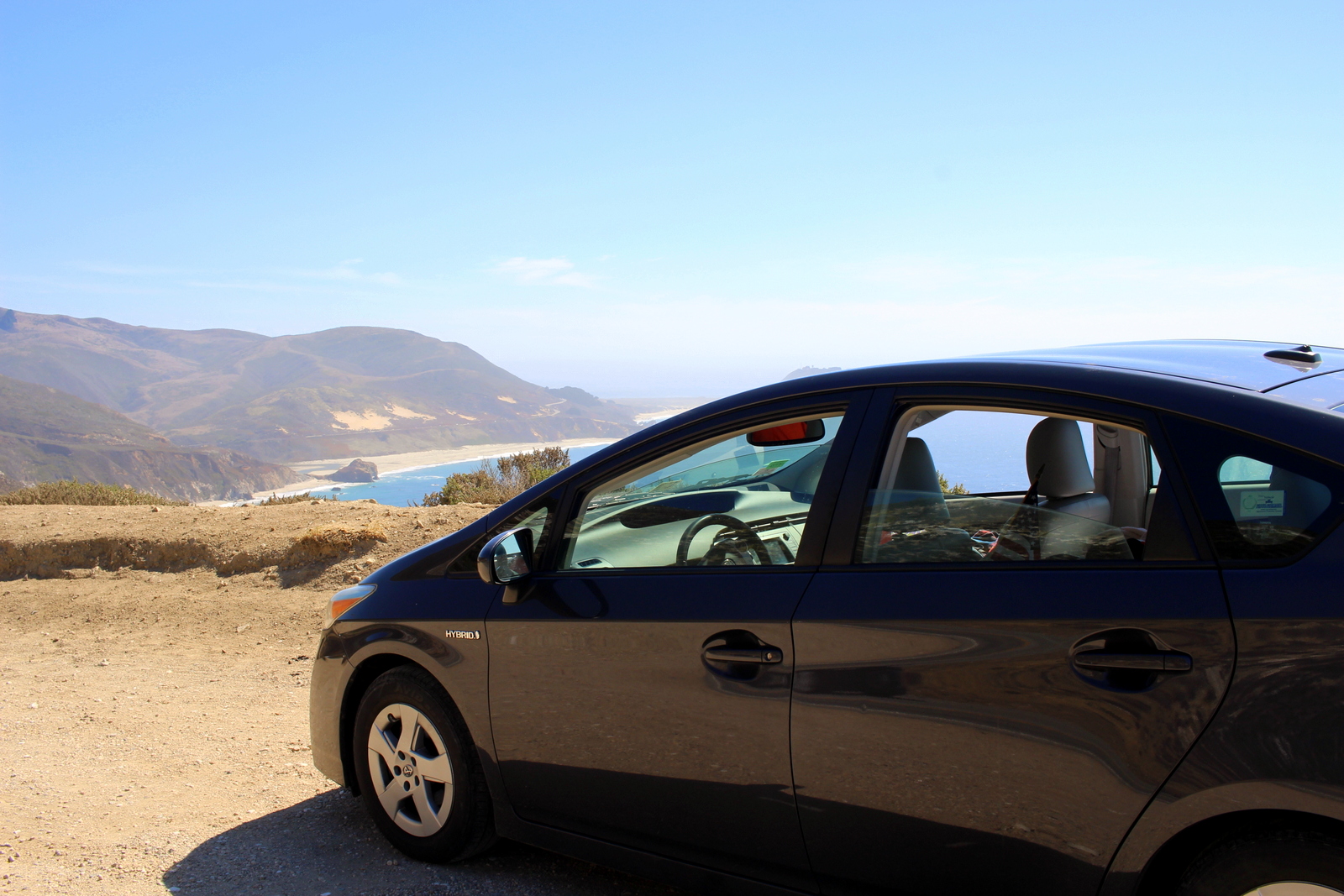
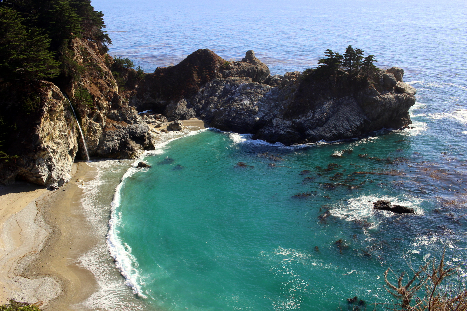
I hit the road for Big Sur. There have been several moments where the driving has been on par with the running. Today provided one of those moments. As I drove on the Pacific Coast Highway, on the cliffs high above the Pacific Ocean, I felt completely at peace. The drive took forever, but that was okay. I got to see the coast like this.

Along the way, at Dan's recommendation, I stopped for a late lunch (AKA at 3:30 p.m.) at Nepenthe, a family-run restaurant built into the cliffs overlooking the coast. The Ambrosia Burger hit the spot, and the multiple glasses of iced tea gave me just the boost I needed to continue my drive.

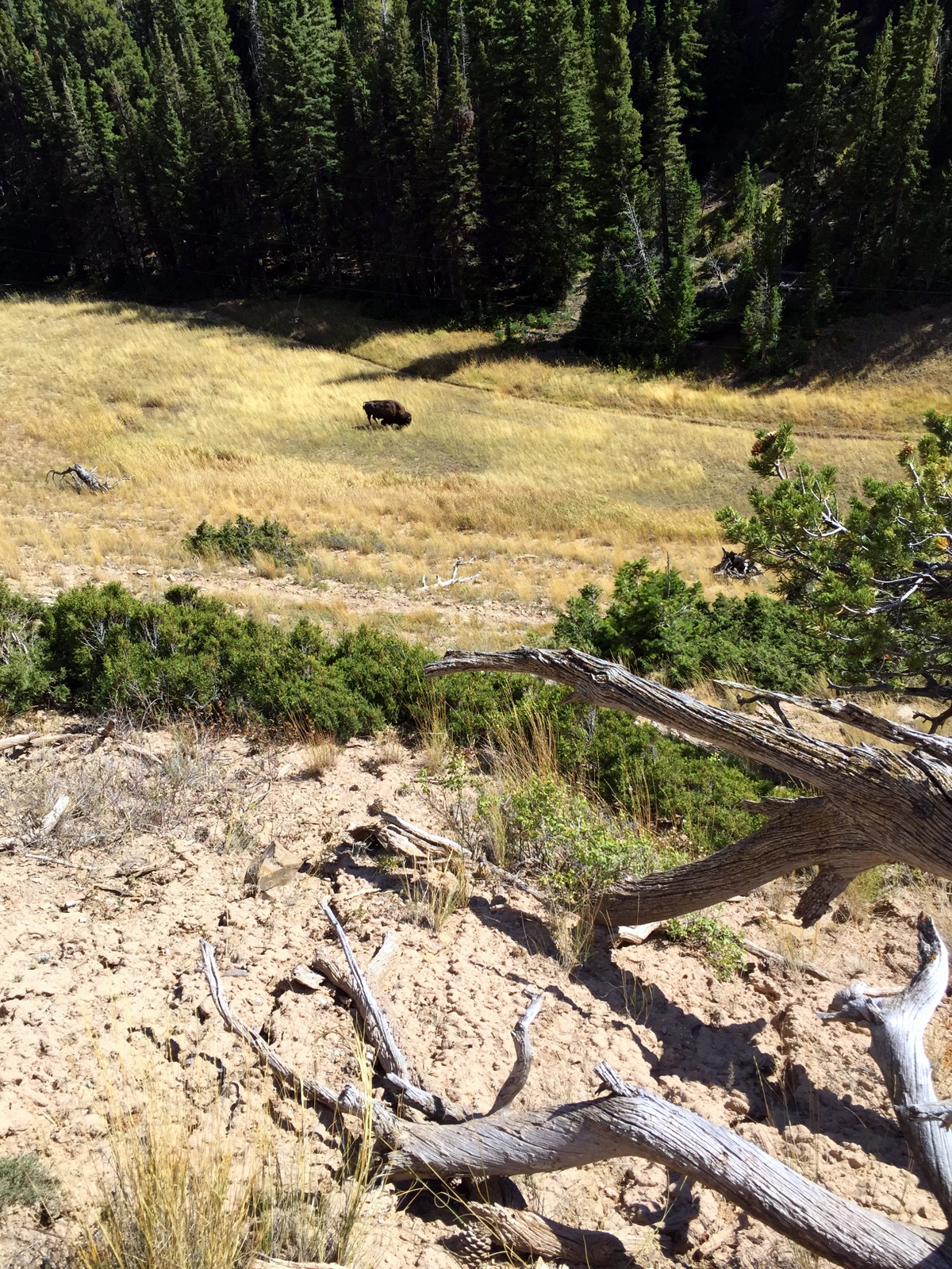
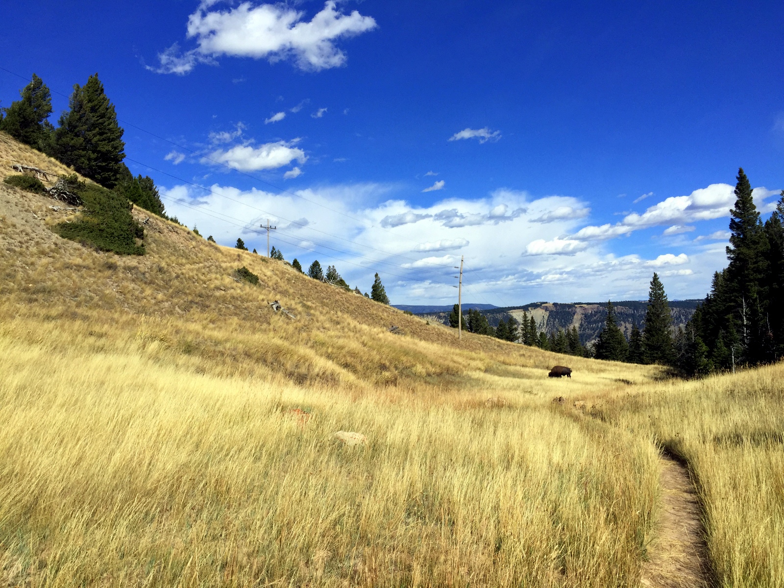
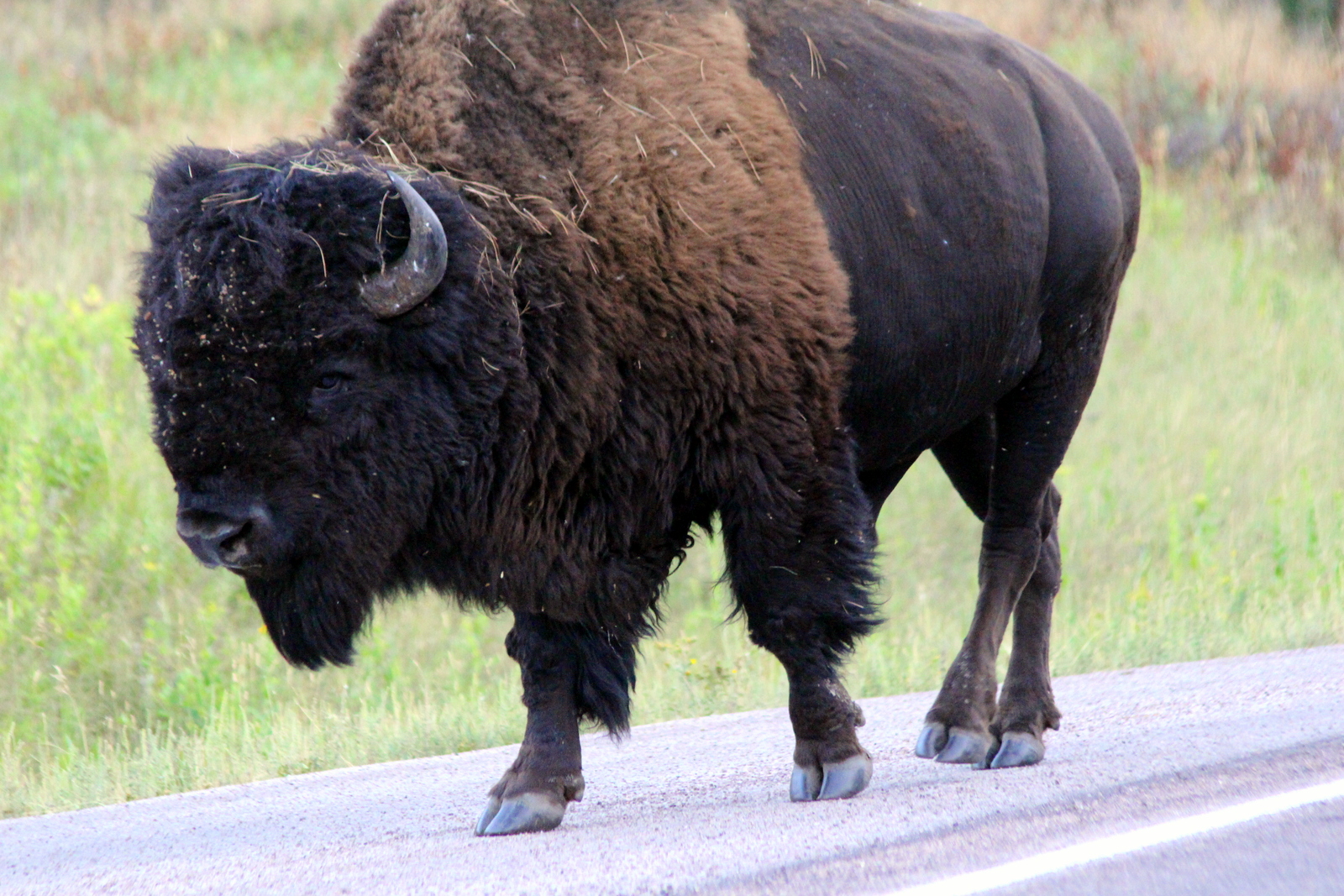
I continued, taking in the coastal beauty. I even saw wildlife along the way. I believe these are California sea lions, but they were enjoying an evening nap on the beach.

Before I knew it, the sun had set. It was past 8 p.m., and I was just pulling into Santa Barbara, a coastal town a couple hours west of Los Angeles. I was pit-stopping here for the night in an Airbnb before heading to the Channel Islands the following morning. My hosts, Karen and John, were very kind, and directed me to Super Cucas Taqueria, which served up a phenomenal meal--exactly what I needed.

I love ending a long day with a solid meal (as opposed to pasta and tuna, my standard camping fare). I demolished the plate and retired for the evening, eagerly anticipating what awaited me tomorrow--Channel Islands National Park.

Day 24: San Francisco, CA by Wookie Kim

I woke up in a sketchy RV park. I was in no mood to hang out and cook pancakes. So I decided to hit the road and hope that something was open in Mendocino at 7 a.m. this Sunday. I found a family-run grocery store that had a breakfast bar--except everything was still cold or frozen. Turns out I needed to pick my food, pay for it, and then cook it using the microwave at the front of the store. It wasn't the tastiest meal, but it got the fueling job done.

And with that, I was off for San Francisco. The city has a weird place in my heart. I've spent most of my life living in, or being around, the east coast. That has meant that I've grown to become a person with a certain personality and vibe. At the same time, every visit I've made to the Bay Area has made me rethink whether I shouldn't just pick up and move west (actually, I've had similar feelings with respect to Portland and Denver). There's just something about the west coast lifestyle that I think matches my personality and passions. Most apparently, west coasters seem to weave outdoorsy things into their daily lives in a way that east coasters don't (or can't) do. And leading a healthy, balanced life appears to be more of a priority. The grass is always greener on the other side, though, so I have no real way of knowing whether this is just something that I'm sensing as an outsider.

I'd last been to the Bay Area in October. I was ready to be back. And I was ready to run in the Marin Headlands, a part of the Golden Gate National Recreation Area. When I visited last fall, I had the chance to run with Larisa Dannis, a high school classmate of mine who has been tearing up the ultra running scene lately. She had shown me a few of her favorite trails. I wanted to be back to explore more of them. Larisa was unable to join me on my run, primarily because of the intense mid-day heat. But I arrived at the Tennessee Valley trailhead and decided to set out for Muir Beach via the Coastal Trail.

I begin by descending the Tennessee Valley Trail towards Tennessee Cove. I didn't quite reach the beach, but it looked beautiful as I turned off on the Coastal Trail.

2015-09-20 12.39.29.jpg

Unsurprisingly, the Coastal Trail eventually took me out to the coast. It was a hot day, but the sky was remarkably clear.

I'd planned for today to be a rest day, but I knew that the heat and the hills would prevent that from happening. Still, I kept my pace as easy as I could under the circumstances. Soon, I made it to Pirates Cove, which was just over the first major hill.

I continued and made it to the hill that overlooked Muir Beach. Behind me was the beautiful beach at Pirates Cove. Looking forward, I could see plenty of people taking advantage of a perfect beach day at Muir Beach.

I decided not to descend into Muir Beach. It was hot, and that would add both time and effort, things I didn't not want to expend at this point. I had things to do, people to see! So I backtracked to the Tennessee Valley trailhead, toweled off the dirt caked onto my sweat and sunscreen, and made my way into San Francisco. A few miles into my drive, I'd passed through a tunnel and had my first view of the Golden Gate Bridge.

Each time I cross the Golden Gate Bridge, I'm reminded of the summer of 2006--the summer I biked 4,400 miles from New Haven to San Francisco. It was the best summer of my life, and the partial inspiration behind this summer's trip. I've compared that trip to this trip several times now, and I've realized that they are distinct in a variety of ways.

I made it into San Francisco, and immediately began meeting up with family and friends. I stopped to see my cousins and Abby, their new baby. I met up with other friends for afternoon beers at the Crafty Fox Ale House. I had dinner with more friends at Thep Phanom. And then I ended the day by cooling off with more beers at Toronado.

And just like that, the day was gone.

Day 23: Redwood National Park, CA + Mendocino, CA by Wookie Kim

My first stop today, after leaving Ed and Elsie's place just north of Crescent City, was Prairie Creek Redwoods State Park (the previous night, I'd run in Jedediah Smith Redwoods State Park, a different state park unit co-managed by the NPS). Prairie Creek was 90 minutes further south along the coast. I was running in another redwood forest because I wanted to see how they differed, if at all, in different locations. I also wanted to give running in the forests in daylight a shot.

But I had plenty to marvel at even before I got to Prairie Creek. From Crescent City, I took US 101, which in this part of the state is called the Redwood Highway. Very quickly, it took me out to the coast and to my first view of the Pacific Ocean on this trip. I immediately decided to stop.

As I continued driving, I made additional stops to take in the views of the coast. I also got to sea level and beneath the fog/clouds.

2015-09-19 12.32.42.jpg

After about 90 minutes of driving, I'd made it to Prairie Creek. I spoke to a park ranger about possible easy trails. I'd been feeling a little tired from my double-run day yesterday (summitting Mount Scott in Crater Lake and running the Boy Scout Tree Trail in Jedediah Smith), and wanted something relatively easy. The ranger suggested the eponymous Prairie Creek Trail, with the Western Ridge Trail as a higher-altitude add-on. I wasn't about to disagree.

Running in redwood forests is a soothing experience. You just feel very secure amidst these tall, wise, and powerful trees. Prairie Creek was unique because it had some of the tallest redwoods around. Redwoods are all up and down the coast, but the ones in this grove were particularly massive. This is the first extra large redwood I saw.

I made easy progress through the forest. The trail was soft and wide--perfect for an easy recovery day. I loved running between the big trees.

Just to show a sense of the scale, here I am standing in front of one of the massive trees I came across. My arm span doesn't even get close to the width of the tree.

The forest was surprisingly cool on a surprisingly hot day. But it was incredibly humid inside. I began sweating much sooner than I'd expected. As I was running, I kept looking up and cramping my neck a bit. There was just so much to see, and most of it was above eye-level. Heck, the exposed root system of a fallen tree was nearly double my height!

I particularly enjoyed seeing areas of the forest where sunlight shone in to create contrasts of light and dark.

I also continued playing while running between the trees. Here, I'm jumping off a little ledge between two trees.

I made it to the first intersection and proceeded up Zig Zag 1 to the West Ridge. It was a relatively steep ascent off of the forest floor. And I could finally now see the redwoods more at "eye level".

Running the ridgeline was a treat. I was a couple hundred feet above the creek, and it really felt cool to run high up and see redwoods in all directions. Again, the forest was just so impressive to see.

I made it off the trail at 2 p.m. I was starving. Back at the visitor center, I asked a ranger if there was food nearby. She mentioned that the first town I'd come across on the way south had a roadside burger shack that was delicious. I stopped for lunch at the Snack Shack, sat by the roadside, and ate a burger, just like she'd suggested.

I was still 4+ hours away from where I wanted to camp that night. I was basically still half a day behind, and hadn't made up the time. It didn't help that I drove slowly along the coast, stopping every now and then to take in the coast line.

As I continued driving south towards Fort Bragg and Mendocino, the sun finally set. It looked a bit like an atomic bomb blowing up on the horizon.

Given that it was a Saturday night on a weekend with nice weather, I should've planned ahead with lodging. I didn't. I ended up reaching the state park (Van Damme State Park) in which I'd planned to camp only to find out that all the sites had been taken. I frantically scrambled around the area, looking not only for other state park campsites, but also simply any inn, motel, or hotel that had availability. There were no rooms. Finally, at the entrance to one state park, a ranger gave me a sheet with a list of all the private campgrounds in the area. It was already dark, and I still didn't know where I was sleeping (was I about to sleep in my car for the first time?), so I dialed up each place with gusto. I eventually found an RV park that had tent sites available. I was the only tent in the entire campground. Let's just say I felt a bit out of place as a result.

I set up my tent, and then decided I'd head into Fort Bragg for dinner. I'd passed North Coast Brewing on the way down, and figured beers would cool me off after another great day on the trails. It was a delicious meal, and a delicious flight of beers. I returned to my tent, and nodded off almost immediately. 

It was another great day on the California coast.

Day 22: Crater Lake National Park, OR by Wookie Kim

Yesterday's arrival in Crater Lake was a disappointment. I put faith in the law of averages that today would be different. It was.

I'd set my alarm for 5:30 a.m the night before. I was going all in. I'd either see the most beautiful sunrise from the rim of the crater, or I'd stand on that rim and shiver while the cold fog covered everything in sight.

I'd slept awfully. It was sub-freezing, and I just wasn't prepared for that. I woke up twice in the middle of the night, with my toes so cold and numb that I thought I might've gotten frostbite in my sleep. The second time, I went to my car and found all of my towels and fleeces and stuffed the bottom of my sleeping bag with them. It didn't help much.

5:30 rolled around, and I was up and out of my tent immediately. I wanted to see whether the early alarm had been worth it. I looked straight up into the sky. I saw the Milky Way. There were no clouds. I was stoked.

I broke camp faster than I've ever broken camp. Partly, I was excited to finally get to see Crater Lake. More importantly, it was that cold. I was also racing against time. The weather report had noted that official sunrise was 6:50 a.m. Even so, I had to drive the 20 minutes up to Rim Drive and around to the Watchman Overlook, a spectacular viewpoint on the west side of the rim. And, even if sunrise was officially 6:50, I knew from experience that most of the awe-inspiring colors came earlier than that.

I made it up to the rim at 6:18. This was my first view of Crater Lake. I could tell that this was an impressive sunrise in the making.

I made it to the Watchman Overlook and stood on the lookout point, staring out over the lake and to the sun rising over the hills to the east of Crater Lake. The lake looked serene--just like how I felt in that moment.

Other people had the same idea, and soon arrived where I'd been standing alone. I figured I'd get a shot with me in it. I was just a silhouette.

As the sun continued creeping up into the sky, the colors changed ever so slightly, but ever so beautifully. In fact, looking west, outside of the crater and over my car, the sky showed an incredible range of purplish-blue colors.

But the beauty shot was when the sun actually poked out from behind the hills and begin shining its rays into the crater.

This sunrise was incredible, one of the highlights of my trip so far, for sure. The colors continued to morph, both the lake's and the sky's. What was also awesome to see was how the area outside the crater's rim was covered with low-lying clouds. The crater was above all of that--thank goodness!

As the sun continued rising, the lake became bluer and bluer. Wizard Island--which is a volcano that formed within Crater Lake (which itself is a water-filled crater formed by the collapse of Mount Mazama roughly 7,700 years ago)--provided a mesmerizing silhouette in the middle of the blue. 

For fun, I took a photo of my favorite water bottle--I'd gotten it a year and a half ago, on my last visit to Portland, from Powell's, the best book store on earth.

Eventually, the sun had risen enough that the first rays began hitting the surface of the lake. That was cool.

It was now 7:15, and the best of the sunrise had passed. Because I was so cold, and didn't want to cook pancakes outdoors, I headed to the Crater Lake Lodge for hot breakfast. I then headed the trailhead for Mount Scott, the highest point in the park. I wanted to see the view from the summit.

On paper, the route wasn't particularly challenging. It was 5 miles out and back, with about 1,200 feet of elevation gain. By this point in the trip, I could do these routes in my sleep. But as soon as I began, I realized the ascent would be slightly more challenging than usual. Simply put, the trail was very snowy.

Two days earlier, it had snowed quite a bit. Yesterday, it had rained a good amount and the temps had stayed very low. So it was still around at 10 a.m. as I began.

I kept a comfortable pace going up. When I reached the first set of switchbacks, I turned around and looked at the view. It was awesome to see the lake from halfway up the mountain.

After about 45 minutes, I made it to the summit. And I saw this:

It was truly something. The layer of snow made the landscape that much more spectacular.

I spent 20 minutes at the summit taking it all in. I fiddled with some photos and videos, and even had a furry friend stop by to say hello.

I carefully made my way back down. To my surprise, most of the lower portion of the trail was completely snow-free--it had all melted within the last 90 minutes. I guess it made sense; this was snow on the west face of Mount Scott that had been in shadows for the early morning. Now that it was almost noon, the sun overhead could melt it with ease.

I felt content that I'd seen Crater Lake at sunrise and from high above. But as I drove around the rim, I was once again impressed by the deep blue color of the lake. I stopped for a picnic lunch at one of the pullout spots. I stared into the lake.

It's hard to get a sense of the scale of the lake. It was almost 6 miles wide, and almost 2,000 feet deep--one of the deepest in the world. I saw a small boat moored near the shore. That provides a sense of scale.

After eating lunch, I was ready to leave Crater Lake and head for Redwood National Park in northern California. On my way out, I noticed an area of the forest that had been hit hard by some of the forest fires in the region. The trees were shriveled up, and the earth was black ash. I pulled over to take a closer look. Some of the trees had big bulges in it (presumably because the fire had warped them?). Despite the devastation, I actually found the dead trees quite pretty. I don't know what that says about me.

I finally hit the road for Redwood. It was roughly 1 p.m.--the time I'd originally planned to be running in Redwood. I was half a day behind. But I eventually made it to northern California, and ended up running in Redwood that evening at dusk. This was a full day--one of the fullest, and most fulfilling, yet.

Day 22: Redwood National Park, CA by Wookie Kim

The park police was waiting for me when I finished my run in Jedediah Smith Redwoods State Park (a park that is co-managed by the NPS). I'd squeezed this run into my already very long day, and I guess the officer wasn't happy about it. It was past 8 p.m., and it was pitch black deep in the redwood forest.

I'd spent the first half of the day making the rounds in Crater Lake. It had taken far longer than I'd expected to make it to California.

I didn't arrive at my Airbnb (this is my 3rd time using it this trip) until almost 6 p.m. Although the day was basically over, I wasn't about to let it end without a run in the woods. Redwood National Park is scattered and huge. But I wanted to see a little bit of each unit, so it made sense to run in one of the units tonight. Ed, my host, had mentioned that the Boy Scout Tree Trail was nearby. My national parks guidebook had also mentioned this trail as a must-do. I set out to run it.

I arrived at the trailhead right as two groups were getting off the trail. One group had turned around early because the sun was beginning to set, and they were worried it was getting dark. The other group had just finished. I asked them what the trail conditions were like. They said it was fine, but that the trail felt very long, and that it would get dark soon. I nodded. I realized that there were only two cars at the trailhead. They were the last of the day's hikers. I would be the only person on the trail.

I feared that I might be starting too late, that the forest would become dark while I was still running in it. This was a place with absolutely no cell service--deep in an old-growth forest. If I got lost in the dark, it would be a long, cold night of wandering.

I decided to chance it. I figured I could cover the 5.6-mile trail in about an hour so that I'd be back at my car at roughly 8 p.m. Knowing that sunset was around 7:30, I assumed that I'd have ample light until the last couple miles. I wasted no time. I was off chasing Fern Falls, the end of the trail.

I moved quickly, with fast leg turnover on the cushy dirt trail. I was determined to minimize the amount of time I spent running in the dark. It was a race against time. This also meant my photos were blurry.

I tried to make the most of my brief forest foray by looking around as I scrambled across the forest floor. These trees were incredibly beautiful--and huge!

I made it to Fern Falls in just under 30 minutes. I'd moved at a solid pace, given the undulating hills, and the root-laden trail I'd followed. I saw a massive fallen redwood that seemed like a continuation of the trail. I decided to see where it led. While tiptoeing across it, I looked down to the side and realized that, if I fell, I'd be stuck in a little ravine. The tree was so big that it was not resting directly on the forest floor. It was at this moment that I decided to turn around.

I booked it back to the car. But not before it got dark. It was already past official sunset, and I could sense it. There were portions of the trail where the trees were less dense. Between strides, I could look up and see the dark blue sky--it was not yet completely dark. But, pretty soon, I was in a part of the forest that was so dense that I looked up and saw nothing but black. I'd underestimated the thickness of the forest cover, and how that would prevent the already dwindling ambient light from hitting the forest floor.

Thankfully, I had my headlamp on me for the very purpose of providing lighting when the natural light went out. I used it to scan 10-15 yards ahead for obstacles, mainly roots, but sometimes also stumps. It continued to get darker. And the return leg seemed without end. As things became ever so slightly less well-lit, I started to make ever so slightly more errors. I began stubbing my toes on roots, and occasionally caught myself from twisting my ankle. I had quite the adrenaline rush come over me as I zigzagged back to the trailhead.

For the last mile, I ran in almost complete darkness. My headlamp lit the forest floor before me. It was so dark that I decided to also hold my iPhone and use the flashlight function to light the trail right in front of me. Despite the darkness, I moved at an even brisker pace. I was determined to get out.

I finally made it out. It had taken just over 27 minutes. Waiting by my car, however, was a park police officer. He had hiis heavy maglite out, and was walking around my car. When I arrived back at the trailhead, sweating buckets, and breathing somewhat hard, he asked me what I'd been doing. I told him I'd been running on the Boy Scout Tree Trail. He told me that people couldn't be on the trails after dark. I told him I was sorry, and that I was done for the evening. He said I was lucky--he was just about to give me a ticket when I'd arrived back at the trailhead. And then he left.

I changed out of my sopping wet running clothes, and took a moment to listen to the forest. It was extremely quiet, and I had the entire forest to myself. I hopped back into my car and drove slowly back to the highway.

Despite the literal and figurative stumbling blocks, tonight's was a good run. I'd tested my limits by running in near darkness. And I had no regrets.

Day 21: Crater Lake National Park, OR by Wookie Kim

This day began slowly, and it ended slowly too. I'd spent the night at an Airbnb in Springfield, just over the Willamette River from Eugene. It was a rainy morning, and the hosts made a delicious breakfast for me. I felt lazy.

On my way out of the city to Crater Lake, I stopped by Pre's Rock, the rock ledge that Steve Prefontaine crashed into and died from when he was 24 years old.

Pre's Rock has become a place of pilgrimage for runners of all stripes. The site is covered with medals and memorabilia.

I decided to leave something: the medal the woman had given me at the summit of Table Mountain. (I knew that it might not be there long.)

Before.

Before.

After.

After.

From that quiet, residential street in Eugene, I drove for Crater Lake. It was a slow drive. I was feeling tired. Also, the sky was ominous. I had my fingers crossed that, magically, the weather up on the rim and inside the caldera would be better. It wasn't. Here was my first view of the park.

It was only 3 p.m., and I didn't know what I was going to do. I proceeded to the visitor center. At 4 p.m., they played a short video on Crater Lake. It was a full house--every single person who'd visited today was packed into the tiny auditorium.

I continued driving around the rim, hoping to catch a glimpse of the lake. I finally did. It was just a glimpse.

I felt disappointed. Crater Lake was the park for which I'd had the highest expectations. Before this trip, I'd never even heard of it. Once I learned about the high-altitude lake, I began to look forward to this visit. The fog was heavy, and there was freezing rain, too.

I had to make a bit of a strategic decision. Did I just say goodbye and drive straight out of the south entrance and sleep in an Airbnb en route to Redwood (my next destination)? Or did I set up camp in the freezing rain and hope for better weather tomorrow? I couldn't bear the thought of having driven all the way here only to see fog and rain and snow, so I decided I'd pitch a tent and try again tomorrow.

With lightning speed, I found a campsite and set up camp. It was only 5 p.m. at this point, and I had no idea how to spend my free time. I figured I'd eat an early dinner and go to bed early as well. There was a lodge with a cafe in it, so I ate there instead of cooking in the frigid outdoors. After chowing down on pot roast and a pizza, I settled in for the night. By 9 p.m., I was asleep.

My goal was to wake up at 5:30 a.m., break camp, and be at the Watchman Overlook by 6:15 to watch the sun rise over the east rim of Crater Lake. I went to bed dreaming the weather would turn.

Day 20: Silver Falls State Park, OR + Eugene, OR by Wookie Kim

Today was less about appreciating our national parks as it was a day to appreciate running culture.

Even though I'd gone to bed at 2 (David and I had lots to catch up on), I rose at 6:45, because I wanted to tag along with David and visit Nike's campus. After a cup of Chemex-brewed coffee and some delicious pastries from a bakery in the Pearl District, we were off to Beaverton. When we arrived, I was lucky enough to park next to the spot reserved for Michael Jordan.

I looked around and noticed that the section of the lot was filled with celebrity athletes--Dwayne Wade, Carlos Tevez, Kenenisa Bekele, Manny Pacquiao, Rafael Nadal.

David took me on a walking tour of the campus. I could immediately feel Nike's commitment to athletics while walking around the vast campus. Evidence of that commitment was visible, too--banners and plaques celebrating and memorializing past and present Nike athletes were everywhere.

Despite Nike's influence on sports generally, I was particularly interested in the visit because of Nike's role in giving birth to modern American running. Nike started out as a fledgling company that made track shoes in conjunction with legendary University of Oregon track coach Bill Bowerman. It's now the sports behemoth that it is because of that unique beginning.

In the main entrance, there was a brief exhibit on Nike's running past. I particularly enjoyed the segment on Steve Prefontaine. Every serious runner admires Pre, not only for his sheer athletic talent, but also for his work ethic and spirit--all of which were simply unrivaled when he was dominating the world's running scene in the 70s. I thought back to my high school cross country running days, when my teammates and I would quote Pre and watch "Without Limits" the night before races.

In fact, I was on my way to Eugene, Oregon, to pay tribute to him by seeing his storied hometown track, Hayward Field, and running on the jogging trail created in his memory, Pre's Trail. After another cup of coffee in Nike's cafeteria, I bade farewell to David.

I headed in Eugene's direction, but I wasn't about to go there without doing a beautiful trail first. On one of the Stumprunner runner's recommendation, I decided to run the Trail of Ten Falls at Silver Falls State Park.

I've already noted how we have so many national monuments that often go unseen. The same goes for state parks. In fact, for various reasons, there are probably state parks out there that are even more beautiful and awe-inspiring than some of the spaces managed by the National Park Service. I can say with confidence that Silver Falls ranks pretty high.

The loop I ran--the Trail of Ten Falls--was 9 miles. Along the way, I'd get to see ten different waterfalls. It was an incredible experience. For 90 minutes, I practically chased the sound of falling water. The falls were so close together, but each had distinct character. Here are photos of nine of the falls (I accidentally missed the spur trail for one of them!):

What was particularly impressive were the falls that had trails that cut under and behind. I thought about how this had formed. I also wondered how several other features reached their present form, like one giant boulder that lay in the middle of the river.

I'm glad I made the stop. The trail was really easy to run on, and had undulations that felt good for my feet. I was also testing the Nike Terra Kiger trail shoes that David had given me. They felt good--perfect for non-technical trails like this one.

I'd made the circuit in just under 90 minutes. When I met the park ranger who'd greeted me earlier, he'd said it would take 3-4 hours. I bumped into him as I was heading back to my car, and he asked me how long the run had taken. When I told him, he couldn't believe it. I told him I was a trail ultrarunner. He laughed.

I now proceeded for Eugene. On the way, I stopped at Burger King and chowed on a Double Whopper meal--my first in probably at least a decade. I normally don't eat that kind of fast food, but for this trip, I'm okay with it (more on nutrition later).

I arrived first at Hayward Field. This is the University of Oregon's historic track and field stadium. This was Prefontaine's home turf. In fact, the prestigious Prefontaine Classic is held each year at Hayward Field and is named for him. Sadly, I was unable to get inside the field, but I had to take a photo from outside the main gate.

I'd already done a run for the day, but I felt an itch to do more. Specifically, I decided I'd drive over the Willamette River to Alton Baker Park, home to "Pre's Trail"--a 4+ mile, woodchip trail created in Pre's memory. He'd always loved running on the soft surfaces he'd found while traveling in Europe, so he'd set into motion a plan to create a soft trail in Eugene. Sadly, he died before that happened under his watch.

The trail was soft and springy, and I made a comfortable pace around the park. For the first time all trip, I ran without my fastpack; I had nothing weighing me down. I thought about Prefontaine--his spirit, mostly--and imagined what it would be like to run alongside him. It was liberating.

After finishing my run, it was already 6 p.m. I'd made a decision to stay in the area using Airbnb again because it was supposed to rain at night. I drove over to Springfield, met my awesome hosts, showered, and hit main street's Plank Town Brewing for a couple flights of beer and a delicious meal to go with it.

Today felt different. It felt like a day to go back to one's roots. Prefontaine was one of my early running heroes. 40 years after his death, his spirit lives on.

Day 19: Mount St. Helens National Volcanic Monument, WA + Portland, OR by Wookie Kim

I think Washington State doesn't like me much. Yesterday's weather was absolutely miserable, and I'd spent 5+ hours on the Wonderland Trail wondering where Mount Rainier was. This morning, I broke camp early and made my way out of the park, only to turn a bend and see this.

I imagined what yesterday would've been like had snow and fog been replaced by light clouds and sun. I turned a few more bends, and saw another picturesque view of the mountain. It was at this point that I also grew jealous of my friends who'd either climbed (Julie D.!) or were planning to climb (Victoria B.!) Mount Rainier. I was determined to get out of the state.

But not without seeing Mount St. Helens. After all, I was in the area, and it was on the way to Portland, my next destination. I was barely over 100 miles away from that famous volcanic mountain, but I knew that many of those miles were on windy, mountain roads. It took almost 3 hours to go that distance. After popping out of the forest and getting my first view of the valley, my heart sunk. This was what I saw.

I'd already spent 2 hours driving deep into the forest, so I decided to continue to the end of the scenic road, which was another 10 miles up the valley. I secretly hoped that I'd drive high enough so that I'd be above the fog and clouds. I reached Windy Ridge and saw this.

I was done. Done with trying to see mountains. And, more importantly, done with the state of Washington. I was now Portland bound! I retraced my route, and continued along the windy forest road to the main highway. The drive was so long and there were so many windy turns that my wrists started getting sore from all the pushing and pulling of the steering wheel. 

Just 50 miles outside of Portland, Washington state redeemed itself. I passed through what I later learned was an unincorporated town called Yale. I stopped by Yale Park, marveled at Yale Reservoir, and even took a look at Yale School. (Can you guess where I went to school?)

Finally on good terms with Washington, I crossed over into Oregon state and into Portland. My friend, David Y., had already made arrangements for my arrival. The first thing I did was laundry. It's been almost 3 weeks and I've had zero opportunities to wash my clothes. I then washed my cookware, most of which was starting to get grimy. After showering, I decided to roam the streets a bit before David got back from work. I did the stereotypical Portland tourist things; I visited the Ace Hotel, took down an espresso from Stumptown Coffee Roasters, and stopped by Powell's. (I'd been to all these places before, but why not go again?)

David arrived in the late afternoon. We caught up, got on a conference call regarding our high school, and then prepared for the run for the day: the Portland Stumprunners group run. The Stumprunners are the closest thing Portland has to November Project (query: why hasn't November Project established itself in this city?). A group of about 15 passionate, outdoorsy, runner types showed up at 7 p.m. outside the Peculiarium. Tonight's run destination was particularly cool; we ran to and across Tilikum Crossing, the new bridge across the Willamette River that allows everyone but drivers.

I had a blast. I think this was so for a number of reasons. First, I was running with a group again. I'd spent the last 2.5 weeks running alone. It was refreshing to run in a pack, and to chat with other like-minded runners. Second, I was running on flat road. My pace over the past few weeks has been incredibly slow. As just one example, I ran yesterday's 15 miles on the Wonderland at 19-minute pace. I couldn't even remember the last time I ran anything under 7:30 pace. It was nice to run unencumbered by dirt, rocks, and vertical. Third, as I've explained before, running is the best way to explore a new city. This was a workout, but it was a running tour, too. I got to see Portland in a new light (well, without light--it was after sunset).

We started at a relatively brisk pace, but casual enough so that we could chat. I hung with David and chatted with some of the runners. When we reached Tilikum Crossing, we stopped midway to take some group photos. From there, it was 4 miles back to the start. I decided I'd give my legs a spin, to rev the engine a little bit. The three of us in the front accelerated into a smooth but persistent pace. It was somewhat chilly, but I was now beginning to sweat. But it felt great. My legs were turning over quickly, and I could feel my stride lengthening as we picked up the pace. I was particularly surprised by our pace. We were cruising between 6:15 and 6:45 and I didn't even notice it. We'd done the last 3.5 miles at 6:35 pace--and it felt easy.

This little tempo piece at the end was reassuring. I'd spent part of the last few days wondering if all of this super-slow, super-long running would affect my ability to run fast. Lately, I'm lucky if I spend a couple miles under 9-minute pace. I know the rough terrain and the significantly higher time-on-feet account for some of that. But still. I wasn't sure I could run fast anymore. Tonight, I proved myself wrong. In fact, I think I'm getting into the best running shape I've been in for quite some time. I now plan to add a fall marathon to the calendar just to see what I can do on the road (on top of the Patapsco Valley 50K, which, seeing as it is "home turf", I want to crush).

After the run, a few of us met at Samurai Blue, a sushi joint on Mississippi Avenue. We nommed on sushi and beer, and chatted about Nike (practically everyone in Stumprunners appears to work at Nike). And after eating sushi, we ate ice cream, and continued chatting about Nike.

Then it was time to head home. I was staying at David's sweet new pad. I finished folding laundry, and we chatted about all of the things.

One of the other benefits of the group run was that I now know where I'll be running tomorrow. I'll begin by following David to the Nike campus for a quick tour. Then, I'll drive to Silver Falls State Park to do the Trail of Ten Falls. I'll make my way to Eugene to see the legendary Hayward Field (and maybe run a lap or two on it, if the cross country team will let me). And I'll end by setting up camp in either the Willamette or Deschutes National Forests.

Day 18: Mount Rainier National Park by Wookie Kim

When I signed up to do the Wonderland Trail, I did not sign up for snow, bone-chilling winds, and heavy fog. This about sums up my day today on the Wonderland Trail--the 93-mile trail that encircles Mount Rainier.

image.jpg

I'd left Yakima at a decent hour, and managed to get to the wilderness center in the White River entrance by 10 a.m. I looked up trail conditions and asked the on-duty ranger about how difficult the trail was from Fryingpan Creek to Indian Bar. He said the trail was in great shape, and that I should be able to do it no problem. A little bit into our conversation, he received what appeared to be an urgent call. There was an ongoing incident, perhaps a fatality. I wished him luck and went on my way.

image.jpg

While driving to the White River campground, I could see very little. The fog had rolled in and covered everything in sight.

image.jpg

As I was arriving at the White River campground, I could see, far off in the distance, and ever so faint, Mount Rainier. I hoped that the sun would come out and kill the fog. 

image.jpg

I quickly set up my tent in a secluded area surrounded by tall trees. Cozy. 

image.jpg

By 11:15, I was at the trailhead, ready to run the famed Wonderland Trail. It was surprisingly cold. So much so, that I actually began my run with tights, windbreaker, and gloves. 

image.jpg

As has become typical practice, I began by proceeding through a forested section. The trail was wide and flat--perfect footing to start the day. 

image.jpg

I'd chosen a section that basically involved a 3,500-foot ascent right from the get-go. So there was very little running involved. Instead, I went up switchbacks through the forest.  I was getting hot. I shed my layers.

image.jpg

It's always fun to look down from above, and see how the trail switchbacks up a hill.

image.jpg

I eventually reached the end of the forested section and popped out into the famous Summerland area of the trail. This was a wide meadow, typically overflowing with colorful wildflowers. Apparently, because there was less snow this season, and because it was hotter this summer, the flowers had already bloomed and died. I saw the remnants (kind of like arriving two days too late to see the cherry blossoms in the Tidal Basin in D.C.). From Summerland, I could see the edges of Mount Rainier, shrouded by snow, fog, and clouds. 

image.jpg
image.jpg

Between Summerland and Indian Bar, hikers pass through Panhandle Gap, which is the highest point on the 93-mile trail. I began my ascent towards the Gap on wooden stairs.

image.jpg

I stopped by a stream to fill up water. After topping up, I realized my body felt somewhat rigid. As I continued hiking, I then noticed precipitation--it was snowing.

I'd not expected snow. I'd seen the fog, but I didn't realize that, inside that fog, there was also snow. Thankfully, not only had I brought a wind shell, but I'd also brought my thicker fleece. I quickly put that on and proceeded up to the Gap. 

image.jpg

I reached the gap, and all of a sudden, everything grew quiet. There was no wind, and almost no sound. All I could hear was the crunching of the dirt or rocks beneath my feet. The fog had rolled in even thicker by now, and visibility was decreasing. 

image.jpg

I became a little more cautious now. I was over 6 miles in, and wanted to see if I could make it to Indian Bar, but I also didn't want to get stuck in the cold (especially because I was still battling my own common cold), or in the creeping fog. The trail was easy enough to follow, so I continued, albeit slowly. 

image.jpg

This place felt eerie. I also felt a little bit like Beowulf, tiptoeing through barren land in search of Grendel. I was all alone, and all I could see was fog.

Eventually, I reached the end of Panhandle Gap. I began the 3-mile descent into Indian Bar. I soon realized that, each step I took down would be a step I'd have to take back up. I hadn't seen much in terms of scenery, and was starting to feel chilly. I decided I'd be better off turning around and heading back. So, after 7.5 miles, I turned around. 

image.jpg

The way down was easy. It got progressively warmer, and the fog got progressively less thick. I was able to get a clearer view of the Fryingpan Glacier (I think this is it). 

image.jpg

Right before reaching Summerland again, I was in what I could tell was the most scenic part of the trail--if only the fog were gone. The rocks were brilliantly colored, kind of like pastel-colored Fruity Pebbles.

image.jpg

I rested by the stream, rehydrated, and looked at the faint outline of Mount Rainier that I could see. 

image.jpg

I continued down to Summerland. I could immediately picture what this place would look like in full bloom. I decided that I would come back some day and run the entire 93-mile loop--in nice weather. 

image.jpg
image.jpg

The descent back to the trailhead was peaceful. I passed one group of hikers that asked me about the conditions up in Panhandle Gap. They were worried that the weather would only get worse tomorrow. I told them to wait. It couldn't get much worse. 

When I was only a mile from the trailhead, I noticed that a massive tree had fallen across the trail. This was not here when I started, so it had happened within the last couple hours. Seeing this made me realize just how important it is to be aware of one's surroundings. Normally when I run, I run with my iPod Shuffle. I was glad I'd not listened to music even one on this trip. 

image.jpg

I finished right around 4 p.m. It was a slow, peaceful day, and I hadn't quite seen the picture-perfect views that one expects from the Wonderland Trail. But it had turned out to be an exhilarating day navigating through snow and fog. I'd come off the trail a bit chilly, but otherwise felt completely fine. 

As I returned to my campsite, I noticed a blue bird on the side of the road. He seemed inquisitive, and kept squawking as I followed him around, trying to take a photo. 

image.jpg

The Wonderland Trail is aptly named. I had a great 15-mile day, but I ended the day with a lot to wonder about. 

Day 6: Effigy Mounds National Monument, IA + Afton State Park, MN by Wookie Kim

I began the day with the luxury of being able to use a real kitchen. I was at my friend Laura's place in Chicago. I'd been on a streak of making Birch Benders pancakes, so why not extend that streak? And why not add in some Justin's almond butter? Laura, coincidentally, is from Vermont, so we had excellent maple syrup to round out our breakfast.

Today, I was headed for Effigy Mounds National Monument, just across the Wisconsin border in Iowa, on the same latitude as Madison. As I drove through Wisconsin, I thought about stopping to try cheese. I really didn't have time though. Instead, I compromised by stopping in Mt. Horeb, a town that appeared to be themed around trolls. I stopped in Grumpy Troll Brewing for some pre-run nutrition. This was, after all, my first real run since running the Twisted Branch 100K only a few days earlier. I needed all the fat, protein, and carbohydrates I could get.

I ordered a bunch of boneless wings, and a flight of beer.

I then consumed all of it.

I was fueled to run! A couple hours later, I'd arrived at the visitor center in Effigy Mounds. One of the rangers helped me figure out which trail to explore. He recommended the North Unit because it had more scenic views, though it had fewer effigy mounds to see.

What's an effigy mound, you ask? I had no idea what it was either, but now I know. It's a mound of earth shaped in the form of something else. Some mounds would be geometrical shapes, like cones and lines. Others would be in the form of animals including most notably, bears. Native Americans living in the area had built these mounds for religious regions. Effigy Mounds National Monument was unique because it contained a significant proportion of extant effigy mounds.

I began my run. The trail was soft--the perfect surface to run on after a hard ultramarathon.

The trail quickly turned into gradual switchbacks away from the visitor center. I walked these.

As I ascended, the forest would open up every now and then, and I could see some of the effigy mounds, even if they were hard to spot.

I reached the first lookout point. I could see the Mississippi River and, across from it, Wisconsin.

There was also a pretty humorous (and overly dramatic) warning sign.

Because there were no observation towers, it was actually quite hard to see the effigy mounds properly. After struggling to identify several mounds, I gave up. I decided to run to the vista at the end of the trail--Hanging Rock.

A couple miles later, I was there. It was cloudy out, so the view wasn't incredibly picturesque, but it was nice to see the grand Mississippi.

I knew I still had a long way to drive before getting to my campsite for the night. I was headed for Afton State Park in Minnesota, just east of the Twin Cities. I hustled back to the visitor center.

On the way up to Afton, I took US-61 along the banks of the Mississippi. It was a beautiful, windy drive. As the sun began to set, I couldn't resist pulling over and trying to capture it.

I ended up arriving at Afton long after the sun had set. I hadn't realized that my campsite was a remote backcountry hike-in site. It was over a mile from the nearest parking lot, and involved several hundred feet of elevation gain. Being the camping novice, I stupidly decided to bring practically everything in my car. Moreover, because it was dark, I couldn't tell exactly which trail I was supposed to follow (try telling me you can follow this ridiculous map!), so I ended up taking a wrong turn. As a result, I trudged an extra 1.5 miles with all of my unnecessary gear. It took me over an hour to get to my campsite. I was drenched in sweat, dotted with mosquito bites, and covered in red marks from all the straps on the bags I was carrying. I learned my lesson that night: when camping, pack light.

Day 17: Boise, ID to Yakima, WA by Wookie Kim

Today was a driving day. I covered almost 400 miles from Boise, Idaho, to Yakima, Washington.

All along, I'd planned to spend today driving, not only to cover a lot of distance, but also to rest up for what I was hoping would be an uncomfortably long day on the 93-mile Wonderland Trail that encircles Mount Rainier. Specifically, I was thinking about doing a one-day 30-to-35 mile out-and-back.

But that plan changed. I have a cold. It's a minor one. But it's still a cold. And I can't risk testing my body's outer limits in this condition. So I've scrapped my plan. Instead of setting a specific distance target, I'm going to compromise by setting a time target. I'm planning to spend roughly 2.5 to 3 hours running out on the Wonderland. I'll then have plenty of time to get back--slow if I need to. It will still be a long day, but I won't be beholden to any specific distance.

I spent the first part of the drive annoyed by the change in plans. I really wanted to see as much of the Wonderland Trail as possible. But I quickly got over this feeling of resentment. I focused on just getting to Mount Rainier ASAP.

The drive was actually quite pleasant. There were few cars on the road. The route also followed the Oregon Trail, and I spent most of the day wondering how the early settlers traveled by oxen-pulled wagon across this dry expanse. It was really hard to grasp.

I also saw a vehicle from the 1960s, cruising along at 50 mph on an 80 mph highway. It was a sight to see.

When I stopped for lunch, I decided that I wasn't going to make it all the way to Mount Rainier National Park. More precisely, it wouldn't make sense to drive all the way there and try and find a campground in the dark. I decided I'd instead look up lodging options in Yakima, the city just outside of the park. I found an absolute gem on Airbnb.

The price? $60. Unbelievable, right? (This is partly why Airbnb is revolutionizing travel. Every Airbnb I've stayed at has been exceedingly memorable and surprisingly affordable.) The hosts--John and Barbara--were incredibly friendly and welcoming. I felt right at home. To top things off, they have over half a dozen cats, and two dogs to play with. After a couple weeks of camping, it was nice to have an evening unwinding in a place like this.

This kitten likes my backpack.  

This kitten likes my backpack.  

Tomorrow, I hit Mount Rainier National Park.

Day 13: Yellowstone National Park + Sepulcher Mountain by Wookie Kim

The can hissed and released a powerful, thick, reddish-orange plume exactly as it had been advertised. I was near the bottom of Sepulcher Mountain, in the northwest corner of Yellowstone National Park, and I was testing out my newly acquired bear spray. Every park ranger I spoke to seemed to think it was a bad idea to go solo in the backcountry in bear country. I wasn't about to not go. So the least I could do was be prepared.

But let's rewind to the beginning of the day. I woke up determined to have a better day than the day before (which I've already described as not so great). I'd decided not to run Electric Peak, but I had high hopes for the alternate: Sepulcher Mountain. This summit wasn't as high, but the ascent involved 4,000 feet of elevation gain over the course of 5 very steep miles. Thankfully, I'd chosen a loop, and the 7 miles back from the summit would be easier on the legs.

I made a quick breakfast (Birch Benders pancakes, obviously), before packing up and heading back down into the valley through Gardiner, the northern, Montana-based gateway to Yellowstone.

Gardiner is exactly what one might picture when one imagines a frontier town.

Gardiner is exactly what one might picture when one imagines a frontier town.

I made my way up the valley into the park and immediately to the Indian Creek campground--the site that had filled up by the time I'd arrived the day before--and snagged one of the open sites. Hah, I had a campsite in the park! I quickly set up my tent, changed into my gear, and headed to Mammoth Hot Springs, where I parked my car by the trailhead. I suppose the hot springs were pretty cool, too.

Mammoth Hot Springs.

Mammoth Hot Springs.

At around 11 a.m., I hit the trailhead. Immediately, I was in a deep, dark forest. Because I'd seen no one for the first 30 minutes, I figured now was a good time to test my bear spray. It was easier to deploy than I expected. Nevertheless, I practiced quick-drawing it from my fastpack's chest pocket. I'd heard plenty of stories of people getting mauled, despite having bear spray, because they either did not have it readily accessible (i.e., it was in their pack) or did not know how to deploy it immediately. I wasn't about to make that same mistake. I also knew that bears can run 50 yards in 3 seconds, so there would be no room for error. I practiced my quick-draw. I got pretty good at it. I had no way of timing it, but I think I had the safety off and pointed at the ghost bear within 1 second.

As I continued ascending through the forest, I grew excited. This was my first serious climb (though I suppose Harney Peak was pretty serious, too), and I was eager to experience my first epic view. Barely a mile in, I'd already passed through the forest and come into a burn area--the dead trees littered the meadow, which had no shade.

The ascent through the burn area was on pretty steep switchbacks. At one point, I looked back and saw how far I'd already climbed.

I got into a nice rhythm with my trekking poles. On the semi-steeps, I was able to make quick progress with one pole planted with each step. On the super-steeps, I double-poled up. (After using the Black Diamond Carbon Zs for the Twisted Branch, and the first 12 days of this trip, I simply can't imagine doing any serious trails without them.) Soon, the burn area was behind me, and I was back into a forest, this time on a ridge line.

I felt totally at ease throughout. It was a cool day, probably in the mid 60s, but windy enough so that it felt much cooler. So there was no worry about heat. Before I knew it, I was out of the forest, ascending very steep meadows. And then I saw my first glimpse of what I'd climbed by looking over to the northeast. In the valley below was Gardiner. You can almost see the little campground I slept at last night, by the creek to the upper-right of the picture.

Getting to see views like this is one reason why I run. The excitement grew. I knew I was less than a mile from the summit, but the slope felt like it only got steeper. I plodded along, still keeping my heart rate under control (surprisingly), and just chugging along. I then saw my destination through a gap in the trees.

I pushed for a few more minutes, before I came to the final ridgeline leading to the summit.

From here, it was all adrenaline. I crushed that last half mile or so to the summit. I'd made it to the summit in under 2 hours; if I'd wanted to, I could've finished the entire loop in 4. Yet, the park rangers had noted how "strenuous" this hike was, and how it would take 6 to 8 hours. I guess I'm in decent shape. When I reached the summit, I took some photos, emptied my shoes of rocks and sand, ate a KIND bar for a summit lunch (of course, this was not the only food I ate--I'm religious about eating ~200 calories every 45 minutes), and simply soaked it all in.

After spending around half an hour, I was ready to descend. But before I did, I looked over to my west and saw the peak that I'd originally planned to hit--Electric Peak. 

It was so grand. Given how easy Sepulcher Mountain had been, I had a pretty good feeling that Electric Peak would've been entirely doable. But I was still ultimately okay with not having made the attempt. I'm glad to have gotten my feet wet on solo hiking in bear country with something a little closer to the rest of humanity.

Now it was time to descend. Interestingly, the scenery on this side of the mountain was entirely different. It was mostly grassy meadows. Given that I could see for hundreds of yards, if not miles, I decided there'd be no risk in running the descents in the open fields. The only bears that could be hidden within were of the gummy or teddy variety.

When I was about 9 miles in, I reached an obstacle: a bison in my path. This had happened before. But this time, I was alone. I opted for the high ground, over and around him. He continued munching on grass while I tiptoed past him and back onto the trail.

Surprisingly, with 3 miles to go, I was out of water. One of the hardest things about rationing water using a Camelbak system is that you never know how much water you have left. I'd gone through the 70 ounces I started with way too quickly. I knew I had another hour at least, and it was getting hot in the valley. Most importantly, I had plans to do another serious climb the next day, and I didn't want to come out of this one dehydrated.

Thankfully, I'd brought my Sawyer water filter with me. But where was the water? As I descended, I finally came across a small stream. I dipped my water pouch into the water, screwed on the filter, and squeezed out some cool, clear creek water. It was so refreshing. It felt good to know that I could safely drink water (assuming I could find it) going forward.

The rest of the hike was uneventful. I descended back through cool forests. I let my bear bell jingle, and every now and then I hooted or yelped or ha-ha'ed into the forest to alert any bears to my presence. It all seemed stupid, but I'd rather seem stupid than accidentally ambush a bear and get mauled.

I popped back out by Mammoth Hot Springs. In 4.5 hours, I'd done the complete loop to the summit, around the other side, and back. What a day.

Wait, the day wasn't over! It was only 3:30, and there was plenty of sunlight left. I decided I'd do a driving tour of the upper portion of the figure eight-shaped Grand Loop Road. Simply put, Yellowstone is breathtaking. The focus for this segment of my driving tour was on the Grand Canyon of the Yellowstone. I stopped at all of the lookout points. Eventually, the sun began to set, right as I was making my way back to the campsite at Indian Creek that I'd managed to snag. I grinned when I saw that the "FULL" sign near the turnoff. Here are some photos from my driving tour in the late evening.

Day 10: Mount Rushmore National Monument + Harney Peak by Wookie Kim

The landscape changes rapidly as you head west. Badlands turn into prairie, and prairie turns into forest. On this morning, I entered Black Hills National Forest, expecting to make only a quick pit stop at Mount Rushmore, before continuing down to Wind Cave National Park. I ditched that plan, and decided to run to the highest point in the state of South Dakota--Harney Peak.

I began with Mount Rushmore. To be frank, I wasn't particularly interested in visiting this monument. Sure, it'd be impressive to see, but this trip is about running in our parks, not trying to avoid getting knocked over by tourists. Sure enough, when I arrived at 10:30 a.m., expecting to have beaten the majority of the Labor Day crowd, the throngs were already milling about.

I took the obligatory photos while jog-walking the Presidential Trail to get a closer look. I made it back to the amphitheater for a brief ranger talk on President Roosevelt.

By this point, it was already almost noon. My original plan was to head to Wind Cave. But a ranger had mentioned that Harney Peak was just a few miles down the road. I decided I'd run it.

There are two approaches to Harney Peak. One is 3.5 miles one way with 1,100 feet of elevation gain on a relatively easy trail. The other is closer to 6 miles, with 2,200 feet gained on a rugged trail. Obviously, I chose the latter (I subscribe to the doctrine of "The Strenuous Life").

I've always loved climbing. Whether on bike or foot, it feels amazing to reach a summit or crest a hill. Climbing is hard work, and can put you in a world of hurt. But it--both the journey and the summit--is always worth it.

I began, as always, by carefully reviewing the posted information, and orienting myself on the trail map. I have a pretty good habit of getting lost, but my compass has always helped me get back where I need to be.

And then I was off. Pretty soon, I thought I could see where I was headed.

I got into a steady rhythm, power-hiking up the inclines, and running the flats and the dips. I was getting closer.

The trees started thinning out as well.

But when I followed the trail that rounded what I thought was the summit, I noticed that there was a whole expanse that I hadn't seen from the bottom. I paused to catch my breath and stare out into the Black Hills.

I followed the ridge line, and then realized that I could now see the summit--there clearly was an observation tower at the top.

Right at this point, a couple was descending back down the trail. When I passed them, the man said, "You're almost there--it's about 30 minutes from here." I chuckled to myself. 30 minutes? More like 10! (It turns out it took me 12 more minutes to get to the top.) There were a lot of people up at the top. It was a picture-perfect day, with cool temps of 60 on the summit and 70 further below, so I wasn't surprised.

2015-09-06 16.03.34.jpg

I took my obligatory summit photo, which also conveniently served as a way for the winds to dry off the sweat on my shirt.

I looked down from the top and decided it was time to start descending. I hadn't realized it, but I'd just spent an hour at the summit, and the day was about to disappear if I stayed longer than that. So I began descending--and quickly!

This was an unplanned detour. But it was so worth it. Life is generally better with a plan. But sometimes you have to learn when to stray from the plan and act spontaneously.

By now, I was past even the time I'd thought I'd be arriving at Wind Cave. It was a short drive away, but I opted to take the Needles Highway, known for its granite towers and pillars. I drove very slowly, not only to see the scenery, but also because the road was windy.

There were also several single-lane tunnels through the granite. The highlight was the Needle's Eye, a narrow one-lane slit that cars somehow passed through.

I made it through unscathed. I stopped at a turnout to take a photo of the dramatic landscape. But I also decided to pay photographic tribute to a silent partner in this entire endeavor: my car.

I finally made it out of the Needles Highway and back onto the road through Custer State Park. Because it was past 7 p.m. now, I began seeing more wildlife coming out to eat. There were lots of bison, both on the roadside, but also out in the prairies.

I also saw a pack of pronghorn nomming on the grass close to the highway.

As the sun set over the hills while I arrived at my campground in the ponderosa pine forest, I felt thankful for another amazing day out in our parks.

Day 8: Theodore Roosevelt National Park, ND by Wookie Kim

My first big run--in Theodore Roosevelt National Park--didn't go as planned. I got lost in the backcountry. And the NPS rangers helped me get out. Let me explain.

My original plan was to tackle the Achenbach Trail, a challenging 18-mile loop in a remote area of the park. On the 2.5-hour drive from Bismarck to the park's North Unit, however, the sky looked ominous. I'd checked, and the weather forecast called for thunderstorms. If that were the case, I simply didn't want to risk being backcountry by myself on such a challenging trail. 

The sky wasn't ominous all day. A double rainbow.  

The sky wasn't ominous all day. A double rainbow.  

When I arrived at the visitor center, the ranger confirmed my intuition. He recommended against running the Achenbach. Not only did it require two river crossings, which could get dangerously high in storm conditions, but it also had a significant amount of bentonite clay. I didn't quite understand the physical properties of this clay, but apparently when it gets wet, it is so slick that it feels like an ice skating rink. If I were to go on the Achenbach and it rained, I would risk being stuck in an extremely remote area with a very treacherous trail.

There was absolutely no question what I was going to do: anything but the Achenbach. I know that safety came first. I'm a greenhorn when it comes to backcountry navigation. I wasn't going to risk anything, especially on my first day doing a serious run. I've also been following the principle of building up gradually, so I knew that I wanted to do something simpler first.

The ranger suggested the Buckhorn Trail, an 11.2-mile loop that covered most of the park and included a couple prairie dog towns, and possibly also the Caprock Coulee Trail, a short 4.5-mile loop that covered some of the best vistas in the park. I opted to do both, and I decided to begin with the Buckhorn.

Right from the get-go, I was having trouble following the trail. The ranger in the visitor center had warned me that following any trails would be difficult in this park. Specifically, the bison had a tendency to create their own trails. And, to the human eye, a bison-created trail looked identical to a human-created trail. (In fact, I later learned that some bison trails seem more like "real" trails than the actual trail itself!)

Bison poop.  

Bison poop.  

Bentonite clay.  

Bentonite clay.  

Because the Buckhorn began in a very narrow patch of land between the park's main road and the Little Missouri River, I wasn't too worried about going off-trail. As long as I kept the road to the north, and the river to the south, of me, I knew that I'd be fine just generally proceeding east. As a result, the first 4 miles or so were of no real concern. I took time to explore the ecosystem where the buckhorn used to roam. I marveled at the sedimentary layers of the badlands buttes--the patterns are so naturally pleasing. I also noticed ubiquitous evidence that bison were around--fresh bison poop. And I found patches of bentonite clay, which I could easily envision getting extremely slick when wet.

Eventually, I popped back over the main road to the beginning of the backcountry portion of the Buckhorn Trail. I still felt very comfortable, and let myself push up a narrow trail as it ascended gradually. I passed through a wooded area, before reaching my first scenic point. It was amazing to take everything in from high up above.

Running through the woods.  

Running through the woods.  

My first overlook.  

My first overlook.  

After about 2 hours and 8 miles, I had ascended way up above the buttes and had come out onto a grassy prairie. Imagine a grassy field that extended into the horizon along 270 degrees. I continued following the trail posts until--well, until I could no longer see either where the trail continued or the next trail post. At this point, I took out my map and compass to assess the situation. Several times, I ventured out before backtracking, realizing I'd not gone down the right trail. When I came back to the original post, I noticed that a trail continued back down the buttes. I followed that trail, dropping back down into the valley. Then, oddly, I passed 3 water troughs and a fenced section. I suspected that this was not part of the main trail and that I'd come across some kind of service or maintenance area (I later learned these troughs were for the bison). I continued anyways. Eventually, I found myself descending quickly again, and the views, again, were incredible. WAIT. This view was almost exactly as incredible as the one I'd already seen. And then it hit me: I was going in reverse down the trail I had originally come up.

At this point, I panicked a tad. My legs were fresh, I had lots of water and food, and I even had cell service high up on the prairie, but I just felt uneasy knowing that I'd somehow U-turned without even realizing it. Making this kind of mistake once would be fine. But if I kept doing this, I could get stuck out here. 

I took out my compass and figured out which general direction I needed to follow. I quickly realized that my original direction was correct. But I still couldn't, for the life of me, explain why I had done a loop and ended up retracing my steps. I knew I had to go out onto the prairie so I continued back in the original direction again, more determined than ever to find the right trail. 

Again, this proved extremely difficult. Every time I found a post, I could find no clear trail. Any time I thought I'd found a clear trail, I'd follow it for a few hundred yards and then it would disappear into tall prairie grass. I knew it couldn't be the case that the trail would take us into such tall grass. So I'd retrace my steps and try again. This was a labyrinth game, except I was criss-crossing the prairie. 

Following one of these paths, I noticed a prairie dog town on my right. I thought I could use the town to reorient myself, because the map noted two such towns. But when I looked at the map, I realized that both towns were supposed be on my left. This town was on my right. How? Again, I was utterly perplexed. Meanwhile, the prairie dogs just sat there, yapping away with their mating calls and poking their heads out every now and then to taunt me. 

Prairie dogs.  

Prairie dogs.  

At this point, I'd spent almost an hour in the exact same spot venturing out on various trails, realizing that they were false, and then returning to my starting point. I still had plenty of water, and it was a cool, overcast day, but I knew I didn't want to do this all day.

Realizing that I had cell signal, I decided to call the ranger station. The ranger I'd spoken to earlier got on the line. He tried to determine where I was and helped walk me through my route. With his help, I realized where I'd gone wrong. Past one of the posts, there was a very faint trail in some brush that I was supposed to follow. This trail was much more faint than the two other "trails" I'd attempted to follow. Those trails were created by bison. But now that he mentioned it, I could see that this was a trail nonetheless. I thanked the ranger, hung up, and pushed onward.

I reached the next post a few hundred yards away. But, again, the trail seemed to disappear. And, the only things crisscrossing the post were trails that went in the wrong direction relative to where I knew was supposed to be going. I strongly suspected that it was going in the wrong direction, but one trail was so clearly stamped down that I figured it must be the right one. I followed it, again breaking into a fast clip across the flat prairie.  I crossed over a dry stream bed and, within minutes, found myself at the park's fence. I was at the boundary. Beyond, I could see the highway. I knew I was supposed to come close to the northern border, but I didn't think I'd actually hit the border. I again called up the ranger station. He said I shouldn't be at the fence, even though it was possible to see the fence from the trail. After trying to figure things out, he said that I should just wait there. He'd send a ranger to meet me.

15 minutes later, I saw a white truck cruising on a road in the distance toward me. It was a ranger. Given the difficulties I'd been having, he suggested I just cut my losses and hop back in with him. I wasn't out here to prove anything. And, more than anything, I was sick of wasting time tracking the trail, and wanted to get back onto a different part of the park. So I hopped in.

Back inside the park, I met with the head ranger, John Heiser (he's been at this park for 42 years!). He wanted to know where things had gone wrong. I sheepishly waited for him to scold me. Interestingly, he was very friendly and understanding about the situation, and did no scolding of any sort. He just wanted to get the facts, walk through what happened, and provide tips for future runs. He was like a military commander doing a post-mortem analysis.

John Heiser, certified badass.  

John Heiser, certified badass.  

I explained everything that had happened and he nodded along with me. He pointed out how tough it was to navigate this trail. This park is one of the least-visited, and some of these backcountry trails get very limited use. So the trails are already incredibly faint due to the lack of consistent human foot traffic. To make matters worse, the bison, as already noted, create their own trails--ones that are indistinguishable from, and oftentimes even more real-looking than, the actual trail. Heavy summer rains that had led to overgrown grass didn't help with trail post visibility. All in all, he commended me for cutting my losses and calling the ranger station for guidance, instead of pressing on when I knew something was off.

John also explained some other principles of following a trail. I should generally be able to see the next post from the current post. Unless it was plainly obvious, when I reached a post, I was to continue in the same direction. And using my compass to verify my course was a prudent thing to do regularly. He noted how even some of the newer rangers had gotten lost in the very section I'd gotten lost in.  (I later discovered that my neighbors at my campsite--lawyers from Canada--also started on the Buckhorn this afternoon and got completely lost and ended up popping out onto the road far from where they were supposed to.) 

John also explained good trail selection practice. He said that, in every new park I visited, I should always start off by "testing" an easy trail to "get a feel for the land." Every ecosystem had unique challenges. And those challenges couldn't be taken lightly. Here, the challenge was the misleading bison trails and the very faint actual trail (also, in wet conditions, the bentonite clay). Other parks would have their own challenges, and it was better to try them out first before pushing out too far.

After this mini-lesson, I told John how demoralized and discouraged I'd now become. This was meant to be my first epic run. And it had ended somewhat miserably, and in failure. To be clear, at no point was I in panic mode. I had plenty of food and water, and also knew that I could reverse course and return to the main road the way I'd come in. But it was disconcerting that I was unable to complete what was already my "second-choice" trail. More importantly, if I couldn't do this, how could I continue to do some of the other trails I've selected in other parks?

John disagreed with my dour assessment. He noted how smart I'd been in using my compass, in trying to retrace my steps, and, ultimately, in calling NPS. He also made it clear that this would be the hardest trail to follow, by far, in the national parks I was visiting. The bison create such incredibly realistic trails, that it's practically impossible not to get lost up here. He asked where I was going next, and he nodded along--all of the trails in those parks would be infinitely easier to follow.

After this 20-minute debriefing, John suggested I continue with the Caprock Coulee Trail anyways. He said it was nowhere near as difficult to follow, and that I should be able to do it no problem. And the vista had spectacular views that I couldn't miss. It was still the early afternoon, so I figured why not. Perhaps this could lift my spirits, and my self-confidence, after the Buckhorn Trail mishap. 

I thanked all of the rangers I spoke to, and drove over to the trailhead for Caprock Coulee. As I was about to set off onto the trail, John's truck pulled into the lot. He told me again not to worry about what had happened earlier and to have fun out there. I thanked him again and was about to set off when another car pulled in, and a trio of women popped out. Before I could leave, John told them about my earlier mishap, and joked about how they shouldn't follow me. That was funny. I said hello to the trio and set off.

Nat, Ruth-Ann, and Megan. 

Nat, Ruth-Ann, and Megan. 

The Caprock Coulee Trail began with a gradual ascent. I didn't want my heart rate to go too high, so I kept it easy. Right as I was reentering my running groove, I noticed movement in the corner of my eye. There, a hundred yards away, was a bison, standing watch over the trail (like the troll guarding the bridge from that one fairytale).

The bison watching over the path.  

The bison watching over the path.  

​I immediately stopped and walked backwards away from the bison. I knew how dangerous bison were--I'd heard about the people who'd been killed this summer from trying to take selfies with them--and the rangers had noted that they have a top speed of 30 mph and can jump over 6-foot fences. I knew this beast was not worth messing with.

Cleaning off dirt? 

Cleaning off dirt? 

The bison seems uninterested.  

The bison seems uninterested.  

So, from afar, I took photos. Here, he was cleaning off some dirt (even though it looks like he's stomping). I waited 15 minutes, and he was still standing there, staring me down. Eventually, the trio of women caught up with me. After waiting several more minutes together, we decided we'd try to climb up the hill and around the bison. We scrambled up some dusty section, traversed 50 feet above the bison, and then descended behind him. We had successfully navigated around a bison!

At this point, I felt like my run had been foiled again. I simply was no longer in the mood to run. Also, the ladies were good company, so I decided I'd hike with them for the remainder of the loop.

The bison in our rear view mirror.  

The bison in our rear view mirror.  

I'm glad I continued, and with them. We climbed up and up and reached some spectacular ridges. At one point, we looked back down and saw that the bison was still exactly where we'd left it.

The bison is ruler of this kingdom.  

The bison is ruler of this kingdom.  

The views only got more spectacular.

Amazing view.  

Amazing view.  

Ruth-Ann at River Bend.  

Ruth-Ann at River Bend.  

Megan at River Bend.  

Megan at River Bend.  

I took the women's photos, and they took mine. We eventually reached the River Bend Outlook. This, too, was impressive. We munched on some snacks, took some more photos, and expressed our love for the park. We then proceeded to finish the trail. 

River Bend Outlook. Too bad it was overcast.  

River Bend Outlook. Too bad it was overcast.  

The patterns are mesmerizing.  

The patterns are mesmerizing.  

I'd spent from roughly 11:30 a.m. to 6:00 p.m. out on the trails in one form or another. I'd only covered 15 miles or so, but those were very slow, hard miles. Despite the hitches, it was a great day. It was also an important learning day. I learned that I really can't underestimate the wilderness. All of my fitness means nothing if I get lost.

Going forward, I'm going to be even more inquisitive at visitor centers to make sure I'm equipped with all the knowledge I need to know to navigate the unique aspects of each park. I'll take each day as an opportunity to become an even better outdoorsperson. And I'll continue running wild and free, with and alongside buffalo. 

Simple but delicious.  

Simple but delicious.  

I had a peaceful evening in a campsite in a juniper forest. I cooked a simple but hearty dinner--spaghetti with black beans,canned tuna, and a crapload of coconut oil. Next stop: Badlands National Park in South Dakota. 

Day 5: Indiana Dunes National Lakeshore, IN + Chicago, IL by Wookie Kim

I'm a day behind, but better late than never.

Tuesday morning was a little rushed, because I knew I had a lot to cover: I needed to drive 310 miles to Indiana Dunes National Lakeshore; explore the dunes; drive another 60 miles into Chicago; and meet my friend for a night out on the town.

I was able to break camp quickly and efficiently, but the part that took longer than I imagined was walking back with my gear to the parking lot, which was almost a mile away. I ended up leaving just before 8:30, which ultimately wasn't too late.  The morning drive was, all in all, pleasant. By 11:30, I'd entered Indiana. And, by 1:30, I was at the visitor center.

A caterpillar greeted me at the visitor center. 

A caterpillar greeted me at the visitor center. 

Naturally, I spoke to a ranger first. She talked me into doing two things: complete the 3-dune challenge, and hike to the Beach House Blowout. Normally, the 4-5 miles involved would've been a breeze. But I had to deal with two obstacles: the sand, and my lingering fatigue from the 100K. I simply didn't want to overstress my body by running again too soon. And tractionless sand wouldn't be a good running surface anyways.

I first set out for the 3-dune challenge. This was a 1.5-mile loop that ascended 3 sand dune "mountains." Quotation marks are necessary because the maximum elevation was something like 190 feet above sea level--not entirely deserving of mountain status.

Trailhead for the 3-dune challenge. 

Trailhead for the 3-dune challenge. 

But this hike was no breeze (moreover, there was no breeze on this hike, and it was insanely hot). What made it challenging was the sand. It was hard to gain traction as I was ascending the dune slopes, some of which were quite steep.

Ascending a dune.

Ascending a dune.

I went up and down, up and down, and then up one last time to the last sand dune's summit. From there, an easy exit appeared: 

Sand-less stairway. 

Sand-less stairway. 

Given that I have many epic runs ahead of me, I didn't want to burn any more energy while still recovering from Twisted Branch. I opted for the stairs. 

Having completed the 3-dune challenge, I turned to the next trail leading to the sand dune "blowout". I don't know how to describe what a blowout is, but it's kind of what you'd expect. My friend likened it to a "bowl" on a ski mountain--a wide open area that leads to a ridge.

Little did I know that the trail leading to the blowout would have so many trees. In fact, I learned that the region is home to one of the few remaining oak tree savannas in the country. I was impressed by the sheer size of some of these trees.

A big oak. 

A big oak. 

As impressive was the depth of the savanna--the trees seemed to extend endlessly into the distance. I tried to capture that depth on camera. 

The deep oak savanna. 

The deep oak savanna. 

But more than anything, it was just really pretty in the savanna--the trees were beautiful to see.

Oaks in the oak savanna. 

Oaks in the oak savanna. 

Interestingly, the density of the trees varied as I walked. And a higher density altered the feel of the savanna--everything just felt darker.

Denser, darker oak savanna. 

Denser, darker oak savanna. 

Thankfully, the footing here was better. Instead of soft sand, the trail was harder-packed, but still not entirely firm, sand. But the trek was worth it, because after about 30 minutes, and after one dune ascent out of the forest, I made it to the blowout.

The view from the top of the Beach House Blowout. 

The view from the top of the Beach House Blowout. 

The color of Lake Michigan was spectacular. I never wouldn't imagined that a lake could have that hue of blue. It was almost tropical-looking. Part of me wanted to trek down to the water for a dip. Another part of me knew that I would hate myself on the hike back up--and through sand. I opted to skip the descent. This was a good call. 

On the way back to the visitor center, I took out my telephoto lens and focused on finding critters. The only thing I saw was a squirrel, scampering around in the low brush.

Squirrel friend in the forest. 

Squirrel friend in the forest. 

But that was literally all the wildlife I saw on the hike. Actually, I didn't even see a single human while hiking, either, which made for a peaceful walk. 

Eventually I saw a bunch of birds. 

Bird one. (I know very little about birds.) 

Bird one. (I know very little about birds.) 

Bird two. 

Bird two. 

Bird three. 

Bird three. 

The kicker is that I took these photos by the nature center, which puts out food to attract the birds, squirrels, and chipmunks. I'd like to think I spotted them in the wild on my own.

By now, it was 4 p.m. and I was ready to head into Chicago. I arrived just after 5:30, parked my car near my friend Laura P.'s house, and then went to meet her at Millenium Park for the final Summer Film Series screening.  The movie? The Breakfast Club (which I had no idea was older than I am!).

The crowds at the Pritzker Pavilion. 

The crowds at the Pritzker Pavilion. 

Before the movie began, though, I had to take the obligatory photo in front of the "bean"--Anish Kapoor's Cloud Gate. 

Melding parts of the Chicago skyline. 

Melding parts of the Chicago skyline. 

I've seen Kapoor's works in other modern art museums (including one in Seoul), and I always come away impressed by his creativity. 

Anyways, Laura and I caught up while watching bits and pieces of the movie and chatting with some of her coworkers. The movie was a hoot, and we certainly saw it in a different light. I guess the passage of time helps see old things differently.

Before we knew it, the movie was over. 

The end of the movie. 

The end of the movie. 

Before heading back to Laura's, I had the chance to visit her office in the Prudential Building. Seeing the city from above at night gave me a good sense of the scale of this city--it is massive. 

Chicago's grid. 

Chicago's grid. 

Tomorrow (Day 7) is a driving day. I'm currently in my 7th state (Minnesota), but I need to make it as far into North Dakota as possible tomorrow because Friday is when I run Theodore Roosevelt National Park. Here's to a good night's rest for a good day of driving.

Day 4: Cuyahoga Valley National Park, OH by Wookie Kim

You may not believe this, but I'm posting this from inside my tent in a backcountry campsite in Cuyahoga Valley National Park. I'll explain my technology set-up later (and I'll also explain why I'm not really even attempting to "unplug" from society during this trip), but, for now, I wanted to share some thoughts and some sights from my first solo day on the road.

I left Baltimore at 9:30 a.m. That was 3.5 hours after I'd planned to leave. I got back later than expected last night from upstate New York. Obviously resting and recovering from Twisted Branch was important. So I slept in and left late. 

That ended up being fine, because the day couldn't have been more perfect. I made good progress in my Prius, and arrived in Cuyahoga Valley National Park at around 4 p.m. The first thing I did was stop by the visitor center. Naturally, the Ranger was incredibly friendly, and gave me several trail suggestions. I told her I'd just run a 100-kilometer trail race, and that I wanted to do some easy recovery hiking. She immediately suggested that I watch the sunset at the Ledges Outlook. I also asked her if I should visit Brandywine Falls. She said "yes, definitely! But just so you know, you're going up and down a big hill to get there..."

I decided to set up camp before setting out onto the trails. Tonight, after all, is the first night in my entire life that I've camped alone. The last thing that I wanted was to have to set up in the dark. So I hustled over to the Stanford House campsite, where I'd booked a spot. By 5 p.m., I'd set up my tent, and brought all the gear I needed to cook dinner. 

My campsite.

My campsite.

WIth the knowledge that I had shelter for the day, I proceeded 1.7 miles down the Stanford Trail. The trail was peaceful, and, given that I had absolutely no plans to run today, I lingered and took photos. Also, despite the Ranger's warning, the "hill" that I had to climb was a joke--I climbed probably 100 of those on Saturday! Still, going downhill stressed the quads. I'm glad I opted not to run today (I plan to take tomorrow off from running too). 

Experimenting with depth of field. 

Experimenting with depth of field. 

Shot from ground level. 

Shot from ground level. 

Eventually, I made it to the Brandywine Falls. It was certainly fun to see, but I can't say it took my breath away. I decided to see if I could come away with a couple good photos. I wanted to capture the blur of the falling water, and I also wanted to test out my travel tripod. The results are below.

Brandywine Falls--kind of blurry, right? I tried. 

Brandywine Falls--kind of blurry, right? I tried. 

Testing out my Joby GorillaPod. It worked. 

Testing out my Joby GorillaPod. It worked. 

Seeing that it was already 6:15, and that the Ranger told me I should be on the Ledges Overlook by 7:30, I speedwalked back to the parking lot. I stopped to take a close-up of a flower along the way.

Having taken the REI one-day outdoor photography class, I now love manipulating depth of field. 

Having taken the REI one-day outdoor photography class, I now love manipulating depth of field. 

I made it over to the Ledges Overlook by 7:00. The sun had not yet set. But people were already gathered, including some canine friends as well.

On the Ledges Overlook. 

On the Ledges Overlook. 

I didn't want to miss the sunset, but I also didn't want to miss seeing the rock cliffs that make the Ledges Trail one of the must-dos of this park. So I descended briefly to see what i could find.

Moss-covered rocks. 

Moss-covered rocks. 

Time passed too quickly, and I realized the forest was already getting dark! I scampered back up the trail to get back to the Overlook. And there was the sun, setting the evening sky on fire with an orange glow. I watched in awe as it continued to set. Realizing how quickly it was disappearing into the horizon, I decided I'd try to capture it on camera. Its color had turned red by this point, but was just as incredible to see. Here's my best photo. 

The setting sun at Ledges Overlook. 

The setting sun at Ledges Overlook. 

By this point, I was surrounded by people. There were couples, families, solo hikers, runners--all manner of people. All were here to witness something worth witnessing--a spectacular setting sun.

Watching the sunset. 

Watching the sunset. 

It was now approaching 8:30. I returned to my campsite and realized it was pitch black. After a failed attempt to start my Whisperlite camping stove, I finally succeeded in getting that burning blue flame going.

A flame in the dark--success!

A flame in the dark--success!

I cooked a quick pot of mac and cheese, opened a can of tuna, and rounded out my meal with some grape tomatoes I'd had in my fridge when I left Baltimore this morning. It was a surprisingly healthy meal. I'm well on my way to recovery from the 100K.

Tomorrow, I head to Indiana Dunes National Lakeshore before spending the night in Chicago (one of six urban friend-stops I'll be making this trip). I'm hoping I wake up naturally, but I've set my alarm for 6 a.m. just in case. I have no time to waste!

On photography. by Wookie Kim

I'm documenting this trip not only in words, but also in photos.

Photos are incredibly powerful carriers of meaning and emotion. And they carry that meaning in a medium that requires almost no mental bandwidth to understand. In the time it would take me to read a written description of what's in a photo, I can "process"--that is, draw meaning from--dozens of photos.

This makes photos incredibly useful in documenting one's personal history. I value knowing about my past, and photos are the primary way that I keep tabs on that past. To me, a photo gallery is a visual distillation of an era of my life. A quick scan of my eyes through a folder of photos on my hard drive lets me re-see the things I've seen, and re-live the experiences I've had. In a sense, then, the fact that I plan to take lots of photos is not so much a decision as an impulse to preserve memories for later.

I also feel a separate sense of obligation to take awesome photos on this trip. I plan to be in some of the most beautiful and awe-inspiring areas of this country. I simply can't go to these places without taking the time to capture and communicate what those areas look and feel like to others. Photos are the perfect way to do that. Obviously, a lot of the running that I'll do will be in heavily trafficked areas of heavily trafficked parks. Any photos I take there are far more likely to be run-of-the-mill. But I think I'll also reach some more remote areas of some less-frequented parks. In those areas, I might have the opportunity to capture something unique.

To do a better job at documenting this trip, I decided to take photography a little more seriously--I signed up for an REI outdoor photography class. You see, my entire life, my photography repertoire has included two skills: (1) point and (2) shoot. Last December, I got my first DSLR (a Canon SL1) and immediately began expanding my repertoire--by exactly zero skills. Even though I had all these fancy dials and buttons to touch, I actually touched none of them (except "Auto" mode, which obviously came in clutch!). I wanted to touch some buttons and turn some dials this trip, but I didn't know how. That's where REI's fantastic Outdoor School came in.

I couldn't have been more impressed by the class, which took place this weekend in Pohick Bay Regional Park. For almost 8 hours, our instructor, Ward Morrison, taught me and six other budding photographers the building blocks of photography. We started with the three basic settings that determine a photo's exposure--aperture, shutter speed, and film speed. I'd always seen all manner of these numbers flashing on my screen, but I never really took the time to truly understand what they meant, and how to adjust them to my shooting needs. Today, I actually began the process of learning those principles.

After 4 hours of guided instruction on photo theory and a quick lunch break, we took to the trails to put our new-found knowledge to the test. Below are some of the photos I took, after applying what I'd learned from Ward. Objectively speaking, they're pretty ordinary. But I'm incredibly proud of them because, for the first time ever, I took all of these photos in "Manual" mode only. I never thought I'd be able to say it, but I now actually feel comfortable turning that dial to "Manual" and taking photos! I'm still terrible at practically everything, but I have 45 days to begin figuring this whole photography thing out. Of course, all of this also means I'll spend the trip in a perpetual quest for the perfect shot. I hope I find one.